
Mori Atlas logo
Protected areaKönigsberg

Analyzing the geological formations, forest habitats, and cultural topography of the Königsberg massif

Königsberg in the Nordpfälzer Bergland: A Detailed Atlas of Protected Mountain Landscapes

The Königsberg rises as a forested ridge within the Nordpfälzer Bergland in Rheinland-Pfalz. This massif reaches 568 meters and serves as a vital protected area, featuring extensive mixed beech and oak forests alongside rare rhyolite scree slopes on the Leienberg. The terrain reflects centuries of geological evolution and historical mining, creating a complex landscape that encompasses medieval castle ruins, abandoned settlements, and distinct ridgelines between the Lauter and Talbach valleys.

low mountain rangemixed forestbeech forestoak forestscree sloperhyolite
A flat-style digital illustration depicting a mountain valley with a waterfall, coniferous trees, a winding river, and distant peaks under a light sky.

Königsberg

Protected area

Park overview

Structured park overview, official facts, and landscape profile for Königsberg

Königsberg park facts, protected area profile, and essential visitor context

Review the core facts for Königsberg, including designation, size, terrain, visitor scale, habitats, and operating context in one park-focused overview.

About Königsberg

The Königsberg is a mid-elevation summit in the rolling hill country of the Nordpfälzer Bergland, in the northern part of the Palatinate region in Rhineland-Palatinate, western Germany. Its 568-meter peak is one of the highest points in the Landkreis Kusel, and the surrounding massif forms a continuous wooded ridge between the valleys of the Lauter and Talbach streams.

Landscape variety is a defining feature of the mountain. The summit and most upper slopes are heavily forested, while the lower western and northwestern flanks open into farmland and vineyards around Wolfstein and the neighboring villages. The massif includes a series of secondary summits, including the Leienberg at 524 meters and the Hahnenkopf at 535 meters, and connects in the south to the 546-meter Selberg. This compact group of hills creates abrupt valley relief, with Wolfstein lying nearly 300 meters below viewpoints near the main summit.

The Königsberg carries several layers of cultural and ecological significance. Three medieval castles (the Sprengelburg on the western spur and Alt- and Neu-Wolfstein on the eastern slope) line its flanks, while historic mining adits, spoil heaps, and abandoned worker settlements like Laufhausen illustrate centuries of extractive use. At the same time, a substantial area is protected as a European Habitats Directive site, recognizing the value of its beech-oak forests, scree habitats, and associated wildlife. Today the mountain serves primarily as a recreational and conservation landscape, threaded with hiking trails, managed huts, and a Nordic walking route.

Quick facts and research context for Königsberg

The Königsberg reaches 568 meters above sea level and stands as one of the highest points in the Landkreis Kusel in Rhineland-Palatinate, Germany. It is located within the Verbandsgemeinde Lauterecken-Wolfstein and forms part of the Nordpfälzer Bergland hill range.

The massif spans roughly 5 kilometers north to south and about 4 kilometers east to west, including subsidiary summits such as the Leienberg and the Hahnenkopf. Much of the area is designated as a European Habitats Directive (FFH) site of about 1,047 hectares, covering beech and oak forests, a rare rhyolite scree slope, and habitat for species such as black woodpecker and kingfisher. The mountain also sits within a historic mining landscape that operated intermittently from the 18th century until the mid-20th century.

Protection and recognition

Terrestrial protected area designations and Natura 2000 records

Königsberg Protection Status and International Recognition Standards

Terrestrial conservation records for Königsberg outline documented protection status and official Natura 2000 recognition details. Structured baseline facts compile verified management scope and international framework entries for territorial analysis.

International recognition

Protection details

Protection scope
Terrestrial
Transboundary protection
No
Park context

Deeper park guide and search-rich context for Königsberg

Königsberg history, landscape, wildlife, and travel context

Explore Königsberg through its history, landscape character, ecosystems, wildlife, conservation priorities, cultural context, and seasonal travel timing in a structured park guide built for atlas discovery and search intent.

Why Königsberg stands out

The Königsberg is best known for its protected mixed beech and oak forests, its unusual rhyolite scree slope landscape on the Leienberg, and its dense concentration of medieval castles and historic mining sites. The combination of a formally designated FFH habitat with centuries of industrial and cultural layers gives the mountain a distinctive identity within the Nordpfälzer Bergland. It also stands out for its sweeping views over the town of Wolfstein from the "Dreimärker" viewpoint near the summit, and for being crossed by long-distance trails such as the Pfälzer Höhenweg, which links the Donnersberg and Wolfstein via the Königsberg.
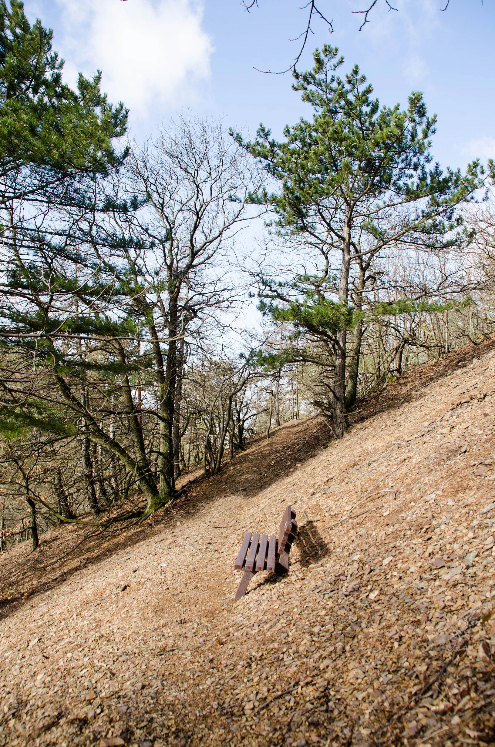
A wooden bench sits on a steep, rocky, brownish-red slope with pine and deciduous trees under a light blue sky.
A wooden bench placed on a steep, rhyolite-rich slope along a hiking trail at Leienberg.

Königsberg history and protected-area timeline

Human activity on the Königsberg reaches back to the Roman period, when a road from the Kaiserslautern area crossed the high ground of the mountain on its way toward Lauterecken. The mountain's medieval history is written into its castle ruins: the Sprengelburg on the western spur and the twin castles of Alt- and Neu-Wolfstein on the eastern slope above the town of Wolfstein. Other traces of vanished settlements, such as the Zweikirche near Rutsweiler an der Lauter, point to small communities that once lived on or near the mountain.

Mining shaped the Königsberg across several centuries. From 1725 into the 1950s, the mountain hosted intensive extractive activity, with at times up to 53 separate mining operations. Miners worked deposits of barite, mercury ore, iron ore, limestone, and coal. Named workings included the Erzengel, Schwerspat, and Pfälzer Mut(h), and the now-vanished village of Laufhausen originated as a mining settlement. The active mining era declined through the 20th century; most of the older adits are now collapsed or filled in, leaving only spoil heaps and faint foundations, while the limestone mine in Wolfstein operated until 1967 and is preserved as a visitor mine.

In more recent decades the Königsberg has shifted toward recreation and conservation. Long-distance trails such as the Pfälzer Höhenweg, opened in 2010 and running from Winnweiler via the Donnersberg to Wolfstein, now cross the mountain, and large sections of the area are formally protected under the European Habitats Directive.

Königsberg landscape and geographic character

The Königsberg rises as a forested ridge within the softly modeled uplands of the Nordpfälzer Bergland. Its summit sits at 568 meters, but the broader massif extends roughly five kilometers from north to south and about four kilometers east to west, producing a substantial block of high ground that separates the Lauter valley to the north from the Talbach valley to the south.

The terrain is shaped by geological contrasts. Most of the upper slopes are cloaked in continuous mixed forest, with farmland confined to the lower western flanks around Eßweiler and Oberweiler im Tal and to the northwestern slopes between Hinzweiler and Aschbach. In Wolfstein, a steep south-facing slope below Burg Neu-Wolfstein is terraced for viticulture. A particularly unusual feature is found on the Leienberg, where the slope toward the Taufenbachtal is almost entirely covered by a rhyolite scree field. This loose, rocky surface supports only sparse, stunted oaks and pines scattered among isolated bushes, giving the hillside a stark, almost otherworldly character.

The relief of the Königsberg is unusually abrupt for the region. From the "Dreimärker" viewpoint near the summit, the town of Wolfstein lies nearly 300 meters below, and the steep ascents from the surrounding valleys make many of the hiking routes physically demanding. The ridge continues southward into the Selberg, while subsidiary summits such as the Leienberg and the Hahnenkopf break the outline of the massif as seen from below.
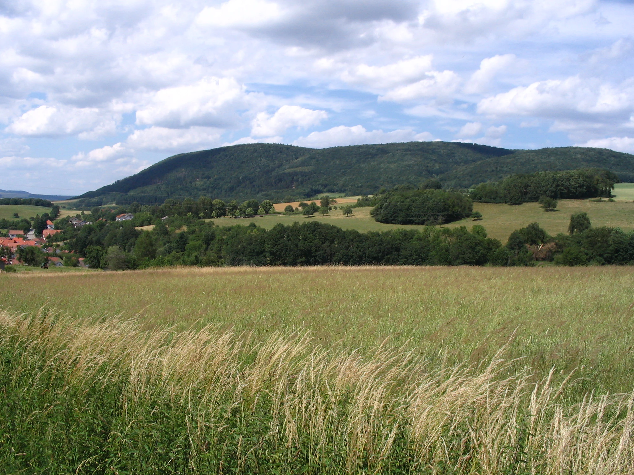
A wide landscape view of a green, forest-covered hill rising above open fields and meadows under a sky with scattered white clouds.
A view of the Königsberg mountain massif from the west, characterized by forested slopes and surrounding meadows.

Königsberg ecosystems, habitats, and plant life

The vegetation of the Königsberg is dominated by deciduous forest, primarily mixed stands of beech and oak that cover most of the summit and upper slopes. Small patches of spruce interrupt the broadleaf cover, while the lower flanks blend woodland with pasture, cropland, and vineyards near Wolfstein.

The most distinctive botanical feature of the mountain lies on the Leienberg, where a rhyolite slope debris field has produced an unusually harsh substrate for plant growth. Here, the forest canopy opens into a stunted, almost shrub-like woodland: krummholz-style oaks and pines, rarely taller than a person, cling to the loose rocky ground among scattered bushes. This habitat is rare in the Nordpfälzer Bergland and contributes significantly to the site's ecological value.

The protected status of the Königsberg reflects this habitat diversity. The mountain is designated as an FFH (Fauna-Flora-Habitat) area under the EU Habitats Directive, covering about 1,047 hectares. The mix of mature broadleaf forest, open scree habitat, valley streams, and edge farmland supports a wide gradient of plant communities typical of the Palatinate hill country.
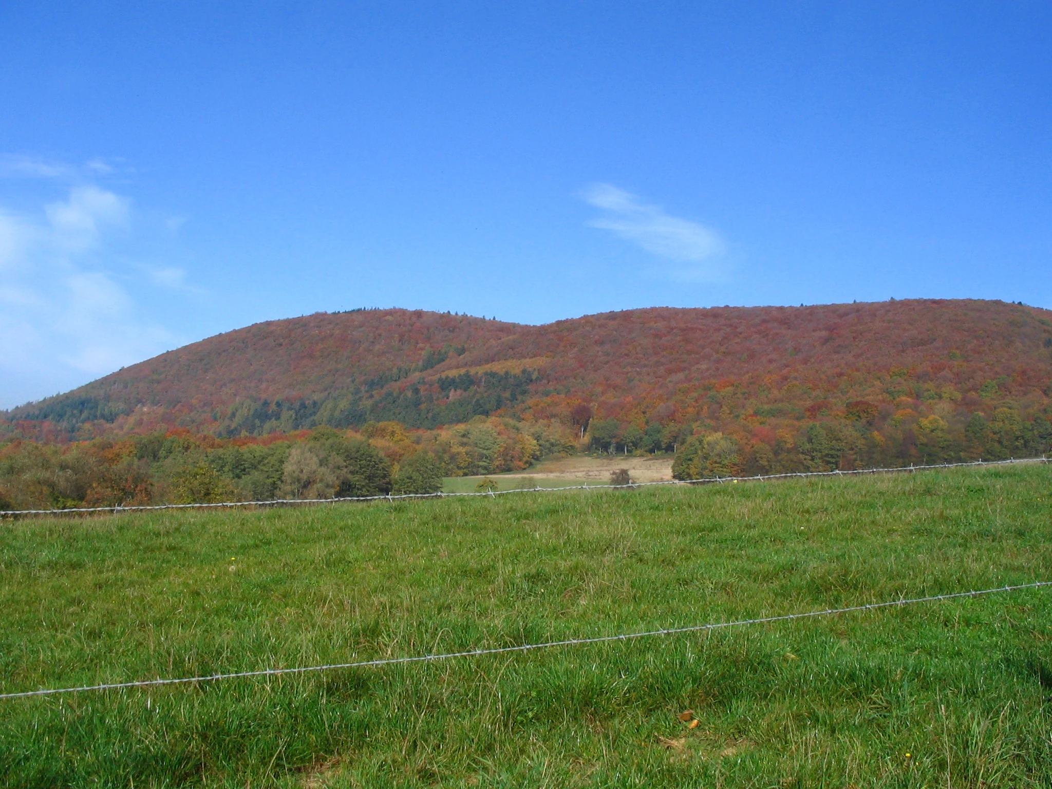
A wide view of a rolling, forested mountain slope covered in autumn foliage, viewed from a green grassy meadow with a wire fence in the foreground.
The autumn landscape of the Königsberg massif in the North Palatine Uplands.

Königsberg wildlife and species highlights

The varied terrain around the Königsberg supports a rich mammal fauna. Common medium-sized species include wild boar, roe deer, red fox, and European badger. European mouflon were introduced into the area in past decades, and there are occasional, though not fully verified, observations of European wildcat.

Birdlife in the broader Königsberg area reflects typical Central European woodland and valley communities, with the mountain itself hosting the black woodpecker as a resident species. Unconfirmed sightings of eagle owl have been recorded in the forest. Along the Talbach valley, the streams and adjacent trees provide habitat for kingfisher and grey heron, while the red kite still occurs in the surrounding landscape.

Because the habitats blend continuously with the broader Nordpfälzer Bergland, the Königsberg does not support a tightly defined avifauna of its own. Instead, the protected FFH designation recognizes the value of the area as a continuous block of forest, scree, and valley habitat that contributes to regional biodiversity for both resident and ranging wildlife.

Königsberg conservation status and protection priorities

The principal conservation significance of the Königsberg lies in its formal designation as a European Habitats Directive (FFH) site, recorded under area number 6411-302 and covering approximately 1,047 hectares. This status reflects the European importance of its forest habitats and the rare geological feature of the Leienberg's rhyolite scree slope.

The protected area safeguards a large, contiguous block of mixed beech and oak forest, one of the characteristic woodland types of the Palatinate hill country. The Leienberg slope adds a contrasting habitat that supports specialist flora adapted to thin, rocky soils, while the transition zones between forest, scree, valley streams, and farmland increase the overall habitat diversity of the site.

Alongside its ecological role, the Königsberg shows how cultural heritage and conservation can overlap. Historic mining features, medieval castles, and abandoned settlements are embedded within the protected landscape, and the area is now managed primarily for low-intensity recreation and habitat preservation rather than industrial use.

Königsberg cultural meaning and human context

The Königsberg has been a focus of human activity for nearly two thousand years. A Roman road once crossed the high ground of the mountain, linking settlements in the Kaiserslautern area with Lauterecken to the east. In the medieval period, the mountain's strategic value is reflected in three castles: the Sprengelburg on the western spur and the paired castles of Alt-Wolfstein and Neu-Wolfstein overlooking Wolfstein on the eastern flank.

The mountain's deeper cultural identity is tied to small-scale mining. From 1725 through the mid-20th century, generations of miners extracted barite, mercury ore, iron, limestone, and coal from the Königsberg's slopes. Mining communities such as the now-vanished Laufhausen grew directly out of this industry. Although the active workings have shut down, the surviving remnants, including the visitor limestone mine in Wolfstein and the foundations and spoil heaps scattered through the forest, remain visible elements of the local heritage.

In the present day, the cultural context of the Königsberg is shaped less by industry than by walking culture. Local clubs, including the Pfälzerwald-Verein and the Heimat- und Verkehrsverein Eßweiler, manage several huts along the trails, and the mountain forms a key segment of the regional long-distance Pfälzer Höhenweg.

Top sights and standout views in Königsberg

The Königsberg combines ecological protection with layers of cultural and historical interest, all within a relatively compact mountain massif in the Nordpfälzer Bergland. Its beech-oak forests, designated FFH habitats, and rare rhyolite scree slope give it clear value for nature-focused visitors, while its three castles, historic mining features, and abandoned worker settlements add a strong cultural dimension.

Long-distance and circular trails, including the Pfälzer Höhenweg, the Leienbergweg, and a Nordic walking route called "Königsland," make the mountain accessible for hikers who want both scenic views over Wolfstein and engagement with the larger Palatinate hill landscape.

Best time to visit Königsberg

The Königsberg can be visited year-round, but the experience shifts noticeably with the seasons. Spring and summer bring active birdlife, blooming woodland edges, and the most comfortable walking conditions, while also coinciding with the operating season of several managed huts along the trails. Late spring and early summer are well suited to viewing the mixed beech and oak forests at their most lush.

Autumn offers the most visually striking experience, with broadleaf foliage turning color across the ridge and clear views over the valleys around Wolfstein. Winter conditions can make the steeper ascents from the Lauter and Talbach valleys more demanding, and are best suited to experienced walkers prepared for slick, steep forest trails. Because the area is popular with regional hiking clubs, weekends and holidays tend to be the most socially active periods, while weekdays offer quieter trail experiences.


Monthly climate preview

Long-term monthly temperature averages and precipitation measurements for Rheinland-Pfalz

Königsberg Climate Normals, Annual Temperature and Precipitation Rhythm

Representative coordinates record measured multi-year temperature variations and monthly precipitation distributions across the protected terrain. Access the full twelve-month profile to examine complete long-term climatological normals and detailed variations.
Annual mean9 °C
0 °C19 °C
Jan
Feb
Mar
Apr
May13°
Jun17°
Jul19°
Aug19°
Sep14°
Oct
Nov
Dec
Warmest month
July

19.2 °C

Coolest month
January

-0.2 °C

Wettest month
December

2.4 mm/day

Driest month
April

1.5 mm/day

Park location guide

Geography guide, regional context, and park location map for Königsberg

Königsberg park geography, regions, and map view in Germany

Understand where Königsberg sits in Germany through a broader geographic reading of the surrounding landscape, nearby location context, and its mapped position within the national park landscape.

How Königsberg fits into Germany

Germany is a federal republic in Western and Central Europe with a population of over 83 million across sixteen constituent states. It is Europe's largest economy by nominal GDP and a major global exporter and importer. The capital is Berlin, and the country borders Denmark, Poland, Czech Republic, Austria, Switzerland, France, Luxembourg, Belgium, and the Netherlands.

Wider geography shaping Königsberg in Germany

Germany is located in Western and Central Europe, spanning 357,022 km². It borders Denmark to the north, Poland and the Czech Republic to the east, Austria and Switzerland to the south, and France, Luxembourg, Belgium, and the Netherlands to the west. The country has coastlines on the Baltic Sea and North Sea to the north, with the Alps located in the southern region.

Map view of Königsberg

Use this park location map to pinpoint Königsberg in Germany, understand its exact geographic position, and read its mapped placement within the surrounding landscape more clearly.

Pigeon | © OpenStreetMap contributors

Location context for Königsberg

Rheinland-Pfalz
Recorded earthquake history

Explore the Historical Earthquake Record for Königsberg Mountain

Examine the verified history of recorded seismic events associated with the geography of Königsberg. MoriAtlas provides a clear, structured collection of earthquake data to support regional geological exploration and provide historical context for the Nordpfälzer Bergland.

Königsberg Earthquake History Records

Catalogued events

27 events

Strongest magnitude

Magnitude 3.8

Most recent event

Dec 13, 2007

This history includes earthquakes recorded inside the park or within 50 km of its borders

Visual exploration of mixed forests, rocky scree slopes, and ridge terrain

Königsberg Photos and Protected Landscape Scenery in the Nordpfälzer Bergland

Captured imagery reveals the forested mountain terrain, rare rhyolite scree slopes, and protected habitats defining the Königsberg massif. Visual reference collections help visitors understand the complex topography, geological formations, and natural environment spanning the regional uplands.

A wooden bench sits on a steep, rocky, brownish-red slope with pine and deciduous trees under a light blue sky.

A wide view of the green western slope of Königsberg, featuring mixed deciduous and coniferous forest patches alongside rolling meadows.

A wide landscape view of a green, forest-covered hill rising above open fields and meadows under a sky with scattered white clouds.

A wide view of a rolling, forested mountain slope covered in autumn foliage, viewed from a green grassy meadow with a wire fence in the foreground.

Park atlas

Compare regional hill terrain, mixed forests, and nearby conservation areas.

Explore Other Parks Near Königsberg and Surrounding Protected Landscapes

Discover protected areas and forested uplands adjacent to Königsberg for broader regional comparison. Evaluating neighboring terrain reveals the wider ecological character and protected landscape spread of the Nordpfälzer Bergland.
Nature reserveRhineland-Palatinate
9.7 km away#1 closest

South

Westricher Moorniederung Nature Reserve: Protected Wetland and Moorland Atlas

Mapping low-lying basin landscapes and riparian corridors in the German Palatinate.

Spanning 40 kilometers between the Bliesaue and Kaiserslautern, the Westricher Moorniederung protects an intricate network of bogs, marsh zones, and alluvial forests. This lowland basin acts as a vital ecological link within Rhineland-Palatinate, defined by its drainage systems and diverse mire habitats. Gain insight into the regional geography and protected land boundaries that define this significant wetland system.

Area
21.52 km²
Established
1998
IUCN
IV
A soft watercolor painting depicting a rolling landscape with fields, a small forest edge, and a mountain peak in the background.
Protected areaRhineland-Palatinate
12 km away#2 closest

East

Donnersberg Protected Area: A Geographic Atlas of the Palatinate Region's Highest Massif

Geological landscapes, Celtic heritage sites, and forested mountain terrain.

The Donnersberg massif represents a critical point of geographic and archaeological interest in Rhineland-Palatinate. This protected area encompasses a 24-square-kilometer rhyolite cryptodome featuring high-altitude plateaus, a complex network of forest ecosystems, and well-preserved remnants of ancient Celtic fortifications. Its steep slopes and diverse rock formations offer a clear look at the geological and historical layering of the German landscape.

Area
24 km²
Relief
Mountain
Climate
Temperate
Access
Easy access
Protected areaRheinland-Pfalz
About 13 km away#3 closest

Northwest

Truppenübungsplatz Baumholder: Protected Area and Geological Landmark in Rheinland-Pfalz

A vast military training ground and Natura 2000 ecological sanctuary.

Truppenübungsplatz Baumholder is a expansive protected landscape in Rheinland-Pfalz, functioning as both an active military installation and a preserved natural habitat. The terrain features a striking mix of dense deciduous forest, open firing corridors, and unusual volcanic geological remnants like rare lava flows and agate deposits. This site serves as a critical study in how restricted access shapes regional biodiversity.

Area
116 km²
Established
1937
Relief
Upland
Access
Highly restricted
Nature reserveRheinland-Pfalz
14 km away#4 closest

Southeast

Naturschutzgebiet Vogelwoog-Schmalzwoog: An Urban-Edge Wetland and Forest Mosaic in Germany

Protected nature reserve in the Rheinland-Pfalz region.

Naturschutzgebiet Vogelwoog-Schmalzwoog represents a significant micro-landscape characterized by the Vogelwoog lake and surrounding peat bogs. This protected area contains a dense concentration of ecosystems ranging from wet meadows to sand grasslands, showcasing the importance of small-scale conservation within the Hammerbach valley. Access map-driven details on the varied terrain that defines this unique Rhineland-Palatinate nature reserve.

Area
0.22 km²
Established
1996
Relief
Lowland
Climate
Temperate
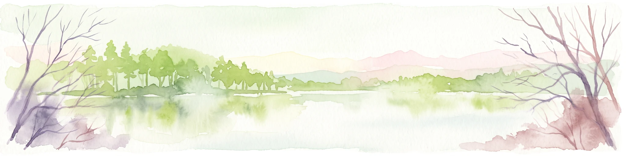
A soft watercolor painting of a wetland landscape with a gentle shoreline, grassy foreground, scattered trees, and distant hills under a pale sky.
Nature reserveRheinland-Pfalz
About 17 km away#5 closest

South

Schachenwald Nature Reserve: Geographic Overview and Protected Landscape Boundaries

Mapping the sand dunes and wetland terrain of Rheinland-Pfalz

Schachenwald functions as a vital nature reserve in the Kaiserslautern district, distinguished by its tightly knit combination of dry, sandy dune forests and damp alder swamp woodlands. The reserve highlights the complex interaction between weathered Buntsandstein ridge geology and bog-influenced lowlands, providing a clear window into the ecological diversity of the regional landscape.

Area
0.638 km²
Established
1987
IUCN
IV
Relief
Lowland
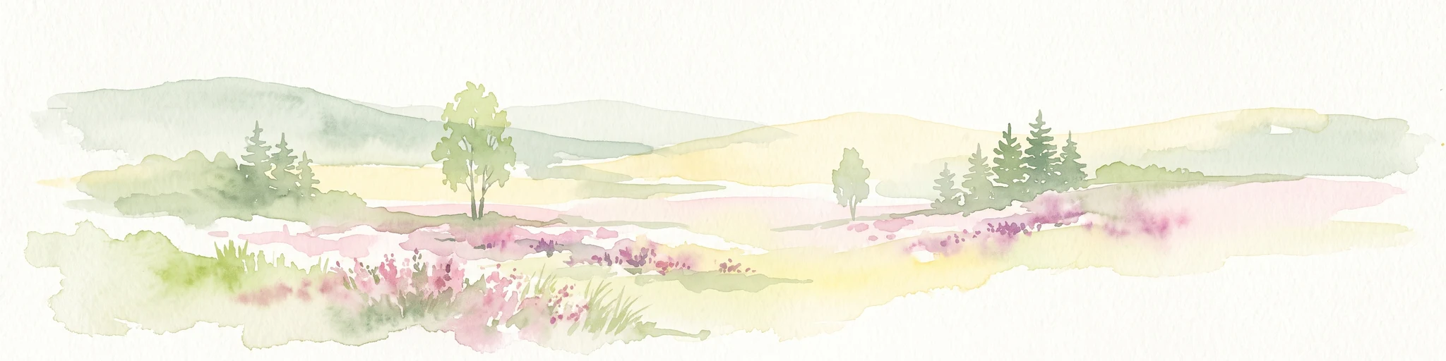
Watercolor painting of a heathland landscape with rolling hills, purple heather, and scattered pine trees.
Nature reserveRhineland-Palatinate
17 km away#6 closest

Southeast

Mehlinger Heide Nature Reserve: Geography and Protected Heathland Atlas of Rhineland-Palatinate

A rare mosaic of inland sandy heath and dry grassland habitats

Spanning over 400 hectares in Rhineland-Palatinate, Mehlinger Heide offers a distinctive protected area featuring inland dunes and dwarf-shrub heath. This nature reserve presents an unusual ecological environment within Germany, supporting specialised insect and bird populations through its open pioneer habitats and remnants of historic military training grounds. Explore the mapped terrain and natural boundaries of this significant conservation site.

Area
3.99 km²
Established
2001
IUCN
IV
Relief
Upland
Nature reserveRheinland-Pfalz
About 18 km away#7 closest

South

Täler und Verlandungszone am Gelterswoog: Nature Reserve and Wetland Geography

A mosaic of lakes, mires, and stream valleys in Rheinland-Pfalz

Located in the Palatinate Forest, this protected nature reserve centers on the western shores of the Gelterswoog lake. It conserves a rare assembly of habitats including peat-forming moorland, reeds, and narrow forested valleys that provide essential breeding grounds for protected dragonfly species.

Area
0.554 km²
Established
1997
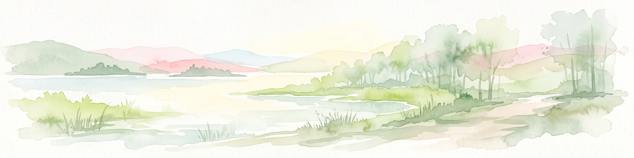
A minimalist watercolor illustration featuring a green treeline, soft rolling hills, and a calm body of water in warm light tones on a white background.
Protected landscapeRhineland-Palatinate
About 18 km away#8 closest

South

Landstuhler Bruch Protected Landscape: Regional Geography and Mapped Wetland Basin

Exploring the historic moorland basin of the Westpfalz

Situated in the Westpfalz region of Rhineland-Palatinate, the Landstuhler Bruch is a gentle lowland depression marked by a complex history of drainage and conservation. This protected area offers deep insight into the regional geology, preserved wetland pockets, and hydrological networks that define the local landscape. Understanding this basin provides a window into the intersection of cultural heritage and active ecological restoration in southwestern Germany.

Area
67 km²
Established
1985
IUCN
V
Relief
Lowland

Common questions about visiting, size, designation, and location context for Königsberg

Königsberg FAQs for park facts, access, geography, and protected area context

Find quick answers about Königsberg, including protected-area facts, park geography, trail and visitor context, and how the park fits into its surrounding country and regional landscape.
MoriAtlas Explorer

Continue Your Protected Areas Search Across the Global Atlas

Deepen your exploration by continuing the structured search for national parks and protected areas worldwide. Utilize the comprehensive filtering capabilities to compare different conservation landscapes and refine your understanding of global park geography. Discover more about the distribution and characteristics of protected natural areas.

Global natural geography