
Mori Atlas logo
Protected landscapeKorab-Koritnik Nature Park

Tracing the high-elevation mountain massifs and diverse forest ecosystems of the Eastern Albanian borderlands

Korab-Koritnik Nature Park: A Comprehensive Atlas of Alpine Landscapes and Protected Boundaries

(Parku Natyror i Korab-Koritnikut)

Korab-Koritnik Nature Park encompasses a vast mountainous territory along the border between Albania, Kosovo, and North Macedonia. This protected landscape defines a key section of the European Green Belt, featuring the towering Mount Korab alongside extensive coniferous forests, glacial lakes, and deep river valleys. The rugged topography is shaped by Paleozoic shale and limestone, offering an essential reference for understanding regional geography and the complex ecology of the Balkan mountain chain.

alpine landscapesmountain parkEuropean Green Beltnational nature parkconiferous forestsglacial lakes
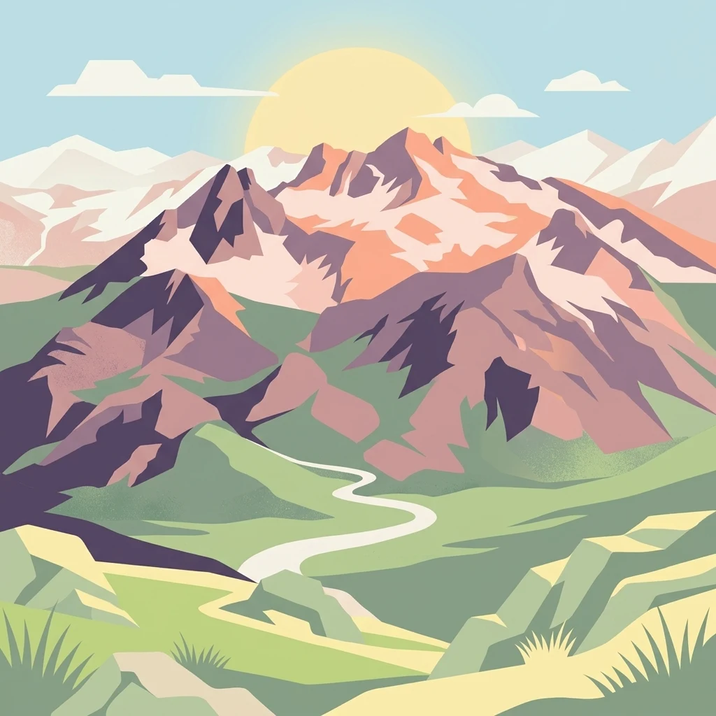
An illustration of a large mountain range under a setting sun, with a winding river valley in the foreground.

Korab-Koritnik Nature Park

Protected landscape

Park overview

Structured park overview, official facts, and landscape profile for Korab-Koritnik Nature Park

Korab-Koritnik Nature Park park facts, protected area profile, and essential visitor context

Review the core facts for Korab-Koritnik Nature Park, including designation, size, terrain, visitor scale, habitats, and operating context in one park-focused overview.

About Korab-Koritnik Nature Park

Korab-Koritnik Nature Park is a cornerstone of Albania's system of protected natural areas, occupying one of the most mountainous and ecologically rich sections of the country's eastern frontier. Its territory stretches from the border with Kosovo in the north, along the Macedonian border, and southward into the Desha Mountains, creating a long, narrow protected corridor that anchors the Albanian portion of the European Green Belt.

The defining characteristic of the park is its dramatic range of elevations and landforms, which compress several distinct ecological worlds into a relatively compact territory. At the upper end of this range stands Mount Korab, the tallest peak shared by Albania and North Macedonia, a heavily weathered massif of Paleozoic shale and limestone with severely damaged Permo-Triassic gypsum formations. Its western face falls steeply in dramatic rock walls, while its northern flank is composed of rugged, craggy outcrops. Surrounding peaks such as Mali i Bardhë, Maja e Pikëllimës on Koritnik, and Mali i Gramës give the park a consistently mountainous, sky-bound character.

Equally important is the park's role as a transnational conservation corridor. As a section of the European Green Belt, it functions as a retreat for endangered plant and animal species whose habitats were historically fragmented by national borders. Albania's National Agency of Protected Areas oversees its management, while the International Union for Conservation of Nature has placed it within Category IV, a category reserved for areas managed primarily for habitat and species conservation through active intervention when needed. The result is a park whose identity rests as much on biodiversity and ecological connectivity as on its striking scenery.

Quick facts and research context for Korab-Koritnik Nature Park

Korab-Koritnik Nature Park lies in eastern Albania across parts of Dibër County and Kukës County, with the nearest major towns being Kukës and Peshkopi. It was officially established on 21 December 2011 and is managed by Albania's National Agency of Protected Areas.

The park extends along the international frontier, running from the Kosovo border in the north along the border with North Macedonia down to the Desha Mountains in the south. It falls within the Dinaric Mountains mixed forests and Balkan mixed forests ecoregions of the Palearctic temperate broadleaf and mixed forests biome, reflecting a transitional position between major Balkan ecological systems.

Protection and recognition

Documented terrestrial protection framework and regional governance metrics

Korab-Koritnik Nature Park Protection Status and Transboundary Scope

Korab-Koritnik Nature Park maintains a structured terrestrial protection scope and verified transboundary status across regional borders. Documented conservation records outline the official designation framework and administrative management guidelines for this protected landscape.

Protection details

Protection scope
Terrestrial
Transboundary protection
Yes
Park context

Deeper park guide and search-rich context for Korab-Koritnik Nature Park

Korab-Koritnik Nature Park history, landscape, wildlife, and travel context

Explore Korab-Koritnik Nature Park through its history, landscape character, ecosystems, wildlife, conservation priorities, cultural context, and seasonal travel timing in a structured park guide built for atlas discovery and search intent.

Why Korab-Koritnik Nature Park stands out

The park is best known for encompassing Mount Korab, the highest peak of both Albania and North Macedonia and one of only two summits in Europe that form the highest point for more than one country. Beyond the headline peak, the park is recognized for its rugged Paleozoic shale and limestone massifs, deeply incised alpine valleys and glacial lakes, and extensive coniferous forests dominated by silver fir, Austrian pine, Bosnian pine and Macedonian pine. It is equally distinguished in conservation terms. Both the Korab and Koritnik massifs have been recognized as Important Plant Areas by Plantlife, and the entire territory is rated as an IUCN Category IV protected landscape. These overlapping international designations underline the park's standing as a refuge for endangered flora and fauna along the European Green Belt.
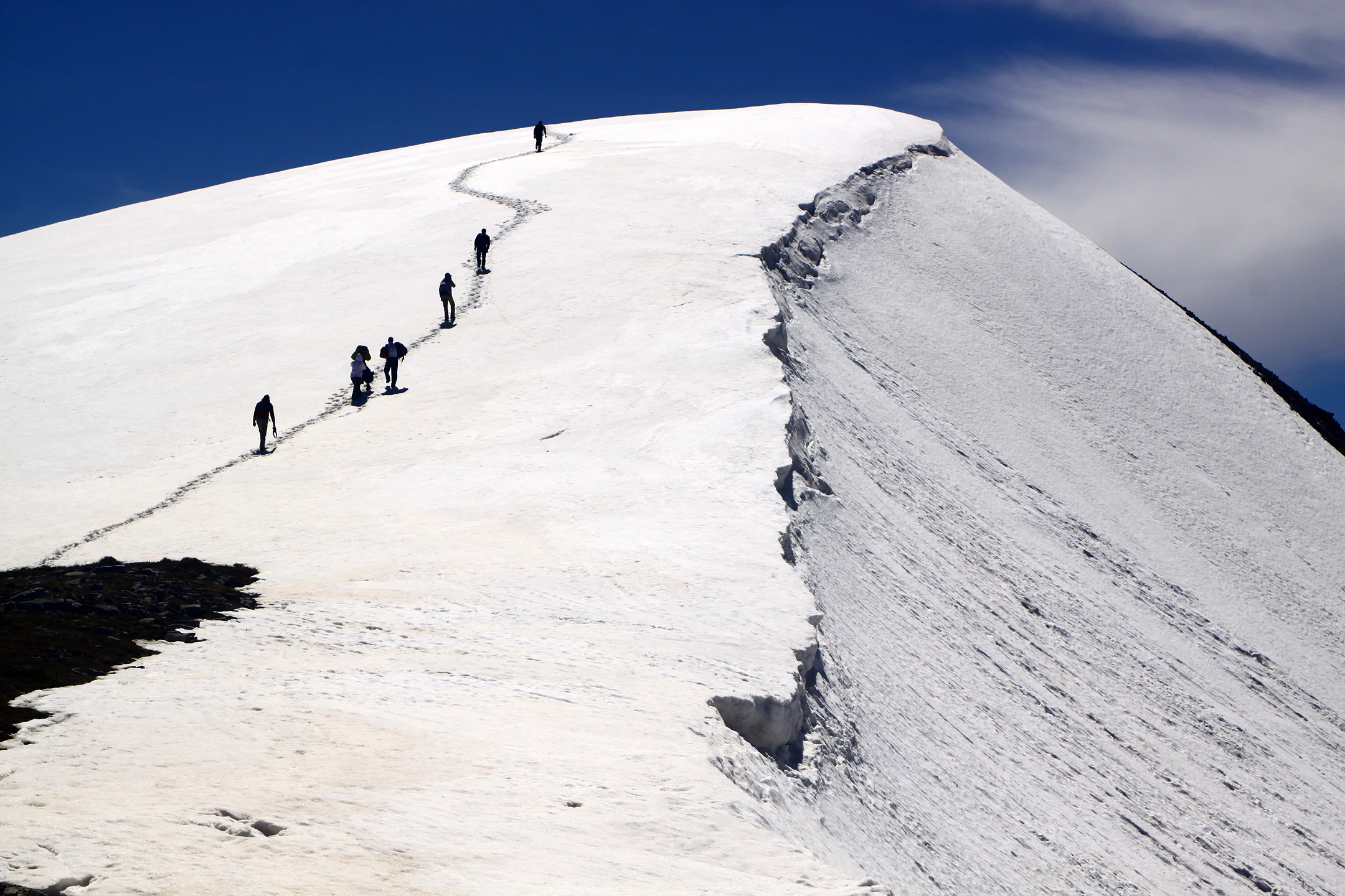
A group of hikers in dark gear walk single file up a steep, snow-covered mountain ridge against a deep blue sky.
A group of hikers ascending the snowy slopes toward the summit of Koritnik peak.

Korab-Koritnik Nature Park history and protected-area timeline

Korab-Koritnik Nature Park was officially established on 21 December 2011, formalizing the protection of a vast alpine territory in eastern Albania that had long held ecological importance but lacked a unified protected-area designation. Its creation aligned Albania with the broader European Green Belt initiative, an effort to link valuable natural habitats across the continent along the historical line of the former Iron Curtain.

Following its establishment, the park came under the governance of Albania's National Agency of Protected Areas, which is responsible for managing the country's network of protected natural and national landscapes. The IUCN subsequently classified the park as Category IV, affirming its significance for habitat and species conservation.

A particularly important chapter in the park's conservation history involves international botanical recognition. Separately from the park's own establishment, both the Korab Mountains and Koritnik Mountain were recognized as Important Plant Areas by Plantlife, the international organization devoted to wild plant conservation. These designations, based on the botanical richness of the massifs, reinforced the rationale for protecting the broader landscape and added a layer of international scientific endorsement to the park's national status.

Korab-Koritnik Nature Park landscape and geographic character

The landscape of Korab-Koritnik Nature Park is defined by high alpine topography. The Korab massif dominates the central and northern portion of the park, with its summit reaching above 2,700 meters. The peak's geological structure is highly distinctive, built primarily from Paleozoic shale and limestone with heavily disturbed Permo-Triassic gypsum, and shaped into blocky, rugged formations that weather into dramatic relief.

The terrain changes sharply across short distances. On the western side of the massif, the mountain falls abruptly in steep rock walls, while the northern side is composed of broken, craggy rocks that create some of the most visually severe ground in the park. Lower elevations transition into a network of valleys, rivers and glacial lakes, with caves and canyons adding further geomorphic variety.

Beyond Korab itself, the park includes additional named landscapes such as Mali i Bardhë, Mali i Gramës and the high slopes of Koritnik, including Maja e Pikëllimës near its summit. Together these features give the park a varied terrain profile in which glacially carved basins, exposed ridgelines, deep river valleys and forested middle slopes all play prominent roles.
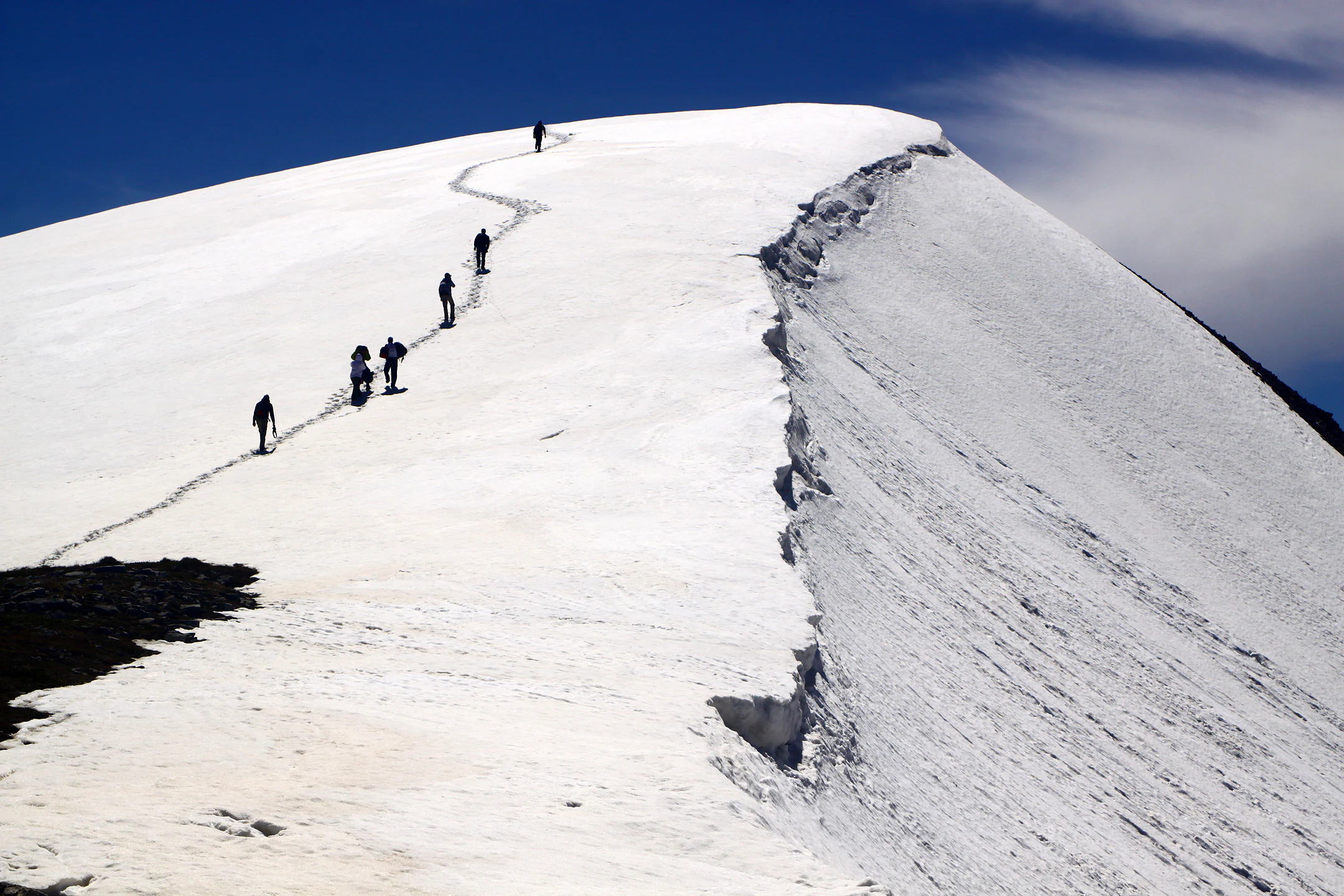
A group of hikers walking single file up a steep, snow covered mountain ridge under a clear blue sky.
Hikers ascending the snow covered slopes toward the summit of Koritnik peak.

Korab-Koritnik Nature Park ecosystems, habitats, and plant life

Ecologically, Korab-Koritnik Nature Park sits at the meeting point of two major Palearctic ecoregions: the Dinaric Mountains mixed forests and the Balkan mixed forests. This transitional position gives it a composition of species drawn from both systems, producing a richer botanical and zoological mix than is typical of either ecoregion alone.

The park's vegetation is organized into distinct altitudinal zones. Below roughly 900 meters, oak-dominated forests prevail, featuring species such as downy oak, Macedonian oak, oriental hornbeam and field maple. From about 1,000 to 2,000 meters, the forest character shifts to a mix of conifers and beech interspersed with broadleaved trees. The middle elevations are particularly notable for their coniferous forests, where silver fir, Austrian pine, Bosnian pine and Macedonian pine form extensive stands, often alongside black alder along watercourses. Mountain meadows and deciduous forest patches complete the vertical sequence, while a wide variety of wildflowers adds seasonal diversity throughout the territory.
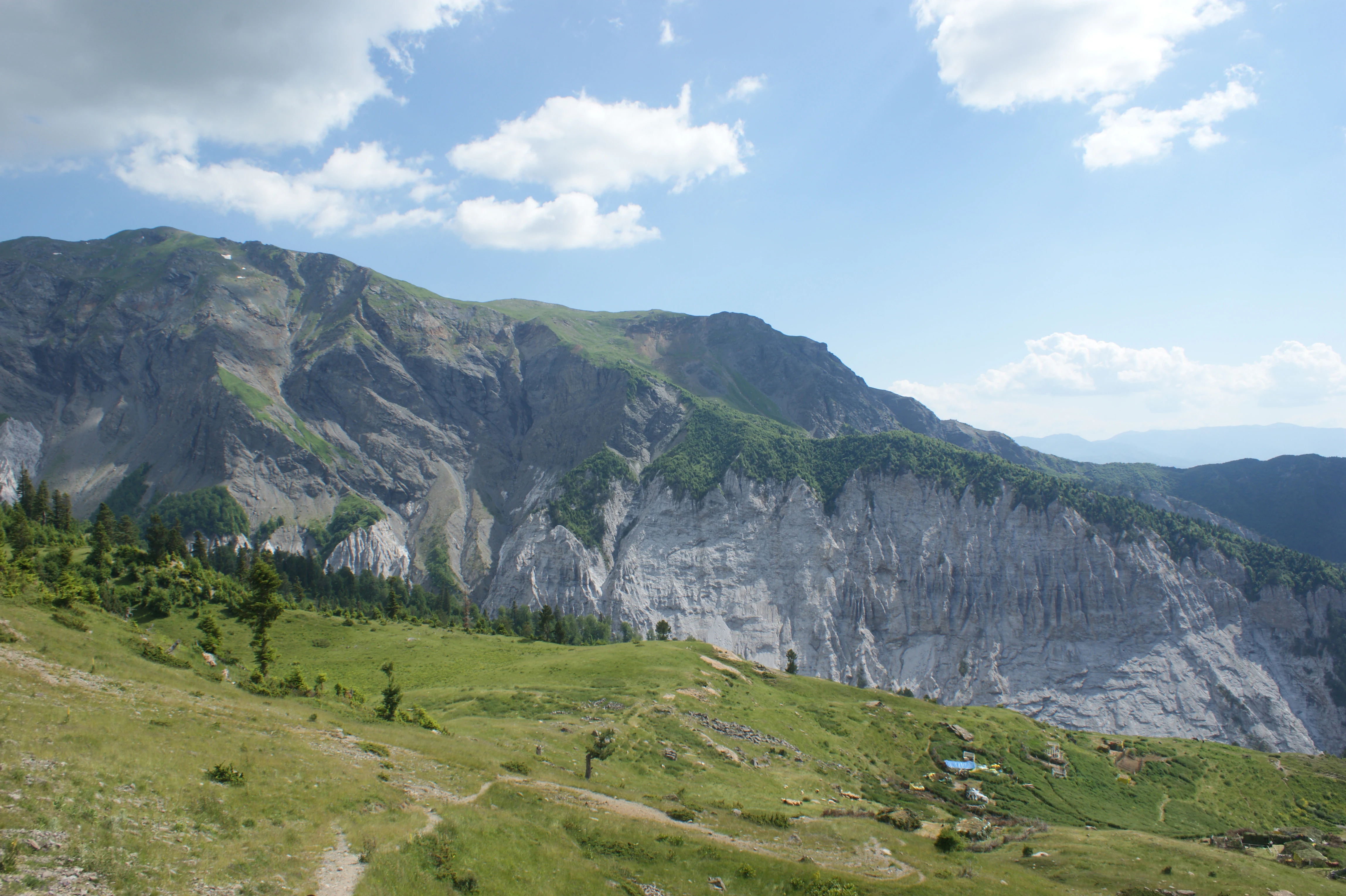
A wide view of a large, rugged mountain with light-colored, exposed rock layers, rising above green, grassy alpine meadows under a blue sky with scattered clouds.
A scenic view of Grama Mountain in Korab-Koritnik Nature Park, showcasing its distinctive geology and alpine slopes.

Korab-Koritnik Nature Park wildlife and species highlights

The fauna of Korab-Koritnik Nature Park is shaped by its large size, varied elevation and position along the European Green Belt. Mammal diversity is significant, with around 37 mammal species recorded in total. Among the larger mammals that inhabit or pass through the park are brown bears, grey wolves, Balkan lynx, roe deer and wild boar, alongside smaller species such as weasels, European pine martens and red squirrels. The presence of the Balkan lynx is particularly notable, given the species' rarity and conservation status across the region.

Birdlife is also strikingly rich, supported by the park's mosaic of forests, cliffs and high meadows. Raptors are well represented, with golden eagles, peregrine falcons, common buzzards, accipiters, Eurasian eagle-owls and griffon vultures breeding or hunting in the area. The diverse forest habitats support dense populations of western capercaillie and hazel grouse, two grouse species closely tied to mature woodland. The combination of large carnivores, game species and a strong raptor and grouse community gives the park a wildlife profile typical of the most intact Balkan mountain ecosystems.
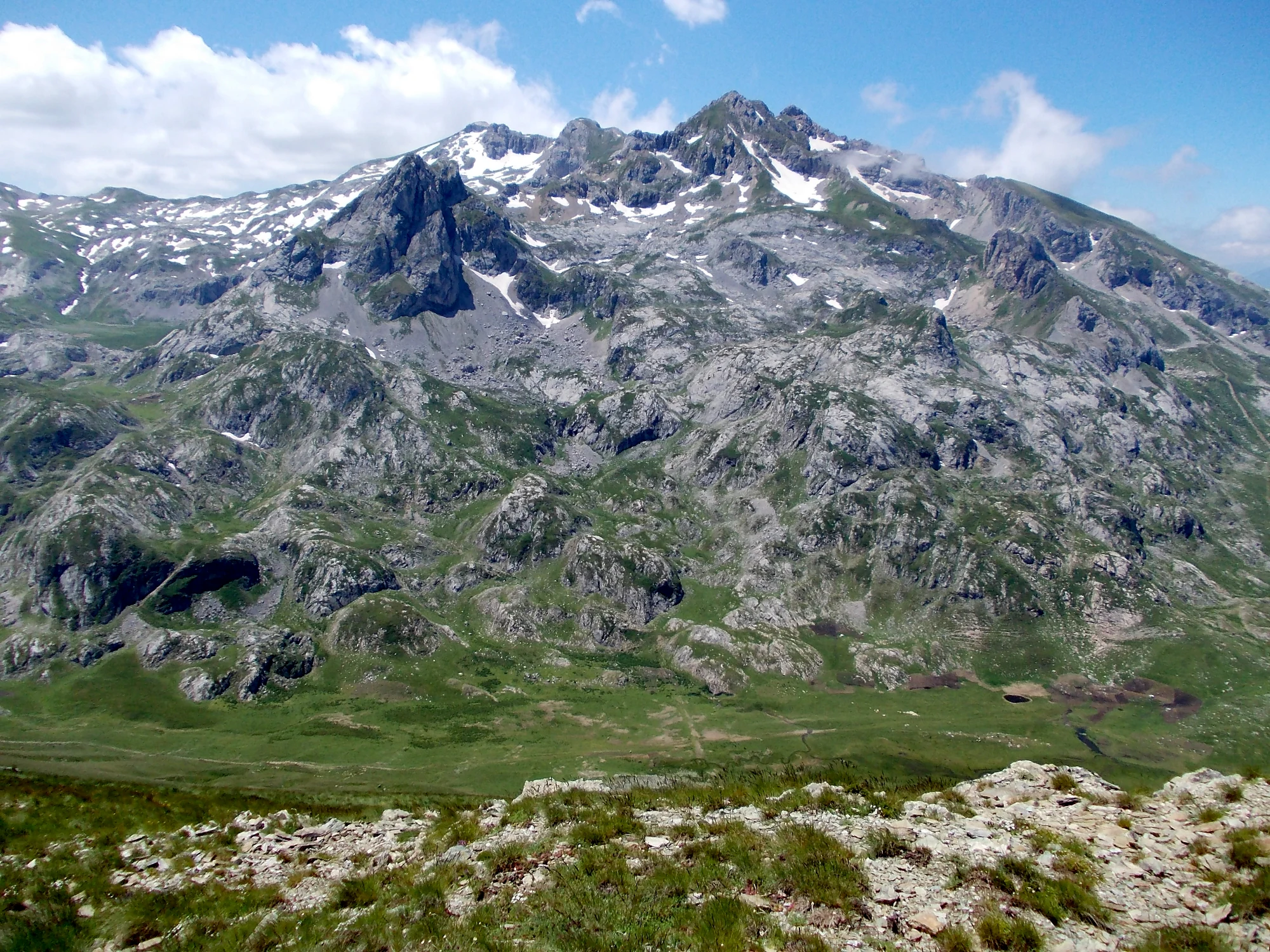
A wide view of the rocky, mountainous landscape of Mount Korab under a blue sky with light clouds, showing snow patches on the high crags.
The rugged summit and slopes of Mount Korab, the highest peak in Albania and the centerpiece of Korab-Koritnik Nature Park.

Korab-Koritnik Nature Park conservation status and protection priorities

Conservation is central to the identity of Korab-Koritnik Nature Park. Its designation as part of the European Green Belt positions it as a critical node in a transnational network of protected areas aimed at maintaining ecological continuity along one of the most intensively altered political boundaries in modern European history. The Green Belt concept gives the park an importance that exceeds its national footprint, framing its forests, valleys and highland habitats as a refuge for species whose ranges cross national borders.

The park's IUCN Category IV classification reflects a specific conservation mandate focused on the protection of particular species or habitats, often requiring active management to maintain the targeted ecological values. This broad institutional framework is reinforced by the Important Plant Area designations granted to both Korab and Koritnik by Plantlife, recognizing both massifs for their internationally significant botanical value. Taken together, these overlapping designations give the park one of the more robust international conservation profiles of any protected area in Albania.

Top sights and standout views in Korab-Koritnik Nature Park

Korab-Koritnik Nature Park's most defining highlights are concentrated in its high mountain heart. Mount Korab stands as both Albania's and North Macedonia's tallest peak, a rugged massif of Paleozoic shale and limestone whose steep western walls and craggy northern flanks give the park some of its most dramatic scenery. The surrounding massifs of Mali i Bardhë, Mali i Gramës and the high country of Koritnik, including Maja e Pikëllimës, extend this alpine character across the entire protected territory.

Equally significant are the ecological highlights. Dense coniferous forests of silver fir, Austrian pine, Bosnian pine and Macedonian pine cover much of the middle slopes, while glacial lakes, deep river valleys, canyons and caves punctuate the landscape below. Above the tree line, mountain meadows filled with diverse wildflowers provide seasonal contrast. These natural assets sit within a park that is internationally recognized through its inclusion in the European Green Belt, its IUCN Category IV status and its twin Important Plant Area designations for Korab and Koritnik.
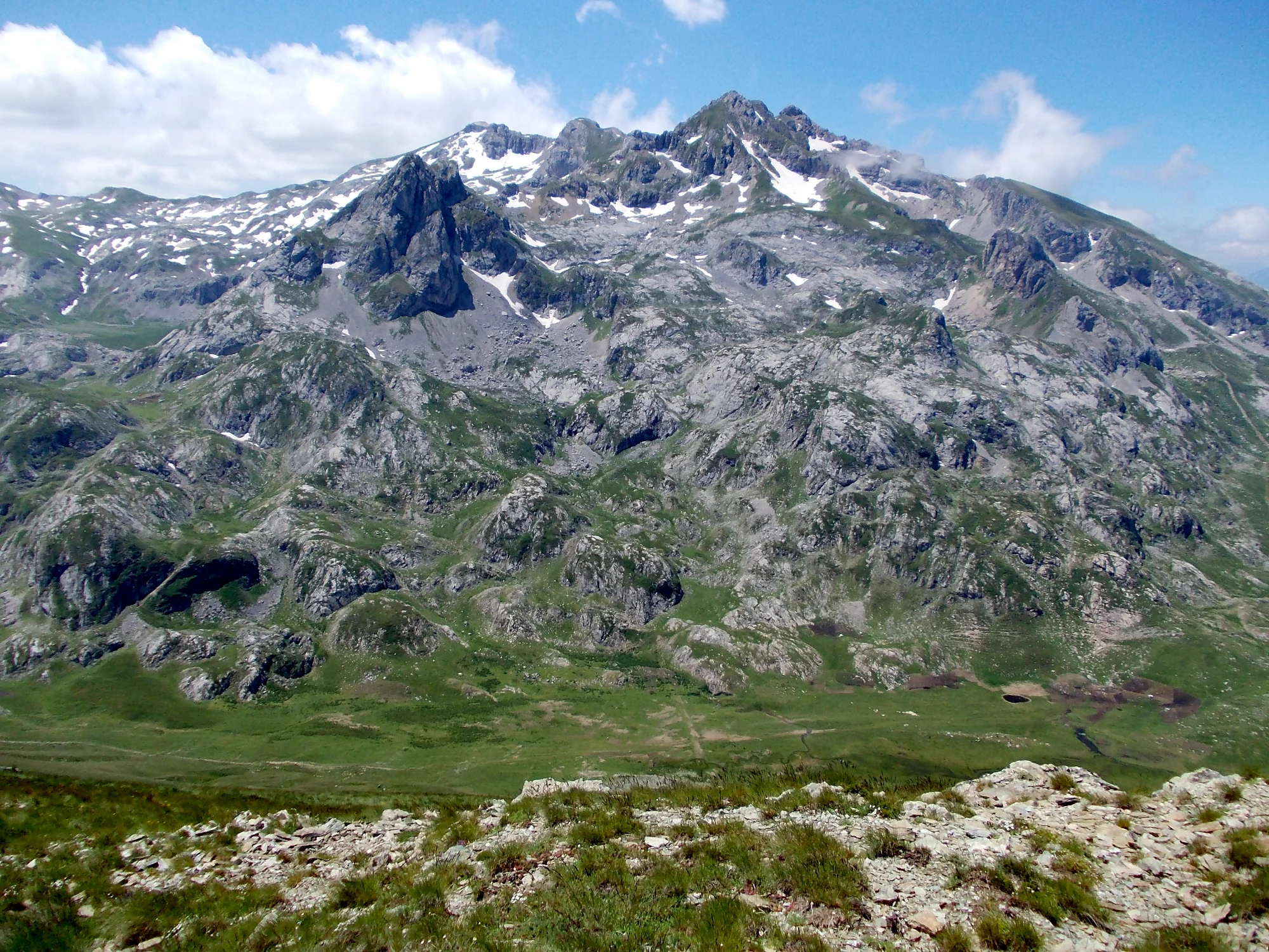
A wide view of a large, rocky mountain massif with patches of snow near the summit, rising above a green alpine valley.
The rugged summit of Mount Korab, the highest peak in Albania, within Korab-Koritnik Nature Park.

Best time to visit Korab-Koritnik Nature Park

The park's moderate humid continental climate shapes its seasonal character. Winters are wet and cold, bringing snow cover to the higher elevations and transforming the alpine terrain into a stark, white landscape that contrasts sharply with the warmer months. Summers are drier and hot in the valleys, but the high elevations typically remain cooler and more comfortable for walking and viewing scenery.

The most balanced window for experiencing the park's overall landscape comes during the warmer months, when lower-elevation oak and mixed forests are in full leaf, the coniferous middle slopes release their resinous scent, and mountain meadows erupt in wildflowers. This is also the period when wildlife viewing tends to be most rewarding, particularly for birds and larger mammals that retreat to denser cover during harsher winter conditions.

Monthly climate preview

Long-term representative monthly temperature and precipitation data measurements

Korab-Koritnik Nature Park Climate Normals and Annual Weather Patterns

Korab-Koritnik Nature Park exhibits a documented annual rhythm of recorded mean temperatures and monthly precipitation values across the sampled coordinate. Examining the complete twelve-month climate profile reveals structured long-term averages for detailed regional analysis.
Annual mean8 °C
-2 °C20 °C
Jan-2°
Feb-1°
Mar
Apr
May12°
Jun16°
Jul19°
Aug20°
Sep15°
Oct
Nov
Dec-1°
Warmest month
August

19.9 °C

Coolest month
January

-2.4 °C

Wettest month
November

3.3 mm/day

Driest month
August

1.2 mm/day

Park location guide

Geography guide, regional context, and park location map for Korab-Koritnik Nature Park

Korab-Koritnik Nature Park park geography, regions, and map view in Albania

Understand where Korab-Koritnik Nature Park sits in Albania through a broader geographic reading of the surrounding landscape, nearby location context, and its mapped position within the national park landscape.

How Korab-Koritnik Nature Park fits into Albania

Albania is a unitary parliamentary republic in Southeast Europe, situated on the Balkan Peninsula along the Adriatic and Ionian coastal regions. With a population of approximately 2.4 million people, it borders Montenegro, Kosovo, North Macedonia, and Greece. The country features varied landscapes ranging from the Albanian Alps to fertile coastal plains, with Tirana as its capital and largest city.

Wider geography shaping Korab-Koritnik Nature Park in Albania

Albania occupies the western part of the Balkan Peninsula in Southeast Europe. The country features a varied terrain with rugged mountain ranges including the Albanian Alps (Accursed Mountains), Korab, Skanderbeg Mountains, Pindus, and Ceraunian Mountains. Fertile lowland plains extend along the Adriatic and Ionian coastal regions. The country borders Montenegro to the northwest, Kosovo to the northeast, North Macedonia to the east, and Greece to the south.

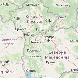
Map view of Korab-Koritnik Nature Park

Use this park location map to pinpoint Korab-Koritnik Nature Park in Albania, understand its exact geographic position, and read its mapped placement within the surrounding landscape more clearly.

Pigeon | © OpenStreetMap contributors

Location context for Korab-Koritnik Nature Park

Dibër CountyKukës County

Visual reference for rugged massifs, glacial basins, and protected mountain habitats.

Korab-Koritnik Nature Park Photos and Alpine Landscape Scenery

Visual documentation captures the dramatic alpine terrain, limestone ridges, and dense coniferous forests defining Korab-Koritnik Nature Park. Photographic records reveal the stark topography of Mount Korab and surrounding protected ecosystems across the Balkan borderlands.

A group of hikers in dark gear walk single file up a steep, snow-covered mountain ridge against a deep blue sky.

Wide shot of a vast, high altitude mountain range completely covered in deep snow under a bright blue sky.

A group of hikers walking single file up a steep, snow covered mountain ridge under a clear blue sky.

A wide view of a large, rugged mountain with light-colored, exposed rock layers, rising above green, grassy alpine meadows under a blue sky with scattered clouds.

A wide view of the rocky, mountainous landscape of Mount Korab under a blue sky with light clouds, showing snow patches on the high crags.

A wide, expansive view of snowy mountain peaks and ridges under a pale blue, slightly cloudy sky.

A wide view of a large, rocky mountain massif with patches of snow near the summit, rising above a green alpine valley.

A mountainous landscape showing rocky slopes, forested hillsides, and a prominent peak under a partly cloudy sky.

A wide landscape view of the rugged, steep slopes of Mali i Grames, showing light gray gypsum rock formations alongside green alpine meadows and sparse trees under a blue sky.

Park atlas

Compare adjacent mountain terrain and connected regional conservation zones

Parks Near Korab-Koritnik Nature Park and Surrounding Protected Landscapes

Browsing other protected areas near Korab-Koritnik Nature Park reveals shared alpine topography and connected regional ecosystems across the borderlands. Continuing into surrounding national nature parks provides wider geographical context for regional mountain ranges and valley formations.
National parkNorth Macedonia
Mapped location lies within the park boundary#1 closest

Southeast

Mavrovo National Park: North Macedonia's Extensive Protected Alpine Terrain and Wildlife

Mapped geography of Alpine peaks, gorges, and unique endemic species.

Mavrovo National Park, North Macedonia's largest protected area, offers a deep dive into a complex Alpine geography. Dominated by the Šar, Korab, and Bistra mountain systems, the park features towering peaks and the dramatic Radika River gorge. This protected landscape is globally significant for its role in conserving the rare Balkan lynx and harbors endemic tertiary relic plant species like Macedonian pine. Explore the mapped boundaries, glacial lakes, and distinct terrain that define this vital conservation area.

Area
730.88 km²
Established
1949
IUCN
II
Relief
Mountain
Watercolor illustration of mountainous landscape with rolling hills, green fields, and distant snow-capped peaks.
National parkNorth Macedonia
About 14 km away#2 closest

Northeast

Šar Planina National Park: North Macedonia's Premier Alpine Protected Landscape

Explore glacial lakes, high peaks, and critical Balkan lynx habitat.

Šar Planina National Park is an expansive protected area in North Macedonia, defined by its striking alpine terrain and significant ecological value. The park safeguards a landscape featuring approximately 220 peaks over 2,000 meters and 29 permanent glacial lakes, known as 'Šar's Eyes.' This national park serves as a vital refuge for endangered wildlife, including the Balkan lynx, and offers a unique geographic context for understanding mountain wilderness and protected land distribution in the Balkan region. Its mapped boundaries encompass a rich biodiversity and a landscape shaped by glacial and fluvial processes.

Area
627 km²
Established
2021
IUCN
II
Relief
Mountain
Watercolor illustration of rolling green hills and distant mountains under a soft sky
National parkDibër County
About 26 km away#3 closest

West

Lurë-Dejë Mountain National Park: Mapped Protected Landscape and Glacial Lake Geography

Dibër County's alpine protected area with unique glacial lakes.

Delve into the detailed geographic context and mapped protected area of Lurë-Dejë Mountain National Park, an essential natural landscape in Albania's Dibër County. This park is renowned for its rare chain of twelve glacial lakes, situated at high elevations amidst dramatic alpine terrain. Its protected status ensures the preservation of significant old-growth forest ecosystems, including the critically endangered Balkan pine, contributing to its recognition as an Important Bird and Plant Area. Explore the park's distinctive terrain, from its soaring mountain peaks to its unique alpine meadows, all within a comprehensive geographic atlas framework.

Area
202.42 km²
Established
1966
IUCN
II
Relief
Mountain
Watercolor painting of rolling mountains with green forests and pastel-colored hills
National parkKosovo
About 55 km away#4 closest

Northeast

Sharr Mountains National Park: Kosovo's Alpine Protected Landscape and Geographic Atlas

Explore its dramatic peaks and glacial terrain.

Sharr Mountains National Park in Kosovo is a prime example of dramatic alpine topography, featuring jagged peaks, steep glacial valleys, and clear evidence of ancient glacial shaping. This protected area safeguards critical ecosystems, including extensive old-growth forests and diverse alpine meadows, supporting notable wildlife conservation efforts. Its scenic ridgelines, glacial lakes, and mountain streams define the park's natural landscape, offering rich context for atlas-based geographic discovery within the Balkans.

IUCN
II
Relief
Mountain
Scope
Terrestrial
A minimalist watercolor painting showing a tranquil lake surrounded by gentle hills and trees against a soft, pale sky.
Nature reserveDibër County
About 58 km away#5 closest

West

Lake Ulza Nature Park: Mapped Geography and Protected Area Overview in Dibër County

Analyzing the reservoir and river valley landscapes of central Albania

Lake Ulza Nature Park represents a significant protected mosaic where the Mat River creates a corridor of reservoirs, oak forests, and stony uplands. This overview examines the park geography, offering a structured look at how water bodies and mountainous terrain converge to form a unique inland habitat in Dibër County. Explore the physical relief and environmental boundaries that define this essential Albanian natural landmark.

Area
42.06 km²
Established
2013
IUCN
IV
Relief
Mixed relief
An abstract watercolor painting showing a horizontal landscape with grassy foreground and distant rolling hills in soft green, yellow, and purple tones.
Nature reserveDibër County
About 63 km away#6 closest

Southwest

Mali me Gropa-Bizë-Martanesh Nature Park: Karst Plateau and Mountain Geography in Central Albania

A diverse nature reserve in the heart of the Albanian highlands

This protected area features a unique mosaic of karst landscapes, including the distinctive Mali me Gropa plateau, alongside deep canyons and glacial features. It provides essential habitat for large carnivores and represents a vital ecological link within the mountain terrain of central Albania, offering a structured look at the region's vertical landscape zonation and natural monuments.

Area
252.66 km²
Established
2007
IUCN
IV
Relief
Mountain
Nature reserveAlbania
About 63 km away#7 closest

Southwest

Shtamë Pass Nature Park: Geographic Overview and Protected Mountain Landscape Map

Highland pine forests and freshwater corridors in Albania

Shtamë Pass Nature Park sits within the central Albanian mountains, providing a critical ecological link between coastal-inland gateway regions. The area protects a complex mosaic of alpine terrain, including clear mountain lakes, cold freshwater springs, and dense black pine forests that shelter brown bears and wolves. This protected zone offers a comprehensive view of regional highland geography and topography through its distinct mountain pass corridor.

Area
68.64 km²
Established
1996
IUCN
IV
A soft watercolor painting of a lake landscape with rolling green hills, distant mountains, and gentle reflections in pale greens, pinks, and yellows.
Nature reserveNorth Macedonia
About 68 km away#8 closest

South

Lake Ohrid Nature Reserve: Mapped Geographic Boundaries and Ancient Balkan Lake Ecosystems

A tectonic mountain lake system in North Macedonia

Lake Ohrid represents a monumental protected landscape within the mountainous southwestern Balkans. As one of the oldest and deepest lakes in Europe, it serves as a critical refuge for unique endemic species that exist in its clear, oligotrophic waters. This area showcases the complex interplay between tectonic geological history, high-mountain terrain, and the sustained conservation of a globally significant natural basin.

Area
358 km²
Relief
Mixed relief
Climate
Mediterranean
Access
Easy access

Common questions about visiting, size, designation, and location context for Korab-Koritnik Nature Park

Korab-Koritnik Nature Park FAQs for park facts, access, geography, and protected area context

Find quick answers about Korab-Koritnik Nature Park, including protected-area facts, park geography, trail and visitor context, and how the park fits into its surrounding country and regional landscape.
MoriAtlas Explorer

Continue Your Protected Areas Search Across the Global Atlas

Deepen your exploration by continuing the structured search for national parks and protected areas worldwide. Utilize the comprehensive filtering capabilities to compare different conservation landscapes and refine your understanding of global park geography. Discover more about the distribution and characteristics of protected natural areas.

Global natural geography