
Mori Atlas logo
Nature reserveKrebsbachtal bei Ruppertshain

A vital stream valley landscape and Natura 2000 conservation site in the Taunus foothills of Hessen

Krebsbachtal bei Ruppertshain Nature Reserve: Mapped Geography and Protected Area Context

(Naturschutzgebiet Krebsbachtal bei Ruppertshain)

Krebsbachtal bei Ruppertshain serves as a protected ecological corridor within the Main-Taunus district, encompassing the Fischbach stream valley and surrounding deciduous woodland. This nature reserve, designated as an official FFH site, preserves the transitional terrain between the Vordertaunus slopes and the Hornauer Bucht. The landscape reveals a compact yet significant valley habitat that provides essential regional connectivity near the prominent landmarks of the Altkönig ridge and historic Taunus castles.

nature reserveFFH siteNatura 2000stream valleymixed deciduous forestTaunus foothills
A flat vector illustration of a valley landscape, featuring a winding river, pine trees, and a waterfall cascading down a distant rocky slope.

Krebsbachtal bei Ruppertshain

Nature reserve

Park overview

Structured park overview, official facts, and landscape profile for Krebsbachtal bei Ruppertshain

Krebsbachtal bei Ruppertshain park facts, protected area profile, and essential visitor context

Review the core facts for Krebsbachtal bei Ruppertshain, including designation, size, terrain, visitor scale, habitats, and operating context in one park-focused overview.

About Krebsbachtal bei Ruppertshain

Krebsbachtal bei Ruppertshain is a small nature reserve on the western edge of the Taunus uplands in the German state of Hesse. Administered from the city of Kelkheim in the Main-Taunus district, the reserve follows the valley of the Fischbach stream through a wooded, hill-framed landscape at the transition between the Vordertaunus and the Hornauer Bucht natural area.

The protected area is narrow and elongated, running on both sides of a regional road that connects the villages of Ruppertshain and Fischbach in the Taunus. To the south it reaches the lower slopes of the Rossert massif, while nearby ridges look out toward the Altkönig and the castles of Königstein and Falkenstein. This setting, between low mountain ridges and a small lowland valley, defines both the scenery and the ecological character of the reserve.

Alongside its role as a German nature reserve (Naturschutzgebiet), the same territory has been part of the European Natura 2000 network as an FFH site since 2000. It is therefore valued less as a destination landscape and more as a tightly defined conservation area for the stream valley habitats and the surrounding mixed forests of the western Taunus.

Quick facts and research context for Krebsbachtal bei Ruppertshain

Krebsbachtal bei Ruppertshain is a small Hessian nature reserve and EU FFH site covering roughly 84.5 hectares in the Main-Taunus district of Hesse, Germany. It lies within the city area of Kelkheim (Taunus), between the villages of Ruppertshain and Fischbach, in the wooded foothills of the Vordertaunus. The reserve was designated in 1992 and joined the Natura 2000 network in 2000, protecting the valley of the Fischbach stream together with the surrounding mixed deciduous forests of the Taunus uplands.

Protection and recognition

Documented terrestrial designation history, management scope, and Natura 2000 records

Krebsbachtal bei Ruppertshain Protection Status and International Recognition

Terrestrial protected area records establish the designation history and formal management scope established for Krebsbachtal bei Ruppertshain since the year 2000. Official source documentation outlines verified Natura 2000 recognition alongside reference data for international protected area tracking.

International recognition

Protection details

Protection scope
Terrestrial
Designated year
2000
Transboundary protection
No
WDPA ID
164245
Park context

Deeper park guide and search-rich context for Krebsbachtal bei Ruppertshain

Krebsbachtal bei Ruppertshain history, landscape, wildlife, and travel context

Explore Krebsbachtal bei Ruppertshain through its history, landscape character, ecosystems, wildlife, conservation priorities, cultural context, and seasonal travel timing in a structured park guide built for atlas discovery and search intent.

Krebsbachtal bei Ruppertshain history and protected-area timeline

Krebsbachtal bei Ruppertshain was placed under formal nature protection in 1992, when it was designated a Hessian nature reserve (Naturschutzgebiet) covering roughly 84.5 hectares. The designation focused on the valley of the Fischbach stream, the adjacent mixed forests, and the transitional slopes of the surrounding Taunus foothills.

In 2000, the area was recognized at the European level when it was added to the Natura 2000 network as an FFH (Fauna-Flora-Habitat) site, using the same boundaries and the same name. Since then the reserve has functioned under both German state nature conservation law and the EU Habitats Directive framework, reinforcing its role as a long-term protected valley landscape in the Main-Taunus district.

Krebsbachtal bei Ruppertshain landscape and geographic character

The reserve occupies a clearly defined low mountain valley. The Fischbach stream runs through the area and continues downstream to join the Schwarzbach near Eppstein, giving the protected zone a recognizable linear, valley-shaped form. The terrain rises from the stream corridor up into the wooded hills of the Vordertaunus.

To the south, the reserve climbs toward the Fischbacher Kopf, a secondary summit of the Rossert massif, while the northern end reaches almost to the edges of Ruppertshain and Fischbach. A regional road (Landesstraße L 3016) passes through the valley, dividing it visually but not severing the ecological continuity of the surrounding slopes. In the wider visual context the valley lies beneath notable landmarks of the eastern Taunus, including the Altkönig hill and the castles of Königstein and Falkenstein.

Krebsbachtal bei Ruppertshain ecosystems, habitats, and plant life

Ecologically, the reserve is built around the moist and shaded habitats of the Fischbach valley and the deciduous and mixed forests that clothe the surrounding Taunus slopes. The stream corridor provides the humid microclimate that supports the area's characteristic woodland and valley vegetation, while the adjacent hill forests transition into drier mixed stands typical of the Vordertaunus.

Because the same area is also an EU FFH site, the habitats here are considered noteworthy at the European level for their contribution to the survival of certain stream-valley and woodland habitat types that are scarce elsewhere in the surrounding, heavily settled Rhine-Main region.

Krebsbachtal bei Ruppertshain conservation status and protection priorities

Krebsbachtal bei Ruppertshain sits at the intersection of two coordinated protection regimes. In 1992 it was designated a Hessian nature reserve (Naturschutzgebiet) under federal and state nature conservation law, and in 2000 the same area, with identical boundaries and name, was added to the European Natura 2000 network as an FFH site under the EU Habitats Directive.

Its conservation value is rooted in the combination of a small, near-natural stream valley with adjacent mixed deciduous forest on the lower slopes of the Vordertaunus. Such habitats are increasingly rare and fragmented in the densely settled Rhine-Main region, making even a compact area of about 84 hectares significant for landscape connectivity. The reserve contributes to the broader mosaic of protected valley sites in the Main-Taunus district, alongside neighboring reserves such as Rossert - Hainkopf - Dachsbau and Kickelbach von Fischbach.

Top sights and standout views in Krebsbachtal bei Ruppertshain

The reserve is distinctive for its compact combination of a forested Taunus stream valley, an FFH-grade European protection status, and a setting right next to the cultural landmarks of Königstein, Falkenstein, and the Altkönig summit. Its value lies as much in ecological connectivity within the densely populated Rhine-Main region as in any single dramatic landscape feature.

Monthly climate preview

Long-term representative monthly temperature and precipitation rhythm in Hessen

Krebsbachtal bei Ruppertshain Climate Normals and Annual Temperature Patterns

Historical data records mean monthly temperatures ranging from sub-zero winter minimums to warm summer maximums alongside consistent daily precipitation averages at the sampled coordinate. Examining the complete twelve-month record reveals detailed monthly temperature spreads and precipitation distributions across the protected landscape.
Annual mean9 °C
0 °C20 °C
Jan
Feb
Mar
Apr
May13°
Jun17°
Jul20°
Aug19°
Sep15°
Oct
Nov
Dec
Warmest month
July

19.6 °C

Coolest month
January

-0.1 °C

Wettest month
July

2.2 mm/day

Driest month
April

1.5 mm/day

Park location guide

Geography guide, regional context, and park location map for Krebsbachtal bei Ruppertshain

Krebsbachtal bei Ruppertshain park geography, regions, and map view in Germany

Understand where Krebsbachtal bei Ruppertshain sits in Germany through a broader geographic reading of the surrounding landscape, nearby location context, and its mapped position within the national park landscape.

How Krebsbachtal bei Ruppertshain fits into Germany

Germany is a federal republic in Western and Central Europe with a population of over 83 million across sixteen constituent states. It is Europe's largest economy by nominal GDP and a major global exporter and importer. The capital is Berlin, and the country borders Denmark, Poland, Czech Republic, Austria, Switzerland, France, Luxembourg, Belgium, and the Netherlands.

Wider geography shaping Krebsbachtal bei Ruppertshain in Germany

Germany is located in Western and Central Europe, spanning 357,022 km². It borders Denmark to the north, Poland and the Czech Republic to the east, Austria and Switzerland to the south, and France, Luxembourg, Belgium, and the Netherlands to the west. The country has coastlines on the Baltic Sea and North Sea to the north, with the Alps located in the southern region.

Map view of Krebsbachtal bei Ruppertshain

Use this park location map to pinpoint Krebsbachtal bei Ruppertshain in Germany, understand its exact geographic position, and read its mapped placement within the surrounding landscape more clearly.

Pigeon | © OpenStreetMap contributors

Location context for Krebsbachtal bei Ruppertshain

Hessen
Recorded earthquake history

Review the Historical Earthquake Catalogue for Krebsbachtal bei Ruppertshain

Access a structured collection of recorded seismic events that have occurred within the surrounding geography of the Krebsbachtal bei Ruppertshain nature reserve. This resource by MoriAtlas provides clear, historical data on local tremors and epicentre distances to support your exploration of the regional terrain.

Krebsbachtal bei Ruppertshain Earthquake History

Catalogued events

29 events

Strongest magnitude

Magnitude 4.3

Most recent event

May 17, 2014

This history includes earthquakes recorded inside the park or within 50 km of its borders

Visual exploration of protected stream valleys and forest habitats in the Taunus foothills

Krebsbachtal bei Ruppertshain Photos and Landscape Scenery

Visual records capture the linear valley terrain and mixed deciduous woodlands defining Krebsbachtal bei Ruppertshain. Detailed imagery reveals the protected stream environments and low mountain topography characterizing the nature reserve.

Panoramic landscape view of a green valley and rolling hills under a blue sky, with a mix of open meadows and dense forest patches.

Park atlas

Compare nearby protected areas and connected valley reserves across the Taunus foothills

Explore Other Parks Near Krebsbachtal bei Ruppertshain and Surrounding Protected Landscapes

Browsing other parks near Krebsbachtal bei Ruppertshain reveals a network of protected stream valleys and forested hill terrain throughout the surrounding region. Extending the geographic comparison helps trace ecological continuity and regional conservation patterns beyond a single protected zone.
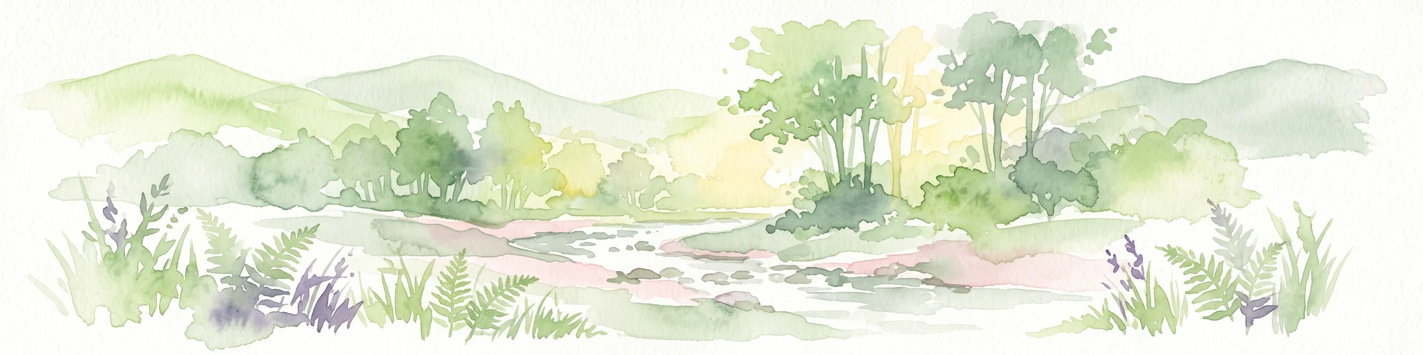
A soft watercolor painting depicting rolling green hills and a forested landscape under a pale, sunrise-hued sky.
Nature reserveHessen
0.5 km away#1 closest

West

Rossert - Hainkopf - Dachsbau Nature Reserve: Geography and Protected Taunus Forest Landscapes

A preserved ridge system in the Hessen region of Germany

The Rossert - Hainkopf - Dachsbau nature reserve represents a compact but ecologically vital ridge system in the Taunus foothills. Spanning over 120 hectares of mixed forest, this protected area preserves the transition between woodland and open meadow while securing the headwaters of the Wellbach stream within its geographic boundaries.

Area
1.19 km²
Established
1977
IUCN
IV
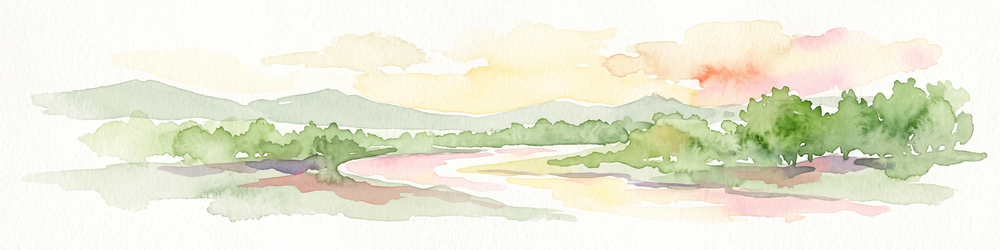
A horizontal watercolor painting showing a soft, impressionistic landscape with rolling green hills and patches of forest under a pale, muted sky.
Nature reserveHessen
4.3 km away#2 closest

Northeast

Burghain Falkenstein Nature Reserve: Protected Woodland Map and Regional Geography

A forest enclave in the Taunus uplands of Hessen, Germany

Burghain Falkenstein stands as a prominent nature reserve and Natura 2000 site located on the slopes of the Burgberg. This compact protected area features a mosaic of beech and ravine forests, providing a rare green massif amidst the urban sprawl of the Taunus foothills. The reserve documents a complex history where natural woodland succession intersects with medieval fortification remains, offering a concentrated study of regional forest geography near Frankfurt am Main.

Area
0.363 km²
Established
1966
IUCN
IV
Relief
Mountain
A watercolor illustration of a serene valley landscape with a small winding stream running through grassy meadows, bordered by trees in the distance.
Nature reserveHesse
About 4.5 km away#3 closest

Northwest

Dattenbachtal zwischen Kröftel und Vockenhausen Nature Reserve in Hesse, Germany

Stream valley and protected riparian landscape mapping

This nature reserve protects a vital section of the Dattenbach stream valley between the villages of Kröftel and Vockenhausen. Spanning cross-district boundaries in the Taunus foothills, the site is defined by its two-parcel structure and its role in preserving headwater stream habitats within the larger Hessian landscape.

Area
0.909 km²
Established
1993
A soft, impressionistic watercolor painting of a meadow with wildflowers in the foreground, rolling hills and trees in the midground, and a faint mountain range in the background.
Nature reserveHochtaunuskreis
About 6.8 km away#4 closest

North

Reifenberger Wiesen Nature Reserve: Geographic Profile and Protected Meadow Boundaries

High Taunus mountain meadows within the Hochtaunuskreis region.

Located in the High Taunus mountains, Reifenberger Wiesen provides a concentrated example of mountain hillside meadows. This nature reserve features specialized nutrient-poor grasslands that host diverse botanical communities, supported by its distinct north-facing slope geography and proximity to the headwaters of the Weil river, forming a critical ecological link in the Hessian landscape.

Area
0.234 km²
Established
1983
Nature reserveHesse
About 8.5 km away#5 closest

South

Prügelwiesen bei Wiesbaden in Breckenheim: Protected Fen and Meadow Nature Reserve

Mapped landscapes and wetland conservation in Hesse, Germany

Prügelwiesen bei Wiesbaden in Breckenheim preserves a diverse wetland ecosystem featuring calcareous fens, sedge beds, and traditional orchard meadows. Located in the Rhine-Main region, this nature reserve offers a look into rare grassland communities and groundwater-dependent habitats that characterize the transition between the Taunus foothills and the Main lowlands.

Area
0.079 km²
Established
1994
IUCN
IV
Relief
Lowland
Watercolor painting depicting a landscape with rolling hills in the background and trees in autumn colors in the midground.
Nature reserveHochtaunuskreis
About 11 km away#6 closest

North

Saubach und Niedgesbach bei Schmitten Nature Reserve: High Taunus Landscape Geography

Mapped protected valleys in the Hochtaunuskreis region.

This nature reserve protects the parallel stream valleys of the Saubach and Niedgesbach near the village of Schmitten. The site is a significant example of High Taunus upland ecology, where abandoned pastoral land has fostered unique plant diversity. It remains a key focal point for understanding the transition of cultural landscapes into protected wild habitats within the Hochtaunuskreis.

Area
0.58 km²
Established
1995
A watercolor illustration of a landscape with green meadows, flowering bushes, and distant rolling hills on a white background.
Nature reserveHesse
13 km away#7 closest

West

Rabengrund von Wiesbaden: Mapping Protected Landscapes and Habitats in Hesse

Nature reserve and FFH site in the Taunus foothills

Rabengrund von Wiesbaden serves as a distinct protected valley system characterized by a compact coexistence of acid grasslands, reedbeds, and orchid-rich meadows. Managed as both a nature reserve and a Natura 2000 site, this area provides a rare window into the historical cultural landscape of the Taunus region. The site offers essential insight into small-scale habitat diversity near the urban core of the Hessian state capital.

Area
0.791 km²
Established
1988
IUCN
IV
Relief
Upland
A horizontal watercolor painting depicting a gentle stream flowing through a lush meadow with trees and hills in the background.
Nature reserveHessen
About 14 km away#8 closest

North

Oberes Dombachtal Nature Reserve: Valley Geography and Protected Landscapes in Hessen

Mapping rare floodplain habitats in the eastern Taunus foothills

Oberes Dombachtal protects a specialized valley system characterized by relict alder woodland, purple moor-grass stands, and near-natural stream segments. Located in the eastern Taunus, the reserve serves as a crucial link for local biodiversity, offering a concentrated look at the valley-floor ecosystems that define this part of the Hessen landscape. Its geography demonstrates the importance of small-scale corridor protection for stream health.

Area
0.187 km²
Established
1995
IUCN
IV
Relief
Upland

Common questions about visiting, size, designation, and location context for Krebsbachtal bei Ruppertshain

Krebsbachtal bei Ruppertshain FAQs for park facts, access, geography, and protected area context

Find quick answers about Krebsbachtal bei Ruppertshain, including protected-area facts, park geography, trail and visitor context, and how the park fits into its surrounding country and regional landscape.
MoriAtlas Explorer

Continue Your Protected Areas Search Across the Global Atlas

Deepen your exploration by continuing the structured search for national parks and protected areas worldwide. Utilize the comprehensive filtering capabilities to compare different conservation landscapes and refine your understanding of global park geography. Discover more about the distribution and characteristics of protected natural areas.

Global natural geography