

Mori Atlas logo
Biosphere reserveKruger to Canyons Biosphere

Tracing the geographic transition from the Blyde Escarpment to the vast Lowveld savanna plains

Kruger to Canyons Biosphere: A Comprehensive Atlas of Protected Landscapes in Limpopo, South Africa

(Kruger to Canyons Biosphere Region)

The Kruger to Canyons Biosphere represents an ecologically significant conservation region in northeastern South Africa, bridging the gap between high-altitude montane forests and extensive lowland savanna. This protected area unites landmarks including the Blyde River Canyon and vast reaches of the Kruger system, creating a distinct corridor of biodiversity from the Drakensberg escarpment to the Mozambique border. Through this spatial perspective, examine the complex integration of core conservation zones, buffer areas, and diverse natural terrain.

biosphere reserveUNESCOsavannacanyonescarpmentDrakensberg
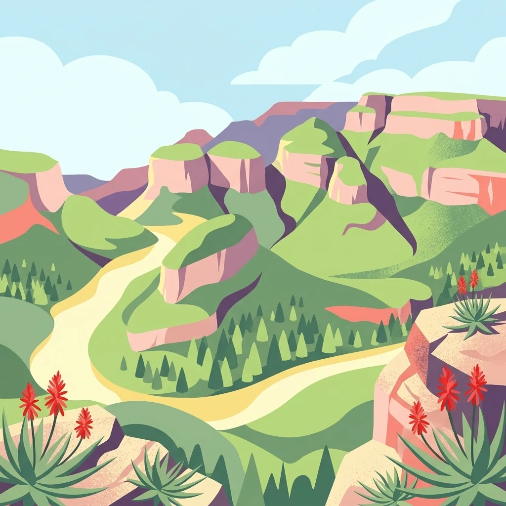
A vibrant, flat-style digital illustration depicting a winding river through a canyon with steep, rocky cliffs, pine-like trees, and flowering aloe plants in the foreground.

Kruger to Canyons Biosphere

Biosphere reserve

Park overview

Structured park overview, official facts, and landscape profile for Kruger to Canyons Biosphere

Kruger to Canyons Biosphere park facts, protected area profile, and essential visitor context

Review the core facts for Kruger to Canyons Biosphere, including designation, size, terrain, visitor scale, habitats, and operating context in one park-focused overview.

About Kruger to Canyons Biosphere

The Kruger to Canyons Biosphere Region is a large-scale UNESCO biosphere reserve in northeastern South Africa, recognized internationally for its ecological richness and its model approach to conservation. Officially designated in 2001, the biosphere spans parts of Limpopo and Mpumalanga Provinces, creating a contiguous landscape that connects protected wilderness with surrounding rural and agricultural areas.

At its core, the region is defined by extraordinary ecological variety. The biosphere encompasses savanna plains associated with Kruger National Park, the steep cliffs and river gorges of the Blyde River Canyon, montane forests and grasslands along the Drakensberg escarpment, and the Wolkberg mountains, recognized as one of the leading international floral hotspots. This range of habitats supports a correspondingly wide variety of plant and animal life, making the area a focal point for biodiversity research and protection in southern Africa.

Equally important is the biosphere's social and geographic scale. The region extends from the Letaba River in the north to the Sabie River in the south, and from the Blyde Escarpment in the west to the Mozambique border in the east. Within this expansive area, the biosphere accommodates a substantial resident population across its core, buffer, and transition zones, reflecting UNESCO's intent that biosphere reserves serve as landscapes where biodiversity conservation and human development coexist and reinforce one another.

The landscape also holds strong tourism significance, incorporating two of South Africa's most visited natural destinations. By linking Kruger National Park with the Blyde River Canyon and surrounding protected corridors, the biosphere offers a continuous ecological and scenic sweep that few other regions in the country can match.

Quick facts and research context for Kruger to Canyons Biosphere

The Kruger to Canyons Biosphere Region is a UNESCO biosphere reserve covering a vast area in northeastern South Africa across Limpopo and Mpumalanga Provinces. It was officially ratified by UNESCO on 1 January 2001 under the Man and the Biosphere Programme, making it part of an international framework that links biodiversity conservation with sustainable development.

The region is anchored by Kruger National Park and the Blyde River Canyon Nature Reserve, two of South Africa's most significant protected areas, and also includes the Wolkberg, an internationally recognized floral hotspot. The biosphere is managed through the Kruger to Canyons Biosphere Region Non-Profit Company (K2C NPC), established in 2011 to coordinate conservation, sustainable land management, and community-based projects across the landscape.

Protection and recognition

Examining documented protection scope and official UNESCO recognition data.

Kruger to Canyons Biosphere Protection Status and International Recognition

Kruger to Canyons Biosphere brings together documented protection status, management scope, and official international recognition records. Official sources verify the designated status alongside global recognition frameworks for this protected landscape.

International recognition

Protection details

Protection scope
Mixed
Designated year
2001
Transboundary protection
No
Core area
9,230 km²
Buffer area
4,850 km²
Park context

Deeper park guide and search-rich context for Kruger to Canyons Biosphere

Kruger to Canyons Biosphere history, landscape, wildlife, and travel context

Explore Kruger to Canyons Biosphere through its history, landscape character, ecosystems, wildlife, conservation priorities, cultural context, and seasonal travel timing in a structured park guide built for atlas discovery and search intent.

Why Kruger to Canyons Biosphere stands out

The Kruger to Canyons Biosphere is best known for bringing together some of South Africa's most iconic natural areas within a single UNESCO-recognized framework. The region unites Kruger National Park, one of Africa's largest game reserves, with the Blyde River Canyon, the Wolkberg floral hotspot, and the dramatic Mpumalanga Drakensberg escarpment. Its defining identity lies in the combination of savanna wildlife ecosystems, deep river canyons, montane habitats, and high floristic diversity. The biosphere is also notable for demonstrating how large-scale landscape conservation can integrate ecological protection with the realities of rural communities and land-use pressures, making it both a conservation zone and a model for sustainable development.
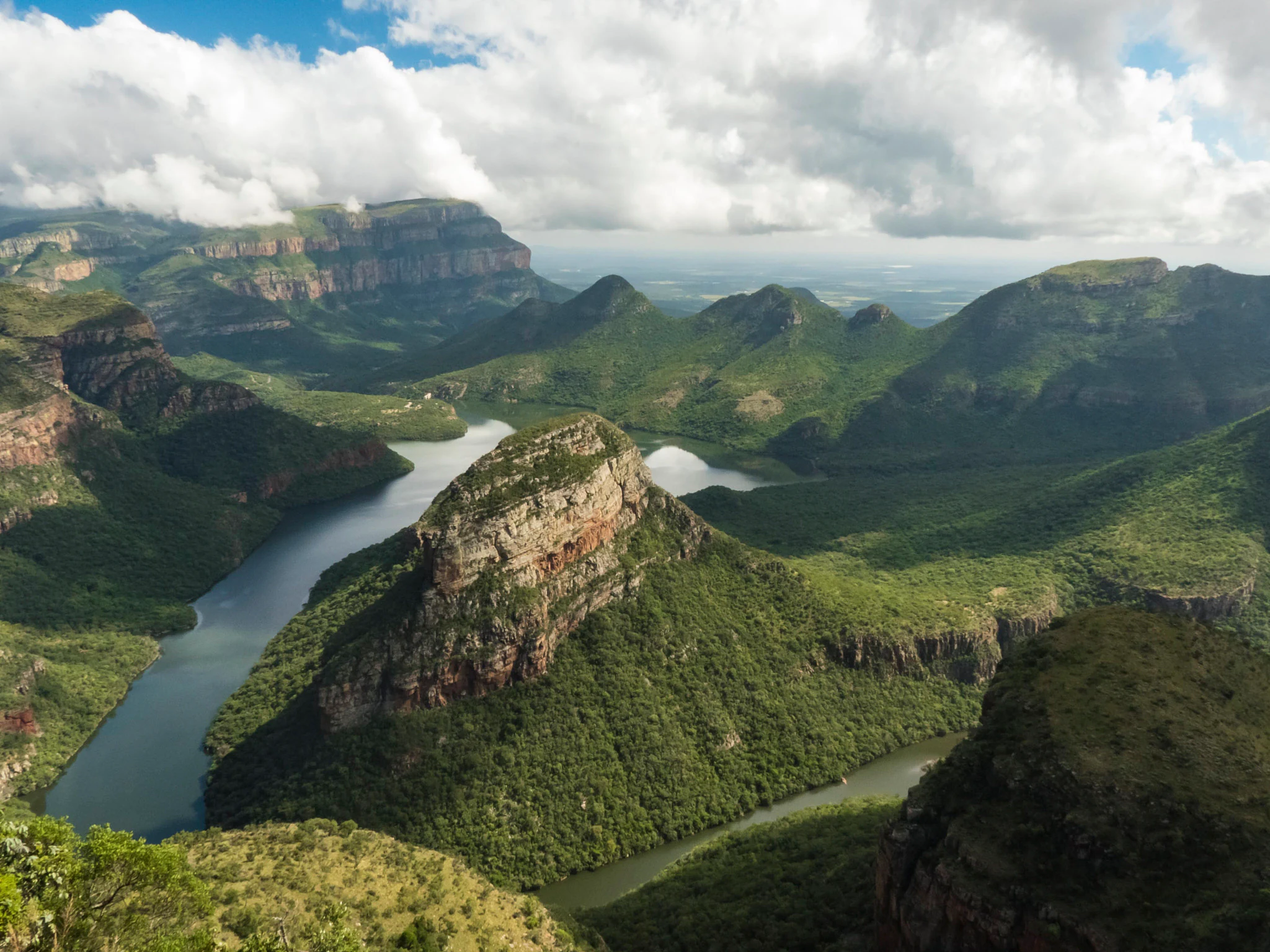
A wide aerial view looking down into the lush green Blyde River Canyon, with a river winding through the steep rocky valley and clouds resting on the distant mountain peaks.
The scenic Blyde River Canyon, a primary feature of the Kruger to Canyons Biosphere.

Kruger to Canyons Biosphere history and protected-area timeline

The Kruger to Canyons Biosphere Region was officially designated as a UNESCO biosphere reserve on 1 January 2001, following a process led by South Africa's then Department of Environmental Affairs. The designation was made under UNESCO's Man and the Biosphere (MaB) Programme, which promotes biosphere reserves as learning landscapes that integrate biodiversity conservation, sustainable development, and community engagement alongside formally protected core areas.

The ratification reflected growing recognition in South Africa during the late 1990s and early 2000s of the need to manage large, ecologically significant landscapes holistically, rather than relying solely on traditional protected-area models. By linking Kruger National Park and the Blyde River Canyon through coordinated zoning and governance, the biosphere established one of the country's first internationally recognized frameworks for landscape-scale conservation.

In 2011, the Kruger to Canyons Biosphere Region Non-Profit Company (K2C NPC) was established to coordinate biosphere-related activities on the ground. The founding board put early enabling structures in place, after which a strategic plan was developed and implemented within the framework of South African company law. Today, the K2C NPC operates as the coordinating body for an expanding portfolio of conservation, land management, and community-focused projects across the biosphere region.

Kruger to Canyons Biosphere landscape and geographic character

The landscape of the Kruger to Canyons Biosphere Region is defined by dramatic contrasts in terrain and elevation across northeastern South Africa. Its western edge is anchored by the Blyde Escarpment and the deep Blyde River Canyon, one of the largest and most spectacular green canyons in the world. Here, sheer cliffs plunge toward forested valley floors, and landmarks such as Mariepskop rise above the surrounding ridges, offering sweeping views of the Drakensberg.

To the east, the terrain transitions into the broad savanna plains associated with Kruger National Park, creating a vast lowveld landscape shaped by ancient river systems and seasonal rainfall. The northern boundary follows the Letaba River, while the southern boundary traces the Sabie River, both key tributaries that feed into the wider Limpopo system near the Mozambique border.

Between the escarpment and the lowveld lie transitional landscapes that include montane grasslands, Afromontane forests, and the Wolkberg mountains, home to exceptional botanical diversity. This gradient from high escarpment to open bushveld produces one of the most visually and ecologically varied landscapes in southern Africa.

Kruger to Canyons Biosphere ecosystems, habitats, and plant life

The Kruger to Canyons Biosphere Region encompasses an unusually broad range of ecosystems within a single contiguous conservation framework. The lowveld areas in the east support classic African savanna habitats shaped by large herbivore populations and seasonal wet-and-dry cycles, while the escarpment and canyon systems to the west preserve microclimates that sustain moisture-loving montane forests and rare plant communities.

The Wolkberg mountains, identified internationally as a leading floral hotspot, contribute exceptional botanical diversity to the biosphere. The region is also characterized by strong altitudinal gradients, from the high ridges of the Drakensberg escarpment down through forested slopes to the open plains of the lowveld. These ecological transitions create overlapping habitats that support a wide spectrum of plant and animal life while also creating ecological corridors between formally protected areas.

Conservation initiatives operating within the biosphere include invasive alien plant clearing, sustainable rangeland management, and efforts to expand protected-area coverage across catchments such as the Blyde, reinforcing the ecological integrity of the broader landscape.

Kruger to Canyons Biosphere wildlife and species highlights

The wildlife profile of the Kruger to Canyons Biosphere is closely tied to Kruger National Park, which forms a core area of the reserve and supports one of Africa's most diverse large-mammal communities. The savanna ecosystems of the lowveld sustain populations of iconic species that have come to define South African wildlife tourism, including elephants, lions, buffaloes, leopards, and rhinoceroses, alongside diverse plains game and a rich birdlife typical of bushveld habitats.

The Blyde River Canyon and surrounding escarpment habitats add a distinct ecological dimension, supporting bird species associated with cliffs, forested valleys, and montane environments. The gradient from canyon to escarpment to lowveld gives the biosphere strong potential as a corridor species and seasonal migration route, while also contributing to the broader conservation value of the landscape beyond any single national park boundary.

Kruger to Canyons Biosphere conservation status and protection priorities

The Kruger to Canyons Biosphere Region represents an important example of UNESCO's landscape-scale approach to conservation in South Africa. By encompassing core areas such as Kruger National Park and the Blyde River Canyon Nature Reserve alongside buffer and transition zones, it extends the reach of formal protection into surrounding land uses and rural communities. This zoning structure is designed to maintain ecological connectivity while supporting sustainable development.

Conservation South Africa operates within the biosphere as a partner in the Catchment Investment Programme, which focuses on invasive alien plant clearing, sustainable rangeland management, and protected-area expansion across key catchments including the Blyde. The K2C NPC coordinates a broader portfolio of projects linking biodiversity conservation with water security, agro-ecology, capacity building for environmental monitors, and environmental education, reinforcing the biosphere's role as both an ecological asset and a functioning conservation management unit.

Kruger to Canyons Biosphere cultural meaning and human context

The biosphere region occupies a landscape with a long history of human settlement, with rural communities living across its core, buffer, and transition zones. The integration of these communities into biosphere governance reflects UNESCO's broader philosophy that reserves should be living landscapes where conservation is linked to economic and social realities.

In practical terms, this means the Kruger to Canyons Biosphere supports community-based environmental monitoring, sustainable land use, and local engagement with conservation projects alongside its formal protected-area mandate.

Top sights and standout views in Kruger to Canyons Biosphere

The most distinctive feature of the Kruger to Canyons Biosphere is its ability to unite two of South Africa's defining natural landmarks, Kruger National Park and the Blyde River Canyon, under a single UNESCO framework. Its sheer geographic range, from the Letaba River in the north to the Sabie River in the south, and from the Blyde Escarpment to the Mozambique border, gives it unusually high ecological and scenic diversity.

Equally notable is the region's role as a model for integrated conservation. Through the K2C NPC, the biosphere runs projects spanning invasive plant clearing, protected-area expansion, water security, agro-ecology, and community-based environmental monitoring, demonstrating how landscape-scale conservation can function alongside rural settlement and land use.

Best time to visit Kruger to Canyons Biosphere

The Kruger to Canyons Biosphere straddles areas with broadly similar seasonal patterns, shaped by northeastern South Africa's wet and dry cycles. The dry winter months generally bring cooler temperatures, thinner vegetation, and easier wildlife visibility in the lowveld and savanna sections, while also offering clear conditions for enjoying the dramatic viewpoints along the Blyde River Canyon and Drakensberg escarpment.

The wetter summer months transform the landscape with lush vegetation, stronger flowing rivers, and greener montane slopes, making the canyon's forested areas and escarpment viewpoints particularly scenic, though wildlife viewing may be more challenging due to denser bush.
Monthly climate preview

Long-term representative coordinate measurements tracing monthly weather patterns

Kruger to Canyons Biosphere Climate Normals, Annual Temperature and Precipitation Rhythm

Kruger to Canyons Biosphere exhibits a measured annual rhythm of shifting temperatures and precipitation rates across twelve distinct monthly intervals. Examining the complete climate profile provides deeper quantitative insight into long-term averages for this representative protected location.
Annual mean23 °C
18 °C27 °C
Jan27°
Feb27°
Mar26°
Apr23°
May21°
Jun18°
Jul18°
Aug20°
Sep23°
Oct25°
Nov26°
Dec27°
Warmest month
December

26.9 °C

Coolest month
July

18 °C

Wettest month
January

3.6 mm/day

Driest month
June

0.2 mm/day

Park location guide

Geography guide, regional context, and park location map for Kruger to Canyons Biosphere

Kruger to Canyons Biosphere park geography, regions, and map view in South Africa

Understand where Kruger to Canyons Biosphere sits in South Africa through a broader geographic reading of the surrounding landscape, nearby location context, and its mapped position within the national park landscape.

How Kruger to Canyons Biosphere fits into South Africa

South Africa is the southernmost country in Africa, spanning 1.22 million km² with a population of over 63 million. The country operates with three capital cities, Pretoria (executive), Cape Town (legislative), and Bloemfontein (judicial), and is renowned for its biodiversity, national parks, and multicultural society.

Wider geography shaping Kruger to Canyons Biosphere in South Africa

South Africa occupies the southernmost region of Africa, with coastline along both the Atlantic Ocean to the west and the Indian Ocean to the east. The interior features elevated plateaus including the Highveld, with the Drakensberg escarpment marking the eastern highlands. The country shares borders with Namibia, Botswana, Zimbabwe, Mozambique, Eswatini, and Lesotho.

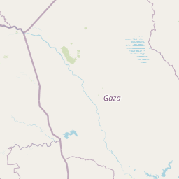
Map view of Kruger to Canyons Biosphere

Use this park location map to pinpoint Kruger to Canyons Biosphere in South Africa, understand its exact geographic position, and read its mapped placement within the surrounding landscape more clearly.

Pigeon | © OpenStreetMap contributors

Location context for Kruger to Canyons Biosphere

LimpopoMpumalanga

Visual reference of protected terrain, escarpments, and savanna habitats

Kruger to Canyons Biosphere Landscape and Scenery Photography

Visual documentation captures the diverse terrain, deep river canyons, and broad savanna ecosystems that define Kruger to Canyons Biosphere. Photographic records illustrate the distinct environmental gradients spanning from the Drakensberg escarpment down to the lowveld plains.

A wide aerial view looking down into the lush green Blyde River Canyon, with a river winding through the steep rocky valley and clouds resting on the distant mountain peaks.

A high-angle scenic view from a rocky mountainside covered in aloe plants with red flowers, looking out over a deep valley and distant ridges.

Park atlas

Compare surrounding regional geography and connected conservation zones

Parks Near Kruger to Canyons Biosphere and Related Protected Landscapes

Browse nearby national parks and protected areas sharing the broader lowveld and escarpment terrain of northeastern South Africa. Examining adjacent reserves provides deeper geographic context on savanna ecosystems and rugged mountain topography.
Nature reserveLimpopo
About 8.8 km away#1 closest

Southwest

Balule Nature Reserve: Mapping the Protected Lowveld Savannah and Olifants River Corridor

An open-system wilderness integral to the Greater Kruger ecological network.

Explore the geographic identity of Balule Nature Reserve, a vast protected area in South Africa characterized by its integration with the Greater Kruger wilderness. The terrain encompasses a rich mix of mopane-dominated woodland, riverine forest along the Olifants River, and open subtropical bushveld that supports significant wildlife migrations.

Area
400 km²
Relief
Lowland
Climate
Subtropical
Access
Moderate access
National parkSouth Africa
About 17 km away#2 closest

East

Kruger National Park: South Africa's Iconic National Park for Geographic Discovery

Explore savanna landscapes and mapped protected area boundaries.

Kruger National Park serves as a paramount example of a protected landscape, offering a rich tapestry of savanna ecosystems and varied terrain across South Africa's Lowveld. This canonical entry details its vast geographic scope, approximately 19,623 square kilometres, and its status as the nation's first national park. Understand the park's environmental context, from the Lebombo Mountains to the Limpopo River, and its integral role within larger transfrontier conservation initiatives, providing critical insight for atlas-based geographic exploration.

Area
19,623 km²
Established
1926
IUCN
II
Visitors
1.7M annual
Wildlife reserveLimpopo
About 36 km away#3 closest

South

Kapama Game Reserve: Geographic Atlas and Protected Landscape Map of Limpopo

Explore the diverse terrain and riverine ecosystems of this South African wildlife reserve

Kapama Game Reserve sits within the Limpopo Lowveld, featuring a complex mix of open savanna, mixed bushveld, and dense riverine corridors shaped by the Blyde River. This record provides a detailed look at the reserve as a functional piece of the greater regional conservation landscape, highlighting its topography and its role in protecting South Africa's native habitat.

Area
130 km²
Established
1993
Scope
Terrestrial
Nature reserveMpumalanga
About 40 km away#4 closest

Southeast

Timbavati Private Nature Reserve: Protected Landscape and Regional Map Overview

Savanna bushveld geography in Mpumalanga, South Africa

Spanning over 534 square kilometres, Timbavati Private Nature Reserve provides a crucial habitat mosaic within the Mpumalanga region. The area is defined by its pioneering unfenced conservation model, linking private land with the Greater Kruger National Park to protect a broad spectrum of woodland habitats and diverse savanna ecosystems.

Area
534 km²
Established
1956
Relief
Upland
Climate
Subtropical
Wildlife reserveLimpopo
About 50 km away#5 closest

South

Thornybush Game Reserve: A Protected Wildlife Landscape in Limpopo, South Africa

Mapped savanna corridors and riverine ecological zones

Located in the Limpopo province of South Africa, Thornybush Game Reserve is an essential private wildlife area known for its open savanna and rich riparian vegetation. By maintaining an unfenced boundary with the neighboring national park, it acts as a critical extension of the Greater Kruger wilderness. This entry details its geographical scope, terrain features, and its function as a managed, integrated component of the regional conservation landscape.

Area
140 km²
Water
Minor water
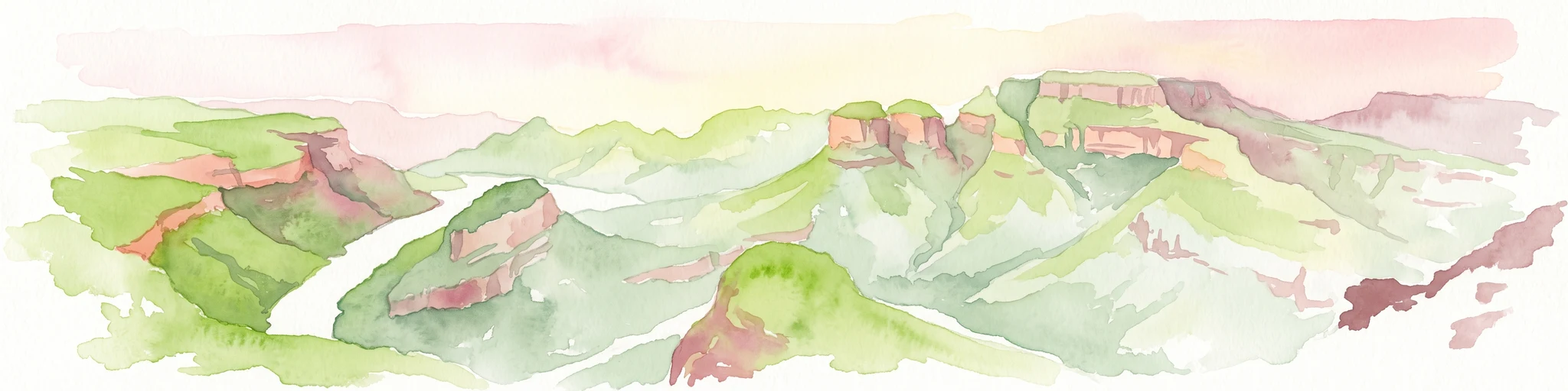
A horizontal watercolor painting depicting the Blyde River Canyon with green slopes, reddish cliff faces, and a winding river.
Nature reserveMpumalanga
About 60 km away#6 closest

South

Blyde River Canyon Nature Reserve: Escarpment Geography and Protected Landscape Map

Mapping river-carved canyons and plateau ecosystems in Mpumalanga

Blyde River Canyon Nature Reserve protects a vast stretch of the Mpumalanga Drakensberg, characterized by vertical cliffs, rocky massifs, and deep river gorges. This atlas-focused resource highlights the reserve's geological landmarks, including the Three Rondavels and Bourke's Luck Potholes, offering a clear view of the complex terrain and protected natural boundaries defining this northeastern South African landscape.

Area
290 km²
Established
1965
Relief
Mountain
Climate
Subtropical
Wildlife reserveMpumalanga
About 71 km away#7 closest

Southeast

Manyeleti Game Reserve: Protected Area Boundaries and Lowveld Landscape Mapping

Ecological connectivity within the Mpumalanga conservation mosaic.

Manyeleti Game Reserve offers significant insights into the Lowveld landscape of Mpumalanga. Known for its unfenced connection to neighboring wildlife areas, the reserve provides a case study in contiguous protected land management and bushveld geography that sustains large mammal populations across regional boundaries.

Area
227.5 km²
Established
1967
Water
Minor water
Season
Year-round
National parkMozambique
About 77 km away#8 closest

East

Limpopo National Park: Mozambique's Savanna Ecosystem and Protected Landscape

Explore its mapped boundaries and transfrontier park significance.

Limpopo National Park is a protected national park in Mozambique, distinguished by its savanna ecosystem and its critical role as the eastern segment of the Great Limpopo Transfrontier Park. This page offers an atlas-driven exploration of its geographic scope, mapped protected area boundaries, and its function as a key wildlife migration corridor, providing essential context for understanding this significant conservation landscape.

Area
10,000 km²
Established
2002
IUCN
II
Relief
Lowland

Common questions about visiting, size, designation, and location context for Kruger to Canyons Biosphere

Kruger to Canyons Biosphere FAQs for park facts, access, geography, and protected area context

Find quick answers about Kruger to Canyons Biosphere, including protected-area facts, park geography, trail and visitor context, and how the park fits into its surrounding country and regional landscape.
MoriAtlas Explorer

Continue Your Protected Areas Search Across the Global Atlas

Deepen your exploration by continuing the structured search for national parks and protected areas worldwide. Utilize the comprehensive filtering capabilities to compare different conservation landscapes and refine your understanding of global park geography. Discover more about the distribution and characteristics of protected natural areas.

Global natural geography
