

Mori Atlas logo
National parkLa Marquesa National Park

Discover the mapped boundaries and regional geography of this early Mexican national park.

La Marquesa National Park: Protected Highland Forest Landscape in Mexico's Sierra de las Cruces

(Parque Nacional Insurgente Miguel Hidalgo y Costilla)

La Marquesa National Park stands as a significant protected natural area within Mexico's central highlands, nestled in the mountainous terrain of the Sierra de las Cruces. This park, established to safeguard its extensive pine and oak woodlands and vital watershed, offers a starkly beautiful landscape characterized by steep ridges and deep ravines shaped by volcanic geology. As one of the foundational national parks in the region, it preserves crucial ecosystems and provides essential water resources for the Mexico City metropolitan area, presenting a unique intersection of conservation, geography, and regional importance.

National ParkMexicoPine ForestsWatershed ProtectionSierra de las CrucesCentral Mexico

La Marquesa National Park

National park

Park overview

Structured park overview, official facts, and landscape profile for La Marquesa National Park

La Marquesa National Park park facts, protected area profile, and essential visitor context

Review the core facts for La Marquesa National Park, including designation, size, terrain, visitor scale, habitats, and operating context in one park-focused overview.

About La Marquesa National Park

La Marquesa National Park occupies a strategic position in the central Mexican highlands within the Sierra de las Cruces, a mountainous corridor that forms part of the trans-Mexican volcanic belt. The park's terrain is marked by dramatic elevation changes, with steep-sided valleys and ridgelines that create a visually striking mountain landscape. The protected area encompasses ecosystems typical of central Mexico's highland forests, where pine and oak species dominate the vegetation communities. These forests have historically served as vital water catchments, with numerous streams and springs originating within the park boundaries that feed into downstream water systems serving populated areas. The protection of this area reflects an early recognition in Mexican conservation history that preserving forest cover in headwater zones is essential for maintaining water supplies and preventing erosion in populated mountain valleys.

Quick facts and research context for La Marquesa National Park

La Marquesa National Park is situated in the State of Mexico, approximately 60 kilometers west of Mexico City, within the Sierra de las Cruces mountain range. The park protects a forest ecosystem in the trans-Mexican volcanic belt, featuring pine-oak woodlands on rugged terrain. It functions as a critical watershed for the Valley of Mexico, helping to regulate water supply for surrounding communities. The park was created to preserve these forest resources and has been a protected area since the mid-20th century.

Park context

Deeper park guide and search-rich context for La Marquesa National Park

La Marquesa National Park history, landscape, wildlife, and travel context

Explore La Marquesa National Park through its history, landscape character, ecosystems, wildlife, conservation priorities, cultural context, and seasonal travel timing in a structured park guide built for atlas discovery and search intent.

Why La Marquesa National Park stands out

La Marquesa National Park is best known for its role as a watershed protection area for the Mexico City metropolitan region, its old-growth pine and oak forests, and its position as one of the earliest designated national parks in central Mexico. The park's location along the Sierra de las Cruces places it at a critical ecological junction between the Valley of Mexico and the western highlands.

La Marquesa National Park history and protected-area timeline

La Marquesa National Park was established as part of Mexico's early national park system, created to protect the forest watersheds that supply water to the growing Mexico City metropolitan area and surrounding communities in the State of Mexico. The park was officially designated with its formal name honoring Miguel Hidalgo y Costilla, the insurgent priest and leader of Mexico's independence movement. This naming reflects the tradition of using significant national figures to designate protected areas during the 20th century. The establishment of the park represented an early effort in Mexico to formalize watershed protection through national-level designation, recognizing that the forests of the central highlands provided essential ecosystem services beyond their ecological value.

La Marquesa National Park landscape and geographic character

The landscape of La Marquesa National Park is defined by the mountainous terrain of the Sierra de las Cruces, where steep slopes and deep ravines create a rugged, forested environment. The underlying geology consists of volcanic materials from the trans-Mexican volcanic belt, which have produced soils capable of supporting dense forest growth. Elevation within the park supports distinct vegetation zones, with pine forests dominating at higher elevations and oak woodlands prevalent on lower slopes and in protected coves. Stream courses carved into the terrain create natural corridors through the forest, and the overall impression is one of a heavily forested mountain landscape that contrasts with the more developed valleys below.

La Marquesa National Park ecosystems, habitats, and plant life

The natural environment of La Marquesa centers on the pine-oak forest ecosystem that characterizes much of the central Mexican highlands. These forests are adapted to the cooler, more humid conditions found at higher elevations in the trans-Mexican volcanic belt. The vegetation structure includes both mature trees forming canopy layers and understory species adapted to the shaded forest floor. These forests provide important habitat value, supporting bird species and small mammals that depend on the forest structure for shelter and food. The watershed function of these forests is particularly significant, as the root systems help maintain soil stability on steep slopes while the forest cover regulates the timing and quality of water flow into streams and springs.

La Marquesa National Park wildlife and species highlights

The wildlife community in La Marquesa National Park reflects the central Mexican highland forest environment, where bird species are particularly diverse. The pine and oak forest canopy provides nesting habitat and foraging grounds for various songbird species, while the forest understory supports small mammal populations. The protected status of the area helps maintain habitat connectivity in a region where forest cover has been reduced by agricultural expansion and urban development. These forests serve as refuge areas for species adapted to mature forest conditions.

La Marquesa National Park conservation status and protection priorities

La Marquesa National Park represents an important conservation designation in central Mexico, protecting forest ecosystems that provide critical watershed services to one of the country's most densely populated regions. The park's establishment reflected early understanding that preserving headwater forests is essential for maintaining water quality and regulating downstream water availability. The protected area helps maintain ecological corridors in the Sierra de las Cruces, connecting forest patches and supporting biodiversity in a landscape increasingly influenced by human activity. Conservation of this area addresses both ecological preservation and the practical need to protect water resources for surrounding communities.

La Marquesa National Park cultural meaning and human context

The Sierra de Las Cruces and the area surrounding La Marquesa have been part of the historical landscape of central Mexico, long before modern conservation designations. The region's forests would have been utilized by local communities for water, timber, and other resources. The park's location in the State of Mexico places it within a region of significant historical and cultural importance, as this area lies between the Valley of Mexico and the western highlands that have been inhabited and cultivated for centuries.

Top sights and standout views in La Marquesa National Park

The standout qualities of La Marquesa National Park include its role as a critical watershed protection area serving the Mexico City metropolitan region, its old-growth pine and oak forests in the Sierra de las Cruces, and its designation as one of Mexico's early national parks preserving central highland forest ecosystems. The park offers a forested mountain landscape within reach of the country's largest urban population, providing accessible nature experiences and environmental education opportunities.

Best time to visit La Marquesa National Park

The best time to explore La Marquesa National Park is during the dry season from November through April, when visitor conditions are most favorable and the risk of heavy rain is lowest. The winter and spring months offer clearer skies and more predictable access to trail areas within the park. The forest environment is pleasant year-round due to the moderating effect of elevation, though visitors should be prepared for cooler temperatures at higher elevations.
Monthly climate preview

Long-term temperature and precipitation averages for this protected high-elevation landscape

La Marquesa National Park Climate Normals and Monthly Weather Records

Representative coordinate measurements track average monthly temperature swings and precipitation levels across the terrain from recorded baseline normals. Detailed monthly breakdowns provide deeper insight into long-term thermal rhythms and moisture distribution patterns.
Annual mean14 °C
10 °C17 °C
Jan10°
Feb12°
Mar14°
Apr16°
May17°
Jun16°
Jul15°
Aug15°
Sep14°
Oct13°
Nov12°
Dec11°
Warmest month
May

17 °C

Coolest month
January

10.3 °C

Wettest month
August

4.8 mm/day

Driest month
December

0.2 mm/day

Park location guide

Geography guide, regional context, and park location map for La Marquesa National Park

La Marquesa National Park park geography, regions, and map view in Mexico

Understand where La Marquesa National Park sits in Mexico through a broader geographic reading of the surrounding landscape, nearby location context, and its mapped position within the national park landscape.

How La Marquesa National Park fits into Mexico

Mexico, officially the United Mexican States, is a country in North America spanning the Sierra Madre mountain ranges, coastal plains, and tropical regions. It borders the United States to the north, Guatemala and Belize to the southeast, and has coastlines along the Pacific Ocean, Gulf of Mexico, and Caribbean Sea. With a population exceeding 130 million, Mexico is home to one of the world's most significant concentrations of Indigenous languages alongside Spanish.

Wider geography shaping La Marquesa National Park in Mexico

Mexico occupies a land area of 1,972,550 km2, making it the thirteenth-largest country in the world. The terrain is highly diverse, featuring the Sierra Madre Occidental and Sierra Madre Oriental mountain ranges, the Mexican Plateau, coastal lowlands along the Pacific and Gulf/Caribbean margins, and the Yucatan Peninsula. The country spans multiple climate zones from desert in the north to tropical rainforest in the south.

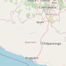
Map view of La Marquesa National Park

Use this park location map to pinpoint La Marquesa National Park in Mexico, understand its exact geographic position, and read its mapped placement within the surrounding landscape more clearly.

Pigeon | © OpenStreetMap contributors
Park atlas

Compare surrounding national parks and protected landscapes across central Mexico's diverse highland geography.

Explore Other National Parks and Protected Areas Near La Marquesa National Park

Explore other national parks and protected areas located in Mexico's central highlands, expanding your geographic view beyond La Marquesa National Park to include adjacent mountain forest ecosystems. Compare diverse protected landscapes, trace watershed zones, and examine regional conservation efforts across the varied pine and oak woodlands of central Mexico.
National parkMexico City
About 5.6 km away#1 closest

Northeast

Desierto de los Leones National Park: Protected National Park and its Geographic Setting

Explore mapped boundaries and regional landscape context near Mexico City.

Delve into the specifics of Desierto de los Leones National Park, a designated national park recognized for its protected landscape. This MoriAtlas entry focuses on its geographic presence within the Mexico City region, providing clear insights into its mapped boundaries and the surrounding natural terrain. Understand the park's importance as a conservation area and its contribution to the regional geography through dedicated atlas data.

Area
18.67 km²
Established
1917
IUCN
II
Visitors
205K annual
National parkMexico
About 12 km away#2 closest

Southeast

Cumbres del Ajusco National Park: Exploring Mexico's National Park Protected Landscape

Discover mapped boundaries and regional geography.

Cumbres del Ajusco National Park is an important national park offering rich opportunities for geographic exploration. This detailed profile focuses on its identity as a protected landscape within Mexico, providing essential context for map-based discovery. Understand the park's specific location, its mapped territory, and its role within the nation's network of conservation areas, facilitating a structured atlas view.

Area
9.2 km²
Established
1936
IUCN
II
Relief
Mountain
Protected landscapeEstado de México
About 17 km away#3 closest

Southwest

Ciénegas del Lerma: Protected Highland Wetland Landscape in the State of Mexico

Mapping the upper Lerma River basin and remnant marsh ecosystems.

Ciénegas del Lerma serves as a significant protected landscape in central Mexico, encompassing three main lakes and extensive marshland corridors. This atlas entry details the site's hydrological structure, encompassing open-water zones and alluvial soils that support diverse aquatic vegetation and endemic species within a human-influenced highland setting.

Area
30.23 km²
Established
2002
IUCN
VI
Relief
Upland
National parkMexico
About 18 km away#4 closest

East

Fuentes Brotantes de Tlalpan National Park: National Park Geographic Atlas and Terrain Exploration

Explore protected land boundaries and mapped natural landscapes.

Delve into the geographic specifics of Fuentes Brotantes de Tlalpan National Park, a protected national park situated within Mexico. This detailed view highlights the park's mapped terrain and its significance as a distinct natural landscape. Understand its role in the country's protected area network and its contribution to the broader atlas of natural geography.

Area
0.08 km²
Established
1936
IUCN
II
Relief
Upland
National parkState of Mexico
About 20 km away#5 closest

South

Lagunas de Zempoala National Park: Protected Landscape and Geographic Atlas Entry

Explore mapped boundaries and natural terrain context.

Lagunas de Zempoala National Park is a dedicated protected area within the State of Mexico, serving as a vital point for understanding national park geography and landscape mapping. This entry provides foundational atlas data on its protected boundaries and its specific natural terrain. It is designed for users seeking structured information on the park's geographic scope and its importance as a mapped natural landscape for regional context.

Area
47.9 km²
Established
1936
IUCN
II
Relief
Mountain
National parkMexico State
About 24 km away#6 closest

Northeast

Los Remedios National Park: Protected Landscape and Historical Geography of Mexico State

Mapped terrain and cultural heritage within this unique national park.

Delve into the protected landscape of Los Remedios National Park, a national park situated in Mexico State. This page provides detailed geographic context, focusing on its volcanic terrain, mapped boundaries, and the convergence of pre-Hispanic and colonial heritage. Understand its role as a protected area within the western Valley of Mexico and explore the mapped elements that define its cultural and natural identity.

Area
4 km²
Established
1938
IUCN
II
Relief
Mountain
National parkMexico City
About 28 km away#7 closest

East

Cerro de la Estrella National Park: Mapped Protected Landscape and Regional Geography

Explore the national park's mapped boundaries within Mexico City.

Cerro de la Estrella National Park represents a key protected area for geographic study and atlas exploration within the urban landscape of Mexico City. This entry provides detailed insight into the park's mapped boundaries and its role as a national park, highlighting its unique protected landscape character. Understand its position within the regional geography and explore what makes this park an important feature for mapped terrain and conservation awareness.

Area
1.5 km²
Established
1938
IUCN
II
Relief
Mixed relief
National parkMexico
About 35 km away#8 closest

Northeast

El Tepeyac National Park: Protected National Park Landscape and Regional Geography

Explore mapped boundaries and the park's geographic context.

Gain a detailed understanding of El Tepeyac National Park, a protected national park situated within Mexico. This entry provides essential geographic context, focusing on its mapped boundaries and its role as a protected landscape. It is designed to support users interested in the atlas-level exploration of natural areas, offering foundational information about the park's identity and its position within the broader geographic framework of Mexico.

Area
15 km²
Established
1937
IUCN
VI
Relief
Upland

Common questions about visiting, size, designation, and location context for La Marquesa National Park

La Marquesa National Park FAQs for park facts, access, geography, and protected area context

Find quick answers about La Marquesa National Park, including protected-area facts, park geography, trail and visitor context, and how the park fits into its surrounding country and regional landscape.
MoriAtlas Explorer

Continue Your Protected Areas Search Across the Global Atlas

Deepen your exploration by continuing the structured search for national parks and protected areas worldwide. Utilize the comprehensive filtering capabilities to compare different conservation landscapes and refine your understanding of global park geography. Discover more about the distribution and characteristics of protected natural areas.

Global natural geography