

Mori Atlas logo
Protected areaLac Bam

Examining the ecological transition zone between Sahelian and Sudanian savanna landscapes

Lac Bam Protected Area and Regional Landscape Geography in Bam Province Burkina Faso

Lac Bam represents a vital natural freshwater reservoir situated in the Bam Province of Burkina Faso. This protected area occupies a broad depression at the junction of the Sahelian and Sudanian phytogeographic regions, characterized by wooded savanna and a vast catchment basin. Understanding the hydrological dynamics and shoreline variability of this 23 kilometer long lake provides essential insight into the regional environment and the critical role of wetlands in north-central Burkina Faso.

SahelSudanian savannafreshwater lakewetland habitatnatural reservoirBurkina Faso

Lac Bam

Protected area

Park overview

Structured park overview, official facts, and landscape profile for Lac Bam

Lac Bam park facts, protected area profile, and essential visitor context

Review the core facts for Lac Bam, including designation, size, terrain, visitor scale, habitats, and operating context in one park-focused overview.

About Lac Bam

Lac Bam is a prominent natural lake in the West African country of Burkina Faso, situated just outside the town of Kongoussi in the province of Bam. With a surface area on the order of 30 square kilometers and a length of roughly 23 kilometers, it is widely regarded as the country's largest natural freshwater lake and one of its most important inland water resources.

The lake's setting is ecologically distinctive. It lies within the transition between the southern Sahelian zone to the north and the northern Sudanian zone to the south, two phytogeographic regions that share an approximate boundary near this latitude. The result is a landscape shaped by wooded savanna, punctuated by characteristic species such as shea trees, néré, tamarind, and red-flowered kapok, and interspersed with wetland and aquatic habitats along the lake's margins.

Beyond its natural values, Lac Bam plays a central role in the rural economy of Bam Province. The lake supports an active fishing community with hundreds of local fishers, and its shores host extensive market gardening plots and agroforestry systems that supply food and income to thousands of residents. Cattle and other livestock are also watered at the lake, further embedding it in the daily life of the surrounding villages.

In recent years, the lake has faced environmental strain related to gradual drying and changing water levels, prompting concern about the sustainability of its fisheries, agriculture, and pastoral use. The combination of ecological importance, livelihood significance, and conservation concern gives Lac Bam a meaningful place within Burkina Faso's network of freshwater and wetland sites.

Quick facts and research context for Lac Bam

Lac Bam is a natural freshwater lake located near Kongoussi in Bam Province, Burkina Faso. Covering roughly 30 square kilometers and reaching about 23 kilometers in length, the lake sits at an elevation of around 302 meters above sea level within a watershed of more than 2,600 square kilometers.

It occupies a transitional ecological zone where southern Sahelian and northern Sudanian landscapes meet, producing a mosaic of wooded savanna, wetland habitats, and open water. The lake supports fishing, market gardening, and agroforestry in the surrounding province, and it is referenced among the significant Ramsar-related wetland sites of Burkina Faso.

Protection and recognition

Documented terrestrial protection scope and official Ramsar wetland recognition history

Lac Bam Protection Status and International Ramsar Wetland Recognition

Terrestrial protection records for Lac Bam incorporate official Ramsar wetland designation data to outline formal conservation status. Structured baseline facts summarize international recognition sources and management scope without implying unverified outcomes.

International recognition

Protection details

Protection scope
Terrestrial
Park context

Deeper park guide and search-rich context for Lac Bam

Lac Bam history, landscape, wildlife, and travel context

Explore Lac Bam through its history, landscape character, ecosystems, wildlife, conservation priorities, cultural context, and seasonal travel timing in a structured park guide built for atlas discovery and search intent.

Why Lac Bam stands out

Lac Bam is best known for being Burkina Faso's largest natural surface water reservoir and for its position at the ecological crossroads between Sahelian and Sudanian landscapes. The combination of a sizeable freshwater body, surrounding wooded savanna, and diverse aquatic and bird life gives the lake a distinctive ecological profile within the West African Sahel. The lake is also recognized for its role in sustaining local livelihoods: thousands of people in Bam Province depend on it for fishing, irrigated vegetable cultivation, and livestock watering. Its seasonal cycles, biodiversity, and ongoing environmental pressures have made it a focal point for wetland conservation in Burkina Faso.
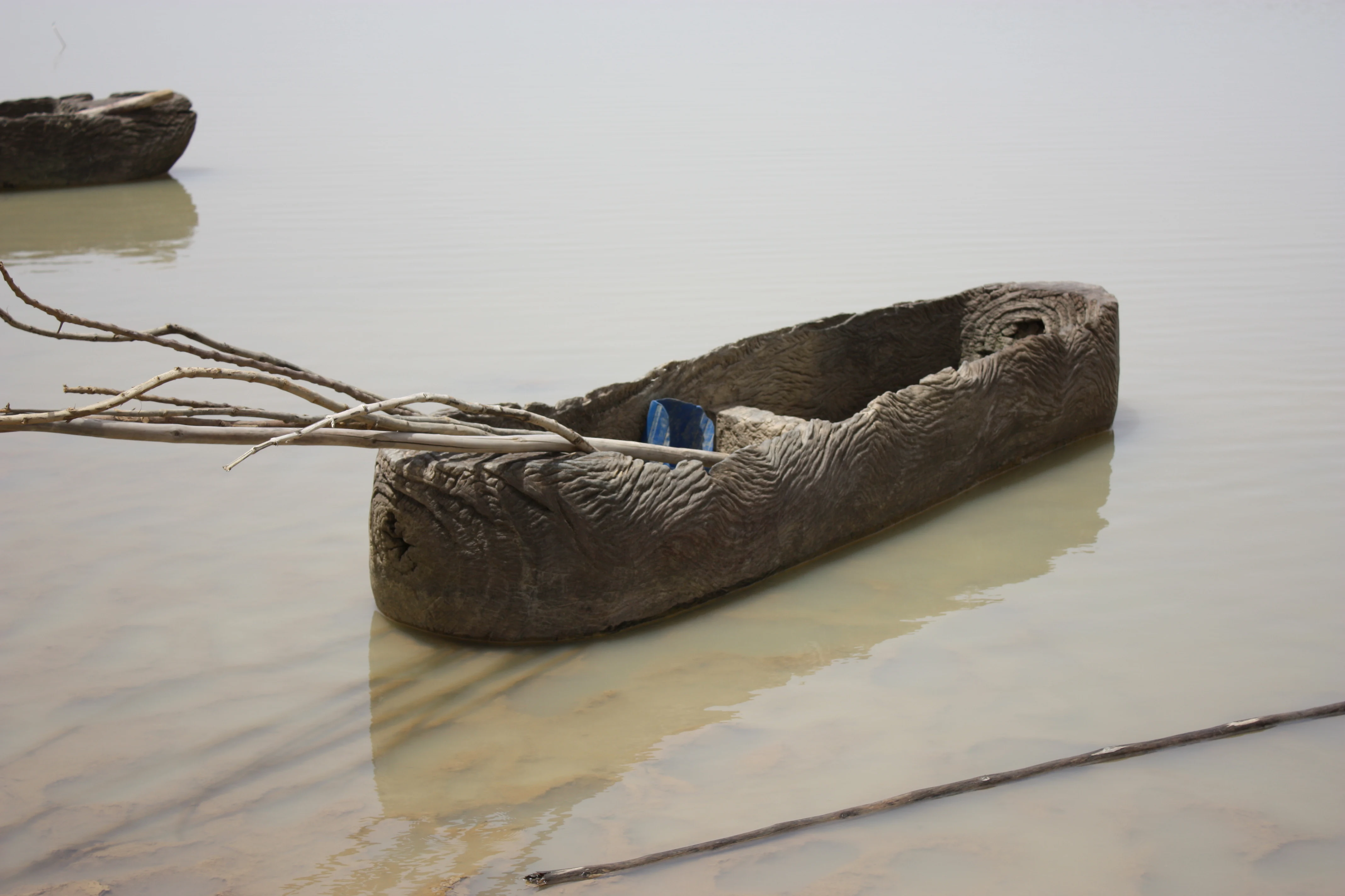
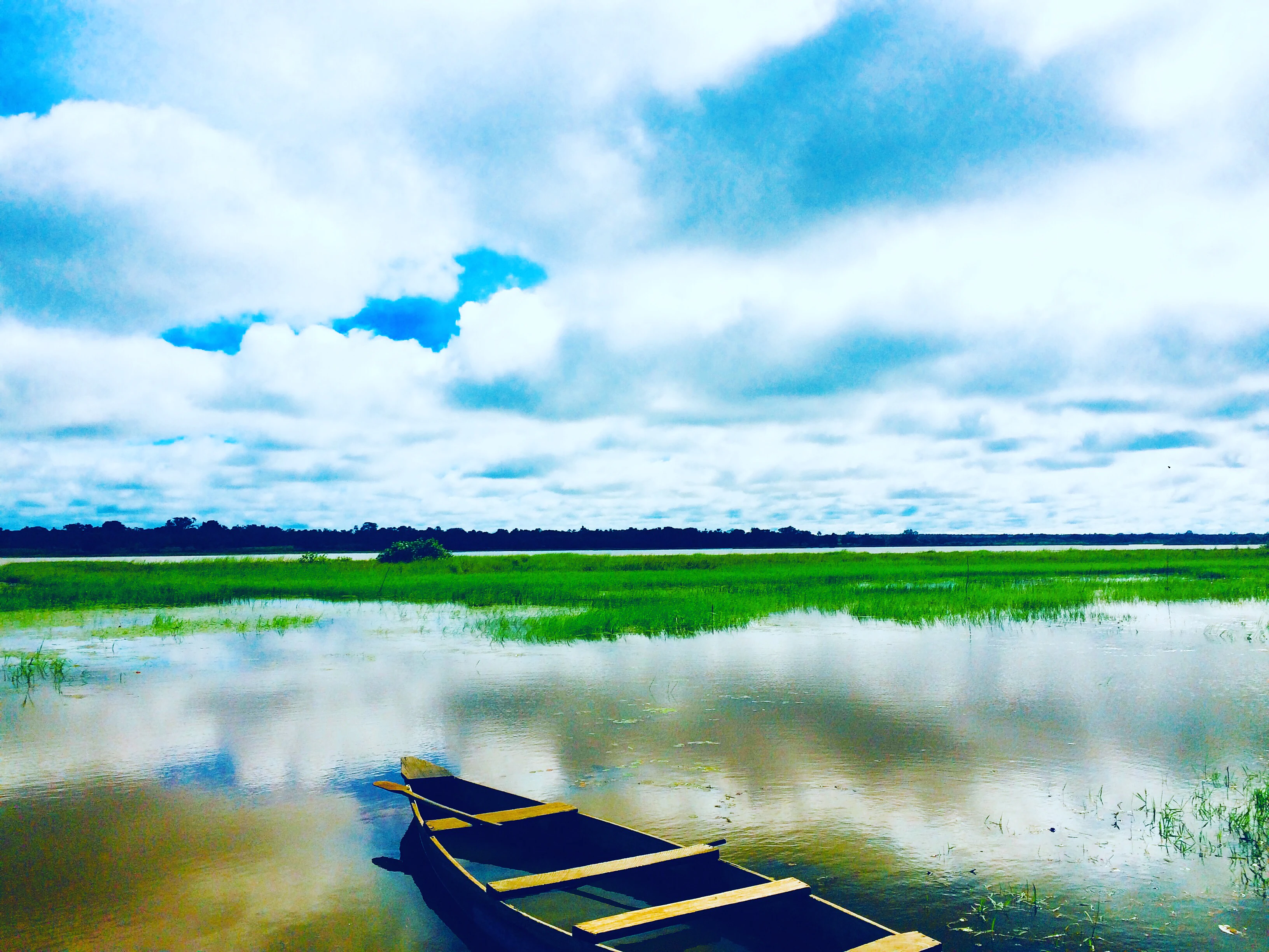
Pirogue on Lac Bam
A boat on Lac Bam in Burkina Faso.

Lac Bam history and protected-area timeline

The historical record for Lac Bam, as represented in available sources, focuses on the lake's longstanding role as a natural water body and resource for the Bam region rather than on a specific founding date or designation event. The lake's importance to local communities predates modern conservation framing, supporting traditional fishing, agriculture, and pastoral activities for the population of the surrounding province.

More recently, the lake has come into focus as a site of environmental concern. Reports note progressive drying of the lake and its associated risks to fish stocks, irrigation water, and livestock watering, and large-scale restoration or management works have been identified as necessary to preserve the lake's function. A 2024 national inventory of water reservoirs in Burkina Faso highlights the lake among the country's significant inland water bodies, underscoring its continuing relevance for water management policy.

Lac Bam landscape and geographic character

Lac Bam occupies a broad depression in the landscape of north-central Burkina Faso, with the lake extending roughly 23 kilometers in length and about 4 kilometers in width. Its surface sits at an elevation of approximately 302 meters above sea level, and the surrounding terrain reflects the gently undulating Sahelian plains that characterize much of the country's north.

The shoreline is bordered by wooded savanna that gradually blends into the broader countryside near Kongoussi and the neighboring communes such as Bourzanga. During the wet season, the lake expands across its basin; during drier periods, exposed margins and reduced water levels alter the visible shape of the shoreline. This variability is part of what defines the visual character of the site, with wide open expanses of water at peak fill and more fragmented, reed-fringed shallows during low-water phases.

The lake is set within a watershed of more than 2,600 square kilometers that gathers rainfall and runoff from the surrounding countryside. This catchment defines the hydrological behavior of the lake, and its gradual infilling or siltation, along with changing rainfall patterns, has become a defining feature of the lake's modern landscape dynamics.
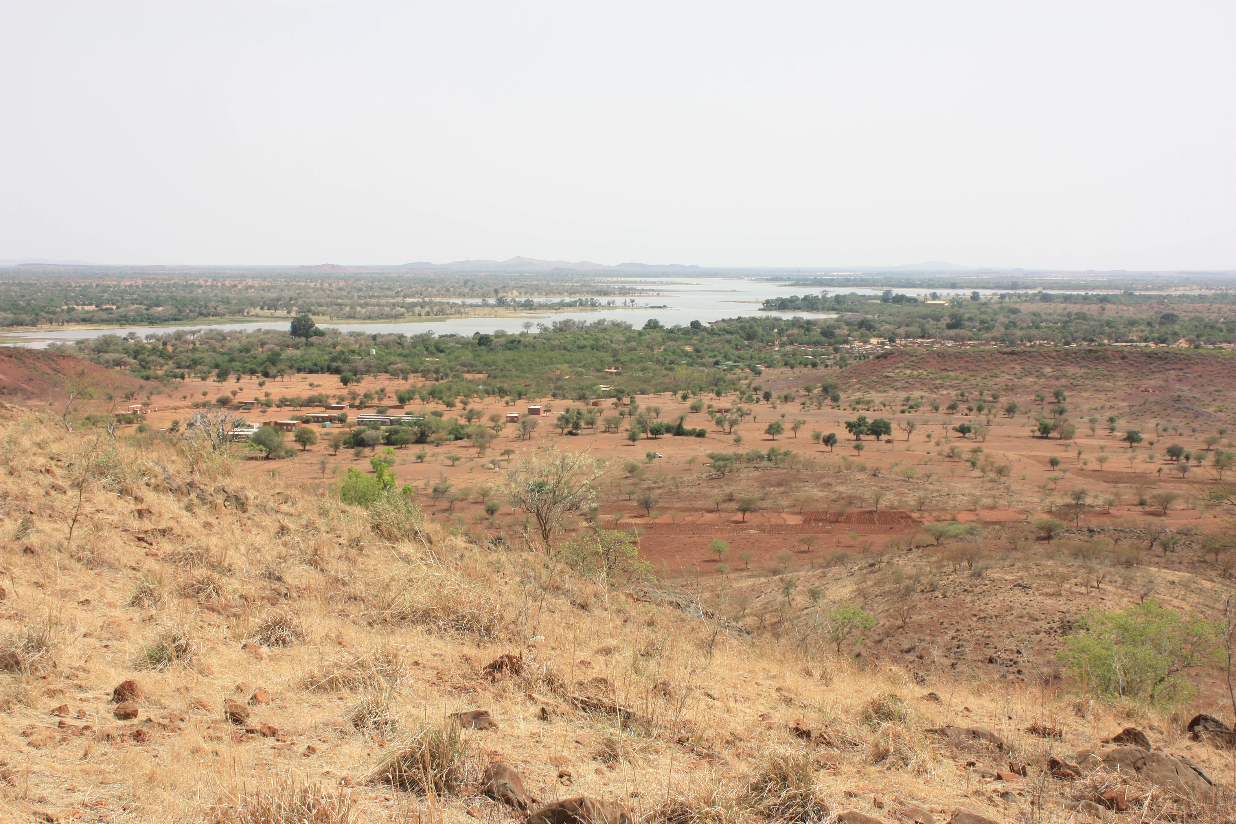
Lac de Bam
View of Lac de Bam, Burkina Faso

Lac Bam ecosystems, habitats, and plant life

Lac Bam lies at the ecological interface between two major phytogeographic regions: the southern Sahel to the north and the northern Sudanian zone to the south. This transition gives the surrounding vegetation a mixed character, with dry Sahelian elements blending into more mesic Sudanian woodland communities.

The dominant vegetation around the lake is wooded savanna, in which several characteristic tree species play a visible role. Shea trees, néré, tamarind, and Bombax costatum help define the canopy of the surrounding woodlands, and these species also contribute to local agroforestry systems. Closer to the water, wetland and aquatic plant communities occupy the lake margins, supporting the productivity of fish populations and the feeding grounds of waterbirds.

Biodiversity at the site is closely tied to this mosaic of aquatic, wetland, and savanna habitats, and the lake's hydrological state influences how these communities are expressed from season to season. The combination of freshwater, fringing wetlands, and surrounding savanna makes Lac Bam a notable ecological node within Burkina Faso's inland landscape.
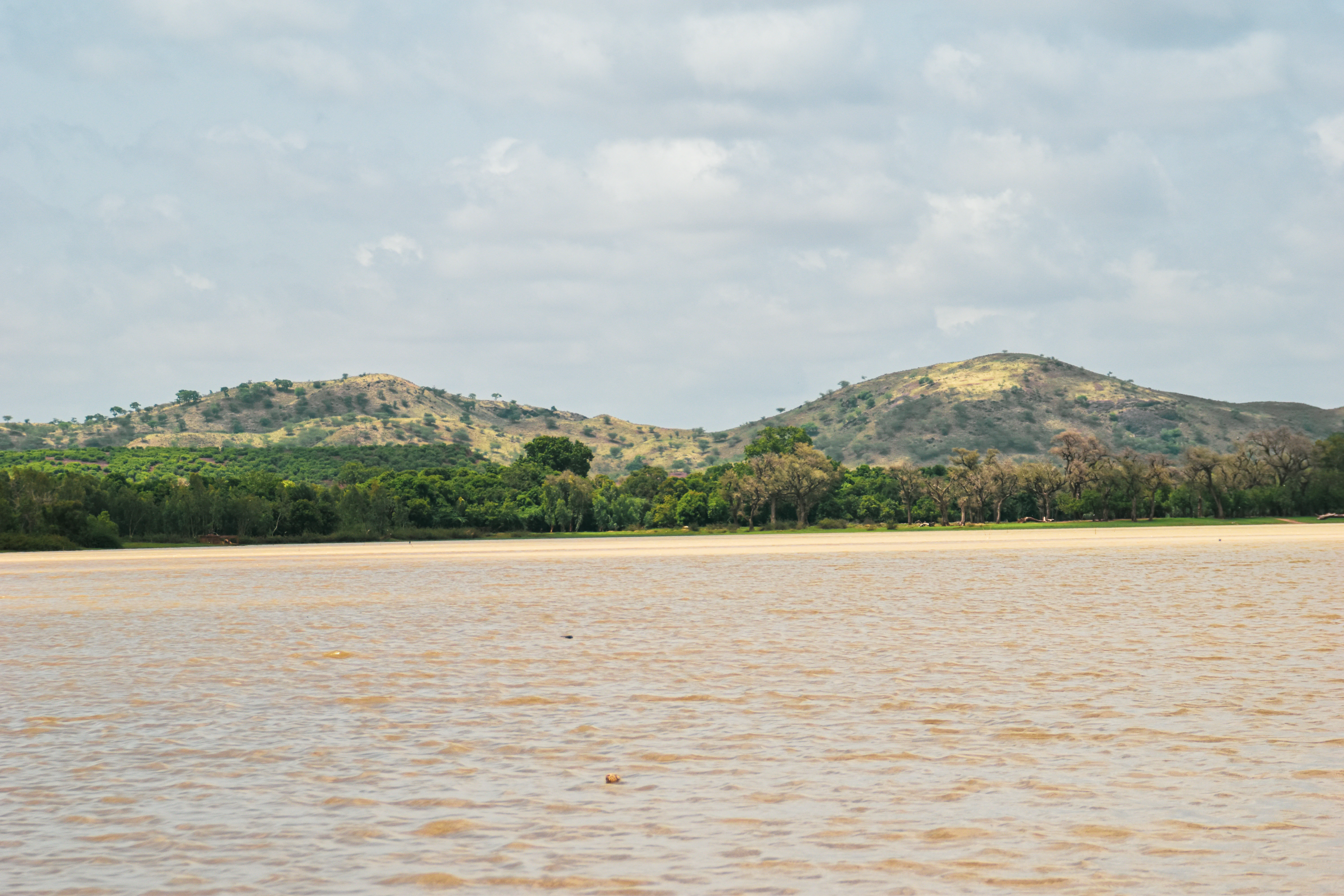
Lac Bam
Lac Bam

Lac Bam wildlife and species highlights

Lac Bam supports a varied wildlife community shaped by its freshwater, wetland, and adjacent savanna habitats. The lake's open water and fringing shallows attract waterbirds that depend on predictable aquatic conditions, including species such as the cattle egret and the yellow wagtail, both documented in the area.

Fish populations are a defining feature of the lake's fauna and an important basis for its local fishery. Species recorded in the lake include the Nile tilapia and Schilbe mystus, among others, supporting a community of roughly 800 fishers who depend on the resource for livelihoods and protein supply.

The lake is also known for hosting a notable population of Nile crocodiles, an apex predator that reflects the ecological completeness of the aquatic system and adds to the site's wildlife character. On land, the surrounding wooded savanna supports typical Sahelian and Sudanian fauna in addition to its rich tree communities, extending the wildlife interest of the area beyond the lake itself.
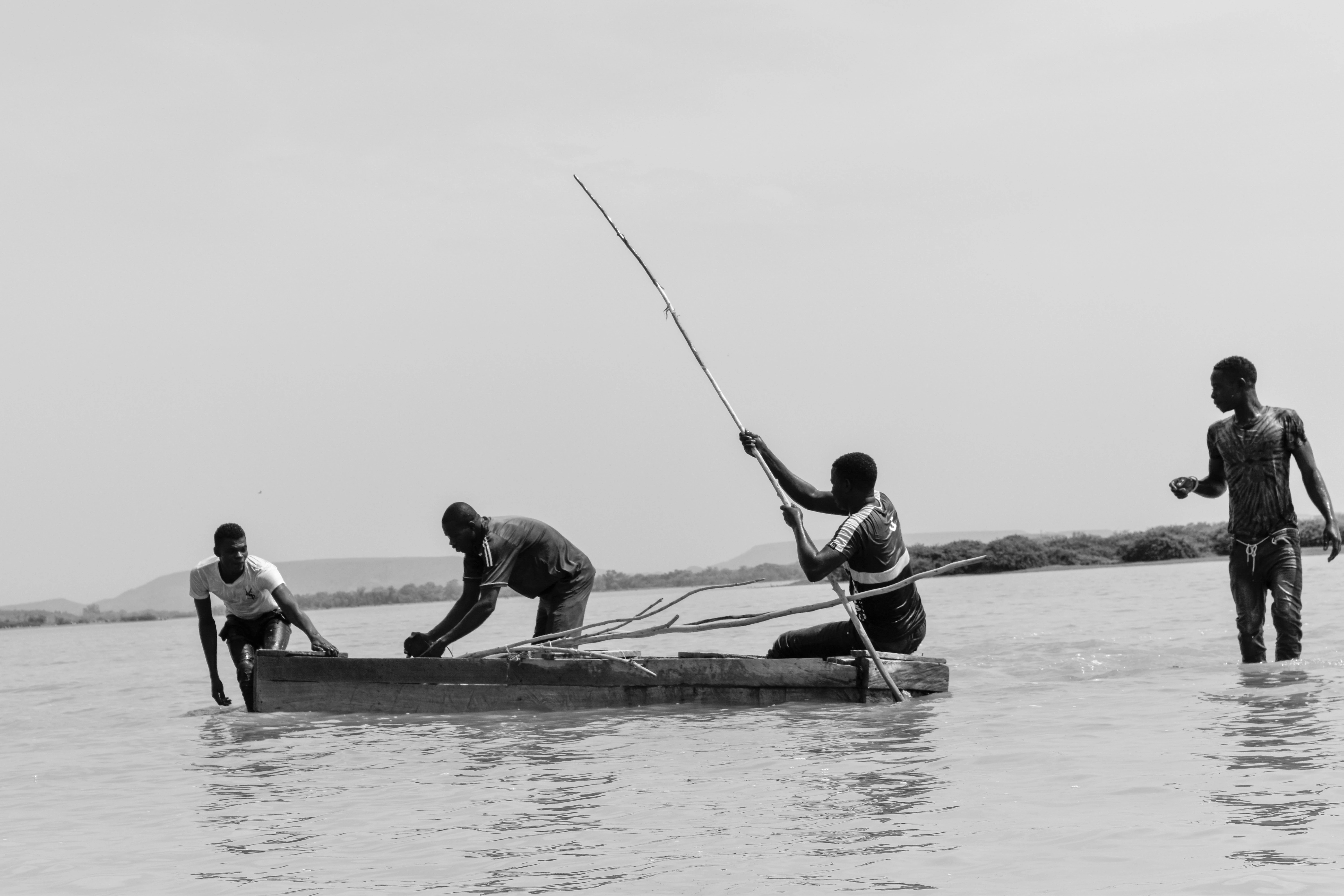
Fishermen on Lac Bam
Fishermen on Lac Bam, Burkina Faso, representing a traditional livelihood threatened by the lake's gradual drying.

Lac Bam conservation status and protection priorities

Lac Bam holds significant conservation value as Burkina Faso's largest natural surface water reservoir and as a habitat-rich site situated at the Sahelian-Sudanian ecological transition. Its mosaic of open water, wetland margins, and surrounding wooded savanna supports fish, waterbirds, and crocodiles, while also providing the ecological foundation for the livelihoods of thousands of people in Bam Province.

The lake's ongoing environmental stress is a central conservation concern. Progressive drying threatens fish stocks, irrigation water for market gardening, and water supply for livestock, with potential knock-on effects for food security and rural economies in the surrounding area. The hydrological balance of the lake is closely tied to how intensively it is used by local communities.

Recognizing these pressures, the site has been highlighted within national inventories of water reservoirs and within broader discussions of wetland conservation in Burkina Faso, including its place among the country's Ramsar-relevant sites. Large-scale rehabilitation and management interventions have been identified as necessary to secure the lake's ecological functions and its role as a sustainable resource for the Bam region.

Lac Bam cultural meaning and human context

Lac Bam is deeply embedded in the daily life and rural economy of Bam Province. The lake's fishing tradition, illustrated by the use of dugout pirogues on its waters, is a longstanding cultural and economic practice, with several hundred fishers drawing their livelihood from the lake.

Market gardening along the lakeshore, agroforestry in the surrounding savanna based on species such as shea and néré, and pastoral watering of livestock all shape the seasonal rhythms of villages around the lake. The interaction between local communities and the lake's resources defines the cultural identity of the area, and the lake's environmental decline carries significant cultural and social implications beyond purely ecological ones.
Fishing on Lac Bam
A view of the lake featuring a fishing scene

Top sights and standout views in Lac Bam

The defining features of Lac Bam are its scale as Burkina Faso's largest natural freshwater lake and its ecological position at the Sahelian-Sudanian transition. The lake's 23-kilometer length, its broad catchment, and its mosaic of wooded savanna, wetland margins, and open water combine to give it a distinctive ecological and landscape character for the region.

Equally central to the lake's identity is its role in sustaining local livelihoods through fishing, market gardening, and livestock watering, and the ongoing concerns about its gradual drying. Together, these qualities place Lac Bam among the most significant inland water sites in Burkina Faso, both ecologically and socially.

Best time to visit Lac Bam

Lac Bam's character shifts notably between its wet and dry seasons. During and shortly after the rainy season, the lake is at or near its fullest extent, presenting wide open water surfaces, active fisheries, and greener surrounding savanna. This period is generally the most visually rewarding time to experience the lake as a functioning inland sea in the middle of the Sahel.

In the dry season, water levels recede, exposing more of the shoreline and concentrating wildlife around remaining water and wetland edges. This can make birdwatching and fishing activity more visible, while also reflecting the hydrological stress that has become part of the lake's modern story. Visitors interested in the lake's ecological character and local livelihoods may find meaning in both phases of the annual cycle.
Monthly climate preview

Long-term representative averages tracking monthly temperature and precipitation rhythms for Lac Bam

Lac Bam Climate Normals and Measured Annual Temperature Patterns

Representative coordinates record measured monthly temperature swings and shifting precipitation rates across the landscape of Lac Bam. Examining the complete twelve-month climatology profile reveals deeper details regarding long-term temperature averages and monthly precipitation distributions.
Annual mean28 °C
23 °C34 °C
Jan23°
Feb26°
Mar30°
Apr33°
May34°
Jun31°
Jul28°
Aug27°
Sep27°
Oct28°
Nov26°
Dec24°
Warmest month
May

33.6 °C

Coolest month
January

23.3 °C

Wettest month
August

7.1 mm/day

Driest month
December

0 mm/day

Park location guide

Geography guide, regional context, and park location map for Lac Bam

Lac Bam park geography, regions, and map view in Burkina Faso

Understand where Lac Bam sits in Burkina Faso through a broader geographic reading of the surrounding landscape, nearby location context, and its mapped position within the national park landscape.

How Lac Bam fits into Burkina Faso

Burkina Faso is a landlocked West African nation. The Mossi people settled the area in the 11th and 13th centuries, establishing kingdoms such as Ouagadougou, Tenkodogo, and Yatenga. The French colonized the region in 1896 as part of French West Africa, and the country gained independence in 1960 as the Republic of Upper Volta before being renamed Burkina Faso in 1984 by President Thomas Sankara.

Wider geography shaping Lac Bam in Burkina Faso

Burkina Faso is a landlocked country in West Africa, bordered by Mali to the northwest, Niger to the northeast, Benin to the southeast, Togo and Ghana to the south, and Ivory Coast to the southwest. The terrain consists primarily of a peneplain with some laterite plateaus in the southeast. The country has several major rivers including the Mouhoun, Nakambe, and Comoé, though most are seasonal.

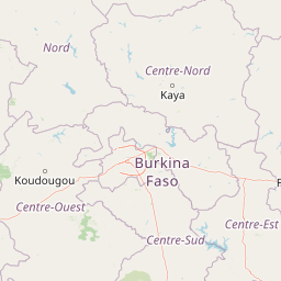
Map view of Lac Bam

Use this park location map to pinpoint Lac Bam in Burkina Faso, understand its exact geographic position, and read its mapped placement within the surrounding landscape more clearly.

Pigeon | © OpenStreetMap contributors

Location context for Lac Bam

Bam Province

Explore photographic views of wooded savanna, wetland habitats, and transitional ecoregions surrounding the basin.

Lac Bam Photos and Landscape Scenery: Visualizing Burkina Faso's Largest Natural Reservoir

Visual records capture the distinctive terrain, water margins, and wooded savanna that define the natural basin. Photographic documentation reveals environmental conditions and transitional ecological features across the protected landscape.

Pirogue on Lac Bam

Fishermen on Lac Bam

Lac de Bam

Lac Bam

Fishermen on Lac Bam

Fishermen on Bam Lake

Fishing on Lac Bam

Park atlas

Compare surrounding regional reserves and neighboring wetland habitats

Exploring Parks Near Lac Bam: Protected Areas and Regional Landscapes

Browsing parks near Lac Bam reveals connected protected landscapes and regional wetland habitats across the surrounding terrain. Examining these adjacent natural areas provides broader geographic context for northern Burkina Faso ecosystems.
Nature reserveOubritenga
About 103 km away#1 closest

South

Forêt classée de Gonsé Nature Reserve: Protected Landscape and Geographic Atlas Record

Sudano-Sahelian woodland and Massili River floodplain context

Examine the protected landscape of Forêt classée de Gonsé, a nature reserve in the Oubritenga region of Burkina Faso. This record details the park's savanna recovery, riverine habitats, and the legacy of its reforestation history as part of the West African Sudano-Sahelian interface.

Relief
Lowland
Climate
Subtropical
Access
Easy access
Scope
Terrestrial
Watercolor depiction of a river flowing through a landscape with green trees and distant mountains under a light sky
National parkBurkina Faso
About 205 km away#2 closest

South

Kaboré Tambi National Park: Burkina Faso's Largest National Park and Protected Landscape

Explore the mapped savanna and birdwatching geography of this vital West African area.

Kaboré Tambi National Park represents a critical protected area in Burkina Faso, spanning a considerable expanse of Sudan-Guinea savanna. The park's geography is defined by the Nazinon River and a mosaic of woodland and grassland ecosystems, making it a significant site for understanding regional protected lands and landscape ecology. It offers a valuable point of reference for atlas-based exploration of West African natural areas.

Area
1,555 km²
Established
1976
IUCN
II
Relief
Lowland
Wildlife reserveBurkina Faso
About 214 km away#3 closest

Southeast

Lac de Bagré Wildlife Reserve: Mapping the Inland Reservoir of Central Burkina Faso

A critical wetland site within the Nakambé River valley.

Lac de Bagré acts as a major freshwater reservoir, stretching through the Boulgou and Zoundwéogo provinces of Burkina Faso. This artificial lake, created by the Bagré Dam, supports a unique ecological profile as a Ramsar-recognized wetland, offering a deep look into the intersection of hydrological infrastructure and protected Sahelian landscapes.

Area
367.93 km²
Established
1992
Water
Water-dominated
Protected areaSahel Region
238 km away#4 closest

East

Lac Higa Protected Area: Wetland Geography and Sahel Region Landscape Mapping

A vital freshwater ecosystem in northeastern Burkina Faso.

Explore the spatial characteristics of Lac Higa, a permanent wetland and protected area in the Sahel Region of Burkina Faso. This atlas entry details the lake basin, the Yali River connection, and the surrounding shrub savanna terrain, providing essential context for this unique hydrological and biological site.

Area
15.14 km²
Relief
Lowland
Climate
Arid
Scope
Terrestrial
National parkBurkina Faso
About 240 km away#5 closest

Southwest

Deux Balés National Park: Burkina Faso's Elephant Sanctuary and Savanna Protected Landscape

Explore mapped terrain and key geographic features of this protected area.

Deux Balés National Park serves as a vital protected area within Burkina Faso, acclaimed for harboring the largest elephant population in West Africa. This national park's protected landscape is defined by undulating granitic plains, lateritic plateaux, and distinct gallery forests lining the Black Volta River. The presence of ancient African baobab trees adds a unique visual character to the savanna ecosystem. Investigating this park reveals its significance for regional conservation, its mapped geographic boundaries, and its role within the broader context of protected lands in West Africa.

Area
810 km²
Established
1937
IUCN
II
Relief
Lowland
Protected areaTillaberi Region
About 275 km away#6 closest

East

Kokorou-Namga Complex: Protected Sahelian Wetland Landscapes and Regional Geography

Intermittent lakes and dune corridors in the Tillaberi Region

Explore the ecological identity of the Kokorou-Namga Complex, a vast wetland system in Niger featuring a unique interplay between seasonal water bodies and parallel sandy dune formations. This protected area acts as a primary refuge for migratory waterbirds while showcasing rare forest-savanna mosaics thriving on iron-rich soils in an otherwise dry landscape.

Area
668.29 km²
Established
2001
Relief
Lowland
Climate
Arid
Wildlife reserveUpper West Region
About 317 km away#7 closest

South

Gbele Resource Centre Wildlife Reserve: A Regional Atlas of Protected Savanna Landscapes

Mapped geography and protected woodland in Ghana

Gbele Resource Centre represents one of the most substantial protected savanna landscapes in northwestern Ghana, spanning over 500 square kilometres of Sudano-Sahelian woodland. The terrain is defined by the seasonal Kulpawn River and a distinct composition of African baobab and sycamore fig trees, which together anchor an important ecological corridor. This reserve provides a vital opportunity to map and understand the conservation geography and avian diversity that distinguish the Upper West Region from other parts of the country.

Area
565 km²
Relief
Lowland
Scope
Terrestrial
Water
Minor water
Protected areaKompienga Province
About 335 km away#8 closest

Southeast

Lac de la Kompienga: Geography and Mapped Protected Landscapes in Kompienga Province

A landmark hydroelectric reservoir and wetland habitat

Lac de la Kompienga constitutes a primary water resource and ecological site within the dry savanna of Burkina Faso. This artificial reservoir creates a vital wetland mosaic, supporting diverse aquatic birdlife and fisheries while functioning as a critical component of the regional Volta Basin hydrology. The site captures the transition between engineered water management and the natural dry woodland ecosystems characteristic of the Est Region.

Area
175.45 km²
Established
1988
Relief
Lowland
Scope
Terrestrial

Common questions about visiting, size, designation, and location context for Lac Bam

Lac Bam FAQs for park facts, access, geography, and protected area context

Find quick answers about Lac Bam, including protected-area facts, park geography, trail and visitor context, and how the park fits into its surrounding country and regional landscape.
MoriAtlas Explorer

Continue Your Protected Areas Search Across the Global Atlas

Deepen your exploration by continuing the structured search for national parks and protected areas worldwide. Utilize the comprehensive filtering capabilities to compare different conservation landscapes and refine your understanding of global park geography. Discover more about the distribution and characteristics of protected natural areas.

Global natural geography

