Mori Atlas logo
Park earthquake history

Review historical seismic events catalogued by epicenter proximity to the park landscape.

Recorded Earthquake History and Seismic Data for Lake Meredith National Recreation Area in Texas

This collection presents a structured catalogue of recorded earthquake activity situated within the broader geographic vicinity of Lake Meredith National Recreation Area. Each entry provides event details, including date, magnitude, depth, and calculated distance from the recreation area, based on verified USGS data. This resource serves as a reference for understanding the seismic history of the Texas Panhandle region surrounding the Canadian River canyon corridor.

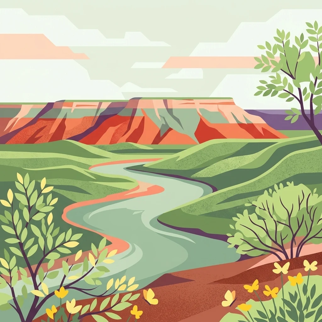
A digital illustration depicting a winding river flowing through a lush green valley toward a colorful red-rock mesa under a soft, light sky.

A reservoir-backed Panhandle escape for boating, fishing, and rolling plains scenery.

Lake Meredith National Recreation Area

Lake Meredith National Recreation Area is a United States national recreation area set in the Texas Panhandle, roughly 30 miles north of Amarillo. It is centered on a sizeable reservoir known as Lake Meredith, which was created by Sanford Dam on the Canadian River and now forms the heart of the recreation experience. The surrounding landscape is characteristic of the High Plains, an arid to semi-arid environment that blends open prairie, rugged canyon terrain along the lake's edges, and pockets of riparian habitat along the Canadian River. The recreation area supports boating, fishing, swimming, camping, hiking, and hunting, and it sits adjacent to Alibates Flint Quarries National Monument, linking the natural landscape to important Native American heritage. Lake Meredith's identity has always been tied to water levels. Its reservoir filled the canyons and rolling plains along the Canadian River, transforming them into a regional hub for outdoor recreation. Drought and fluctuating supply have reshaped the visitor experience over time, yet the park remains a defining feature of the northern Texas Panhandle.

Location
United States of America
Park type
Protected area
Established
1990
Area
182 km²
Lake Meredith National Recreation Area Atlas

Review Lake Meredith National Recreation Area events by distance

Search earthquakes near Lake Meredith National Recreation Area

Lake Meredith National Recreation Area’s collection associates reported epicentres with its Texas Panhandle boundary by calculated distance, without linking seismic activity to the reservoir or High Plains terrain. Each record provides a date, magnitude, depth, locality, source, and site distance for historical comparison without attributing landscape effects, present hazard, or future events.

Sort by
Magnitude
Location

This page describes catalogued earthquakes associated with the park by epicentre location and distance. It does not establish causation, assess current danger, or predict future earthquakes.

No earthquake records match the current filters

Park atlas

Continue from Lake Meredith National Recreation Area earthquake data

Discover more parks after Lake Meredith National Recreation Area

After the earthquake data around Lake Meredith National Recreation Area, the atlas continues into protected destinations beyond its Texas reservoir context. Their pages do not signal shared recreation status, High Plains landscape, proximity, geology, seismic evidence, hazards, risk, or information coverage.
A horizontal watercolor painting showing a soft, stylized view of open, rolling grassland under a hazy sky, with yucca-like plants in the foreground.
Wildlife reserveTexas
79 km away#1 closest

Northwest

Rita Blanca National Grassland: Protected Shortgrass Prairie Geography and Map

Mapping the mosaic of federal lands in the Texas Panhandle

Rita Blanca National Grassland offers a detailed look at restored shortgrass prairie ecosystems within the southern Great Plains. The area consists of intermixed federal and private land parcels that define the regional geography of the Texas and Oklahoma borderlands. This protected landscape provides habitat for pronghorn, prairie dogs, and raptors across a semi-arid, gently sloping terrain.

Area
376.31 km²
Established
1960
Relief
Upland
Climate
Arid
Protected landscapeTexas
80 km away#2 closest

Southeast

McClellan Creek National Grassland: Protected Landscape and Texas Geography Atlas

Restored shortgrass prairie and riparian reservoir geography

Located in the Texas Panhandle, McClellan Creek National Grassland serves as a critical example of soil conservation and shortgrass prairie restoration. The protected area features open, rolling plains surrounding the impounded McClellan Lake, providing a focused look at the environmental history and geographic character of the southern Great Plains.

Area
5.86 km²
Water
Minor water
A horizontal watercolor painting depicting a soft-toned, misty prairie landscape with rolling green hills, patches of tall grass, and distant hazy ridgelines under a pale sky.
Wildlife reserveUnited States of America
123 km away#3 closest

East

Black Kettle National Grassland: Protected Prairie Geography and Regional Map Context

A restored mixed-grass ecosystem in the southern Great Plains

Spanning scattered parcels in Oklahoma and Texas, Black Kettle National Grassland functions as a representative sample of restored southern plains prairie. The terrain consists of sandy soils, rocky red hills, and leafy draws along the Washita River headwaters. This protected area preserves a complex ecological and historical landscape that defines the character of the southern Great Plains, now managed for habitat restoration and natural resource protection.

Area
126.61 km²
Established
1960
Relief
Upland
Climate
Temperate
A horizontal watercolor illustration of a wide, open prairie landscape featuring soft green hills, sparse shrubs, and grasses against a pale background.
Protected landscapeNew Mexico
133 km away#4 closest

West

Kiowa National Grassland: Protected Landscapes, Canyon Terrain, and Prairie Geography

Northeastern New Mexico shortgrass prairie and river canyon systems.

Kiowa National Grassland represents a distinctive protected landscape within the southwestern Great Plains, featuring a mix of rolling steppe, pinyon-juniper woodland, and the deep gorges of the Canadian River Canyon. This area offers significant insight into the regional geography of New Mexico, where historic Santa Fe Trail corridors and seasonal playa lakes define the local terrain and ecosystem.

Area
554.95 km²
Established
1960
Relief
Upland
Climate
Temperate
A pale, soft watercolor illustration of a wide, open prairie with gentle rolling hills in the background, low shrubs, and grasses in the foreground.
Protected areaKansas
142 km away#5 closest

North

Cimarron National Grassland: Mapping the Largest Protected Area in Kansas

Shortgrass prairie geography and historical riparian landscapes

Spanning over 100,000 acres in southwestern Kansas, Cimarron National Grassland serves as a major ecological refuge within the Great Plains. The protected area features a unique terrain characterized by sand sagebrush uplands, cottonwood-forested bottomlands, and the winding course of the Cimarron River. This mapping data highlights the intersection of modern wildlife conservation and the remnants of the historic Santa Fe Trail.

Area
437.77 km²
Established
1960
Relief
Upland
Climate
Arid
A wide watercolor painting showing a green grassy plain with distant hills and a row of purple circular shapes in the foreground.
Protected areaColorado
151 km away#6 closest

Northwest

Comanche National Grassland: Geographic Atlas of Southeastern Colorado Protected Plains

Exploring canyon systems and prairie landscape boundaries

Spanning across Baca, Otero, and Las Animas counties, Comanche National Grassland represents a distinctive protected landscape of shortgrass prairie and deep canyon networks. The region is marked by the dramatic Purgatoire River and Carrizo Creek systems, offering a rich study in semi-arid topography, riparian corridors, and fossil-rich geological formations within the Colorado plains.

Area
1,793.09 km²
Established
1960
Relief
Upland
Climate
Temperate
Watercolor painting of a gentle, rolling landscape with a small stream, a small waterfall, and scattered trees under a soft, light sky.
Protected landscapeNew Mexico
301 km away#7 closest

West

Santa Fe National Forest: Geographic Atlas and Protected Landscape Overview

New Mexico mountain geography and wilderness mapping

Santa Fe National Forest spans more than 1.5 million acres of Northern New Mexico, featuring a dramatic transition from canyon river systems to the high elevations of the Pecos Wilderness. This protected landscape contains a complex network of forest districts across the Jemez and Sangre de Cristo Mountains, defined by volcanic plateaus, alpine basins, and seasonal aspen forests. Use this resource to understand the park boundaries, regional mountain geography, and the interconnected nature of these protected lands.

Area
6,306.83 km²
Established
1915
Relief
Mountain
Access
Easy access
Watercolor painting of a serene mountain landscape featuring rolling hills, coniferous trees, and a lake in the foreground, rendered in light pastel tones.
Protected landscapeColorado
339 km away#8 closest

Northwest

San Isabel National Forest: Geographic Overview and Protected Mountain Landscape Atlas

Central Colorado alpine terrain and designated wilderness areas

Spanning eleven counties in central Colorado, San Isabel National Forest serves as a cornerstone of the Southern Rocky Mountains. The forest landscape is dominated by the Sawatch and Sangre de Cristo ranges, offering a unique atlas of alpine tundra, dense coniferous forests, and high-altitude peaks that define the character of the region. This protected area provides a vital habitat and a vast, rugged environment characterized by volcanic formations like the Spanish Peaks and glacial geological features.

Area
4,533.42 km²
Established
1902
Relief
Mountain
Climate
Alpine
MoriAtlas Explorer

Trace the Mapped Boundaries and Canyon Landscapes of Lake Meredith National Recreation Area

Gain a deeper understanding of the High Plains geography by examining the reservoir and canyon topography of Lake Meredith National Recreation Area. MoriAtlas provides detailed context on the regional features and protected terrain of this significant Texas Panhandle site for those interested in landscape analysis.