
Why Lake Yuriria stands out
Lake Yuriria is best known for being one of the oldest artificial wetlands in the Americas, created in the 16th century to regulate the waters of the Lerma River and irrigate adjacent farmland. Its combination of colonial-era hydraulic heritage and modern ecological importance makes it a rare example of a long-standing human-made lake that has become a haven for wildlife. The lake is also distinguished by its role as a refuge for migratory and endemic birds in central Mexico, including the black-polled yellowthroat, a highland wetland endemic whose survival depends on large reed beds like those fringing Yuriria. Combined with its Ramsar status and recognition as an Important Bird Area, the lake is a benchmark site for bird conservation in the Bajío region.
Lake Yuriria history and protected-area timeline
The name "Yuriria" derives from "Yuririapundaro," meaning "lake of blood" in the Purépecha language, reflecting the lake's identity as part of the Purépecha Empire's territory prior to Spanish contact. Archaeological evidence suggests the wider region supported human settlement along ancient lake and marshland systems from late Pleistocene times onward, and the regional influence of the Chupícuaro culture extended into the area around what is now Yuriria.
The modern lake is a colonial creation. In 1548, the Augustinian friar Diego de Chávez y Alvarado, with authorization from Bishop Vasco de Quiroga, oversaw construction of a canal to divert water from the Lerma River into a natural marshland, forming Laguna de Yuriria. This canal, historically known as the Taramatacheo, ranks among the first major hydraulic engineering works in colonial America and was intended to improve irrigation and reduce flooding. Friar Diego de Chávez also initiated construction of the Augustinian monastery in the town of Yuriria on the lake's southern shore, anchoring the lake into the colonial settlement pattern of the Bajío.
During the colonial period the lake supported both agriculture and the organization of local mining administration, while later changes to nearby Lake Cuitzeo, including a 19th-century levee built to block overflow from the brackish Cuitzeo basin, reshaped the regional drainage relationship. In the 20th and 21st centuries, growing recognition of the lake's ecological value led to formal protections: an Important Bird Area designation from CONABIO in 1999, state-level protected area status in 2001, and inscription as a Ramsar wetland of international importance in 2004.
Lake Yuriria landscape and geographic character
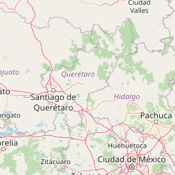
Lake Yuriria lies in a volcanic landscape within the Mesa Central of Mexico, part of the broader Trans-Mexican Volcanic Belt. The terrain surrounding the lake is characterized by mountainous relief, with the lake itself occupying the lowest portion of a former natural ciénega, or marshland depression. This geological setting gives the shoreline an irregular contour, where low volcanic slopes meet flat, wetland margins.
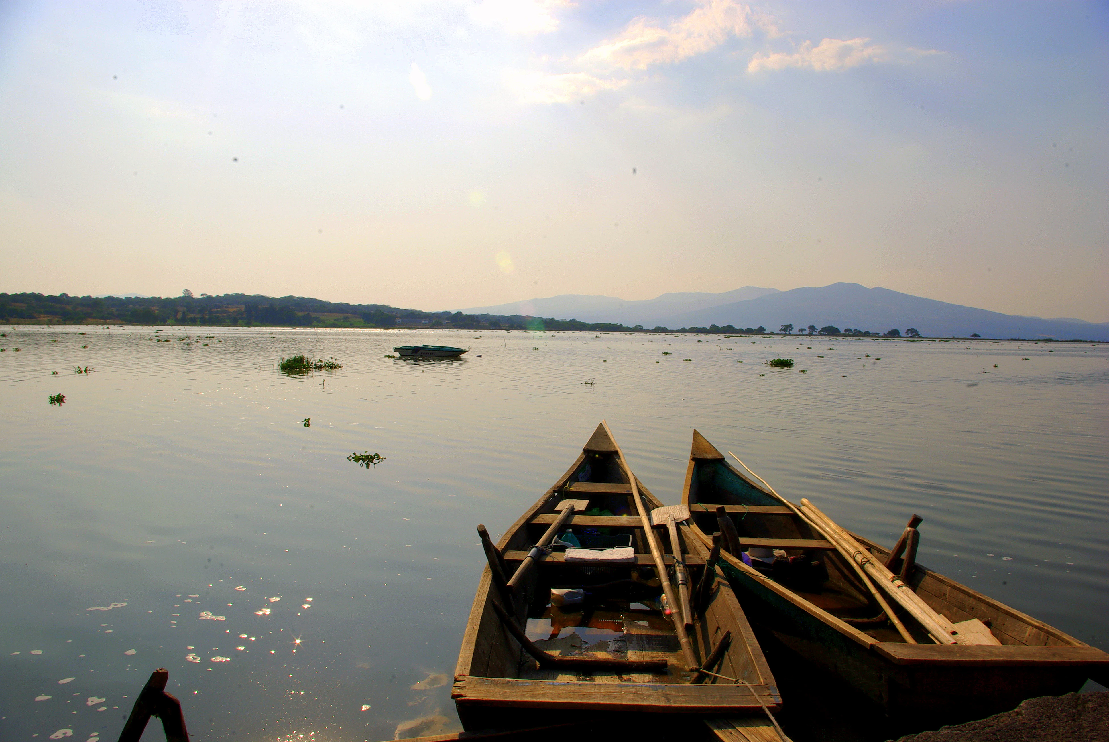
The lake stretches roughly 17 kilometers in length and about 6 kilometers across, with a high-water surface elevation around 1,730 meters above sea level. Several interior islands, including San Pedro, El Fuerte, and Las Cabras, rise from the shallow water and break the otherwise open expanse. To the north, several orographic prominences limit the lake's expansion in that direction, defining the boundary between open water and upland Bajío dry forests. The lake's surface behaves as a humidifying element in an otherwise semi-arid regional landscape, generating a more moderate microclimate along its shores.
Lake Yuriria ecosystems, habitats, and plant life
The lake is a eutrophic, shallow waterbody with maximum depths around 2.6 meters and very low underwater visibility. Despite, or partly because of, its nutrient richness, it supports a dense aquatic vegetation community. Dominant emergent plants include tule (Typha domingensis), which forms extensive reed beds in shallow areas, and common reed (Phragmites australis) along the margins, both of which stabilize sediments and provide critical nesting and cover habitat for birds and other wildlife.
Floating and submerged aquatic plants are also present, including water hyacinth and water lettuce, species that can influence the lake's ecological dynamics when populations expand. The terrestrial ecology of the shoreline and watershed falls within the Bajío dry forests ecoregion, a tropical dry forest system characteristic of central Mexico, which frames the wetland in a distinctive seasonally dry landscape. The interplay between open water, emergent marshes, and adjacent dry forest patches creates a mosaic of habitats within a relatively compact area.
Lake Yuriria wildlife and species highlights
Lake Yuriria is internationally significant for its birdlife. More than 140 bird species were documented between 1981 and 1997 alone, and broader surveys indicate that over 200 species have been recorded overall. The lake serves as a key stopover and wintering site on the central Mexico migratory flyway, attracting waterfowl, shorebirds, and raptors from both North and tropical America.
Among recorded species are blue-winged teal, American wigeon, Mexican duck, American white pelican, red-tailed hawk, and peregrine falcon. Orioles and other passerines also use the lake's margins and surrounding woodland, with species such as the black-vented oriole and hooded oriole noted. The endemic black-polled yellowthroat, a highland wetland specialist of central Mexico, has been recorded in the lake's reed beds, giving the site particular importance for the conservation of restricted-range species.
Beyond birds, the lake and its margins support coyotes, gray foxes, and raccoons that interact with the wetland food web, while reptiles such as the Mexican spiny lizard and the endemic Mexican earth snake occur in surrounding terrestrial habitats. The Monarch butterfly migration route passes through the broader Yuriria region, connecting the wetland to one of the world's most famous insect migration phenomena.
Lake Yuriria conservation status and protection priorities
Lake Yuriria has accumulated an unusually rich set of formal conservation designations for an artificial lake of its size. In 1999 it was recognized as an Important Bird Area by Mexico's National Commission for the Knowledge and Use of Biodiversity (CONABIO), highlighting its importance for resident and migratory bird populations. In 2001, the state government of Guanajuato issued a decree establishing the protected area "Laguna de Yuriria y su Zona de Influencia," covering roughly 15,020 hectares across the municipalities of Yuriria, Valle de Santiago, and Salvatierra, in the category of ecological restoration.
The lake's profile was raised further in 2004 when it was designated a Ramsar Wetland of International Importance, acknowledging its role as a globally significant freshwater wetland. The Ramsar designation specifically recognizes the lake as an important resting and feeding site for migratory waterbirds, as well as its value for regional hydrology and climate moderation. Conservation concerns at the site include water quality pressures from urban and industrial discharges in the wider basin, the spread of invasive aquatic plants such as water hyacinth, and habitat loss in adjacent dry forests. The black-polled yellowthroat, in particular, is considered a flagship species for the lake's conservation importance because its highland marsh habitat is restricted and highly localized.
Lake Yuriria cultural meaning and human context
The lake is deeply woven into the cultural identity of the town of Yuriria and the surrounding Bajío communities. The very name "Yuriria" preserves a Purépecha linguistic legacy, and the lake has functioned for centuries as a shared economic and social resource for agriculture, fishing, and local recreation. The Augustinian monastery founded alongside the lake by Friar Diego de Chávez in the 16th century remains a defining landmark of the town on the lake's southern shore.
Traditional festivities, foodways, and livelihoods in Yuriria are closely tied to the lake, and commercial fishing has historically supported a significant number of local families. The lake also serves as a community gathering space and a setting for environmental education, while conservation efforts increasingly reflect a local sense of stewardship, blending colonial heritage with contemporary ecological awareness.
Top sights and standout views in Lake Yuriria
Lake Yuriria combines the rare status of being a 16th-century colonial hydraulic engineering achievement with that of a globally designated Ramsar wetland. Its enduring dual identity, as both a working irrigation reservoir and an internationally recognized bird habitat, makes it distinctive among Mexico's protected natural areas.
Inner islands such as San Pedro and El Fuerte interrupt the open water, while extensive tule and reed beds around the margins support everything from waterfowl to endemic passerines like the black-polled yellowthroat. Set against the volcanic terrain of the Trans-Mexican Volcanic Belt and bordered by Bajío dry forests, the lake offers an unusually rich combination of engineered and natural heritage.
Best time to visit Lake Yuriria
Visits to Lake Yuriria are shaped strongly by season because the lake is shallow and surrounded by seasonally dry terrain. The cooler, drier months typically offer clearer skies and more comfortable conditions for observation of migratory and wintering waterfowl, when the lake functions as a refuge for both temperate and tropical migrants passing through central Mexico.
The warmer wet season, by contrast, brings higher water levels fed by the Lerma River and more vigorous growth of marginal vegetation, which can alter both the visual character of the wetland and its accessibility for birdwatching. In general, transitional and cooler months tend to be especially rewarding for visitors focused on birdlife and open-water scenery, while any visit benefits from an awareness that the lake remains a working, regulated waterbody whose levels and margins can shift through the year.