
Why Landschaftsschutzgebiet Asmecker Bachtal stands out
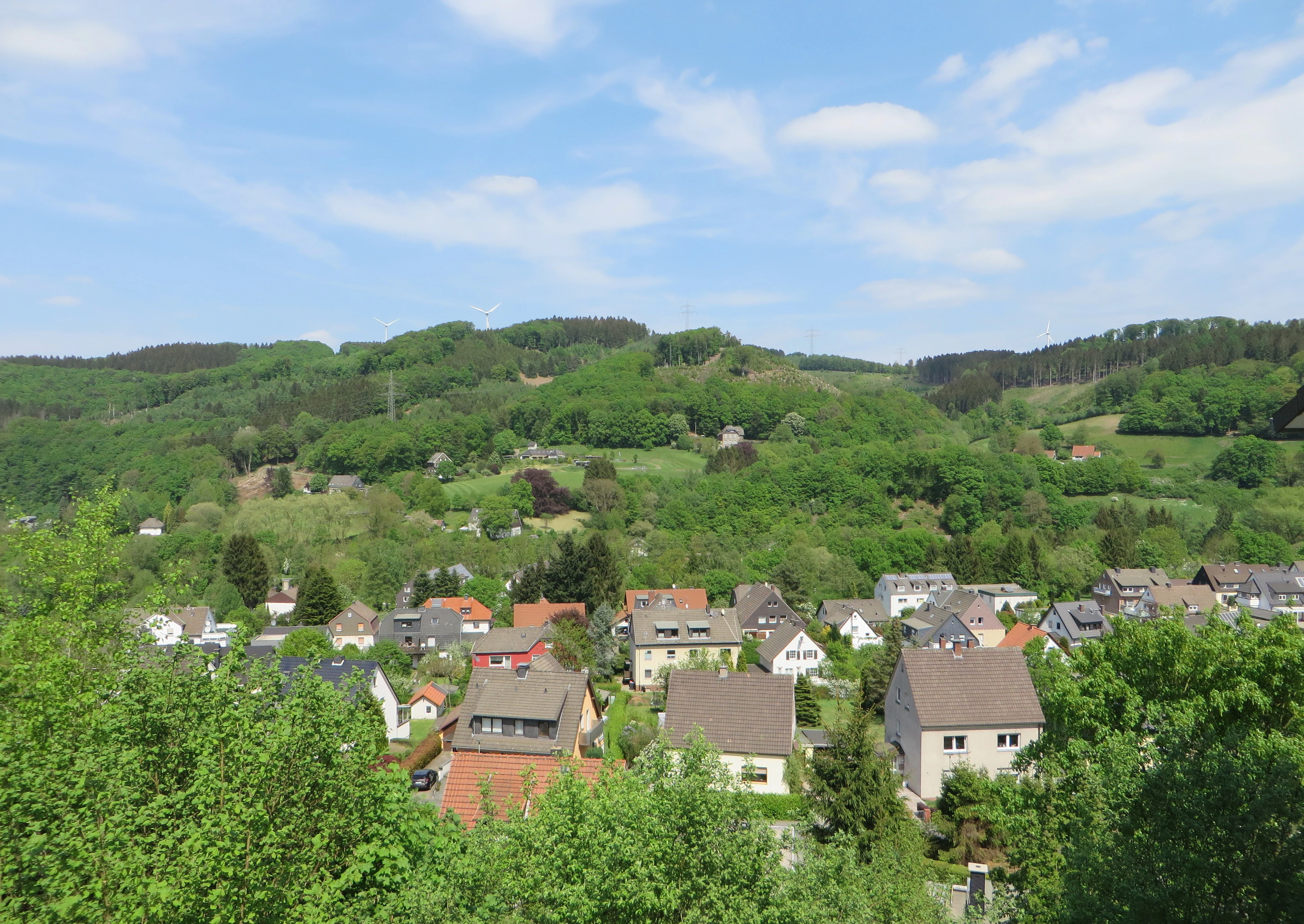
The landscape protection area is especially known for the forest communities lining the Asmecker stream valley, which gave the protected area its name and were a central justification for its designation. These wooded valley landscapes combine with adjacent farmland and historic farm buildings to create a mixed semi-rural setting within an otherwise heavily motorway-bounded stretch of the Hagen municipal area. The area also stands out for its role as a recreational green space for the Dahl neighborhood of Hagen, where residents can experience forest scenery close to the urban edge. Between the motorway, federal roads, cemetery land, and neighboring nature reserves, the Asmecker Bachtal sits as a preserved woodland corridor in a landscape otherwise shaped by transport infrastructure and residential development.
Landschaftsschutzgebiet Asmecker Bachtal history and protected-area timeline
The protection history of the Asmecker Bachtal area is rooted in the broader regional landscape planning approach used in North Rhine-Westphalia, where cities and districts prepare formal Landscape Plans to identify and designate protected areas. The Hagen city council adopted the Hagen Landscape Plan in 1994, and with this plan formally designated the Asmecker Bachtal as a Landschaftsschutzgebiet, or protected landscape area.
The 1994 designation reflects the standard German practice of recognizing landscapes that combine ecological value, scenic quality, and recreational function. In this case, the council's decision specifically cited the value of the forest communities in the Asmecker stream valley, the diversity and character of the local scenery, and the role of the woodland as an outdoor recreation area for residents of the Dahl neighborhood.
The two heritage-listed former farmsteads, Brake and Auf dem Stein, point to a longer human land-use history within the area that predates the 1994 designation by centuries. Their inclusion within the protected landscape underlines that the area's cultural heritage, including former agricultural structures and a former quarry, is now preserved alongside its natural and scenic values rather than being treated as separate from them.
Landschaftsschutzgebiet Asmecker Bachtal landscape and geographic character
The physical landscape of the Asmecker Bachtal is shaped by a small valley system centered on the Asmecker Bach, the stream that lends its name to the protected area. Forest dominates the valley slopes and broader high ground, while smaller fields of agricultural land occupy cleared or more level sections. This mixed forest-and-farmland pattern creates a classic valley landscape of west-central Germany, characterized by enclosed wooded slopes, small pastures, and isolated historic farmsteads.
The area's boundaries are heavily influenced by infrastructure and urban land use. The A 45 motorway runs along the eastern edge, forming a hard eastern boundary against the adjacent Egge landscape protection area. The B 54 federal road, together with the Dahl built-up area, defines the western limits. The L 693 country road cuts across the northern portion, and a finger of woodland extends further north toward a small local road called Hinter den Gärten.
A former quarry within the area adds a notable element to the topography, marking past industrial extraction and contributing to localized relief and exposed rock features. The monument-protected former farmsteads Brake and Auf dem Stein anchor the cultural landscape within the natural setting, illustrating the long-standing coexistence of settlement, agriculture, and forest that has shaped this part of Hagen's countryside.
Landschaftsschutzgebiet Asmecker Bachtal ecosystems, habitats, and plant life
Ecologically, the Asmecker Bachtal is defined primarily by its forest communities, with the woodland along the Asmecker stream valley identified at the time of designation as especially valuable. The protection statement singles out these forests as central to maintaining the area's natural balance and as worthy of preservation and, where needed, restoration. Smaller agricultural areas within the protected landscape provide habitat edges and open-land transitions that complement the dominant woodland cover.
The protected area's pattern of woodland interspersed with fields, combined with its proximity to the Hardt nature reserve and several neighboring landscape protection areas, gives it a connective ecological role within the broader green infrastructure around Hagen. Forest along the stream valley provides shade, moisture, and structural continuity for woodland species, while the open agricultural patches and the former quarry offer more variable microhabitats within an otherwise forested setting.
Landschaftsschutzgebiet Asmecker Bachtal wildlife and species highlights
The wildlife profile of the Asmecker Bachtal is closely linked to its forest-dominated character. The valley woodlands, particularly along the Asmecker Bach, create the habitat conditions most relevant to animal life in the area. These forests support the typical mammal, bird, and invertebrate communities associated with mixed deciduous and coniferous woodland in the lower elevations of the Sauerland and Westphalian hill country.
Edges between forest and the smaller agricultural fields provide transitional habitat often used by birds, small mammals, and insects. The former quarry and the structures of the listed farmsteads Brake and Auf dem Stein also create additional habitat variety, offering nesting or shelter opportunities for species that benefit from a mix of natural and built features within a wooded landscape.
Landschaftsschutzgebiet Asmecker Bachtal conservation status and protection priorities
From a conservation perspective, the Asmecker Bachtal was designated to preserve and, where necessary, restore the performance of natural systems within its boundaries, with particular attention to valuable woodland along the Asmecker stream valley. The Hagen Landscape Plan behind the 1994 designation explicitly anchors this protection in the ecological function of the forest communities and in the scenic qualities of the broader landscape.
Within the wider system of protected areas around Hagen, the Asmecker Bachtal plays a connective role. It borders the Egge landscape protection area across the A 45, the Eilper Berg/Langenberg landscape protection area to the west, and the Brantenberg/Stapelberg landscape protection area to the south. To the north it touches the Hardt nature reserve, a stricter protection category that complements the broader landscape-scale safeguarding of Asmecker Bachtal itself. This network of overlapping protection categories strengthens the overall conservation value of the area beyond its own boundaries.
Landschaftsschutzgebiet Asmecker Bachtal cultural meaning and human context
The cultural context of the Asmecker Bachtal is shaped by centuries of agricultural land use within what is now a heavily urbanized part of North Rhine-Westphalia. The two monument-protected former farmsteads, Brake and Auf dem Stein, reflect the small-scale farming tradition that once sustained the rural fringes of present-day Hagen. Their status as listed heritage sites within the protected landscape underlines the integration of cultural heritage preservation into the broader landscape protection framework.
A former quarry within the protected area adds another layer of local heritage, recording a period of geological resource extraction that has since ended, leaving behind a landscape feature with both topographic and historical interest. The area also holds everyday cultural significance for residents of the Hagen-Dahl neighborhood, whose outdoor recreation and nature experience in the surrounding forest is explicitly cited as one of the reasons for the 1994 protection.
Top sights and standout views in Landschaftsschutzgebiet Asmecker Bachtal
Strong forest cover along the Asmecker Bach stream valley sits at the heart of the protected area and was the central ecological justification for its 1994 designation. The landscape combines this woodland with smaller agricultural patches, creating a balanced rural setting within the urban boundaries of Hagen.
Within the area, visitors and locals encounter two listed heritage farmsteads, Brake and Auf dem Stein, alongside a former quarry. The protected landscape also functions as a green corridor in a region otherwise framed by major roads, sitting between the A 45 and the B 54, and connecting to neighboring protected areas such as the Hardt nature reserve and the Egge and Eilper Berg/Langenberg landscape protection areas.
Best time to visit Landschaftsschutzgebiet Asmecker Bachtal
The woodland valleys of the Asmecker Bachtal are most appealing in late spring and early summer when fresh leaf cover defines the stream valley scenery, and again in early autumn when the mixed forest takes on seasonal color. Summer offers dense shade under the canopy and is well suited to quiet walks, while crisp winter days can open up views through the bare deciduous trees and reveal the wider valley structure. The area's recreational role for the Dahl neighborhood means visitors are likely to encounter other walkers at any time of year, especially on weekends.