
Mori Atlas logo
Nature reserveLanges Luch / Dachsheide

Discover the ecological mosaic of glacial bogs, forest swamps, and inland sand dunes

Langes Luch / Dachsheide: A Protected Nature Reserve within the Berlin Glacial Landscape

(Naturschutzgebiet Langes Luch / Dachsheide)

The Langes Luch / Dachsheide nature reserve represents a distinct protected landscape situated in the southwestern Grunewald forest of Berlin. This compact site preserves a rare combination of transitional mire, floating peat mats, and alder swamp woodland carved by glacial meltwater channels. Adjacent sandy heathland and artificial dunes provide an ecologically coherent habitat mosaic that serves as a vital refuge for specialized bog flora and rare invertebrate species within the urban environment.

bogtransitional mireSchwingrasenalder swamp forestdry heathinland dunes
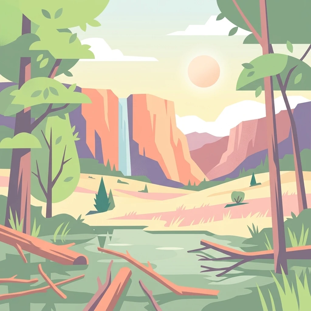
A flat vector-style illustration of a nature reserve landscape with a central waterfall descending from cliffs into a marshy area with fallen logs and surrounding trees at sunrise.

Langes Luch / Dachsheide

Nature reserve

Park overview

Structured park overview, official facts, and landscape profile for Langes Luch / Dachsheide

Langes Luch / Dachsheide park facts, protected area profile, and essential visitor context

Review the core facts for Langes Luch / Dachsheide, including designation, size, terrain, visitor scale, habitats, and operating context in one park-focused overview.

About Langes Luch / Dachsheide

Langes Luch / Dachsheide is one of Berlin's compact but ecologically rich nature reserves, occupying a transitional zone between the sprawling Grunewald forest to the north and the open agricultural landscapes of the Teltow plateau to the south. Although it covers only around 32 hectares, the reserve contains a striking diversity of habitats, including a glacial bog basin, alder swamp forest, sandy heath vegetation, and open inland dunes, all within an urban state.

The Langes Luch basin is the hydrological and ecological heart of the site. It lies in a section of the buried glacial meltwater valley that runs beneath the Grunewald lake chain. Over thousands of years, peat-forming vegetation colonized this nutrient-poor, acidic depression, producing a system of open bog, floating peat mats, and surrounding alder swamp woodland. A drainage channel along the eastern side of the basin connects it hydrologically to the larger Grunewaldsee system to the northeast and, ultimately, southward to the Riemeisterfenn. This wetland context is the reason the area was first designated as a protected site back in 1960, when the city placed the original 15-hectare wetland under nature conservation oversight.

The 2017 ordinance expanded the reserve's scope southward and eastward by formally including the Dachsheide, a stretch of sandy terrain with inland dune structures, dry heath vegetation, and patches of pine forest. This addition transformed the reserve from a single bog site into a dual-character protection area, where wet and dry, acidic and sandy ecosystems meet. The Dachsheide's surface also retains visible traces of twentieth-century military activity, including artificial dunes created during the time when American allied forces still occupied the Grunewald.

Management of the reserve focuses on rewetting the bog basin and removing invasive woody species such as black cherry and ashleaf maple, which would otherwise crowd out the open moor vegetation. A natural toboggan run descending the Teltow slope into the southern end of the Langes Luch basin shows how closely recreational use and conservation coexist in this reserve, where informal outdoor activities remain part of the surrounding Grunewald's identity.

Altogether, Langes Luch / Dachsheide represents Berlin's effort to preserve a functioning bog-and-heath landscape within a metropolitan setting, offering a refuge for specialized flora and fauna in a region where most remaining natural ecosystems have long since been built over.

Quick facts and research context for Langes Luch / Dachsheide

Langes Luch / Dachsheide is a nature reserve (Naturschutzgebiet) in Berlin, Germany, classified under IUCN Category IV as a Habitat/Species Management Area. It lies in the Dahlem locality at the western edge of the Grunewald and currently covers about 32.35 hectares. The protected area consists of two connected but ecologically contrasting zones: the wet glacial depression of Langes Luch and the sandy heathland of Dachsheide.

The original 15-hectare wetland portion was placed under protection in 1960, with the current legal ordinance dating from 2017, which formally added the Dachsheide area. The reserve is part of the broader Grunewald lake chain system and serves an important function in preserving bog habitats, alder swamp forest, and inland sand-dune vegetation within a heavily urbanized region.

Protection and recognition

Documented terrestrial protection metrics and official designation records

Langes Luch / Dachsheide Protection Status and Designation History

Langes Luch / Dachsheide maintains a recorded terrestrial protection status established in 2017 within global conservation registers. Structured protection data outlines the official designation history and management scope associated with the protected area.

Protection details

Protection scope
Terrestrial
Designated year
2017
Transboundary protection
No
WDPA ID
164368
Park context

Deeper park guide and search-rich context for Langes Luch / Dachsheide

Langes Luch / Dachsheide history, landscape, wildlife, and travel context

Explore Langes Luch / Dachsheide through its history, landscape character, ecosystems, wildlife, conservation priorities, cultural context, and seasonal travel timing in a structured park guide built for atlas discovery and search intent.

Why Langes Luch / Dachsheide stands out

Langes Luch / Dachsheide is best known for safeguarding an open transitional bog and alder swamp woodland within a glacial meltwater channel, despite being situated inside the city of Berlin. The reserve's combination of nutrient-poor, acidic wetland with adjoining sandy heathland gives it a distinctive ecological character rarely found so close to an urban environment. Its other defining trait is the mosaic of bog pools, floating peat mats, and dry inland habitats created by past human land use, including a former natural toboggan run descending from the Teltow plateau into the wet depression and artificial dunes on the Dachsheide left over from the area's time as allied military ground. Together, these features make it a recognized refuge for threatened bog plants and specialized invertebrate species.
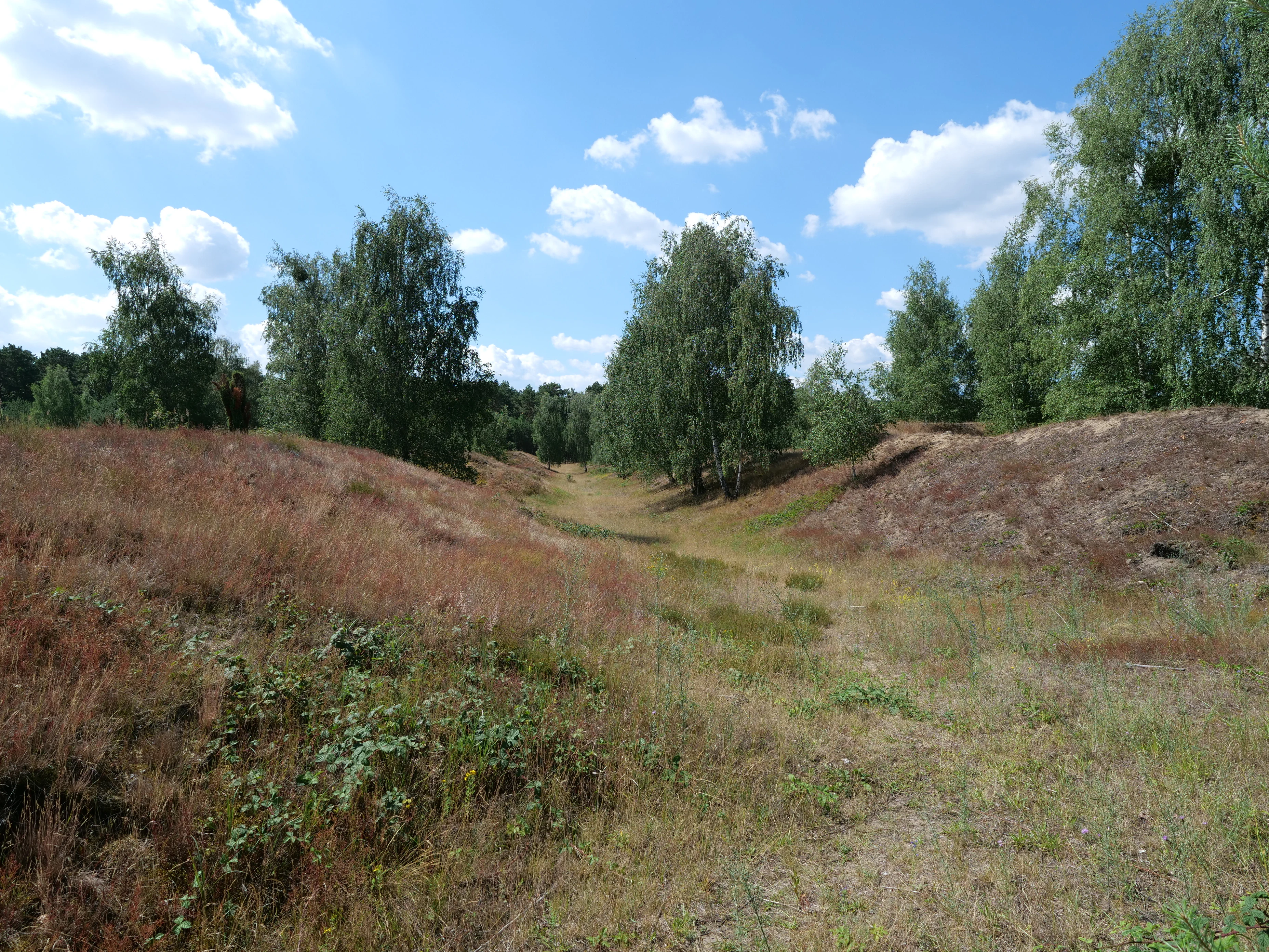
A wide, grassy path leads through a depression in a dry, sandy heathland with birch trees under a blue sky with white clouds.
A view of the Dachsheide area within the Grunewald forest.

Langes Luch / Dachsheide history and protected-area timeline

The conservation history of Langes Luch / Dachsheide begins in 1960, when Berlin placed an initial 15-hectare wetland area under formal protection, recognizing the ecological value of the peatland within the Grunewald lake chain system. This original designation focused on the bog basin itself and the surrounding wet habitats.

In 1987, a revised ordinance replaced the 1960 framework and its subsequent amendments with a consolidated regulation that articulated the reserve's protection goals in detail. It emphasized the preservation of the open transitional bog communities, the floating peat mats, the alder swamp woodland, the rare and threatened plant species, and the bog's stratigraphic profile.

The most recent milestone came on 20 December 2017, when a new ordinance extended the protected area to cover roughly 32 hectares and formally incorporated the Dachsheide, adding sandy heath and inland dune habitats that complement the original wetland. This expansion reflected broader conservation recognition that the bog and the adjacent sandy heath together form a coherent ecological unit worth protecting as a single reserve.

Langes Luch / Dachsheide landscape and geographic character

The landscape of Langes Luch / Dachsheide is shaped by two contrasting but adjoining landform systems. The first is the wetland basin of Langes Luch, a low-lying, marshy depression within the glacial meltwater channel of the Grunewald lake chain. Its surface is irregular, with shallow bog pools, floating peat mats, and patches of alder swamp woodland, all sitting within a broader forested setting that connects visually and hydrologically to the nearby Grunewaldsee and Riemeisterfenn.

The adjoining Dachsheide introduces a much drier element to the reserve. Here the terrain rises onto sandy soils that support inland dune formations, low pine cover, and open dry heath vegetation. Some of these dune structures are natural relicts of post-glacial sand movement, while others were created artificially during the period in which the Grunewald was used as allied military ground. A channel runs along the eastern edge of the bog, providing an apparent hydrological link within the buried glacial valley.

At the southern margin, the slopes of the Teltow plateau descend into the bog basin, and the flat lower extension of a natural toboggan run curves for several hundred metres down the slope into the wet depression, marking an unusual intersection of recreational, cultural, and ecological landscapes.
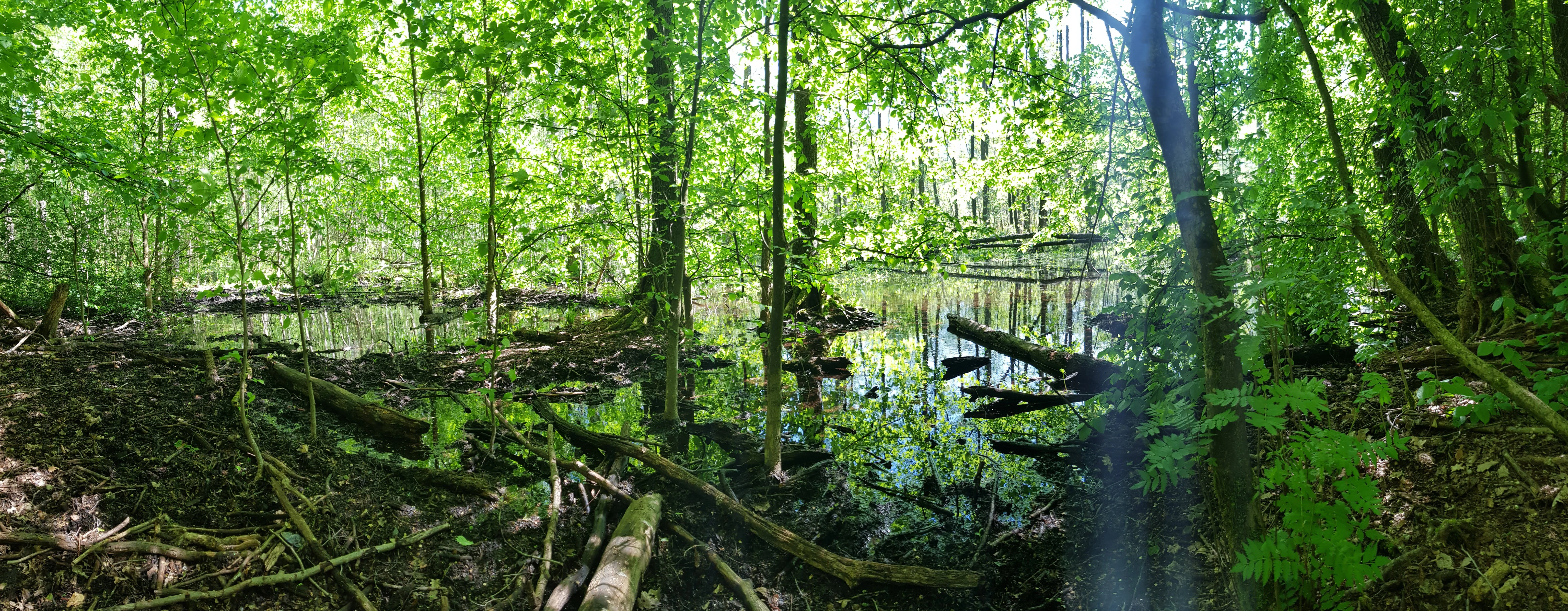
A wide, eye level shot of a lush green forest swamp with a pond reflecting trees, fallen logs, and dense canopy cover.
A view into the swampy woodland environment of the Langes Luch nature reserve in Berlin.

Langes Luch / Dachsheide ecosystems, habitats, and plant life

The ecological character of Langes Luch / Dachsheide is defined by the coexistence of two rare habitat types within a very compact area. The bog basin preserves open transitional mire (Übergangsmoor) vegetation, a community typical of nutrient-poor, acidic, and waterlogged conditions. Within this wetland, floating peat mats (Schwingrasen) form a sparse, fragile surface layer above the open water, and the surrounding margins support alder swamp woodland adapted to permanently saturated soils.

The Dachsheide adds a contrasting mosaic of dry, sandy habitats, including inland dune vegetation and dry heath communities. These open, sun-exposed sandy environments host plant species very different from those of the wet basin, yet both systems are bound together by shared acidic, nutrient-poor conditions.

Management efforts concentrate on preserving these open habitat structures. The reserve's ordinance specifically calls for rewetting the bog to maintain its characteristic vegetation, and for removing moor-untypical woody invaders such as black cherry (Prunus serotina) and ashleaf maple (Acer negundo), which would otherwise close the canopy over open bog surfaces. These interventions aim to keep the ecological conditions favorable for the specialized species that depend on the reserve.
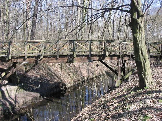
A rustic wooden footbridge with a lattice railing crossing a narrow, dark stream in a deciduous forest during late winter or early spring.
A wooden footbridge crossing a small stream in the Langes Luch nature reserve.

Langes Luch / Dachsheide wildlife and species highlights

The wildlife value of Langes Luch / Dachsheide lies less in charismatic large species and more in the specialized invertebrates that depend on its bog and heath habitats. The reserve's conservation targets explicitly mention preserving the habitat of bog-typical fauna, recognizing that many of the bog's ecological functions depend on its invertebrate communities.

A specific historical record illustrates this focus: in 1987, the water beetle Haliplus fulvicollis was documented within the Langes Luch basin. This species was listed as strongly endangered on the Red List of water beetles for Brandenburg, underlining the reserve's importance as a refuge for vulnerable invertebrate populations otherwise threatened by drainage and habitat loss in surrounding regions.

Beyond this single documented species, the combination of open water, floating peat mats, alder swamp, and dry sandy heath creates a range of microhabitats for spiders, beetles, and other small fauna specialized in bog and heath environments. While the source material does not provide a broader list of vertebrate species, the reserve's protection goals implicitly support the broader moor-typical fauna around these invertebrates.
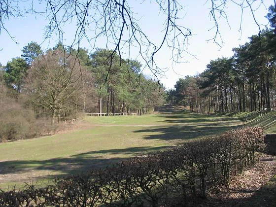
A wide, grassy clearing bordered by pine trees and hedges, photographed in early spring.
A grassy sledding hill at the Langes Luch nature reserve in Berlin.

Langes Luch / Dachsheide conservation status and protection priorities

From a conservation perspective, Langes Luch / Dachsheide is significant primarily because it preserves an intact, functioning bog system inside one of Germany's largest cities. The site's protection goals, codified in successive ordinances, are unusually explicit and emphasize four main pillars: maintaining the open transitional bog communities and floating peat mats, preserving rare and endangered plant species, securing the habitat for moor-typical fauna, and protecting the peat stratigraphy itself for scientific and regional-historical reasons.

The 2017 ordinance strengthened this profile by extending protection across the dune-influenced sandy terrain of the Dachsheide. Bundling the wet and dry habitats under a single designation reflects the modern understanding that bog, heath, and inland dune ecosystems share ecological affinities and together constitute a coherent conservation priority.

Active management is also central to the reserve. Rather than treating it as a passive protected landscape, Berlin's conservation authorities actively rewet the mire and remove invasive woody species that would otherwise convert open bog into closed-canopy forest. This combination of legal protection, ecological management, and habitat rewetting makes Langes Luch / Dachsheide a small but representative example of applied urban bog conservation.

Langes Luch / Dachsheide cultural meaning and human context

The site has a strong cultural dimension rooted in regional land use and Berlin's twentieth-century history. The natural toboggan run that descends the Teltow slope into the southern end of Langes Luch links the reserve to a long-standing tradition of winter recreation in and around the Grunewald.

The Dachsheide, meanwhile, bears visible traces of more recent political and military history: its artificial dunes were created during the period in which the Grunewald hosted US-allied military facilities. The fact that these disturbance features have been absorbed into a formal nature reserve illustrates how conservation in the Berlin region frequently builds on, rather than conceals, layered histories of land use.

Top sights and standout views in Langes Luch / Dachsheide

Langes Luch / Dachsheide combines a glacial bog basin with adjacent inland dune and heath within a compact city reserve, making it ecologically distinct despite its small size. Its open transitional mire, floating peat mats, and alder swamp woodland form one of the few surviving bog systems within Berlin's urban area.

The reserve is also notable for its layered land-use history, expressed in the natural toboggan run sliding down the Teltow slope and the artificial dunes in the Dachsheide from the era of allied military occupation. These cultural and historical layers overlap directly with the reserve's tightly defined conservation objectives, which focus on rewetting the bog, removing invasive woody species, and sustaining the rare mire flora and fauna for which the site is recognized.

Best time to visit Langes Luch / Dachsheide

Langes Luch / Dachsheide can be visited year-round, as the reserve's main attractions, the protected mire itself and its accompanying heath and dune habitats, remain accessible regardless of season. Spring is generally favorable for observing the bog's characteristic vegetation develop and for wetland bird and insect activity, while summer highlights the contrast between the lush wet basin and the dry, sun-exposed sandy terrain of the Dachsheide.

Winter brings its own particular appeal when the natural toboggan run along the southern margin becomes the dominant recreational feature, drawing local visitors into the area. Cooler months can also make bog pools and floating peat mats easier to observe, as lower vegetation cover exposes the structure of the mire. As always in small wetland reserves, visitors should avoid disturbing sensitive bog surfaces and stick to established paths and bridges.

Monthly climate preview

Long-term monthly temperature and precipitation data for Langes Luch / Dachsheide

Langes Luch / Dachsheide Climate Normals and Annual Temperature Patterns

Historical data captures the measured annual temperature and precipitation rhythm across twelve months at Langes Luch / Dachsheide. Complete monthly climate normals reveal detailed long-term averages for temperature swings and precipitation rates.
Annual mean9 °C
-1 °C20 °C
Jan-1°
Feb
Mar
Apr
May14°
Jun18°
Jul20°
Aug20°
Sep15°
Oct
Nov
Dec
Warmest month
July

20.3 °C

Coolest month
January

-0.7 °C

Wettest month
July

2.4 mm/day

Driest month
April

1 mm/day

Park location guide

Geography guide, regional context, and park location map for Langes Luch / Dachsheide

Langes Luch / Dachsheide park geography, regions, and map view in Germany

Understand where Langes Luch / Dachsheide sits in Germany through a broader geographic reading of the surrounding landscape, nearby location context, and its mapped position within the national park landscape.

How Langes Luch / Dachsheide fits into Germany

Germany is a federal republic in Western and Central Europe with a population of over 83 million across sixteen constituent states. It is Europe's largest economy by nominal GDP and a major global exporter and importer. The capital is Berlin, and the country borders Denmark, Poland, Czech Republic, Austria, Switzerland, France, Luxembourg, Belgium, and the Netherlands.

Wider geography shaping Langes Luch / Dachsheide in Germany

Germany is located in Western and Central Europe, spanning 357,022 km². It borders Denmark to the north, Poland and the Czech Republic to the east, Austria and Switzerland to the south, and France, Luxembourg, Belgium, and the Netherlands to the west. The country has coastlines on the Baltic Sea and North Sea to the north, with the Alps located in the southern region.

Map view of Langes Luch / Dachsheide

Use this park location map to pinpoint Langes Luch / Dachsheide in Germany, understand its exact geographic position, and read its mapped placement within the surrounding landscape more clearly.

Pigeon | © OpenStreetMap contributors

Location context for Langes Luch / Dachsheide

Berlin

Visual exploration of wetland basins, sandy heathland, and glacial valley terrain

Langes Luch / Dachsheide Photos and Landscape Scenery

Visual records capture the striking contrast between swampy transitional bogs and dry sandy heathland within the protected reserve. Photographic documentation reveals the distinct glacial meltwater topography and specialized habitats characterizing the natural park environment.

A wide, grassy path leads through a depression in a dry, sandy heathland with birch trees under a blue sky with white clouds.

A wide, open, sunlit landscape featuring dry, grassy, and heath-like terrain dotted with small, sparse trees and bushes, under a bright blue sky with scattered white clouds.

A wide, eye level shot of a lush green forest swamp with a pond reflecting trees, fallen logs, and dense canopy cover.

A rustic wooden footbridge with a lattice railing crossing a narrow, dark stream in a deciduous forest during late winter or early spring.

A wide, grassy clearing bordered by pine trees and hedges, photographed in early spring.

Park atlas

Compare adjacent wetland reserves and connected glacial meltwater landscapes

Other Parks Near Langes Luch / Dachsheide and Surrounding Protected Areas

Browsing other parks near Langes Luch / Dachsheide reveals a broader network of protected wetlands and sandy heathlands across the surrounding region. Such regional comparisons provide essential context for understanding urban conservation habitats and glacial valley geography.
Nature reserveBerlin
About 0.8 km away#1 closest

Southwest

Riemeisterfenn Nature Reserve and Protected Peatland Landscape in Berlin

A rare bog ecosystem within the city glacial lake chain

Riemeisterfenn is a distinct nature reserve in Berlin, characterized by its marshy lowlands, reed beds, and alder carr vegetation. This site offers an essential look at a preserved peatland habitat and the Fennkanal hydrology that connects these protected areas to the wider Grunewald forest ecosystem.

Area
0.072 km²
Established
1987
Relief
Lowland
Climate
Temperate
A watercolor painting showing a soft green marshy landscape with low hills in the background and a winding stream in the foreground.
Nature reserveBerlin
About 2 km away#2 closest

Northeast

Hundekehlefenn Nature Reserve: Geography and Protected Wetland Landscapes in Berlin

Glacial meltwater channel and moorland in Grunewald

Hundekehlefenn represents one of the last surviving pieces of original Berlin vegetation, preserved as a nature reserve within the city limits. This compact protected area showcases a glacial meltwater channel geography, featuring marshy depressions, mesotrophic bog remnants, and alder swamp forests. It serves as an essential ecological link within the Grunewaldseenkette lake chain, providing a window into the natural terrain history of the region.

Area
0.1 km²
Established
1987
Relief
Lowland
Climate
Temperate
Watercolor illustration of a serene wetland scene with soft green hills and a light pink sky.
Nature reserveBerlin
About 3.2 km away#3 closest

North

Sandgrube im Jagen 86 Nature Reserve: Mapped Geography and Protected Area Context

A unique habitat mosaic within the Berlin forest region

Sandgrube im Jagen 86 functions as a protected nature reserve in Berlin, characterized by a bowl-shaped terrain of glacial sands. The area provides a critical habitat for specialized wildlife by balancing nutrient-poor grasslands with open water bodies and sun-exposed slopes, illustrating an effective example of managed conservation within an urban forest.

Area
0.135 km²
Established
1992
IUCN
IV
Relief
Lowland
Nature reserveBerlin
About 5.7 km away#4 closest

Northwest

Windmühlenberg Nature Reserve: Glacial Terrain and Steppe Flora in Berlin

Protected sand-dry grasslands on the Nauen Plateau edge

Windmühlenberg preserves a rare ecological landscape in western Berlin. This glacial hill and nature reserve functions as a protected habitat for steppe-relict flora and specialized insects, serving as a critical point of interest for understanding the geomorphology and sand-based grassland environments of the Havel river valley.

Area
0.051 km²
Established
2002
Relief
Upland
Climate
Temperate
Nature reserveBerlin
About 6.4 km away#5 closest

North

Fließwiese Ruhleben: A Glacial Nature Reserve and Wetland Mosaic in Berlin

Mapping a unique urban protected area and its peat marsh topography

Fließwiese Ruhleben is a protected nature reserve in western Berlin that preserves a distinct relic of Weichselian glaciation. The site features a narrow, basin-like depression carved by glacial meltwater, supporting a rich diversity of peat-forming marshland and alder swamp forests. This protected area remains a vital node for regional biodiversity, contrasting sharply with the surrounding urban landscape of the Teltow plateau.

Area
0.118 km²
Established
1959
Relief
Lowland
Climate
Temperate
Protected landscapeBerlin
About 6.8 km away#6 closest

Northwest

Tiefwerder-Wiesen Protected Landscape: Berlin Riverine Geography and Floodplain Map

Mapping the historic Havel river floodplains and wetland habitats.

Tiefwerder-Wiesen serves as an important ecological corridor in Berlin, safeguarding the last functional pike spawning grounds within the city. This protected landscape contains a dense network of river arms, ditches, and sedge meadows that illustrate the historical and ongoing geomorphological processes of the Havel river valley.

Area
0.667 km²
Established
1960
Relief
Lowland
Climate
Temperate
Watercolor painting of a green wetland area with soft, blurred rolling hills in the background.
Nature reserveBerlin
About 9.3 km away#7 closest

Southwest

Großes Fenn Nature Reserve: Protected Peatland and Kettle Bog Geography in Berlin

A study of post-glacial landforms and mire environments.

Großes Fenn represents a rare urban kettle bog formed during the last glacial period, now protected within the Berlin region. This reserve showcases the historical peat-forming processes and the fragile ecological balance of small depressions in the Düppeler Forest, offering a compact site for understanding glacial landscape legacies.

Area
0.064 km²
Established
1986
IUCN
IV
A horizontal watercolor illustration depicting a calm lake surrounded by soft green forest and distant hazy hills.
Protected areaBerlin
About 9.8 km away#8 closest

Southwest

EU-Vogelschutzgebiet Westlicher Düppeler Forst: Protected Area and Regional Geography

Ecological sanctuary and Havel lakeshore landscape in Berlin

Located in the Steglitz-Zehlendorf district, this protected area spans nearly 10 square kilometres of diverse woodland and aquatic terrain. The site combines historical cultural landmarks with essential breeding grounds for migratory birds, including significant woodpecker populations and varied riparian corridors throughout the southwestern Berlin borderlands.

Area
9.44 km²
Established
2003

Common questions about visiting, size, designation, and location context for Langes Luch / Dachsheide

Langes Luch / Dachsheide FAQs for park facts, access, geography, and protected area context

Find quick answers about Langes Luch / Dachsheide, including protected-area facts, park geography, trail and visitor context, and how the park fits into its surrounding country and regional landscape.
MoriAtlas Explorer

Continue Your Protected Areas Search Across the Global Atlas

Deepen your exploration by continuing the structured search for national parks and protected areas worldwide. Utilize the comprehensive filtering capabilities to compare different conservation landscapes and refine your understanding of global park geography. Discover more about the distribution and characteristics of protected natural areas.

Global natural geography