
Mori Atlas logo
Protected landscapeLassen National Forest

Tracing the geological boundaries and forest ecosystems in northeastern California

Lassen National Forest: A Comprehensive Atlas of Volcanic Terrain and Protected Landscapes

Spanning 1,700 square miles of rugged mountain terrain, Lassen National Forest serves as a critical protected landscape in northeastern California. This region offers a complex mapped geography, characterized by ancient lava flows, cinder cones, and dense coniferous forests that bridge the gap between the Sierra Nevada and the Cascades. The forest provides a foundational atlas for understanding volcanic geological processes and the conservation of diverse highland habitats.

National ForestVolcanic landscapeConiferous forestsOld-growth forestCascade RangePacific Crest Trail
A colorful vector-style illustration showing a waterfall cascading down pink cliffs into a blue lake, surrounded by green pine trees and rocky terrain under a sunny sky.

Lassen National Forest

Protected landscape

Park overview

Structured park overview, official facts, and landscape profile for Lassen National Forest

Lassen National Forest park facts, protected area profile, and essential visitor context

Review the core facts for Lassen National Forest, including designation, size, terrain, visitor scale, habitats, and operating context in one park-focused overview.

About Lassen National Forest

Lassen National Forest operates as an expansive network of public land administered by the United States Forest Service. Geographically, the forest acts as an ecological bridge, bordering California's agricultural Central Valley to the west while rising into the foothills of the Sierra Nevada and the volcanic southern Cascade Range. The landscape is heavily forested, primarily supporting Sierra Nevada mixed conifer, Jeffrey Pine, Red Fir, and Lodgepole Pine ecosystems, alongside unique volcanic features like lava tubes and cinder cones.

Forest management balances resource extraction with conservation and recreation, maintaining numerous campgrounds, developed sites, and primitive areas. Surveys suggest that nearly 92,000 acres of the forest consist of old-growth timber, representing a significant proportion of California's remaining mature coniferous woodlands. The forest's identity is deeply intertwined with regional water flow, encompassing segments of major river systems and bordering Lake Almanor, which shapes local hydrology and aquatic habitats.

Quick facts and research context for Lassen National Forest

Established on June 2, 1905, Lassen National Forest spans approximately 1,070,344 acres across the counties of Lassen, Shasta, Tehama, Plumas, and Butte in California. Its administrative headquarters are located in Susanville, California, with additional ranger district offices in Chester and Fall River Mills. Governed by the U.S. Forest Service, the region is named after pioneer Peter Lassen and harbors an estimated 92,000 acres of old-growth forest.

Protection and recognition

Explore documented terrestrial protection metrics and conservation history for Lassen National Forest.

Lassen National Forest Protection Status and International Recognition

Lassen National Forest maintains a documented terrestrial protection status with structured records covering its management scope and conservation history. Review verified designation data and international recognition metrics associated with this protected natural landscape.

Protection details

Protection scope
Terrestrial
Transboundary protection
No
Park context

Deeper park guide and search-rich context for Lassen National Forest

Lassen National Forest history, landscape, wildlife, and travel context

Explore Lassen National Forest through its history, landscape character, ecosystems, wildlife, conservation priorities, cultural context, and seasonal travel timing in a structured park guide built for atlas discovery and search intent.

Why Lassen National Forest stands out

Lassen National Forest is especially recognized for its sweeping stands of old-growth conifers, mixed volcanic topography, and its proximity to the active geothermal environment of Lassen Volcanic National Park. The forest features a significant portion of the Pacific Crest Trail, alongside historic byways like the Nobles Emigrant Trail. Furthermore, it is home to the Lassen Pack, a wild gray wolf family descended from Oregon's famous OR7, marking a vital point of interest in modern wildlife conservation.
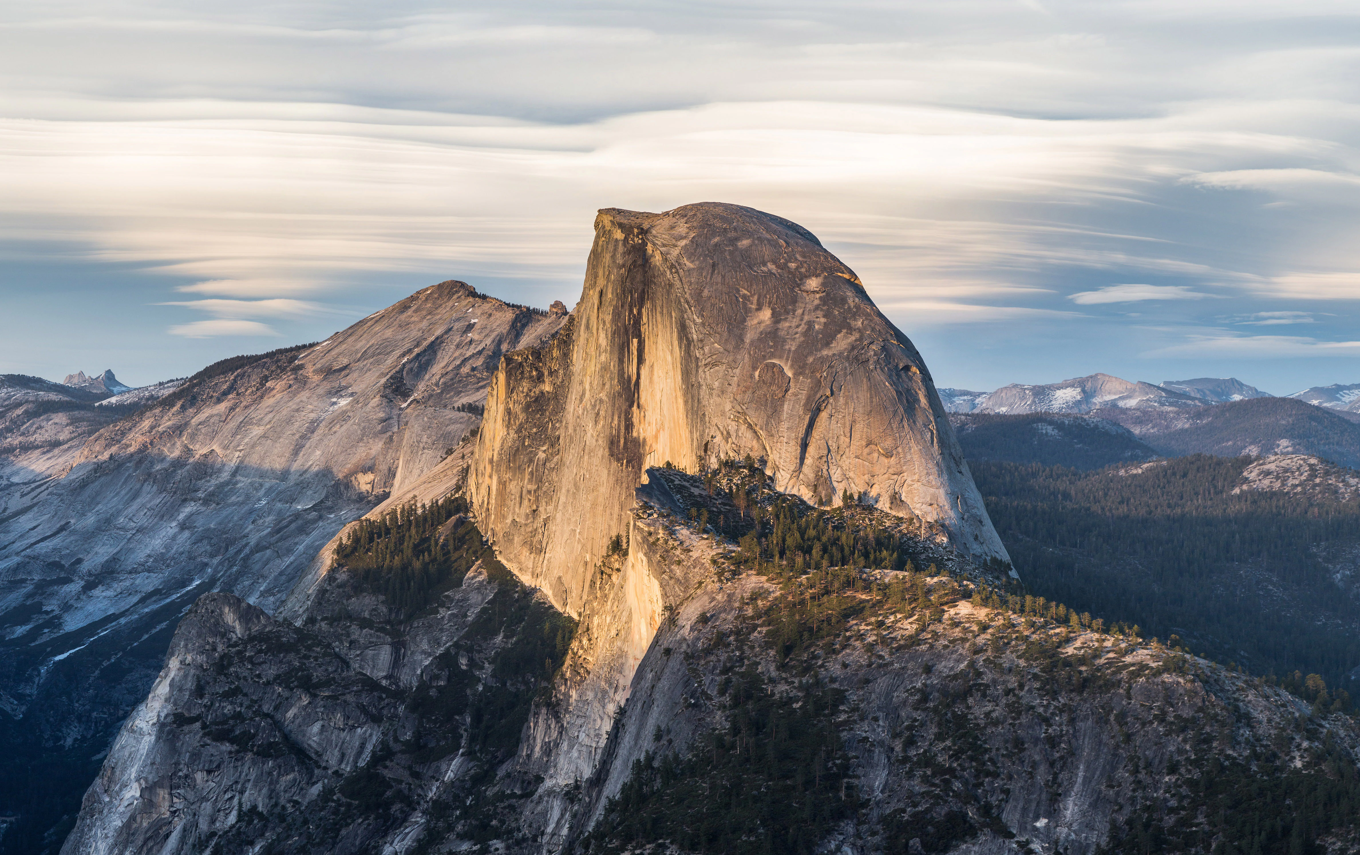
A large granite dome mountain illuminated by warm sunlight with layered clouds above and forested slopes below in a mountainous landscape
Half Dome illuminated by golden light with lenticular clouds above, viewed from Glacier Point

Lassen National Forest history and protected-area timeline

The origins of Lassen National Forest trace back to the Forest Reserve Act of 1891, which authorized the President to set aside public lands. It was formally designated the Lassen Peak Forest Reserve in 1905 before being transferred to the newly established U.S. Forest Service. In 1908, the forest expanded by absorbing parts of the Diamond Mountain National Forest and conducting land exchanges with the Plumas and Shasta National Forests.

A pivotal administrative shift occurred in 1916 when Lassen Volcanic National Park was carved directly from the forest's territory, defining a boundary that persists today. This division sparked ideological conflicts between the U.S. Forest Service, which advocated for utilitarian management including logging under the scientific management philosophy of Gifford Pinchot, and preservationists like Congressman John F. Lacey. By 1931, Congress explicitly forbade the national park from expanding further into the forest. Later, the establishment of the Caribou Primitive Area in 1932, and eventually the 1964 Wilderness Act, formalized the protection of distinct zones within the forest, cementing its dual role as a working landscape and a preserved wilderness.

Lassen National Forest landscape and geographic character

The physical geography of Lassen National Forest is defined by its position on a volcanic rim, a geological remnant of the ancient, heavily eroded Mount Tehama. This high-elevation plateau, starting at approximately 6,000 feet above sea level, features exposed rock faces, cinder cones, and extensive, barren lava flows. The terrain transitions outward into deeply forested mountains and rolling watersheds.

The hydrology of the region is shaped by the Susan River and the North Fork of the Feather River, which feeds the adjacent Lake Almanor. Visitors encounter diverse microclimates, ranging from the arid, rugged rock formations of the Caribou Wilderness to the dense aspen groves and bubbling springs found along the Spencer Meadows National Recreation Trail. Unique subterranean features, such as Subway Cave, offer an accessible view into the region's volcanic tube systems.
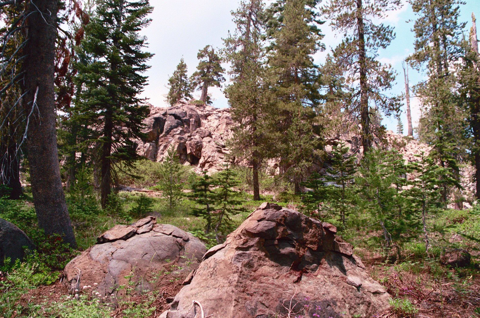
Large reddish-brown rock formations in the foreground and midground, surrounded by tall conifer trees and green undergrowth, with a rocky cliff visible in the background under a partly cloudy sky.
Rock wall formation surrounded by conifer forest in the Caribou Wilderness Area of Lassen National Forest, Northern California.

Lassen National Forest ecosystems, habitats, and plant life

Lassen National Forest harbors a highly diverse vertical zonation of vegetation, reflective of its varied elevations and volcanic soils. The predominant flora consists of Sierra Nevada mixed conifer forests, heavily populated by Coast Douglas-fir, Ponderosa Pine, and White Fir. As elevation increases, the tree composition shifts to hardy stands of Red Fir and Lodgepole Pine, alongside expansive meadows featuring aspen groves and incense cedar.

These continuous tracts of forest play a critical role in regional biodiversity. The presence of nearly 92,000 acres of old growth provides essential habitat complexity, supporting everything from large predators to specialized migratory birds. The juxtaposition of arid volcanic landscapes and wet, forested valleys creates a mosaic of ecological niches across the forest expanse.
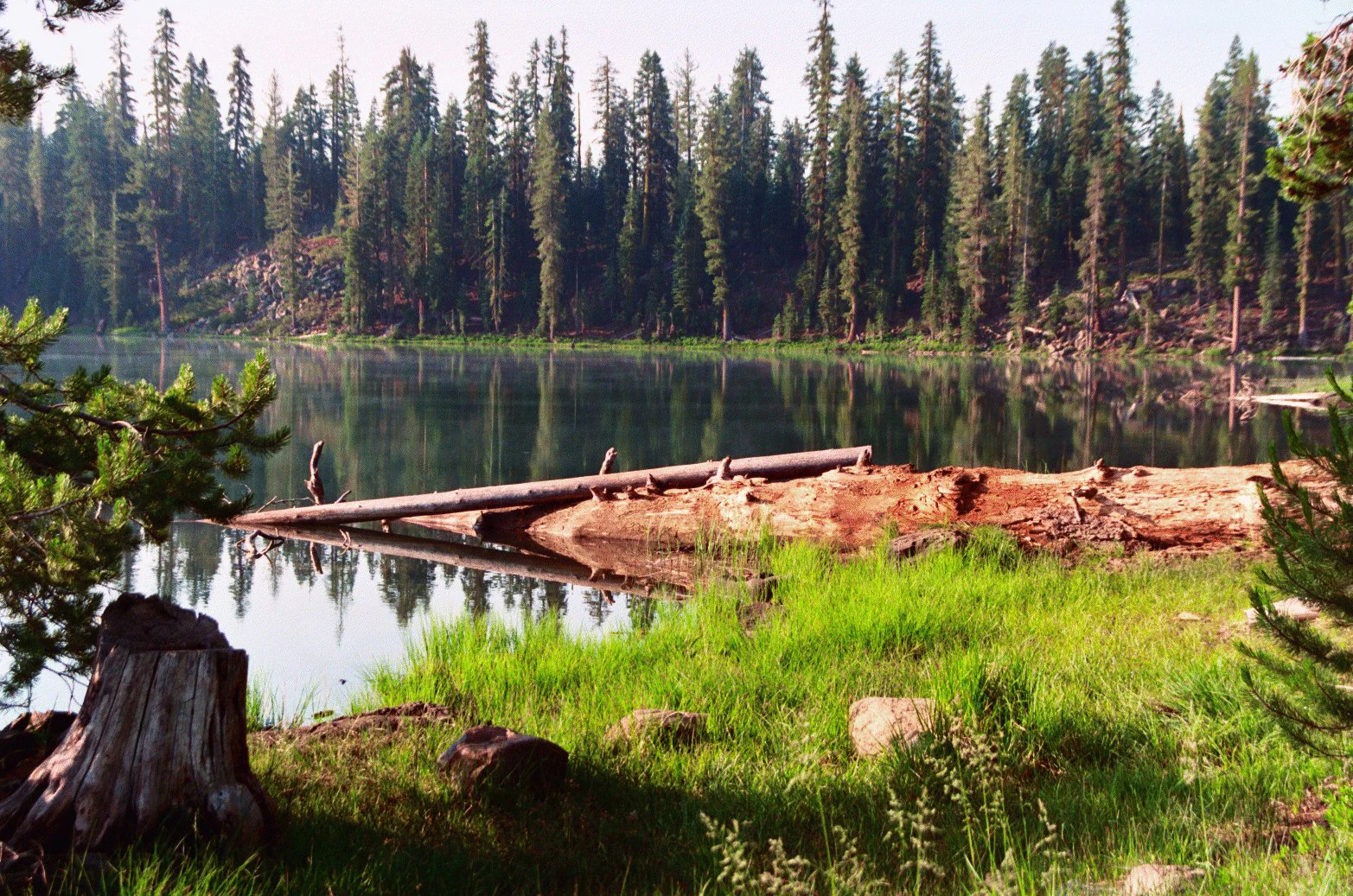
A calm lake surrounded by tall conifer trees, with green grass in the foreground, a tree stump, and fallen logs near the water's edge.
A view of Echo Lake in Lassen National Forest, Northern California, showing calm water reflecting the surrounding conifer forest with fallen logs along the grassy shore.

Lassen National Forest wildlife and species highlights

The wildlife within Lassen National Forest is abundant, supported by its unbroken tracts of forest and diverse altitudinal gradients. Common mammals traversing the region include American black bears, cougars, bobcats, coyotes, mule deer, and American martens. Smaller fauna, such as raccoons, foxes, skunks, weasels, long-toed salamanders, and various bat, mouse, and chipmunk species, thrive throughout the understory. Avian life is similarly robust, featuring forest dwellers like the brown creeper, mountain chickadee, and white-headed woodpecker.

A major highlight of modern wildlife observation is the presence of the Lassen Pack, a breeding group of gray wolves. The pack's lineage is traced back to OR7, a collared wolf that was the first of its species to migrate into California from Oregon in nearly a century. By 2020, the pack had expanded to fourteen members, marking a significant milestone in the natural recolonization of the region's apex predators.
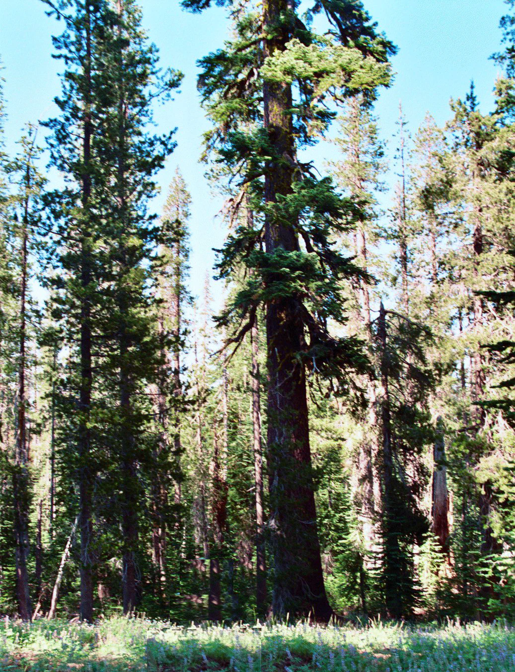
A tall old growth California red fir tree in a dense conifer forest with green grass in the foreground and blue sky above.
A mature California red fir tree standing in the Caribou Wilderness of Lassen National Forest.

Lassen National Forest conservation status and protection priorities

Conservation within Lassen National Forest centers on the protection of ancient ecosystems and the management of designated wilderness areas. The forest houses three officially designated wilderness components: the Ishi Wilderness, the Caribou Wilderness, and the Thousand Lakes Wilderness. The Caribou Wilderness represents a foundational chapter in American conservation, receiving official primitive area status in 1932, well before the broader national system was formalized.

Forest Service advocates Aldo Leopold and Bob Marshall championed the early 20th-century movement to set aside portions of the forest from logging, mining, and grazing. Their efforts culminated in the formal protection of these zones via the Wilderness Act of 1964, securing the forest's most sensitive habitats. Today, managing the extensive old-growth timber against the backdrop of historical logging and modern recreational pressure remains a focal point of the forest's conservation mandate.

Lassen National Forest cultural meaning and human context

The cultural legacy of Lassen National Forest is complex, deeply rooted in both 19th-century westward expansion and the tragic displacement of indigenous peoples. The region is named after Peter Lassen, a Danish-born pioneer who established land holdings in the Sacramento Valley and Honey Lake Valley before his murder in the Black Rock Desert in 1859. Nearby, the Nobles Emigrant Trail, established in 1852, highlights the area's role as a critical corridor for gold rush era settlers.

Perhaps the most profound cultural landmark within the forest is the Ishi Wilderness. This rugged, dry terrain served as the final refuge for Ishi, a member of the Yahi people, the southernmost division of the Yana. Ishi emerged from hiding in 1911, becoming known as the last wild Indian, and spent his remaining years under the care of anthropologist Alfred Kroeber at the University of California. The wilderness stands as a physical testament to his enduring story and the history of California's native inhabitants.

Top sights and standout views in Lassen National Forest

A visit to Lassen National Forest reveals a remarkable overlap of severe volcanic geology and resilient conifer ecosystems. Highlights include the sprawling remnants of Mount Tehama, visible in the eroded topography and exposed rock walls of the Caribou Wilderness. The forest provides an essential corridor for the Pacific Crest Trail, alongside specialized routes like the Bizz Johnson National Recreation Trail, which follows an abandoned 1914 Southern Pacific rail line.

Recreation is heavily diversified, ranging from spelunking in the accessible Subway Cave lava tube to hiking the alpine segments of the Spencer Meadows and Heart Lake trails. The intersection of the forest with Lassen Volcanic National Park allows visitors to experience the broader regional ecosystem. Furthermore, the ongoing presence of the Lassen gray wolf pack offers a rare opportunity to observe the recovery of an apex predator in the California landscape.

Best time to visit Lassen National Forest

The optimal timing for visiting Lassen National Forest largely depends on the intended recreational activity, as weather patterns vary drastically across the protected elevation gradient. Spring and early summer provide the most accessible conditions for hiking the lower trails, viewing the blooming aspen groves, and exploring the Subway Cave lava tube before the high country fully thaws. Summer remains highly popular, though visitors to arid regions like the Ishi Wilderness are strictly cautioned by the U.S. Forest Service to travel during cooler months due to a severe lack of drinking water.

As autumn progresses, forested areas transition through vibrant seasonal changes, offering excellent wildlife viewing opportunities as animals prepare for winter. Winter brings heavy snowfall to the higher elevations, potentially closing mountain passes and transforming the Bizz Johnson trail corridor into a scenic, snow-dusted canyon environment. Year-round, visitors should check localized conditions, particularly when planning to traverse higher elevations or volcanic ridges.

Monthly climate preview

Measured monthly weather patterns and precipitation averages for Lassen National Forest

Lassen National Forest Climate Normals and Long Term Temperature Records

Lassen National Forest exhibits a wide temperature range and distinct precipitation cycles across the recorded monthly coordinates. Reviewing the full climate normals provides deeper context for long term atmospheric conditions at this representative elevation.
Annual mean8 °C
-1 °C20 °C
Jan-1°
Feb
Mar
Apr
May
Jun14°
Jul20°
Aug19°
Sep15°
Oct
Nov
Dec-1°
Warmest month
July

19.8 °C

Coolest month
December

-1.4 °C

Wettest month
December

5.7 mm/day

Driest month
July

0.2 mm/day

Park location guide

Geography guide, regional context, and park location map for Lassen National Forest

Lassen National Forest park geography, regions, and map view in United States of America

Understand where Lassen National Forest sits in United States of America through a broader geographic reading of the surrounding landscape, nearby location context, and its mapped position within the national park landscape.

How Lassen National Forest fits into United States of America

The United States of America is a federal presidential republic and one of the world's largest countries by area and population. It consists of 50 states across a vast territory spanning multiple time zones, with its capital in Washington, D.C. and largest city in New York City. The nation has a diverse economy, influential political system, and significant cultural and military presence globally.

Wider geography shaping Lassen National Forest in United States of America

The United States occupies a vast territory in North America, bordered by Canada to the north and Mexico to the south. The 48 contiguous states stretch from the Atlantic to the Pacific Ocean, while Alaska occupies the northwestern region and Hawaii is an archipelago in the Pacific. The country encompasses diverse terrain including the Rocky Mountains, Appalachian Mountains, Great Plains, and extensive river systems.

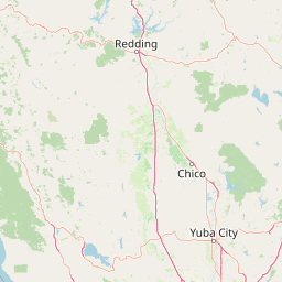
Map view of Lassen National Forest

Use this park location map to pinpoint Lassen National Forest in United States of America, understand its exact geographic position, and read its mapped placement within the surrounding landscape more clearly.

Pigeon | © OpenStreetMap contributors

Location context for Lassen National Forest

California
Natural feature types

Browse the Natural Landscape Index of Lassen National Forest

Examine the diverse array of geologic and hydrographic features documented across Lassen National Forest. MoriAtlas provides a structured view of the mountain terrain, volcanic remnants, and forested wilderness, allowing for deeper engagement with the unique geography of this significant California region.
Recorded earthquake history

Explore the Historical Earthquake Catalogue for Lassen National Forest

MoriAtlas offers a structured collection of recorded seismic data for the areas surrounding Lassen National Forest. Examine historical event logs, including magnitudes and epicentre locations, to better understand the seismic context of this significant protected landscape.

Lassen National Forest Earthquake History

Catalogued events

505 events

Strongest magnitude

Magnitude 5.7

Most recent event

Jun 27, 2026

This history includes earthquakes recorded inside the park or within 50 km of its borders

Examine the protected landscapes, rugged volcanic rims, and high-elevation topography of northern California.

Lassen National Forest Photos and Scenery: Visualizing Volcanic Terrain and Conifer Habitats

Visual records capture the sweeping stands of old-growth conifers, exposed lava flows, and rugged wilderness zones that define the protected landscape. Examining these field photographs reveals the complex volcanic geography and diverse habitats characterizing the southern Cascades.

A large granite dome mountain illuminated by warm sunlight with layered clouds above and forested slopes below in a mountainous landscape

A waterfall cascading through rocky terrain into a turbulent pool, surrounded by conifer trees and rocky outcroppings under a blue sky with scattered clouds

Large reddish-brown rock formations in the foreground and midground, surrounded by tall conifer trees and green undergrowth, with a rocky cliff visible in the background under a partly cloudy sky.

A calm lake surrounded by tall conifer trees, with green grass in the foreground, a tree stump, and fallen logs near the water's edge.

A tall old growth California red fir tree in a dense conifer forest with green grass in the foreground and blue sky above.

Park atlas

Compare adjacent volcanic terrain, mountain wilderness, and regional reserves

Explore Parks Near Lassen National Forest and Surrounding Protected Landscapes

Browse nearby national parks and protected areas sharing the volcanic geography of northeastern California. Continuing beyond Lassen National Forest reveals broader regional ecosystems and connected wilderness zones across the southern Cascades.
Wildlife reserveCalifornia
Park boundaries overlap#1 closest

Southwest

Ishi Wilderness Wildlife Reserve: Mapping the Volcanic Canyons of the Cascade Foothills

Geographic atlas of protected northern California wilderness and cultural landscapes.

Ishi Wilderness represents a crucial protected area in northern California, where volcanic geology meets a deep-rooted cultural history. Explore the mapped ridgelines, river canyons, and diverse oak woodland habitats that define this unique wildlife reserve and its role within the Cascade foothills.

Area
167.29 km²
Established
1984
IUCN
Ib
Relief
Mountain
National parkCalifornia
Park boundaries overlap#2 closest

West

Lassen Volcanic National Park: Protected Landscape Identity and Geographic Context

Discover the mapped boundaries and natural terrain of this California national park.

Gain a structured understanding of Lassen Volcanic National Park as a protected landscape. This detail page provides essential geographic context, focusing on the park's mapped boundaries and its specific terrain characteristics within California. It is designed for users seeking detailed information about the park's protected status and its placement within the broader atlas of natural areas, emphasizing its unique geographic identity and conservation significance.

Area
430.8 km²
Established
1916
IUCN
II
Visitors
504.8K annual
Protected landscapeCalifornia
Park boundaries overlap#3 closest

North

Modoc National Forest: Protected Landscape and Warner Mountains Geography

High desert volcanic terrain in northeastern California

Modoc National Forest encompasses a massive expanse of volcanic plateaus and rugged mountain ridges in the northeastern corner of California. This protected area offers significant geographic variety, transitioning from arid sagebrush basins to lush, high-elevation conifer forests. It serves as a vital natural landscape, home to the South Warner Wilderness and large stands of old-growth timber, reflecting the unique geologic history of the regional lava flows.

Area
6,695.09 km²
Established
1904
Relief
Mountain
Access
Moderate access
Protected landscapeCalifornia
Park boundaries overlap#4 closest

Southeast

Plumas National Forest: Mapped Geography and Protected Landscape Features in California

Exploring the Sierra Nevada watershed and wilderness terrain

Plumas National Forest serves as a critical protected landscape in northern California, anchoring the headwaters of the Feather River system. This atlas entry details the forest's rugged canyons, high elevation mountain lakes, and significant old growth conifer stands that define its role within the northern Sierra Nevada ecosystem.

Area
4,640 km²
Established
1907
Relief
Mountain
Climate
Mediterranean
A soft watercolor painting depicting a serene landscape with gentle green hills, a small forest, and a calm lake at sunrise or sunset.
Protected landscapeCalifornia
Park boundaries overlap#5 closest

West

Shasta, Trinity National Forest: Mapping the Protected Landscapes of Northern California

Volcanic peaks, expansive reservoirs, and rugged mountain wilderness

Spanning over two million acres, Shasta, Trinity National Forest represents a major protected landscape in Northern California. The geography includes the iconic Mount Shasta volcano and the complex shoreline of Shasta Lake, while hosting expansive wilderness areas and diverse terrain ranging from oak-forested foothills to alpine meadows.

Area
8,942.87 km²
Established
1954
Relief
Mountain
Climate
Temperate
A soft watercolor illustration depicting a series of distant mountain ranges behind a line of evergreen trees against a white background.
Wildlife reserveCalifornia
41 km away#6 closest

Northwest

Mount Shasta Wilderness: A Geographic Profile of California Volcanic and Alpine Landscapes

Mapping protected volcanic peaks and glacial ecosystems

Deeply explore the protected geography of Mount Shasta Wilderness, a 38,200-acre reserve in Northern California. This record details the park's stratovolcano foundations, glacial terrain, and forested corridors, offering a clear view of the complex landforms and boundary systems that define this significant high-elevation protected area.

Area
155 km²
Established
1984
IUCN
Ib
Relief
Mountain
Protected landscapeCalifornia
47 km away#7 closest

South

Tahoe National Forest: Exploring Protected Mountain Landscapes in the California Sierra Nevada

An atlas of granite river canyons and alpine ridge terrain

Tahoe National Forest defines a critical segment of the western Sierra Nevada, containing granite river canyons, numerous reservoirs, and summits reaching above 9,000 feet. This protected landscape acts as a vital headwater for California foothill communities and Nevada, hosting significant natural features like the Placer County Big Trees Grove and segments of the Pacific Crest Trail.

Area
3,526.82 km²
Established
1899
Relief
Mountain
Climate
Mediterranean
Protected landscapeCalifornia
61 km away#8 closest

West

Whiskeytown, Shasta, Trinity National Recreation Area: Geographic and Protected Landscape Overview

Mapped terrain across northern California reservoir units

Investigate the environmental character of Whiskeytown, Shasta, Trinity National Recreation Area, spanning from the expansive waters of Shasta Lake to the forested ridges of the Whiskeytown unit. This atlas entry details the interplay between large-scale reservoir management, riparian habitats, and the transition from Mediterranean chaparral to high-elevation conifer forests in California.

Area
99,588 km²
Established
1965
IUCN
V
Visitors
1.5M annual

Common questions about visiting, size, designation, and location context for Lassen National Forest

Lassen National Forest FAQs for park facts, access, geography, and protected area context

Find quick answers about Lassen National Forest, including protected-area facts, park geography, trail and visitor context, and how the park fits into its surrounding country and regional landscape.
MoriAtlas Explorer

Continue Your Protected Areas Search Across the Global Atlas

Deepen your exploration by continuing the structured search for national parks and protected areas worldwide. Utilize the comprehensive filtering capabilities to compare different conservation landscapes and refine your understanding of global park geography. Discover more about the distribution and characteristics of protected natural areas.

Global natural geography