Peaks
Red Cinder Cone
2,444.5 m

Analyzing the terrain, elevation ranges, and complex volcanic landscape structures
This geographic profile details the physical scope of Lassen Volcanic National Park in California. Discover technical data including recorded boundary measurements, total area, and elevation range, alongside a list of prominent peaks and volcanic formations within the park.
Related tags
Active volcanic landscapes at the southern end of the Cascade Range
Lassen Volcanic National Park is a national park in northeastern California that protects a remarkable volcanic landscape at the southern end of the Cascade Range. The park's dominant feature is Lassen Peak, the largest plug dome volcano in the world and the southernmost active volcano in the Cascades. The park is one of the few places on Earth where all four types of volcanoes can be found: plug dome, shield, cinder cone, and stratovolcano. The area remains geologically active with boiling mud pots, fumaroles, and hot springs demonstrating ongoing volcanic processes beneath the surface. Established in 1916 following a period of significant eruptive activity, the park preserves approximately 106,000 acres of diverse terrain ranging from glaciated canyons and alpine lakes on the western side to a vast lava plateau dotted with cinder cones on the eastern side. The landscape tells a compelling geological story of volcanic construction, collapse, and ongoing thermal activity.
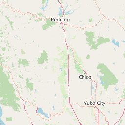
Regional placement and administrative county borders in California
Interactive protected-area geometry and calculated dimensional metrics
Mountain relief summary and recorded natural features
Peaks
2,444.5 m
Viewpoints
Lakes
Natural springs
Streams
Lakes
Temperate climate zones, mountainous relief, and major water presence profiles
Mountains · Valleys · Plateau · Canyon · Cliffs · Forest · Grassland · Wetland · Lakes · Rivers · Dunes · Volcano
Trace the Volcanic Landscape and Connected Protected Areas Across California's Cascade Range

East

Volcanic terrain and expansive old growth ecosystems
Lassen National Forest represents a vast protected landscape in Northern California, defined by its severe volcanic geology and resilient conifer forests. This atlas entry provides essential geographic context regarding the forest boundaries, the volcanic rim of Mount Tehama, and the intricate river systems shaping the region. Explore the terrain, from accessible lava tubes to the wilderness areas preserved within this significant mountain corridor.
Southeast
Exploring the Sierra Nevada watershed and wilderness terrain
Plumas National Forest serves as a critical protected landscape in northern California, anchoring the headwaters of the Feather River system. This atlas entry details the forest's rugged canyons, high elevation mountain lakes, and significant old growth conifer stands that define its role within the northern Sierra Nevada ecosystem.
Southwest
Geographic atlas of protected northern California wilderness and cultural landscapes.
Ishi Wilderness represents a crucial protected area in northern California, where volcanic geology meets a deep-rooted cultural history. Explore the mapped ridgelines, river canyons, and diverse oak woodland habitats that define this unique wildlife reserve and its role within the Cascade foothills.
North
High desert volcanic terrain in northeastern California
Modoc National Forest encompasses a massive expanse of volcanic plateaus and rugged mountain ridges in the northeastern corner of California. This protected area offers significant geographic variety, transitioning from arid sagebrush basins to lush, high-elevation conifer forests. It serves as a vital natural landscape, home to the South Warner Wilderness and large stands of old-growth timber, reflecting the unique geologic history of the regional lava flows.

West
Volcanic peaks, expansive reservoirs, and rugged mountain wilderness
Spanning over two million acres, Shasta, Trinity National Forest represents a major protected landscape in Northern California. The geography includes the iconic Mount Shasta volcano and the complex shoreline of Shasta Lake, while hosting expansive wilderness areas and diverse terrain ranging from oak-forested foothills to alpine meadows.

West
Mapped terrain across northern California reservoir units
Investigate the environmental character of Whiskeytown, Shasta, Trinity National Recreation Area, spanning from the expansive waters of Shasta Lake to the forested ridges of the Whiskeytown unit. This atlas entry details the interplay between large-scale reservoir management, riparian habitats, and the transition from Mediterranean chaparral to high-elevation conifer forests in California.

Southeast
An atlas of granite river canyons and alpine ridge terrain
Tahoe National Forest defines a critical segment of the western Sierra Nevada, containing granite river canyons, numerous reservoirs, and summits reaching above 9,000 feet. This protected landscape acts as a vital headwater for California foothill communities and Nevada, hosting significant natural features like the Placer County Big Trees Grove and segments of the Pacific Crest Trail.

Northwest
Mapping protected volcanic peaks and glacial ecosystems
Deeply explore the protected geography of Mount Shasta Wilderness, a 38,200-acre reserve in Northern California. This record details the park's stratovolcano foundations, glacial terrain, and forested corridors, offering a clear view of the complex landforms and boundary systems that define this significant high-elevation protected area.
Deepen your understanding of Lassen Volcanic National Park by examining its precise geographic boundaries and the unique natural terrain it preserves. This destination offers key insights into the park's protected status and its role within California's geographic tapestry. Continuing your exploration here provides valuable data for appreciating its mapped landscape and context within the comprehensive atlas of protected areas.