
Mori Atlas logo
Nature reserveLippeaue zwischen Hamm und Lippstadt mit Ahsewiesen

A comprehensive geographic analysis of alluvial corridors, wetland meadows, and fluvial dynamics

Lippeaue zwischen Hamm und Lippstadt mit Ahsewiesen Nature Reserve and Floodplain Landscape

(EU-Vogelschutzgebiet Lippeaue zwischen Hamm und Lippstadt mit Ahsewiesen)

This protected area along the Lippe River comprises a mosaic of near-natural river channels, oxbow lakes, and expansive grasslands in Nordrhein-Westfalen. The site represents a crucial floodplain system where restored water dynamics and varied moisture levels support a high density of wetland habitats. Users can examine the terrain, boundary characteristics, and connectivity between the river corridor and the adjacent Ahsewiesen grassland complex.

bird sanctuaryfluvial floodplainfloodplain meadowswet grasslandriparian habitatEuropean Bird Directive
A flat-style digital illustration of a calm river scene, showing a river flowing past grassy banks with a fallen tree trunk stretching across the water surface, surrounded by lush vegetation and a soft-toned sky.

Lippeaue zwischen Hamm und Lippstadt mit Ahsewiesen

Nature reserve

Park overview

Structured park overview, official facts, and landscape profile for Lippeaue zwischen Hamm und Lippstadt mit Ahsewiesen

Lippeaue zwischen Hamm und Lippstadt mit Ahsewiesen park facts, protected area profile, and essential visitor context

Review the core facts for Lippeaue zwischen Hamm und Lippstadt mit Ahsewiesen, including designation, size, terrain, visitor scale, habitats, and operating context in one park-focused overview.

About Lippeaue zwischen Hamm und Lippstadt mit Ahsewiesen

The Lippeaue zwischen Hamm und Lippstadt mit Ahsewiesen is a major Natura 2000 bird protection area in the northeastern part of North Rhine-Westphalia, extending across three administrative regions: the city of Hamm, the district of Soest, and the district of Warendorf. It consists of two connected parts: the Lippe floodplain itself, running continuously from east of Hamm to west of Lippstadt, and the Ahse meadows, a separate but ecologically linked grassland complex situated south of the main river near the municipality of Welver.

At the heart of the protected area is a near-natural and partially restored stretch of the Lippe River, which retains a dynamic flow regime and is flanked by a rich mosaic of alluvial landforms. Oxbow lakes, old river arms, reed beds, tall herb vegetation, and remaining patches of floodplain forest give the floodplain a strongly natural character. The Ahse meadows add a complementary dimension, consisting of a large, structurally diverse complex of grassland communities at different moisture levels.

Together, these two sub-areas form a large connected open landscape dominated by grassland, with the meadow habitats interwoven with still waters, slow-moving channels, ditches, and wooded edges. The protected area has been formally designated since 2004 and is jointly managed by the regional authorities of Arnsberg and Münster. It is recognized as a bird area of national significance within North Rhine-Westphalia because it provides critical habitat for both breeding and migratory wetland and grassland birds.

Beyond its ecological value, the site plays an important role in the broader Lippe floodplain programme, a long-term effort to reconnect the river with its natural floodplain, rewet formerly drained grasslands, and re-establish semi-natural flood dynamics that support the full range of floodplain habitats.

Quick facts and research context for Lippeaue zwischen Hamm und Lippstadt mit Ahsewiesen

The Lippeaue zwischen Hamm und Lippstadt mit Ahsewiesen is a European Bird Protection Area (Vogelschutzgebiet) with the official identifier DE-4314-401, located in North Rhine-Westphalia, Germany.

It falls within the city of Hamm and the districts of Soest and Warendorf, and is administered by the Arnsberg and Münster regional authorities. Designated in 2004, the area covers a continuous stretch of the Lippe floodplain east of Hamm to west of Lippstadt, together with the Ahse meadows near Welver.

Roughly half of the site is classified as wet or mesophilic grassland, while standing and flowing waters, drained grassland, deciduous woodland, and a small share of arable land and conifer plantations make up the remainder. Its combination of floodplain meadow, wetland, and forest habitats gives it state-level importance for breeding, migrating, and wintering birds.

Protection and recognition

Documented terrestrial protection metrics and international recognition data

Lippeaue zwischen Hamm und Lippstadt mit Ahsewiesen Protection Status

Lippeaue zwischen Hamm und Lippstadt mit Ahsewiesen maintains structured terrestrial protection records with verified geographic database identifiers. Official conservation documentation outlines the complete management scope and regional designation framework for this protected area.

Protection details

Protection scope
Terrestrial
Transboundary protection
No
WDPA ID
555537498
Park context

Deeper park guide and search-rich context for Lippeaue zwischen Hamm und Lippstadt mit Ahsewiesen

Lippeaue zwischen Hamm und Lippstadt mit Ahsewiesen history, landscape, wildlife, and travel context

Explore Lippeaue zwischen Hamm und Lippstadt mit Ahsewiesen through its history, landscape character, ecosystems, wildlife, conservation priorities, cultural context, and seasonal travel timing in a structured park guide built for atlas discovery and search intent.

Why Lippeaue zwischen Hamm und Lippstadt mit Ahsewiesen stands out

The protected area is best known for its extensive, near-natural floodplain meadows along the Lippe River and the adjacent Ahse meadows, which together form one of the most outstanding bird landscapes in North Rhine-Westphalia. Its importance lies particularly in the close interweaving of natural grassland at different moisture levels with a dense mosaic of oxbows, stillwaters, reed beds, alluvial forests, and tall herb communities. This habitat diversity supports large numbers of breeding and migratory birds, especially ducks, waders, and threatened species such as the curlew, the marsh harrier, and the corncrake. The area is also recognized for ongoing river restoration and rewetting efforts under the Lippe floodplain programme, which aim to restore natural flooding dynamics and rehabilitate the floodplain ecosystem as a whole.
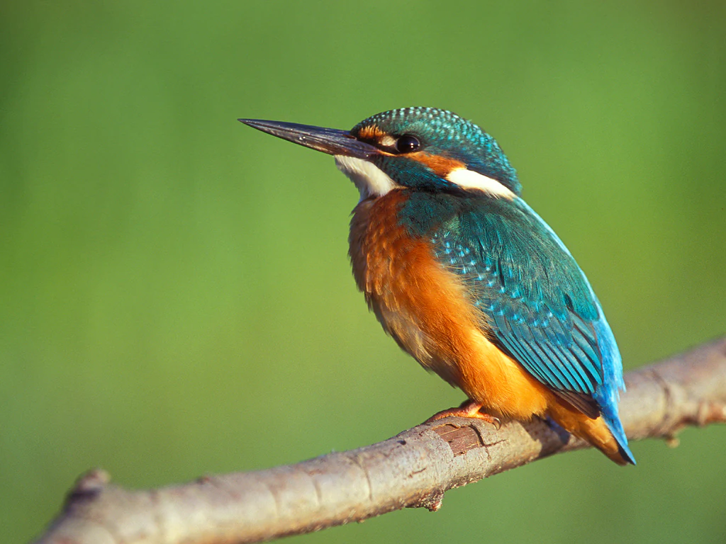
A close-up profile view of a vibrant common kingfisher with iridescent blue and orange plumage perched on a bare wooden branch against a blurred green background.
A common kingfisher perched on a branch in the Lippeaue wetlands.

Lippeaue zwischen Hamm und Lippstadt mit Ahsewiesen history and protected-area timeline

The Lippeaue zwischen Hamm und Lippstadt mit Ahsewiesen was formally designated as a European Bird Protection Area in 2004 by the regional authorities of Arnsberg and Münster. Its establishment marked an important step in the implementation of the European Birds Directive in North Rhine-Westphalia and tied in with the wider Lippe floodplain programme, a coordinated effort to restore the ecological function of the Lippe floodplain.

The site's history is closely linked to the long-running rewetting and grassland extensification initiatives in the Ahse meadows, which began as conservation efforts aimed at maintaining populations of species such as the Eurasian curlew, the marsh harrier, and the corncrake. Restoration work has emphasized the continuation of rewetting measures, the reintroduction of natural flow dynamics in selected stretches of the Lippe, and the extensive management of meadows to maintain their value as bird habitat.

Over time, the area has become part of a broader network of related protected sites, including several Natura 2000 Habitat Directive (FFH) areas and numerous smaller nature reserves along the river corridor, creating a near-continuous conservation landscape along the Lippe and Ahse rivers.

Lippeaue zwischen Hamm und Lippstadt mit Ahsewiesen landscape and geographic character

The landscape of the protected area is shaped by two complementary elements: the floodplain of the Lippe River and the adjacent Ahse meadows. The Lippe floodplain forms a long, continuous corridor running from east of Hamm to west of Lippstadt, with the river itself having undergone partial restoration to recover its natural flow dynamics.

Along the Lippe, ancient river arms, oxbows, and meander relics give the floodplain a typical alluvial structure. Reed beds, tall herb communities, and fragments of softwood and hardwood floodplain forest line the watercourse and provide structural diversity across the floodplain. The terrain is predominantly flat, reflecting the lowland character of this part of North Rhine-Westphalia, with subtle differences in elevation corresponding to old channels, levees, and depressions that retain water for longer periods.

The Ahse meadows, located south of the Lippe and near the municipality of Welver, consist of a large, structurally rich complex of grasslands at varying moisture levels. The mosaic of wet meadows, mesophilic grassland, drier meadows, and reed fringes is typical of formerly drained and partially rewetted lowland floodplain landscapes. The combined effect of river, floodplain meadows, and associated water features is a wide, open agricultural-natural landscape in which nature, water, and traditional grassland use are closely interwoven.
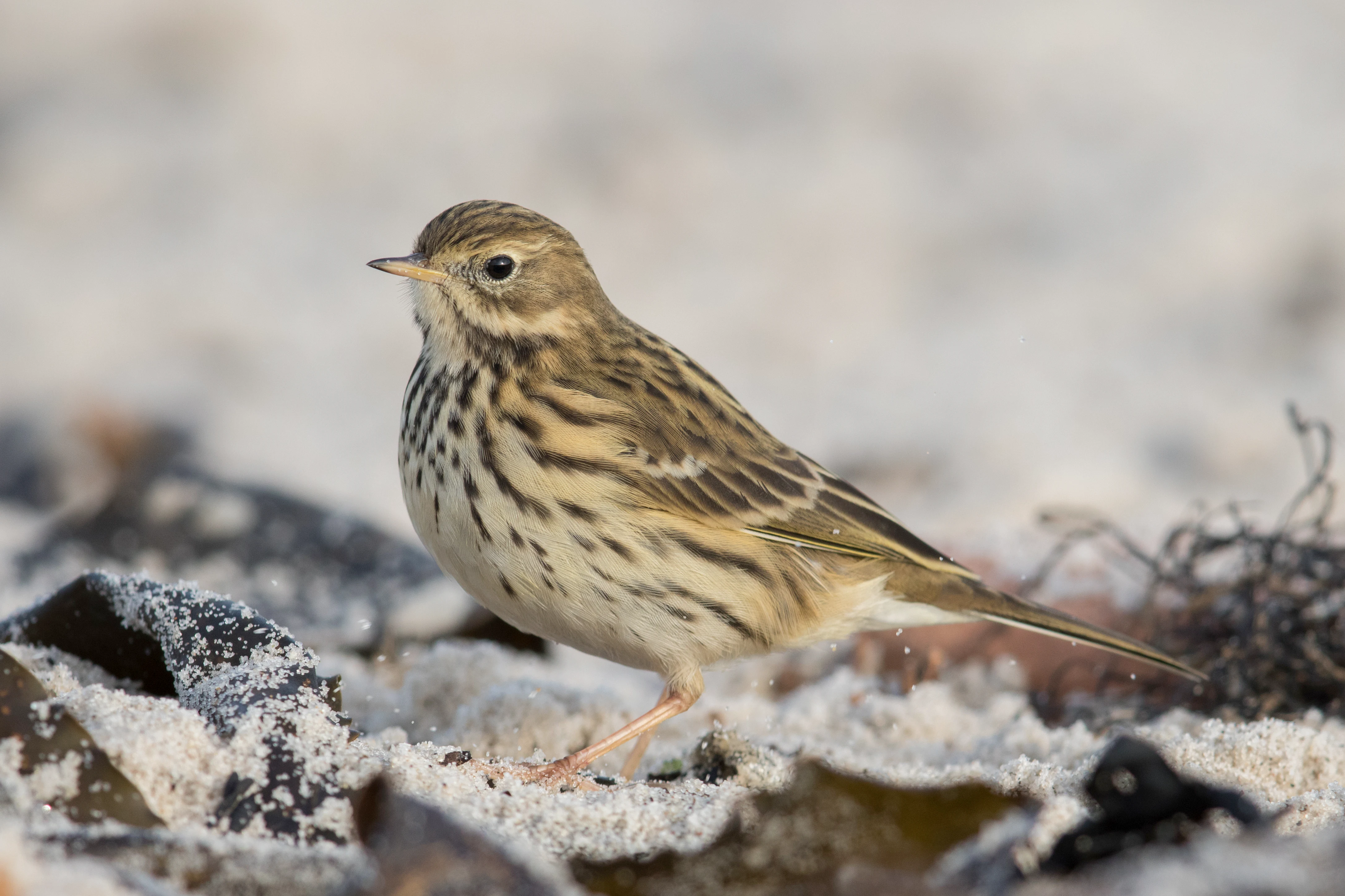
A small brown and white meadow pipit bird standing on light-colored sand with dark seaweed fragments around it.
A meadow pipit perched on a sandy, debris-strewn surface.

Lippeaue zwischen Hamm und Lippstadt mit Ahsewiesen ecosystems, habitats, and plant life

Ecologically, the protected area is dominated by a floodplain grassland system interwoven with a dense network of aquatic and wetland habitats. Roughly half of the site is classified as wet or mesophilic grassland, representing the heart of the floodplain meadow complex along the Lippe and the Ahse meadows. Standing and flowing waters, including the Lippe itself, oxbows, ditches, and other small water bodies, contribute a substantial share of the habitat mosaic.

The floodplain supports a layering of habitats typical of near-natural river systems. Reed beds, sedge communities, and tall herb fringes line the watercourses and damp depressions, while fragments of softwood and hardwood alluvial forest appear along more stable banks and terraces. Deciduous woodland, including remnants of ash and alder floodplain woodland and oak-elm hardwood floodplain forest, contributes to habitat diversity along the river.

A range of important habitat types under the European Habitats Directive occur within the site, including nutrient-poor to mesotrophic standing waters, naturally eutrophic lakes with rich aquatic vegetation, lowland river stretches with characteristic submerged vegetation, moist tall herb fringes, lowland hay meadows, and various types of alluvial forest. Together, these habitats form an ecologically coherent floodplain system whose value extends well beyond any single patch.
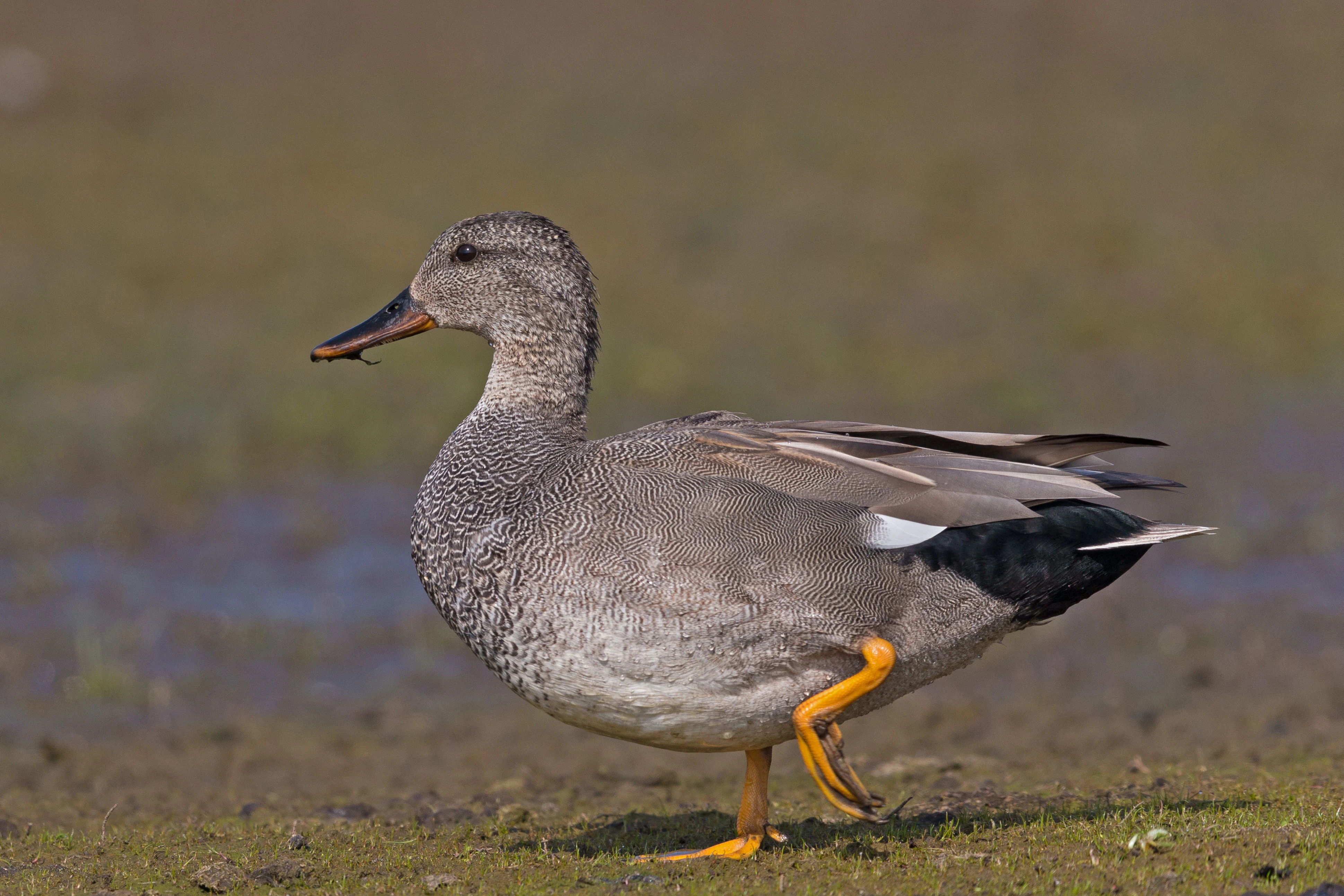
A Gadwall duck in profile stands on a muddy, textured bank with one leg lifted, showing grey and brown mottled plumage.
A Gadwall duck standing on a muddy bank.

Lippeaue zwischen Hamm und Lippstadt mit Ahsewiesen wildlife and species highlights

The protected area is of exceptional importance for birds, both as a breeding ground and as a resting and wintering site along the central European flyway. The combination of wet meadows, dynamic floodplain waters, reed beds, oxbows, and small pools supports a rich community of waterfowl, waders, and other wetland-dependent species.

Among the breeding birds, the curlew, the marsh harrier, and the corncrake are of particular conservation significance, which is why their protection has long been a focus of the area's management. The site also supports the common snipe, the Eurasian bittern, the little crake, the spotted crake, and many duck species, including garganey, Eurasian teal, gadwall, northern shoveler, and common pochard. Raptors such as the hen harrier, Montagu's harrier, black kite, red kite, and peregrine falcon use the open landscape for hunting and, in some cases, breeding.

The floodplain's structural diversity also benefits smaller passerines and woodland species. The kingfisher breeds along the natural river stretches with suitable earth banks and root plates, while the golden oriole, the common nightingale, and the red-backed shrike benefit from the remaining floodplain woodland and bushy edges. In winter and during migration, the area is visited by large numbers of northern lapwings, golden plovers, dunlins, ruffs, black-tailed godwits, common cranes, and various goose species that use the open meadows, shallow water zones, and wet depressions as feeding and resting habitat.
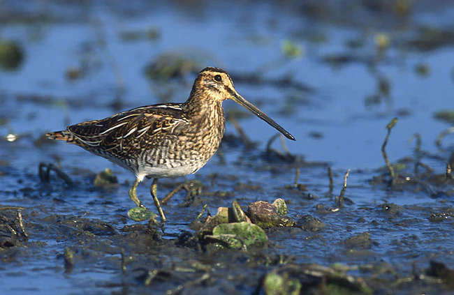
A common snipe with a long, thin beak, mottled brown and white feathers standing in shallow, muddy water.
A common snipe standing in a wetland habitat, a typical species found in the floodplain areas of the Ahsewiesen.

Lippeaue zwischen Hamm und Lippstadt mit Ahsewiesen conservation status and protection priorities

The Lippeaue zwischen Hamm und Lippstadt mit Ahsewiesen is designated as a European Bird Protection Area (EU-Vogelschutzgebiet) under the European Birds Directive and forms part of the Natura 2000 network. The overarching conservation objective is the long-term protection and recovery of populations of birds listed under the directive, particularly those associated with floodplain meadows, wet grasslands, and dynamic river landscapes.

Management efforts focus on maintaining and restoring natural floodplain dynamics along the Lippe, including the continuation of rewetting programmes in the Ahse meadows and the ecological extensification of grassland use. These measures aim to stabilize high groundwater levels, prevent further drainage of wet meadows, and maintain the structural diversity of grassland communities that is essential for breeding waders such as the curlew, the lapwing, and the black-tailed godwit.

The area is embedded in a wider conservation landscape that includes habitat directive sites, such as the Ahse meadows FFH area and the Lusebredde, Hellinghäuser Wiesen und Klostermersch area, as well as numerous nature reserves along the Lippe and Ahse rivers. Together, these sites form a near-continuous protected corridor that supports migratory, breeding, and wintering bird populations and preserves one of the most important floodplain ecosystems in North Rhine-Westphalia.

Lippeaue zwischen Hamm und Lippstadt mit Ahsewiesen cultural meaning and human context

The landscape of the Lippeaue has been shaped by centuries of human use, particularly through traditional grassland management, small-scale river regulation, and drainage practices that transformed much of the original floodplain into meadows and pasture. The continued importance of low-intensity mowing and grazing is now a key part of conservation management, linking the cultural heritage of the region with modern biodiversity goals.

Small villages and historic farmsteads such as those in and around Hamm, Welver, and the surrounding districts of Soest and Warendorf remain closely tied to the floodplain landscape, and traditional land use continues to influence the structure of the meadows, ditches, and field edges that birds depend on for breeding and feeding.
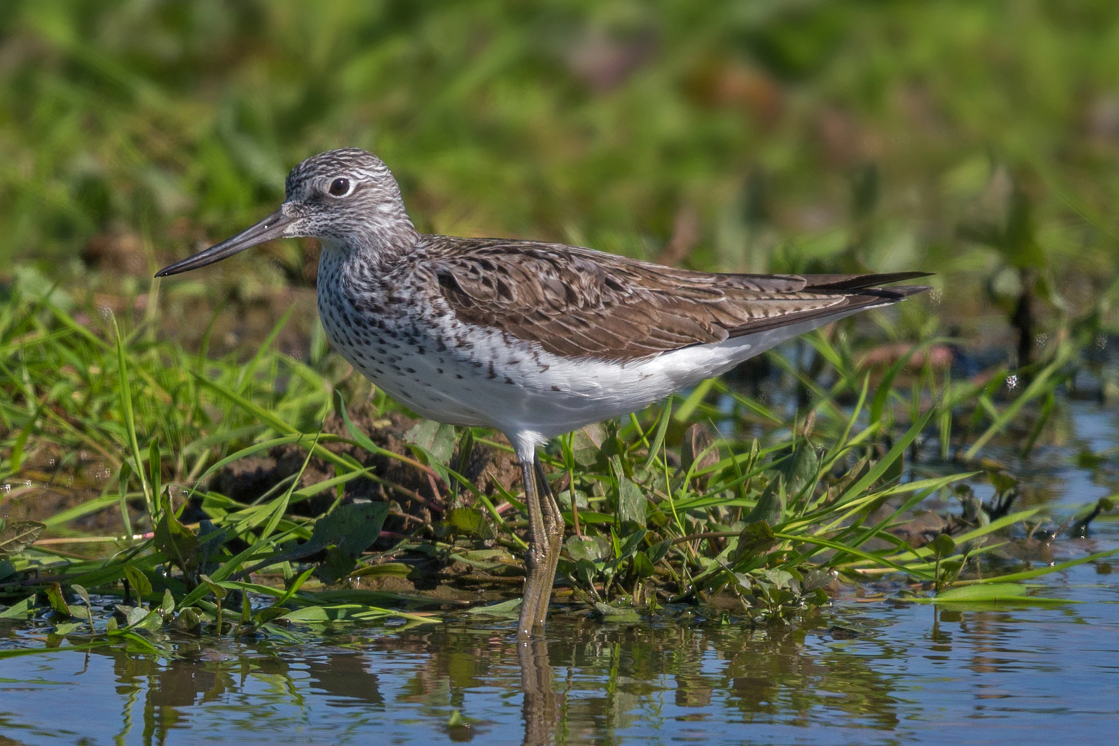
A common greenshank bird standing in shallow water among green grasses, captured in profile.
A common greenshank wading in the shallow waters of the Lippe river floodplain.

Top sights and standout views in Lippeaue zwischen Hamm und Lippstadt mit Ahsewiesen

The key strengths of the Lippeaue zwischen Hamm und Lippstadt mit Ahsewiesen lie in the unusual scale and quality of its floodplain meadows and the diversity of wetland habitats that accompany them. The site combines near-natural stretches of the Lippe River with an exceptionally rich mosaic of mesophilic and wet grasslands, oxbows, reed beds, and alluvial forest remnants.

Its significance for waterfowl, waders, and threatened farmland birds such as the curlew and the corncrake makes it one of the most important inland bird areas in North Rhine-Westphalia. Combined with ongoing restoration work under the Lippe floodplain programme, the area represents both a functional refuge for wetland biodiversity and a long-term demonstration of large-scale floodplain rehabilitation in an intensively used lowland landscape.
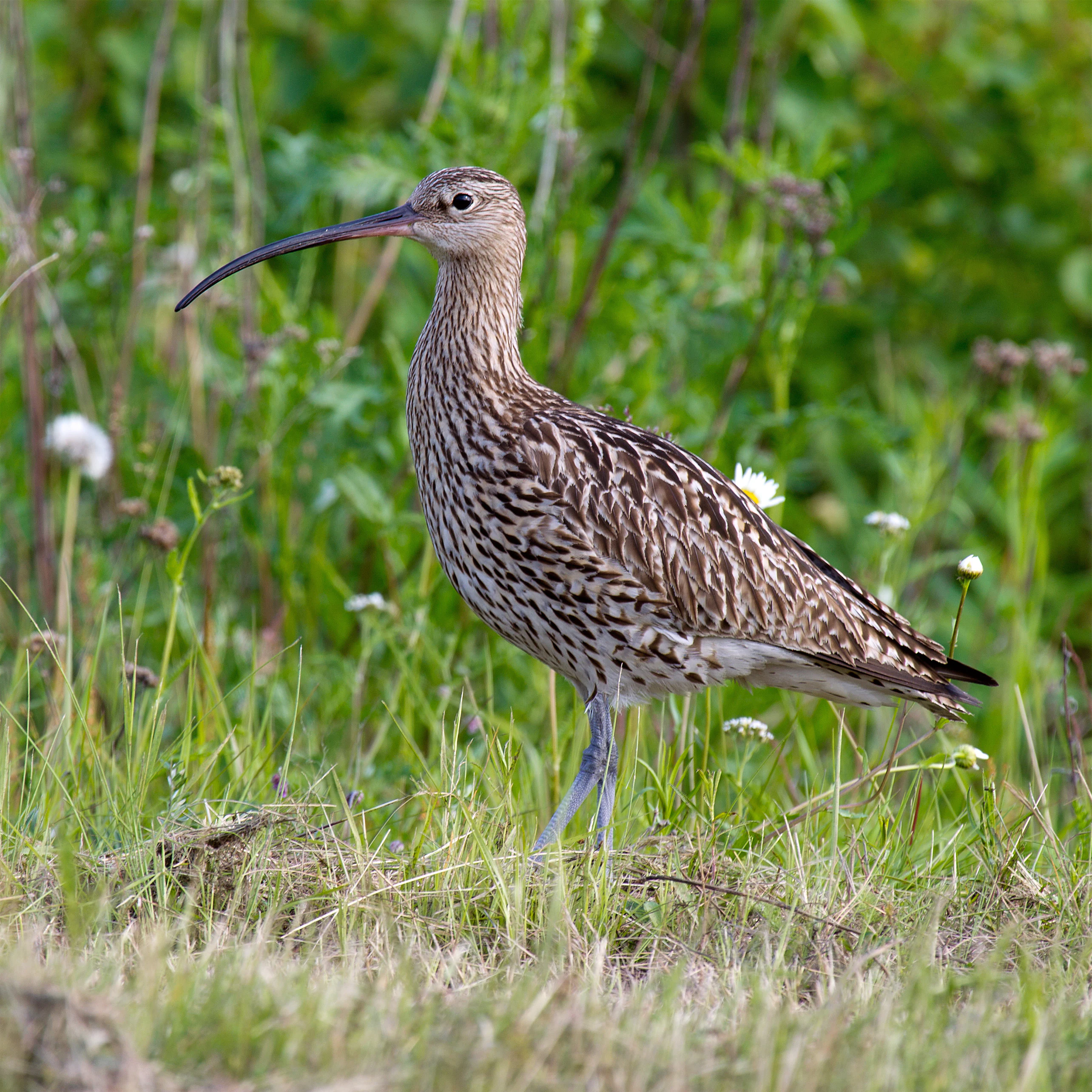
A Eurasian Curlew standing in tall green grass and wildflowers.
An Eurasian Curlew, a characteristic bird species found in the wetlands and meadows of the Lippeaue region.

Best time to visit Lippeaue zwischen Hamm und Lippstadt mit Ahsewiesen

The protected area can be appreciated across the year, with each season offering different natural highlights. Spring is the most rewarding period for breeding birds, when meadows, reed beds, and riverbanks come alive with songbirds, waders, and raptors. Wet meadows around the Ahse meadows and the Lippe floodplain are particularly active, and species such as the curlew, lapwing, and marsh harrier are establishing their territories.

Summer offers the most diverse bird activity, with full breeding cycles underway and reed beds hosting species such as the Eurasian bittern, the common reed warbler, and the little crake. Late summer and early autumn are the main passage seasons, when large numbers of waders, including dunlins, ruffs, and godwits, use the area's shallow waters and wet meadows as staging sites. Winter brings concentrations of geese, cranes, and other waterfowl to the open meadows and shallow floodplain waters, especially when the landscape is softened by frost and low light.


Monthly climate preview

Long-term representative temperature and precipitation patterns across twelve recorded cycles

Lippeaue zwischen Hamm und Lippstadt mit Ahsewiesen Climate Normals and Weather by Month

Lippeaue zwischen Hamm und Lippstadt mit Ahsewiesen experiences measured monthly temperature variations alongside steady year-round precipitation averages at the sampled elevation coordinate. Examining the complete twelve-month climatology profile reveals broader multi-month thermal shifts and detailed precipitation distribution patterns across the protected landscape.
Annual mean9 °C
0 °C18 °C
Jan
Feb
Mar
Apr
May12°
Jun16°
Jul18°
Aug18°
Sep14°
Oct
Nov
Dec
Warmest month
July

18.2 °C

Coolest month
January

0.3 °C

Wettest month
December

2.7 mm/day

Driest month
April

1.7 mm/day

Park location guide

Geography guide, regional context, and park location map for Lippeaue zwischen Hamm und Lippstadt mit Ahsewiesen

Lippeaue zwischen Hamm und Lippstadt mit Ahsewiesen park geography, regions, and map view in Germany

Understand where Lippeaue zwischen Hamm und Lippstadt mit Ahsewiesen sits in Germany through a broader geographic reading of the surrounding landscape, nearby location context, and its mapped position within the national park landscape.

How Lippeaue zwischen Hamm und Lippstadt mit Ahsewiesen fits into Germany

Germany is a federal republic in Western and Central Europe with a population of over 83 million across sixteen constituent states. It is Europe's largest economy by nominal GDP and a major global exporter and importer. The capital is Berlin, and the country borders Denmark, Poland, Czech Republic, Austria, Switzerland, France, Luxembourg, Belgium, and the Netherlands.

Wider geography shaping Lippeaue zwischen Hamm und Lippstadt mit Ahsewiesen in Germany

Germany is located in Western and Central Europe, spanning 357,022 km². It borders Denmark to the north, Poland and the Czech Republic to the east, Austria and Switzerland to the south, and France, Luxembourg, Belgium, and the Netherlands to the west. The country has coastlines on the Baltic Sea and North Sea to the north, with the Alps located in the southern region.

Map view of Lippeaue zwischen Hamm und Lippstadt mit Ahsewiesen

Use this park location map to pinpoint Lippeaue zwischen Hamm und Lippstadt mit Ahsewiesen in Germany, understand its exact geographic position, and read its mapped placement within the surrounding landscape more clearly.

Pigeon | © OpenStreetMap contributors

Location context for Lippeaue zwischen Hamm und Lippstadt mit Ahsewiesen

Nordrhein-Westfalen

Explore floodplain meadows, riparian habitats, and wetland scenery across the protected area

Visualizing Lippeaue zwischen Hamm und Lippstadt mit Ahsewiesen Photos and Landscapes

High-resolution park photography reveals the complex mosaic of wet grasslands, oxbow lakes, and restored river corridors shaping Lippeaue zwischen Hamm und Lippstadt mit Ahsewiesen. Visual records provide essential insight into lowland river terrain, alluvial forest fragments, and critical waterfowl habitats.

A close-up profile view of a vibrant common kingfisher with iridescent blue and orange plumage perched on a bare wooden branch against a blurred green background.

A Great Grey Shrike, a grey bird with a black eye mask, perched on a frost-covered thorny branch with a small prey animal impaled on a thorn.

A small brown and white meadow pipit bird standing on light-colored sand with dark seaweed fragments around it.

A Gadwall duck in profile stands on a muddy, textured bank with one leg lifted, showing grey and brown mottled plumage.

A common snipe with a long, thin beak, mottled brown and white feathers standing in shallow, muddy water.

A black-tailed godwit with a long orange bill and mottled brown plumage stands on a weathered wooden post against a blurred green background.

A common greenshank bird standing in shallow water among green grasses, captured in profile.

A Eurasian Curlew standing in tall green grass and wildflowers.

A male Eurasian Wigeon duck with a chestnut head, cream-colored crown, and grey body, standing in short green grass.

A red kite bird of prey soaring through a clear blue sky with its wings spread.

Two black storks with dark plumage and long red beaks standing in a dense, green wetland area near the water.

A calm, still river or oxbow lake with a large fallen tree extending across the water surface, surrounded by green riverside vegetation and trees under a clear blue sky.

Park atlas

Compare adjacent river corridors, wet grasslands, and regional protected landscapes.

Exploring Other Parks Near Lippeaue zwischen Hamm und Lippstadt mit Ahsewiesen

Browsing other protected areas near Lippeaue zwischen Hamm und Lippstadt mit Ahsewiesen reveals shared lowland river geography and floodplain habitats. Comparing adjacent reserves expands regional conservation context across North Rhine-Westphalia.
A minimalist watercolor painting showing a winding river through a soft green and yellow landscape with distant rolling hills.
Nature reserveKreis Warendorf
About 14 km away#1 closest

West

Lippeaue zwischen Schloss Oberwerries und Dolberg Protected Riverine Landscape Atlas

Nature reserve geography and riparian floodplain terrain

Located in Kreis Warendorf, Lippeaue zwischen Schloss Oberwerries und Dolberg is a distinctive nature reserve shaped by the Lippe River. The area features a concentration of still waters, reed beds, and meandering channels that showcase the natural dynamics of a lowland floodplain. This protected territory provides a detailed look at the interface between riverine ecosystems and regional landscape preservation in Germany.

Area
0.31 km²
Established
1993
IUCN
IV
Relief
Lowland
Nature reserveNordrhein-Westfalen
About 14 km away#2 closest

Northeast

Märzenbecherwald Nature Reserve: Wetland Mosaic and Protected Forest in Nordrhein-Westfalen

A rare calcareous fen and alder swamp forest ecosystem

This protected nature reserve in the Warendorf district serves as a vital ecological anchor, preserving a mosaic of spring-fed seeps, damp woodlands, and calcareous fens. Despite its modest size, the area provides a sharp contrast to the surrounding agricultural fields of the Münsterland region, maintaining a essential water-logged habitat for specialized plant species.

Area
0.016 km²
Established
1995
IUCN
IV
Relief
Lowland
Watercolor painting of a sparse line of trees in a wetland or fen landscape with light washes of green and pink hues.
Nature reserveNorth Rhine-Westphalia
About 20 km away#3 closest

East

Muckenbruch Nature Reserve: Geographic Map and Protected Wetland Landscape Overview

Regional wetland habitat within the Hellwegbörde of North Rhine-Westphalia

Muckenbruch is a structurally diverse lowland peat bog located at the northern edge of Bad Westernkotten. The reserve protects an intricate terrain of bog woodland, sedge marshes, and flowing waters that have undergone significant rewetting to restore native wetland vegetation and support local species. This site represents a key contribution to the conservation of peatland mosaics within the agricultural landscape of Kreis Soest.

Area
0.971 km²
Established
1996
Relief
Lowland
Access
Moderate access
A soft watercolor painting of a serene, open natural landscape with trees, rolling hills, and a calm body of water in the background.
Nature reserveKreis Soest
About 20 km away#4 closest

South

Möhnesee Nature Reserve: Mapping the Protected Landscapes of Kreis Soest

A vital aquatic sanctuary in the Westphalian Bight.

The Möhnesee nature reserve anchors a significant corridor of forest and water in central Westphalia. This sanctuary manages an expansive reservoir environment, offering a layered ecological profile that provides essential staging territory for migrating waterbirds while integrating with regional Natura 2000 protected networks.

Area
11.888 km²
Established
1983
IUCN
IV
Relief
Mixed relief
Nature reserveGermany
About 24 km away#5 closest

South

Naturschutzgebiet Quellbäche der Schlibbecke: Protected Headwaters and Brook-Valley Geography

A vital nature reserve within the Northern Sauerland forest landscape.

This nature reserve protects the near-natural headwaters and floodplain forest of the Schlibbecke brook system in Germany. It features a varied topography of steep, narrow valley slopes and moist alder-dominated woodlands, serving as a crucial biotope connection within the broader, largely conifer-influenced regional landscape of the Hochsauerlandkreis.

Area
0.093 km²
Established
1998
Relief
Upland
Scope
Terrestrial
A soft watercolor illustration depicting rolling green hills, dense forest patches, and a winding stream flowing through a grassy meadow.
Protected landscapeGermany
About 24 km away#6 closest

South

Luerwald und Bieberbach Protected Landscape: Regional Forest Map and Habitat Overview

A major continuous woodland reserve in North Rhine-Westphalia, Germany.

Spanning the landscape between Neheim and Menden, Luerwald und Bieberbach functions as a critical Special Protection Area. The terrain features extensive beech and oak woodlands intersected by the Bieberbach stream, creating an important haven for woodland species and maintaining a large, undisturbed environmental mosaic across the northern Sauerland.

Nature reserveHochsauerlandkreis
About 26 km away#7 closest

South

Naturschutzgebiet Oberlauf des Saliesiepens: Protected Riparian Woodland and Brook Geography

A vital stream-side habitat in the Hochsauerlandkreis uplands

This protected area stands out for its narrow, meandering Saliesiepen brook and the surrounding alder forest patches. It offers a focused view of riparian restoration in a region otherwise dominated by conifer plantations. The reserve represents a specific, linear valley landscape providing essential connectivity for local water-dependent flora and fauna.

Area
0.054 km²
Established
2021
Relief
Lowland
Scope
Terrestrial
A soft watercolor painting of a river flowing through a lush green landscape with trees lining both banks under a bright, pale sky.
Nature reserveNorth Rhine-Westphalia
About 27 km away#8 closest

Southwest

Naturschutzgebiet Obergraben westlich Wickede: Protected Floodplain and Nature Reserve Atlas

Mapped Ruhr river habitats and protected meadow corridors in North Rhine-Westphalia

Naturschutzgebiet Obergraben westlich Wickede functions as a vital ecological corridor along the Ruhr, featuring a compact mosaic of floodplain woodland, wet meadows, and river island structures. This nature reserve plays a significant role in supporting waterbird populations and maintaining the connectivity of protected riverine landscapes across North Rhine-Westphalia.

Area
0.47 km²
Established
2002
IUCN
IV
Relief
Lowland

Common questions about visiting, size, designation, and location context for Lippeaue zwischen Hamm und Lippstadt mit Ahsewiesen

Lippeaue zwischen Hamm und Lippstadt mit Ahsewiesen FAQs for park facts, access, geography, and protected area context

Find quick answers about Lippeaue zwischen Hamm und Lippstadt mit Ahsewiesen, including protected-area facts, park geography, trail and visitor context, and how the park fits into its surrounding country and regional landscape.
MoriAtlas Explorer

Continue Your Protected Areas Search Across the Global Atlas

Deepen your exploration by continuing the structured search for national parks and protected areas worldwide. Utilize the comprehensive filtering capabilities to compare different conservation landscapes and refine your understanding of global park geography. Discover more about the distribution and characteristics of protected natural areas.

Global natural geography