
Why Little Dry Run Wilderness stands out
Little Dry Run Wilderness is especially known for its central namesake stream, Little Dry Run, which is a native trout stream fringed by eastern hemlock and white pine. The area's cove forests contain stands of tulip poplar, sugar maple, white ash, and eastern hemlock, and remnants of old growth are still found near Sindion Point. Botanists also value the wilderness as part of a broader Southern Appalachian area that supports the rare round-leaf birch. The wilderness is also recognized for its birdlife. Its dense canopy of eastern redbud, Fraser magnolia, witch-hazel, and mountain maple provides nesting cover for songbirds such as the wood thrush, summer tanager, red-eyed vireo, and ovenbird, while warblers, including worm-eating, black-and-white, and pine warblers, are regularly seen along the slopes.
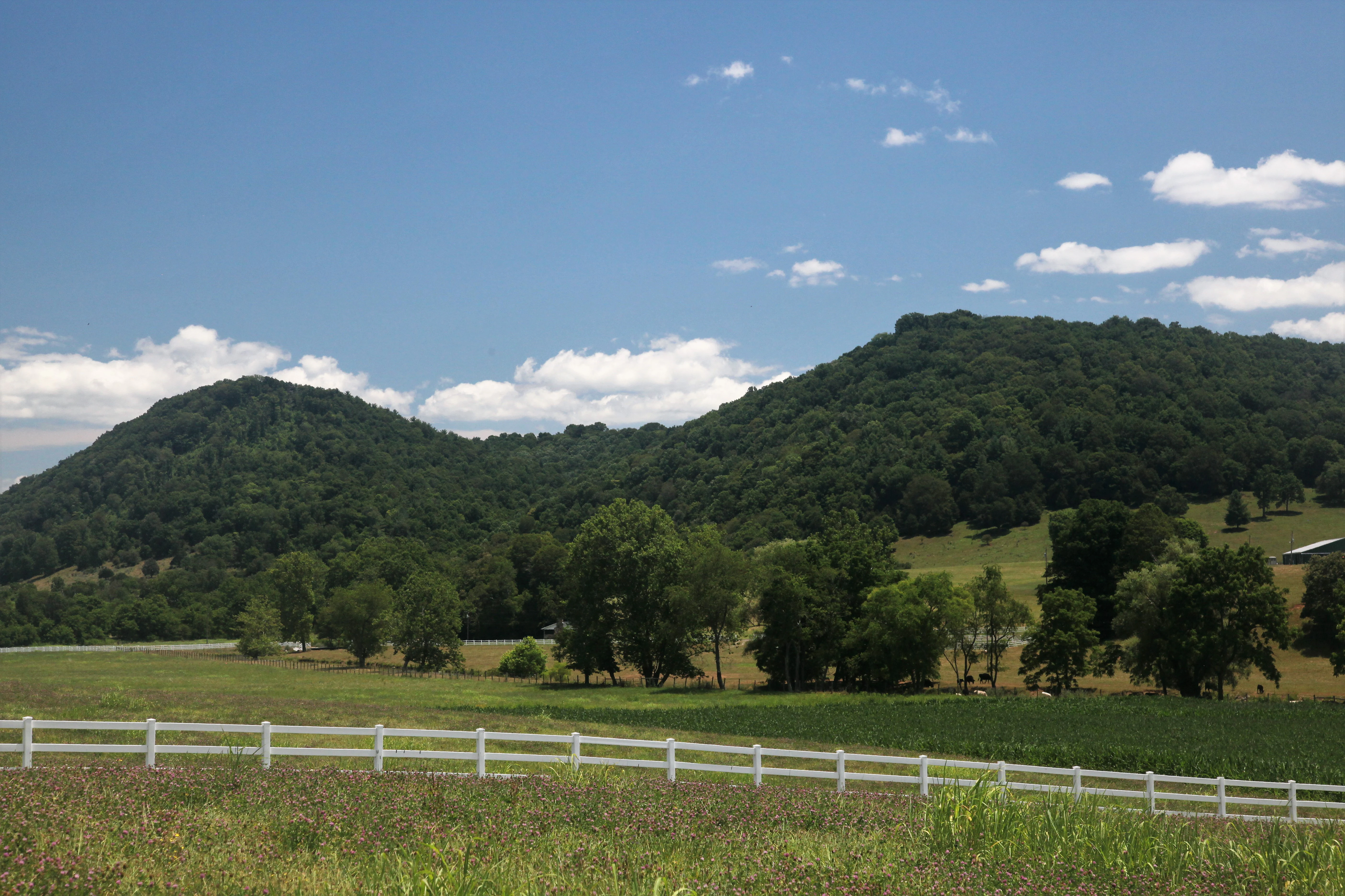
Little Dry Run Wilderness history and protected-area timeline
Little Dry Run Wilderness was formally designated by Congress in 1984 through the Eastern Wilderness Act, at which time roughly 2,845 acres were placed into the National Wilderness Preservation System. The designation was part of a broader effort during the early 1980s to protect additional eastern roadless lands that exemplified the qualities of wilderness, even in landscapes that had long histories of logging, agriculture, and settlement.
The area sits within the Mount Rogers National Recreation Area, a unit of the George Washington and Jefferson National Forests, and forms the eastern end of a loosely grouped complex of National Forest wildernesses collectively referred to as the Mount Rogers Cluster. From the time of its designation, stewardship of Little Dry Run has been carried out by the U.S. Forest Service under the framework established for congressionally designated wilderness, with management intended to preserve the area's natural conditions and support its role as habitat for native plant and animal populations.
Over the decades since designation, the main changes in the wilderness have come not from within its boundaries but from the trails and recreation infrastructure built or maintained along its edges. The Little Dry Run Trail, the Virginia Highlands Horse Trail, and the Virginia Highlands Extension pass around or through portions of the area, providing access for hikers and horseback riders while channeling use away from the more sensitive interior. Although small remnants of past land use may still be detectable in the surrounding forest, the wilderness itself has been managed to maintain the present, natural condition that Congress sought to protect.
Little Dry Run Wilderness landscape and geographic character
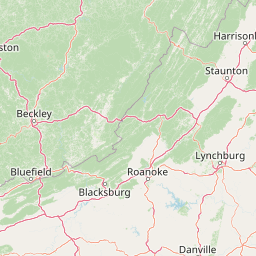
The wilderness occupies a compact slice of the southern Blue Ridge Mountains in southwestern Virginia, with terrain shaped by streams, ridges, and small enclosed basins rather than by dramatic high summits. Elevations climb from around 2,440 feet along Little Dry Run at the lower end of the watershed to a high point of about 3,614 feet on an unnamed peak within the area, and the land rises and falls across a series of knobs and saddles typical of the Blue Ridge.
Near the center of the wilderness, the watershed of Little Dry Run rises from a small bog and then drops through a forested valley before joining Dry Run to the north, which flows along the eastern edge of the area. Two additional drainages frame the wilderness: Jones Creek runs along the northwest boundary, while West Dry Run Fork traces part of the south. Standout landforms include Sindion Point, a small knob at roughly 3,018 feet in the northwest corner that marks the end of a ridgeline running through the area. Just outside the wilderness to the south, Comers Rock rises to about 4,102 feet and provides a notable overlook of the surrounding countryside.
Geologically, the area belongs to the Blue Ridge Province, which differs in character from the Ridge and Valley Province that lies to the west. The transition between these two provinces is one of the defining features of the region's broader landscape, and Little Dry Run sits firmly on the Blue Ridge side of that divide. Forests clothe nearly the entire area, giving it a continuous green profile in which the underlying topography is revealed mainly by streams, rocks, and changes in canopy texture rather than by open vistas.
Little Dry Run Wilderness ecosystems, habitats, and plant life
The wilderness preserves a compact cross section of southern Blue Ridge ecosystems, from streamside hemlock and white pine stands on Little Dry Run to mature cove hardwood forests higher on the slopes. Cove forests within the area support white basswood, tulip poplar, sugar maple, white ash, and eastern hemlock, while other portions of the canopy include eastern redbud, Fraser magnolia, witch-hazel, and mountain maple. These layered forests are dense enough to provide critical nesting cover for songbirds, and the structural diversity of the canopy is one of the defining ecological features of the area.
A small bog sits at the head of the Little Dry Run watershed, offering a distinctive wet habitat that contrasts with the surrounding slopes and contributes to the botanical diversity of the area. In spring, herbaceous species such as wood anemone, false Solomon's seal, foamflower, mayapple, large-flowered trillium, red trillium, and Solomon's seal are visible along streams and forest edges. The wilderness also lies within a broader region that supports rare round-leaf birch, a species of particular interest to botanists studying the Southern Appalachians.
Because the area has been managed to keep its natural conditions intact, small remnants of old-growth forest, with characteristics notably different from the surrounding second-growth stands, are still present near Sindion Point. While these patches are limited in extent, they are ecologically important as reference sites for understanding the natural composition and structure of Blue Ridge forests.
Little Dry Run Wilderness wildlife and species highlights
Little Dry Run Wilderness supports a rich mix of forest birdlife, which constitutes one of its most visible wildlife assets. The closed canopy of cove forests, redbuds, magnolias, witch-hazel, and mountain maple provides nesting cover for a variety of songbird species, including wood thrush, summer tanager, red-eyed vireo, and ovenbird. Mixed flocks of warblers, including worm-eating, black-and-white, and pine warblers, move through the understory and mid-canopy layers, along with golden-crowned kinglets and eastern wood pewees, making the area appealing to birdwatchers, especially during spring and early summer.
Little Dry Run itself is recognized as a native trout stream, and the watershed's cool, shaded waters offer habitat for native brook trout and other aquatic species typical of high-elevation Appalachian streams. The presence of these fish is closely tied to the surrounding forest cover, which shades the water and helps maintain the cool temperatures that native trout require.
Mammals and other wildlife typical of the southern Blue Ridge, including white-tailed deer, black bears, and various small mammals and reptiles, are present in the area as well, though the dense forest vegetation and limited trail network mean that many species are more often detected by sign than by direct observation. Overall, the wilderness functions as a small but ecologically coherent refuge where breeding birds, native stream fauna, and the broader Appalachian forest fauna coexist within a protected, unmodified setting.
Little Dry Run Wilderness conservation status and protection priorities
Little Dry Run Wilderness was set aside by Congress in 1984 with the explicit objective of preserving the area in its present, natural condition. As part of the National Wilderness Preservation System, it is managed to maintain a variety of natural life forms and to contribute to the broader diversity of plant and animal gene pools protected across designated wilderness areas in the United States. Because more than half of the country's ecosystems are represented within such designations, even a relatively small wilderness like Little Dry Run has a recognized role in protecting ecological variety at a national scale.
Protection here is enforced through restrictions typical of wilderness management: motorized equipment, motor vehicles, and mountain bikes are prohibited, group sizes are limited to ten people, and camping is regulated to minimize lasting impacts. These measures limit the types of disturbances that can affect forest structure, streams, nesting birds, and sensitive plant populations, and they help maintain the contrast between the wilderness interior and the more heavily used portions of the surrounding Mount Rogers National Recreation Area.
The wilderness also has specific conservation value for particular species and habitats. It safeguards native trout in Little Dry Run, nesting habitat for songbirds throughout the coves and ridges, and habitat for rare plants such as round-leaf birch within its broader region. The small remnants of old growth near Sindion Point are themselves a conservation resource, providing reference points for understanding Southern Appalachian forest ecology and a seed source for surrounding forests.
Little Dry Run Wilderness cultural meaning and human context
Little Dry Run Wilderness is embedded in the rural landscape of Wythe County in southwestern Virginia, in an area long associated with small mountain communities, horse culture, and traditional Appalachian land use. Although the wilderness itself is managed to exclude most modern uses, the surrounding region reflects the heritage of the southern Blue Ridge, where settlement, small-scale farming, forestry, and horseback recreation have shaped the local economy and identity for generations.
The presence of the Virginia Highlands Horse Trail along the southern edge of the area reflects this regional horseback-riding tradition and ties the wilderness into a broader network of riding routes on the national forest. Nearby communities such as Speedwell and the broader Wytheville area continue to be gateways for outdoor recreation in the Mount Rogers region, and the wilderness, with its limited road and trail access, offers a quieter counterpoint to the more heavily developed west side of the recreation area.
Top sights and standout views in Little Dry Run Wilderness
Little Dry Run Wilderness is notable for being a congressionally designated wilderness at the east end of the Mount Rogers National Recreation Area, with elevations ranging from roughly 2,440 to 3,614 feet and a watershed organized around Little Dry Run, a native trout stream. Its cove forests, small bog at the watershed's head, and old-growth remnants near Sindion Point give it an ecological character that feels more remote than its modest acreage suggests.
Hikers come for the maintained Little Dry Run Trail, the connecting Virginia Highlands and Virginia Highlands Extension trails, and the more adventurous Ridge Top Area Bushwhack, while nearby Comers Rock offers one of the most expansive viewpoints in the surrounding national forest. The combination of restricted access, southern Blue Ridge terrain, and a strong songbird presence makes the wilderness a quiet but rewarding destination within Virginia's largest collection of National Forest wilderness areas.
Best time to visit Little Dry Run Wilderness
Because the wilderness sits at moderate elevations in the southern Blue Ridge, spring and early summer are particularly rewarding for visitors interested in wildflowers and birdlife. In spring, woodland blooms such as wood anemone, mayapple, foamflower, and both large-flowered and red trillium appear along streams and forest edges, while warblers, thrushes, vireos, and tanagers become more vocal and visible during the breeding season. Cooler temperatures and generally manageable trail conditions make this period well suited to longer hikes such as the Little Dry Run Trail and the Ridge Top Area Bushwhack.
Fall brings cooler, drier conditions and an extended canopy of color from the area's mixed hardwoods, which include sugar maple, tulip poplar, white ash, and witch-hazel. Cooler weather also makes the included streams and higher trails more comfortable for sustained hiking. Winters tend to be quieter and colder, with snow possible at higher elevations and reduced access depending on conditions, while summer can be warm and humid at lower elevations but remains shaded under the dense cove forest canopy along Little Dry Run and its tributaries.