

Mori Atlas logo
Nature reserveLittle Llangothlin Nature Reserve

Explore this Ramsar-listed wetland and its intact basalt landscape within the New England region of New South Wales.

Little Llangothlin Nature Reserve: A High-Elevation Freshwater Lagoon on the New England Tablelands

Little Llangothlin Nature Reserve serves as a vital refuge for waterbirds, amphibians, and native woodland within the pastoral mosaic of the Northern Tablelands in New South Wales. Reaching roughly 1,360 metres above sea level, this protected area preserves one of the last remaining high-elevation freshwater lagoons on basalt soil. The reserve represents a critical site for landscape and habitat conservation, offering unique insights into the geological and ecological character of the New England Plateau.

Ramsar wetlandfreshwater lagoonhigh-elevation wetlandNew England TablelandsNorthern Tablelands New South Waleswaterbird refuge

Little Llangothlin Nature Reserve

Nature reserve

Park overview

Structured park overview, official facts, and landscape profile for Little Llangothlin Nature Reserve

Little Llangothlin Nature Reserve park facts, protected area profile, and essential visitor context

Review the core facts for Little Llangothlin Nature Reserve, including designation, size, terrain, visitor scale, habitats, and operating context in one park-focused overview.

About Little Llangothlin Nature Reserve

Little Llangothlin Nature Reserve is situated on the Northern Tablelands of New South Wales, near the rural localities of Llangothlin and Guyra in the New England region of eastern Australia. The 257-hectare reserve occupies a high position on the New England Plateau, where Tertiary basalt soils support a distinctive tableland landscape that has otherwise been heavily modified by clearing for cropping and grazing. Within this largely pastoral setting, the reserve protects an unusually intact example of an upland wetland system, anchored by the 120-hectare Little Llangothlin Lagoon and the smaller Billy Bung Lagoon.

The defining feature of the reserve is its high-elevation freshwater lagoon, which sits on a basalt substrate at around 1,360 metres above sea level. This elevation makes Little Llangothlin one of the few remaining naturally functioning high-altitude freshwater lagoons in the region. A former agricultural drainage ditch that had lowered the lagoon's water levels has been filled in, helping to restore a more natural depth of about 2 metres when the wetland is full. The result is a shallow, seasonal freshwater habitat that contrasts sharply with the cleared grazing land that surrounds it.

The reserve is much more than an isolated waterbody. It provides habitat for a wide range of native plants, including New England peppermint, snowgum, and silver wattle in the surrounding woodland, while rare species such as the Hairy Anchor Plant and Austral Toadflax have been recorded in the reserve. The sedgeland, herbland, and grassy woodland communities around the lagoon support a rich assemblage of native fauna, including waterbirds that use the wetland as a drought refuge, as well as frogs, reptiles, and mammals attracted to the remaining native vegetation in a landscape otherwise dominated by farmland.

The significance of Little Llangothlin extends beyond regional conservation. Its designation as a Ramsar wetland of international importance in 1996 placed it among a small set of Australian sites recognised globally for their wetland values. The combined listing with the adjacent Bagot Road area on Australia's Register of the National Estate further highlights the importance of the wider landscape mosaic in which the reserve sits. For visitors, a 4.8-kilometre walking track encircles the lagoon, offering a way to experience a rare pocket of tabAfter the walk continues through grassy woodland and sedgeland, providing habitat for waterbirds using the drought refuge as well as frogs and reptiles. The track also passes patches of New England peppermint, snowgum, and silver wattle. For botanists and ecologists, the reserve offers an unusually intact opportunity to study both rare plant species such as the Hairy Anchor Plant and Austral Toadflax and the broader wetland assemblage on the New England Plateau.

In practical terms, the reserve is administered by the NSW National Parks and Wildlife Service and managed under the NSW National Parks and Wildlife Act 1974. Its compact size, combined with the pressures of grazing, drainage, and past land modification in the surrounding landscape, make careful management of water levels and vegetation communities essential. The fact that the lagoon has recovered part of its original depth after drainage works were reversed demonstrates how a small but well-targeted reserve can preserve a wetland system that would otherwise have been lost from the region.

Quick facts and research context for Little Llangothlin Nature Reserve

Little Llangothlin Nature Reserve lies on basalt soils of the New England Plateau in northern New South Wales, at approximately 1,360 metres above sea level. The reserve was established in December 1979 under the NSW National Parks and Wildlife Act 1974 and is managed by the NSW National Parks and Wildlife Service.

The reserve includes the 120-hectare Little Llangothlin Lagoon, a shallow high-altitude freshwater lake that reaches about 2 metres in depth when full. In 1996 the site became a Ramsar wetland of international importance, recognising its value as a drought refuge for waterbirds and a habitat for native flora and fauna within a heavily cleared agricultural landscape.

Protection and recognition

Documented terrestrial protection history and international Ramsar wetland recognition

Little Llangothlin Nature Reserve Protection Status and Ramsar Recognition

Little Llangothlin Nature Reserve holds a documented terrestrial protection status established in 1996 with verified international Ramsar wetland recognition. Structured conservation records outline the official designation history and management scope for this protected area.

International recognition

Protection details

Protection scope
Terrestrial
Designated year
1996
Transboundary protection
No
Park context

Deeper park guide and search-rich context for Little Llangothlin Nature Reserve

Little Llangothlin Nature Reserve history, landscape, wildlife, and travel context

Explore Little Llangothlin Nature Reserve through its history, landscape character, ecosystems, wildlife, conservation priorities, cultural context, and seasonal travel timing in a structured park guide built for atlas discovery and search intent.

Why Little Llangothlin Nature Reserve stands out

The reserve is best known for protecting one of the last naturally functioning high-elevation freshwater lagoons on basalt soils on the New England Tableland. Rising to about 1,360 metres above sea level, the lagoon occupies a natural depression in the tableland landscape and provides a drought refuge for waterbirds in a region where most comparable wetlands have been cleared or drained for agriculture. Its international recognition as a Ramsar wetland underscores the ecological importance of this small reserve. The site stands out for the contrast it offers to the surrounding pastoral farmland, preserving sedgeland, herbland, and grassy woodland communities along with rare plant species and a diverse community of amphibians, reptiles, and birds that depend on its still largely natural waterbody.

Little Llangothlin Nature Reserve history and protected-area timeline

The reserve was formally established in December 1979 under the NSW National Parks and Wildlife Act 1974, placing it under the management of the state's National Parks and Wildlife Service. Its creation reflected growing recognition of the need to protect highland wetlands on the New England Plateau, where most comparable lagoons had already been cleared, drained, or converted to pasture.

A key turning point in the reserve's history came in 1996, when Little Llangothlin Nature Reserve was designated a wetland of international importance under the Ramsar Convention. This international listing acknowledged the site's importance as a drought refuge for waterbirds and as one of the few remaining high-altitude freshwater lagoons on basalt soils in eastern Australia. The reserve, together with the adjacent Bagot Road area, has also been included on Australia's Register of the National Estate, reflecting both its natural and cultural landscape values.

Management actions have also shaped the reserve's ecological history. A former agricultural drainage ditch that had deepened and altered the natural water regime of the lagoon was filled in, helping to restore an approximate original depth of around 2 metres when the wetland fills. This restoration intervention illustrates the broader history of the site, where human-driven drainage had reduced its natural values before formal protection began to reverse some of those impacts.

Little Llangothlin Nature Reserve landscape and geographic character

The reserve occupies part of the New England Plateau, a high tableland that forms part of the broader Northern Tablelands of New South Wales. The region is built on Tertiary basalt soils that produce a gently undulating plateau surface, broken by natural depressions in which shallow freshwater lagoons have historically formed. Little Llangothlin Lagoon fills one of these depressions and represents a small but unusually intact example of a landscape feature that has been mostly lost elsewhere on the tableland.

At about 1,360 metres above sea level, the reserve sits higher than most lowland Australian wetlands, giving it a cooler, more montane character. Visitors moving from the surrounding pastoral farmland into the reserve experience a clear shift in landscape texture, from open improved pastures to a mosaic of sedgelands, herblands, grassy woodland, and open water. The boundary between heavily cleared farmland and intact native vegetation is unusually sharp here, emphasising how isolated the wetland habitat has become.

The lagoon itself is shallow, reaching roughly 2 metres at full depth, and is encircled by a 4.8-kilometre walking track. This scale keeps the landscape compact, but the combination of basalt geology, high elevation, seasonal water levels, and surrounding woodland gives the reserve a strong sense of place that is quite different from both coastal lagoons and inland floodplain wetlands elsewhere in New South Wales.

Little Llangothlin Nature Reserve ecosystems, habitats, and plant life

The reserve protects an unusually intact mosaic of wetland and upland habitats set on basalt soils. Its ecological character is shaped by the high elevation of the New England Plateau and the contrast between the lagoon's natural vegetation and the surrounding cleared farmland. Together, the plant communities of the reserve include sedgelands dominated by sedges, herblands of low-growing flowering plants, and grassy woodlands that transition into taller eucalypt forest around the margins.

Vegetation plays a key role in the reserve's ecological identity. Open and semi-open areas around the lagoon support reed-like and herbaceous wetland plants, while the surrounding slopes are dominated by woodland species such as New England peppermint, snowgum, and silver wattle. This mosaic creates microhabitats for a wide range of animals, including waterbirds that depend on the open water and fringing wetlands, and terrestrial species that rely on the woodland and sedgeland patches for shelter and food.

Flora of conservation interest adds another important dimension to the reserve's ecological profile. The Hairy Anchor Plant and Austral Toadflax, both considered rare in New South Wales, have been recorded in the reserve. The presence of these species demonstrates that even a relatively small protected wetland can contribute meaningfully to the conservation of uncommon plant communities at the edge of their range on the New England Tableland.

Little Llangothlin Nature Reserve wildlife and species highlights

In a landscape where most natural wetland habitat has been lost to agriculture, Little Llangothlin provides a critical refuge for native fauna. The reserve supports a broad range of birds, mammals, amphibians, and reptiles, with waterbirds forming the most prominent and widely recognised group. Because the lagoon functions as a drought refuge, it can support flocks of waterbirds that move into the reserve during dry periods elsewhere in the region.

The wetland also supports a notable community of frogs and reptiles. The combination of shallow water, fringing sedgeland and herbland, and surrounding woodland provides suitable breeding and shelter habitat for amphibians that depend on standing water, as well as for reptiles that hunt along the wetland margins. Mammals that use the reserve are thought to benefit from the woodland patches and the refugial quality of the site in a heavily cleared landscape.

The reserve's wildlife significance is reinforced by its Ramsar listing. Wetland refuges of this kind provide habitat for migratory and nomadic waterbirds, local breeding populations of frogs and reptiles, and a wide range of invertebrates that form the base of the reserve's food web. The contrast with the surrounding pastoral land makes the reserve disproportionately important for biodiversity on the New England Plateau.

Little Llangothlin Nature Reserve conservation status and protection priorities

Little Llangothlin Nature Reserve is one of the most important wetland conservation sites on the New England Plateau. Its protected status, established in 1979, aims to safeguard the lagoon and its associated vegetation from the pressures of drainage, grazing, and agricultural intensification that have affected most other high-elevation lagoons in the region. Because so much of the surrounding land has been converted to improved pasture, the reserve also plays a critical role as a refuge habitat, allowing species that would otherwise be lost from the local landscape to persist.

International recognition has been central to the reserve's conservation identity. The 1996 designation under the Ramsar Convention placed Little Llangothlin among a select group of Australian wetlands recognised for their global ecological significance. This designation reflects the site's role as a drought refuge for waterbirds, its importance for native frogs and reptiles, and its value as a relatively natural example of a high-altitude freshwater lagoon on basalt soils.

Management actions within the reserve have focused on restoring the lagoon's natural water regime, including the reversal of an earlier agricultural drainage ditch that had reduced water levels. The inclusion of the site, together with the adjacent Bagot Road area, on Australia's Register of the National Estate further reinforces the conservation framework around the reserve. Together, these designations and management efforts give Little Llangothlin an importance that extends well beyond its modest 257 hectares.

Little Llangothlin Nature Reserve cultural meaning and human context

The wider landscape of the New England Tablelands, in which Little Llangothlin sits, has a long pastoral and agricultural history. Much of the natural vegetation across the region was cleared for grazing and cropping through the nineteenth and twentieth centuries, leaving only isolated patches such as this reserve in a matrix of improved farmland. The contrast between the reserve and the surrounding paddocks is itself a cultural marker, illustrating how dramatically the regional landscape has been transformed.

The nearby rural localities of Llangothlin and Guyra also reflect the agricultural settlement of the New England region, with names that hint at broader Australian patterns of rural community development. While the reserve itself is primarily valued for natural heritage, its position within this landscape of working farmland helps explain why a small, formally protected wetland carries such significance for both regional identity and biodiversity conservation.

Top sights and standout views in Little Llangothlin Nature Reserve

The standout feature of Little Llangothlin Nature Reserve is its 120-hectare high-elevation freshwater lagoon, one of the last naturally functioning examples of its kind on basalt soils of the New England Plateau. Set at roughly 1,360 metres above sea level, the shallow lagoon, together with the adjacent Billy Bung Lagoon and fringing sedgeland, herbland, and grassy woodland, gives the reserve a distinctive ecological character not easily found elsewhere in the region.

Equally important is the reserve's international recognition. Designated as a Ramsar wetland in 1996 and listed on Australia's Register of the National Estate, Little Llangothlin combines international, national, and state-level protection in a compact 257-hectare site. For visitors, the 4.8-kilometre lagoon walk provides an accessible way to experience a Ramsar-listed wetland, a rare drought refuge for waterbirds, and a surviving patch of New England peppermint and snowgum woodland, all within a short distance of the surrounding rural landscape.

Best time to visit Little Llangothlin Nature Reserve

The reserve's atmosphere and wildlife activity change meaningfully through the year because the lagoon is a seasonal wetland that fluctuates in depth and extent. Visiting in the warmer months tends to bring the lagoon closer to its full depth of around 2 metres and supports higher activity among frogs, reptiles, and waterbirds, including species that move into the reserve as a drought refuge during drier periods elsewhere in the region.

Cooler months can offer clearer views across the open water and surrounding woodland, when the New England peppermint, snowgum, and silver wattle that line the reserve become more visible and the lagoon margins are easier to walk around. Because conditions can vary with regional rainfall, the lagoon can be at its fullest after wet periods and contract during extended dry spells. This natural rhythm is part of what makes the reserve interesting through the year, rather than something to be scheduled around a fixed calendar.
Monthly climate preview

Long-term monthly temperature and precipitation averages for New South Wales

Little Llangothlin Nature Reserve Climate Normals and Temperature Patterns

Representative coordinate records show measured shifts in monthly temperature extremes and daily precipitation rhythms across the protected area. Examining the full twelve-month dataset clarifies long-term meteorological trends beyond this summary preview.
Annual mean13 °C
6 °C20 °C
Jan20°
Feb19°
Mar17°
Apr13°
May10°
Jun
Jul
Aug
Sep11°
Oct14°
Nov16°
Dec18°
Warmest month
January

19.8 °C

Coolest month
July

6.1 °C

Wettest month
February

4.1 mm/day

Driest month
July

1.2 mm/day

Park location guide

Geography guide, regional context, and park location map for Little Llangothlin Nature Reserve

Little Llangothlin Nature Reserve park geography, regions, and map view in Australia

Understand where Little Llangothlin Nature Reserve sits in Australia through a broader geographic reading of the surrounding landscape, nearby location context, and its mapped position within the national park landscape.

How Little Llangothlin Nature Reserve fits into Australia

Australia is a constitutional monarchy and federal parliamentary democracy comprising six states and ten territories. With a population of nearly 28 million, it is one of the world's most urbanised countries, with most people concentrated on the eastern seaboard. The country has a high Human Development Index and is known for its cultural diversity, ancient Aboriginal heritage, and unique wildlife.

Wider geography shaping Little Llangothlin Nature Reserve in Australia

Australia occupies the entire Australian continent, the island of Tasmania, and numerous smaller islands. It is the world's flattest and driest inhabited continent, featuring vast deserts in the interior (the Outback), tropical rainforests along the eastern coast, and a coastline bordering the Indian and Pacific Oceans.

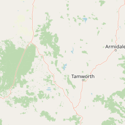
Map view of Little Llangothlin Nature Reserve

Use this park location map to pinpoint Little Llangothlin Nature Reserve in Australia, understand its exact geographic position, and read its mapped placement within the surrounding landscape more clearly.

Pigeon | © OpenStreetMap contributors

Location context for Little Llangothlin Nature Reserve

New South Wales
Recorded earthquake history

Review Recorded Seismic History for Little Llangothlin Nature Reserve

Examine the documented history of seismic events occurring near Little Llangothlin Nature Reserve. MoriAtlas provides a structured catalogue of past earthquakes to support your investigation of the regional geological context on the New England Tablelands.

Little Llangothlin Nature Reserve Earthquakes

Catalogued events

1 event

Strongest magnitude

Magnitude 3.3

Most recent event

Oct 11, 1981

This history includes earthquakes recorded inside the park or within 50 km of its borders

Park atlas

Compare high-elevation wetlands and protected areas across the Northern Tablelands region

Parks Near Little Llangothlin Nature Reserve and Related Protected Landscapes

Browsing parks near Little Llangothlin Nature Reserve reveals connected protected areas and high-elevation wetland reserves across the New England Tableland. Extending the search helps trace regional conservation networks, plateau terrain, and comparable natural habitats throughout eastern Australia.
National parkNew South Wales
11 km away#1 closest

Northeast

Warra National Park: Protected Landscape Identity and Geographic Setting in New South Wales

Mapped boundaries and regional natural terrain context.

Warra National Park represents a key protected area, offering critical insights into the natural geography of New South Wales, Australia. This detail page focuses on its identity as a national park, detailing its mapped boundaries and the surrounding landscape context. Understand the specific geographic features and the protected land designation that define Warra National Park, enhancing your atlas exploration with precise regional details.

Area
19.2 km²
Established
1999
IUCN
II
Relief
Highland
Watercolor illustration of rolling hills, green forests, and pink flowering trees
National parkNew South Wales
27 km away#2 closest

East

Guy Fawkes River National Park: National Park Geographic Context and Mapped Boundaries

Explore the protected landscape and regional geography of this New South Wales national park.

Gain a structured understanding of Guy Fawkes River National Park, a key national park in New South Wales, Australia. This entry provides detailed insights into its mapped geographic boundaries, its role as a protected landscape, and its contribution to the broader regional context for atlas exploration. Examine the park's place within the natural terrain of New South Wales for a clearer picture of conservation lands.

Area
1,005.9 km²
Established
1972
IUCN
Ib
Relief
Highland
National parkNew South Wales
About 36 km away#3 closest

West

Single National Park National Park: A Protected Landscape within New South Wales

Explore mapped boundaries and regional geography.

Single National Park represents a vital protected area, contributing significantly to the natural landscape of New South Wales. This entry offers a deep dive into its geographic scope, detailing mapped park boundaries and the surrounding regional context. It serves as a foundational piece for understanding the park's identity as a protected natural asset and its place within Australia's broader conservation geography.

Area
25.63 km²
Established
1999
IUCN
II
Relief
Mixed relief
Nature reserveNew South Wales
About 48 km away#4 closest

Northeast

Mann River Nature Reserve: Geography and Protected Forest Terrain in New South Wales

Highland river valleys and Great Dividing Range landscapes

Spanning over 7,000 hectares of rugged highland terrain, Mann River Nature Reserve provides a vital protected habitat within the Northern Tablelands. The landscape is defined by the incision of the Mann River through deep, forested gorges and sharp mountain ridges, creating a distinct physical setting that serves as a sanctuary for native Australian wildlife.

Area
71.28 km²
Established
1985
IUCN
II
Relief
Mountain
National parkNew South Wales
48 km away#5 closest

West

Indwarra National Park: New South Wales National Park Protected Landscape and Geographic Context

Explore mapped park boundaries and regional geography.

Indwarra National Park is identified as a significant protected area within New South Wales, Australia, offering a unique focus for geographic exploration. As a national park, its mapped boundaries define a distinct natural landscape. This page provides detailed atlas-style information, enabling a deeper understanding of its terrain, regional context, and protected-area significance for structured discovery.

Area
9 km²
Established
1999
IUCN
Ia
Relief
Mountain
National parkNew South Wales
51 km away#6 closest

Southeast

Cathedral Rock National Park: New South Wales Protected Landscape and Geography

Explore mapped boundaries and regional natural context.

Delve into Cathedral Rock National Park, a designated national park located in New South Wales, Australia. This detailed view focuses on its protected landscape characteristics, offering insights into its mapped geographic features and its position within the broader regional atlas. Understand the park's terrain and its contribution to the natural landscape context of its location for comprehensive exploration.

Area
89 km²
Established
1978
IUCN
II
Relief
Mountain
National parkNew South Wales
53 km away#7 closest

South

Oxley Wild Rivers National Park: National Park Protected Landscape and Regional Geography

Explore mapped boundaries and natural terrain.

Oxley Wild Rivers National Park is a key protected area in New South Wales, Australia, designated as a national park. This entity provides essential geographic context, allowing for detailed exploration of its mapped boundaries and the surrounding natural landscape. Understand the park's role within the region and its contribution to a broader atlas of protected lands. Discover the specific landscape character and geographic identity that define this Australian national park.

Area
1,452.33 km²
Established
1986
IUCN
Ib
Relief
Mixed relief
National parkNew South Wales
53 km away#8 closest

Northeast

Barool National Park: National Park Discovery and Geographic Context

Mapped protected area within New South Wales.

Barool National Park is identified as a protected national park, contributing to the rich tapestry of natural landscapes across New South Wales. Understanding its specific location and mapped boundaries is essential for appreciating its role within the regional geography of Australia. This entry provides a factual basis for exploring the park's identity as a defined protected area, offering a unique point of reference for geographic discovery.

Area
112.44 km²
Established
1999
IUCN
II
Climate
Temperate

Common questions about visiting, size, designation, and location context for Little Llangothlin Nature Reserve

Little Llangothlin Nature Reserve FAQs for park facts, access, geography, and protected area context

Find quick answers about Little Llangothlin Nature Reserve, including protected-area facts, park geography, trail and visitor context, and how the park fits into its surrounding country and regional landscape.
MoriAtlas Explorer

Continue Your Protected Areas Search Across the Global Atlas

Deepen your exploration by continuing the structured search for national parks and protected areas worldwide. Utilize the comprehensive filtering capabilities to compare different conservation landscapes and refine your understanding of global park geography. Discover more about the distribution and characteristics of protected natural areas.

Global natural geography