

Mori Atlas logo
National parkGuy Fawkes River National Park

Discover the mapped boundaries and regional context of this protected natural landscape in New South Wales.

Guy Fawkes River National Park: Protected Landscape and National Park Geography

Guy Fawkes River National Park is a significant national park situated within the diverse geography of New South Wales, Australia. This protected area offers a crucial point of reference for understanding regional landscape patterns and the distribution of natural lands. Explore its mapped boundaries and geographic identity, contributing to a comprehensive atlas view of Australia's protected territories.

Wilderness AreaOld-Growth ForestRiver GorgesWaterfallsTablelandsWild Horses
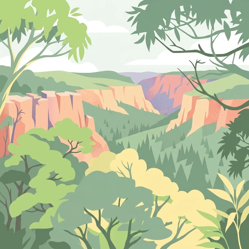
Stylized illustration of a canyon with red rock cliffs and forested areas

Guy Fawkes River National Park

National park

Park overview

Structured park overview, official facts, and landscape profile for Guy Fawkes River National Park

Guy Fawkes River National Park park facts, protected area profile, and essential visitor context

Review the core facts for Guy Fawkes River National Park, including designation, size, terrain, visitor scale, habitats, and operating context in one park-focused overview.

About Guy Fawkes River National Park

Guy Fawkes River National Park occupies a distinctive position on the transition between the New England Tablelands and the Dorrigo Plateau, creating a landscape of remarkable topographic diversity. The park's defining geographic feature is the series of deep river gorges that have been carved over millions of years, with the Guy Fawkes River Valley representing a particularly dramatic example where the river follows the trace of an ancient geological fault. These rugged gorges create isolated wilderness pockets that have remained largely free of development and intensive human disturbance. The park's elevation ranges from the high open country of the tablelands down into the steep-walled valleys below, where the microclimate and vegetation change noticeably as one descends into the gorge environments. Waterfall Way, the main access corridor through the park, follows a route that showcases this transition from plateau to gorge country, providing visitors with views of the park's dramatic terrain. The park's size and remoteness mean that extensive areas remain truly wild, offering a wilderness experience that is increasingly rare in the populated regions of eastern Australia.

Quick facts and research context for Guy Fawkes River National Park

Located approximately 560 kilometres north of Sydney, the park is accessed via Waterfall Way near the small town of Ebor, about 80 kilometres north-east of Armidale. Established in 1972 and classified as IUCN Category Ib wilderness area, the park protects over 100,000 hectares of remote tableland and gorge country. The Guy Fawkes River, Aberfoyle River, Sara River, and Henry River have all carved spectacular rugged gorges through the park's terrain. The park contains 28 threatened plant species and 24 threatened fauna species, reflecting its ecological significance within the broader Northern Rivers region.

Protection and recognition

Analyzing the terrestrial protection framework and documented management boundaries.

Guy Fawkes River National Park Protection Status and Protected Area Designation

Geographic records outline the terrestrial protection status and documented conservation frameworks established for Guy Fawkes River National Park. Verifying official designations and geographic management parameters helps researchers track the administrative boundaries of global protected landscapes.

Protection details

Protection scope
Terrestrial
Transboundary protection
No
Park context

Deeper park guide and search-rich context for Guy Fawkes River National Park

Guy Fawkes River National Park history, landscape, wildlife, and travel context

Explore Guy Fawkes River National Park through its history, landscape character, ecosystems, wildlife, conservation priorities, cultural context, and seasonal travel timing in a structured park guide built for atlas discovery and search intent.

Why Guy Fawkes River National Park stands out

Guy Fawkes River National Park is best known for its spectacular wilderness gorges, particularly the deeply incised Guy Fawkes River Valley that follows an ancient fault line through the park. The dramatic Ebor Falls, where the Guy Fawkes River drops off the Northern Tablelands, represents one of the most visually striking waterfall landscapes in northern New South Wales. The park is also notable for its population of wild horses, direct descendants of Australian wartime cavalry horses known as Walers, which have been recognized as having significant historical, military and cultural heritage value. The park protects one of the most extensive old-growth forest areas in the state.
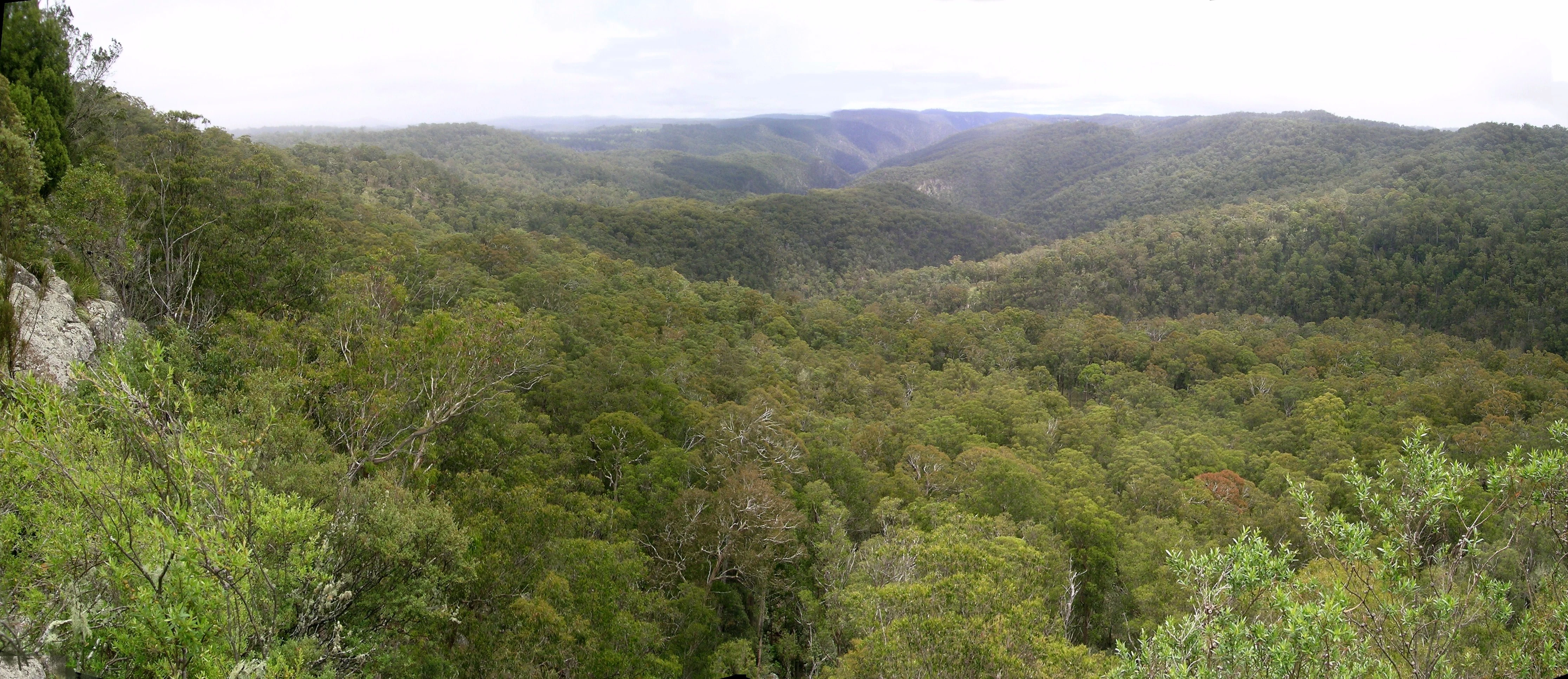
Wide landscape view showing dense green forest covering rolling hills and valleys under a partly cloudy sky
Panoramic view of Guy Fawkes River National Park's forested valleys and hills

Guy Fawkes River National Park history and protected-area timeline

Guy Fawkes River National Park was established in 1972 as a protected wilderness area, recognizing the outstanding natural values of this rugged tableland and gorge landscape. The protection of this area came at a time when awareness of wilderness preservation was growing in Australia, and the park's designation as an IUCN Category Ib wilderness area reflected its exceptional unmodified character. Prior to formal protection, the landscape had been used for pastoral grazing, but the rugged terrain limited the intensity of development compared to surrounding areas. The establishment of the park also recognized the significance of the Guy Fawkes River system and its tributaries, which drain from the high country of the Northern Tablelands into the Clarence River system below. The history of wild horses in the park dates to the 1930s, when horses were introduced to the area. By 2000, the population had grown to approximately 600 animals, leading to a controversial culling program by the NSW National Parks and Wildlife Service. Public response to the cull prompted a heritage assessment, which in 2002 determined that these horses were direct descendants of Australia's wartime cavalry horses and possessed significant historical, military and cultural value. Since then, over 400 horses have been passively trapped and removed from the park, with around 200 finding new homes. A formal register and Stud Book has been established to preserve the unique genetics of this heritage horse population.

Guy Fawkes River National Park landscape and geographic character

The landscape of Guy Fawkes River National Park is defined by a series of deeply incised river valleys that cut through the eastern edge of the New England Tablelands. The most prominent feature is the Guy Fawkes River Valley, which has been carved along the line of an ancient fault, creating a dramatic landscape of steep-sided gorges and rugged river corridors. The river plunges off the tablelands at Ebor Falls, where water drops dramatically over the edge of the plateau into the gorge below. Similar gorges are formed by the Aberfoyle River, Sara River, and Henry River, all of which flow through the park in deeply cut valleys. The terrain is characterized by steep gradients, rocky outcrops, and exposed cliff faces, particularly along the gorge walls where ancient sedimentary rocks are exposed. The high plateau country above the gorges presents a different character, with more open terrain and different vegetation communities suited to the higher elevation and more exposed conditions.

Guy Fawkes River National Park ecosystems, habitats, and plant life

The park supports an exceptional diversity of vegetation, with over 40 different vegetation communities identified within its boundaries. This remarkable botanical richness reflects the park's position at the transition between different bioregions and the variety of microclimates created by the complex topography of gorges, ridges, and plateaus. Significant areas of old-growth forest are protected within the park, representing some of the most intact forest remaining in northern New South Wales. These old-growth forests are characterized by large, mature trees and complex canopy structures that provide habitat for numerous species. The vegetation ranges from wet sclerophyll forests in the gorge environments to more open woodland and heath communities on the exposed ridge tops and plateau areas. The diversity of habitats supports the park's significant threatened species profile, with 28 plant species and 24 animal species listed as threatened under various conservation legislation.

Guy Fawkes River National Park wildlife and species highlights

Guy Fawkes River National Park supports 24 threatened fauna species, reflecting the ecological importance of this diverse landscape. The combination of old-growth forest, riparian corridors, and varied terrain creates habitat for numerous species adapted to wilderness environments. The park's position on the Northern Tablelands places it within a transition zone between different biogeographic regions, supporting species from both cooler highland environments and warmer lowland forests. The riparian zones along the Guy Fawkes River and its tributaries provide important habitat for aquatic species and wildlife that depends on water sources throughout the year. The extensive old-growth forests provide nesting and foraging habitat for forest-dependent birds and arboreal mammals, while the more open country supports different assemblages of ground-dwelling species.

Guy Fawkes River National Park conservation status and protection priorities

The park's designation as an IUCN Category Ib wilderness area reflects its highest level of protection within the international protected area system, recognizing its unmodified character and outstanding natural values. The protection of significant old-growth forest represents a key conservation priority, as these forests are increasingly rare in the cleared and modified landscapes of eastern Australia. The presence of 28 threatened plant species and 24 threatened fauna species underscores the park's role as a critical refuge for species that have declined across much of their former range. The wilderness designation provides strong legal protection for the park's natural values, limiting development and ensuring that the landscape remains in a wild state for future generations. The management of the wild horse population has also become a conservation issue, as while these animals have heritage significance, they also pose threats to sensitive vegetation communities and riparian areas through overgrazing and soil disturbance.

Guy Fawkes River National Park cultural meaning and human context

The cultural context of Guy Fawkes River National Park includes the heritage value of its wild horse population, which has been formally recognized as significant by government heritage assessment. These horses, known as Guy Fawkes Heritage Horses, are direct descendants of Australian cavalry horses (Walers) that served in World War I and World War II. The heritage study completed in 2002 found these horses had significant historical, military and cultural value, representing the only group of Australian wild horses with proven heritage significance. The Bicentennial National Trail, established in the 1970s, was plotted to run along the western side of the Guy Fawkes River on what was historically a travelling stock route, connecting the park to the broader heritage of pastoral movement through the Australian landscape.

Top sights and standout views in Guy Fawkes River National Park

The spectacular Ebor Falls, where the Guy Fawkes River drops dramatically from the Northern Tablelands, represents one of the park's most iconic landscapes. The deeply incised Guy Fawkes River Valley, following an ancient fault line through the park, offers dramatic gorge scenery that remains largely inaccessible and truly wild. The extensive old-growth forests, some of the most intact remaining in northern New South Wales, provide a glimpse of what much of the region's pre-colonial landscape would have resembled. The park's wilderness classification ensures that large areas remain in a natural state, offering remote backcountry experiences for those seeking truly unmodified landscapes.

Best time to visit Guy Fawkes River National Park

The park can be visited throughout the year, with the cooler months of autumn and winter offering pleasant conditions for exploring the tableland areas. Summer and early autumn can bring thunderstorm activity to the Northern Tablelands, with dramatic cloud formation and rainfall contributing to the water flow at Ebor Falls. The higher elevation of the park means that winter temperatures can be cold, particularly in the gorge bottoms where cold air pools. Spring offers the opportunity to see wildflowers in bloom across the plateau areas and a good time to observe the park's birdlife as breeding activity increases.

Monthly climate preview

Historical temperature ranges and daily precipitation patterns across the annual cycle

Guy Fawkes River National Park Monthly Climate Normals and Weather Patterns

Long term climatology at the representative elevation of 631 meters reveals mean temperatures spanning from a cool 9.5 degrees Celsius in July to a warm 21.5 degrees Celsius in January. Accessing the complete monthly profile provides the detailed weather by month averages including daily precipitation rates and historical temperature extremes.
Annual mean16 °C
10 °C22 °C
Jan22°
Feb21°
Mar19°
Apr16°
May13°
Jun10°
Jul10°
Aug11°
Sep14°
Oct17°
Nov19°
Dec20°
Warmest month
January

21.5 °C

Coolest month
July

9.6 °C

Wettest month
February

5.7 mm/day

Driest month
July

1.3 mm/day

Park location guide

Geography guide, regional context, and park location map for Guy Fawkes River National Park

Guy Fawkes River National Park park geography, regions, and map view in Australia

Understand where Guy Fawkes River National Park sits in Australia through a broader geographic reading of the surrounding landscape, nearby location context, and its mapped position within the national park landscape.

How Guy Fawkes River National Park fits into Australia

Australia is a constitutional monarchy and federal parliamentary democracy comprising six states and ten territories. With a population of nearly 28 million, it is one of the world's most urbanised countries, with most people concentrated on the eastern seaboard. The country has a high Human Development Index and is known for its cultural diversity, ancient Aboriginal heritage, and unique wildlife.

Wider geography shaping Guy Fawkes River National Park in Australia

Australia occupies the entire Australian continent, the island of Tasmania, and numerous smaller islands. It is the world's flattest and driest inhabited continent, featuring vast deserts in the interior (the Outback), tropical rainforests along the eastern coast, and a coastline bordering the Indian and Pacific Oceans.

Map view of Guy Fawkes River National Park

Use this park location map to pinpoint Guy Fawkes River National Park in Australia, understand its exact geographic position, and read its mapped placement within the surrounding landscape more clearly.

Pigeon | © OpenStreetMap contributors

Location context for Guy Fawkes River National Park

New South Wales
Natural feature types

Explore Geographic Features of Guy Fawkes River National Park

Navigate through the diverse natural features that shape the rugged wilderness and gorge landscapes of Guy Fawkes River National Park. MoriAtlas provides a structured look at the landforms and river systems defining this significant protected area.
Recorded earthquake history

Explore Historical Earthquake Records for Guy Fawkes River National Park

Review the documented seismic history associated with this diverse wilderness area. MoriAtlas provides a structured catalogue of events, offering insight into historical activity patterns through recorded epicentre data and magnitude statistics, distinct from predictive hazard assessments.

Guy Fawkes River National Park Earthquake Records

Catalogued events

1 event

Strongest magnitude

Magnitude 3.3

Most recent event

Oct 11, 1981

This history includes earthquakes recorded inside the park or within 50 km of its borders

Discover the Rugged Terrain, Deep River Valleys, and Old-Growth Forest Habitats of This Australian Protected Area Through Key Imagery

Guy Fawkes River National Park Photos, Landscape, and Scenery: Visual Exploration of Wilderness Gorges

Explore the distinctive landscapes of Guy Fawkes River National Park through a curated collection of photos, revealing its dramatic gorges, iconic Ebor Falls, and sprawling old-growth forests. These images offer visual context for the park's rugged terrain, unique habitats, and remote wilderness character, aiding a deeper understanding of its geographic and conservation significance.

Wide landscape view showing dense green forest covering rolling hills and valleys under a partly cloudy sky

Dense green forest covering a steep hillside with rocky cliffs and a narrow river visible in the background

Park atlas

Map nearby protected areas and national parks to extend your exploration beyond Guy Fawkes River National Park, comparing diverse regional landscapes.

Explore Related National Parks and Protected Areas Near Guy Fawkes River National Park

After exploring Guy Fawkes River National Park's wilderness gorges and old-growth forests, discover other national parks and protected areas that share its regional geography in New South Wales. This curated selection allows for direct comparison of adjacent conservation landscapes, helping you trace the geographic distribution of Australia's remarkable natural heritage.
National parkNorthern Tablelands
Park boundaries overlap#1 closest

East

Chaelundi National Park: Landmark Old-Growth Forest Protection in the Northern Tablelands

Mapped protected area landscape and regional geography.

Chaelundi National Park stands as a vital component of protected natural landscapes on Australia's Northern Tablelands. This national park is celebrated for its extensive old-growth forest, a direct result of significant environmental legal battles that highlighted its ecological importance. With declared wilderness areas covering thousands of hectares, the park offers a substantial glimpse into the region's conservation values and the complex interplay between landscape, law, and protected land status, providing rich context for geographic exploration.

Area
191.74 km²
Established
1997
IUCN
II
Relief
Highland
National parkNew South Wales
0.2 km away#2 closest

South

Cathedral Rock National Park: New South Wales Protected Landscape and Geography

Explore mapped boundaries and regional natural context.

Delve into Cathedral Rock National Park, a designated national park located in New South Wales, Australia. This detailed view focuses on its protected landscape characteristics, offering insights into its mapped geographic features and its position within the broader regional atlas. Understand the park's terrain and its contribution to the natural landscape context of its location for comprehensive exploration.

Area
89 km²
Established
1978
IUCN
II
Relief
Mountain
National parkNew South Wales
5.2 km away#3 closest

North

Barool National Park: National Park Discovery and Geographic Context

Mapped protected area within New South Wales.

Barool National Park is identified as a protected national park, contributing to the rich tapestry of natural landscapes across New South Wales. Understanding its specific location and mapped boundaries is essential for appreciating its role within the regional geography of Australia. This entry provides a factual basis for exploring the park's identity as a defined protected area, offering a unique point of reference for geographic discovery.

Area
112.44 km²
Established
1999
IUCN
II
Climate
Temperate
National parkNew South Wales
5.5 km away#4 closest

South

New England National Park: Escarpment Landscape and Protected Area Discovery in New South Wales

Explore dramatic cliffs, ancient rainforests, and diverse ecosystems.

New England National Park represents a critical protected landscape on the eastern edge of New South Wales' Northern Tablelands. This area is characterized by its spectacular escarpment country, featuring impressive cliffs, rugged ridges, and deep valleys that cradle some of Australia's most botanically rich environments. As a designated national park, it preserves ancient ecosystems and offers unique opportunities for atlas-based geographic discovery of its mapped terrain and wilderness character.

Area
673 km²
Established
1937
IUCN
Ib
Relief
Mountain
Nature reserveNew South Wales
About 7.6 km away#5 closest

Southeast

Mount Hyland Nature Reserve: An Ancient Rainforest Sanctuary in the New England Highlands

High-elevation protected terrain in New South Wales

Mount Hyland Nature Reserve protects a 2,519-hectare tract of highland country dominated by a triple-peaked mountain mass. This important conservation area features ancient temperate rainforests of common sassafras and provides a critical habitat for rare fauna in the rugged landscape of the New England region.

Area
25.19 km²
Established
1984
IUCN
Ia
Relief
Mountain
National parkNew South Wales
8 km away#6 closest

West

Warra National Park: Protected Landscape Identity and Geographic Setting in New South Wales

Mapped boundaries and regional natural terrain context.

Warra National Park represents a key protected area, offering critical insights into the natural geography of New South Wales, Australia. This detail page focuses on its identity as a national park, detailing its mapped boundaries and the surrounding landscape context. Understand the specific geographic features and the protected land designation that define Warra National Park, enhancing your atlas exploration with precise regional details.

Area
19.2 km²
Established
1999
IUCN
II
Relief
Highland
National parkNew South Wales
8.8 km away#7 closest

Northeast

Nymboida National Park: A Protected National Park in New South Wales with Mapped Geographic Context

Explore its protected landscape and regional park geography

Nymboida National Park is a key protected area within the state of New South Wales, Australia. This page provides essential details for atlas exploration, focusing on its mapped boundaries and the geographic context it occupies. Understand the park's identity as a national park and its contribution to the protected landscape of the region, offering insights into its natural terrain and regional distribution.

Area
316 km²
Established
1980
IUCN
Ib
Relief
Mountain
Nature reserveNew South Wales
About 10 km away#8 closest

Northwest

Mann River Nature Reserve: Geography and Protected Forest Terrain in New South Wales

Highland river valleys and Great Dividing Range landscapes

Spanning over 7,000 hectares of rugged highland terrain, Mann River Nature Reserve provides a vital protected habitat within the Northern Tablelands. The landscape is defined by the incision of the Mann River through deep, forested gorges and sharp mountain ridges, creating a distinct physical setting that serves as a sanctuary for native Australian wildlife.

Area
71.28 km²
Established
1985
IUCN
II
Relief
Mountain

Common questions about visiting, size, designation, and location context for Guy Fawkes River National Park

Guy Fawkes River National Park FAQs for park facts, access, geography, and protected area context

Find quick answers about Guy Fawkes River National Park, including protected-area facts, park geography, trail and visitor context, and how the park fits into its surrounding country and regional landscape.
MoriAtlas Explorer

Continue Your Protected Areas Search Across the Global Atlas

Deepen your exploration by continuing the structured search for national parks and protected areas worldwide. Utilize the comprehensive filtering capabilities to compare different conservation landscapes and refine your understanding of global park geography. Discover more about the distribution and characteristics of protected natural areas.

Global natural geography