Why Little Wilson Creek Wilderness stands out
The wilderness is best known for its high-elevation position on a shelf roughly 4,800 feet above sea level, where northern hardwood and spruce-fir forest communities rise above the more typical southern Appalachian oak-hickory cover. It is also known for unusual plant communities recognized by the Virginia Natural Heritage Program, including bog habitat along Little Wilson Creek and a conifer-northern hardwood forest above 4,400 feet on Third Peak. Its combination of grassy balds, old-growth remnants, rare Appalachian flora, and proximity to Grayson Highlands State Park makes it a signature southern Appalachian wilderness experience.
Little Wilson Creek Wilderness history and protected-area timeline
Little Wilson Creek Wilderness was designated by Congress in 1984 under the Eastern Wilderness Act, placing it within the National Wilderness Preservation System and committing the area to long-term protection in its natural condition. As part of this system, the wilderness was intended to preserve natural plant and animal communities and to contribute to the diversity of regional gene pools that sustain more than half of the United States' ecosystems in protected form.
The land itself carries deep traces of past human use. Much of the area was logged and burned in the early twentieth century, and State Route 613 along the western border follows the old grade of a railroad used to haul out that timber. The forest of today is largely 21 to 100 years old as a result, though patches of older growth survive. Following designation in 1984, the U.S. Forest Service assumed management responsibility and continues to administer the wilderness through the Mount Rogers National Recreation Area under regulations that restrict motor vehicles, motorized equipment, and mountain bikes, while limiting group size and imposing camping rules designed to preserve the wilderness character.
Little Wilson Creek Wilderness landscape and geographic character
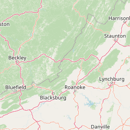
The wilderness lies within the Southern Blue Ridge Mountains subsection of the Central Appalachian Broadleaf Coniferous Forest-Meadow Province, shaped by long-term tectonic uplift that lifted the ridges to their current elevations. Elevations rise from about 3,220 feet in the south to roughly 4,857 feet in the north, with most of the area sitting above 4,000 feet. From this elevated core, the terrain rolls out into a network of streams, ridges, and balds.
The eastern edge of Pine Mountain forms the central spine of the wilderness, marked by three named summits, First Peak, Second Peak, and Third Peak, that tower above the run. Bearpen Ridge extends southward from Pine Mountain, and beyond the ridges lie large open grassy balds that contrast with the dense forest cover. Little Wilson Creek itself begins on the southeastern slope of Pine Mountain in a rare high-elevation bog and flows southeast through the wilderness to join Wilson Creek, which then separates the wilderness from Grayson Highlands State Park. The northeastern portion of the area is drained by Mill Creek and Solomon's Branch, both of which flow into Fox Creek; Solomon's Branch is notable for a forty-foot waterfall along its course.
Little Wilson Creek Wilderness ecosystems, habitats, and plant life
The plant communities of Little Wilson Creek Wilderness reflect its elevation, exposure, and complex geological history. Below the highest ridges, the typical southern Appalachian oak-hickory forest provides the baseline cover, with species such as white oak, northern red oak, basswood, cucumber tree, white ash, eastern hemlock, and red maple. At higher elevations, this transitions into forest types that feel decidedly northern: yellow birch, American beech, and sugar maple appear alongside Fraser magnolia, and above roughly 4,400 feet on Third Peak, a conifer-northern hardwood community develops. This high-elevation forest includes American beech, yellow birch, sugar maple, mountain maple, striped maple, and red spruce, while pockets of true spruce-fir forest crown the upper slopes.
Because much of the area was logged and burned in the early twentieth century, most of the existing timber is between 21 and 100 years old, but significant old-growth forest also remains. The unusual assembly of habitats here is notable enough that one of the area's natural communities is recognized by the Virginia Natural Heritage Program for its uncommon plant composition, and part of the Little Wilson Creek Headwaters Special Biological Area lies within the wilderness boundaries.
Little Wilson Creek Wilderness wildlife and species highlights
The wildlife community of Little Wilson Creek Wilderness reflects both its southern Appalachian setting and its high-elevation forest conditions. Typical large and game species such as white-tailed deer, black bear, ruffed grouse, and bobwhite quail are found throughout the area. The wilderness is also an important habitat for species more commonly associated with the broader Appalachian landscape, including the northern flying squirrel and more than 21 species of salamanders, reflecting the moist, high-elevation forest understory.
Birdlife adds further character to the area. The hermit thrush, a species regarded as extremely rare in Virginia, is common here, underscoring the wilderness's role as a refugium for typically montane bird species. Together with the rare plant communities described elsewhere, the presence of these species makes the area a meaningful stronghold for Appalachian biodiversity.
Little Wilson Creek Wilderness conservation status and protection priorities
Little Wilson Creek Wilderness plays a meaningful conservation role within the broader Southern Blue Ridge and Mount Rogers landscape. Designated as a Wilderness Area in 1984, it is managed to maintain its present natural condition, free from motor vehicles, motorized equipment, and mountain bikes, with group-size limitations to keep visitor impact low. These management choices support the long-term integrity of its forests, streams, and sensitive high-elevation habitats.
At a larger scale, the wilderness helps safeguard more than half of the distinct ecosystems that occur within U.S. wilderness areas, contributing to the national effort to maintain plant and animal gene pools. It also preserves a recognized Virginia Natural Heritage community, rare plant populations, the Little Wilson Creek Headwaters Special Biological Area, and the upper headwaters that feed into the New River drainage, all of which strengthen the conservation fabric that stretches across the Mount Rogers Cluster and the surrounding national recreation area.
Little Wilson Creek Wilderness cultural meaning and human context
Although the wilderness is managed primarily for its natural values, the surrounding landscape holds visible traces of early twentieth-century logging and railroad activity that shaped the modern forest. State Route 613 along the western border of the area follows the old grade of a railroad used to haul timber out of the high country, a reminder that today's recovering forests sit atop land that was once intensively worked. Nearby place names such as Scales, where cattle were once corralled and weighed after summering in the high mountain pastures, hint at the long tradition of seasonal high-country grazing that continues to influence the open balds and grassy areas the wilderness now protects.
Top sights and standout views in Little Wilson Creek Wilderness
Few wilderness areas pack so much ecological diversity into such a compact footprint. Little Wilson Creek Wilderness combines high-elevation spruce-fir and northern hardwood forests with older oak-hickory stands, open grassy balds, rare high-country bogs, and a waterfall on Solomon's Branch, all linked by a trail network that connects to the Appalachian Trail and to neighboring Grayson Highlands State Park. Its mix of old-growth remnants, second-growth forest, designated biological areas, and rare Appalachian flora and fauna make it a standout destination within the Mount Rogers Cluster.
Best time to visit Little Wilson Creek Wilderness
Little Wilson Creek Wilderness's high-elevation setting means that seasons strongly shape the experience of a visit. Late spring and early summer bring mild temperatures and active wildlife, and are a good window for observing wildflowers and the area's rare plant communities. Summer provides comfortable hiking weather in the upper forests and balds, though afternoon storms are common in the southern Appalachians. Fall is widely considered a peak season, when cool nights turn the high-elevation hardwoods into vivid displays of color and the open balds offer long views across the surrounding ridges. Winter brings snow, ice, and dramatically reduced crowds, but trails above 4,000 feet become more demanding, and visitors should expect winter conditions at the higher elevations for much of the season.