Mori Atlas logo
State or regional parkMacMillan Provincial Park

Explore the geographic boundaries of this coastal temperate rainforest and river delta ecosystem.

MacMillan Provincial Park: An Ancient Old-Growth Forest Landscape in British Columbia

MacMillan Provincial Park preserves a unique old-growth Douglas fir stand known as Cathedral Grove, situated between the eastern dry forests and wetter coastal terrain of Vancouver Island. This protected area encompasses the Cameron River delta and the western shoreline of Cameron Lake, functioning as a critical ecological transition zone in the British Columbia landscape. The park provides an accessible view of massive, multi-centennial timber stands within a distinct river-valley corridor.

old-growth forestDouglas firtemperate rainforestcoastal forestfreshwater lakeriver delta

MacMillan Provincial Park

State or regional park

Park overview

Structured park overview, official facts, and landscape profile for MacMillan Provincial Park

MacMillan Provincial Park park facts, protected area profile, and essential visitor context

Review the core facts for MacMillan Provincial Park, including designation, size, terrain, visitor scale, habitats, and operating context in one park-focused overview.

About MacMillan Provincial Park

MacMillan Provincial Park occupies a narrow but ecologically rich slice of central Vancouver Island, positioned where the island's eastern dry-forest climate gives way to the wetter conditions of its west coast. The park follows Highway 4 and the Island Rail Corridor, hugging the rugged western shore of Cameron Lake and extending along the delta where the Cameron River flows into the lake. This setting places the park at a natural transition point between two of British Columbia's most important biogeoclimatic zones.

The ecological centerpiece of MacMillan is Cathedral Grove, a 157-hectare remnant of old-growth forest that has survived more than a century of intense logging pressure elsewhere on Vancouver Island. Cathedral Grove is distinguished by towering Douglas firs, many of them several centuries old, that rise from a dense understory of western redcedar, western hemlock, bigleaf maple, and grand fir. Beneath the canopy, the forest floor is layered with red huckleberry, salal, and devil's club, creating a classic temperate rainforest understory.

What makes MacMillan particularly significant among British Columbia's protected areas is its accessibility. It is the only park in the province where a major public highway passes directly through a protected old-growth Douglas-fir stand, allowing visitors to engage with ancient forest without venturing into remote terrain. This unique combination of ecological value and visitor access has shaped both the park's fame and its management challenges over the decades.

The park's setting on Cameron Lake and along the Cameron River also adds freshwater habitat to the conservation portfolio. The river and lake are actively stocked with rainbow, brown, and cutthroat trout, creating both recreational fisheries and aquatic habitat complexity. Together, the old-growth forest, river delta, and lakeshore landscape give MacMillan a layered identity that goes well beyond its iconic grove.

MacMillan's importance is also cultural and historical. It protects culturally modified trees documented as far back as AD 1137, evidence of long Indigenous presence in the area, and it represents a landmark conservation success in British Columbia's forestry history, having been preserved through a major industrial-era land donation rather than through top-down state acquisition alone.

Quick facts and research context for MacMillan Provincial Park

MacMillan Provincial Park covers 301 hectares of central Vancouver Island in British Columbia, Canada, and is managed by BC Parks under the Class A provincial park designation. It lies along Highway 4 between Port Alberni and Qualicum Beach and protects a portion of the Cameron River delta and the western shoreline of Cameron Lake.

The park's defining feature is Cathedral Grove, a 157-hectare old-growth forest dominated by ancient Douglas fir, with western redcedar, western hemlock, bigleaf maple, and grand fir as significant companion species. Established in 1947 through a major timber donation, the park is British Columbia's primary highway-accessible sanctuary of old-growth Douglas fir.

Protection and recognition

Examining documented terrestrial protection parameters and administrative scope

MacMillan Provincial Park Protection Status and Regional Conservation Scope

MacMillan Provincial Park maintains a documented terrestrial protection scope within the regional conservation network. Structured conservation records provide verified administrative metrics for ongoing park management analysis.

Protection details

Protection scope
Terrestrial
Transboundary protection
No
Park context

Deeper park guide and search-rich context for MacMillan Provincial Park

MacMillan Provincial Park history, landscape, wildlife, and travel context

Explore MacMillan Provincial Park through its history, landscape character, ecosystems, wildlife, conservation priorities, cultural context, and seasonal travel timing in a structured park guide built for atlas discovery and search intent.

Why MacMillan Provincial Park stands out

MacMillan Provincial Park is best known for Cathedral Grove, an ancient old-growth stand of enormous Douglas fir trees, some of which exceed 800 years in age and reach roughly 9 metres in circumference. The grove is recognized as the only old-growth Douglas-fir forest in British Columbia that can be experienced directly from a major public highway, making it a singular destination for visitors interested in old temperate rainforest. Beyond its trees, the park is valued as a transitional ecological zone, sitting at the overlap of Vancouver Island's dry Coastal Douglas-fir zone and its wetter Coastal Western Hemlock zone. The combination of monumental trees, accessible location, and ecological transition has made MacMillan one of the most famous provincial parks in British Columbia.
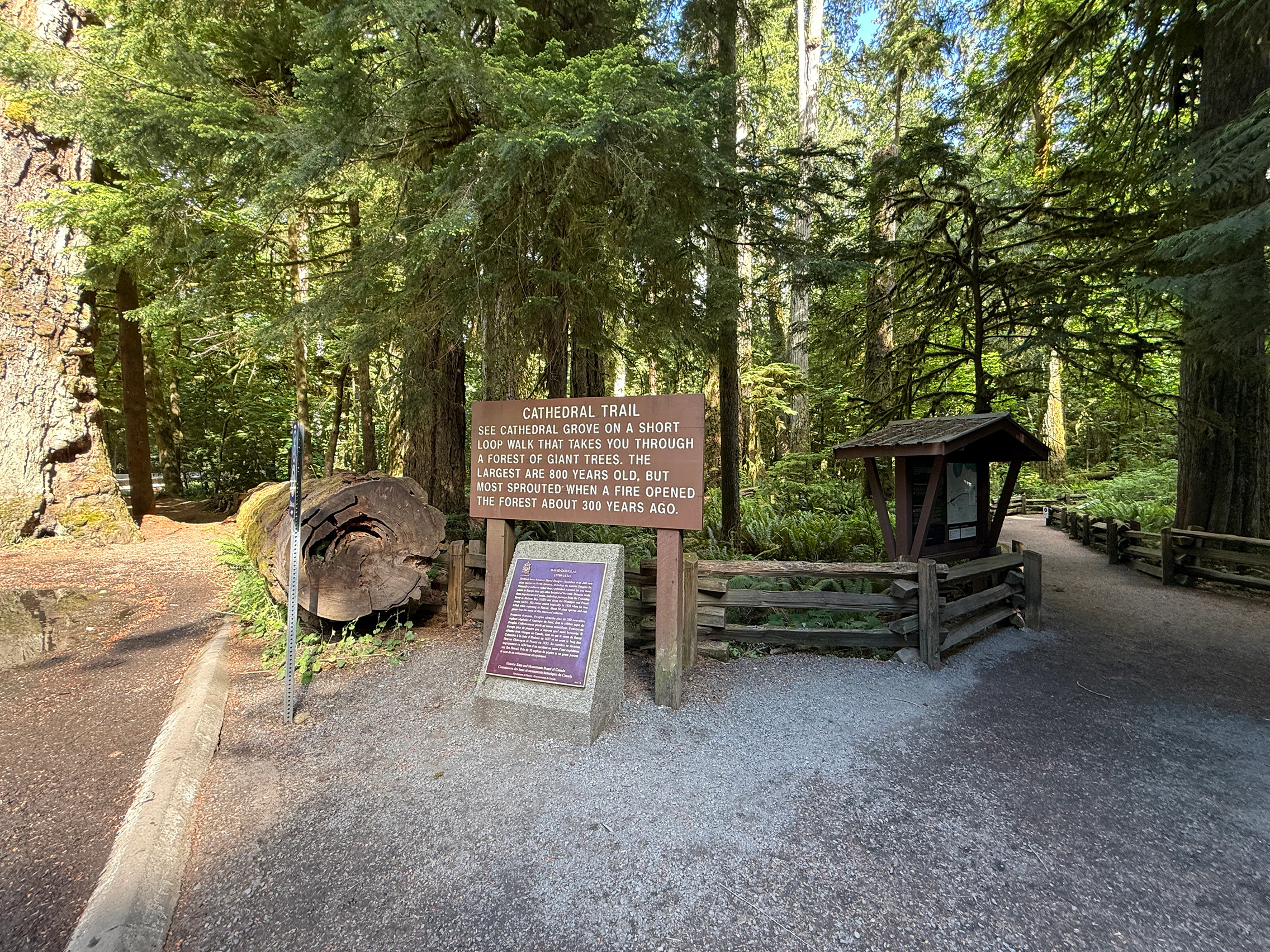
A brown information sign titled Cathedral Trail stands in a forest, with a smaller plaque below and a dirt path leading into the trees.
The entrance to the Cathedral Trail in MacMillan Provincial Park, featuring interpretive signage and large ancient trees.

MacMillan Provincial Park history and protected-area timeline

Long before MacMillan became a park, the area around Cathedral Grove was part of the traditional territory of Indigenous peoples, who appear to have used the forest for ceremonial purposes well before sustained European contact arrived on Vancouver Island in the mid-19th century. Researchers have documented culturally modified western redcedar trees in and around the grove, some of which carry evidence of bark harvesting dating back to AD 1137, indicating an extraordinarily long record of human interaction with the forest.

The name Cathedral Grove is itself a product of the early twentieth century. It is commonly attributed to the Viscount Willingdon, Governor General of Canada, during a 1928 visit, and the name quickly entered correspondence with the provincial government. By the 1920s and 1930s Cathedral Grove was already a popular stop for travellers on Vancouver Island, even though the land remained privately owned and was surrounded by active logging operations.

Throughout the early twentieth century the public repeatedly pressured the provincial government and the surrounding timber industry to protect the grove. H.R. MacMillan, who had served as British Columbia's first chief forester and later ran the large H.R. MacMillan Export Company (which became MacMillan Bloedel), became the central figure in the park's eventual creation. After years of resisting public demands, he agreed in 1944 to donate the company's 136 hectares of Cathedral Grove timber holdings to the province in recognition of the forest's unique character. In 1947 the area was formally established as a Class A provincial park, becoming one of the most prominent conservation donations in British Columbia's history.

The late twentieth century brought new pressures to the park. Logging of the upper Cameron Valley, outside the park boundary, altered runoff patterns and weakened the forest's resilience. Severe storms in 1990 and again in 1997 caused extensive blowdown and streambank damage, and the park suffered further storm impacts in December 2018 and November 2024. Beginning in the 1990s, BC Parks undertook trail rehabilitation programs to reduce visitor-driven compaction and damage, recognizing that the park's popularity had become a conservation challenge in its own right.

MacMillan Provincial Park landscape and geographic character

MacMillan Provincial Park lies in a transition landscape between the drier east coast of Vancouver Island and the wetter, more rugged terrain to the west. Its physical setting is defined by the long, narrow valley corridor that follows Highway 4 and the Island Rail Corridor, the western shoreline of Cameron Lake, and the delta of the Cameron River where the river enters the lake.

The terrain is shaped by glacial and fluvial processes typical of central Vancouver Island, with relatively low elevations, rolling forested slopes, and a lake-and-river valley rather than dramatic mountain relief. Cathedral Grove itself sits on relatively flat to gently sloping terrain, allowing its enormous trees to develop deep root systems in rich, moisture-retentive soils fed by the wet coastal climate.

The presence of Cameron Lake gives the park a clear freshwater shoreline component, while the Cameron River delta adds a softer, sediment-rich landscape feature. The combination of old-growth forest, lakeshore, river delta, and valley terrain creates a compact but visually diverse landscape within a relatively small protected footprint.
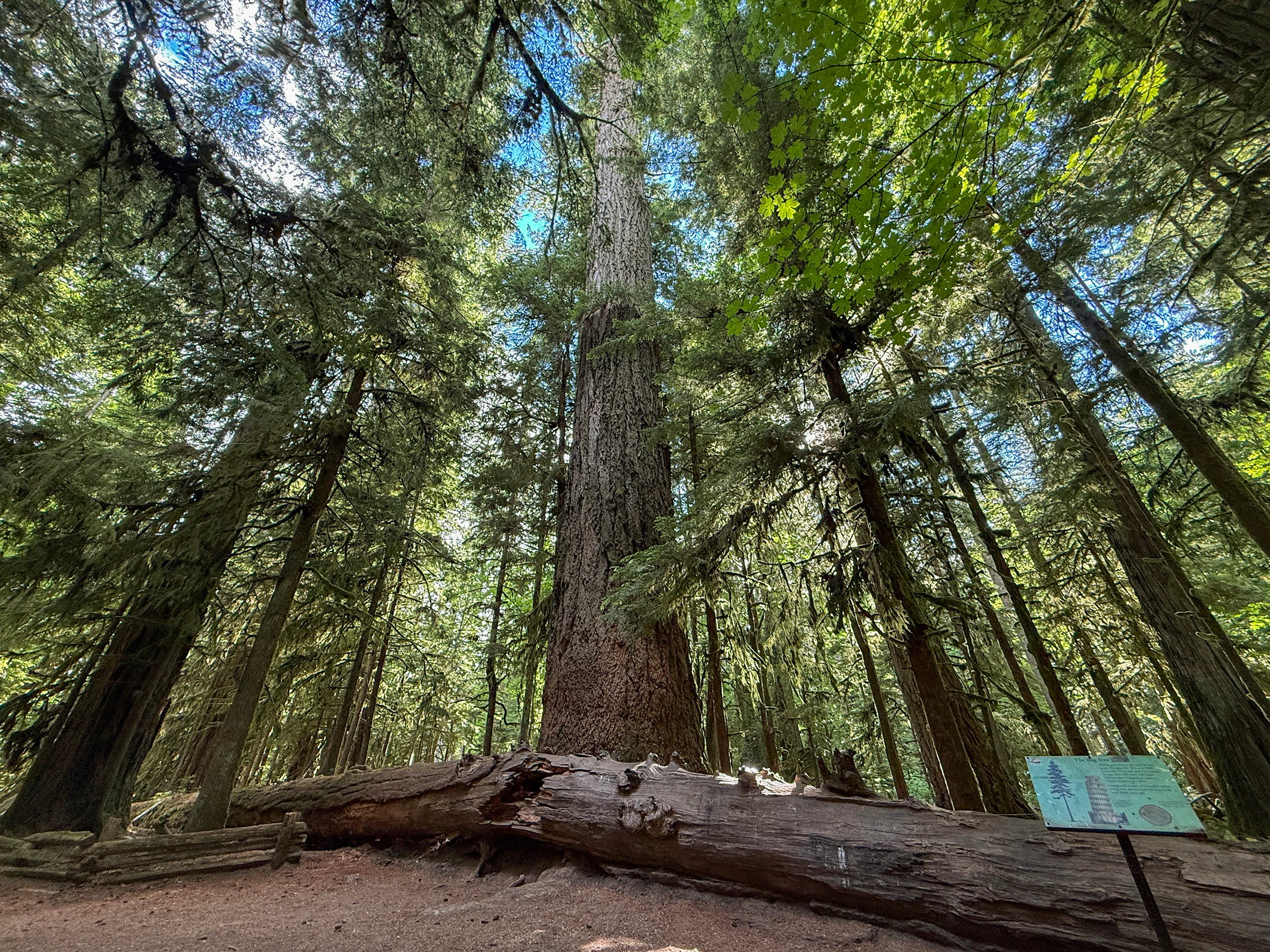
A low-angle view looking up at a massive, ancient Douglas fir tree surrounded by a dense forest in Cathedral Grove, with a fallen tree log in the foreground and a small interpretive sign on the right.
An ancient, towering Douglas fir tree within the Cathedral Grove section of MacMillan Provincial Park.

MacMillan Provincial Park ecosystems, habitats, and plant life

The forest of MacMillan Provincial Park exists at a meaningful ecological threshold. The park sits precisely on the meeting point between the Coastal Douglas-fir Biogeoclimatic Zone (CDF), which shapes the drier eastern side of Vancouver Island, and the Coastal Western Hemlock Biogeoclimatic Zone (CWH), which dominates the wetter western coast. This transition creates a forest that blends characteristics of both zones, enriching both species composition and structural complexity.

Above the canopy, old-growth Douglas fir dominates Cathedral Grove, with some specimens exceeding 800 years of age and roughly 9 metres in circumference. Beneath and around the Douglas fir, the forest includes tall stands of western redcedar, particularly in moister pockets, as well as western hemlock, bigleaf maple (notably distributed south of Highway 4), and grand fir. The result is a multi-layered temperate rainforest that reflects the climatic gradient the park straddles.

The understory of MacMillan is classic Pacific Northwest rainforest, with red huckleberry, salal, and devil's club thriving in the shaded lower layers. The shaded, humid microclimate beneath the ancient canopy supports moisture-loving plants and contributes to the dense, sheltered feeling that gives Cathedral Grove its cathedral-like atmosphere. The Cameron River delta and shoreline support a different ecological community, tied to freshwater, sediment, and riparian processes rather than upland old-growth dynamics.
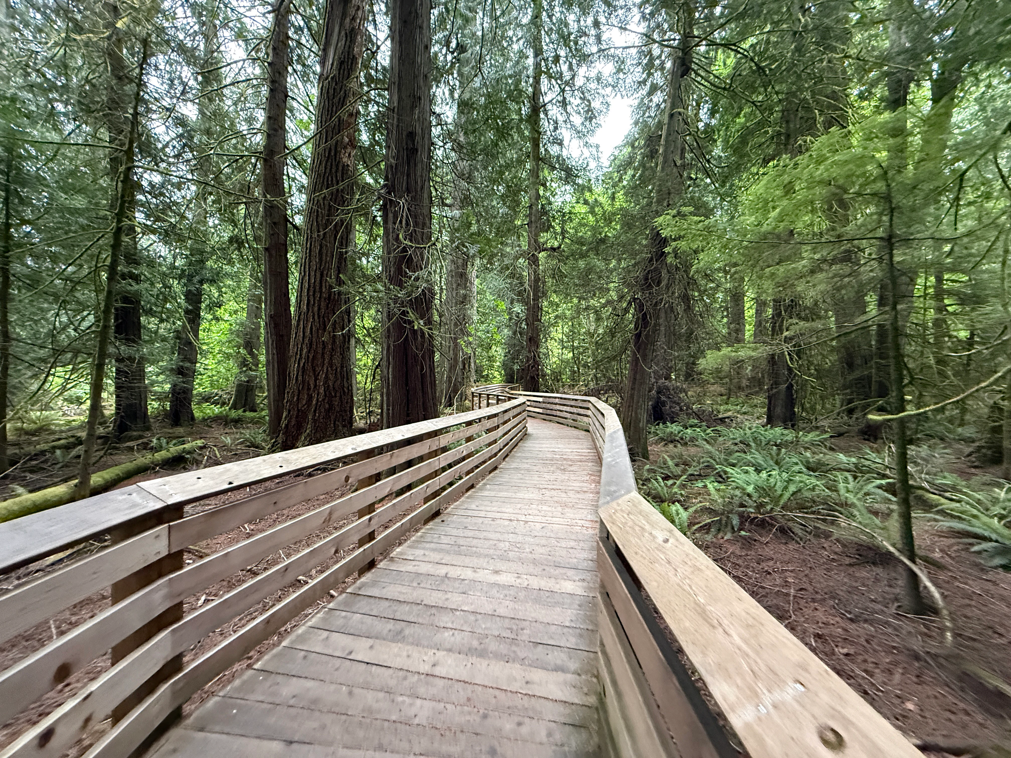
A wooden boardwalk trail framed by railings curves through a dense forest of tall old growth trees and ferns.
A wooden boardwalk winding through the ancient old growth forest of Cathedral Grove.

MacMillan Provincial Park wildlife and species highlights

MacMillan Provincial Park supports a typical central-Vancouver-Island forest fauna shaped by its mix of old-growth canopy, riparian habitat, and lakeside environments. The ancient trees of Cathedral Grove provide nesting cavities, perches, and foraging substrate for forest birds, including owls and woodpeckers, both of which depend on large old trees for survival.

Mammals recorded in and around the park include deer, black bear, elk, and cougar, all of which thrive in the mosaic of old-growth and adjacent younger forest typical of the region. The presence of large predators such as cougar and black bear reflects the ecological integrity of the surrounding landscape, even though the park itself is a relatively small protected area.

The freshwater systems within the park add an additional wildlife dimension. Cameron Lake and the Cameron River are home to populations of rainbow, brown, and cutthroat trout maintained through stocking, creating both angling opportunities and a freshwater predator-prey system that supports other aquatic and riparian life. Together, the terrestrial and aquatic wildlife of the park reflect the biodiversity expected of a transitional coastal temperate forest ecosystem on Vancouver Island.
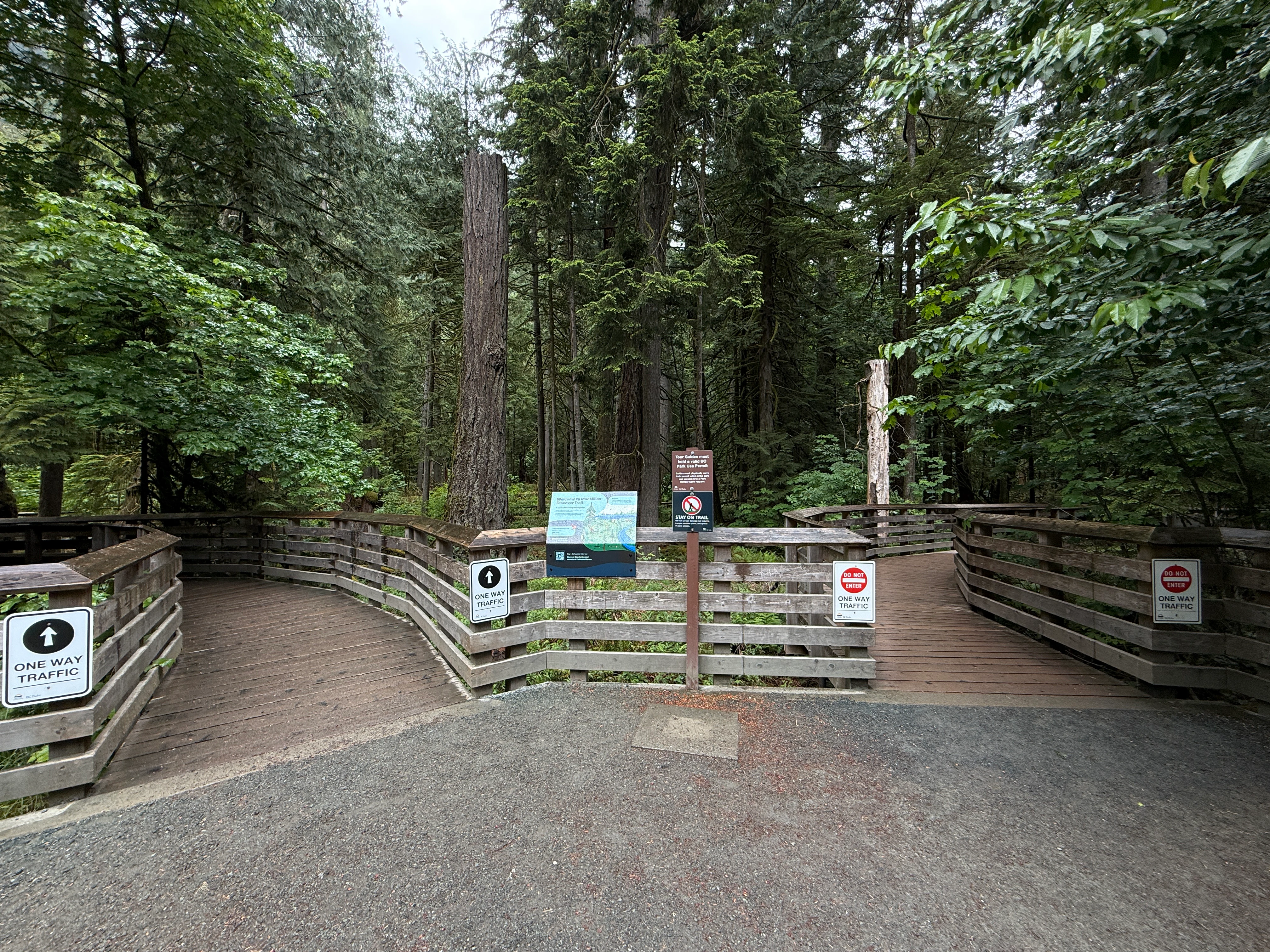
A gravel area leads to a split wooden boardwalk entrance in a forest. Signs on the wooden railings indicate one-way traffic, and a central information board stands between the two paths.
The entrance to the Cathedral Grove trail in MacMillan Provincial Park, featuring wooden boardwalks leading into an old growth forest.

MacMillan Provincial Park conservation status and protection priorities

MacMillan Provincial Park's primary conservation significance lies in its protection of an accessible old-growth Douglas-fir stand at a time when such forests have become vanishingly rare on Vancouver Island. Cathedral Grove represents not only an intact biological community but also a genetic and ecological reservoir for ancient-forest species, including trees, understory plants, cavity-nesting birds, and associated fungi and invertebrates.

The park also plays an important role in conserving the ecological transition between the Coastal Douglas-fir and Coastal Western Hemlock biogeoclimatic zones. Because this transition is sensitive to changes in moisture, temperature, and disturbance regime, protecting a representative piece of the gradient has value beyond the park's modest size.

Conservation management at MacMillan has grown more complex over time as logging, climate, and visitation pressures have intensified. Storm damage in 1990, 1997, 2018, and 2024 has repeatedly stressed the grove, while BC Parks' trail rehabilitation efforts reflect a recognition that visitor impact is itself a conservation concern. The park's ongoing challenge is preserving ancient-forest integrity while accommodating the very public access that has made it iconic.

MacMillan Provincial Park cultural meaning and human context

The cultural landscape of MacMillan Provincial Park reaches back more than nine centuries. Culturally modified trees in and near Cathedral Grove, particularly western redcedar trees with documented bark-stripping, carry evidence of use by Indigenous communities as early as AD 1137, well before sustained European presence on Vancouver Island. The park subsequently came to carry a powerful cultural meaning in British Columbia's environmental and forestry history.

The naming of Cathedral Grove by the Governor General in 1928, followed by decades of public campaigning to protect the forest, reflects how the grove became a cultural symbol of the tension between industrial logging and conservation on Vancouver Island. The eventual donation of the timber lands by H.R. MacMillan in 1944 turned the park into a landmark case of industrial-era philanthropy shaping public conservation outcomes, and MacMillan's name on the park keeps that story visible.

Top sights and standout views in MacMillan Provincial Park

The defining highlight of MacMillan Provincial Park is the Cathedral Grove stand of ancient Douglas fir, where individual trees exceed 800 years in age and produce the towering, cathedral-like atmosphere for which the grove is named. Equally important is the park's role as the only highway-accessible old-growth Douglas-fir forest in British Columbia, a status that has made it both a global visitor draw and a key conservation showcase.

Beyond the grove, MacMillan's setting on Cameron Lake and along the Cameron River delta adds freshwater and riparian character to the experience, while the biogeoclimatic transition between Vancouver Island's eastern dry forests and its western wet forests gives the park unusually rich ecological diversity for its size.

Best time to visit MacMillan Provincial Park

MacMillan Provincial Park is open year-round as a temperate coastal forest experience, but the character of a visit shifts meaningfully with the seasons. Late spring through early autumn generally offers the most comfortable conditions for walking among the giant trees and enjoying the lakeshore, while winter months bring cooler, wetter weather that emphasizes the rainforest character of the grove.

Visitors seeking the calmest experience may prefer shoulder seasons, when Cathedral Grove receives fewer tour buses and the forest can be appreciated in relative quiet. Storm events, which have shaped the grove repeatedly over the decades, can briefly close or restrict access to damaged areas and should be considered when planning a winter or late-fall visit. Summer brings the park's busiest period, when the small roadside parking situation and the narrow Highway 4 corridor make early-morning visits especially rewarding.

Monthly climate preview

Examine long-term representative temperature and precipitation averages by month for MacMillan Provincial Park

MacMillan Provincial Park Climate Normals and Annual Weather Patterns

Long-term representative point measurements show the annual temperature and precipitation rhythm across twelve recorded intervals for MacMillan Provincial Park. Reviewing the complete monthly climate profile provides deeper context on measured thermal and moisture patterns at a single coordinate.
Annual mean10 °C
4 °C18 °C
Jan
Feb
Mar
Apr
May13°
Jun15°
Jul18°
Aug18°
Sep15°
Oct10°
Nov
Dec
Warmest month
August

18.1 °C

Coolest month
December

4.2 °C

Wettest month
November

5.7 mm/day

Driest month
July

1 mm/day

Park location guide

Geography guide, regional context, and park location map for MacMillan Provincial Park

MacMillan Provincial Park park geography, regions, and map view in Canada

Understand where MacMillan Provincial Park sits in Canada through a broader geographic reading of the surrounding landscape, nearby location context, and its mapped position within the national park landscape.

How MacMillan Provincial Park fits into Canada

Canada is a federal parliamentary constitutional monarchy spanning North America from the Atlantic to the Pacific and Arctic Oceans. With a population of over 41 million, it is officially bilingual in English and French at the federal level. The country gained independence from the United Kingdom through a gradual process culminating in 1982.

Wider geography shaping MacMillan Provincial Park in Canada

Canada occupies the northern portion of North America, sharing its longest international border with the United States. The country extends from the Atlantic Ocean to the Pacific Ocean and northward into the Arctic Ocean, giving it the longest coastline of any nation.

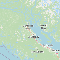
Map view of MacMillan Provincial Park

Use this park location map to pinpoint MacMillan Provincial Park in Canada, understand its exact geographic position, and read its mapped placement within the surrounding landscape more clearly.

Pigeon | © OpenStreetMap contributors

Location context for MacMillan Provincial Park

British Columbia

Visualizing ancient old growth temperate rainforest and valley terrain

MacMillan Provincial Park Photos and Scenery: Exploring Cathedral Grove

Visual documentation of MacMillan Provincial Park reveals the towering scale of ancient old growth Douglas fir trees and coastal forest habitats. Examining these protected landscapes provides clear insight into Vancouver Island terrain and rare temperate rainforest ecosystems.

A brown information sign titled Cathedral Trail stands in a forest, with a smaller plaque below and a dirt path leading into the trees.

A dense forest floor in MacMillan Provincial Park with large fallen logs covered in moss and surrounded by thick ferns.

A low-angle view looking up at a massive, ancient Douglas fir tree surrounded by a dense forest in Cathedral Grove, with a fallen tree log in the foreground and a small interpretive sign on the right.

A wooden boardwalk trail framed by railings curves through a dense forest of tall old growth trees and ferns.

A gravel area leads to a split wooden boardwalk entrance in a forest. Signs on the wooden railings indicate one-way traffic, and a central information board stands between the two paths.

Park atlas

Compare regional ecosystems, surrounding valleys, and coastal forest reserves

Other Protected Areas and Parks Near MacMillan Provincial Park

Browsing parks near MacMillan Provincial Park reveals adjacent temperate rainforests, valley corridors, and protected coastal landscapes across Vancouver Island. Expanding the regional comparison helps trace connected conservation zones and forested terrain beyond Cathedral Grove.
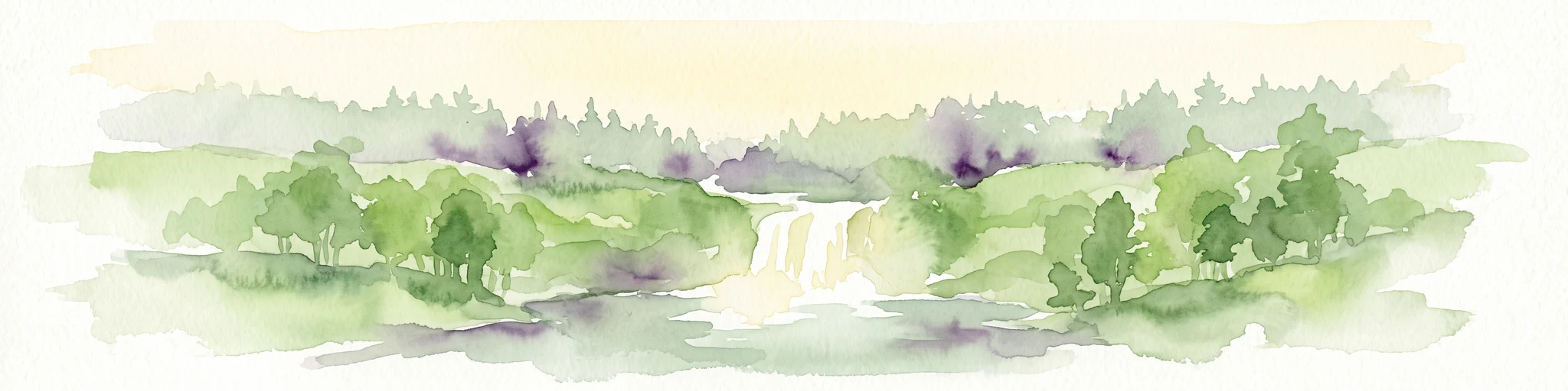
A soft watercolor illustration depicting a winding river flowing through a lush green valley with coniferous forests on the hillsides and mountains in the background.
State or regional parkBritish Columbia
About 0.3 km away#1 closest

East

Little Qualicum Falls Provincial Park: Regional Protected Landscape and Atlas Geography

River canyon and mountain lake habitat in British Columbia

Explore the structured geography of Little Qualicum Falls Provincial Park, a protected area characterized by its sequence of dramatic river cascades and old-growth Douglas Fir stands. This entry maps the park's key natural features, including the Cameron Lake shoreline and the rugged canyon terrain of the Little Qualicum River.

Area
4.4 km²
Established
1940
IUCN
II
Relief
Mountain
State or regional parkBritish Columbia
About 9.1 km away#2 closest

Northwest

Horne Lake Caves Provincial Park: Mapped Protected Landscapes and Cave Networks

Vancouver Island protected area and karst geography

Horne Lake Caves Provincial Park protects a distinct array of limestone cave systems, including Main, Riverbend, and Euclataws caves. The area bridges underground geological formations with surface-level river recreation along the Qualicum River, providing a comprehensive look at the karst and forested terrain of central-eastern Vancouver Island.

Area
1.58 km²
Established
1971
IUCN
II
Relief
Upland
Watercolor painting of a waterfall surrounded by lush green trees and forest.
State or regional parkBritish Columbia
About 23 km away#3 closest

East

Englishman River Falls Provincial Park: Regional Geography and Protected Area Overview

Vancouver Island river canyon and coastal forest terrain

Englishman River Falls Provincial Park protects a concentrated area of canyon scenery and old-growth forest on the eastern side of Vancouver Island. The landscape is characterized by the dramatic steps of the Englishman River, deep plunge pools, and mature cedar and hemlock stands. This geography provides an essential look at the coastal rainforest ecosystems and river-fed topography that define the recreational corridors of British Columbia.

Area
0.97 km²
IUCN
II
Relief
Upland
Access
Easy access
A pale, minimalist watercolor painting depicting a wide, sandy beach shoreline with a line of evergreen trees in the distance.
State or regional parkBritish Columbia
About 28 km away#4 closest

East

Rathtrevor Beach Provincial Park: Coastal Geography and Protected Land Overview

Vancouver Island coastal terrain and forested landscapes

Spanning over 300 hectares, Rathtrevor Beach Provincial Park protects a rare combination of fine sandy beaches and ancient Douglas fir groves along the Strait of Georgia. This coastal sanctuary on Vancouver Island serves as a critical habitat for migrating birds and represents a preserved segment of regional geography amidst the surrounding developed shoreline.

Area
3.47 km²
Established
1967
IUCN
II
Visitors
836.2K annual
Watercolor painting of a tranquil body of water with gentle hills in the background and a cluster of trees on the right shore.
State or regional parkBritish Columbia
About 40 km away#5 closest

Northeast

Jedediah Island Marine Provincial Park: Coastal Terrain and Regional Protected Area Map

Mapping island boundaries and sheltered maritime ecosystems

Jedediah Island Marine Provincial Park offers a unique study in coastal geography, featuring a complex shoreline of pebble beaches and indented bays. Located within the Strait of Georgia, the park serves as a protected landmass that blends maritime forest ecosystems with open water corridors. Its boat-only access ensures the landscape remains a quiet, preserved example of Gulf Islands terrain.

Area
6.03 km²
Established
1995
IUCN
II
Relief
Lowland
National parkBritish Columbia
About 55 km away#6 closest

South

Pacific Rim National Park Reserve: National Park Protected Landscape & Map Atlas

Mapped boundaries and regional geographic context in British Columbia.

Pacific Rim National Park Reserve stands as a distinct protected natural landscape, serving as a critical component of Canada's national park inventory. This page facilitates an atlas-style exploration of its mapped boundaries and its position within the broader geography of British Columbia. Understanding the park's protected status and its integration with the surrounding natural terrain offers valuable insight into conservation landscapes.

Area
511 km²
Established
1970
IUCN
VI
Visitors
1.2M annual
A minimalist watercolor illustration showing rolling hills in the background and soft foliage in the foreground on a white background.
State or regional parkBritish Columbia
About 56 km away#7 closest

East

Petroglyph Provincial Park: Protected Indigenous Heritage and Coastal Geography

Cultural landscape and bedrock carvings in British Columbia

Petroglyph Provincial Park preserves a remarkable concentration of ancient carvings etched into the sandstone bedrock of the Nanaimo River estuary. This protected area on Vancouver Island provides a rare look at how Indigenous traditions integrated with powerful natural features, offering a unique geographic context for studying historical rock art in the Pacific Northwest.

Area
0.02 km²
Established
1948
IUCN
III
Relief
Lowland
A watercolor painting showing a horizontal landscape with a green forest in the foreground and soft pink, layered rolling hills in the background.
State or regional parkBritish Columbia
About 61 km away#8 closest

East

Morden Colliery Historic Provincial Park: Heritage Infrastructure and Regional Coal Mining History

Industrial landscape and historic rail corridor in British Columbia

Located near Nanaimo, this heritage site preserves the substantial concrete remains of the Morden Colliery. The park serves as a physical archive of southern Vancouver Island industrial life, contrasting engineering landmarks with local forest environments and interpretive trails along former coal railway alignments.

Area
0.04 km²
Established
1972
Relief
Lowland
Scope
Terrestrial

Common questions about visiting, size, designation, and location context for MacMillan Provincial Park

MacMillan Provincial Park FAQs for park facts, access, geography, and protected area context

Find quick answers about MacMillan Provincial Park, including protected-area facts, park geography, trail and visitor context, and how the park fits into its surrounding country and regional landscape.
MoriAtlas Explorer

Continue Your Protected Areas Search Across the Global Atlas

Deepen your exploration by continuing the structured search for national parks and protected areas worldwide. Utilize the comprehensive filtering capabilities to compare different conservation landscapes and refine your understanding of global park geography. Discover more about the distribution and characteristics of protected natural areas.

Global natural geography