Mori Atlas logo
Marine protected areaMacquarie Island Marine Park

Mapping the deep seafloor, diverse submarine canyons, and critical subantarctic wildlife foraging zones

Macquarie Island Marine Park: A Comprehensive Atlas of Australian Subantarctic Marine Geography

Macquarie Island Marine Park covers a vast expanse of the southwest Pacific Ocean, protecting unique subantarctic ecosystems that stretch from the surface down to deep abyssal plains. This protected area safeguards complex submarine landscapes, including steep escarpments, trenches, and ridges that surround the remote, mantle-derived landmass of Macquarie Island. By integrating deep-sea habitats with productive pelagic zones, the park serves as a cornerstone for marine conservation in the southern hemisphere.

subantarcticmarine protected areaisland marine parkdeep sea habitatsabyssal plainsubmarine canyon

Macquarie Island Marine Park

Marine protected area

Park overview

Structured park overview, official facts, and landscape profile for Macquarie Island Marine Park

Macquarie Island Marine Park park facts, protected area profile, and essential visitor context

Review the core facts for Macquarie Island Marine Park, including designation, size, terrain, visitor scale, habitats, and operating context in one park-focused overview.

About Macquarie Island Marine Park

The Macquarie Island Marine Park is one of Australia's most far-flung marine reserves, encircling Macquarie Island in the cold, windswept subantarctic waters of the southwest Pacific Ocean. The island sits on a unique geological platform, being one of the only places where rocks from the Earth's mantle are exposed at the ocean surface, and the surrounding marine park extends that special character out into the deep ocean.

The marine park protects a vast range of seafloor environments, including abyssal plains, deep canyons, steep escarpments, isolated knolls and abyssal hills, elongated ridges, sloping continental margins, and trench-like troughs. These varied features give rise to a range of benthic habitats and help explain why the waters above are exceptionally productive for higher predators. Across these depths, the marine park ensures that key ecological processes of the subantarctic southwest Pacific remain intact.

The park is administered by Parks Australia and forms part of the South-east Marine Parks Network, where it is the largest of fourteen managed marine parks. While the overall marine park is classified under IUCN Category IV, its internal zoning includes stricter protections, including a Sanctuary Zone in which no fishing or extractive activity is permitted, and a National Park Zone that limits most commercial activity. Together, these zones give the park both broad coverage and highly protected core areas.

As an Australian marine park, the Macquarie Island Marine Park works in tandem with the adjacent Macquarie Island land reserve to safeguard one of the most ecologically significant subantarctic regions in the Southern Ocean. Its remoteness, scale, and unusual combination of geological and biological values make it a globally important example of large-scale marine protection in a high-latitude ocean environment.

Quick facts and research context for Macquarie Island Marine Park

The Macquarie Island Marine Park is an Australian marine park surrounding Macquarie Island in the southwest Pacific Ocean and is the largest reserve in the South-east Marine Parks Network. It is managed by Parks Australia and is classified overall as an IUCN Category IV protected area, while internal zones include stricter IUCN categories such as Sanctuary (Ia) and National Park Zone (II) classifications.

At its establishment the park covered 162,000 square kilometres of ocean, and in 2023 this area was substantially expanded, adding around 385,000 square kilometres of additional protected water and bringing the total marine park to a much larger extent in the subantarctic southwest Pacific. The marine park was originally proclaimed in 1999 and has been managed under successive names and zoning arrangements, with its current name and structure reflecting the renewed Australian marine parks framework of 2017 and the major territorial expansion of 2023.

Protection and recognition

Examine documented marine protection scope and official designation records.

Macquarie Island Marine Park Protection Status and Conservation Recognition

Marine protection status and management records for Macquarie Island Marine Park provide structured baseline facts for conservation research. Official protected area designations establish the baseline framework for evaluating environmental administration across remote oceanic waters.

Protection details

Protection scope
Marine
Transboundary protection
No
Park context

Deeper park guide and search-rich context for Macquarie Island Marine Park

Macquarie Island Marine Park history, landscape, wildlife, and travel context

Explore Macquarie Island Marine Park through its history, landscape character, ecosystems, wildlife, conservation priorities, cultural context, and seasonal travel timing in a structured park guide built for atlas discovery and search intent.

Why Macquarie Island Marine Park stands out

The marine park is best known for protecting the deep and productive subantarctic waters that surround Macquarie Island, an exposed portion of the Earth's mantle that is itself a UNESCO World Heritage Site. The park's fame derives from the combination of rare geological setting, exceptional subantarctic wildlife, and the sheer scale of ocean protection it provides. It is particularly recognized for safeguarding important foraging habitat for killer whales, southern elephant seals, several species of fur seals, and a remarkable variety of penguins including royal, king, rockhopper, and gentoo penguins. The wandering albatross, one of the great oceanic seabirds, also relies on these waters. Together, these features make the Macquarie region a flagship for subantarctic marine conservation.

Macquarie Island Marine Park history and protected-area timeline

The Macquarie Island Marine Park was originally proclaimed on 20 October 1999 under the name Macquarie Island Marine Park, providing Australia's first formal framework for protecting the ocean around this remote subantarctic island. The reserve was renamed the Macquarie Island Commonwealth Marine Reserve on 28 June 2007, reflecting a shift in how Australian Commonwealth marine reserves were labelled at that time.

This name remained in place through a period in which Australia reorganized its approach to Commonwealth marine protection. As part of the broader Australian Marine Parks framework, the reserve regained its original name, Macquarie Island Marine Park, in 2017. That name change coincided with renewed zoning and management arrangements that continue to define the reserve today.

In early 2023, the Australian federal government announced a major expansion of the marine park, intended to triple its size. Roughly 385,000 square kilometres of additional protected waters were added to the existing 162,000 square kilometres, dramatically increasing the area of subantarctic ocean under protection. This expanded configuration came into effect on 1 July 2023, marking the most significant change to the park's history since its initial proclamation.

Macquarie Island Marine Park landscape and geographic character

The marine park's landscape is defined almost entirely by the sea, with the small and rugged Macquarie Island at its heart. Macquarie Island itself is a remote, narrow, and heavily weathered landmass lying in the subantarctic region of the southwest Pacific, formed from rocks that have been pushed up from deep within the Earth's mantle. The marine park extends outward from this island across hundreds of thousands of square kilometres of open ocean.

Beneath the surface, the seafloor topography is exceptionally varied for a marine park of this size. The protected area includes broad abyssal plains and deep-ocean floor environments, as well as steep submarine canyons cutting through the slope. There are dramatic escarpments, isolated knolls and abyssal hills, elongated ridges, sloping continental margins, and trench-like troughs. Together, these seafloor features create a complex three-dimensional habitat system.

Above the seafloor, the ocean environment is characterized by cold subantarctic waters, long fetches of open ocean, and strong weather systems typical of the Southern Ocean. Waves, persistent westerly winds, and rapidly shifting weather define the surface conditions, while the underlying bathymetry shapes currents, upwelling, and the distribution of nutrients across the marine park.

Macquarie Island Marine Park ecosystems, habitats, and plant life

The Macquarie Island Marine Park protects a wide range of marine ecosystems across both the water column and the seafloor. Deep-ocean floor habitats, abyssal plains, canyons, escarpments, knolls, ridges, slopes, and trenches fall within its boundaries, providing a mosaic of benthic environments that support distinct communities adapted to very different depths and substrates.

These varied habitats underpin a productive pelagic ecosystem. Cold, nutrient-rich subantarctic waters feed the base of a food web that supports substantial populations of higher predators, including seals, penguins, seabirds, and cetaceans. The marine park's ecological value lies in this connection between unusual seafloor structure and an unusually rich surface ecosystem.

Surface waters also include kelp-dominated coastal fringes near the island, where submerged forests of giant kelp fringe the shoreline of Macquarie Island. These kelp habitats are themselves significant features of the broader Macquarie marine environment and form a transition between the terrestrial island ecosystems and the open ocean beyond. Within the marine park's zoning, more sensitive habitats are given stronger protection, particularly in the Sanctuary Zone, where natural ecosystem processes are largely undisturbed.

Macquarie Island Marine Park wildlife and species highlights

The marine park is particularly important as a foraging area for marine mammals and seabirds that depend on the subantarctic waters around Macquarie Island. Killer whales are among the most conspicuous high-level predators in these waters, while southern elephant seals, Antarctic fur seals, Subantarctic fur seals, and New Zealand fur seals all use the marine park extensively for feeding.

Penguins are among the most iconic wildlife features of the broader Macquarie region, and the marine park supports several species. Royal penguins, which breed primarily on Macquarie Island, are especially associated with these waters, while king penguins, rockhopper penguins, and gentoo penguins also forage within and around the marine park. The assemblage of penguin species makes this one of the most significant penguin foraging areas in the subantarctic southwest Pacific.

Seabirds also rely heavily on the marine park. The wandering albatross, one of the largest and most far-ranging seabirds in the world, is among the notable species that forage in this region. Together, the marine mammal, penguin, and seabird communities give the marine park a globally significant wildlife profile, complementing the terrestrial fauna protected on Macquarie Island itself.

Macquarie Island Marine Park conservation status and protection priorities

The Macquarie Island Marine Park plays a key role in conserving the marine environment of one of the most ecologically significant subantarctic regions on Earth. By protecting the waters around Macquarie Island, the park extends conservation value outward from a UNESCO World Heritage Site into the surrounding ocean, supporting the broader integrity of the Macquarie region.

From a conservation perspective, the marine park's significance lies in the combination of unusual geology, varied deep-sea habitats, and exceptionally productive surface waters. Its protected seafloor features, including abyssal plains, canyons, ridges, and escarpments, preserve habitat types that are increasingly rare in regions subject to deep-sea trawling or resource extraction elsewhere. The recently expanded boundaries greatly increase the area of seafloor and ocean under formal protection.

The park's zoning system reinforces its conservation purpose. The Sanctuary Zone removes most direct pressures on the most sensitive areas, while the broader Habitat Protection and National Park Zones manage human activity across the rest of the marine park. Together, these zones create a graduated framework that aims to maintain ecosystem function while minimizing conflicts with other ocean uses. The marine park is therefore not only a large reserve but also a carefully structured conservation landscape.

Top sights and standout views in Macquarie Island Marine Park

The Macquarie Island Marine Park stands out for combining extraordinary remoteness, a unique geological setting, and one of the most important assemblages of subantarctic marine wildlife in the Australian region. Its protection of varied seafloor features alongside highly productive surface waters makes it a rare example of a marine park that safeguards both deep-sea and pelagic ecosystems at very large scale.

The park's zoning, which includes a strict Sanctuary Zone where no fishing or extractive activities are permitted, adds a strong conservation backbone to that broad coverage. Combined with the 2023 expansion, the marine park now represents one of Australia's most ambitious commitments to protecting subantarctic ocean habitats, and a key component of the South-east Marine Parks Network.

Best time to visit Macquarie Island Marine Park

Macquarie Island and its surrounding marine park sit in the subantarctic zone, where weather and sea conditions are variable and the climate is cool year-round. The waters are generally calmer during the Southern Hemisphere summer months, from roughly late spring through early autumn, when the southern winter storm season has not yet peaked.

Penguin breeding, seal activity, and seabird presence vary across seasons, with much of the wildlife cycle tied to the summer months when conditions are most accessible and breeding colonies are active. Severe storms and heavy seas are more common in the Southern Hemisphere winter, reducing opportunities to reach the island and observe the surrounding marine environment.


Monthly climate preview

Long-term average temperature and monthly precipitation statistics for Macquarie Island Marine Park

Macquarie Island Marine Park Climate Normals and Annual Weather Patterns

Historical data records a measured annual temperature and precipitation rhythm across representative coordinate points in Macquarie Island Marine Park. Opening the complete monthly climate normals allows detailed inspection of average temperature shifts and precipitation totals by month.
Annual mean4 °C
2 °C6 °C
Jan
Feb
Mar
Apr
May
Jun
Jul
Aug
Sep
Oct
Nov
Dec
Warmest month
February

5.6 °C

Coolest month
July

2.2 °C

Wettest month
March

3.6 mm/day

Driest month
July

2.5 mm/day

Park location guide

Geography guide, regional context, and park location map for Macquarie Island Marine Park

Macquarie Island Marine Park park geography, regions, and map view in Australia

Understand where Macquarie Island Marine Park sits in Australia through a broader geographic reading of the surrounding landscape, nearby location context, and its mapped position within the national park landscape.

How Macquarie Island Marine Park fits into Australia

Australia is a constitutional monarchy and federal parliamentary democracy comprising six states and ten territories. With a population of nearly 28 million, it is one of the world's most urbanised countries, with most people concentrated on the eastern seaboard. The country has a high Human Development Index and is known for its cultural diversity, ancient Aboriginal heritage, and unique wildlife.

Wider geography shaping Macquarie Island Marine Park in Australia

Australia occupies the entire Australian continent, the island of Tasmania, and numerous smaller islands. It is the world's flattest and driest inhabited continent, featuring vast deserts in the interior (the Outback), tropical rainforests along the eastern coast, and a coastline bordering the Indian and Pacific Oceans.

Map view of Macquarie Island Marine Park

Use this park location map to pinpoint Macquarie Island Marine Park in Australia, understand its exact geographic position, and read its mapped placement within the surrounding landscape more clearly.

Pigeon | © OpenStreetMap contributors
Recorded earthquake history

Explore Recorded Earthquake History for Macquarie Island Marine Park

Review the comprehensive catalogue of seismic events documented near Macquarie Island Marine Park. This dataset provides insight into historical activity levels through recorded epicentre distances, magnitudes, and depths for researchers and geography enthusiasts interested in subantarctic marine regions.

Macquarie Island Marine Park Earthquake History

Catalogued events

219 events

Strongest magnitude

Magnitude 7.4

Most recent event

Jul 2, 2026

This history includes earthquakes recorded inside the park or within 50 km of its borders

Park atlas

Compare adjacent marine reserves, island habitats, and regional conservation networks.

Parks Near Macquarie Island Marine Park and Related Subantarctic Protected Areas

Browse other protected areas and marine reserves connected to the broader subantarctic ecosystem surrounding Macquarie Island Marine Park. Comparing these regional conservation spaces provides valuable context for understanding remote ocean habitats and island ecosystems across the southern ocean.
Marine protected areaNew Zealand Subantarctic Islands
325 km away#1 closest

Northeast

Moutere Ihupuku / Campbell Island Marine Reserve: Protected Marine Landscape and Map

Subantarctic marine geography in the New Zealand island chain.

Moutere Ihupuku / Campbell Island Marine Reserve safeguards a remote underwater wilderness defined by its volcanic origins. From its basalt pinnacles to the vast sponge gardens and boulder fields, the reserve functions as a vital protected area for Southern Ocean biodiversity. Map the connections between these extreme coastal environments and the world's largest population of southern royal albatross residing within the New Zealand Subantarctic Islands.

Established
2014
Relief
Mixed relief
Access
Remote access
Scope
Marine
Marine protected areaNew Zealand
About 364 km away#2 closest

Northeast

Auckland Islands Marine Mammal Sanctuary: Subantarctic Protected Area and Marine Geography

Mapping remote marine mammal habitats in the New Zealand southern Pacific

Covering over half a million hectares of oceanic terrain, the Auckland Islands Marine Mammal Sanctuary acts as a cornerstone of New Zealand conservation. The area protects complex underwater ecosystems, ranging from sheltered fjord-like inlets to deep-sea abyssal zones, while providing a stable recovery environment for vulnerable whale and sea lion populations in the subantarctic region.

Area
5,605.64 km²
Established
1993
Climate
Subpolar
Access
Highly restricted
Nature reserveNew Zealand
About 368 km away#3 closest

Northeast

Auckland Islands: Protected Subantarctic Geography and Volcanic Archipelago Map

An uninhabited island wilderness and nature reserve in southern New Zealand.

The Auckland Islands comprise a rugged, uninhabited volcanic archipelago south of New Zealand. This expansive nature reserve features deeply indented coastlines, sheltered harbours like Carnley Harbour, and complex subantarctic ecosystems. Gain detailed insights into this protected marine and land sanctuary, home to vital seabird colonies, endemic wildlife, and significant southern right whale gathering grounds.

Area
570 km²
Relief
Mountain
Climate
Subpolar
Access
Highly restricted
National parkNew Zealand
760 km away#4 closest

Northeast

Rakiura National Park: New Zealand's Remote Protected Wilderness & Landscape Atlas

Explore its rugged terrain and unique subantarctic ecosystem.

Rakiura National Park encompasses the majority of Stewart Island, offering a unique glimpse into one of New Zealand's most remote and undisturbed natural environments. This protected landscape features rugged forested hills, extensive coastlines with isolated beaches, and is globally recognized for its abundant kiwi populations. Discover the park's geographic setting and its significance as a protected area for both wildlife and cultural heritage within the broader atlas of New Zealand's natural wonders.

Area
1,399.6 km²
Established
2002
IUCN
II
Relief
Lowland
Wildlife reserveNew Zealand
About 813 km away#5 closest

Northeast

Ulva Island Wildlife Reserve: Mapped Geography and Protected Forest Landscapes

An open sanctuary located in Paterson Inlet, New Zealand

Explore the unique geography of Ulva Island, a 2.7 square kilometre wildlife reserve within Rakiura National Park. This predator free island features dense temperate rainforest, sheltered coastal bays, and vital recovery habitats for native bird species, offering a distinct study in southern New Zealand's protected forest terrain.

Area
2.67 km²
Relief
Lowland
Climate
Temperate
Access
Easy access
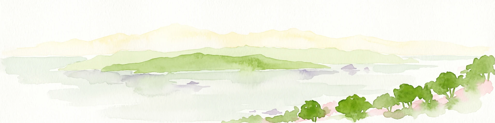
A soft watercolor illustration showing an island with green rolling hills rising from the water, with a line of trees along the shoreline in the foreground.
Nature reserveSouthland Region
About 817 km away#6 closest

Northeast

Codfish Island / Whenua Hou: A Protected Nature Reserve in the Southland Region

Coastal terrain and island geography in New Zealand

Located off the coast of Stewart Island, Codfish Island / Whenua Hou functions as an essential nature reserve. The island features moderate terrain, temperate coastal forests, and a protected landscape that preserves rare species and seabird colonies. Its geography is defined by a remote maritime setting, making it a globally significant site for predator-free wildlife conservation in the Tasman Sea.

Area
14 km²
Established
1987
Relief
Upland
Climate
Temperate
National parkSouthland Region
861 km away#7 closest

North

Fiordland National Park: A Protected Landscape of Glacier-Carved Fiords and Alpine Wilderness

Explore its vast boundaries and unique temperate rainforest.

Fiordland National Park, located in the Southland Region of New Zealand, is a testament to dramatic geological forces, featuring fifteen major fiords like Milford Sound, whose Mitre Peak rises majestically from the water. This protected national park encompasses an immense wilderness of alpine terrain, ancient beech forests, and numerous waterfalls, fueled by exceptional rainfall. Its inclusion in the Te Wāhipounamu World Heritage Area underscores its global significance for biodiversity and natural landscape preservation.

Area
12,607 km²
Established
1952
IUCN
II
Visitors
500K annual
Marine protected areaFiordland
921 km away#8 closest

North

Moana Uta (Wet Jacket Arm) Marine Reserve: Mapped Protected Landscapes in Fiordland

Exploring unique fiord stratification and dense marine coral habitats

Located in the remote southwestern reaches of New Zealand, Moana Uta (Wet Jacket Arm) Marine Reserve preserves a complete fiord system. The area is notable for its exceptional physical conditions, including high black coral density and a distinct freshwater surface layer that sustains diverse underwater communities across steep rock walls, reefs, and deep basins.

Area
20.07 km²
Established
2005
Relief
Lowland
Climate
Temperate

Common questions about visiting, size, designation, and location context for Macquarie Island Marine Park

Macquarie Island Marine Park FAQs for park facts, access, geography, and protected area context

Find quick answers about Macquarie Island Marine Park, including protected-area facts, park geography, trail and visitor context, and how the park fits into its surrounding country and regional landscape.
MoriAtlas Explorer

Continue Your Protected Areas Search Across the Global Atlas

Deepen your exploration by continuing the structured search for national parks and protected areas worldwide. Utilize the comprehensive filtering capabilities to compare different conservation landscapes and refine your understanding of global park geography. Discover more about the distribution and characteristics of protected natural areas.

Global natural geography