
Mori Atlas logo
Biosphere reserveMagaliesberg Biosphere Reserve

Mapping the ecological intersection of savanna, grassland, and afro-montane forest biomes

Magaliesberg Biosphere Reserve: A Deep Dive into its Ancient Landscapes and Geography

The Magaliesberg Biosphere Reserve protects a transition zone where three distinct African biomes converge across an ancient, billion-year-old mountain range. This protected landscape contains river valleys, rocky cliffs, and essential habitats while encompassing the Cradle of Humankind. The geography reveals a complex interplay of geological uplift and diverse ecosystems that span across South Africa's North West and Gauteng provinces.

biosphere reserveUNESCOafro-montane forestsavannagrasslandrocky cliffs
Digital illustration of a river bending through a landscape with dense green trees on the left and pale pink, rocky cliffs on the right under a soft, light-colored sky.

Magaliesberg Biosphere Reserve

Biosphere reserve

Park overview

Structured park overview, official facts, and landscape profile for Magaliesberg Biosphere Reserve

Magaliesberg Biosphere Reserve park facts, protected area profile, and essential visitor context

Review the core facts for Magaliesberg Biosphere Reserve, including designation, size, terrain, visitor scale, habitats, and operating context in one park-focused overview.

About Magaliesberg Biosphere Reserve

The Magaliesberg Biosphere Reserve occupies a strategic position in the northeastern interior of South Africa, bridging the densely populated urban arc around Pretoria and Johannesburg with the more rural landscapes of North West province. The reserve takes its name from the Magaliesberg, a mountain range whose geological origins stretch back billions of years and whose varied terrain defines the character of the entire region.

Ecologically, the reserve is remarkable for its biome convergence. The Central Grassland Plateaux and sub-Saharan savannah meet across its slopes, and small fragments of Afro-montane forest survive in sheltered kloofs and valleys. Four major habitat types have been identified within the reserve: the Moot Plains Bushveld, dominated by acacia savanna; the Gold Reef Mountain Bushveld, with denser woody vegetation on rocky hills; the Northern Afrotemperate Forest, a rare and species-poor afromontane formation; and the Marikana Thornveld, characterized by open Acacia karroo woodlands in valleys and plains. Together these habitats support 14 distinct vegetation types.

Beyond its ecological importance, the reserve carries deep cultural and scientific weight. The Cradle of Humankind core area preserves fossil sites, Stone Age localities, and limestone caves documenting early human evolution over the past four million years. Around ninety indigenous mammal species have been recorded in the broader biosphere area, alongside a bird community that includes the Cape vulture, secretary bird, martial eagle, and African grass-owl. Plains and ridges of the surrounding mountains are also known for the world's richest platinum and platinum group mineral deposits, formed in association with the Bushveld Igneous Complex and the ancient Transvaal geological system.

Quick facts and research context for Magaliesberg Biosphere Reserve

The Magaliesberg Biosphere Reserve covers roughly 3,578 square kilometers across Gauteng and North West provinces in South Africa. It was formally recognized by UNESCO on 9 June 2015 under the Man and the Biosphere Programme and is administered in connection with the South African Department of Environmental Affairs.

The reserve is built around a zoned structure typical of biosphere reserves, with core areas surrounded by buffer and transition zones. Its two core zones are the Cradle of Humankind World Heritage Site and the Magaliesberg Protected Natural Environment, anchoring both the cultural and natural heritage of the region.

Protection and recognition

Documented terrestrial protection scope and international recognition data

Magaliesberg Biosphere Reserve Protection Status and UNESCO Recognition

Magaliesberg Biosphere Reserve maintains documented terrestrial protection status alongside verified UNESCO biosphere reserve recognition. Structured facts outline the recorded designation history and management scope for this protected area.

International recognition

Protection details

Protection scope
Terrestrial
Designated year
2015
Transboundary protection
No
Core area
582.12 km²
Buffer area
1,095.61 km²
Park context

Deeper park guide and search-rich context for Magaliesberg Biosphere Reserve

Magaliesberg Biosphere Reserve history, landscape, wildlife, and travel context

Explore Magaliesberg Biosphere Reserve through its history, landscape character, ecosystems, wildlife, conservation priorities, cultural context, and seasonal travel timing in a structured park guide built for atlas discovery and search intent.

Why Magaliesberg Biosphere Reserve stands out

The Magaliesberg Biosphere Reserve is best known for its position at the meeting point of savanna, grassland, and afro-montane forest biomes, making it a transitional landscape of unusual ecological richness. It is also distinguished by the inclusion of the Cradle of Humankind, a UNESCO World Heritage Site containing fossil and archaeological evidence of human evolution stretching back several million years. The reserve is additionally recognized for the geological antiquity of the Magaliesberg mountain range, one of the oldest ranges on Earth, and for the bird diversity recorded within its boundaries, which represents nearly half of the bird species found in the broader southern African sub-region.
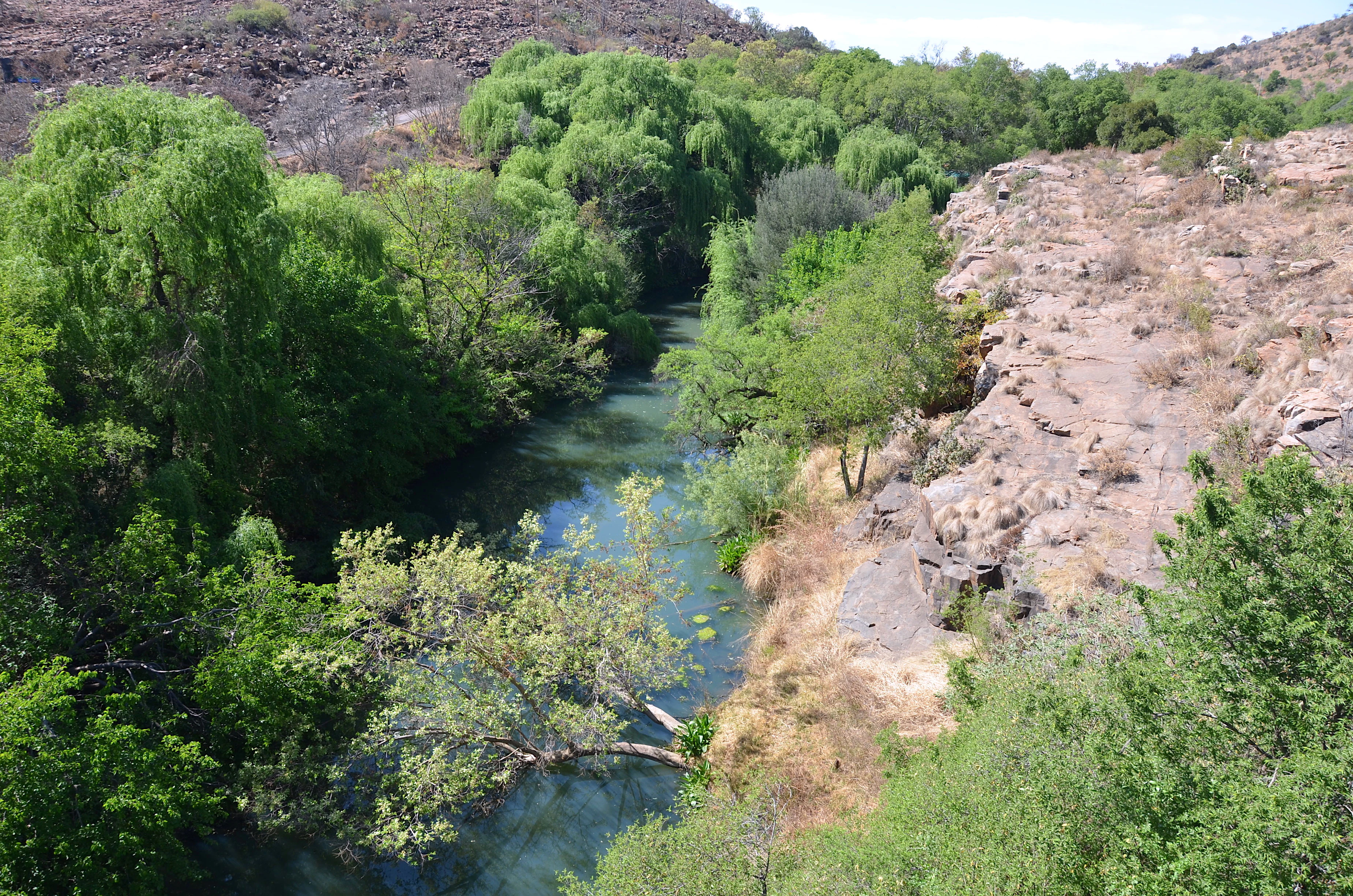
A narrow, winding river flowing through a deep valley, surrounded by dense green trees on one bank and a dry, rocky hillside on the other.
The Magalies River flowing through a lush, tree-lined valley within the Magaliesberg region.

Magaliesberg Biosphere Reserve landscape and geographic character

The Magaliesberg Biosphere Reserve is defined by the Magaliesberg mountain range, one of the oldest mountain ranges on Earth, with geological roots estimated at roughly 2.3 billion years. The mountains were shaped by long-term processes of sedimentation and tectonic activity, and their formation was further affected by the Vredefort impact event around 2 billion years ago, when a large asteroid struck the region and deformed surrounding rock layers, contributing to uplift and folding visible in the present-day topography.

The landscape combines high ridges, cliffs, and crests with deeply cut kloofs, river valleys, and gently sloping plains. Underlying geology is dominated by the Transvaal System and the Bushveld Igneous Complex, two formations that also hold the world's richest platinum and platinum group mineral deposits. This combination of varied relief and ancient geology produces a patchwork of exposures, soils, and microclimates that supports the reserve's ecological diversity.

Magaliesberg Biosphere Reserve ecosystems, habitats, and plant life

The reserve encompasses four principal habitats. The Moot Plains Bushveld is an open to closed, low and thorny savannah dominated by various acacia species. The Gold Reef Mountain Bushveld occupies rocky hills and ridges with denser woody cover, while the Northern Afrotemperate Forest consists of low, relatively species-poor forests of afromontane origin surviving in sheltered localities. The Marikana Thornveld is made up of open Acacia karroo woodlands on undulating lowland plains and valleys.

Together these habitats support 14 different vegetation types across the biosphere, ranging from savanna grasslands to rocky ridge thickets and remnant afromontane forest patches. Wetlands, rivers, and slopes further diversify the ecological character of the reserve, allowing grassland, savanna, and forest communities to coexist within a relatively compact area.

Magaliesberg Biosphere Reserve wildlife and species highlights

Mammal diversity within the Magaliesberg Biosphere Reserve is substantial, with around 90 indigenous mammal species recorded. Notable species include the klipspringer, which is closely associated with rocky outcrops and cliffs; the sable antelope, a striking antelope of wooded savanna; the leopard, a wide-ranging predator; and the brown hyena, a scavenger found across more open landscapes.

The reserve is particularly notable for its birdlife. Roughly 46 percent of the bird species recorded in the southern African sub-region have been documented within its boundaries. Among the species of conservation or ecological interest are the Cape vulture, the secretary bird, the great white pelican, the martial eagle, and the African grass-owl. Smaller and more range-restricted species, such as the forest shrew, also highlight the importance of afromontane forest remnants for sensitive fauna.

Magaliesberg Biosphere Reserve conservation status and protection priorities

As a UNESCO biosphere reserve, Magaliesberg is managed under a zoned conservation framework that pairs strictly protected core areas with surrounding buffer and transition zones. The core zones, the Cradle of Humankind World Heritage Site and the Magaliesberg Protected Natural Environment, anchor the reserve's conservation strategy by combining globally significant paleontological and archaeological heritage with formally protected natural habitat.

The reserve's broader conservation value lies in its role as a meeting point of savanna, grassland, and Afro-montane forest biomes. Protecting this transitional landscape helps conserve habitat connectivity in a region that is otherwise surrounded by major urban centers and mining activity, while also safeguarding rare vegetation types and species tied to the ancient Magaliesberg terrain.

Magaliesberg Biosphere Reserve cultural meaning and human context

The Magaliesberg Biosphere Reserve has been inhabited for millennia, and the wider region has long been a meeting point of different cultural groups, often in conflict, producing a layered cultural history that reflects the broader story of southern Africa. The Cradle of Humankind core zone is one of the most important Stone Age landscapes in the world and contains 13 listed fossil sites, including one of the largest accumulations of hominid skulls anywhere on the planet, alongside hundreds of unexplored caves.

Today the reserve falls partly within the metropolitan catchments of Pretoria and Johannesburg, giving it a distinctive urban-to-rural transition. The resident population is relatively small compared to these neighboring urban centers, and the local economy is shaped by agriculture, mining, urban development, and tourism, alongside persistent unemployment that has made sustainable land use a defining social issue for the region.

Top sights and standout views in Magaliesberg Biosphere Reserve

The Magaliesberg Biosphere Reserve stands out for the rare overlap of three African biomes within a single protected landscape, and for the sheer antiquity of its mountain terrain, which stretches back more than two billion years. Its inclusion of the Cradle of Humankind adds a dimension of deep-time human history that few other protected areas can match, complementing a strong natural heritage profile anchored by cliffs, kloofs, savanna, and afromontane forest patches.

Equally distinctive is the reserve's bird diversity, which captures nearly half of southern Africa's recorded bird species, and the coexistence of globally important mineral resources, ancient geology, and ecologically sensitive habitats within a landscape that also lies in the immediate shadow of two of South Africa's largest cities.

Best time to visit Magaliesberg Biosphere Reserve

The Magaliesberg region experiences a seasonal climate shaped by warm, wet summers and cooler, drier winters, conditions that influence both landscape character and wildlife visibility. Summer rains typically bring greener vegetation, fuller rivers, and active bird breeding, while winter months offer clearer skies, drier terrain, and more concentrated visibility of large mammals across open plains and ridges.

Migratory and breeding bird patterns, the flowering of savanna and acacia woodland vegetation, and the changing character of riverine and wetland habitats all give the reserve a distinct seasonal rhythm. Visitors interested in lush scenery and active birdlife generally find the warmer months most rewarding, while those drawn to cooler hiking conditions and sharper long-distance views often prefer the drier season.
Monthly climate preview

Long term representative temperature and precipitation averages by month

Magaliesberg Biosphere Reserve Climate Normals and Annual Weather Patterns

Magaliesberg Biosphere Reserve records measured monthly temperature and precipitation normals reflecting long term seasonal rhythms at representative elevations. Examining the complete twelve month profile provides deeper insight into historical averages and localized climate variations across the protected landscape.
Annual mean18 °C
10 °C22 °C
Jan22°
Feb22°
Mar21°
Apr17°
May14°
Jun11°
Jul10°
Aug13°
Sep18°
Oct21°
Nov21°
Dec22°
Warmest month
January

22.5 °C

Coolest month
July

10.3 °C

Wettest month
December

3.9 mm/day

Driest month
July

0.1 mm/day

Park location guide

Geography guide, regional context, and park location map for Magaliesberg Biosphere Reserve

Magaliesberg Biosphere Reserve park geography, regions, and map view in South Africa

Understand where Magaliesberg Biosphere Reserve sits in South Africa through a broader geographic reading of the surrounding landscape, nearby location context, and its mapped position within the national park landscape.

How Magaliesberg Biosphere Reserve fits into South Africa

South Africa is the southernmost country in Africa, spanning 1.22 million km² with a population of over 63 million. The country operates with three capital cities, Pretoria (executive), Cape Town (legislative), and Bloemfontein (judicial), and is renowned for its biodiversity, national parks, and multicultural society.

Wider geography shaping Magaliesberg Biosphere Reserve in South Africa

South Africa occupies the southernmost region of Africa, with coastline along both the Atlantic Ocean to the west and the Indian Ocean to the east. The interior features elevated plateaus including the Highveld, with the Drakensberg escarpment marking the eastern highlands. The country shares borders with Namibia, Botswana, Zimbabwe, Mozambique, Eswatini, and Lesotho.

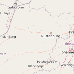
Map view of Magaliesberg Biosphere Reserve

Use this park location map to pinpoint Magaliesberg Biosphere Reserve in South Africa, understand its exact geographic position, and read its mapped placement within the surrounding landscape more clearly.

Pigeon | © OpenStreetMap contributors

Location context for Magaliesberg Biosphere Reserve

GautengNorth West

Visual reference of ancient mountain terrain and transitional biomes

Magaliesberg Biosphere Reserve Photos and Landscape Scenery

Visual documentation captures the rugged cliffs, deep river valleys, and transitional biomes defining Magaliesberg Biosphere Reserve. Protected area photography reveals the complex topography and geological character shaping this ancient South African landscape.

A narrow, winding river flowing through a deep valley, surrounded by dense green trees on one bank and a dry, rocky hillside on the other.

Park atlas

Compare regional park geography, ancient mountain terrain, and connected conservation landscapes.

Explore Parks Near Magaliesberg Biosphere Reserve and Surrounding Protected Areas

Browsing other protected areas near Magaliesberg Biosphere Reserve allows comparison of overlapping savanna and grassland biomes across regional terrain. Examining adjacent conservation landscapes provides broader geographic context for the ancient mountain topography.
A watercolor illustration of rolling green hills, distant mountains, and a pale sky.
Protected landscapeNorth West
About 2.9 km away#1 closest

North

Magaliesberg Protected Natural Environment: Mapped Geography and Protected Landscape Context

Ancient mountain ridges between Rustenburg and Pretoria

Spanning a long quartzite ribbon, the Magaliesberg Protected Natural Environment represents a sophisticated model of private land conservation. The geography reveals a dramatic elevation gradient where Highveld plateaus meet lower-lying bushveld terrain. This atlas entry details the protected boundaries and the integrated landscape connection between surrounding nature reserves.

Area
343.56 km²
Established
1994
Relief
Mountain
Scope
Terrestrial
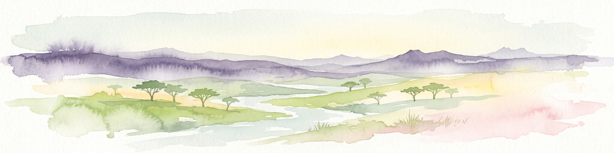
A watercolor painting showing a wide, panoramic view of rolling green and yellow hills, scattered acacia-like trees, and a distant purple mountain range under a light sky.
Nature reserveNorth West
About 35 km away#2 closest

West

Kgaswane Mountain Reserve: Map and Geographic Profile of the Magaliesberg Range

A protected nature reserve in the North West province of South Africa.

Kgaswane Mountain Reserve stands as a pivotal protected landscape within the Magaliesberg Biosphere. This atlas record provides insights into its quartzitic ridges, complex grassland and woodland ecosystems, and status as a Ramsar wetland site, offering a clear view of its geographic and conservation significance.

Area
53 km²
Established
1967
Nature reserveGauteng
About 58 km away#3 closest

Southwest

Abe Bailey Nature Reserve: Geographic Profile and Highveld Protected Area Atlas

Mapped wetlands and grassland ecosystems in Gauteng, South Africa

Spanning 4,200 hectares, Abe Bailey Nature Reserve provides a vital green refuge on the West Rand. This protected area features a unique combination of highveld grassland, seasonal wetlands, and rocky ridges that support rich birdlife and antelope populations, standing as a significant conservation feature within an urbanized province.

Area
42 km²
Relief
Upland
Climate
Temperate
Access
Access unknown
A soft watercolor illustration depicting rolling green hills and subtle landscape features on a white background.
Nature reserveGauteng
About 62 km away#4 closest

East

Klapperkop Nature Reserve: Mapping Protected Bankenveld and Highveld Landscapes

A vital protected nature reserve in Gauteng, South Africa

Klapperkop Nature Reserve protects a representative segment of threatened highveld bankenveld grassland near Pretoria. The reserve features the distinct Klapperkop hill, historic fortifications, and restored savanna ecosystems that offer a window into the natural heritage of the Gauteng region.

Area
4.6 km²
Established
1898
Relief
Upland
Climate
Subtropical
Wildlife reserveNorth West Province
About 77 km away#5 closest

North

Borakalalo Game Reserve: Protected Bushveld and Aquatic Landscapes in North West Province

Mapping a diverse South African wildlife reserve

Borakalalo Game Reserve features a distinct ecological setting within South Africa, combining woodland bushveld with the aquatic ecosystems of Klipvoor Dam. This protected area provides a habitat for varied mammal species and an extensive bird list, set against the backdrop of the interior plateau landscape in North West Province.

Area
130 km²
Relief
Upland
Access
Access unknown
Scope
Terrestrial
A pale, minimalist watercolor painting depicting rolling green hills in the distance with a winding dirt path leading through grassy plains in the foreground.
National parkNorth West Province
About 81 km away#6 closest

Northwest

Pilanesberg National Park: Geologic Mapping of a South African Alkaline Ring Complex

Explore concentric volcanic terrain and protected bushveld landscapes

Pilanesberg National Park covers the eroded root of a massive 1.2 billion year old volcano. Its defining feature is a series of concentric hills and basins that rise from the flat bushveld plains of South Africa. This protected area offers a distinct geographic study in volcanic topography, featuring rocky syenite outcrops, open savanna, and varied water sources that define the ecological character of this significant regional landscape.

Area
572 km²
Established
1984
Relief
Mountain
Climate
Subtropical
Wildlife reserveGauteng
About 108 km away#7 closest

Southeast

Marievale Bird Sanctuary: A Wildlife Reserve and Wetland Habitat in Gauteng, South Africa

Discover protected floodplain geography and wetland mapping

Marievale Bird Sanctuary preserves a complex network of pans and reedbeds along the Blesbokspruit. As a landmark of South African conservation, the area offers a focused look at how wetland ecosystems function within the Highveld topography of Gauteng, providing a critical refuge for diverse water-dependent species and migratory birds.

Area
15.26 km²
Established
1978
Relief
Lowland
Climate
Temperate
Watercolor illustration depicting a winding river through a grassy landscape with rolling hills and distant trees under a soft yellow sky.
Wildlife reserveGauteng
About 109 km away#8 closest

East

Dinokeng Game Reserve: Geographic Atlas and Protected Wildlife Area Profile

Savanna Landscapes and Riverine Corridors in Gauteng

Dinokeng Game Reserve functions as a primary wildlife sanctuary within Gauteng, South Africa, featuring a diverse mosaic of grassland and riverine bushveld. This atlas profile details the reserve geographic layout, from the Pienaars River watercourses to its integrated conservation zones, providing a clear overview of the terrain that supports its status as a significant regional protected area.

Area
210 km²
Established
2011
Relief
Upland
Climate
Subtropical

Common questions about visiting, size, designation, and location context for Magaliesberg Biosphere Reserve

Magaliesberg Biosphere Reserve FAQs for park facts, access, geography, and protected area context

Find quick answers about Magaliesberg Biosphere Reserve, including protected-area facts, park geography, trail and visitor context, and how the park fits into its surrounding country and regional landscape.
MoriAtlas Explorer

Continue Your Protected Areas Search Across the Global Atlas

Deepen your exploration by continuing the structured search for national parks and protected areas worldwide. Utilize the comprehensive filtering capabilities to compare different conservation landscapes and refine your understanding of global park geography. Discover more about the distribution and characteristics of protected natural areas.

Global natural geography