
Mori Atlas logo
Protected landscapeMagaliesberg Protected Natural Environment

A cooperative protected landscape stretching across the North West and Gauteng provincial boundaries.

Magaliesberg Protected Natural Environment: Exploring Ancient Quartzite Mountain Geography and Protected Landscapes

The Magaliesberg Protected Natural Environment preserves one of the oldest mountain ranges in the world, characterized by billion-year-old quartzite ridges and deep wooded kloofs. This unique protected landscape functions as an essential ecological corridor between Rustenburg and Pretoria. Visitors can analyze the abrupt transition between Highveld grasslands and subtropical bushveld within this significant, cooperatively managed mountainous expanse.

mountain rangebiosphere reserve core zonequartzite ridgeHighveldbushveld transitionprivate-land conservation
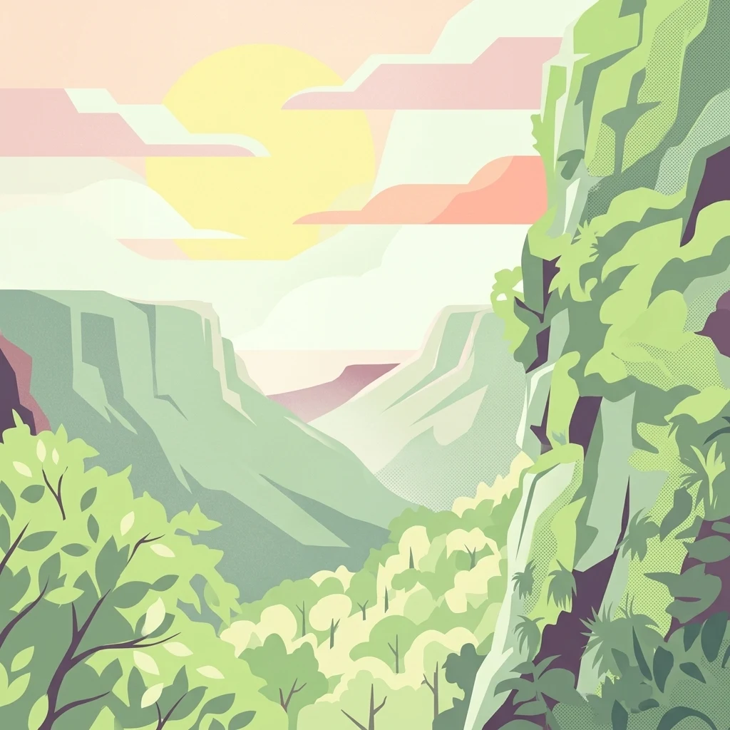
A graphic illustration showing a mountain range with rocky cliffs, lush green vegetation, and a soft sunset in the background.

Magaliesberg Protected Natural Environment

Protected landscape

Park overview

Structured park overview, official facts, and landscape profile for Magaliesberg Protected Natural Environment

Magaliesberg Protected Natural Environment park facts, protected area profile, and essential visitor context

Review the core facts for Magaliesberg Protected Natural Environment, including designation, size, terrain, visitor scale, habitats, and operating context in one park-focused overview.

About Magaliesberg Protected Natural Environment

The Magaliesberg Protected Natural Environment occupies a pivotal position within South Africa's network of protected landscapes. It is one of the two designated core zones of the Magaliesberg Biosphere Reserve; the other is the Magaliesberg Biosphere Reserve itself. Together these cores anchor the biosphere's broader aim of integrating biodiversity conservation, cultural heritage, and sustainable development across a region that is geologically extraordinary and ecologically diverse.

Geographically, the environment stretches along the spine of the Magaliesberg, a quartzite mountain ridge that separates the cool Highveld plateau to the south from the warmer, drier bushveld to the north. Its extent runs more than a hundred kilometers from the area around Rustenburg in the North West province eastward toward Pretoria in Gauteng. This linear, mountain-bound shape defines much of the environment's ecological character: a long, narrow corridor of wooded kloofs, rocky outcrops, and grassy plateaus rather than a single compact park area.

Although the protected environment sits adjacent to, and effectively functions as, a natural-area anchor for surrounding towns, it is unusual in that the land is almost entirely privately owned. Only the Kgaswane Mountain Reserve portion along its upper edges is in public hands. Protection is therefore implemented through a cooperative framework in which landowners, conservation authorities, and provincial government work together under the Protected Environment designation rather than through conventional national-park state ownership.

The Magaliesberg range that the environment protects is sometimes described as one of the oldest mountain ranges on Earth, with rocks estimated at roughly two billion years old. Overlying these ancient quartzites are younger geological features, including cave systems and dolomite formations, which add significant ecological and cultural interest. The environment consequently holds both natural and historical importance; the Magaliesberg has long been inhabited, and archaeological sites associated with early human presence occur across the broader range.

At a regional scale, the protected environment plays an important role in maintaining connectivity between the larger reserves that border it. On its upper edges sits the Kgaswane Mountain Reserve, designated as a Ramsar wetland site of international importance. Toward the east, the Hartbeespoort Dam Nature Reserve intersects the protected environment's edge, and the Wonderboom Nature Reserve lies at the eastern extremity near Pretoria. Together these linked zones create a network of protected habitats running across one of South Africa's most heavily developed corridors, providing a refuge for wildlife and a buffer for water resources in an otherwise urbanized region.

Quick facts and research context for Magaliesberg Protected Natural Environment

The Magaliesberg Protected Natural Environment lies within the Magaliesberg Biosphere Reserve, one of South Africa's designated UNESCO-style biosphere reserves. It functions as a core conservation zone within that biosphere, complementing the Magaliesberg Biosphere Reserve's wider mandate of balancing biodiversity protection with sustainable land use.

Spanning about 343.56 square kilometers, it runs along the Magaliesberg mountain range, a quartzite ridge system widely considered among the oldest mountain ranges on Earth. Protection was first initiated in the 1960s and progressed through a 1977 Natural Area declaration before the modern Protected Environment designation in 2009. Governance is shared with the North West Department of Agriculture, Environment and Rural Affairs.

Protection and recognition

Documented terrestrial protection scope, designation history, and management data.

Magaliesberg Protected Natural Environment Protection Status and Conservation Recognition

Magaliesberg Protected Natural Environment maintains a documented terrestrial protection scope without imported international recognition sources or transboundary status. Structured conservation records compile official designation history and management parameters for geographic analysis.

Protection details

Protection scope
Terrestrial
Transboundary protection
No
Park context

Deeper park guide and search-rich context for Magaliesberg Protected Natural Environment

Magaliesberg Protected Natural Environment history, landscape, wildlife, and travel context

Explore Magaliesberg Protected Natural Environment through its history, landscape character, ecosystems, wildlife, conservation priorities, cultural context, and seasonal travel timing in a structured park guide built for atlas discovery and search intent.

Why Magaliesberg Protected Natural Environment stands out

The Magaliesberg Protected Natural Environment is best known for safeguarding a long stretch of the ancient Magaliesberg mountain range through a cooperative model of private-land conservation. The range itself is famous for its geological age, with quartzite formations dated back billions of years, and for the dramatic transition it creates between the Highveld grasslands above and the subtropical bushveld below. The environment is also notable for its alliance with the Kgaswane Mountain Reserve, a Ramsar-listed wetland on its upper edges, and for serving as a critical biodiversity corridor in a heavily populated region between two major South African urban centers, Pretoria and Rustenburg.
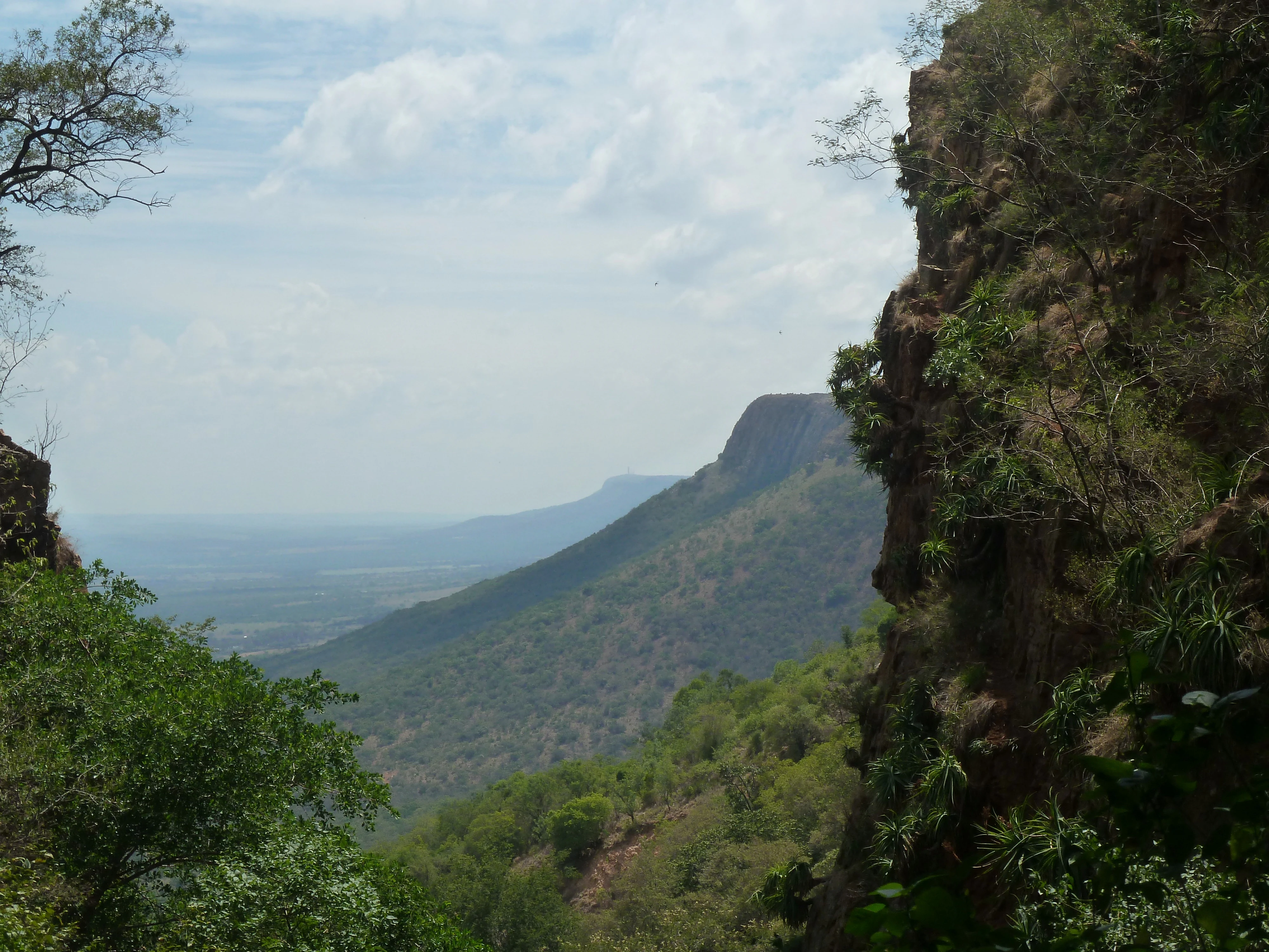
A wide view of the Magaliesberg mountain range in South Africa, framed by steep, rocky cliff faces on the sides and overlooking a valley covered in trees.
The Magaliesberg escarpment west of Dewetsnek, showcasing the rugged terrain and dense vegetation characteristic of the mountain range.

Magaliesberg Protected Natural Environment history and protected-area timeline

Efforts to conserve the Magaliesberg began in the 1960s, when early recognition of the mountain range's geological and ecological significance prompted initial advocacy for formal protection. By 1977, the area had been declared a Natural Area, giving it a baseline legal recognition that allowed conservation activities to proceed under provincial oversight.

The decisive step came in 2009, when the total current extent of about 343.56 square kilometers was formally declared a Protected Environment under South Africa's protected-area framework. This designation reflected the cooperative character of conservation in the Magaliesberg, where most of the land is privately owned, and where protection relies on coordination among landowners, conservation bodies, and the provincial government. The North West Department of Agriculture, Environment and Rural Affairs, together with biosphere-reserve partners, plays a central governing role.

The Kgaswane Mountain Reserve, on the protected environment's upper edges, achieved international recognition as a Ramsar wetland site, underscoring the broader regional importance of habitat conservation in this part of South Africa. The protected environment's history is therefore less about dramatic proclamations of a single national park and more about a cumulative, decades-long cooperative effort that turned an inhabited mountain landscape into a formally protected zone while keeping it in private ownership.

Magaliesberg Protected Natural Environment landscape and geographic character

The defining feature of the Magaliesberg Protected Natural Environment is the Magaliesberg mountain range itself: a long, narrow quartzite ridge running east to west through the landscape between Rustenburg and Pretoria. The range is widely cited as one of the oldest mountain ranges in the world, with quartzite rocks estimated at roughly two billion years old. These ancient formations rise sharply above the surrounding plains, producing steep rocky slopes, narrow kloofs, and exposed ridgelines that shape the visual character of the entire protected environment.

Above the ridge, the landscape transitions into Highveld grasslands more typical of the South African interior plateau, while below, the land falls away into the warmer, drier bushveld of the North West province. This abrupt ecological gradient, compressed into a relatively narrow elevation band, is one of the protected environment's defining physical qualities. The result is a striking layered landscape, where mountain woodlands, rocky cliffs, and grassy plains meet within short distances.

The environment's boundaries closely mirror the mountain range's footprint, giving it a long, ribbon-like shape rather than a compact park layout. On the upper edges of the protected environment lies the Kgaswane Mountain Reserve, whose wetlands and catchments feed into the Crocodile River system. The Hartbeespoort Dam and its surrounding nature reserve cut across the eastern portion of the environment, while the Wonderboom Nature Reserve lies near the eastern end of the range, close to Pretoria. Throughout the area, cave systems and dolomitic formations add further geological interest beneath the visible quartzite ridges.

Magaliesberg Protected Natural Environment ecosystems, habitats, and plant life

Ecologically, the Magaliesberg Protected Natural Environment occupies a transition zone between two of South Africa's most distinct biomes. The Highveld grasslands to the south support mixes of montane grassland and rocky upland vegetation, while the northern slopes descend into bushveld with increasing woodland and savanna character. This juxtaposition of biomes within a narrow mountain corridor produces unusually high habitat diversity.

The wooded kloofs and rocky slopes support rich montane vegetation, including indigenous trees, shrubs, and grass species adapted to quartzite substrates. The wetlands of the adjacent Kgaswane Mountain Reserve host plant communities of particular conservation significance and have earned the site international recognition under the Ramsar Convention. These wetlands are important not only for biodiversity but also for their role in sustaining downstream water resources, including inflows to the Crocodile River and ultimately to the Hartbeespoort Dam.

Because most of the protected environment is privately owned, the ecological character of the area is closely tied to ongoing land-use practices, and maintaining vegetation cover, water quality, and habitat connectivity depends on continued cooperation between landowners and conservation authorities.

Magaliesberg Protected Natural Environment wildlife and species highlights

The Magaliesberg range supports a varied fauna typical of its interface between Highveld and bushveld, and the protected environment helps to maintain habitat for many of these species in a region otherwise dominated by agriculture and urban development. Antelope species associated with bushveld and montane grassland occur across the range, alongside smaller mammals adapted to rocky and wooded terrain.

The wetland habitats associated with the Kgaswane Mountain Reserve provide important stopover and breeding habitat for waterbirds, which is why the reserve has been recognized as a Ramsar site. Birdlife more generally is one of the protected environment's richest ecological assets, with the gradient between grassland, woodland, and rocky cliff habitats supporting a wide mix of species.

Reptiles and invertebrates also inhabit the quartzite outcrops and kloofs, while caves and rocky formations provide refuge for bat species. The protected environment's biodiversity value is heightened by its role as a corridor, linking habitats from Rustenburg in the west to the urban edge of Pretoria in the east.

Magaliesberg Protected Natural Environment conservation status and protection priorities

Conservation in the Magaliesberg Protected Natural Environment is significant not because of its scale but because of its strategic location. The protected environment preserves a long stretch of ancient mountain landscape within one of South Africa's most populous and economically active corridors, providing a refuge and a movement corridor for biodiversity between two major urban centers.

The 2009 Protected Environment designation reflects a deliberate shift toward cooperative conservation models that work with private landowners rather than requiring state ownership. This approach allows large working farms and estates to remain in production while still contributing to biodiversity protection, habitat preservation, and watershed management.

The international recognition of Kgaswane Mountain Reserve as a Ramsar wetland site adds a global dimension to the protected environment's conservation profile. Together with linked reserves such as Hartbeespoort Dam Nature Reserve and Wonderboom Nature Reserve, the protected environment contributes to a network of formally protected sites that maintain ecological function in a region where development pressure is intense.

Magaliesberg Protected Natural Environment cultural meaning and human context

The Magaliesberg has a deep human history that long precedes its modern conservation designations. The mountain range has been inhabited for thousands of years, and archaeological sites throughout the broader range record the presence of early human communities. Local heritage, including settlement patterns, pastoral land use, and traditional land management practices, is closely tied to the landscape.

The Magaliesberg Biosphere Reserve, of which this protected environment forms one of the two core zones, explicitly recognizes the integration of cultural heritage and biodiversity conservation. The protected environment therefore sits within a cultural landscape shaped by generations of human activity, ranging from pre-colonial communities to contemporary farming communities whose land stewardship now plays an active role in conservation outcomes.

Top sights and standout views in Magaliesberg Protected Natural Environment

The Magaliesberg Protected Natural Environment stands out for combining geological antiquity, biotic diversity, and a working private-landscape conservation model in a single protected zone. Its quartzite ridges, often cited as among the oldest exposed mountain rocks on Earth, give it a visual and scientific identity that few protected areas can match.

Its location between Rustenburg and Pretoria, anchored by Ramsar-listed wetlands and linked to multiple neighboring reserves, makes it a central ecological node in a heavily developed part of South Africa. The protected environment's emphasis on private-landowner cooperation offers a distinctive example of how conservation can proceed outside the conventional national-park framework while still achieving formal protected-area status.

Best time to visit Magaliesberg Protected Natural Environment

The Magaliesberg region experiences a seasonal climate typical of the South African Highveld and bushveld transition. Cool, dry winters offer clear views across the ridges and are well-suited to walking and appreciating the geology, while the warmer, wetter summer months bring lush vegetation, flowing kloofs, and more active birdlife.

Spring and early summer transition periods often combine mild temperatures with refreshed landscapes, while autumn can provide stable weather and good visibility. Because much of the environment is privately owned and visitation is governed by landowner arrangements rather than a single central entrance, visitors generally experience the area through surrounding reserves and access points such as Kgaswane Mountain Reserve, Hartbeespoort, and Wonderboom.
Monthly climate preview

Long-term representative temperature and precipitation patterns across the conservation area

Magaliesberg Protected Natural Environment Annual Climate Normals and Weather by Month

Representative coordinate records show measured monthly temperature ranges and precipitation rates spanning annual cycles in Magaliesberg Protected Natural Environment. Examining the complete twelve-month climatology profile reveals detailed variations in average minimum and maximum thresholds.
Annual mean18 °C
10 °C22 °C
Jan22°
Feb22°
Mar21°
Apr17°
May14°
Jun11°
Jul10°
Aug13°
Sep18°
Oct21°
Nov21°
Dec22°
Warmest month
January

22.5 °C

Coolest month
July

10.3 °C

Wettest month
December

3.9 mm/day

Driest month
July

0.1 mm/day

Park location guide

Geography guide, regional context, and park location map for Magaliesberg Protected Natural Environment

Magaliesberg Protected Natural Environment park geography, regions, and map view in South Africa

Understand where Magaliesberg Protected Natural Environment sits in South Africa through a broader geographic reading of the surrounding landscape, nearby location context, and its mapped position within the national park landscape.

How Magaliesberg Protected Natural Environment fits into South Africa

South Africa is the southernmost country in Africa, spanning 1.22 million km² with a population of over 63 million. The country operates with three capital cities, Pretoria (executive), Cape Town (legislative), and Bloemfontein (judicial), and is renowned for its biodiversity, national parks, and multicultural society.

Wider geography shaping Magaliesberg Protected Natural Environment in South Africa

South Africa occupies the southernmost region of Africa, with coastline along both the Atlantic Ocean to the west and the Indian Ocean to the east. The interior features elevated plateaus including the Highveld, with the Drakensberg escarpment marking the eastern highlands. The country shares borders with Namibia, Botswana, Zimbabwe, Mozambique, Eswatini, and Lesotho.

Map view of Magaliesberg Protected Natural Environment

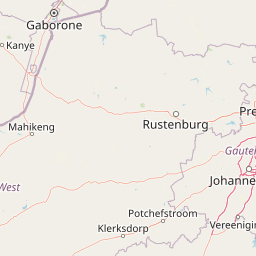
Use this park location map to pinpoint Magaliesberg Protected Natural Environment in South Africa, understand its exact geographic position, and read its mapped placement within the surrounding landscape more clearly.

Pigeon | © OpenStreetMap contributors

Location context for Magaliesberg Protected Natural Environment

North West

Visual reference guide to ancient quartzite ridges, wooded valleys, and diverse park habitats.

Magaliesberg Protected Natural Environment Photos and Landscape Scenery

Explore detailed photography showcasing the rugged terrain and dramatic ecological transition zones of the Magaliesberg Protected Natural Environment. Visual analysis of these ancient mountain ridges and grassy plains reveals the distinct protected landscape character.

A wide view of the Magaliesberg mountain range in South Africa, framed by steep, rocky cliff faces on the sides and overlooking a valley covered in trees.

Park atlas

Explore connected protected areas and regional mountain reserves

Other Parks Near Magaliesberg Protected Natural Environment

Compare Magaliesberg Protected Natural Environment with adjacent nature reserves and neighboring conservation zones across the surrounding landscape. Discover related protected areas sharing similar geological terrain, mountain ridges, and regional ecological traits.
Watercolor painting of a river flowing through a hilly, green valley with rocky cliffs on the right.
Biosphere reserveNorth West
About 2.9 km away#1 closest

South

Magaliesberg Biosphere Reserve: Geographic Overview and Protected Area Landscape Mapping

Ancient mountain ranges in South Africa

The Magaliesberg Biosphere Reserve features a rugged terrain of high ridges and deep kloofs that support a vast array of bird species and vegetation. As a significant conservation area in North West, it preserves geological history alongside critical transitional ecosystems. Discover the mapped boundaries and natural features of this protected region that bridges urban centers and wilderness.

Area
3,578.7 km²
Established
2015
Relief
Mountain
Climate
Subtropical
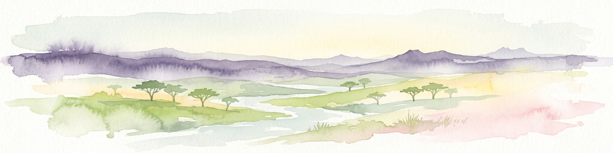
A watercolor painting showing a wide, panoramic view of rolling green and yellow hills, scattered acacia-like trees, and a distant purple mountain range under a light sky.
Nature reserveNorth West
About 33 km away#2 closest

West

Kgaswane Mountain Reserve: Map and Geographic Profile of the Magaliesberg Range

A protected nature reserve in the North West province of South Africa.

Kgaswane Mountain Reserve stands as a pivotal protected landscape within the Magaliesberg Biosphere. This atlas record provides insights into its quartzitic ridges, complex grassland and woodland ecosystems, and status as a Ramsar wetland site, offering a clear view of its geographic and conservation significance.

Area
53 km²
Established
1967
Nature reserveGauteng
About 61 km away#3 closest

Southwest

Abe Bailey Nature Reserve: Geographic Profile and Highveld Protected Area Atlas

Mapped wetlands and grassland ecosystems in Gauteng, South Africa

Spanning 4,200 hectares, Abe Bailey Nature Reserve provides a vital green refuge on the West Rand. This protected area features a unique combination of highveld grassland, seasonal wetlands, and rocky ridges that support rich birdlife and antelope populations, standing as a significant conservation feature within an urbanized province.

Area
42 km²
Relief
Upland
Climate
Temperate
Access
Access unknown
A soft watercolor illustration depicting rolling green hills and subtle landscape features on a white background.
Nature reserveGauteng
About 63 km away#4 closest

East

Klapperkop Nature Reserve: Mapping Protected Bankenveld and Highveld Landscapes

A vital protected nature reserve in Gauteng, South Africa

Klapperkop Nature Reserve protects a representative segment of threatened highveld bankenveld grassland near Pretoria. The reserve features the distinct Klapperkop hill, historic fortifications, and restored savanna ecosystems that offer a window into the natural heritage of the Gauteng region.

Area
4.6 km²
Established
1898
Relief
Upland
Climate
Subtropical
Wildlife reserveNorth West Province
About 75 km away#5 closest

North

Borakalalo Game Reserve: Protected Bushveld and Aquatic Landscapes in North West Province

Mapping a diverse South African wildlife reserve

Borakalalo Game Reserve features a distinct ecological setting within South Africa, combining woodland bushveld with the aquatic ecosystems of Klipvoor Dam. This protected area provides a habitat for varied mammal species and an extensive bird list, set against the backdrop of the interior plateau landscape in North West Province.

Area
130 km²
Relief
Upland
Access
Access unknown
Scope
Terrestrial
A pale, minimalist watercolor painting depicting rolling green hills in the distance with a winding dirt path leading through grassy plains in the foreground.
National parkNorth West Province
About 78 km away#6 closest

Northwest

Pilanesberg National Park: Geologic Mapping of a South African Alkaline Ring Complex

Explore concentric volcanic terrain and protected bushveld landscapes

Pilanesberg National Park covers the eroded root of a massive 1.2 billion year old volcano. Its defining feature is a series of concentric hills and basins that rise from the flat bushveld plains of South Africa. This protected area offers a distinct geographic study in volcanic topography, featuring rocky syenite outcrops, open savanna, and varied water sources that define the ecological character of this significant regional landscape.

Area
572 km²
Established
1984
Relief
Mountain
Climate
Subtropical
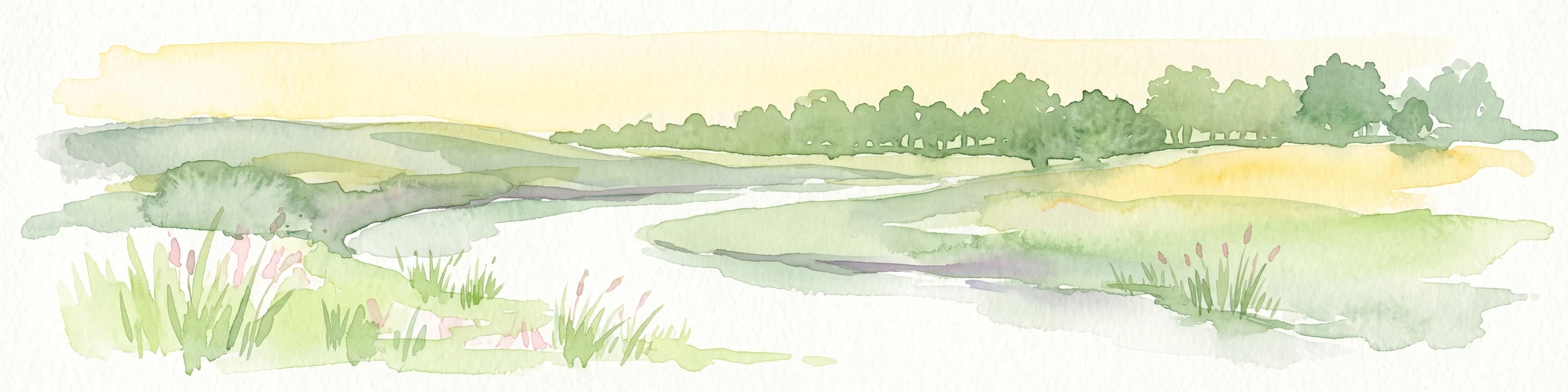
Watercolor illustration depicting a winding river through a grassy landscape with rolling hills and distant trees under a soft yellow sky.
Wildlife reserveGauteng
About 109 km away#7 closest

East

Dinokeng Game Reserve: Geographic Atlas and Protected Wildlife Area Profile

Savanna Landscapes and Riverine Corridors in Gauteng

Dinokeng Game Reserve functions as a primary wildlife sanctuary within Gauteng, South Africa, featuring a diverse mosaic of grassland and riverine bushveld. This atlas profile details the reserve geographic layout, from the Pienaars River watercourses to its integrated conservation zones, providing a clear overview of the terrain that supports its status as a significant regional protected area.

Area
210 km²
Established
2011
Relief
Upland
Climate
Subtropical
Wildlife reserveGauteng
About 110 km away#8 closest

Southeast

Marievale Bird Sanctuary: A Wildlife Reserve and Wetland Habitat in Gauteng, South Africa

Discover protected floodplain geography and wetland mapping

Marievale Bird Sanctuary preserves a complex network of pans and reedbeds along the Blesbokspruit. As a landmark of South African conservation, the area offers a focused look at how wetland ecosystems function within the Highveld topography of Gauteng, providing a critical refuge for diverse water-dependent species and migratory birds.

Area
15.26 km²
Established
1978
Relief
Lowland
Climate
Temperate

Common questions about visiting, size, designation, and location context for Magaliesberg Protected Natural Environment

Magaliesberg Protected Natural Environment FAQs for park facts, access, geography, and protected area context

Find quick answers about Magaliesberg Protected Natural Environment, including protected-area facts, park geography, trail and visitor context, and how the park fits into its surrounding country and regional landscape.
MoriAtlas Explorer

Continue Your Protected Areas Search Across the Global Atlas

Deepen your exploration by continuing the structured search for national parks and protected areas worldwide. Utilize the comprehensive filtering capabilities to compare different conservation landscapes and refine your understanding of global park geography. Discover more about the distribution and characteristics of protected natural areas.

Global natural geography