
Mori Atlas logo
Protected areaMaloti-Drakensberg Park

A transboundary wilderness of basalt cliffs, high plateaus, and ancient cultural heritage sites.

Maloti-Drakensberg Park: Mapping the Protected Mountain Landscapes and Escarpment Geography

Maloti-Drakensberg Park stands as a defining protected landscape along the border of South Africa and Lesotho, encompassing the dramatic Drakensberg escarpment. This expansive mountain terrain features deeply incised valleys, soaring peaks, and a vast network of sub-alpine habitats. Beyond the jagged ridgelines and high-altitude grasslands, the area contains the world's largest concentration of San rock art, physically connecting mountainous biodiversity with thousands of years of human cultural record.

world heritage sitetransboundary parkdrakensberg mountainsmontane ecosystemssub-alpine habitatssouth africa
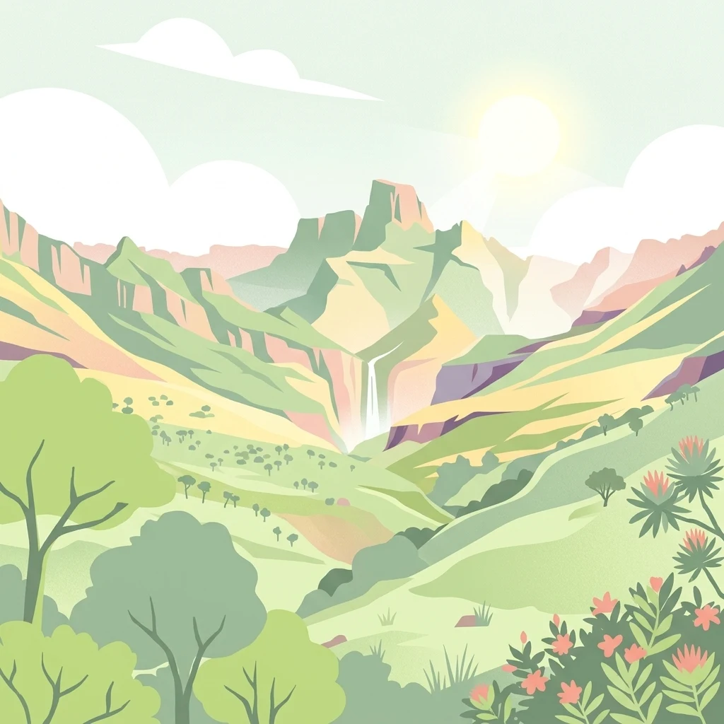
A digital illustration of a green mountain valley with a waterfall cascading down a cliff face under a bright sun.

Maloti-Drakensberg Park

Protected area

Park overview

Structured park overview, official facts, and landscape profile for Maloti-Drakensberg Park

Maloti-Drakensberg Park park facts, protected area profile, and essential visitor context

Review the core facts for Maloti-Drakensberg Park, including designation, size, terrain, visitor scale, habitats, and operating context in one park-focused overview.

About Maloti-Drakensberg Park

The Maloti-Drakensberg Park represents a multinational effort to protect the ecological and cultural heart of the Drakensberg Mountains, the great escarpment that forms the eastern edge of southern Africa's interior plateau. The park exists at the meeting point between Lesotho's highland plateau and the KwaZulu-Natal lowlands of South Africa, places where climate, altitude, and geology combine to produce some of the most distinctive mountain scenery on the continent.

At its core, the park protects a vertical landscape. Lower slopes give way to forested valleys, river gorges, and basalt cliffs, which rise toward the high-altitude grasslands of the upper plateau. This dramatic gradient creates layered ecosystems: riverine woodland in the valleys, montane grassland and shrubland on the slopes, and sub-alpine environments near the highest peaks. The variation in altitude and rainfall contributes to a unique biodiversity profile, with species and vegetation communities that occur nowhere else in such concentration.

The cultural dimension of the park is equally significant. The Drakensberg was home to San communities whose painted images of animals, hunting scenes, and spiritual encounters cover cave walls and overhangs throughout the range. With hundreds of recorded sites and many thousands of individual images, the rock art within the park is considered the most concentrated collection of its kind on Earth. The combination of ecological richness and cultural depth is what gives the Maloti-Drakensberg Park its special place among African heritage sites.

Quick facts and research context for Maloti-Drakensberg Park

The Maloti-Drakensberg Park is a UNESCO World Heritage Site inscribed in 2000 and extended in 2013. It spans the border between Lesotho and South Africa, with the Sehlabathebe National Park on the Lesotho side and the uKhahlamba Drakensberg Park on the South African side.

The combined heritage area covers several hundred thousand hectares of Drakensberg mountain terrain. The highest point within the park is Thaba Ntlenyana, which reaches 3,482 metres and is the highest peak in southern Africa. The park meets both cultural and natural World Heritage criteria, reflecting its dual value as a place of exceptional biodiversity and as a landscape of globally significant San rock art.

Protection and recognition

Documented terrestrial designation history and international recognition scope

Maloti-Drakensberg Park Protection Status and UNESCO Recognition

Maloti-Drakensberg Park holds documented terrestrial protection status and formal designation history established in the year 2000. Official records incorporate verified international recognition sources including UNESCO World Heritage status across a transboundary protected framework.

International recognition

Protection details

Protection scope
Terrestrial
Designated year
2000
Transboundary protection
Yes
Buffer area
466.3 km²
Park context

Deeper park guide and search-rich context for Maloti-Drakensberg Park

Maloti-Drakensberg Park history, landscape, wildlife, and travel context

Explore Maloti-Drakensberg Park through its history, landscape character, ecosystems, wildlife, conservation priorities, cultural context, and seasonal travel timing in a structured park guide built for atlas discovery and search intent.

Why Maloti-Drakensberg Park stands out

The park is best known for two outstanding features: the montane and sub-alpine ecosystems of the central Drakensberg escarpment and the extraordinary San rock art found within them. The combination of high-altitude grasslands, rugged cliffs, deep gorges, and biologically rich habitats supports many endemic species and is recognised internationally for its conservation importance. Equally central to the park's identity is its rock art legacy. Hundreds of sites across the escarpment contain thousands of paintings made by the San people, creating what is widely described as the largest and most significant gallery of rock art in the world. This cultural value is one of the reasons the site is inscribed under both cultural and natural criteria, rather than natural criteria alone.
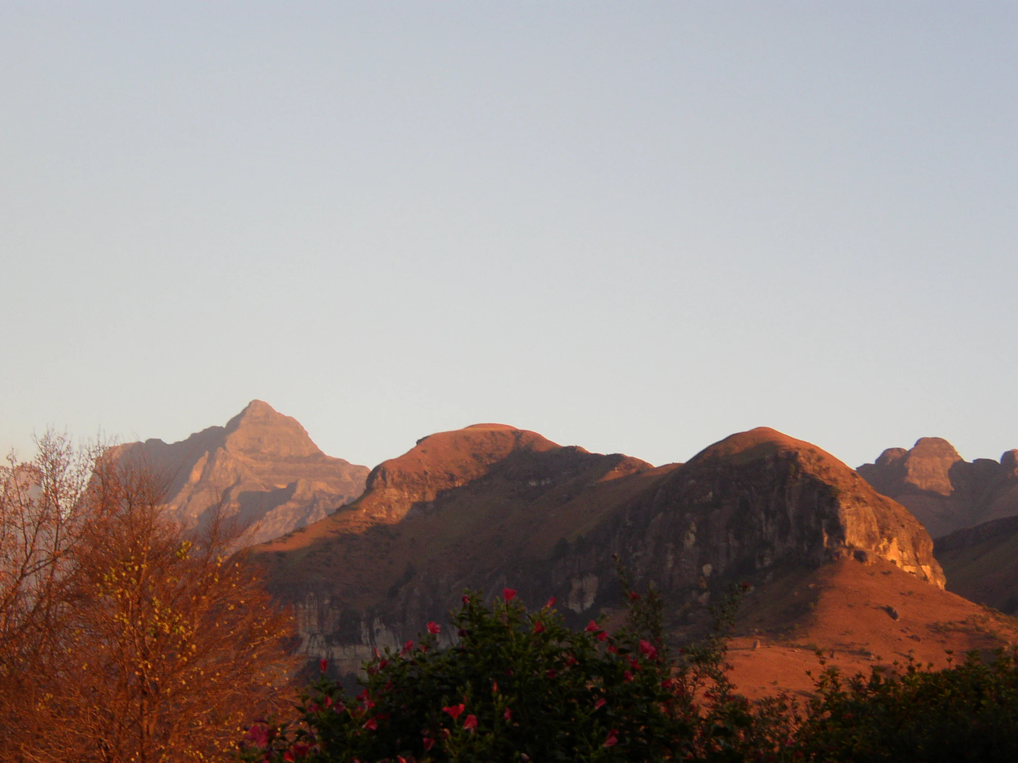
A landscape view of rugged mountain peaks bathed in the orange light of early morning or late afternoon, with darker foreground vegetation.
Golden hour light illuminating the rugged peaks of the Maloti-Drakensberg mountains.

Maloti-Drakensberg Park history and protected-area timeline

The modern Maloti-Drakensberg Park was formally established on 11 June 2001, building on the foundations of two pre-existing national parks: Sehlabathebe National Park in Lesotho and the uKhahlamba Drakensberg Park in South Africa. By linking these landscapes across an international border, the two governments created a single World Heritage Site supported by joint management principles.

The park's inscription as a UNESCO World Heritage Site began in 2000 during the 24th session of the World Heritage Committee, with a later extension in 2013 that consolidated its transboundary profile. The broader conservation framework around the park also includes the Maloti-Drakensberg Transfrontier Conservation and Development Area, conceived as a peace park covering roughly 8,113 square kilometres across Lesotho and KwaZulu-Natal.

Long before any modern designation, the Drakensberg was inhabited by San hunter-gatherer communities who left behind the painted rock art that now forms one of the park's most important heritage values. Recognising this deep human history alongside the ecological significance of the mountains is part of what shaped the park's dual cultural and natural recognition.

Maloti-Drakensberg Park landscape and geographic character

The park is defined by the Drakensberg escarpment, one of the most striking geological formations in Africa. Towering basalt cliffs rise sharply from the KwaZulu-Natal lowlands, giving way to a highland plateau that extends into Lesotho. The mountains are deeply cut by rivers and seasonal streams, producing dramatic gorges, amphitheatres, and waterfalls, including the celebrated Tugela Gorge.

At the upper end of the landscape stands Thaba Ntlenyana, at 3,482 metres the highest peak in southern Africa. Below it, the terrain rolls across rounded spurs, rolling valleys, and rocky outcrops. The combination of sheer cliff faces, broad alpine plateau, and deeply incised valleys gives the park an unusually varied topographic profile, with vistas ranging from flat grassland horizons to near-vertical rock walls.

Maloti-Drakensberg Park ecosystems, habitats, and plant life

The Maloti-Drakensberg Park protects a gradient of ecosystems that mirrors the strong altitude variation of the Drakensberg escarpment. Lower elevations support wooded valleys and grassland slopes, while higher elevations carry montane and sub-alpine vegetation that is adapted to colder temperatures, frost, and heavy seasonal rainfall.

These ecosystems are recognised as globally significant for their biodiversity, with a high proportion of species found nowhere else. The park's vegetation varies from afromontane forest patches in sheltered valleys to high-altitude grassland and shrubland near the plateau edge, creating layered habitats that support a wide community of animal life. The mosaic of altitude, moisture, and substrate makes the park an important refuge for sensitive and endemic plant species.

Maloti-Drakensberg Park wildlife and species highlights

Wildlife in the Maloti-Drakensberg Park reflects the mountain setting rather than the open savanna typical of much of southern Africa. The escarpment and plateau grasslands support populations of large herbivores adapted to cooler, high-altitude environments, including eland, which roam the high slopes and plateaus in small herds.

Predators and smaller mammals typical of Drakensberg ecosystems are present where habitat conditions allow, and the cliffs and rocky terrain provide habitat for birds of prey. Reptiles and amphibians adapted to both montane grassland and high plateau conditions contribute to the park's faunal diversity, while the varied habitats also sustain a rich invertebrate community important to overall ecosystem function.

Maloti-Drakensberg Park conservation status and protection priorities

The park's primary conservation value lies in its ability to protect an unbroken chain of high-altitude ecosystems across an international border. By combining the Lesotho and South African components into a single World Heritage Site, the park safeguards the integrity of montane and sub-alpine habitats that face pressure from climate change, grazing pressure, and development beyond park boundaries.

Recognition under both natural and cultural World Heritage criteria highlights the park's role in preserving both biodiversity and one of the world's most important concentrations of San rock art. The transfrontier approach allows coordinated management of ecosystems and cultural sites across the border, strengthening protection for landscapes that no single country could safeguard alone.

Maloti-Drakensberg Park cultural meaning and human context

The park's cultural significance is inseparable from its natural setting. The Drakensberg shelters one of the most important bodies of prehistoric rock art anywhere in the world, painted by San communities over many generations. These images, depicting animals, hunting scenes, and spiritual experiences, are a profound record of human interaction with the high mountain environment.

The cultural landscape of the Maloti-Drakensberg Park also reflects later human history, as communities in both Lesotho and KwaZulu-Natal have long inhabited and used the mountain foothills and high pastures. The transboundary park recognises that protecting this landscape means protecting both ecological systems and the deep cultural memory embedded in the rock art and the land itself.

Top sights and standout views in Maloti-Drakensberg Park

A World Heritage Site uniting high-altitude ecosystems of global biodiversity importance with the world's largest concentration of San rock art, the Maloti-Drakensberg Park offers a rare combination of natural and cultural value in a single protected landscape.

From the sheer basalt cliffs of the Tugela Gorge to the high plateau summit of Thaba Ntlenyana, the park captures the full vertical drama of the Drakensberg, supporting endemic species in montane and sub-alpine habitats while protecting hundreds of rock art sites that document thousands of years of human presence in the mountains.

Best time to visit Maloti-Drakensberg Park

Seasonal conditions strongly shape the experience of the Maloti-Drakensberg Park. The southern hemisphere summer months bring warmer temperatures but also the main rainfall period, when the mountains turn green, waterfalls run strongly, and visibility can be variable. This is the most lush period for visitors interested in vegetation, dramatic cloud formations, and high rivers.

The cooler, drier winter months often offer clearer skies, cooler hiking conditions, and sharper mountain views. Winter is often considered a strong time for appreciating the escarpment's scale and for comfortably exploring the higher plateaus, though nights and mornings can be very cold. For wildlife and rock art viewing, lighting and weather conditions can matter more than season, so visitors generally benefit from flexible itineraries that allow for both clear and overcast days.

Monthly climate preview

Long term temperature and precipitation records across representative coordinate elevations

Maloti-Drakensberg Park Climate Normals and Monthly Weather Patterns

Representative coordinate records outline the annual temperature range and monthly precipitation totals measured across a multi-year climatology period. Detailed twelve-month climate profiles provide comprehensive averages for analyzing long-term meteorological trends within the protected area.
Annual mean14 °C
7 °C18 °C
Jan18°
Feb18°
Mar16°
Apr13°
May10°
Jun
Jul
Aug10°
Sep14°
Oct15°
Nov17°
Dec18°
Warmest month
January

18.3 °C

Coolest month
July

7.3 °C

Wettest month
January

6.5 mm/day

Driest month
June

0.5 mm/day

Park location guide

Geography guide, regional context, and park location map for Maloti-Drakensberg Park

Maloti-Drakensberg Park park geography, regions, and map view in South Africa

Understand where Maloti-Drakensberg Park sits in South Africa through a broader geographic reading of the surrounding landscape, nearby location context, and its mapped position within the national park landscape.

How Maloti-Drakensberg Park fits into South Africa

South Africa is the southernmost country in Africa, spanning 1.22 million km² with a population of over 63 million. The country operates with three capital cities, Pretoria (executive), Cape Town (legislative), and Bloemfontein (judicial), and is renowned for its biodiversity, national parks, and multicultural society.

Wider geography shaping Maloti-Drakensberg Park in South Africa

South Africa occupies the southernmost region of Africa, with coastline along both the Atlantic Ocean to the west and the Indian Ocean to the east. The interior features elevated plateaus including the Highveld, with the Drakensberg escarpment marking the eastern highlands. The country shares borders with Namibia, Botswana, Zimbabwe, Mozambique, Eswatini, and Lesotho.

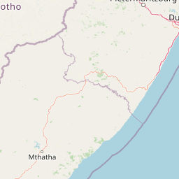
Map view of Maloti-Drakensberg Park

Use this park location map to pinpoint Maloti-Drakensberg Park in South Africa, understand its exact geographic position, and read its mapped placement within the surrounding landscape more clearly.

Pigeon | © OpenStreetMap contributors

Location context for Maloti-Drakensberg Park

KwaZulu-Natal
Natural feature types

Explore the Full Range of Maloti-Drakensberg Park Natural Landmarks

Delve into the mapped natural features of the Maloti-Drakensberg Park landscape. From the highest peaks in southern Africa to the deeply incised valleys of the Drakensberg escarpment, view how these physical landmarks define one of the most important conservation areas on the continent.
Recorded earthquake history

Explore Historical Earthquake Records for Maloti-Drakensberg Park

Access the recorded seismic history for Maloti-Drakensberg Park to review historical earthquake events and epicentre data in this mountain landscape. Use these records to analyze regional seismic trends tracked by geological services across the KwaZulu-Natal and Lesotho mountain regions.

Maloti-Drakensberg Park Earthquake History

Catalogued events

2 events

Strongest magnitude

Magnitude 4.5

Most recent event

Nov 6, 2022

This history includes earthquakes recorded inside the park or within 50 km of its borders

Visual reference of high-altitude terrain, escarpment habitats, and protected wilderness

Maloti-Drakensberg Park Landscape Photos and Mountain Scenery Imagery

Visual documentation captures the dramatic basalt cliffs, deep river valleys, and sweeping plateaus that define the protected landscape. Detailed photography reveals the unique topography of southern Africa, illustrating montane ecosystems and remote wilderness zones.

A landscape view of rugged mountain peaks bathed in the orange light of early morning or late afternoon, with darker foreground vegetation.

A wide view of a lush green valley with rolling grassy hills leading toward a prominent, sheer-faced mountain peak under a cloudy sky.

Park atlas

Compare surrounding mountain terrain and connected regional conservation landscapes

Explore Protected Areas and National Parks Near Maloti-Drakensberg Park

Browse nearby national parks and protected areas sharing the dramatic topography of the southern African escarpment. Regional comparison reveals how highland ecosystems and mountain habitats connect across the wider border landscape.
State or regional parkKwaZulu-Natal
Mapped location lies within the park boundary#1 closest

North

Royal Natal National Park: State or Regional Park in KwaZulu-Natal's Geography

Mapped boundaries and landscape context for South African protected areas.

Royal Natal National Park serves as a vital protected landscape within the diverse geography of KwaZulu-Natal, South Africa. This state or regional park offers a focused point for atlas exploration, allowing for a detailed understanding of its mapped boundaries and regional significance. By examining Royal Natal National Park, users can gain specific insights into South Africa's network of protected natural areas and their distribution, enriching overall geographic comprehension.

Area
80.94 km²
Established
1916
Relief
Mountain
Access
Moderate access
National parkQacha's Nek District
Park boundaries overlap#2 closest

South

Sehlabathebe National Park: Mapped Protected Landscape in Lesotho's Maloti Mountains

Explore high-altitude terrain, waterfalls, and ancient rock art sites.

Sehlabathebe National Park stands as a protected national park within the rugged Maloti Mountains of Lesotho's Qacha's Nek District. This destination is vital for understanding the geographic context of protected areas, featuring dramatic cliffs, iconic waterfalls like Tsoelikana, and numerous rock art sites that speak to its cultural and historical significance. Its high-altitude Afro-Alpine and sub-alpine ecosystems offer unique landscape characteristics and support notable biodiversity, making it a key point of interest for atlas-driven exploration of natural and protected terrains.

Area
69.5 km²
Established
1969
IUCN
IV
Relief
Mountain
Protected areaKwaZulu-Natal
Park boundaries overlap#3 closest

Northeast

uKhahlamba-Drakensberg Park: Protected Mountain Landscapes and Escarpment Geography in South Africa

Exploring the basalt cliffs and alpine plateau of KwaZulu-Natal.

uKhahlamba-Drakensberg Park encompasses an expansive protected region where the Drakensberg escarpment rises sharply from the foothills of KwaZulu-Natal. This atlas record details the park landscape, including its transition from sandstone terraces to high-altitude basalt, its extensive river gorges, and the concentration of archaeological cave sites. Use this resource to understand the geographic scale of this transboundary conservation area.

Area
2,429.13 km²
Relief
Mountain
Climate
Temperate
Access
Access unknown
Nature reserveKwaZulu-Natal
About 17 km away#4 closest

Southeast

Coleford Nature Reserve: Protected Grasslands and Wetlands in KwaZulu-Natal

Tracing the landscape of a key Drakensberg foothill reserve

The Coleford Nature Reserve represents a critical protected area in the Southern Drakensberg, featuring threatened Drakensberg Foothill Moist Grassland. Its landscape is defined by the Ngwagwane River valley and diverse wetland systems, providing essential habitat for endangered bird species. This reserve functions as a gateway to the broader montane geography of the southwestern KwaZulu-Natal region.

Area
12.72 km²
Established
1948
IUCN
IV
Relief
Highland
National parkFree State
21 km away#5 closest

North

Golden Gate Highlands National Park: Protected Area Atlas & Geographic Exploration

Mapping the natural terrain and boundaries of this national park.

Understand the geographic scope and protected landscape of Golden Gate Highlands National Park. This detail page provides an atlas-informed perspective on its natural terrain, mapped boundaries, and regional context within South Africa's Free State. It serves as a foundational entry point for exploring the park's specific geography and protected-area status.

Area
340 km²
Established
1963
Relief
Mountain
Climate
Temperate
Nature reserveKwaZulu-Natal
About 24 km away#6 closest

East

Impendle Nature Reserve: Protecting Endangered Grasslands and Mistbelt Ecosystems

A highland conservation sanctuary in the KwaZulu-Natal region

Located in the mist-prone foothills of the Drakensberg, Impendle Nature Reserve stands as a critical block of surviving Midlands Mistbelt Grassland. The reserve terrain combines rugged dolerite ridges with moisture-rich seepage zones and wetlands, providing a specialized habitat for threatened bird species. This protected area remains a significant site for regional biodiversity, emphasizing scientific conservation over expansive development within the KwaZulu-Natal landscape.

Area
30.46 km²
Established
1983
IUCN
IV
Relief
Upland
Nature reserveKwaZulu-Natal
25 km away#7 closest

Southeast

Ntsikeni Nature Reserve: High-Elevation Wetland Geography and Protected Landscape Atlas

A remote Drakensberg foothills wetland and montane grassland reserve.

Ntsikeni Nature Reserve is recognized as the largest and one of the highest wetlands in South Africa. Located in the KwaZulu-Natal province, this protected area features a unique, misty plateau landscape that sustains diverse orchid flora and essential headwater ecosystems. Use these geographic maps to examine the terrain, park boundaries, and the ecological transition between rolling foothills and the Drakensberg escarpment.

Area
92.87 km²
Established
1978
Relief
Upland
Climate
Temperate
A soft watercolor painting of a serene landscape with rolling hills in the background; a body of water in the midground; and grassy plains with a few scattered trees in the foreground.
Nature reserveKwaZulu-Natal
About 33 km away#8 closest

North

Spioenkop Dam Nature Reserve: Mapping KwaZulu-Natal Reservoir Landscapes and Heritage

Explore aquatic habitats and historic inland terrain.

Spioenkop Dam Nature Reserve serves as a focal point for protected biodiversity and historical land use in KwaZulu-Natal. The reserve spans a significant impoundment, creating a verdant aquatic habitat that contrasts with the surrounding grasslands and woodland terrain. Users can examine the park's boundaries and topographic features, including the historic Spion Kop battlefield that rises above the reservoir to anchor the northern landscape.

Area
44 km²
Established
1975
Relief
Upland
Climate
Temperate

Common questions about visiting, size, designation, and location context for Maloti-Drakensberg Park

Maloti-Drakensberg Park FAQs for park facts, access, geography, and protected area context

Find quick answers about Maloti-Drakensberg Park, including protected-area facts, park geography, trail and visitor context, and how the park fits into its surrounding country and regional landscape.
MoriAtlas Explorer

Continue Your Protected Areas Search Across the Global Atlas

Deepen your exploration by continuing the structured search for national parks and protected areas worldwide. Utilize the comprehensive filtering capabilities to compare different conservation landscapes and refine your understanding of global park geography. Discover more about the distribution and characteristics of protected natural areas.

Global natural geography