
Mori Atlas logo
Protected landscapeManti–La Sal National Forest

Tracing the geographic span from the Wasatch Plateau to the high alpine La Sal Mountains

Manti–La Sal National Forest: A Comprehensive Atlas of Protected Utah Landscapes

(Manti-La Sal National Forest)

Manti–La Sal National Forest serves as a sprawling protected landscape across central and southeastern Utah. The region features a unique topographic range, spanning the forested heights of the Wasatch Plateau to the rugged, remote gorges of the Dark Canyon Wilderness. Through this geographic atlas, explore the forest's transitions from cool, lush evergreen environments to the arid, high-desert terrain of the Colorado Plateau.

national forestLa Sal MountainsWasatch Plateaualpine forestsaspen grovesdark canyon wilderness
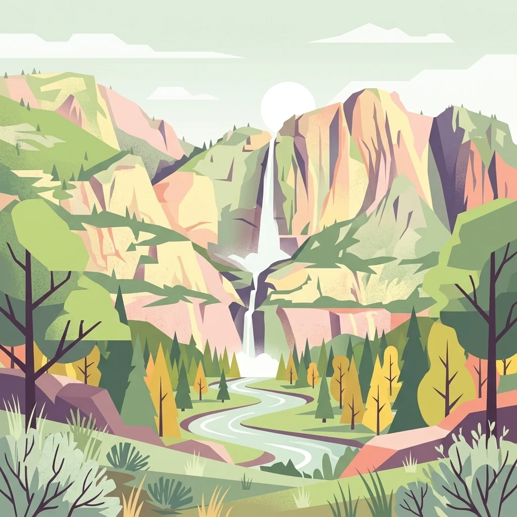
A flat-design, stylized illustration of a mountain valley. A two-tiered waterfall cascades down rocky cliffs in the center, feeding a winding river that flows through a forest of pine and deciduous trees toward the viewer.

Manti–La Sal National Forest

Protected landscape

Park overview

Structured park overview, official facts, and landscape profile for Manti-La Sal National Forest

Manti-La Sal National Forest park facts, protected area profile, and essential visitor context

Review the core facts for Manti-La Sal National Forest, including designation, size, terrain, visitor scale, habitats, and operating context in one park-focused overview.

About Manti-La Sal National Forest

Manti-La Sal National Forest is one of the largest national forests in the Intermountain West, weaving together high forested mountains, broad plateaus, and deep desert canyons across two states. The forest occupies parts of central and southeastern Utah, including San Juan, Sanpete, Emery, Grand, Carbon, Sevier, and Utah counties, with a small western Colorado extension in Montrose and Mesa counties (Only about 2.1% of the forest lies in Colorado).

The La Sal Mountains portion of the forest is the most visually iconic. These peaks rise dramatically above the surrounding desert and form the second-highest mountain range in Utah, topped by Mount Peale at 12,721 feet. Lakes such as Oowah Lake, mixed forests of pine, aspen, and evergreen, and panoramic overlooks make the La Sals a popular escape from the heat of nearby Moab. The La Sal Mountain Loop Road runs from Castle Valley up through Geyser Pass, providing access to hiking trails and dramatic views toward Arches National Park and Canyonlands National Park.

In contrast, the northern districts of the forest lie along the Wasatch Plateau, where Skyline Drive traces the backbone of an elevated forested upland and an extensive ATV trail system supports motorized recreation. The Monticello District reaches deep into the canyon country of the Colorado Plateau and includes the Dark Canyon Wilderness, the forest's only designated wilderness area, a vast and remote landscape of cliffs, gorges, and rugged side canyons.

The forest is closely tied to the broader protected-area landscape of southeastern Utah. In 2016, the Bears Ears National Monument was proclaimed across 1.35 million acres, and most of the Monticello Ranger District, along with the Dark Canyon Wilderness, now lies within the monument. This layering of federal designations reflects how Manti-La Sal functions both as a working, multiple-use national forest and as a core component of one of the most ecologically and culturally significant regions in the American West.

Quick facts and research context for Manti-La Sal National Forest

Manti-La Sal National Forest spans multiple counties in Utah, with a small portion, around 2.1 percent, extending into Mesa and Montrose counties in Colorado. It is administered by the U.S. Forest Service, with headquarters in Price, Utah, and district offices in Price, Ephraim, Ferron, Moab, and Monticello.

The forest's highest point is Mount Peale in the La Sal Mountains, reaching about 12,721 feet above sea level. Its earliest foundation was the Manti Forest Reserve, established in 1903, followed by the La Sal Forest Reserve in 1906. The combined Manti-La Sal National Forest was formally named in 1950.

Protection and recognition

Examine documented terrestrial conservation frameworks and official designation records.

Manti–La Sal National Forest Protection Status and International Recognition Facts

Terrestrial protection status records outline the management scope and conservation framework established for Manti–La Sal National Forest. Structured designation details bring together verified administrative data to clarify international recognition parameters.

Protection details

Protection scope
Terrestrial
Transboundary protection
No
Park context

Deeper park guide and search-rich context for Manti-La Sal National Forest

Manti-La Sal National Forest history, landscape, wildlife, and travel context

Explore Manti-La Sal National Forest through its history, landscape character, ecosystems, wildlife, conservation priorities, cultural context, and seasonal travel timing in a structured park guide built for atlas discovery and search intent.

Why Manti-La Sal National Forest stands out

Manti-La Sal National Forest is best known for the dramatic scenery of the La Sal Mountains, lush with lakes, pine, aspen, and evergreen forests that rise in striking visual contrast above the red rock country of southeastern Utah. The mountains offer a cooler, forested alpine-like climate and a different recreational atmosphere from the desert towns and national parks below. It is also recognized for the Wasatch Plateau and the Skyline Drive, an unpaved route along the spine of the plateau, and for encompassing part of the Dark Canyon Wilderness, one of the most remote canyon landscapes in the Colorado Plateau region.
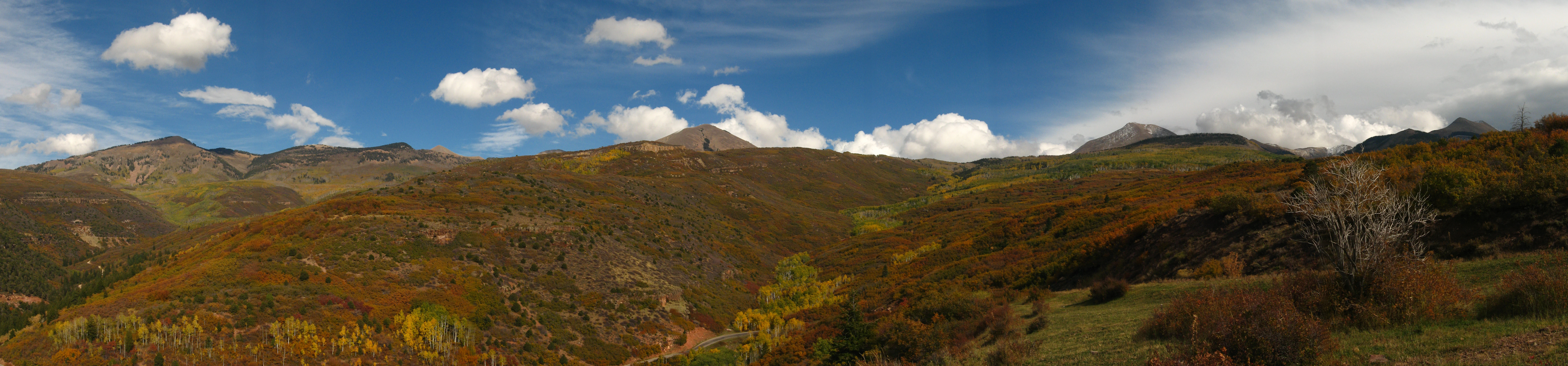
A wide panoramic view of the La Sal Mountains featuring rolling slopes covered in fall foliage under a blue sky with scattered clouds.
The La Sal Mountains in autumn, viewed from the Manti,La Sal National Forest.

Manti-La Sal National Forest history and protected-area timeline

The origins of Manti-La Sal National Forest reach back to the early twentieth century, when the federal government began setting aside forested lands under the forest reserve system that would later become the national forests. The Manti Forest Reserve was created by the United States General Land Office on May 29, 1903, originally covering 584,640 acres. The La Sal Forest Reserve followed on January 25, 1906, protecting the forested slopes of the La Sal Mountains.

Reserves continued to be reorganized and consolidated in the years that followed. On July 1, 1915, Nebo National Forest was added into the Manti reserve, expanding the forest's footprint in central Utah. By November 11, 1949, La Sal National Forest was merged into the larger Manti unit, and on August 28, 1950, the combined lands were formally named Manti-La Sal National Forest.

The forest's modern significance grew further in 2016, when President Barack Obama proclaimed the 1.35 million-acre Bears Ears National Monument. The proclamation incorporated most of the Monticello Ranger District and the Dark Canyon Wilderness into the new monument, placing the forest alongside tribal, federal, and conservation interests in the long-running effort to protect southeastern Utah's canyon country.

Manti-La Sal National Forest landscape and geographic character

Manti-La Sal National Forest encompasses a remarkably wide spectrum of terrain for a single national forest. In the northern districts, the Wasatch Plateau forms a high, broad upland covered in coniferous forest and crossed by the unpaved Skyline Drive, which follows the spine of the plateau for long-distance scenic travel. The plateau country is rolling, forested, and comparatively cool, with extensive vistas across central Utah.

Further south, the La Sal Mountains rise as the forest's most dramatic feature. Laccolithic in origin, the La Sals push above 12,000 feet and tower over the surrounding canyon country, creating strikingly lush, green skylines above arid red rock valleys. The range is dense with pine, aspen, and evergreen stands, dotted with lakes such as Oowah Lake, and ringed with scenic byways, including the La Sal Mountain Loop Road connecting Castle Valley to Geyser Pass.

In the southeastern portion of the forest, the Monticello District transitions into true canyon country. Here, the landscape deepens into the rugged gorges of the Colorado Plateau, including the vast, remote Dark Canyon Wilderness, a maze of cliffs, side canyons, and elevated mesas that harbor one of the most isolated wild landscapes in the region.
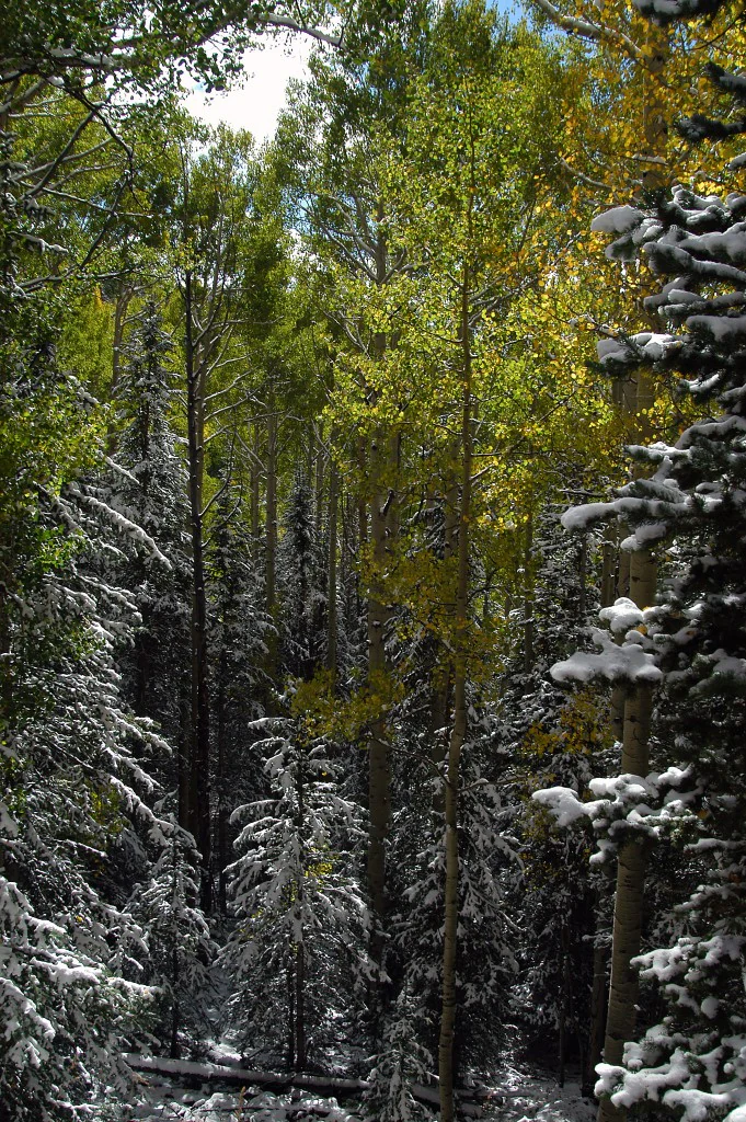
A vertical view into a dense forest with tall quaking aspen trees showing yellow autumn leaves, interspersed with evergreen pine trees covered in a light layer of early season snow.
Autumn foliage of quaking aspen trees mixed with snow-dusted conifers in the La Sal Mountains.

Manti-La Sal National Forest ecosystems, habitats, and plant life

Ecologically, the forest functions almost like a transition zone between the mont forests of the Rocky Mountains and the dry canyonlands of the Colorado Plateau. The higher elevations of the Wasatch Plateau and the La Sal Mountains support cool, moist forests dominated by pines, aspens, spruces, and firs, along with high-elevation meadows and a network of small lakes and streams that sustain both wildlife and recreation.

As elevation drops and the forest moves into its southern and southeastern districts, the vegetation thins into the pinyon-juniper woodlands, sagebrush flats, and slickrock terrain characteristic of the Colorado Plateau. This elevation-driven compression of habitats, from subalpine forest to high-desert scrub within the boundaries of a single forest, gives Manti-La Sal exceptional ecological variation.

Manti-La Sal National Forest wildlife and species highlights

The forest's habitat diversity supports a wide range of wildlife, especially in the La Sal Mountains and the surrounding canyon country. The forested highlands are home to mule deer, elk, black bears, mountain lions, and smaller mammals such as marmots and squirrels, while the aspen groves and meadows attract songbirds, raptors, and seasonal migrants.

In the lower canyon districts, wildlife patterns shift toward those of the Colorado Plateau. Desert bighorn sheep, coyotes, and various reptiles inhabit the slickrock and mesa country, while raptors such as golden eagles soar over the deep canyons of Dark Canyon and the surrounding wilderness. The combination of alpine forest and high-desert canyon ecosystems makes the forest a transitional wildlife landscape between two very different biomes.

Manti-La Sal National Forest conservation status and protection priorities

Manti-La Sal National Forest plays an outsize role in conservation across the Colorado Plateau because it spans both heavily forested highlands and arid canyonlands. The Dark Canyon Wilderness, in particular, represents one of the most intact and least-visited wild landscapes in the southeastern Utah region, providing a refuge for sensitive species, undisturbed watersheds, and undisturbed geological and archaeological resources.

The forest also contributes significantly to large landscape-scale conservation. With the creation of the Bears Ears National Monument in 2016, most of the Monticello Ranger District, including Dark Canyon, was placed under a stronger protective designation. This creates a layered conservation context in which the forest simultaneously serves as a multiple-use landscape for grazing, recreation, and timber, and as a backbone of one of the largest protected regions in the American West.

Manti-La Sal National Forest cultural meaning and human context

The lands within Manti-La Sal National Forest, especially in the Monticello District and the canyon country of Dark Canyon, overlap deeply with traditional cultural landscapes of the Southwest. These areas have long been connected to Indigenous peoples, including multiple tribal nations whose histories, sacred sites, and ancestral ties to the landscape remain an essential part of how the region is understood.

The forest also sits at the edge of a long history of Mormon settlement in central Utah, with communities such as Ephraim, Ferron, and Manti developing alongside the forested highlands. Today, both Indigenous heritage and pioneer-era land use form part of the broader cultural fabric surrounding the forest.

Top sights and standout views in Manti-La Sal National Forest

Standout features of Manti-La Sal include the La Sal Mountains, with their alpine-like forests, aspen color in fall, mountain lakes, and sweeping overlooks. The La Sal Mountain Loop Road and the nearby Geyser Pass offer access to some of the most photogenic scenery in the region, framed against a backdrop of red rock country.

Equally noteworthy are the Skyline Drive across the Wasatch Plateau, the extensive ATV trail system in the northern districts, and the Dark Canyon Wilderness, the forest's only designated wilderness area and one of the least-trammeled canyon landscapes in Utah.

Best time to visit Manti-La Sal National Forest

The forest's character shifts strongly with elevation and season, so the best time to visit depends on the experience sought. Summer is the most comfortable season for visiting the higher elevations of the La Sal Mountains and the Wasatch Plateau, when the snow has melted, lakes are accessible, and trails are open.

Fall is particularly striking in the La Sals, where aspen groves turn bright gold against the dark conifers and offer a vivid contrast with the red rock deserts visible from the range. Spring can be wet and changeable at high elevations, while winter brings snow and road closures across much of the forest except for the lower desert districts.
Monthly climate preview

Long-term representative point measurements tracking monthly averages and precipitation patterns

Manti–La Sal National Forest Climate Normals and Annual Temperature Rhythm

Representative coordinate records outline twelve-month temperature variations and precipitation distribution across the protected landscape. Detailed monthly averages establish long-term climate normals for comprehensive geographic evaluation.
Annual mean4 °C
-8 °C19 °C
Jan-8°
Feb-6°
Mar-1°
Apr
May
Jun14°
Jul19°
Aug18°
Sep12°
Oct
Nov-2°
Dec-7°
Warmest month
July

18.7 °C

Coolest month
January

-7.8 °C

Wettest month
April

1.4 mm/day

Driest month
June

0.7 mm/day

Park location guide

Geography guide, regional context, and park location map for Manti-La Sal National Forest

Manti-La Sal National Forest park geography, regions, and map view in United States of America

Understand where Manti-La Sal National Forest sits in United States of America through a broader geographic reading of the surrounding landscape, nearby location context, and its mapped position within the national park landscape.

How Manti-La Sal National Forest fits into United States of America

The United States of America is a federal presidential republic and one of the world's largest countries by area and population. It consists of 50 states across a vast territory spanning multiple time zones, with its capital in Washington, D.C. and largest city in New York City. The nation has a diverse economy, influential political system, and significant cultural and military presence globally.

Wider geography shaping Manti-La Sal National Forest in United States of America

The United States occupies a vast territory in North America, bordered by Canada to the north and Mexico to the south. The 48 contiguous states stretch from the Atlantic to the Pacific Ocean, while Alaska occupies the northwestern region and Hawaii is an archipelago in the Pacific. The country encompasses diverse terrain including the Rocky Mountains, Appalachian Mountains, Great Plains, and extensive river systems.

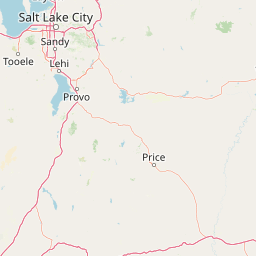
Map view of Manti-La Sal National Forest

Use this park location map to pinpoint Manti-La Sal National Forest in United States of America, understand its exact geographic position, and read its mapped placement within the surrounding landscape more clearly.

Pigeon | © OpenStreetMap contributors

Location context for Manti-La Sal National Forest

ColoradoUtah
Natural feature types

Examine the Natural Feature Atlas of Manti–La Sal National Forest

Delve into the detailed landscape topography of Manti–La Sal National Forest, including its rugged mountain ranges, deep canyons, and elevated plateaus. Gain a clear understanding of the geographic diversity found within this major protected region.
Recorded earthquake history

Explore Historical Earthquake Records near Manti–La Sal National Forest

Examine a comprehensive list of recorded seismic events and epicentre data associated with the landscapes of Manti–La Sal National Forest. MoriAtlas provides this historical catalogue to help users understand the regional seismic context through mapped data and event records.

Manti–La Sal National Forest Earthquake History

Catalogued events

183 events

Strongest magnitude

Magnitude 5.2

Most recent event

May 24, 2025

This history includes earthquakes recorded inside the park or within 50 km of its borders

Visual reference guide to alpine peaks, aspen groves, and rugged plateau terrain

Manti–La Sal National Forest Photos and Landscape Scenery

Visual documentation captures the diverse terrain of Manti–La Sal National Forest, ranging from high montane pine stands to deep desert canyon country. Detailed photographic collections reveal the unique character of the La Sal Mountains and the expansive Wasatch Plateau.

A wide panoramic view of the La Sal Mountains featuring rolling slopes covered in fall foliage under a blue sky with scattered clouds.

A distant view of snow-covered mountain peaks rising above a desert landscape with red rock formations and scrub brush in the foreground.

A vertical view into a dense forest with tall quaking aspen trees showing yellow autumn leaves, interspersed with evergreen pine trees covered in a light layer of early season snow.

Park atlas

Compare adjacent mountain ranges, plateaus, and regional conservation landscapes

Parks Near Manti–La Sal National Forest and Surrounding Protected Areas

Browsing parks near Manti–La Sal National Forest reveals connected ecological corridors spanning alpine uplands and arid canyon country. Examining adjacent protected areas provides broader regional context for the high plateaus and desert mountain ranges of the Colorado Plateau.
National parkUtah
3.2 km away#1 closest

Southeast

Canyonlands National Park: A Mapped Protected Landscape in Utah's Geography

Explore its vast geography and protected area boundaries.

Canyonlands National Park stands as a significant protected entity within the state of Utah, characterized by its immense scale and dramatic geological formations. This page facilitates an atlas-style exploration of its terrain, emphasizing its mapped boundaries and its crucial role as a protected landscape. Gain a deeper appreciation for its unique geographic setting and its place within the broader regional context.

Area
1,366.21 km²
Established
1964
IUCN
II
Visitors
818.5K annual
National parkUtah
3.5 km away#2 closest

East

Arches National Park: Utah National Park Protected Landscape Exploration

Explore mapped terrain and geographic context.

Delve into the specifics of Arches National Park, a protected national park located in Utah. This atlas-focused entry provides detailed insight into the park's protected landscape features and geographic distribution. Understand the mapped park boundaries and the unique natural terrain that shapes this significant conservation area within the United States' broader regional geography.

Area
310.31 km²
Established
1971
IUCN
II
Visitors
1.5M annual
Watercolor painting of a soft landscape featuring distant mountains, rolling hills with light vegetation, and a winding stream in the foreground.
Wildlife reserveUtah
About 12 km away#3 closest

Northwest

Mount Nebo Wilderness: Protected Alpine Ridges and Canyons of the Southern Wasatch Range

Exploring the high-elevation terrain and geological diversity of central Utah

Mount Nebo Wilderness offers a detailed look at the southern terminus of the Wasatch Range, featuring high-altitude summits, subalpine forested corridors, and the iconic badland formations of the Devil's Kitchen. This protected area provides a critical geographic anchor for the region, overlooking Utah Valley and connecting to the wider desert landscapes of the Great Basin through a series of rugged mountain canyons and high-elevation ridgelines.

Relief
Mountain
Climate
Alpine
Access
Moderate access
Scope
Terrestrial
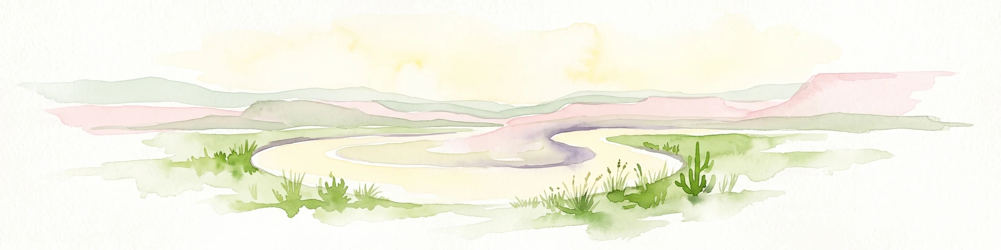
A horizontal watercolor painting showing a soft-focus landscape with a pale river winding through desert terrain under a hazy sky, with stylized cacti in the foreground.
Protected landscapeUnited States of America
14 km away#4 closest

South

Glen Canyon National Recreation Area: Protected Landscape and High Desert Geography Map

Colorado Plateau canyons, sandstone strata, and reservoir environments

Explore the geological architecture of Glen Canyon National Recreation Area, a vast federal protected landscape. The area showcases towering Navajo Sandstone cliffs, deep blue reservoir arms, and remote backcountry canyons that exemplify the distinct high desert terrain of the Colorado Plateau in the United States.

Area
5,075.23 km²
Established
1972
Visitors
5.2M annual
Relief
Upland
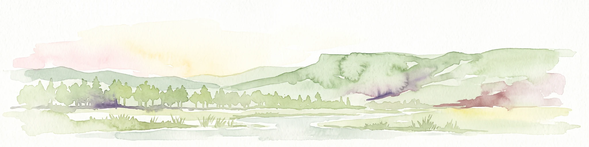
A soft watercolor illustration depicting a flat-topped mountain landscape with a line of trees and a foreground meadow.
Protected landscapeColorado
33 km away#5 closest

East

Grand Mesa National Forest: A Comprehensive Atlas of Colorado High-Plateau Geography

Mapping the basalt-capped flat-top mountain terrain

Grand Mesa National Forest stands as a primary protected landscape within the Colorado Rockies, characterized by its signature basalt-capped plateau. This forest unit serves as a vital geographic landmark, offering unique insights into high-altitude mountain terrain, subalpine water systems, and historical forest conservation. Learn about the boundaries and physical landscape features that define this massive elevated tableland above the surrounding dry valleys.

Area
1,402.46 km²
Established
1892
Relief
Highland
Climate
Alpine
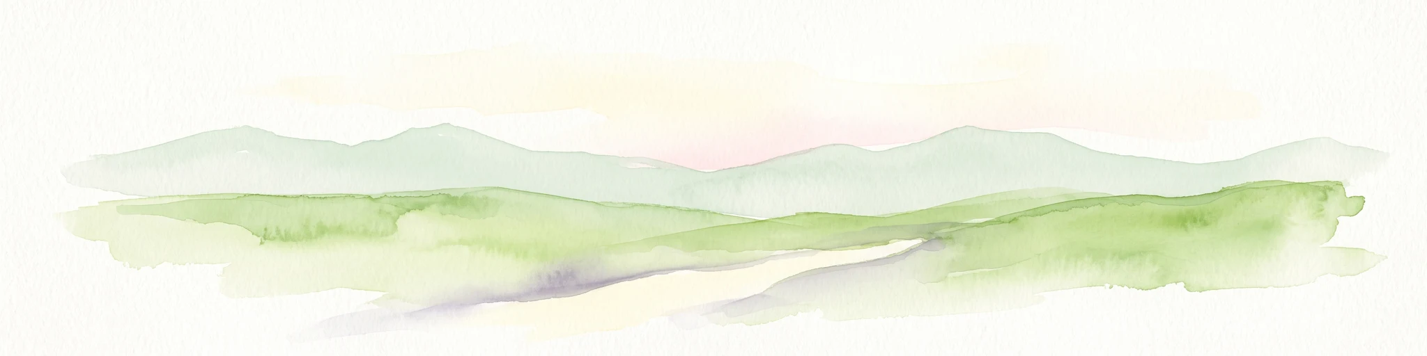
A soft watercolor illustration depicting layered green hills in the foreground with faint mountain outlines in the background against a white background.
Wildlife reserveUtah
43 km away#6 closest

North

Mount Timpanogos Wilderness: Mapping the Protected Alpine Landscape and High Wasatch Terrain

An iconic Utah protected area within the northern Wasatch Range.

Mount Timpanogos Wilderness preserves a dramatic segment of the Wasatch Range, centering on an iconic summit that rises above glacial basins and forested slopes. This protected area offers a distinct study of alpine geology, featuring high-altitude cirques, steep ridges, and the prominent presence of Emerald Lake. As a critical piece of Utah wilderness, it anchors the skyline above the urban corridor, providing a concentrated look at regional mountain ecosystems and rugged natural terrain.

Area
42.56 km²
Established
1984
IUCN
Ib
Relief
Mountain
Wildlife reserveColorado
44 km away#7 closest

East

Dominguez Canyon Wilderness: Protected Sandstone Canyons of the Uncompahgre Plateau

An expansive BLM wilderness area in western Colorado.

Dominguez Canyon Wilderness protects a diverse landscape of sandstone cliffs, benches, and deep drainage systems that descend from the Uncompahgre Plateau. The geography spans high-desert mesa tops and lush riparian canyons, offering a significant protected area within the Dominguez-Escalante National Conservation Area framework.

Area
268.2 km²
Established
2009
IUCN
Ib
Relief
Upland
National parkUtah
45 km away#8 closest

South

Capitol Reef National Park: Utah National Park Protected Landscape and Geography

Explore Capitol Reef National Park's mapped terrain and boundaries.

Delve into the protected landscape and geographic identity of Capitol Reef National Park, a key national park in Utah. This resource provides detailed context on its mapped terrain and regional setting, supporting a structured understanding of protected areas for atlas exploration. Discover the specific geographic features and park boundaries that define this protected natural area.

Area
978.95 km²
Established
1971
IUCN
II
Visitors
1.4M annual

Common questions about visiting, size, designation, and location context for Manti-La Sal National Forest

Manti-La Sal National Forest FAQs for park facts, access, geography, and protected area context

Find quick answers about Manti-La Sal National Forest, including protected-area facts, park geography, trail and visitor context, and how the park fits into its surrounding country and regional landscape.
MoriAtlas Explorer

Continue Your Protected Areas Search Across the Global Atlas

Deepen your exploration by continuing the structured search for national parks and protected areas worldwide. Utilize the comprehensive filtering capabilities to compare different conservation landscapes and refine your understanding of global park geography. Discover more about the distribution and characteristics of protected natural areas.

Global natural geography