Mori Atlas logo
Nature reserveMeiereisee und Kriegbuschwiesen

Analyzing the diverse mosaic of kettle bogs, dystrophic lakes, and former Spree floodplain meadows

Meiereisee und Kriegbuschwiesen Nature Reserve: An Atlas of Protected Landscapes in Brandenburg

(Naturschutzgebiet Meiereisee und Kriegbuschwiesen)

Meiereisee und Kriegbuschwiesen represents a vital protected area located in the Dahme-Spreewald district of Brandenburg. This nature reserve spans four distinct parcels, encompassing rare wetland habitats, inland sand dunes, and species-rich meadows that once belonged to the active Spree river floodplain. The site offers a detailed look at transitional mires and sandy grasslands that act as a refuge for specialized flora and fauna in the broader Brandenburg region.

nature reserveFFH siteNatura 2000Spreewald Biosphere ReserveBrandenburgwetland

Meiereisee und Kriegbuschwiesen

Nature reserve

Park overview

Structured park overview, official facts, and landscape profile for Meiereisee und Kriegbuschwiesen Nature Reserve

Meiereisee und Kriegbuschwiesen Nature Reserve park facts, protected area profile, and essential visitor context

Review the core facts for Meiereisee und Kriegbuschwiesen Nature Reserve, including designation, size, terrain, visitor scale, habitats, and operating context in one park-focused overview.

About Meiereisee und Kriegbuschwiesen Nature Reserve

Meiereisee und Kriegbuschwiesen is a compact but extraordinarily varied protected area in the Spreewald region of Brandenburg, in eastern Germany. Although it covers only around 117 hectares, it has been recognized at the European level as an FFH site in addition to its national nature reserve status, a combination that reflects the unusual concentration of habitat types and protected species within its borders.

Geographically the reserve sits in the Dahme-Spreewald district, within the municipality of Krausnick-Groß Wasserburg. Three of its four component parcels lie roughly one kilometer south of the Krausnick settlement, near the historical Forsthaus Meierei, while the fourth parcel, the Kriegbuschwiesen, lies a further two kilometers to the south. This layout creates a kind of ecological transect: lake and bog close to the village, dune forests and kettle bogs in between, and the more open former floodplain landscape further out toward the Spree.

The diversity of the reserve arises from the meeting of several very different landscape histories in a small area. Glacial and post-glacial processes left behind depressions that became lakes and bogs, wind-blown sands formed low inland dunes, and the shifting arms of the Spree river repeatedly flooded and reworked low-lying meadows. Today's protected area encompasses evidence of all of these processes, from open water and peat-forming vegetation through acidic bog hollows and dry pine-clad dunes to wet meadows that still carry the imprint of natural flooding.

Within this small landscape, the reserve protects a substantial list of plant and animal species. Its flora includes marsh tea, thread rush and true watercress among the species of particular concern, while its fauna includes the moor frog, the small water frog, the sand lizard, the smooth snake, the Eurasian otter, the common crane, and the white-tailed eagle, as well as the barbastelle bat, a species that has prompted specific management measures within the site. Together these elements make the reserve a meaningful component of Brandenburg's protected-area network and of the larger Spreewald Biosphere Reserve landscape.

Quick facts and research context for Meiereisee und Kriegbuschwiesen Nature Reserve

Meiereisee und Kriegbuschwiesen is a 117.23-hectare nature reserve and FFH site in Brandenburg, Germany, designated in 2000 and located in the Dahme-Spreewald district within the Spreewald Biosphere Reserve. The reserve is composed of four separate parcels near the village of Krausnick, with the Meiereisee, the dystrophic lake at its center, anchoring the northernmost section. It protects a rare local combination of dystrophic open water, a kettle bog, inland dunes with pine forest, and relict Spree floodplain meadows. The site holds the Natura 2000 identifier DE3949303 and is recognized at both national protection level under the German Naturschutzgesetz and at the European level through the Habitats Directive.

Protection and recognition

Documented terrestrial protection scope, designation history, and Natura 2000 records.

Meiereisee und Kriegbuschwiesen Protection Status and International Recognition

Meiereisee und Kriegbuschwiesen holds documented terrestrial protection status within official conservation registries. Official recognition records include Natura 2000 designations, providing structured baseline data for this protected landscape.

International recognition

Protection details

Protection scope
Terrestrial
Transboundary protection
No
WDPA ID
555519279
Park context

Deeper park guide and search-rich context for Meiereisee und Kriegbuschwiesen Nature Reserve

Meiereisee und Kriegbuschwiesen Nature Reserve history, landscape, wildlife, and travel context

Explore Meiereisee und Kriegbuschwiesen Nature Reserve through its history, landscape character, ecosystems, wildlife, conservation priorities, cultural context, and seasonal travel timing in a structured park guide built for atlas discovery and search intent.

Why Meiereisee und Kriegbuschwiesen Nature Reserve stands out

The reserve is especially known for the Meiereisee itself, a dystrophic, nutrient-rich lake transitioning into a transitional bog, together with the adjacent Lichtesee kettle bog, an unusual small acidic water body set in a hollow among surrounding dunes. It is also recognized for the Kriegbuschwiesen, a suite of species-rich, sedge-dominated wet meadows and dry sand grasslands that once lay within the active floodplain of the Spree. Beyond these landscape features, the site is valued for its fauna: breeding cranes, white-tailed eagles, otters, moor frogs, small water frogs, sand lizards, smooth snakes, and several bat species of high European conservation interest. Within the protected landscape, the reserve stands out as a small but unusually diverse refuge combining mires, dunes, and floodplain meadows within a single protected entity.
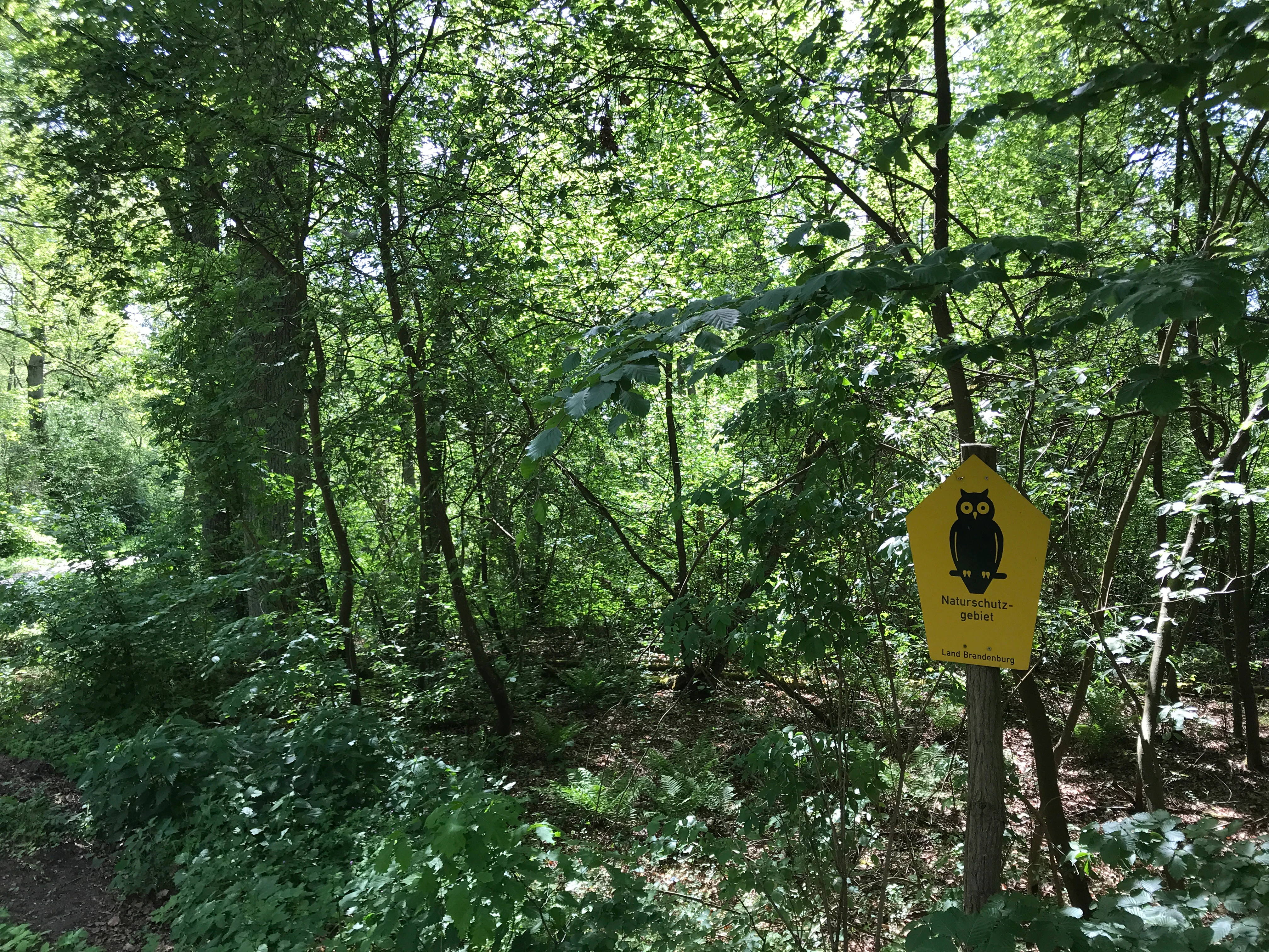
A yellow pentagonal sign with a black owl silhouette attached to a wooden post, standing in a dense green deciduous forest.
A yellow nature reserve sign featuring an owl symbol in the Meiereisee und Kriegbuschwiesen forest.

Meiereisee und Kriegbuschwiesen Nature Reserve history and protected-area timeline

The area that is now Meiereisee und Kriegbuschwiesen was not originally created as a single protected landscape but rather assembled from ecologically valuable parcels that had survived in the southern part of what is today the municipality of Krausnick-Groß Wasserburg. The lands include former floodplain meadows of the Spree river arms, inland dunes, and small lake-and-bog systems that had remained relatively intact while much of the surrounding countryside was converted to agriculture and forestry.

In 2000 the area received formal legal protection as the Naturschutzgebiet Meiereisee und Kriegbuschwiesen, consolidating its four constituent parcels into a single nationally recognized nature reserve under Brandenburg's nature conservation framework. The designation reflected both the local ecological value of the habitats and their broader significance within the Spreewald region, which itself was recognized as a UNESCO-designated biosphere reserve.

A further layer of protection came through the European Natura 2000 network, with the site registered under the identifier DE3949303 as a Fauna-Flora-Habitat (FFH) site. This means the reserve is simultaneously managed under German national nature conservation law and under the European Habitats Directive. A formal Managementplan for the FFH area, prepared by the Brandenburg Ministry for Rural Development, Environment and Agriculture and published in a short version in November 2019, set out concrete conservation objectives and measures, including habitat conversion for bat species and water-table management for the fen soils.

Meiereisee und Kriegbuschwiesen Nature Reserve landscape and geographic character

The landscape of the reserve is best understood as a small mosaic of four distinct physical settings. The northernmost parcel is dominated by the Meiereisee, a small dystrophic lake whose waters are dark, nutrient-rich, and slowly filling in through natural terrestrialization. Around its margins, reeds, sedges and bog vegetation are encroaching on the open water, producing a classic transitional mire in which the lake is gradually becoming peatland.

Just southwest of the Meiereisee lies a second, smaller water body, the Lichtesee, which sits in a kettle-like depression among the surrounding dunes. This kettle bog is mesotrophic to acidic and represents a different stage of mire development from the Meiereisee system: smaller in scale, more strongly acidic, and surrounded by mineral rather than organic substrates.

East of the lake and bog systems, the reserve climbs gently into low inland sand dunes. These dunes still carry traces of their open, grass-covered origins, and in places they remain bare or only sparsely vegetated, while elsewhere they have been colonized by Scots pine. Between the dunes and the mor hummocks grow pedunculate oak and hornbeam, lending these parts of the reserve a distinctly woodland character despite the underlying sandy and often dry substrate.

The southernmost parcel, the Kriegbuschwiesen, has a completely different character. This area was historically part of the active floodplain of the Spree and its branching channels. Although the river no longer regularly floods here, the soils still reflect that history, supporting a mix of low-intensity hay meadows on flatter ground, sedge-rich wet depressions of the former floodplain, and patches of dry sandy grassland (Sandtrockenrasen) on slightly elevated sandy rises. The result is a park-like open landscape of meadows, low thickets, and sandy clearings that contrasts sharply with the wooded dune country further north.

Meiereisee und Kriegbuschwiesen Nature Reserve ecosystems, habitats, and plant life

Ecologically, the reserve is unusual for the way it gathers a small set of habitats, each with its own characteristic flora and fauna, within a single protected area. The lake and transition mire of the Meiereisee support the hydrological and chemical conditions typical of a dystrophic system, with peat-forming vegetation dominating the margins and species adapted to low-pH, nutrient-rich water occurring both in the open water and the surrounding boggy margins.

The Lichtesee kettle bog adds a more strongly acidic and mineral-poor element, where mosses, sedges and bog plants typical of nutrient-poor mires can maintain themselves in a small basin surrounded by dunes. The dune slopes themselves support dry, often impoverished vegetation, ranging from open sand and dry grassland communities to dry pine forest and, in places, more species-rich oak and hornbeam stands.

The Kriegbuschwiesen form the most botanically diverse element of the reserve, because the management of the meadows as low-intensity hay meadows has allowed a mix of wet and dry grassland communities to persist side by side. Flat areas retain their character as nutrient-poor flatland meadows (magere Flachland-Mähwiesen), while slight depressions remain moist enough to support sedge-rich fen and floodplain communities, and sandy elevations carry fragments of dry sand grassland. This compression of contrasting grassland types within a few hundred meters is one of the principal ecological strengths of the site.

Meiereisee und Kriegbuschwiesen Nature Reserve wildlife and species highlights

The fauna of Meiereisee und Kriegbuschwiesen reflects the unusually wide range of habitats within the reserve. Wetland and amphibian life is concentrated around the lake and bog systems. Both the moor frog and the small water frog are recorded as species of particular conservation concern and depend directly on the open water, boggy margins, and surrounding damp habitats of the northernmost parcels.

Reptiles find refuge in the dry, sun-exposed dune slopes and sandy grasslands, where the sand lizard and the smooth snake both occur. These two species are typical inhabitants of warm, dry sandy landscapes with open ground, scattered shrubs, and good basking sites, conditions that the inland dunes and Sandtrockenrasen within the reserve continue to provide.

Larger and more conspicuous species depend on the combination of open water, wet meadows, mature trees, and quiet forest patches that the reserve provides. The Eurasian otter uses the lakes, bogs, and connecting stream corridors as hunting grounds. The common crane breeds in or near the wetter portions of the reserve, while the white-tailed eagle, one of Europe's largest raptors, ranges across the forests, lakes and open meadows of the wider Spreewald landscape and is recorded as a fauna of particular concern within the site.

The site also has notable bat interest. The barbastelle bat is a focus of specific management measures, while Bechstein's bat has an unclear status in the reserve and the pond bat has not yet been confirmed within its boundaries. The presence of these species ties the reserve directly to ongoing conservation work on forest structure, since bat-friendly habitat requires older, tree-rich woodland rather than the conifer plantations that have historically dominated parts of the landscape.

Meiereisee und Kriegbuschwiesen Nature Reserve conservation status and protection priorities

Conservation at Meiereisee und Kriegbuschwiesen operates on two intersecting levels. At the European level, the site is an FFH area within the Natura 2000 network and is bound by the obligations of the EU Habitats Directive. At the national level, it is a Naturschutzgebiet under Brandenburg law, which gives its four component parcels the strongest available form of area protection in the German system.

The site's conservation priorities are set out in the Brandenburg Managementplan for the FFH area. A central measure is the conversion of existing conifer stands, where possible and appropriate, into mixed deciduous-coniferous forest, in order to improve habitat conditions for bat species such as the barbastelle, which depend on older, structurally diverse woodland rather than dense, single-age spruce plantations.

Equally important is water management. Because much of the reserve's value depends on the Meiereisee and the associated lowmoor soils, plans call for raising water levels where this can be done without harming other habitats, in order to secure the Niedermoor (lowmoor) soils and to maintain the hydrological conditions on which the bog vegetation depends. The dry meadows on higher ground within the reserve are deliberately excluded from these measures because their flora depends on the opposite condition: drier, nutrient-poor mineral soils.

A complementary measure addresses the impact of ungulates, particularly through plans to reduce deer populations in order to limit browsing damage to trees, particularly young trees and the regeneration of native broadleaf species. Taken together, these measures aim to stabilize the existing habitat mosaic while gradually shifting the more degraded forest stands toward a structure that better supports the protected fauna.

Meiereisee und Kriegbuschwiesen Nature Reserve cultural meaning and human context

The reserve lies within a region with strong regional identity in eastern Germany. The Spreewald is one of the best-known cultural landscapes of Brandenburg, recognized internationally as a UNESCO Biosphere Reserve since 1991. Lowland forests, meadows, and the branching channels of the Spree river have shaped a distinctive local culture of small Sorbian-influenced villages, traditional Sorbian/Wendish vernacular architecture, and land-use practices that, while now heavily modernized, still leave their mark on the surrounding countryside.

Within this wider cultural setting, the reserve itself does not contain major historical monuments, but its component landscapes carry cultural memory in landscape form. The historical Forsthaus Meierei, a former forester's house near the northern parcels, marks the long-standing role of managed forestry in the area, and the Kriegbuschwiesen themselves reflect centuries of low-intensity meadow use on the floodplains of the Spree. Locally, the meadows have been part of the traditional hay-making economy that still characterizes the Spreewald in modified form.

Top sights and standout views in Meiereisee und Kriegbuschwiesen Nature Reserve

The Meiereisee itself, a dystrophic, terrestrializing lake with surrounding transitional mire, is the single most distinctive landscape feature of the reserve and anchors its northernmost parcel. Close by, the acidic Lichtesee kettle bog offers a contrasting example of small-scale bog formation inside a dune landscape.

The inland dune belt, with its remnant open grasslands, dry sand communities, and pine- and oak-dominated forests, gives the reserve an unusual dry-warm element at the eastern side of the protected area that complements the wetter lake and bog complexes.

Further south, the Kriegbuschwiesen provide a comparatively open, park-like landscape of former Spree floodplain, with nutrient-poor hay meadows, sedge-rich wet depressions, and patches of dry sand grassland, and serve as the most important breeding and feeding habitat for crane, otter, and the suite of amphibians and reptiles that the reserve protects.

Best time to visit Meiereisee und Kriegbuschwiesen Nature Reserve

The reserve's landscapes and wildlife change in character across the year, and the experience of visiting depends heavily on the season. Late spring, from roughly May into early June, is a particularly rewarding period for visitors interested in flora and amphibians, when the meadows of the Kriegbuschwiesen are flowering, the mire vegetation around the Meiereisee is green and growing, and amphibians such as the moor frog and small water frog are most active in and around the pools.

Summer, especially from June through August, brings the full development of the wet meadows and dune grasslands, and is also the main period when the common crane's young are present in the landscape, while the reptiles of the dunes, including the sand lizard and smooth snake, are easiest to observe during warm, dry spells.

Outside these seasons, the reserve's character shifts considerably. Autumn emphasizes woodland colors, fruit set in the oak and hornbeam stands, and crane and raptor migration across the Spreewald landscape, while winter tends to mute both the meadows and the bog vegetation and shifts attention back to the open water and the more dramatic sight of grey herons, wintering waterfowl, and the occasional white-tailed eagle passing over. Visitors should remember that this is a working nature reserve under active conservation management rather than a developed visitor destination.

Monthly climate preview

Analyzing long term temperature ranges and monthly precipitation patterns across representative coordinates

Meiereisee und Kriegbuschwiesen Climate and Weather by Month Normals

Long term climate data for Meiereisee und Kriegbuschwiesen reveals measured monthly temperature swings from sub-zero winter minimums to warm summer maximums alongside steady precipitation rates. Reviewing the complete twelve-month weather profile provides deeper statistical insight into annual meteorological rhythms and multi-year averages.
Annual mean10 °C
-1 °C21 °C
Jan-1°
Feb
Mar
Apr
May14°
Jun18°
Jul21°
Aug20°
Sep15°
Oct
Nov
Dec
Warmest month
July

20.6 °C

Coolest month
January

-0.8 °C

Wettest month
July

2.5 mm/day

Driest month
April

1.1 mm/day

Park location guide

Geography guide, regional context, and park location map for Meiereisee und Kriegbuschwiesen Nature Reserve

Meiereisee und Kriegbuschwiesen Nature Reserve park geography, regions, and map view in Germany

Understand where Meiereisee und Kriegbuschwiesen Nature Reserve sits in Germany through a broader geographic reading of the surrounding landscape, nearby location context, and its mapped position within the national park landscape.

How Meiereisee und Kriegbuschwiesen Nature Reserve fits into Germany

Germany is a federal republic in Western and Central Europe with a population of over 83 million across sixteen constituent states. It is Europe's largest economy by nominal GDP and a major global exporter and importer. The capital is Berlin, and the country borders Denmark, Poland, Czech Republic, Austria, Switzerland, France, Luxembourg, Belgium, and the Netherlands.

Wider geography shaping Meiereisee und Kriegbuschwiesen Nature Reserve in Germany

Germany is located in Western and Central Europe, spanning 357,022 km². It borders Denmark to the north, Poland and the Czech Republic to the east, Austria and Switzerland to the south, and France, Luxembourg, Belgium, and the Netherlands to the west. The country has coastlines on the Baltic Sea and North Sea to the north, with the Alps located in the southern region.

Map view of Meiereisee und Kriegbuschwiesen Nature Reserve

Use this park location map to pinpoint Meiereisee und Kriegbuschwiesen Nature Reserve in Germany, understand its exact geographic position, and read its mapped placement within the surrounding landscape more clearly.

Pigeon | © OpenStreetMap contributors

Location context for Meiereisee und Kriegbuschwiesen Nature Reserve

Brandenburg

Visual exploration of wetland habitats, dunes, and protected terrain

Meiereisee und Kriegbuschwiesen Landscape Photos and Scenery

Visual documentation of Meiereisee und Kriegbuschwiesen reveals the distinct mosaic of dystrophic lakes, acidic kettle bogs, and inland sand dunes. Examining these protected habitats provides deeper insight into the ecological character of the Brandenburg wetland landscape.

A yellow pentagonal sign with a black owl silhouette attached to a wooden post, standing in a dense green deciduous forest.

Park atlas

Discover connected wetland reserves and regional protected landscapes across southern Brandenburg

Explore Parks Near Meiereisee und Kriegbuschwiesen and Surrounding Protected Areas

Compare Meiereisee und Kriegbuschwiesen with other protected areas across the surrounding regional wetland and dune corridor. Continuing into adjacent park geography reveals broader patterns in regional conservation and habitat distribution.
Nature reserveBrandenburg
3.6 km away#1 closest

Southeast

Wiesenau Nature Reserve: Mapped Habitat Mosaic and Protected Landscapes in Brandenburg

Essential geographic overview of the Spreewald floodplain ecosystems.

Located near Lübben, Wiesenau protects a rich array of ponds, oxbows, and sediment zones integrated into the Spreewald Biosphere Reserve. The area serves as a prime example of the diverse, interconnected woodland and wetland terrain characteristic of the Brandenburg lowland region.

Area
1.35 km²
Established
1990
IUCN
IV
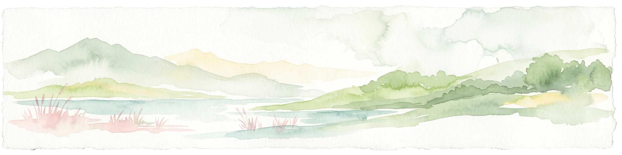
A pale, soft-toned watercolor painting showing a wetlands landscape with rolling green hills, a calm river or stream, and sparse red vegetation in the foreground.
Nature reserveBrandenburg
About 6.3 km away#2 closest

Northeast

Kockot Nature Reserve: Protected Hardwood Forest and Brandenburg Hydrology

A core zone of the Spreewald Biosphere Reserve

Kockot represents an essential piece of Brandenburg lowland geography. This nature reserve protects a water-influenced hardwood forest mosaic on peat and gley soils, offering a focused look at non-intervention forest dynamics within the Spree river floodplain system.

Area
2.868 km²
Established
1990
IUCN
IV
Nature reserveBrandenburg
16 km away#3 closest

Northwest

Stintgraben Nature Reserve: Protected Stream Landscapes in Southern Brandenburg

Ecological connectivity between glacial lakes and river corridors.

Located in the Dahme-Spreewald district, Stintgraben is a protected stream corridor defined by its lowland riparian habitats and position between the Klein Köriser See and the Dahme river. This nature reserve provides essential ecological continuity within the broader Dahme-Heideseen region, offering a clear example of how small-scale protected areas maintain the natural integrity of Germany's glacial lake districts.

Area
1.09 km²
Established
1995
IUCN
IV
Nature reserveBrandenburg
17 km away#4 closest

Northwest

Naturschutzgebiet Löptener Fenne, Wustrickwiesen: Mapped Geography and Protected Landscapes

Glacial mire and wetland systems in Brandenburg, Germany

The Naturschutzgebiet Löptener Fenne, Wustrickwiesen nature reserve provides a critical look at terrestrialized mire landscapes. Beneath its surface lie deep layers of lake-derived mud, marking this site as a key reference for understanding glacial meltwater history in eastern Germany. Today, the area serves as a focal point for active peatland renaturation and habitat management within the Dahme-Spreewald district.

Area
2.18 km²
Established
1998
IUCN
IV
Relief
Lowland
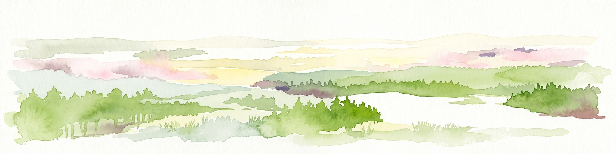
A wide panoramic watercolor illustration showing a lake landscape with green trees and a soft pink and yellow sky.
Nature reserveBrandenburg
17 km away#5 closest

Northwest

Briesensee und Klingeberg Nature Reserve: Mapped Landscapes and Glacial Terrain in Brandenburg

Protected glacial lakes and old-growth forest geography

Situated in the Dahme-Spreewald district, Briesensee und Klingeberg stands as a testament to Brandenburg's glacial past. The reserve protects complex aquatic and forest ecosystems, including genetically documented pine stands over 220 years old and the active Klingespring seepage site. Learn about the interaction between sandy moraine ridges and water-retaining depressions that sustain these rare mire and spring habitats within the German Natura 2000 network.

Area
0.799 km²
Established
2002
IUCN
IV
Nature reserveBrandenburg
About 19 km away#6 closest

North

Streganzsee-Dahme Nature Reserve: Mapping Brandenburg Protected River Landscapes and Dunes

An ecological mosaic in the Dahme-Spreewald river corridor

Streganzsee-Dahme represents an intact Brandenburg riverine corridor characterized by sharply varied topography. The reserve encompasses water bodies, floodplain forests, fens, and dry sandland heaths. Its protected boundaries connect various biotopes, offering an essential look at the region's diverse lowland ecology and the structured geography of the local conservation network.

Area
4.36 km²
Established
1999
IUCN
IV
Relief
Lowland
Nature reserveBrandenburg
19 km away#7 closest

North

Groß Schauener Seenkette Nature Reserve: Mapped Wetlands and Brandenburg Lake Geography

An undisturbed chain of shallow lakes and protected fen landscapes

This protected nature reserve in Brandenburg preserves a vital chain of six interconnected lakes. The geography is defined by extensive reedbeds, sedge stands, and rare inland saline meadows, providing a crucial habitat mosaic. Learn how these wetlands connect to the surrounding Dahme-Heideseen region through a network of terrain-focused conservation areas and historic trails.

Area
21.249 km²
Established
2000
Relief
Lowland
Climate
Temperate
Nature reserveBrandenburg
20 km away#8 closest

North

Katzenberge Nature Reserve: An Atlas of Glacial Moraine Woodlands in Brandenburg Germany

Protected oak forest habitats within the Dahme-Spreewald landscape

Katzenberge offers a focused look at the conservation of mature deciduous forest environments on sandy moraine soils. As a designated nature reserve within the Brandenburg region, the area serves as a primary reference point for studying habitat continuity and the unique glacial terrain that defines the south-eastern lowlands near the Dahme river.

Area
1.44 km²
Established
2004
IUCN
IV
Relief
Upland

Common questions about visiting, size, designation, and location context for Meiereisee und Kriegbuschwiesen Nature Reserve

Meiereisee und Kriegbuschwiesen Nature Reserve FAQs for park facts, access, geography, and protected area context

Find quick answers about Meiereisee und Kriegbuschwiesen Nature Reserve, including protected-area facts, park geography, trail and visitor context, and how the park fits into its surrounding country and regional landscape.
MoriAtlas Explorer

Continue Your Protected Areas Search Across the Global Atlas

Deepen your exploration by continuing the structured search for national parks and protected areas worldwide. Utilize the comprehensive filtering capabilities to compare different conservation landscapes and refine your understanding of global park geography. Discover more about the distribution and characteristics of protected natural areas.

Global natural geography