
Mori Atlas logo
Nature reserveRezerwat przyrody Mewia Łacha

Examining the dynamic dunes, estuarine geography, and avian habitats of the Pomeranian Voivodeship

Rezerwat przyrody Mewia Łacha: Protected Coastal Landscapes at the Vistula River Mouth

(Rezerwat przyrody „Mewia Łacha”)

Rezerwat przyrody Mewia Łacha represents a critically important nature reserve where the Vistula River channel meets the Baltic Sea. This protected area in the Pomeranian Voivodeship features a shifting mosaic of sandbars, embryonic dunes, and brackish lagoons. It provides a sanctuary for coastal bird colonies and grey seals within a complex network of estuarine and deltaic habitats.

coastal reservebird sanctuarytern breeding sitewadersgull coloniesNatura 2000
A stylized vector illustration of a coastal nature landscape featuring a calm river or bay, sandy dunes, scattered rocks in the foreground, and lush trees under a soft, pale sun.

Rezerwat przyrody Mewia Łacha

Nature reserve

Park overview

Structured park overview, official facts, and landscape profile for Mewia Łacha Nature Reserve

Mewia Łacha Nature Reserve park facts, protected area profile, and essential visitor context

Review the core facts for Mewia Łacha Nature Reserve, including designation, size, terrain, visitor scale, habitats, and operating context in one park-focused overview.

About Mewia Łacha Nature Reserve

Mewia Łacha is a coastal faunistic nature reserve centered on the dynamic sand spits, dunes, and lagoon patches that mark the current mouth of the Vistula. The Polish name literally means "Gulls' Sandbar," and the reserve exists to protect a landscape that is constantly reshaped by the interaction between the longshore drift of the Hel Peninsula, the discharge of Poland's largest river, and the shallow waters of the Gulf of Gdańsk. The protected area lies in the Pomeranian Voivodeship and is part of the broader Mierzeja Wiślana mezoregion, sandwiched between the urban coast of Gdańsk and the open rural coastline of the Stegna commune.

The reserve took its present form in 1991, when Polish authorities formally recognized the area as a faunistic, rather than purely ornithological, reserve, expanding its mandate beyond birds alone. Since then, it has functioned as one of the most intensively managed coastal sites in Poland, combining habitat protection with controlled public access. A single permitted footpath links the riverbank to the beach, and visitors are otherwise excluded from the nesting spits, dunes, and delta lake in order to minimize disturbance during the breeding season.

Ecologically, Mewia Łacha represents a rare convergence of freshwater, brackish, and marine influences within a very compact area. The main eastern fragment contains active sandbars and low dunes along the channel mouth, dune slacks and depressions that hold a small delta-type lake, and vegetated strips supporting both freshwater and salt-tolerant plant communities. The smaller western fragment on Sobieszewska Island adds a contrasting setting of older dune formations and quiet lagoons, which doubles both the habitat diversity and the conservation responsibility of the reserve.

The reserve is embedded in a layered system of protection. It overlaps with two Natura 2000 sites, the bird directive area known as Ujście Wisły (PLB220004) and the habitat directive area Ostoja w Ujściu Wisły (PLH220044). It is also recorded in the HELCOM network of Baltic Sea Protected Areas as MPA 302 Ujście Wisły. Within Polish domestic planning, it sits inside the buffer zone of the Mierzeja Wiślana Landscape Park, giving it a continuous protected context from landscape to European network scales.

Today Mewia Łacha is widely considered a flagship site for coastal bird conservation in Poland. Its combination of breeding terns, large gull concentrations, waterfowl staging areas, and seal haul-outs makes it a destination of regional, national, and Baltic-wide significance, and a key reference point for monitoring shoreline dynamics, climate-driven habitat change, and the management of human pressure along the southern Baltic coast.

Quick facts and research context for Mewia Łacha Nature Reserve

Mewia Łacha is a faunistic nature reserve situated in the Pomeranian Voivodeship of northern Poland, on the Baltic coast at the outlet of the Vistula channel into the Gulf of Gdańsk. Created in 1991 by ministerial decree, it lies within the mezoregion known as Mierzeja Wiślana and sits inside the buffer zone of the Mierzeja Wiślana Landscape Park.

The reserve has two separate parts: a smaller western fragment of about 19 hectares on Sobieszewska Island within the city of Gdańsk, and a much larger eastern fragment of roughly 132 hectares on the Stegna commune near Mikoszewo. Total area is approximately 150 hectares, and the site is formally recognized as an EU Natura 2000 bird and habitat area, as well as a HELCOM Marine Protected Area.

Protection and recognition

Review documented protection status and management scope for Rezerwat przyrody Mewia Łacha.

Rezerwat przyrody Mewia Łacha Protection Status and Conservation Recognition

Examine the documented protection status and mixed management scope established for Rezerwat przyrody Mewia Łacha within its regional landscape. Structured records detail the official conservation framework without relying on external international designations or external programs.

Protection details

Protection scope
Mixed
Transboundary protection
No
Park context

Deeper park guide and search-rich context for Mewia Łacha Nature Reserve

Mewia Łacha Nature Reserve history, landscape, wildlife, and travel context

Explore Mewia Łacha Nature Reserve through its history, landscape character, ecosystems, wildlife, conservation priorities, cultural context, and seasonal travel timing in a structured park guide built for atlas discovery and search intent.

Why Mewia Łacha Nature Reserve stands out

Mewia Łacha is best known as the only regular breeding site in Poland for sandwich terns, a species that nests in significant colonies on the reserve's shifting sand spits. It is equally celebrated for hosting the largest concentrations in Europe of little gull and mew gull, with seasonal counts climbing into the tens of thousands. The reserve is also recognized as a critical staging and wintering area for migratory waterfowl, particularly diving ducks such as goldeneye, tufted duck, and smew. Together, these characteristics have made the mouth of the Vistula one of the most important bird sites on the entire southern Baltic coast, and the reserve is widely treated as a flagship location for Polish coastal conservation.
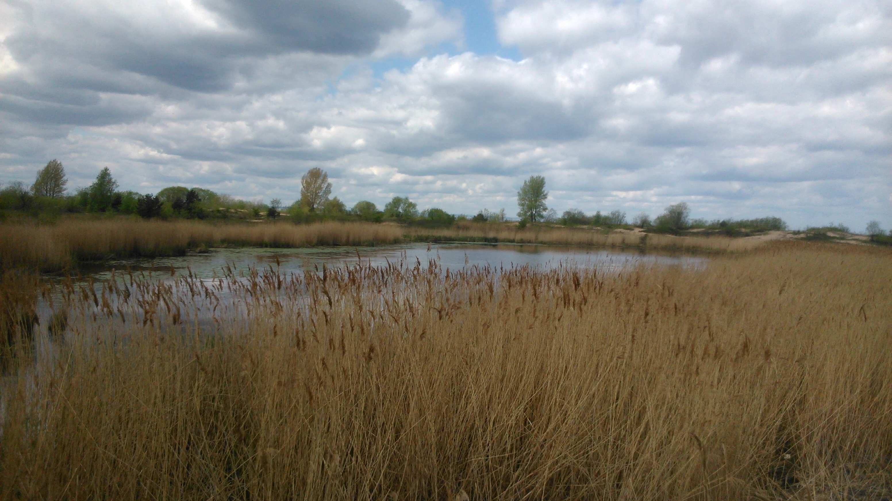
A wide view of a calm, shallow pond surrounded by tall, golden-brown reeds under a cloudy sky.
A view of the wetland habitat and reed beds at the Mewia Łacha Nature Reserve.

Mewia Łacha Nature Reserve history and protected-area timeline

The reserve was established in 1991 by a Polish ministerial decree, formalizing long-standing recognition that the sand spits at the mouth of the Vistula were of exceptional ornithological value. The founding legal act, published in the official Polish journal, set the total area at roughly 150 hectares and gave the site a faunistic classification focused on birds, replacing an earlier narrower ornithological designation.

From 2007 onward, the reserve gained additional national prominence when it became the only confirmed breeding site in Poland for sandwich terns, a species whose colonies fluctuated sharply in response to flooding events on the Vistula. A major flood surge in 2010 destroyed most of that year's nests and reshaped the sandbar hosting the colony, prompting renewed attention to the vulnerability of breeding birds to hydrological extremes.

In 2013, an observation platform on the reserve was destroyed by fire before it could be put into service, marking a small but visible setback for public engagement. The same broader period saw the reserve integrated into the EU Natura 2000 network and recognized as part of the HELCOM Baltic Sea Protected Areas system, anchoring its conservation significance at the European and Baltic-regional levels. Grey seal monitoring projects run between 2015 and 2018 further highlighted the site's growing importance as a marine mammal haul-out, especially during the annual moult.

Mewia Łacha Nature Reserve landscape and geographic character

Mewia Łacha occupies a narrow, dynamic coastal strip where the engineered outlet of the Vistula meets the Baltic Sea. The reserve's terrain is dominated by low-lying sandbars and freshly deposited sediment flats, which shift in outline from year to year under the influence of river discharge, storms, and longshore currents. These open sand surfaces are the core of the site's biological character, and they are surrounded by low embryonic dunes and older, more stable dune ridges toward the inland edge.

Behind the dunes lie shallow dune slacks and a small delta lake on the Stegna side, with additional brackish pools and quiet lagoon margins on the Sobieszewska Island side. The beach itself is wide, flat, and heavily influenced by the freshwater plume from the Vistula, which mingles with the saline waters of the Gulf of Gdańsk to create a distinct estuarine gradient at the shoreline.

Vegetation is sparse on the active sandbars and denser in the slacks and on the older dunes. Shrubby thickets of sea buckthorn anchor the more stable surfaces, while herbaceous communities of dune plants and salt-tolerant species occupy the transitional zones. The result is a landscape that reads as a working mosaic of bare sand, dune, slacks, scrub, and shallow water, all compressed into a small but intensely varied coastal envelope.

Mewia Łacha Nature Reserve ecosystems, habitats, and plant life

Ecologically, Mewia Łacha sits at the meeting point of three strong environmental gradients: freshwater from the Vistula, brackish water from the delta lakes, and fully marine Baltic conditions along the shore. This creates a compact mosaic of habitats, from open sand and pioneer dune vegetation to brackish lagoon margins, wet slacks, scrub, and sheltered standing water.

The sand spits themselves are biologically poor in plant species but extraordinarily rich in their function as breeding plots for colonial seabirds, while the slacks and lagoons support richer plant communities that include protected and regionally rare species. Among the protected flora present in the reserve are fragrant toadflax, seaside eryngo, and a red-flowered orchid, complemented by dune specialists such as broad-leaved helleborine, common restharrow, sand sedge, and sea buckthorn. Salt-tolerant species, including a coastal angelica, beach grass, a saltmarsh bulrush, and a spiny saltwort, occupy the more saline fringes.

The reserve's small delta lake and the lagoon patches near Sobieszewska Island function as important freshwater and brackish stepping stones within an otherwise sand-dominated coastline, supporting amphibians, aquatic invertebrates, and wetland-dependent vegetation. This habitat diversity gives Mewia Łacha a conservation profile that extends well beyond its importance for birds.

Mewia Łacha Nature Reserve wildlife and species highlights

The wildlife profile of Mewia Łacha is dominated by birds, for which the reserve was originally designated and continues to be best known. It is the only regular breeding site in Poland for sandwich terns, with colony sizes that have ranged widely from a few hundred to several hundred pairs, depending on year and disturbance levels. Other terns breeding in the reserve include little tern and common tern, alongside smaller numbers of ringed plovers and oystercatchers, with historical colonies of herring gull and black-headed gull and occasional breeding records of gull-billed tern and Kentish plover.

The reserve is also one of the most important non-breeding season sites in the region. It hosts what is described as the largest concentration in Europe of little gull, peaking at tens of thousands of individuals, and an exceptionally large gathering of mew gull, with seasonal counts reaching into the six figures. In winter, the reserve shelters large flocks of diving ducks, with goldeneye, tufted duck, and smew among the most numerous species, taking advantage of the relatively ice-free waters near the river mouth.

Marine mammals are a regular presence on the reserve's sandbars. A small group of grey seals has been recorded hauling out in the area, with monitoring work in the second half of the 2010s indicating a moult-season herd numbering in the low hundreds. Harbour seals have also been observed, and in 2011 a female harbour seal was recorded with a newborn pup on the reserve, only the second documented birth of the species in Poland. Eurasian beavers occupy the dune lakes and ponds on both sides of the channel mouth, especially around the Mikoszewo lake and the smaller pools near Gdańsk.

Mewia Łacha Nature Reserve conservation status and protection priorities

Mewia Łacha is protected primarily because the shifting sandbars and quiet lagoon margins at the Vistula mouth serve as irreplaceable breeding, feeding, and resting habitat for waterbirds at a continental crossroads. The reserve's conservation significance is amplified by the rarity of comparable conditions elsewhere on the Polish coast, particularly for sandwich terns and for the large gull concentrations that depend on open, undisturbed sand.

At the European level, the reserve is integrated into Natura 2000 through both the bird directive area Ujście Wisły and the habitat directive area Ostoja w Ujściu Wisły, and it appears in the HELCOM Baltic Sea Protected Areas network as MPA 302 Ujście Wisły. Domestically, it sits in the buffer zone of the Mierzeja Wiślana Landscape Park, layering landscape-level protection on top of strict reserve rules.

Management efforts focus on keeping disturbance to a minimum during the breeding season, which is why public access is restricted to a single marked path and dogs, off-path walking, sunbathing, and landing on the sandbars and dunes are all prohibited. These restrictions are explicitly intended to protect nesting terns and plovers from trampling and predation pressure, including from foxes, which have in the past caused entire colonies to abandon parts of the reserve. At the same time, ongoing seal monitoring and Natura 2000 reporting have positioned the reserve as a benchmark site for tracking the recovery of Baltic grey seals and the health of estuarine bird populations in the southern Baltic.

Mewia Łacha Nature Reserve cultural meaning and human context

The site sits on a coast long marked by the interaction between human engineering and natural shoreline dynamics. The Vistula's modern outlet at Przekop Wisły is itself a major twentieth-century intervention, and the reserve exists in part because the engineered mouth produced the very sandbars and lagoon habitats that the protected species depend on. Local communities at Mikoszewo and Świbno have historically worked the river, the fisheries, and the beaches, and the reserve represents a shift in regional identity from working coast toward protected landscape.

The name "Mewia Łacha," meaning something close to "Gulls' Sandbar," reflects an older colloquial understanding of the site as a place defined by its birdlife long before formal conservation status arrived. Today the reserve is also embedded in regional nature education, with the nearby city of Gdańsk using the site as a flagship for public engagement with coastal ecology, although infrastructure setbacks such as the loss of an observation platform in 2013 have limited on-site interpretive capacity.

Top sights and standout views in Mewia Łacha Nature Reserve

Mewia Łacha is distinguished by the rare overlap of three conservation priorities in one small coastal area: an active seabird breeding site, a staging and wintering ground for tens of thousands of waterfowl, and one of the most important grey seal haul-outs on the Polish Baltic coast. The reserve's only-in-Poland sandwich tern colonies give it an outsized national profile, while its little gull and mew gull concentrations place it among the most significant gull sites in Europe.

Equally distinctive is the reserve's compact mosaic of active sandbars, dunes, dune slacks, brackish lagoons, and a delta-type lake, all set inside a layered network of landscape park, Natura 2000, and HELCOM protections. The result is a small but unusually complete example of southern Baltic estuarine ecology, valued as much for its dynamism and vulnerability as for any single iconic species.

Best time to visit Mewia Łacha Nature Reserve

The character of a visit to Mewia Łacha changes noticeably with the seasons, and bird-driven seasonality is the dominant factor. Late spring and summer are the prime breeding period, when terns, plovers, and oystercatchers occupy the sandbars and visitors are most likely to witness active colonies, but this is also when access restrictions are tightest to protect the nests.

Autumn brings large migratory movements of waders and waterfowl, with autumn gull numbers swelling the reserve's already large gatherings, while winter is the time to see the largest concentrations of diving ducks, including goldeneye, tufted duck, and smew, exploiting the relatively ice-free waters near the river mouth. Spring migration adds further variety, and early mornings or evenings generally offer the best chances of both bird activity and seal sightings, though presence of seals is never guaranteed.
Monthly climate preview

Long-term monthly temperature and precipitation data for Rezerwat przyrody Mewia Łacha

Rezerwat przyrody Mewia Łacha climate normals and temperature rhythm

Representative coordinate measurements reveal the annual temperature and precipitation rhythm across Rezerwat przyrody Mewia Łacha from 1991 to 2020. Examining the complete twelve-month climatology profile provides deeper insight into long-term monthly normals for this protected area.
Annual mean8 °C
0 °C18 °C
Jan
Feb
Mar
Apr
May11°
Jun15°
Jul18°
Aug18°
Sep14°
Oct
Nov
Dec
Warmest month
August

18.3 °C

Coolest month
January

-0.5 °C

Wettest month
July

2.5 mm/day

Driest month
April

1.3 mm/day

Park location guide

Geography guide, regional context, and park location map for Mewia Łacha Nature Reserve

Mewia Łacha Nature Reserve park geography, regions, and map view in Poland

Understand where Mewia Łacha Nature Reserve sits in Poland through a broader geographic reading of the surrounding landscape, nearby location context, and its mapped position within the national park landscape.

How Mewia Łacha Nature Reserve fits into Poland

Poland, officially the Republic of Poland, is a Central European country spanning from the Baltic Sea in the north to the Carpathian Mountains in the south. It borders Germany, Czech Republic, Slovakia, Ukraine, Belarus, Lithuania, and Kaliningrad Oblast. The country has a temperate climate, diverse landscapes, and is known for its rich history, cultural heritage, and strong economic position within the EU.

Wider geography shaping Mewia Łacha Nature Reserve in Poland

Poland occupies 312,696 km2 in Central Europe, extending from the Baltic Sea coast in the north to the Sudetes and Carpathian Mountains in the south. It borders Germany to the west, Czech Republic and Slovakia to the south, Ukraine and Belarus to the east, and Lithuania and Kaliningrad Oblast to the northeast. The landscape includes lowland plains, uplands, and mountain ranges.

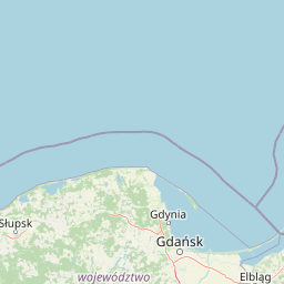
Map view of Mewia Łacha Nature Reserve

Use this park location map to pinpoint Mewia Łacha Nature Reserve in Poland, understand its exact geographic position, and read its mapped placement within the surrounding landscape more clearly.

Pigeon | © OpenStreetMap contributors

Location context for Mewia Łacha Nature Reserve

Pomeranian Voivodeship

Visual reference guide to shifting sand spits, dune habitats, and estuarine wildlife reserves

Rezerwat przyrody Mewia Łacha Photos and Coastal Landscape Scenery

Visual documentation captures the dynamic coastal terrain, active sandbars, and shifting estuarine habitats of Rezerwat przyrody Mewia Łacha. Examining these protected landscapes reveals the physical environment supporting major seabird colonies and coastal wildlife populations along the Baltic shore.

A wide view of a calm, shallow pond surrounded by tall, golden-brown reeds under a cloudy sky.

A wide view of a sandy, marshy coastal area with a small stream flowing toward a larger body of water, with pink surveyor tape marking an area.

Park atlas

Compare adjacent coastal landscapes, regional reserves, and wetland habitats

Other Protected Areas and Parks Near Rezerwat przyrody Mewia Łacha

Browse nearby protected areas and related coastal reserves located around the wider Vistula estuary and Baltic shoreline. Comparing these adjacent conservation lands provides broader geographic context for the dynamic dune and wetland terrain found near Rezerwat przyrody Mewia Łacha.
A wide panoramic watercolor illustration showing a pastoral landscape with green rolling hills, a winding river, scattered trees, and a soft sky with pink and yellow hues.
Protected areaPomeranian Voivodeship
About 19 km away#1 closest

West

Twierdza Wisłoujście Protected Area: Coastal Geography and Historical Mapping in Gdańsk

A historic Baltic fortification and vital ecological site in Pomeranian Voivodeship.

Explore the layered masonry and water-influenced landscape of Twierdza Wisłoujście, a coastal fortress established on the delta of the Vistula River. This site bridges the history of maritime defense and modern ecological conservation as a designated Natura 2000 area. Examine how shifting river channels and centuries of construction define the current defensive perimeters and moated surroundings within the Pomeranian Voivodeship.

Established
1482
Relief
Lowland
Climate
Temperate
Access
Easy access
Nature reserveGdańsk
About 22 km away#2 closest

West

Zbiornik Wody Stara Orunia: A Protected Industrial Heritage Site and Nature Reserve in Gdańsk

Historic brick architecture meeting urban bat conservation zones

Built in 1869, this historic underground reservoir in the Orunia district of Gdańsk combines rare Prussian engineering with a vital role as a Natura 2000 protected habitat. The site serves as a key component of the regional water trail, offering a look into the complex relationship between industrial infrastructure, urban landscape development, and the protection of essential wildlife hibernation cycles.

Area
0.001 km²
Established
1869
Relief
Upland
Climate
Temperate
Protected landscapePoland
About 27 km away#3 closest

East

Zalew Wiślany i Mierzeja Wiślana Protected Landscape and Vistula Coastal Geography

A coastal mosaic of lagoon waters, sand dunes, and bog forests

Understand the physical landscape of Zalew Wiślany i Mierzeja Wiślana, featuring an aquatic environment where three quarters of the territory consists of brackish water. Trace the geography of the Vistula Sandspit as it transitions through dune successions, pine-birch woodlands, and sensitive estuarine meadows along the Polish coast.

Area
408.623 km²
Relief
Lowland
Climate
Temperate
Scope
Mixed
Nature reservePomeranian Voivodeship
About 27 km away#4 closest

West

Dolina Strzyży Nature Reserve Protected Forest and Stream Valley Geography

Natural riparian forest in Pomeranian Voivodeship

Explore the geographic profile of Dolina Strzyży Nature Reserve, a protected valley woodland in the Pomeranian Voivodeship of Poland. This reserve maintains dense oak-hornbeam habitats and stream-side ecosystems, functioning as a vital green connection between urban Gdańsk and the expansive Trójmiejski Park Krajobrazowy, preserving historic forest remnants.

Area
0.385 km²
Established
2007
Relief
Upland
Climate
Temperate
Protected landscapePomeranian Voivodeship
About 30 km away#5 closest

West

Trójmiejski Park Krajobrazowy: Protected Landscape and Glacial Geography in Pomerania

Exploring the forested moraine upland near the Baltic coast

Covering nearly 20,000 hectares, Trójmiejski Park Krajobrazowy forms an essential green belt along the Kashubian moraine. Its terrain is defined by dramatic erosion, including 80-meter deep ravines and extensive pine-beech forests that host rare relic plant species and protected peatland habitats.

Area
199.3 km²
Established
1979
Relief
Upland
Climate
Temperate
Protected landscapeWarmian-Masurian Voivodeship
About 30 km away#6 closest

East

Park Krajobrazowy Wysoczyzny Elbląskiej: Mapping Upland Terrain and Protected Forest Zones

Geography of a distinctive morainic plateau in northern Poland

Investigate the natural landscape of Park Krajobrazowy Wysoczyzny Elbląskiej, a protected area in the Warmian-Masurian Voivodeship. Focus on the interplay between stream valleys, morainic ridges, and rare plant communities. This mapping resource details the ecological significance of the upland terrain and its transition toward coastal lowland borders.

Area
137.32 km²
Established
1985
Relief
Upland
Climate
Temperate
Nature reservePomeranian Voivodeship
About 33 km away#7 closest

Southwest

Dolina Kłodawy Nature Reserve: Geography and Botanical Protected Areas in Pomeranian Voivodeship

Glacial river gorge landscapes in Northern Poland

This protected area centers on a 1.6 kilometer section of the Kłodawa stream, showcasing complex forest ecosystems including ash-alder woodlands and oak-hornbeam slopes. The site remains a vital reference for regional botanical geography, highlighting how glacial moraine hills create unique habitats for rare plants within the Pomeranian Voivodeship landscape.

Area
0.104 km²
Established
1999
Relief
Lowland
Climate
Temperate
A horizontal watercolor illustration showing a gentle river landscape with soft green meadows, trees, and rolling hills in the background.
Nature reservePomeranian Voivodeship
About 34 km away#8 closest

Northwest

Kacze Łęgi Nature Reserve: Mapped Protected Woodland and River Valley Geography

Riparian floodplain forest in the Pomeranian Voivodeship of Poland

Kacze Łęgi functions as a crucial nature reserve that maintains an unusually well-preserved fragment of elm and alder floodplain forest. Nestled along the Kacza River valley in Gdynia, this site offers a concentrated look at the original vegetation of Baltic river valleys. It remains a key component of the regional protected landscape, providing a deep study of moisture-loving woodland within the larger context of the Pomeranian coastal lowlands.

Area
0.09 km²
Established
1983
Relief
Lowland
Scope
Terrestrial

Common questions about visiting, size, designation, and location context for Mewia Łacha Nature Reserve

Mewia Łacha Nature Reserve FAQs for park facts, access, geography, and protected area context

Find quick answers about Mewia Łacha Nature Reserve, including protected-area facts, park geography, trail and visitor context, and how the park fits into its surrounding country and regional landscape.
MoriAtlas Explorer

Continue Your Protected Areas Search Across the Global Atlas

Deepen your exploration by continuing the structured search for national parks and protected areas worldwide. Utilize the comprehensive filtering capabilities to compare different conservation landscapes and refine your understanding of global park geography. Discover more about the distribution and characteristics of protected natural areas.

Global natural geography