
Mori Atlas logo
National parkParc national de Missolonghi-Etolikó

A diverse protected area spanning river deltas, brackish lagoons, and limestone mountain terrain

Parc national de Missolonghi-Etolikó: Mapping the Protected Wetlands and Coastal Landscapes

(National Park of the Missolonghi-Etoliko Lagoons, the Lower Courses and Estuaries of the Acheloos and Evinos Rivers, and the Echinades Islands)

Parc national de Missolonghi-Etolikó encompasses a vast protected territory on the northwestern edge of the Gulf of Patras. This complex geography features the largest lagoon system in Greece, the expansive deltas of the Acheloos and Evinos rivers, and dramatic limestone gorges such as Klisoura. By integrating these diverse environments, from the Echinades Islands to the Lesini ash forest, the park serves as a critical node for coastal and migratory habitats in the Grèce-Occidentale region.

wetlandslagoonsriver-deltacoastal-ecosystemsmigratory-birdsbirdwatching
A stylized vector illustration of a tranquil lagoon with geometric salt pans in the foreground, a small boat on the water, and large mountains in the background under a soft sunrise or sunset sky.

Parc national de Missolonghi-Etolikó

National park

Park overview

Structured park overview, official facts, and landscape profile for Missolonghi-Etoliko National Park

Missolonghi-Etoliko National Park park facts, protected area profile, and essential visitor context

Review the core facts for Missolonghi-Etoliko National Park, including designation, size, terrain, visitor scale, habitats, and operating context in one park-focused overview.

About Missolonghi-Etoliko National Park

The Missolonghi-Etoliko National Park was formally established in 2006 around what was already recognized as one of the most important wetland systems in Greece. Located in the region of Western Greece, in the broader historical area of Aitoloakarnania, it extends from the inland agricultural plains of Agrinio to the open Ionian coast, encompassing the lower Acheloos and Evinos rivers, the lagoons of Missolonghi, Klisova, Etoliko, and Tholi, and the offshore Echinades Islands.

Geographically, the park is defined by the meeting of two major river systems with the Gulf of Patras. The Acheloos, the most voluminous river in Greece, has built an extensive delta and shaped the western half of the protected area, while the Evinos defines much of the eastern boundary. Their combined influence has produced a landscape of soft sedimentary plains, shifting islands, brackish lagoons, salt marshes, and small alluvial hills, in stark contrast to the steep limestone cliffs of Mount Varasova, the wooded gorges of Klisoura, and the Kremasti gorge in the Arakinthos massif.

Ecologically, the park functions as a transitional zone, where freshwater ecosystems, Mediterranean coastal habitats, and marine influences overlap. The lagoon and delta complexes serve as critical staging and wintering sites for waterbirds, while the cliffs and gorges harbor raptors and endemic plants. The Lesini forest, declared a natural monument in 1980 and dominated by narrow-leaved ash, represents a fragment of the broader forest cover that historically cloaked the region.

Culturally and economically, the park is closely tied to the lagoon-based traditions of Missolonghi, including fishing, aquaculture, salt harvesting, and the production of Mesolonghi bottarga. Surrounding archaeological sites such as Calydon, Pleuron, Oeniadae, Stratos, and Paleomanina add a deep historical layer to an area already resonant with the memory of the heroic siege of Missolonghi during the Greek War of Independence.

Quick facts and research context for Missolonghi-Etoliko National Park

The Missolonghi-Etoliko National Park is a coastal and estuarine protected area in the Aitoloakarnania region of western Greece, established in 2006. It lies at the northwestern end of the Gulf of Patras and includes the largest lagoon system in the country, the lower reaches of the Acheloos and Evinos rivers, their deltas and estuaries, and the Echinades island chain.

The park is administered by a dedicated management body headquartered in Etoliko and falls within multiple overlapping protection frameworks, including the Ramsar Convention (since 1975), BirdLife International Important Bird Areas, and the European Natura 2000 network. Landscapes range from brackish lagoons and saltpans to karst gorges, ash-dominated forests, and mountain cliffs rising above the coast.

Protection and recognition

Examine documented conservation data and official protected area records for this region.

Parc national de Missolonghi-Etolikó Protection Status and Designated Area Record

Examine documented protection status and designated area records for Parc national de Missolonghi-Etolikó within global databases. Official administrative listings provide structured context regarding the conservation framework of this protected landscape.

Protection details

WDPA ID
329003
Park context

Deeper park guide and search-rich context for Missolonghi-Etoliko National Park

Missolonghi-Etoliko National Park history, landscape, wildlife, and travel context

Explore Missolonghi-Etoliko National Park through its history, landscape character, ecosystems, wildlife, conservation priorities, cultural context, and seasonal travel timing in a structured park guide built for atlas discovery and search intent.

Why Missolonghi-Etoliko National Park stands out

The park is best known for hosting the largest coastal lagoon complex in Greece and a critical node on major bird migration routes. Its wetlands, river deltas, and estuaries support more than two hundred recorded bird species, many of them of European conservation concern. Equally distinctive is the interplay between freshwater, brackish, and marine environments, combined with the visual contrast of flat shimmering lagoons against the abrupt limestone wall of Mount Varasova and the offshore Echinades Islands. Endemic plants, reptiles, and freshwater fish reinforce the park's biological importance beyond its more visible birdlife.
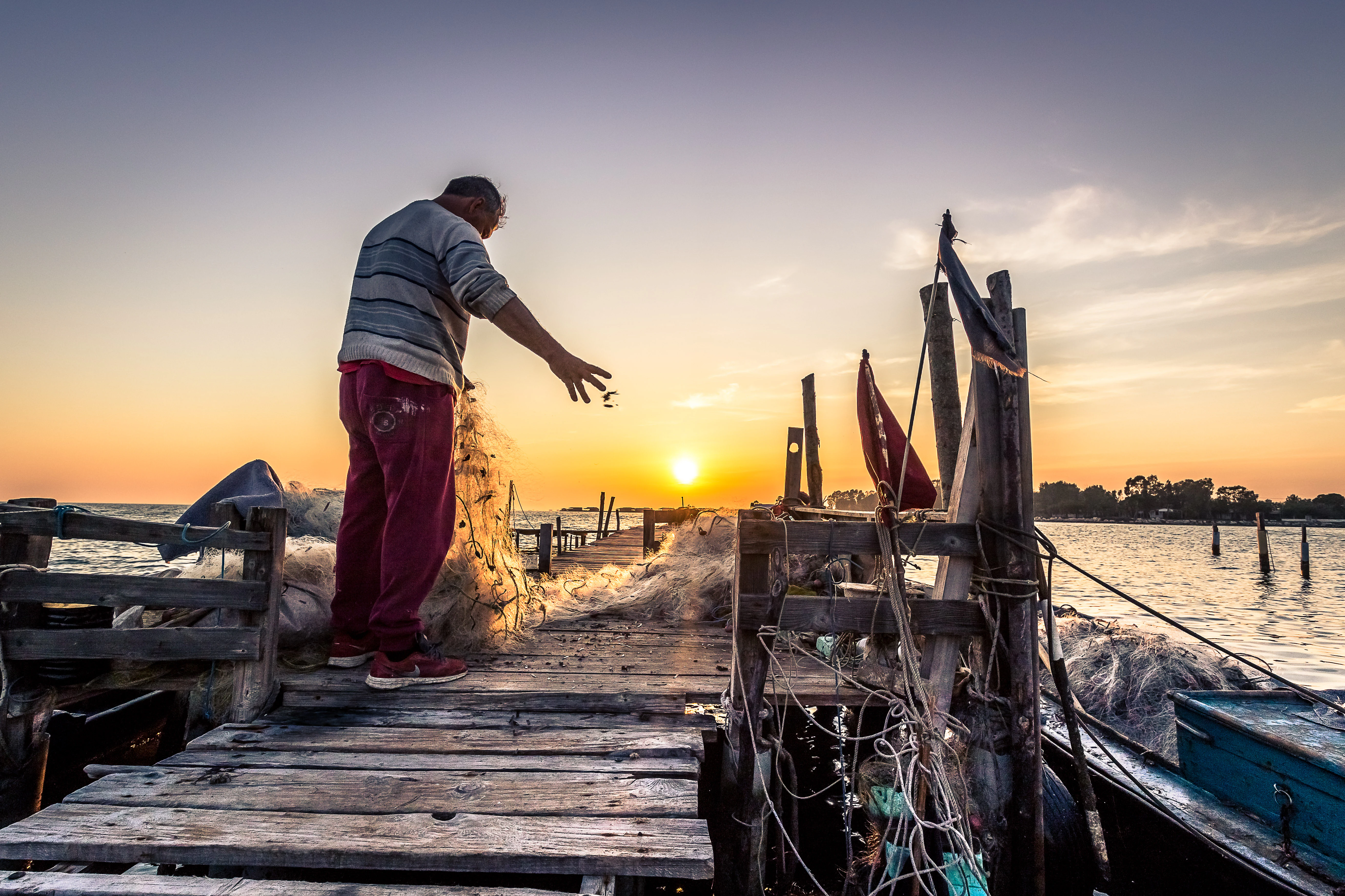
A silhouetted fisherman in casual clothing casts a fishing net from a weathered wooden pier into the water at sunset.
A fisherman casts a net from a wooden pier at sunset in the Missolonghi lagoon.

Missolonghi-Etoliko National Park history and protected-area timeline

The lagoons of Missolonghi received formal international recognition in 1975, when they were inscribed on the list of wetlands of international importance under the Ramsar Convention. By 1990, increasing pressure linked to irrigation and land use prompted Greece to seek their inclusion in the Montreux Record, highlighting concerns about ecological degradation.

Protection work expanded over subsequent decades. The Lesini forest was declared a Greek natural monument in 1980, preserving what remains of a broader forested landscape thinned by centuries of agriculture. In 2003, the managing body of the Missolonghi lagoon was created by ministerial decision, providing the institutional framework that would eventually lead to national park status. In 2006, the Missolonghi-Etoliko National Park was formally established, consolidating the lagoons, river corridors, deltaic plains, gorges, and the Echinades Islands into a single protected area.

Parallel conservation efforts addressed threats of a different kind. Major Acheloos diversion projects, including the Mesochora Dam (2001) and the partially completed Sykia Dam, significantly altered the river's hydrology and raised long-standing ecological concerns. A revived proposal in 2020 to divert large volumes of Acheloos water toward Thessaly reignited debate about the future balance between infrastructure development and the integrity of the deltaic and lagoon ecosystems.

Missolonghi-Etoliko National Park landscape and geographic character

The landscape of the Missolonghi-Etoliko National Park is unusually varied for a single protected area, shifting from flat coastal wetlands to steep mountain terrain within a relatively short distance. Along the coast, the Missolonghi lagoon system dominates the visual character: shallow, brackish waters bordered by reedbeds, salt flats, low sandy shores, and small islands, including parts of the Echinades archipelago emerging from the Ionian Sea.

Inland, the Acheloos river and its tributaries have built broad alluvial plains interrupted by isolated low hills, the remains of former islands now joined to the mainland by accumulated sediment. Lacustrine features such as Lake Lysimachia add still-water environments, while the Evinos carves a winding corridor through the eastern sector, traversing roughly seventy-five kilometers from the Evinos reservoir down to its mouth on the Gulf of Patras.

The park's vertical and geological contrast comes largely from the western Greek limestone belt. Mount Varasova rises sharply along the coast, its cliffs overlooking the Evinos and the gulf, while the Kremasti gorge and the deeper Klisoura gorge cut through the Arakinthos massif farther north. Between these extremes lie the Lesini ash forest and remnant riverside woodlands, offering a transitional environment between the wetlands and the higher limestone terrain.
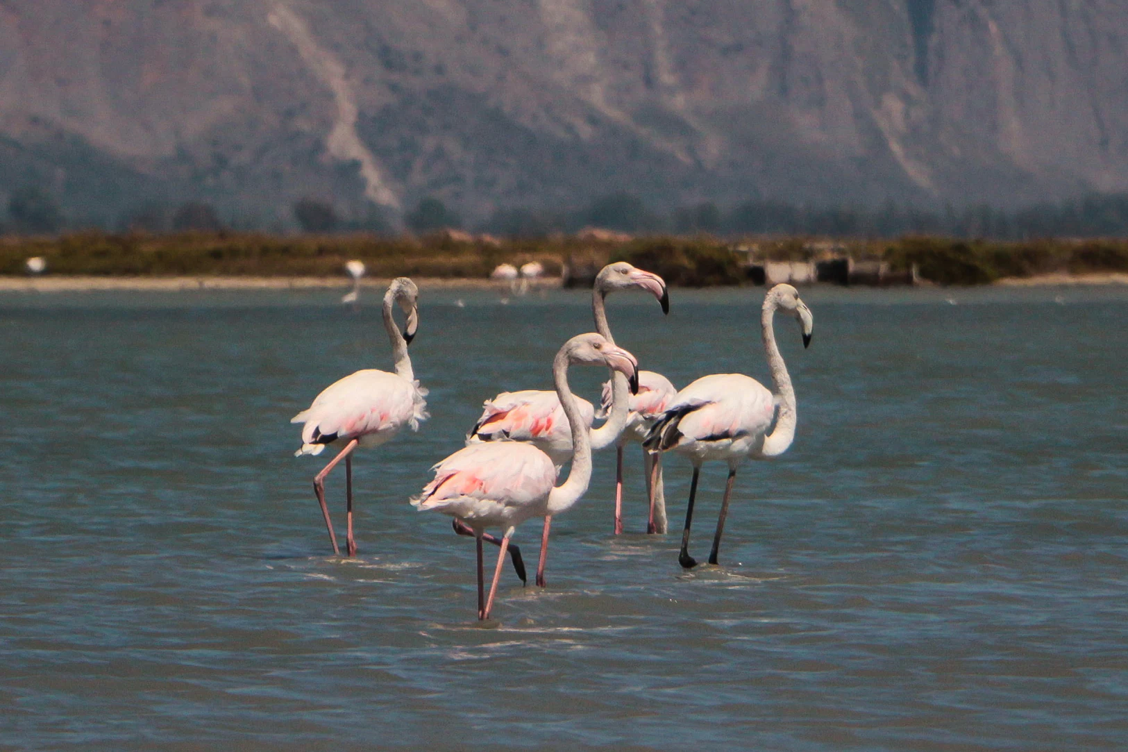
A group of five pink flamingos wading in shallow, calm lagoon water with a distant shoreline and hills in the background.
A group of flamingos wading in the shallow waters of the Mesolonghi Lagoon.

Missolonghi-Etoliko National Park ecosystems, habitats, and plant life

Ecologically, the park spans a remarkable gradient from marine and brackish coastal habitats to riverine ecosystems, lowland agricultural and forest patches, and upland Mediterranean cliffs. Wetland and estuarine habitats dominate its identity and ecological function, with the lagoon surfaces, mudflats, saltpans, reedbeds, and deltaic channels forming a connected system of high biological productivity.

Vegetation reflects this mosaic. Around the lagoons, halophytic and Mediterranean coastal species occupy brackish soils and dunes, while riparian galleries of ash, willow, and poplar border the Acheloos and Evinos. Inland, the Lesini forest, dominated by narrow-leaved ash, represents one of the most important lowland woodland remnants in the region. Habitats scattered across the limestone cliffs and gorges, such as those of Mount Varasova and the Klisoura gorge, harbor many of the park's endemic and rarest plants.

Habitat diversity is mirrored by contrasts in environmental pressures. Dam construction, water diversion projects, irrigation, aquaculture, and historical land reclamation have all shaped the lagoons and river corridors. The protection framework of the park, including its Ramsar status and Natura 2000 designations, is built around maintaining and restoring the ecological balance of these habitats.
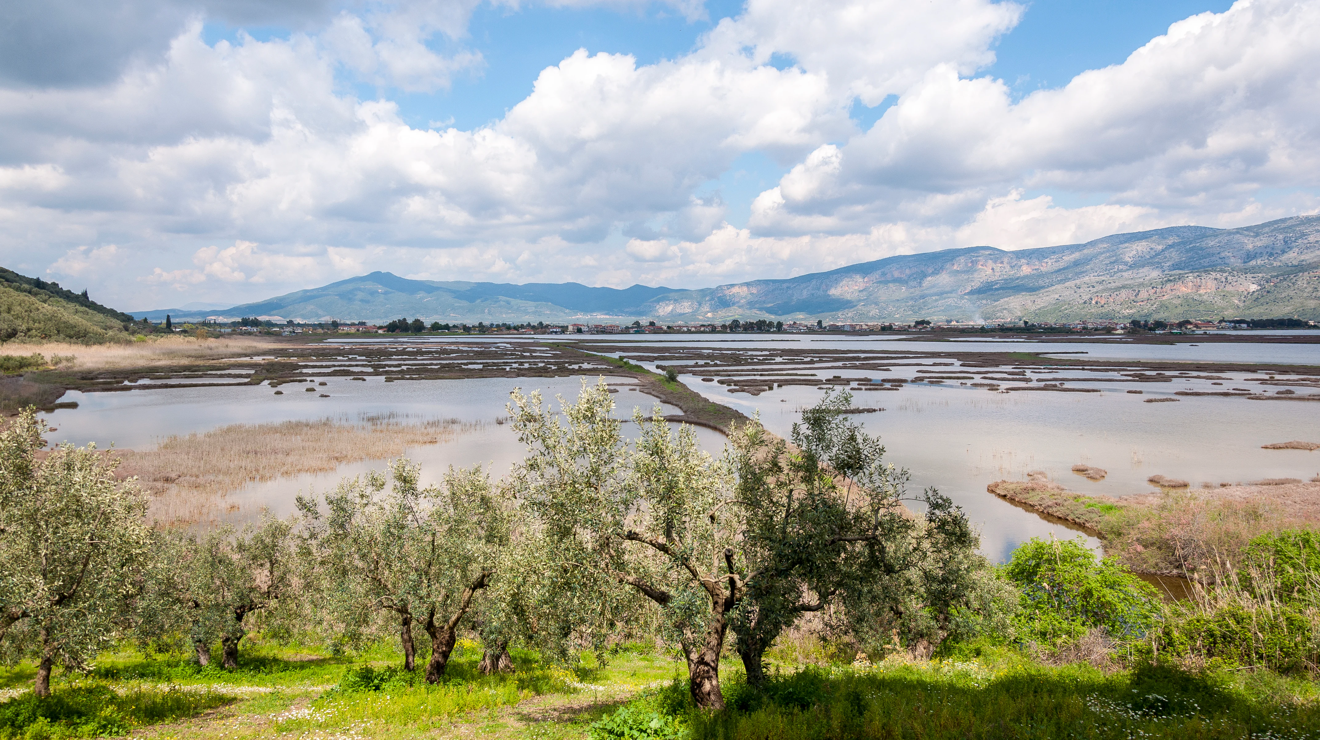
A wide landscape view of a sprawling lagoon with shallow water pools and mudbanks, framed by olive trees in the foreground and mountains in the distance under a partly cloudy sky.
View of the wetland landscape of the Messolonghi Etoliko Lagoon, Greece.

Missolonghi-Etoliko National Park wildlife and species highlights

Wildlife is one of the park's most defining features, particularly its birdlife. The lagoon and delta system, taken together with the Wetlands of Kotychi-Strofylia on the southern shore of the Gulf of Patras, forms one of the most important stopover and wintering areas in Greece for migratory and resident waterbirds. According to the park's managing body, roughly two hundred and seventy species have been recorded, including species listed as globally threatened or near-threatened by the IUCN such as the Dalmatian pelican, ferruginous duck, common pochard, eastern imperial eagle, greater spotted eagle, and cinereous vulture.

Fish diversity is notable for its endemism. The 2016 ichthyological inventory documented sixty-seven species, including several endemic to the Acheloos basin such as Cobitis trichonica, Scardinius acarnicus, the Greek catfish, and Rutilus panosi. Valencia letourneuxi, a killifish endemic to western Greece and southern Albania, is recognized among the world's most threatened species. The European eel, common carp, and green wrasse are also recorded in vulnerable or endangered categories.

Reptiles include threatened species such as the marginated tortoise, Hermann's tortoise, four-lined snake, and European pond terrapin, while loggerhead and green sea turtles are also present in marine areas. Documented amphibians, invertebrates such as the large copper butterfly, and mammals including the European otter and long-fingered bat round out a varied fauna. Marshes, saltpans, lagoons, cliffs, and freshwater channels each contribute distinct components of the park's overall biodiversity.
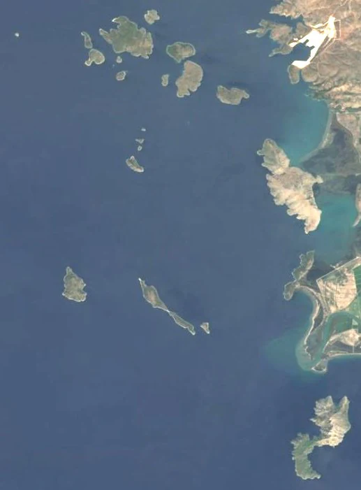
Top-down satellite image showing a cluster of islands in a deep blue sea along a jagged coastline.
Satellite view of the Echinades archipelago and surrounding coastline within Missolonghi-Etoliko National Park.

Missolonghi-Etoliko National Park conservation status and protection priorities

The Missolonghi-Etoliko National Park sits at the heart of one of the most layered conservation frameworks in Greece. The Missolonghi lagoons were listed under the Ramsar Convention in 1975 and have been the subject of international concern since 1990, when Greece requested their placement on the Montreux Record in response to growing anthropogenic pressure. The park is also recognized through BirdLife International's Important Bird Areas and is integrated into the European Natura 2000 network through both Special Protection Areas for birds and Special Areas of Conservation for natural habitats.

At the national level, the park is managed by a dedicated body created in 2003 and reorganized under the 2006 establishment of the protected area. Conservation efforts focus on maintaining the hydrological regimes that sustain the lagoons and deltaic habitats, protecting endemic plant and fish populations (especially those restricted to the Acheloos basin), and safeguarding the cliffs and gorges that support raptors and rare Mediterranean flora.

Significant challenges persist. The long-running Acheloos diversion project, with dams built between the 1960s and the early 2000s and a major interbasin transfer proposal revived around 2020, continues to raise concerns about reduced freshwater inflow, sediment supply, and the future ecological condition of the delta and lagoon system. Aquaculture development, salt production, and traditional fisheries all interact within the same protected landscape, making active management an ongoing task.

Missolonghi-Etoliko National Park cultural meaning and human context

The area surrounding the national park carries a cultural weight that goes well beyond its natural value. The town of Missolonghi, located at the park's edge, is closely associated with the Greek War of Independence and especially the heroic siege of 1825 to 1826, a defining event in modern Greek national memory. Lagoons, saltpans, and fishing communities around the town form part of how this historical identity is locally expressed.

Traditional economic life continues to shape the landscape. Fishing, fish farming, and the production of the protected Mesolonghi bottarga, often described as Greek caviar, remain central to local livelihoods and food culture. Salt harvesting, which expanded notably in the 1970s, links the working landscape to the broader history of human use of the coast, reinforced by the opening of a salt museum in Tourlida in 2020.

The deeper historical layer is visible in the archaeological heritage within and around the park. Sites such as Calydon, Pleuron, Oeniadae, Stratos, and Paleomanina attest to centuries of inland and coastal settlement. The combined presence of ancient sites, contested revolutionary history, and contemporary lagoon-based livelihoods gives the park a distinctive human dimension.
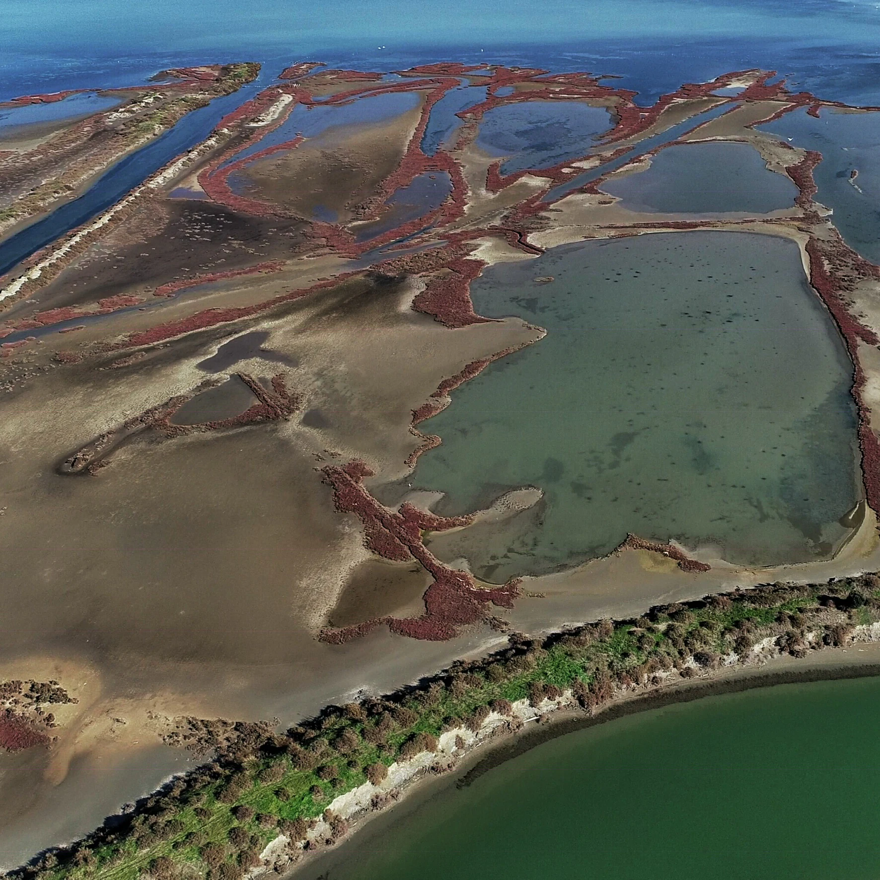
Aerial drone photograph of a coastal lagoon system with distinct land channels, sediment banks, and patches of reddish coastal vegetation, bordered by a larger body of deep green water.
An aerial view of the lagoon complex at the Missolonghi-Etolikó National Park, showcasing the intricate patterns of the wetland formations.

Top sights and standout views in Missolonghi-Etoliko National Park

The park's strongest highlights cluster around its size and ecological diversity. The Missolonghi lagoon, the largest of its kind in Greece, anchors a complex of shallow lagoons and saltpans that support an exceptional richness of wetland life. Combined with the Acheloos and Evinos deltas, this system is one of the most important in the country for migratory waterbirds and coastal biodiversity.

In contrast to the soft, low-lying wetlands, the limestone cliffs of Mount Varasova and the deeply cut gorges of Klisoura and Kremasti provide vertical relief and habitat for raptors and many of the park's endemic plants. The Lesini forest stands out as a rare surviving lowland ash woodland, while the Echinades Islands link the mainland ecosystems with offshore Ionian habitats. The region's deep archaeological and revolutionary history adds an additional layer of cultural significance.
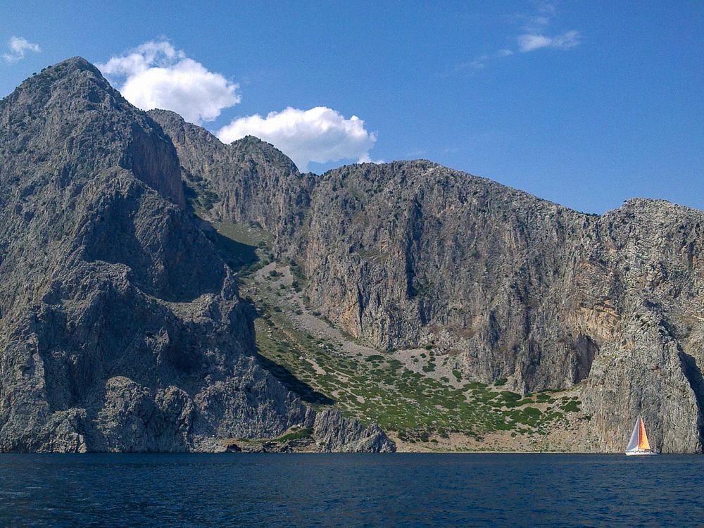
A wide shot showing massive, steep, rocky mountain cliffs rising directly from the dark blue sea, with a small sailboat featuring a colorful sail visible in the lower right.
A view of the rocky coastline of the Vasasova area within the Missolonghi-Etoliko region.

Best time to visit Missolonghi-Etoliko National Park

Seasonal character in the park is driven strongly by water and birdlife rather than alpine conditions. Late winter and early spring are typically the most rewarding periods for observing large numbers of migratory waterfowl, waders, and northern breeding species feeding in the lagoons and mudflats. Spring is also favorable for wildflowers on the cliffs and gorges, particularly around Mount Varasova and the Klisoura gorge, where endemic species bloom in their restricted habitats.

Summer brings higher temperatures, intense light over the lagoons, and very active salt production and fishing activity, while bird numbers tend to shift toward breeding and dispersing populations. Autumn is a transitional period, when returning migrants begin to repopulate the wetlands ahead of the winter peak. Outside of deep winter weather, the lagoon areas remain visually appealing throughout much of the year, with sunsets over shallow waters a notable feature.
Monthly climate preview

Long-term representative temperature and precipitation patterns across the year

Parc National de Missolonghi-Etolikó Climate Normals and Weather by Month

Historical NASA Power records for Parc national de Missolonghi-Etolikó indicate marked shifts in monthly average temperatures and daily precipitation rates at a representative coordinate. Detailed twelve-month climatology data provides deeper comparative context for examining annual weather trends across this protected area.
Annual mean18 °C
9 °C28 °C
Jan
Feb
Mar12°
Apr15°
May19°
Jun24°
Jul27°
Aug28°
Sep24°
Oct19°
Nov15°
Dec10°
Warmest month
August

27.7 °C

Coolest month
January

9 °C

Wettest month
December

3.8 mm/day

Driest month
July

0.4 mm/day

Park location guide

Geography guide, regional context, and park location map for Missolonghi-Etoliko National Park

Missolonghi-Etoliko National Park park geography, regions, and map view in Greece

Understand where Missolonghi-Etoliko National Park sits in Greece through a broader geographic reading of the surrounding landscape, nearby location context, and its mapped position within the national park landscape.

How Missolonghi-Etoliko National Park fits into Greece

Greece, officially the Hellenic Republic, is a country in Southeast Europe occupying the southern Balkans. It borders Albania, North Macedonia, Bulgaria, and Turkey, with coastlines on the Aegean, Ionian, and Mediterranean seas. The country has over 10 million people and is renowned for its ancient Greek heritage, philosophy, democracy, and the Olympic Games.

Wider geography shaping Missolonghi-Etoliko National Park in Greece

Greece occupies the southern tip of the Balkan peninsula in Southeast Europe. It shares land borders with Albania to the northwest, North Macedonia and Bulgaria to the north, and Turkey to the east. The Aegean Sea lies to the east of the mainland, the Ionian Sea to the west, and the Sea of Crete and Mediterranean Sea to the south. The country spans thousands of islands across nine traditional geographic regions and has the longest coastline in the Mediterranean basin.

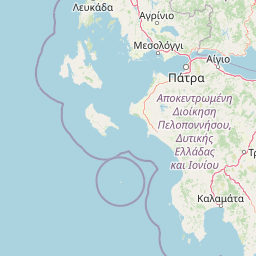
Map view of Missolonghi-Etoliko National Park

Use this park location map to pinpoint Missolonghi-Etoliko National Park in Greece, understand its exact geographic position, and read its mapped placement within the surrounding landscape more clearly.

Pigeon | © OpenStreetMap contributors

Location context for Missolonghi-Etoliko National Park

Grèce-Occidentale

Visual exploration of coastal lagoons, limestone gorges, and protected wetlands

Parc national de Missolonghi-Etolikó Photos and Landscape Scenery

Visual documentation captures the vast coastal lagoon network, river deltas, and abrupt limestone formations defining the terrain. Photographic records provide clear insight into the diverse habitats and protected environments spanning the western Greek coastline.

A silhouetted fisherman in casual clothing casts a fishing net from a weathered wooden pier into the water at sunset.

A small fishing boat is moored in a calm, flat lagoon at sunset. A line of wooden fence posts stands in the foreground, reflecting in the water, with rolling mountains in the hazy distance.

A group of five pink flamingos wading in shallow, calm lagoon water with a distant shoreline and hills in the background.

A wide landscape view of a sprawling lagoon with shallow water pools and mudbanks, framed by olive trees in the foreground and mountains in the distance under a partly cloudy sky.

Top-down satellite image showing a cluster of islands in a deep blue sea along a jagged coastline.

A side view of an Eurasian Oystercatcher bird with a long orange beak, black and white feathers, and reddish legs, walking through shallow foamy water on a sandy beach.

Aerial drone photograph of a coastal lagoon system with distinct land channels, sediment banks, and patches of reddish coastal vegetation, bordered by a larger body of deep green water.

A wide shot showing massive, steep, rocky mountain cliffs rising directly from the dark blue sea, with a small sailboat featuring a colorful sail visible in the lower right.

A curlew sandpiper standing on wet, dark mud, feeding with its long beak down in the marshy ground.

A steep limestone gorge featuring tall, jagged cliffs covered with patches of greenery, with a prominent white cross visible on the left side near the rocky wall.

A wide view of a calm river reflecting rocky mountains in the background, with lush green riparian vegetation along the banks.

Park atlas

Compare adjacent wetland reserves, limestone gorges, and protected landscapes in western Greece

Parks near Parc national de Missolonghi-Etolikó and surrounding regional protected areas

Visitors exploring Parc national de Missolonghi-Etolikó can browse nearby protected areas to compare coastal wetlands, river deltas, and limestone massifs across the surrounding region. Extending the park search reveals connected ecological corridors and contrasting terrain types throughout western Greece.
Protected areaAetolia-Acarnania
About 38 km away#1 closest

Northwest

Lake Amvrakia Protected Area: Atlas of a Tectonic Freshwater Basin in Aetolia-Acarnania

Mapped geography of a unique karstic semipolje in western Greece.

Lake Amvrakia is a distinct tectonic basin located in western Greece. This protected area represents a complex karstic landscape formed in Mesozoic limestone, supporting diverse birdlife and endemic species. The geography reveals a stark contrast between agricultural eastern shores and the preserved riparian zones of the west, marking it as a significant case of human-environment interaction in the region.

Area
13.6 km²
Relief
Lowland
Climate
Mediterranean
Access
Access unknown
A watercolor painting showing a wide view of the Foloi plateau with rolling hills, a small grove of deciduous trees, and a winding stream, set against a pale background.
Protected areaElis
About 84 km away#2 closest

Southeast

Foloi Oak Forest Protected Area and Plateau Landscape in Elis, Greece

Deciduous mountain woodland and regional plateau geography

Examine the geographic profile of the Foloi Oak Forest, a rare seed-regenerated deciduous woodland spread across an elevated plateau in the Elis region. This protected landscape forms an essential ecological boundary in the western Peloponnese, featuring a dense canopy of Hungarian oak and deep gorges that define the surrounding mountain terrain and local drainage systems.

Area
42 km²
Relief
Upland
Climate
Mediterranean
Access
Moderate access
Watercolor illustration of a mountain range with greenery and distant peaks under a light sky
Marine protected areaGreece
About 91 km away#3 closest

Southwest

National Marine Park of Zakynthos: Detailed Protected Marine Area & Geographic Context

Mapping Zakynthos's protected marine territory and regional geography

Investigate the National Marine Park of Zakynthos, a distinguished marine protected area situated in Greece. This dedicated page provides detailed insights into its protected landscape, focusing on its mapped geographic extent and its significance within the Mediterranean. Users can explore the specific boundaries of this protected marine territory and understand its place in the wider regional geography, enhancing atlas-based discovery of Greece's conservation areas.

IUCN
II
Scope
Marine
Water
Water-dominated
A soft, watercolor painting of a mountain range in the distance, featuring a band of evergreen trees in the midground and a grassy foreground on a plain white background.
National parkGreece
About 111 km away#4 closest

East

Parc national du Mont Parnasse: Mapping the Limestone Massif and Alpine Geography of Greece

A protected national park blending karst geology and mountain ecosystems.

Parc national du Mont Parnasse stands as a prominent protected landscape in Central Greece, defined by its fractured limestone geology and subalpine forests. This national park serves as a vital ecological refuge that preserves karst terrain, sinkholes, and diverse Mediterranean mountain habitats rising toward steep alpine summits.

Relief
Mountain
Climate
Mediterranean
Scope
Terrestrial
Water
Minor water
National parkGreece
About 126 km away#5 closest

North

Parc national de Tzoumérka-Achelóos-Ágrafa-Météores National Park: Geography and Landscape Atlas

Central Greece Pindus mountain protected wilderness zone

An extensive protected landscape bridging Thessaly and Epirus, this national park showcases the ecological and geological diversity of the central Pindus Mountains. Analyze the geographic layout of the Athamanian ranges, the Acheloos river corridor, and the unique conglomerate formations at Meteora through a detailed protected-area lens.

Area
3,379.94 km²
Established
2009
IUCN
VI
Relief
Mountain
Watercolor illustration of a mountainous landscape with a river, forests, and distant hills
National parkGreece
About 164 km away#6 closest

North

Pindus National Park: A Protected Greek Mountain Wilderness with Ancient Forests

Explore its rugged terrain, biodiversity, and alpine landscape.

MoriAtlas presents Pindus National Park, a significant protected area in Greece known for its dramatic mountainous terrain, deep valleys, and ancient old-growth forests. This page details its geographic context, featuring rugged highland landscapes, serpentine soils, and vital habitats for species like the Eurasian brown bear. Understand its place within the Pindus mountain range and its importance as a mapped wilderness area for conservation.

Area
69.27 km²
Established
1966
IUCN
II
Relief
Mountain
A soft watercolor painting of a coastal lagoon featuring dunes, grassy vegetation, and a distant treeline under a light sky.
Protected areaIonian Islands
About 168 km away#7 closest

Northwest

Korission Lagoon Protected Area: Coastal Wetlands and Dune Geography in Corfu, Greece

A coastal landscape defined by sand dunes, freshwater, and juniper forests

Korission Lagoon represents a rare ecological convergence on the Ionian Islands, where a tall sand dune barrier separates a freshwater lagoon from the open sea. This protected area supports an intricate mosaic of reed beds and unique juniper woodlands, providing a crucial habitat for a vast array of bird species and endemic wildlife within the coastal plains of Corfu.

Area
4.27 km²
Relief
Lowland
Climate
Mediterranean
Access
Easy access
National parkGreece
About 179 km away#8 closest

North

Vikos-Aoös National Park: Deepest Gorge and Protected Mountain Landscape Atlas

Discover protected area boundaries and regional geography in Epirus.

Vikos-Aoös National Park in Greece's Pindus mountains is a premier destination for exploring dramatic natural geography. Best known for the Vikos Gorge, considered the world's deepest canyon relative to its width, the park also features towering alpine peaks like Mount Tymphe, glacial lakes such as Drakolimni, and rich botanical diversity. As a UNESCO Geopark and part of the Natura 2000 network, it safeguards critical habitats, including significant brown bear populations. This park offers a profound look into protected landscapes, offering detailed geographic context and mapped terrain for atlas-based discovery.

Area
126 km²
Established
1973
IUCN
II
Visitors
100K annual

Common questions about visiting, size, designation, and location context for Missolonghi-Etoliko National Park

Missolonghi-Etoliko National Park FAQs for park facts, access, geography, and protected area context

Find quick answers about Missolonghi-Etoliko National Park, including protected-area facts, park geography, trail and visitor context, and how the park fits into its surrounding country and regional landscape.
MoriAtlas Explorer

Continue Your Protected Areas Search Across the Global Atlas

Deepen your exploration by continuing the structured search for national parks and protected areas worldwide. Utilize the comprehensive filtering capabilities to compare different conservation landscapes and refine your understanding of global park geography. Discover more about the distribution and characteristics of protected natural areas.

Global natural geography