

Mori Atlas logo
Nature reserveMittelbruch

Tracing the mapped boundaries of lowland peat diggings and species rich moor meadows within Germany

Mittelbruch Nature Reserve: A Detailed Geographic Atlas of Protected Wetland Landscapes in Berlin

(Naturschutzgebiet Mittelbruch)

Mittelbruch serves as a significant nature reserve in the Pankow district of Berlin, protecting a unique mosaic of former peat diggings, reed beds, and lowland moor meadows. This compact protected area demonstrates the ecological value of wetland restoration within a dense urban region, functioning as a vital habitat for various bird species and meadow flora. Through detailed atlas mapping, discover the intersection of managed moorland and adjacent woodland that defines the reserve's unique environmental character near the Brandenburg border.

wetlandpeat diggingslowland moor meadowsurban nature reservebirdlifewaterbirds

Mittelbruch

Nature reserve

Park overview

Structured park overview, official facts, and landscape profile for Mittelbruch

Mittelbruch park facts, protected area profile, and essential visitor context

Review the core facts for Mittelbruch, including designation, size, terrain, visitor scale, habitats, and operating context in one park-focused overview.

About Mittelbruch

Mittelbruch is a compact but ecologically rich nature reserve on the northern edge of Berlin. It sits on the territory of the Pankow district in the locality of Berlin-Buch, just over a kilometre from the S-Bahn station of Berlin-Buch. The reserve covers roughly 28 hectares according to its founding ordinance, though Berlin Senate figures cite around 31 hectares. Either way, it represents one of the smaller formally protected areas within Berlin's network of Naturschutzgebiete, yet it carries a clear ecological identity.

The reserve's structure is defined by three former peat diggings: the Kleiner Torfstich, the Großer Torfstich, and the more secluded Nordstich, which lies hidden behind a wide belt of reeds and dense undergrowth. These diggings were originally cut into the wet landscape for peat extraction, but they have since filled with water and become small wetland ponds. Reed fringes, wet meadows, and a band of forest along the edges now surround them, creating a mosaic that contrasts strongly with the surrounding allotment gardens, residential streets of Hörstenweg, and the larger urban fabric of Berlin.

Mittelbruch's protected status was established by formal ordinance on 22 May 1997, with a clearly written purpose: to preserve the peat diggings together with their associated pioneer wetland flora and small reed beds, and to maintain the lowland moor meadows and their adjacent woodland as breeding, resting, and feeding habitats for threatened bird species and as living space for threatened amphibians, reptiles, insects, and wild plants. A second clause in the ordinance also recognizes the area as an exemplary section of the regionally typical cultural landscape, framing the reserve as a surviving fragment of historical rural land use inside the modern city.

The reserve neighbours the Bucher Forst to the northwest and lies just a few hundred metres from the Brandenburg Ausstichgelände Röntgental. Together, these protected areas are part of the Naturpark Barnim, the cross-border park jointly set up by Berlin and Brandenburg in 1998. Within Barnim, Mittelbruch is valued as one of the more open, water-rich inland sites, complementing the larger forests and lake landscapes elsewhere in the park.

Quick facts and research context for Mittelbruch

Mittelbruch is a German nature reserve (Naturschutzgebiet) of roughly 28 to 31 hectares, situated in Berlin-Buch in the Pankow borough of Berlin.

It was formally protected on 22 May 1997 and carries the designation NSG-19, with a World Database on Protected Areas entry (WDPA 164631) recognized under IUCN Category IV.

The reserve forms part of the cross-border Naturpark Barnim and lies adjacent to the Bucher Forst, with the Brandenburg nature reserve Ausstichgelände Röntgental located about half a kilometre to the east.

Protection and recognition

Explore terrestrial protection metrics and recognized conservation frameworks for Mittelbruch.

Mittelbruch Protection Status and International Recognition Data

Documented protection records outline the territorial scope and official Natura 2000 recognition for Mittelbruch. Structured conservation data details administrative frameworks and international designations associated with the protected landscape.

International recognition

Protection details

Protection scope
Terrestrial
Transboundary protection
No
WDPA ID
164631
Park context

Deeper park guide and search-rich context for Mittelbruch

Mittelbruch history, landscape, wildlife, and travel context

Explore Mittelbruch through its history, landscape character, ecosystems, wildlife, conservation priorities, cultural context, and seasonal travel timing in a structured park guide built for atlas discovery and search intent.

Why Mittelbruch stands out

Mittelbruch is best known for its three former peat diggings and the surrounding lowland moor meadows that together form one of the more unusual wetland habitats within Berlin. The diggings, now filled with water and bordered by reeds, act as the ecological core of the reserve and provide breeding, resting, and feeding habitat for waterbirds. The site is also recognized for its meadow flora, which includes around 350 fern and flowering plant species, and for an unusually high share of Red List bird species given the reserve's small size. The contrast between open water, dense reed belts, wet meadows, and adjacent forest gives Mittelbruch a layered character that is rare in the city's inner protected areas.
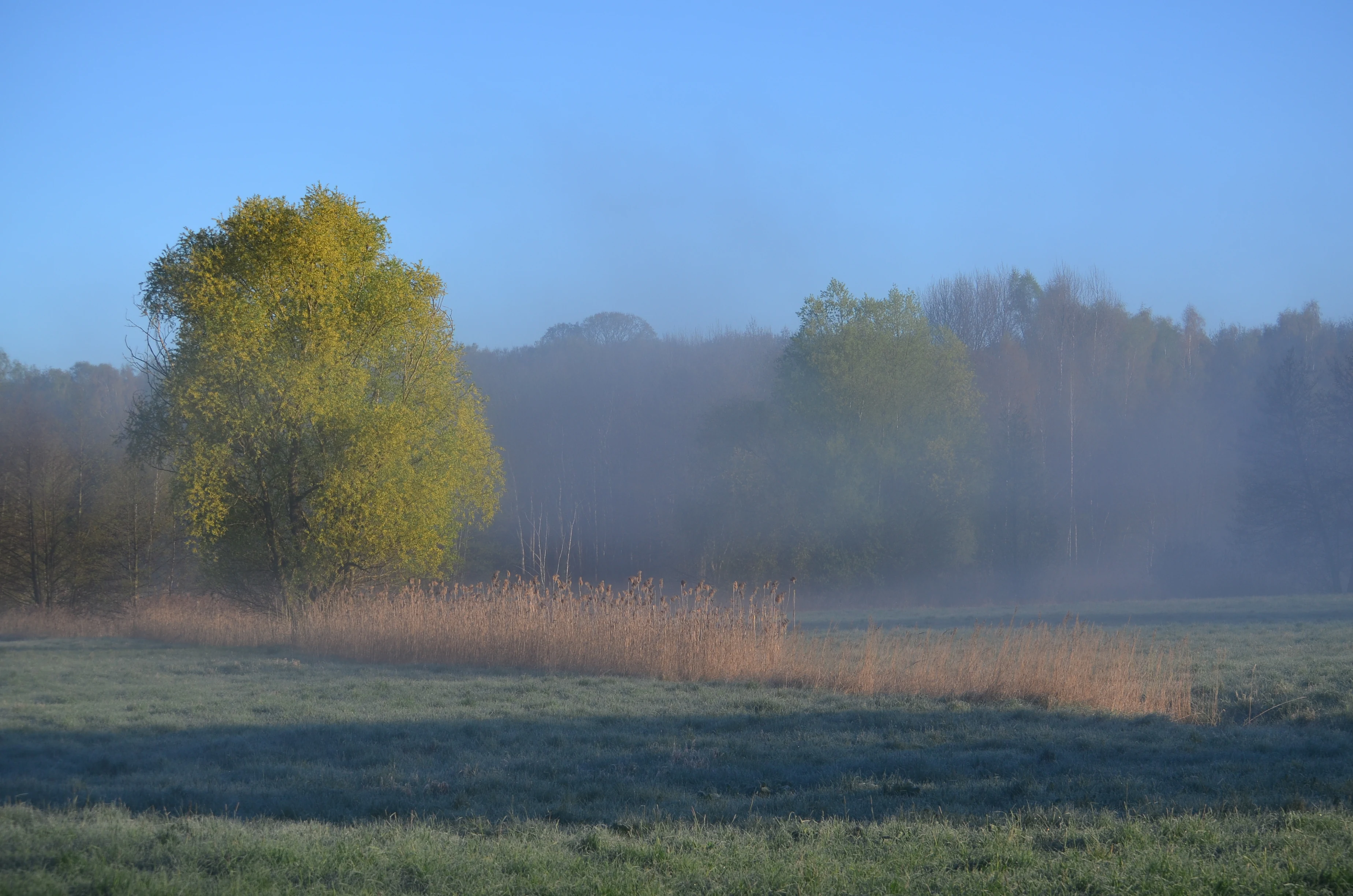
Mittelbruch Nature Reserve
View of the Mittelbruch nature reserve in Berlin

Mittelbruch history and protected-area timeline

The landscape of the Mittelbruch area was shaped by historical peat cutting, which over time produced the three open water bodies that now form the core of the reserve. These Torfstiche, the Kleiner Torfstich, the Großer Torfstich, and the Nordstich, are former peat extraction sites whose surfaces have since filled with water and been recolonized by reeds and wetland vegetation.

For much of the twentieth century the broader area functioned as a working rural and semi-natural landscape of wet meadows, ditches, and woodland on the edge of what was then a separate settlement of Buch outside central Berlin. The cultural landscape character of the site is still recognized in the 1997 ordinance, which explicitly protects Mittelbruch as an exemplary section of the regional cultural landscape.

By the early 1990s, following German reunification, the area fell within the reunified city of Berlin and its Pankow district. Local conservation efforts led to the formal designation of Mittelbruch as a Naturschutzgebiet on 22 May 1997, under the designation NSG-19. Just one year later, in 1998, Berlin and the surrounding state of Brandenburg jointly established the Naturpark Barnim, and Mittelbruch became one of its component protected areas.

Since designation, the meadows around the peat diggings have been actively maintained through hydrological measures, mowing, grazing, and the removal of woody regrowth, in order to keep the open peatland meadows in their species rich condition and prevent succession toward forest.

Mittelbruch landscape and geographic character

Mittelbruch's landscape is shaped by the modest but distinctive terrain of former peat diggings set within lowland moorland. The three diggings form small open pools, with the Nordstich hidden behind a broad belt of reeds and dense undergrowth, while the Kleiner and Großer Torfstich are more open and visible from the path that runs between them along the Eupener Straße access.

Around the diggings stretches a band of Niedermoorwiesen, lowland peat meadows that are kept open through ongoing management. Small patches of woodland and dense undergrowth border parts of the reserve, especially toward the Nordstich and along the boundary with the Bucher Forst to the northwest. Outside the reserve, allotment gardens line the eastern edge, while the residential streets around Hörstenweg form the southern boundary.

The overall impression is of a small, layered wetland landscape tucked into a largely urban setting. Open water, reed belt, meadow, scrub, and woodland edge succeed one another over short distances, creating a compact landscape mosaic that is unusual within Berlin's protected area network.
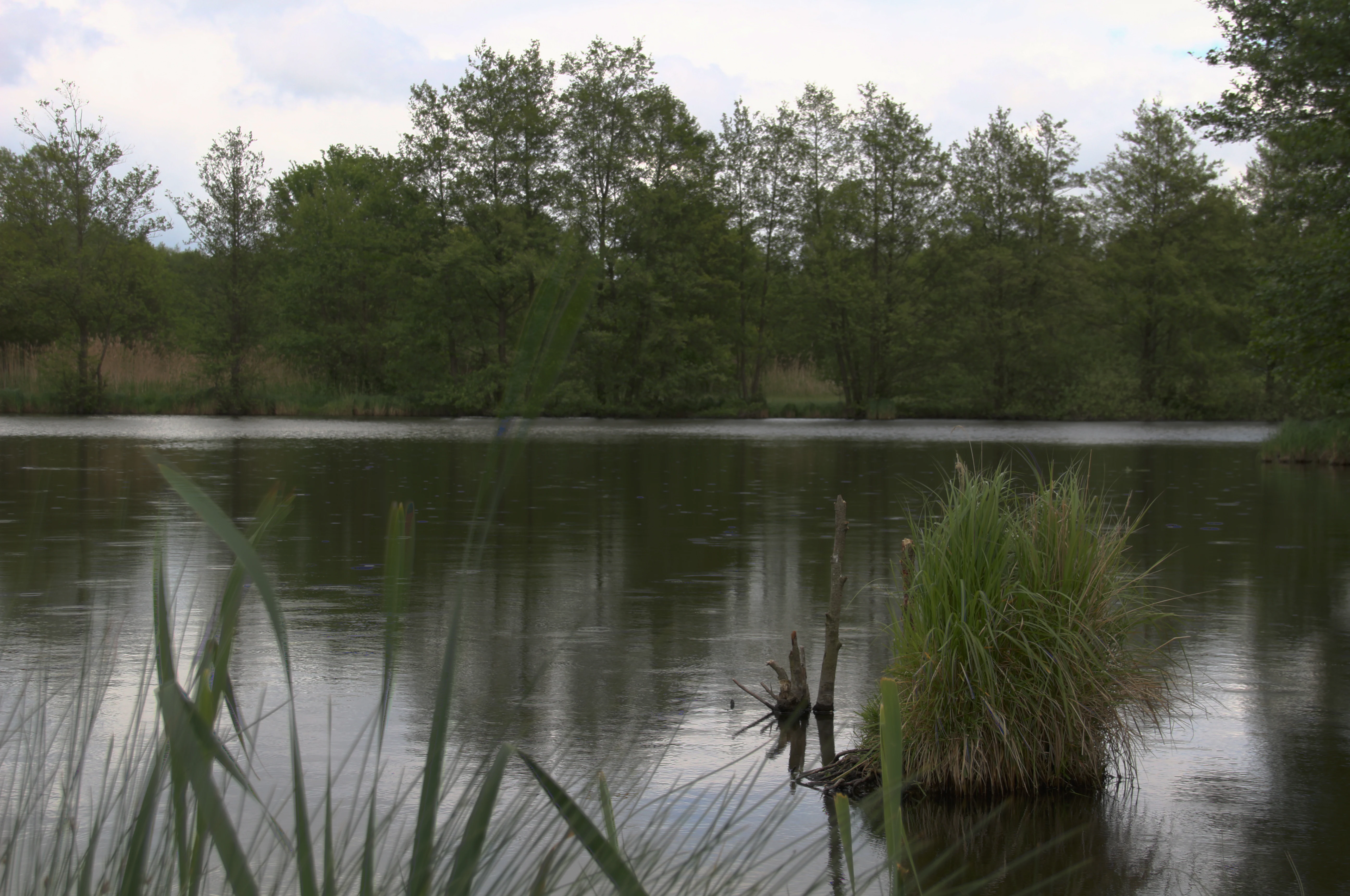
Peat cutting in Mittelbruch
View of a large peat cutting from the path between the peat cuttings in Berlin Pankow, Buch district.

Mittelbruch ecosystems, habitats, and plant life

The ecological identity of Mittelbruch is built on the combination of open water, wet pioneer habitats, lowland moor meadows, and connected woodland edge. The former peat diggings host wet pioneer communities and small reed beds that are the main reason the reserve was designated in 1997.

The Niedermoorwiesen surrounding the pools support a particularly rich flora for such a small site, with roughly 350 species of ferns and flowering plants recorded. Hydrological management, controlled mowing, grazing, and the clearing of woody regrowth all help maintain this open meadow character and the diverse plant communities associated with it.

Reed belts along the diggings, dense scrub around the Nordstich, and the forested margins toward the Bucher Forst add structural diversity. Together these habitats support a mosaic of breeding, feeding, and resting conditions for invertebrate and vertebrate species, including threatened groups associated with both open water and wet meadow environments.

Mittelbruch wildlife and species highlights

Mittelbruch's wildlife profile is dominated by waterbirds and meadow-associated bird species. Surveys have recorded 77 bird species in the reserve, including around 50 breeding species, with 23 of these listed in Red List categories. The reed-fringed diggings are particularly important for waterbirds, while the open meadows support ground-nesting species.

Species observed in the reserve include Marsh Harrier, Red-backed Shrike, Skylark, and Meadow Pipit. Graylag Geese are regularly seen using the open water and surrounding meadows. Wetland, reed bed, and meadow edge together provide a layered habitat structure that supports the unusually high bird diversity recorded for such a small site.

Amphibians and reptiles also make significant use of the reserve. Common Toads breed in and around the diggings, while Slow Worms and Forest Lizards are found along the edges with scrub and woodland. Invertebrate diversity is notable as well, with butterflies including Swallowtail, and moths such as the Rampion Bellflower moth and Reseda White recorded in the meadows, reflecting the botanical richness that supports them.

Mittelbruch conservation status and protection priorities

Mittelbruch is recognized as a conservation site because it preserves a working example of Berlin's historical lowland peat landscape within a strongly urbanized setting. The 1997 ordinance explicitly frames the reserve both as habitat for threatened species and as a representative fragment of the regional cultural landscape.

The reserve's IUCN-aligned recognition (IUCN Category IV, Habitat or Species Management Area) reflects its focus on active management of specific habitats and species rather than on strict non-intervention protection. Management measures include hydrological interventions to maintain wet conditions, mowing, grazing, and the removal of woody regrowth, all aimed at keeping the meadows open and the pioneer wetland habitats functional.

The site's importance is significantly enhanced by its position within the cross-border Naturpark Barnim, established jointly by Berlin and Brandenburg in 1998. Its proximity to the neighbouring Ausstichgelände Röntgental in Brandenburg strengthens the wider peatland and meadow network in the area, providing a contiguous refuge for species at the edge of one of Germany's largest metropolitan regions.

Mittelbruch cultural meaning and human context

Mittelbruch's cultural dimension lies in its character as a surviving piece of historical rural landscape on the edge of a major city. The peat diggings are a direct trace of pre-modern land use, when peat from the wet meadows around Buch was cut for fuel and soil improvement.

The 1997 ordinance formally recognizes this history, naming the reserve as an exemplary slice of the region's cultural landscape. In a district otherwise marked by Berlin-Buch's modern medical and research campus, allotment gardens, and growing residential neighbourhoods, the meadows and pools of Mittelbruch preserve a tangible link to the older agricultural and wetland landscape of the Barnim region.

Top sights and standout views in Mittelbruch

Three former peat diggings now serving as wetland pools form the reserve's ecological core and strongest visual feature.

A network of species rich lowland moor meadows, kept open through active management, surrounds the diggings and supports a notable share of Red List bird species.

The reserve's compact size, just over twenty-eight hectares, and its location within the Naturpark Barnim make it a striking example of high-value urban-edge conservation in Berlin.

Best time to visit Mittelbruch

Mittelbruch, as an urban nature reserve, can be appreciated across much of the year, with the main variations tied to waterbird presence, meadow vegetation, and visitor comfort. Spring and early summer typically offer the richest bird activity, when breeding waterbirds, Skylarks, and Meadow Pipits are using the meadows, and when butterfly species such as Swallowtail can be observed in the flowering meadows.

Late spring into early summer is generally the most rewarding period for observing the reserve's plant diversity in bloom, particularly across the Niedermoorwiesen. Autumn and winter bring different waterfowl use of the pools, with Graylag Geese and other waterbirds regularly present on the open water. Cooler months also reduce insect pressure and make walking along the path between the Kleiner and Großer Torfstich more comfortable.

Monthly climate preview

Track monthly temperature variations and precipitation averages across the protected area

Mittelbruch Climate Normals, Long-Term Temperature and Precipitation Records

Long-term representative records reveal annual temperature fluctuations and monthly precipitation patterns across Mittelbruch. Exploring the full monthly dataset provides deeper insight into historical climate normals and regional weather distributions.
Annual mean9 °C
-1 °C20 °C
Jan-1°
Feb
Mar
Apr
May14°
Jun18°
Jul20°
Aug20°
Sep15°
Oct
Nov
Dec
Warmest month
July

20.3 °C

Coolest month
January

-0.9 °C

Wettest month
July

2.4 mm/day

Driest month
April

1.1 mm/day

Park location guide

Geography guide, regional context, and park location map for Mittelbruch

Mittelbruch park geography, regions, and map view in Germany

Understand where Mittelbruch sits in Germany through a broader geographic reading of the surrounding landscape, nearby location context, and its mapped position within the national park landscape.

How Mittelbruch fits into Germany

Germany is a federal republic in Western and Central Europe with a population of over 83 million across sixteen constituent states. It is Europe's largest economy by nominal GDP and a major global exporter and importer. The capital is Berlin, and the country borders Denmark, Poland, Czech Republic, Austria, Switzerland, France, Luxembourg, Belgium, and the Netherlands.

Wider geography shaping Mittelbruch in Germany

Germany is located in Western and Central Europe, spanning 357,022 km². It borders Denmark to the north, Poland and the Czech Republic to the east, Austria and Switzerland to the south, and France, Luxembourg, Belgium, and the Netherlands to the west. The country has coastlines on the Baltic Sea and North Sea to the north, with the Alps located in the southern region.

Map view of Mittelbruch

Use this park location map to pinpoint Mittelbruch in Germany, understand its exact geographic position, and read its mapped placement within the surrounding landscape more clearly.

Pigeon | © OpenStreetMap contributors

Location context for Mittelbruch

Berlin

Visual reference for former peat diggings, lowland moor meadows, and urban reserve habitats

Mittelbruch Landscape Photos and Protected Wetland Scenery

Visual documentation of Mittelbruch reveals the complex mosaic of former peat diggings, open water pools, and lowland moor meadows that define the reserve. Examining these protected area views helps observers understand the terrain, reed fringes, and habitat conditions supporting regional waterbirds.

Mittelbruch Nature Reserve

Mittelbruch Nature Reserve

Peat cutting in Mittelbruch

Park atlas

Compare nearby regional reserves and connected wetland conservation areas

Explore Other Parks Near Mittelbruch and Surrounding Protected Landscapes

Visitors exploring Mittelbruch can continue browsing other protected areas across the surrounding regional landscape. Expanding the search reveals comparable wetland habitats and connected nature reserves throughout the broader territory.
Nature reserveBrandenburg
About 0.9 km away#1 closest

Northeast

Ausstichgelände Röntgental: Brandenburg Nature Reserve and Protected Wetland Atlas

Mapped ecological landscapes on the Berlin metropolitan fringe

Investigate the detailed geography of Ausstichgelände Röntgental, a compact nature reserve in Brandenburg. Formed from nineteenth-century railway sand quarries, this protected area features a diverse mosaic of reed beds, open water, and alder carr forest. The site provides a compelling case study of post-industrial ecological recovery within the broader Barnim Nature Park landscape.

Area
0.248 km²
Established
1990
IUCN
IV
Nature reserveBrandenburg
About 3.4 km away#2 closest

North

Schönower Heide Nature Reserve: An Atlas View of Brandenburg Protected Heathlands

A restored landscape of glacial dunes and sandy heath

Schönower Heide stands as a significant nature reserve in Brandenburg, Germany. The area protects a unique combination of open sand heath, pine woodland, and wetland meadows formed on post-glacial outwash plains. This protected landscape is recognized for its successful transition from former military terrain into a vibrant habitat for diverse flora and fauna, including managed populations of red deer and mouflon within its fenced boundaries.

Area
5.334 km²
Established
2000
IUCN
V
Relief
Lowland
Nature reserveBrandenburg
About 3.5 km away#3 closest

Northeast

Faule Wiesen bei Bernau Nature Reserve: Mapped Landscapes and Geography of Brandenburg

A vital Panke river corridor protecting rare meadow and woodland biomes.

Spanning 37 hectares near the northern edge of Berlin, Faule Wiesen bei Bernau offers a study in contrasting landscapes. The reserve features open wet meadows and small ponds alongside sandy dry grasslands and oak woodlands. It remains an essential ecological link within the Barnim district, preserving critical habitats for amphibians and orchids within the broader Brandenburg geography.

Area
0.37 km²
Established
2000
Relief
Lowland
Scope
Terrestrial
Nature reserveBerlin
About 3.8 km away#4 closest

Southwest

Karower Teiche Nature Reserve: Mapped Protected Wetland Geography in Northeast Berlin

Transitional lowland fen and pond mosaic

Karower Teiche protects a unique 128 hectare wetland mosaic in the Pankow district of Berlin. Centered on four shallow ponds and extensive reedbeds, the reserve maintains a vital ecological corridor between the Barnim plateau and the Berlin glacial valley. This site provides essential habitat for amphibians and reed-specialist birds within an urban setting.

Area
1.286 km²
Established
1994
IUCN
IV
Relief
Lowland
Nature reserveBrandenburg
About 6.3 km away#5 closest

West

Schönerlinder Teiche Nature Reserve in Brandenburg: Protected Landscape and Geographic Atlas

Explore the wetland mosaic, bird-rich ponds, and grazing conservation areas

Schönerlinder Teiche offers a rare look at post-agricultural land transformation, featuring ponds, meadows, and reed habitats in the Brandenburg region. This nature reserve serves as an essential bird sanctuary and educational site, with water buffalo and Konik horses contributing to ongoing habitat maintenance. View the detailed geography of this protected area and its role within the wider Barnim Nature Park network.

Area
0.408 km²
Established
1997
IUCN
IV
Relief
Lowland
Nature reserveBerlin
About 7.4 km away#6 closest

South

Malchower Aue Nature Reserve: A Detailed Atlas of Urban Protected Landscapes in Berlin

Wetland habitats and glacial terrain within the Berlin city limits.

Malchower Aue stands as a protected enclave of wetland diversity featuring a system of reed-fringed peat-cutting ponds, wet meadows, and rare dry-grassland vegetation on historical soil mounds. This site provides a vital geographic perspective on how post-glacial relief and human land-use history shape protected areas within the modern urban landscape of Berlin.

Area
0.222 km²
Established
1995
Relief
Lowland
Climate
Temperate
Nature reserveBerlin
About 7.4 km away#7 closest

Southeast

Falkenberger Rieselfelder Nature Reserve: A Detailed Atlas of Berlin Protected Lands

Reclaimed wetland geography and urban conservation habitats

Falkenberger Rieselfelder acts as an ecologically rich refuge where former industrial irrigation fields have been repurposed into a mosaic of seasonal pools and meadows. Located on the urban fringe of Berlin, this nature reserve offers a unique look at how conservation grazing and habitat management support species like the great crested newt within a dense metropolitan region.

Area
0.881 km²
Established
1995
IUCN
IV
Relief
Lowland
Nature reserveBarnim District
About 7.9 km away#8 closest

Northeast

Ladeburger Schaeferpfuhle: Nature Reserve and Protected Landscape in Barnim District

Mapped lowland fen ecosystems and habitat geography

Located in the Barnim District of Germany, Ladeburger Schaeferpfuhle is a designated nature reserve defined by its post-glacial lowland fen terrain. This area preserves a mosaic of wet meadows, shrub thickets, and pools that support specialized plant and wildlife populations. The site serves as a vital example of regional hydrology, maintaining open landscapes through traditional grazing practices that protect this fragile habitat.

Area
0.267 km²
Established
2000
Relief
Lowland
Climate
Temperate

Common questions about visiting, size, designation, and location context for Mittelbruch

Mittelbruch FAQs for park facts, access, geography, and protected area context

Find quick answers about Mittelbruch, including protected-area facts, park geography, trail and visitor context, and how the park fits into its surrounding country and regional landscape.
MoriAtlas Explorer

Continue Your Protected Areas Search Across the Global Atlas

Deepen your exploration by continuing the structured search for national parks and protected areas worldwide. Utilize the comprehensive filtering capabilities to compare different conservation landscapes and refine your understanding of global park geography. Discover more about the distribution and characteristics of protected natural areas.

Global natural geography