
Why Mols Bjerge National Park stands out
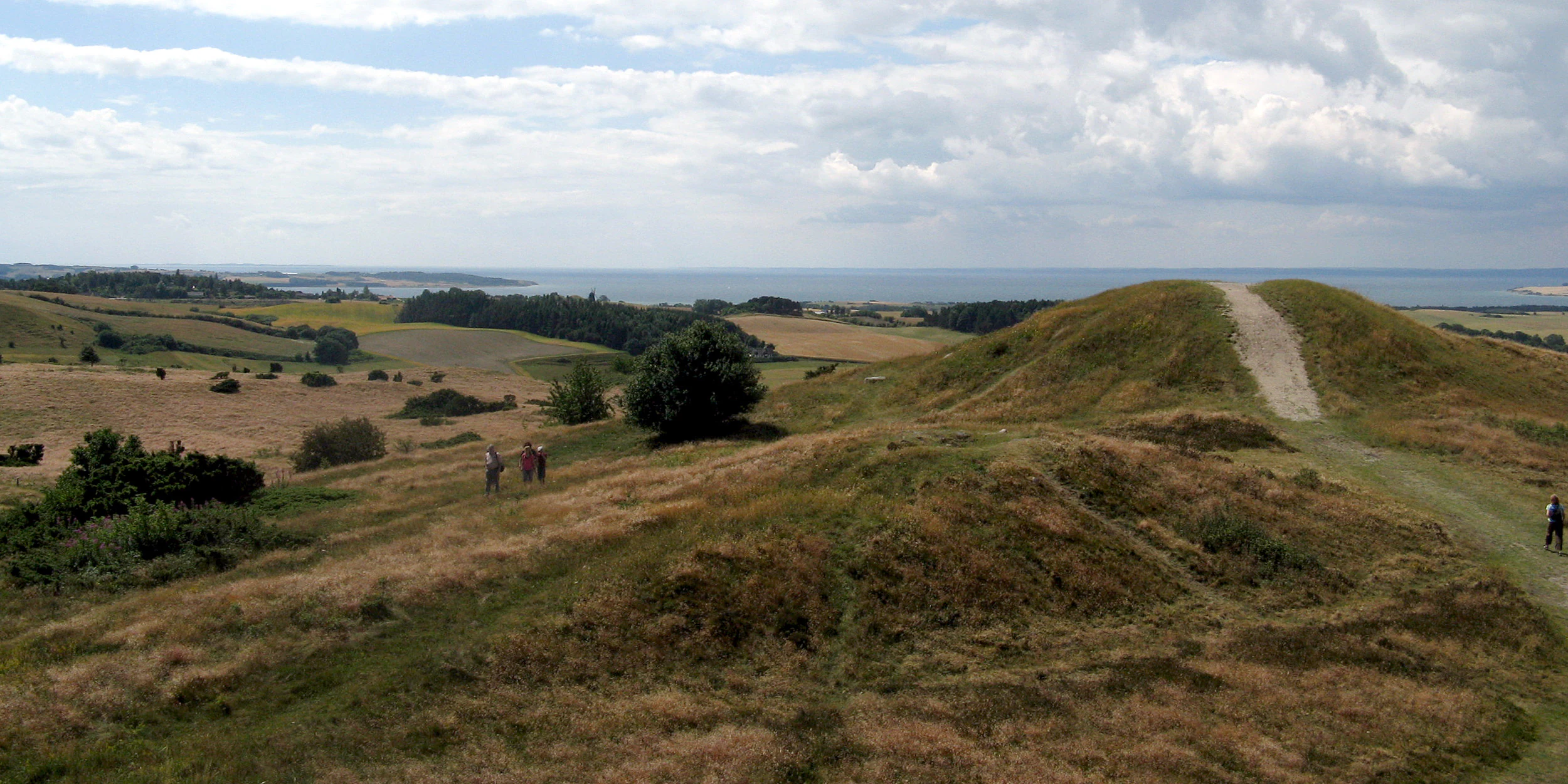
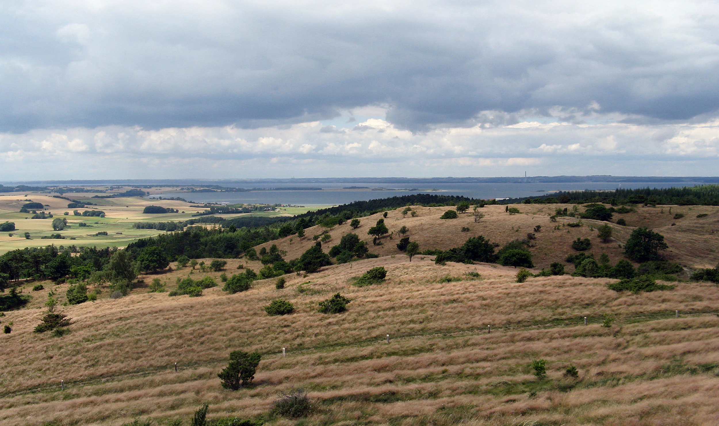
Mols Bjerge is best known for its distinctive rolling glacial hills, which represent one of Denmark's most scenic and geologically significant landscapes. The protected Mols Hills area covers 2,500 hectares and offers panoramic views across the Kattegat sea and the surrounding peninsula. The park is renowned for its exceptional biodiversity, hosting more than half of all wild Danish plant species. Its coastal cliffs at Jernhatten rise 49 metres above sea level and feature unusual steppe-like ecology. The area is also famous for its ancient burial monuments, including well-preserved dolmens, passage graves, and Bronze Age barrows, particularly the Stabelhøje complex near Trehøje.
Mols Bjerge National Park history and protected-area timeline
Mols Bjerge National Park was established through Executive Order 789 on 21 August 2009 and officially inaugurated by Queen Margrethe II on 29 August 2009. The creation of Denmark's second national park was announced by Minister of the Environment Troels Lund Poulsen on 17 January 2008, following years of deliberation about the appropriate boundaries and management framework for the protected area.
The concept of national parks in Denmark differs from some international models, representing not a formal protection or nationalisation of land but rather a declaration of intent to promote natural and cultural values while strengthening accessibility and interpretation. The park operates through a dedicated secretariat, employing nature interpreters to guide visitors and explain the region's ecology and heritage. The secretariat is housed in Jagtslottet, a hunting lodge designed by architect Hack Kampmann in 1898, originally owned by the Jenisch family who used it for summer retreats.
The land within the park remains under both private and state ownership, with approximately 33% under cultivation and 80% of the hill area in private hands. This approach has drawn attention from landowners concerned about the potential for national park status to lead to restrictions on property rights over time. In 2022, a 775-hectare portion of the park was designated as a Naturnationalpark (Nature National Park), representing a new tier of strict protection within the broader national park framework.
Mols Bjerge National Park landscape and geographic character
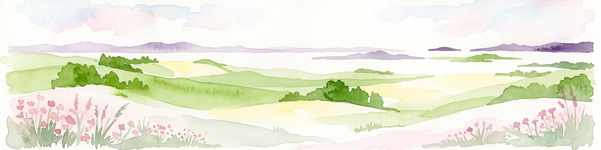
The landscape of Mols Bjerge National Park is defined by its glacial origins, with rolling hills and varied terrain shaped during the Weichselian glaciation. The Mols Hills, the park's most distinctive feature, reach 137 metres at their highest point and consist of 2,500 hectares of protected terrain. The topography varies widely, creating a mosaic of open heath, woodlands, cultivated fields, pastures, bogs, meadows, and coastal zones.
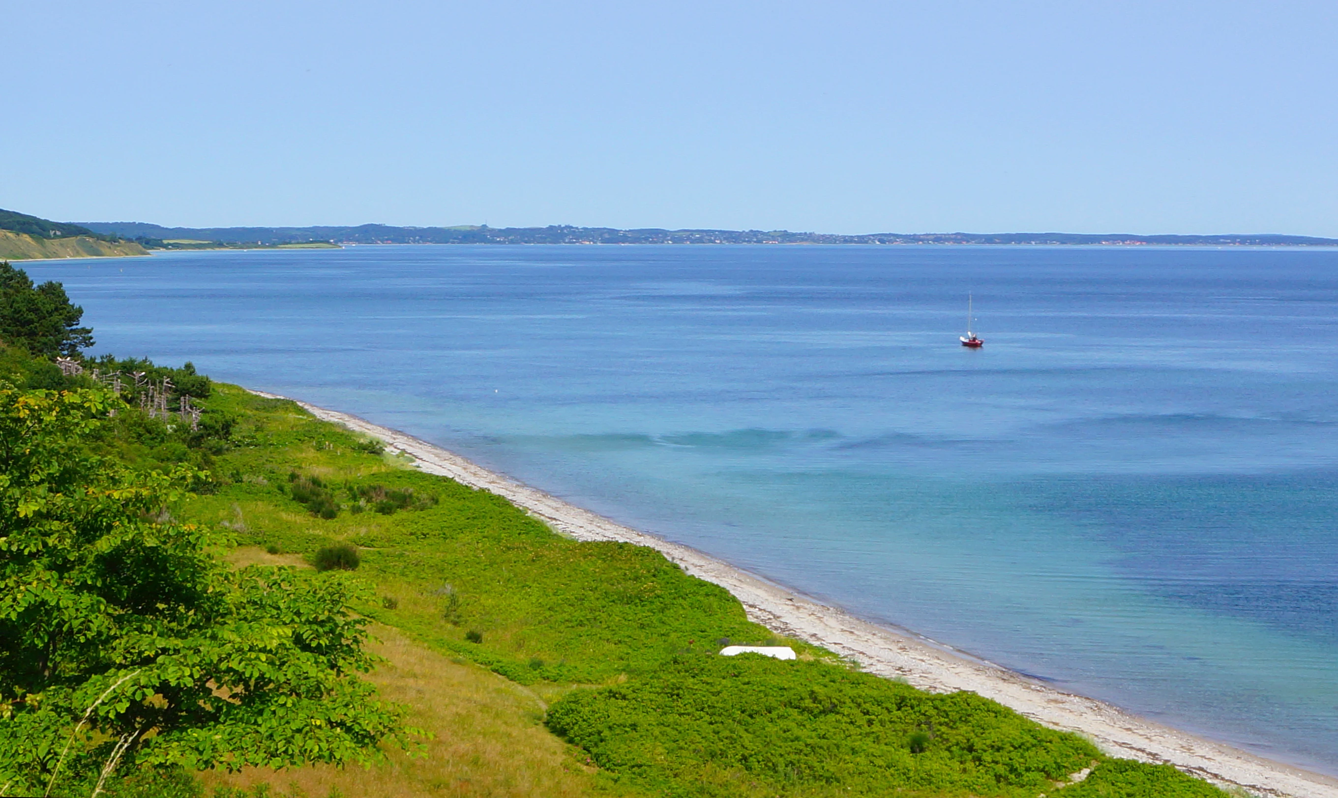
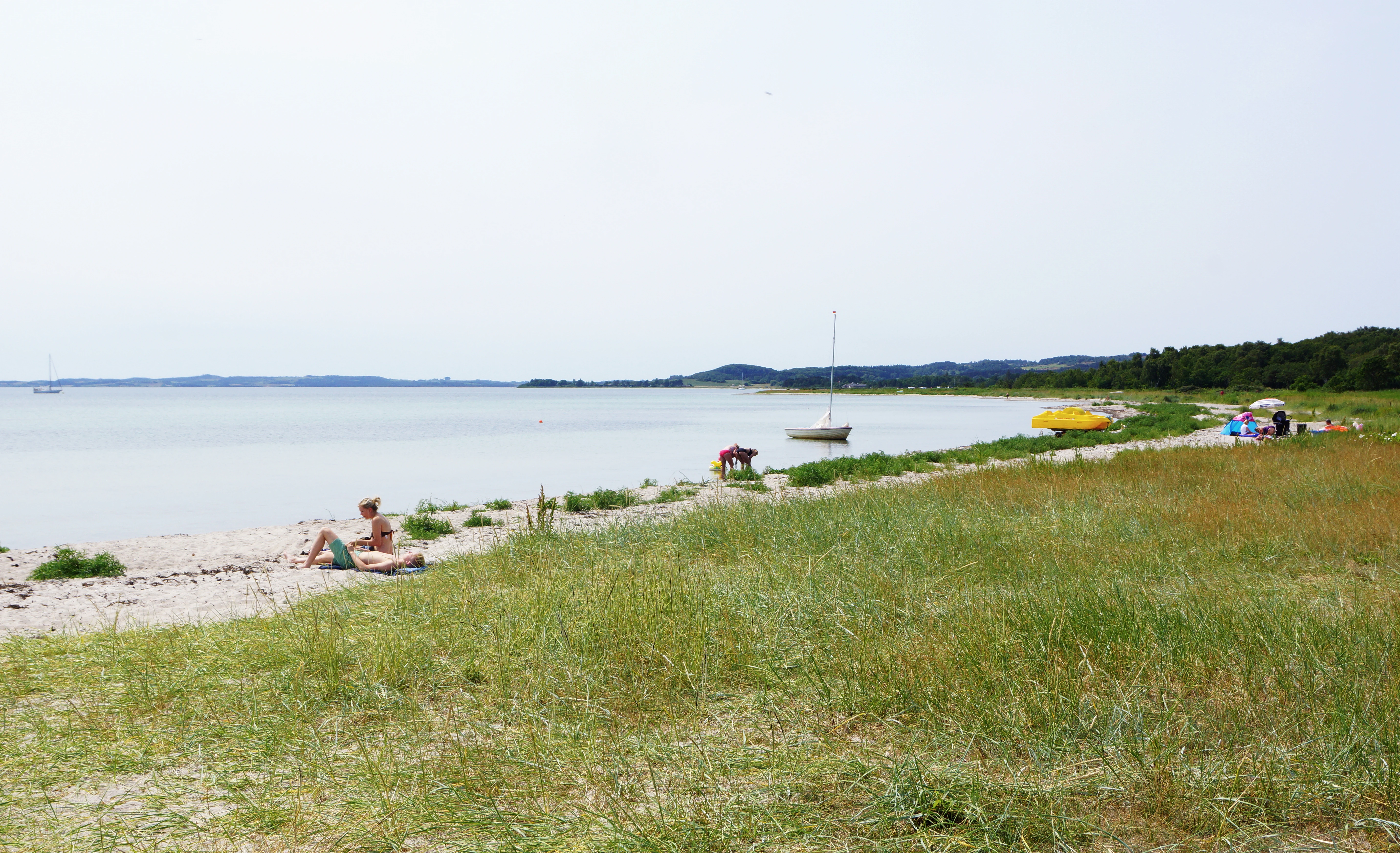
The park's eastern boundary follows the Kattegat sea, where dramatic cliffs at Jernhatten drop 49 metres to the water below. This headland offers panoramic views across the sea to the small island of Hjelm. The seafloor here comprises a cold-water stony reef with extensive kelp forests known as the Blak, providing excellent snorkeling opportunities. South of the hills, the landscape opens into Begtrup Vig, a shallow cove offering safe swimming, snorkeling, and windsurfing conditions, though the peninsula of Helgenæs itself lies outside the park boundaries.
Throughout the park, the terrain is punctuated by the rounded forms of ancient burial mounds—granite barrows, dolmens, and passage graves that serve as standing witnesses to millennia of human presence. The well-preserved Bronze Age burial mound of Stabelhøje is particularly notable, while the treeless hilltops and open heath offer sweeping vistas across the entire region.
Mols Bjerge National Park ecosystems, habitats, and plant life
Mols Bjerge National Park supports exceptional botanical diversity, with more than half of all wild Danish plant species recorded within its boundaries. The park's varied habitats—heath, woodland, pasture, bog, meadow, and coastal zones—create conditions for remarkable ecological richness. Agriculture has heavily shaped the landscape for centuries, and only small remnants of the original ancient woodland survive today, notably in Tolløkke Skov and Skovbjerg.
Skovbjerg represents one of the few remaining ancient forests in the park, dominated by pedunculate oak with acidophilous characteristics. Despite centuries of grazing and timber extraction, the woodland retains valuable epiphytic lichens and a specialized flora. In recent years, beef cattle have been introduced to graze a 15-hectare section moderately, reflecting Denmark's policy allowing 10% of preserved forest land to be managed as wood pasture to maintain stable woodland ecosystems.
Coastal habitats including beach meadows, salt marshes, and coastal heath support important flora and fauna requiring protection. The park contains numerous rare or threatened species and nature types, with a large portion designated as Natura 2000 territory. Notable plant species include the pasque flower, catchfly, and cudweed, while a significant number of rare and threatened fungi have been recorded here, some found nowhere else in Denmark.
Mols Bjerge National Park wildlife and species highlights
The wildlife population in Mols Bjerge includes several mammal species common to Danish ecosystems. Red foxes, European hares, and roe deer are prevalent throughout the park, with roe deer population density reaching approximately 20 deer per square kilometre. Reptiles present include the viviparous lizard and the European adder.
The park supports rich and varied bird populations spanning multiple ecological niches. Sea birds and waders inhabit the coastal areas, while forest birds and cavity-nesting species occupy the woodland habitats. Birds of prey occupy the top of the food chain, with red kite being a notable predator in the area. The coastal shallows at Ahl Plantation attract flocks of foraging gulls and wading birds including lapwing, curlew, oystercatcher, and ringed plover.
The beech woodlands of Troldeskoven (Troll Forest) leading to Jernhatten provide habitat for cavity-nesting birds, while great spotted woodpeckers thrive in the old-growth woods of Tolløkke. Green woodpeckers are common in Ahl Plantation, feeding on the forest's abundant ant-hills. Harbour porpoises may be observed in the Kattegat waters along the coast. The unusual steppe-like ecology at Jernhatten supports specialized species adapted to this rare habitat type in Denmark.
Mols Bjerge National Park conservation status and protection priorities
Mols Bjerge National Park was established partly to protect and collectively manage fragmented natural areas across the region. A large portion of the park is designated as Natura 2000 territory, reflecting the European Union's habitat and bird protection framework. The designation recognizes the park's significant ecological value and the presence of rare or threatened species and habitats requiring special protection.
In 2022, a 775-hectare area within the park was designated as Naturnationalpark Mols Bjerge, creating a higher level of protection for some of the most sensitive ecological zones. This new designation represents Denmark's approach to restoring natural processes and allowing ecosystems to develop with minimal human intervention. The park's conservation approach balances protection with continued agricultural use and public access, recognizing that the cultural landscape has been shaped by centuries of human activity.
The Danish national park concept emphasizes promotion of natural and cultural values rather than strict exclusion, with the park operating through a secretariat that employs nature interpreters to engage visitors and support conservation education. The protection of remaining ancient woodland remnants, the preservation of coastal habitats, and the maintenance of biodiversity in the agricultural landscape all form priorities for the park's management.
Mols Bjerge National Park cultural meaning and human context
The Mols Bjerge landscape bears extensive testimony to human habitation spanning thousands of years. Stone Age settlers left behind granite barrows, dolmens, and passage graves used for burials of chieftains, scattered throughout the terrain. The well-preserved Bronze Age burial mound of Stabelhøje dates to this period of increasing social complexity.
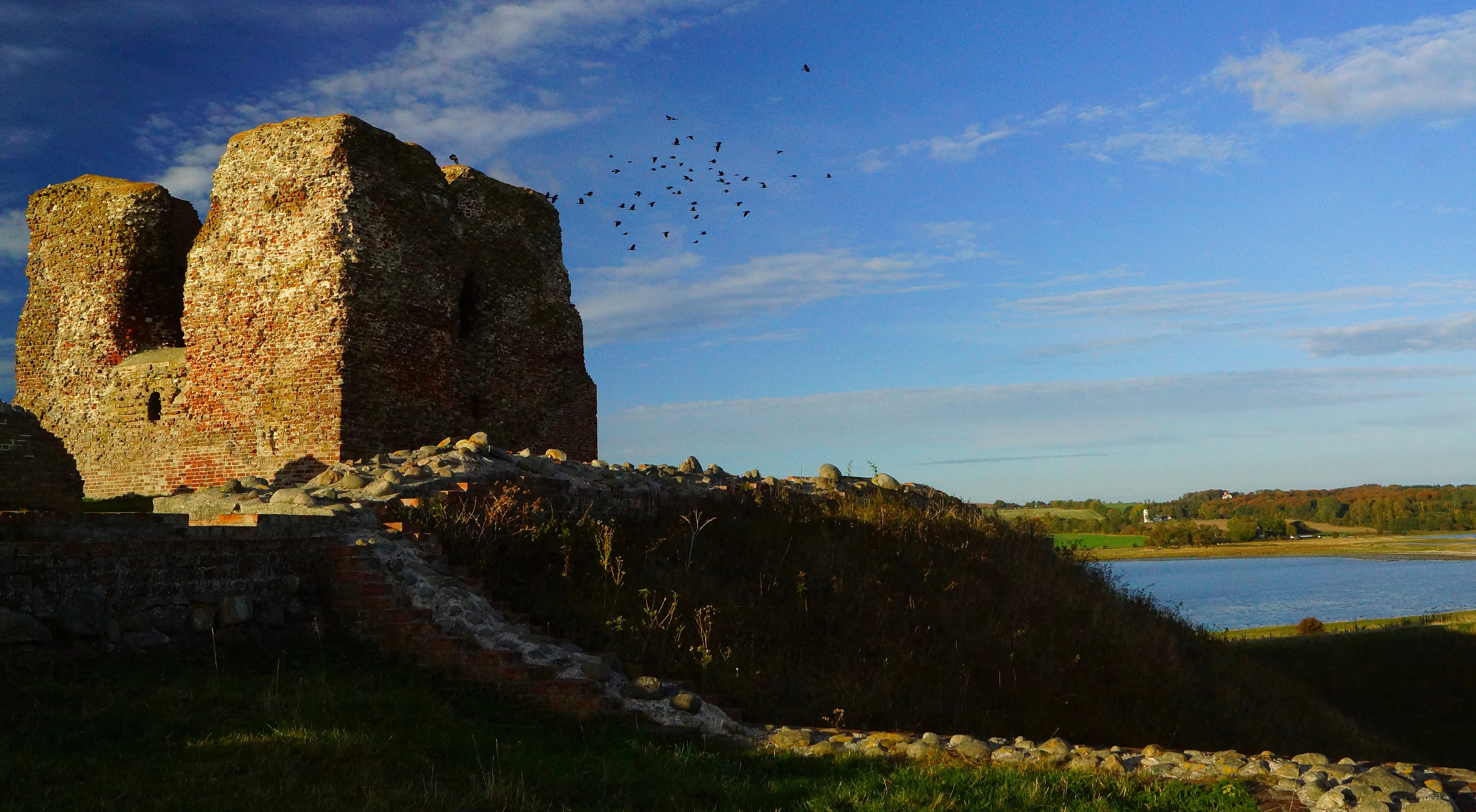
Medieval history is represented by Kalø Castle, a 14th-century fortress strategically positioned on a small island in Kalø Vig. The castle was connected to the mainland by a 500-metre cobblestone causeway, remains of which can still be traversed today. The coastal cliffs at Hestehave Wood supplied clay for brick-making during the castle's construction. The early 18th-century Kalø Gods manor and the 1898 hunting lodge Jagtslottet represent later aristocratic ownership of the estate.
The town of Ebeltoft, with its historic harbour and well-preserved 18th-century buildings, forms the cultural centre within the park. The old farm of Strandkær, with buildings dating to around 1730, now houses the visitor centre and research facilities. The village of Femmøller (Five-mills), though no mills remain, still preserves its millponds and timber-framed houses as evidence of the water-powered industrial history that once characterized the area.
Top sights and standout views in Mols Bjerge National Park
The Mols Hills offer the park's most iconic landscape, with rolling terrain reaching 137 metres and providing panoramic views across the Kattegat and surrounding peninsula. The Stone Age and Bronze Age burial monuments, particularly at Stabelhøje and Trehøje, represent remarkable prehistoric heritage visible across the open heath. Kalø Castle ruins, accessible via a medieval cobblestone causeway, create a dramatic focal point in the southwestern park area.
The coastal cliffs at Jernhatten drop 49 metres to the sea below, with the beech woodland of Troldeskoven providing a mystical approach to this exposed headland. The underwater kelp forests of the Blak reef offer excellent snorkeling in summer months. Begtrup Vig provides safe swimming and watersports in a sheltered cove, while the ancient woodlands of Tolløkke Skov and Skovbjerg preserve remnants of the original forest cover that once dominated the peninsula.
Best time to visit Mols Bjerge National Park
The park can be enjoyed throughout the year, though each season offers distinct experiences. Spring brings the flowering of heath and meadows, with pasque flowers and green-winged orchids appearing in April and May. Summer months offer the best conditions for coastal activities including swimming, snorkeling, and windsurfing at Begtrup Vig, while the long days allow extended exploration of the hiking trails across the hills. Autumn sees the onset of colour in the deciduous woodlands and represents a good time for fungal forays, with numerous rare species recorded in the park. Winter landscapes, particularly when snow covers the hills, offer a different perspective on the terrain, though many facilities have reduced hours. The visitor centre at Strandkær operates year-round and provides information on current conditions and guided activities.