
Mori Atlas logo
Wildlife reserveMotuihe Island

Examining the ecological restoration and island landscape near Auckland, New Zealand

Motuihe Island Wildlife Reserve: A Mapped Geographical and Conservation Overview

(Motuihe Island / Te Motu-a-Ihenga)

Motuihe Island stands as a vital wildlife reserve within the Hauraki Gulf, offering a clear geographic study of island restoration and coastal terrain. Located near Auckland, the island provides a unique look at how community-led ecological projects transform former agricultural land into thriving native bird habitats. By examining the mapped boundaries and the remnants of historic human usage, users can understand the complex evolution of this protected New Zealand landscape.

Hauraki Gulfrecreation reserveisland sanctuarypest-free islandcoastal forestbeaches
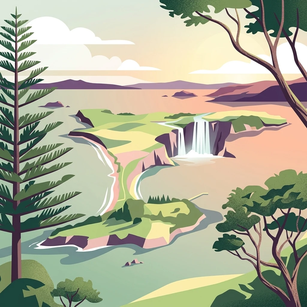
A digital illustration of a scenic island landscape featuring a waterfall plunging into the sea, framed by tall pine and native trees, with coastal hills and surrounding water under a soft sky.

Motuihe Island

Wildlife reserve

Park overview

Structured park overview, official facts, and landscape profile for Motuihe Island

Motuihe Island park facts, protected area profile, and essential visitor context

Review the core facts for Motuihe Island, including designation, size, terrain, visitor scale, habitats, and operating context in one park-focused overview.

About Motuihe Island

Motuihe Island sits in the Hauraki Gulf close to Auckland, framed by the larger landmasses of Motutapu to the west and Waiheke to the south and east. At about 179 hectares, it is a small but ecologically and culturally significant island that bridges the busy urban edge of New Zealand's largest city with the broader Gulf island landscape.

The island is managed as a recreation reserve under the New Zealand Department of Conservation, with the Motuihe Trust playing a central role in restoration, infrastructure, and community engagement. Only a small portion of the island, around 18 hectares, retains coastal forest, while much of the rest was cleared at different times for farming, station use, military activity, or pest control. Today the island is most associated with easy day-trip access from Auckland, its white-sand beaches, and a robust conservation programme that has made it a stronghold for reintroduced native species.

Visitors typically reach Motuihe by private boat or by seaplane, arriving at a wharf on the southern side where day-tripper craft regularly congregate. The trust operates an ongoing programme of native tree planting and invasive weed control, and large-scale community plantings have become a notable feature of the island's identity. Despite its proximity to the city, the island functions as a relatively quiet refuge, with resident staff and seasonal volunteers outnumbering the tiny permanent population.

Quick facts and research context for Motuihe Island

Motuihe Island is roughly 179 hectares in area and lies in the inner Hauraki Gulf between Motutapu and Waiheke, within easy reach of Auckland. Around 18 hectares of coastal forest remain as a native vegetation remnant, with the rest of the land heavily modified by successive waves of farming, quarantine, military, and conservation use.

Geologically the island is built mainly from Waitemata sandstone capped by Parnell Grit. Its protected status is a recreation reserve under the New Zealand Department of Conservation, with day-to-day restoration work led by the Motuihe Trust and supported by large volunteer planting events.

Protection and recognition

Examine the terrestrial protected area designation and official management records.

Motuihe Island Protection Status and Documented Conservation Scope

Review the documented protection status and territorial management framework governing Motuihe Island. Assess official designation records and administrative classifications for this conservation landscape.

Protection details

Protection scope
Terrestrial
Transboundary protection
No
Park context

Deeper park guide and search-rich context for Motuihe Island

Motuihe Island history, landscape, wildlife, and travel context

Explore Motuihe Island through its history, landscape character, ecosystems, wildlife, conservation priorities, cultural context, and seasonal travel timing in a structured park guide built for atlas discovery and search intent.

Why Motuihe Island stands out

Motuihe is best known as a pest-free Hauraki Gulf island with attractive beaches and an unusually layered human history. Visitors associate it with accessible day-trip scenery just a short sail from Auckland, while conservation audiences recognise it as a successful example of community-led island restoration, including eradication of rats, mice, and rabbits and the reintroduction of threatened native birds. The island also stands out for its combination of archaeological significance, with multiple pā sites and traditional cultivation traces, and its twentieth-century role as a quarantine station, First World War internment camp, and naval training base. This mix of natural and historical layers gives Motuihe a distinctive identity compared with other Gulf islands that are more purely scenic or purely ecological.
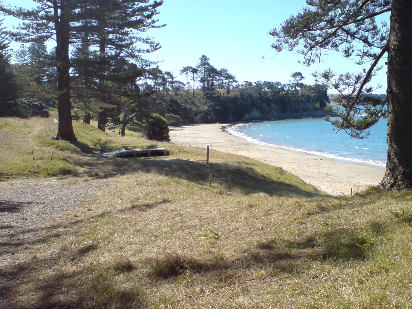
A coastal landscape showing a sandy beach curving along the shoreline of Motuihe Island, framed by large pine trees in the foreground and a grassy bank.
A view of the northern beach on Motuihe Island, looking west along the coastline.

Motuihe Island history and protected-area timeline

Motuihe carries thousands of years of human presence layered onto a relatively small piece of Gulf land. In Tāmaki Māori tradition the island was associated with the Tūrehu, supernatural beings said to have lived there, and its Māori name Te Motu-a-Ihenga commemorates the ancestor Ihenga of Te Arawa, who travelled to the island in the fourteenth century. The landscape still holds extensive archaeological evidence of this earlier era, including pā sites such as Te Rae o Kahu on the eastern headland of Ocean Beach, karaka groves, food storage pits, and traces of traditional crops like gourd and taro.

European contact brought rapid change. In 1839 William Fairburn purchased Motuihe from chiefs of Ngāti Pāoa, Ngāi Tai, and Ngatiwaki, paying for it in goods including blankets, axes, hoes, iron pots, and cloth. Within a few years farming had begun, and surviving stands of Norfolk pines and olive trees still mark the footprint of that nineteenth-century pastoral use.

From the 1870s the island took on a new role as a quarantine station. Designated in 1872 for smallpox cases and built out from 1873, the station handled an 1874 scarlet fever outbreak and operated for close to fifty years. During the First World War it was repurposed as an internment camp, with its most famous prisoner being the German commerce raider Count Felix von Luckner and his crew from SMS Seeadler, captured in September 1917. Luckner's Christmas play escape and subsequent capture became one of New Zealand's most colourful wartime stories.

The station returned to quarantine duty during the 1918 influenza pandemic. With the Second World War it became a naval training base, HMNZS Tamaki, with new buildings and infrastructure added. The navy continued training on the island until 1963, when operations shifted to the North Shore. The quarantine and military era left a dense overlay of structures and stories that still shapes the island's built heritage and conservation planning today.

Motuihe Island landscape and geographic character

Motuihe lies within the Hauraki Gulf near Auckland and is small enough that its entire geography can be read at a glance. The island has a roughly elongated shape, with a narrow western neck separating a northern beach from a southern beach, and an aerial view reveals a low, rolling profile that sits low in the water against the larger islands of Motutapu and Waiheke.

The most prominent physical features are the beaches themselves, which give the island much of its recreational character. The northern and southern beaches are divided by a stretch of land only about thirty metres across at its narrowest, creating two contrasting shorelines within walking distance. The southern side is also home to the main wharf, where day-trip boats cluster in the bay behind it.

Beneath the surface, the island is built primarily from Waitemata sandstone, then capped by Parnell Grit. This geological layering has shaped the rolling slopes and exposed shorelines seen today. Much of the original vegetation has been replaced by pasture remnants and replanted native forest, so the landscape reads as a patchwork of coastal forest strips, regenerating planting blocks, open grassy areas, and the residual stands of introduced Norfolk pines and olive trees left behind by nineteenth-century farming.
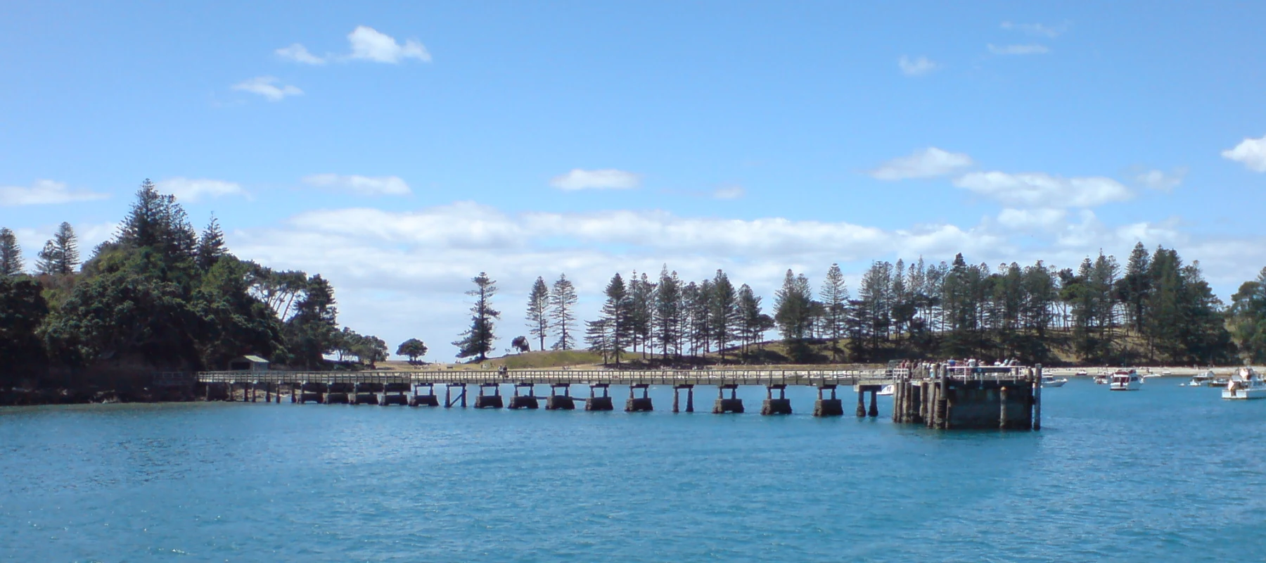
A wide, panoramic view of the wooden wharf stretching out into the calm blue water towards the island shore, with green trees and a clear blue sky in the background.
The wharf at Motuihe Island viewed from the water.

Motuihe Island ecosystems, habitats, and plant life

Motuihe's natural character is defined less by untouched wilderness than by careful reconstruction. The island retains only around 18 hectares of coastal forest as a native vegetation remnant, and the rest of the land has been shaped by repeated cycles of clearance, farming, infrastructure development, and ecological restoration. The trust's replanting work has become a defining ecological feature, with tens of thousands of native trees added in successive planting seasons.

The flora is dominated by regenerating native forest, replanted shelter belts, and surviving patches of original coastal vegetation. Alongside the native plantings, the island still carries the legacy of introduced species from its pastoral history, including stands of Norfolk pines and olive trees. Restoration work continues against a backdrop of persistent invasive weeds such as moth plant, woolly nightshade, and Italian buckthorn, all of which compete with native regeneration and require active volunteer-led control.

Ecologically, Motuihe is best understood as a managed mainland-style island sanctuary. Its ecological identity has been deliberately re-engineered over recent decades to support native fauna, and the removal of introduced mammals has been the foundation of that approach. The combination of small size, accessible coastlines, and intensive management gives the island a tightly woven ecological fabric where habitat restoration, weed control, and species reintroductions are closely linked.

Motuihe Island wildlife and species highlights

Wildlife on Motuihe is largely the product of deliberate conservation effort rather than a long undisturbed ecological history. The removal of rats and mice in 1996 and of rabbits in 2004 transformed the island from a place where introduced mammals dominated pressure on native flora and fauna into a refuge where small, vulnerable native species can be reintroduced.

Birds are the most visible expression of this transformation. The North Island saddleback, known in Māori as tieke, has been reestablished on the island, and in May 2008 thirty-one red-fronted parakeets, or kākāriki, were translocated from Little Barrier Island after a rat incursion had been resolved. In March 2009, fifteen little spotted kiwi were released on Motuihe, marking a significant step in the island's emergence as a mainland-style sanctuary for threatened species.

The island's seabird and coastal bird life is also part of its broader ecological value, while forest patches, regenerating shrublands, and open planted valleys together provide a varied habitat mosaic. The combination of pest control, ongoing native planting, and continued mammalian surveillance means the wildlife profile of the island is still evolving, with each successful breeding season reinforcing Motuihe's role as a small but important node in the Hauraki Gulf conservation network.

Motuihe Island conservation status and protection priorities

Motuihe is one of the clearest examples in the Hauraki Gulf of community-driven island restoration. The Motuihe Trust, working under the Department of Conservation's recreation reserve framework, treats conservation as an integral part of the island's identity rather than as an overlay on top of other land uses. The trust's planting nursery, volunteer programmes, and weed control efforts are central to the island's ongoing ecological recovery.

The history of pest eradication gives a clear measure of the island's conservation significance. Rats and mice were removed in 1996, and rabbits were cleared in 2004, effectively resetting the island's competitive balance in favour of native flora and fauna. The 2008 detection of rat footprints, and the subsequent rapid response that ended with a Norwegian rat being caught by a trained hunting dog, illustrates the urgency of maintaining that pest-free status.

Equally important is the scale of replanting. In May 2009, around 350 volunteers from The Nikolai Organisation planted more than 22,000 native trees in a single day, representing a large share of that year's programme, and other community and corporate planting efforts have added tens of thousands more trees over time. Invasive weeds such as moth plant, woolly nightshade, and Italian buckthorn remain a persistent challenge, but the combination of pest control, native replanting, and species reintroductions has made Motuihe a valuable refuge for saddleback, red-fronted parakeets, and little spotted kiwi within the wider Hauraki Gulf ecosystem.

Motuihe Island cultural meaning and human context

Motuihe carries a deep cultural identity that long predates its modern conservation role. In Tāmaki Māori tradition the island is remembered as a place associated with the Tūrehu, supernatural beings of New Zealand mythology, and its Māori name Te Motu-a-Ihenga reflects the visit of the Te Arawa ancestor Ihenga in the fourteenth century. The island's surviving pā sites, food storage pits, and groves of karaka trees anchor this earlier history in the physical landscape.

The arrival of European settlers added new cultural layers. The 1839 purchase by William Fairburn from chiefs of Ngāti Pāoa, Ngāi Tai, and Ngatiwaki marked the beginning of sustained Pākehā farming presence, while later use as a quarantine station, internment camp, naval training base, and recreation reserve each left their own institutional, social, and architectural footprint. These overlapping layers make Motuihe a place where Māori archaeological heritage, colonial history, and contemporary community restoration work coexist within a single small island landscape.

Top sights and standout views in Motuihe Island

Motuihe's standout qualities sit at the intersection of accessible Gulf scenery and intensive ecological restoration. The island's beaches, particularly the contrasting northern and southern shores separated by a narrow isthmus, give it strong day-trip appeal from Auckland, while the surrounding waters support the active boating traffic that ties the island to the wider Hauraki Gulf community.

Equally distinctive is the combination of ecological milestones, from the 1996 rat and mouse eradication and the 2004 removal of rabbits to the reintroduction of saddleback, red-fronted parakeets, and little spotted kiwi, with a programme of large-scale native planting that has reshaped much of the landscape. Layered on top of this natural story is a remarkable sequence of human uses, from ancient pā sites and traditional cultivation, to a nineteenth-century quarantine station, the First World War internment of Count Felix von Luckner, and a Second World War naval training base, making Motuihe a small island with an unusually rich social and ecological archive.

Best time to visit Motuihe Island

Motuihe's outdoor character shifts with New Zealand's seasons. Summer and the warmer shoulder months generally bring the most settled conditions for beach use, swimming, and day-trip travel by boat or seaplane from Auckland, when the Gulf's waters are calmer and daylight hours are at their longest. These periods also align with the bulk of volunteer planting and conservation activity, giving visitors the chance to encounter trust and DOC staff in active restoration work.

Cooler months bring greener vegetation, more changeable sea conditions, and quieter visitation. Wildlife-focused visits outside the peak summer period can be rewarding, as breeding cues for reintroduced birds such as saddleback, kākāriki, and little spotted kiwi change through the year. Whatever the season, the island's pest-free status and active restoration mean that visits offer both a beach environment and an evolving ecological story rather than a single static experience.

Monthly climate preview

Track long-term average monthly temperatures and precipitation patterns across the protected landscape

Motuihe Island Climate Normals: Annual Temperature and Precipitation Profiles

Historical coordinate data records measured monthly temperature ranges and daily precipitation averages across the protected island terrain. Evaluating the complete twelve-month record clarifies long-term thermal rhythms and moisture distributions.
Annual mean16 °C
11 °C20 °C
Jan20°
Feb20°
Mar19°
Apr17°
May15°
Jun12°
Jul11°
Aug12°
Sep13°
Oct14°
Nov16°
Dec18°
Warmest month
February

20.3 °C

Coolest month
July

11.4 °C

Wettest month
July

3.7 mm/day

Driest month
January

1.8 mm/day

Park location guide

Geography guide, regional context, and park location map for Motuihe Island

Motuihe Island park geography, regions, and map view in New Zealand

Understand where Motuihe Island sits in New Zealand through a broader geographic reading of the surrounding landscape, nearby location context, and its mapped position within the national park landscape.

How Motuihe Island fits into New Zealand

New Zealand is an island nation in the southwestern Pacific Ocean comprising two main islands and numerous smaller islands. Located east of Australia across the Tasman Sea, it features varied topography with the Southern Alps running along the South Island and volcanic terrain on the North Island. The country was settled by Maori people between 1280 and 1350, followed by European exploration beginning in 1642, and became a Dominion in 1907 before gaining full independence in 1947.

Wider geography shaping Motuihe Island in New Zealand

New Zealand lies in the southwestern Pacific Ocean, east of Australia across the Tasman Sea. The country consists of two main islands, the North Island and South Island, plus over 600 smaller islands. The North Island features volcanic plateaus and hills while the South Island is dominated by the Southern Alps mountain range. The country has a long coastline and is surrounded by the Pacific Ocean.

Map view of Motuihe Island

Use this park location map to pinpoint Motuihe Island in New Zealand, understand its exact geographic position, and read its mapped placement within the surrounding landscape more clearly.

Pigeon | © OpenStreetMap contributors

Location context for Motuihe Island

Auckland

Explore coastal forest strips, rolling terrain, and protected island habitats through visual reference.

Motuihe Island Photos and Landscape Scenery: Visualizing the Hauraki Gulf Sanctuary

Visual records reveal the diverse terrain, coastal margins, and regenerated forest blocks that define the protected landscape of Motuihe Island. Detailed photography provides an intimate look at local habitats, shoreline topography, and ongoing conservation environments across the reserve.

A coastal landscape showing a sandy beach curving along the shoreline of Motuihe Island, framed by large pine trees in the foreground and a grassy bank.

A high angle aerial view of Motuihe Island, which is a thin, green island surrounded by the blue waters of the Hauraki Gulf.

A wide, panoramic view of the wooden wharf stretching out into the calm blue water towards the island shore, with green trees and a clear blue sky in the background.

Park atlas

Compare nearby Hauraki Gulf sanctuaries and connected island conservation landscapes

Explore Other Parks Near Motuihe Island and Surrounding Regional Protected Areas

Visitors exploring Motuihe Island can browse nearby protected areas and coastal reserves across the surrounding marine region. Comparing adjacent island sanctuaries provides broader geographical context on restoration projects and marine habitats.
Regional parkAuckland Region
About 10 km away#1 closest

East

Whakanewha Regional Park: Mapping the Protected Landscapes and Wetlands of Waiheke Island

Coastal forest and wetland geography in the Auckland Region

Whakanewha Regional Park serves as a vital protected area on Waiheke Island, known for its mature broadleaf forests and significant freshwater wetlands. The park provides a compact yet varied landscape of stream valleys and coastal ridgelines, representing a key component of the regional geography within the Hauraki Gulf, sheltered from broader environmental pressures.

Area
2.7 km²
Established
2007
Relief
Upland
Climate
Temperate
Regional parkAuckland Region
About 22 km away#2 closest

Southeast

Waitawa Regional Park: Coastal Geography and Recreation Landscapes in Auckland

Mapped terrain along the Tāmaki Strait shoreline

Waitawa Regional Park serves as a notable example of repurposed land within the Auckland Region, featuring an open coastal landscape on the Tāmaki Strait. This protected space, formerly an industrial explosives site, now offers a unique geography of grassy tracks, beach access, and historical remnants. Its layout provides a specialized atlas view of coastal development and public land use for outdoor activity.

Area
1.88 km²
Established
2013
Relief
Upland
Climate
Temperate
A soft, watercolor painting of a coastal landscape featuring green rolling hills, distant pale mountains, and patches of vegetation against a white background.
Nature reserveAuckland Region
About 23 km away#3 closest

East

Rotoroa Island Nature Reserve: Mapping the Geography of this Hauraki Gulf Sanctuary

A vital protected island terrain for native species and reforestation

Rotoroa Island serves as a managed conservation landscape within the Hauraki Gulf, defined by its role as a pest-free sanctuary for threatened bird populations and intensive native forest restoration. The island offers a distinct geography that combines maritime coastal terrain with a rich history of social welfare, preserved through intentional land management and active environmental rehabilitation efforts near the Auckland coast.

Area
0.82 km²
Established
2011
Relief
Lowland
Scope
Terrestrial
A flat-style digital illustration showing a winding river through a valley with pine trees, steep rock cliffs, and a waterfall under a soft sun.
Nature reserveAuckland
About 25 km away#4 closest

South

Puhinui Reserve: Protected Nature Reserve and Volcanic Geography in Auckland, New Zealand

Coastal wetlands, maar craters, and working agricultural lands

Explore the physical geography of Puhinui Reserve, a protected nature reserve in South Auckland. This site encompasses rare saltmarsh habitat, active volcanic maar features, and estuarine environments situated on the shores of the Manukau Harbour. Gain insight into the volcanic ash, alluvium, and peat soil structures that define this unique transitional landscape.

Area
1.99 km²
Established
1991
Relief
Lowland
Climate
Temperate
A pale, minimalist watercolor painting showing a grassy island or shoreline with a small cluster of trees, set against a quiet body of water and soft, distant rolling hills.
Protected areaAuckland Region
About 25 km away#5 closest

West

Motumānawa / Pollen Island: Protected Marine Reserve and Scientific Landscape in Auckland

A coastal shellbank island refuge within the Waitematā Harbour.

Motumānawa / Pollen Island is an essential protected area near the Rosebank Peninsula, serving as a sanctuary for native bird populations and estuarine vegetation. Its status as both a scientific and marine reserve highlights the importance of small-scale coastal conservation within a major metropolitan harbour landscape in New Zealand.

Established
2006
Relief
Lowland
Scope
Marine
Water
Water-dominated
Regional parkAuckland Region
About 36 km away#6 closest

Northwest

Wenderholm Regional Park: Coastal Forest and Estuary Geography in the Auckland Region

Mapped protected landscapes of a coastal New Zealand peninsula

Situated on a narrow peninsula north of Auckland, Wenderholm Regional Park offers a compact study in diverse coastal terrain. The park encompasses the forested Maungatauhoro headland, the tidal Puhoi sandspit, and riverine boundaries that create a distinct protected environment. Since its 1965 founding, the area has become a haven for native bird restoration and coastal vegetation, providing a unique vantage point across the Hauraki Gulf.

Area
1.35 km²
Established
1965
Relief
Mixed relief
Climate
Temperate
A soft watercolor illustration showing the low-lying shape of Motuora Island surrounded by calm water, with a distant hilly coastline in the background.
Nature reserveNorth Island
About 37 km away#7 closest

North

Motuora Nature Reserve: Protected Coastal Island Geography and Restoration Map

Predator-free ecological sanctuary in the Hauraki Gulf

Motuora occupies a key position in the Hauraki Gulf, offering a well-mapped look at coastal island restoration in New Zealand. This protected area features a regenerated forest interior and cliff-edged terrain, serving as an important mainland-island site for avian conservation, including kiwi and petrel colonies.

Area
0.8 km²
Established
1965
Relief
Lowland
Climate
Subtropical
Regional parkAuckland Region
About 37 km away#8 closest

Northwest

Te Muri Regional Park: Mapped Coastal Peninsula and Estuarine Geography in Auckland

Protected native forest and tidal estuary landscapes

Te Muri Regional Park presents a unique peninsular landscape situated between the Puhoi River and Te Muri O Tarariki Stream in Auckland. This protected area showcases a complex interface between native coastal forest and tidal ecosystems, offering clear mapped boundaries that connect to the wider Hauraki Gulf coastal belt. Explore the topographical transition from sea level estuaries to rolling hill country.

Area
4.44 km²
Established
2010
Relief
Upland
Scope
Terrestrial

Common questions about visiting, size, designation, and location context for Motuihe Island

Motuihe Island FAQs for park facts, access, geography, and protected area context

Find quick answers about Motuihe Island, including protected-area facts, park geography, trail and visitor context, and how the park fits into its surrounding country and regional landscape.
MoriAtlas Explorer

Continue Your Protected Areas Search Across the Global Atlas

Deepen your exploration by continuing the structured search for national parks and protected areas worldwide. Utilize the comprehensive filtering capabilities to compare different conservation landscapes and refine your understanding of global park geography. Discover more about the distribution and characteristics of protected natural areas.

Global natural geography