
Mori Atlas logo
Protected landscapeMount Baker–Snoqualmie National Forest

Tracing the glaciated volcanic peaks and expansive wilderness corridors of Washington's Cascade Range

Mount Baker–Snoqualmie National Forest: A Comprehensive Protected Landscape and Geographic Atlas

Mount Baker–Snoqualmie National Forest encompasses a vast stretch of the western Cascade Range in Washington, extending from the Canadian border to the outskirts of Mount Rainier. This protected landscape is defined by its transition from low-elevation maritime forests to rugged high-alpine ridges and glacier-clad volcanic peaks including Mount Baker and Glacier Peak. The mapped geography reveals a complex mosaic of deep river valleys, subalpine meadows, and one of the largest concentrations of designated wilderness areas in the United States.

Cascade RangeNational ForestMountainsGlaciersVolcanic PeaksOld-Growth Forest
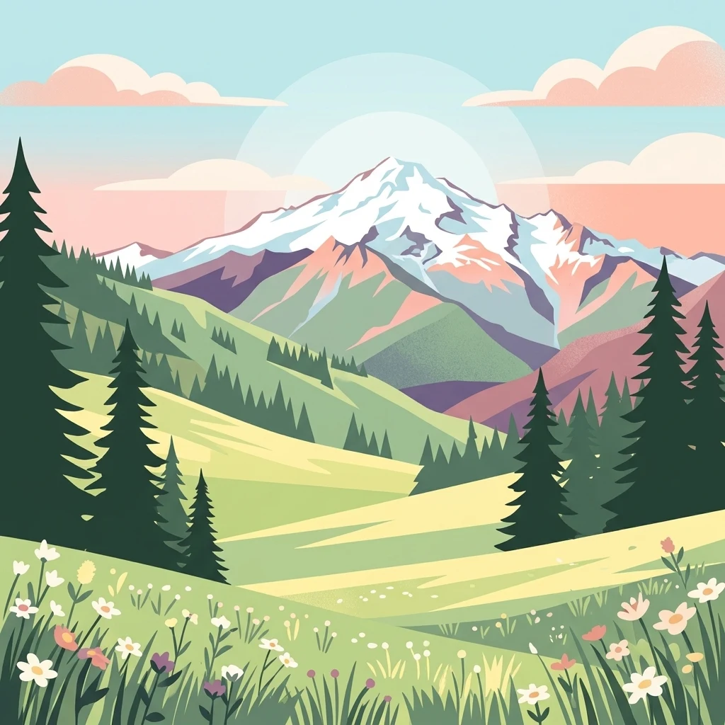
A flat-style digital illustration depicting a prominent snow-capped peak in the distance, framed by coniferous trees and a foreground meadow filled with small wildflowers.

Mount Baker–Snoqualmie National Forest

Protected landscape

Park overview

Structured park overview, official facts, and landscape profile for Mount Baker, Snoqualmie National Forest

Mount Baker, Snoqualmie National Forest park facts, protected area profile, and essential visitor context

Review the core facts for Mount Baker, Snoqualmie National Forest, including designation, size, terrain, visitor scale, habitats, and operating context in one park-focused overview.

About Mount Baker, Snoqualmie National Forest

Mount Baker–Snoqualmie National Forest is a defining landscape of the Pacific Northwest, weaving together dense evergreen forests, rushing glacial rivers, high alpine ridges, and iconic Cascade volcanoes across a vast western swath of Washington State. It runs continuously along the western slopes of the Cascade Range, forming a green and mountainous corridor between the densely populated Puget Sound lowlands and the high volcanic interior of the range.

The forest's identity is shaped by elevation and ecology as much as by its long human history of recreation. Lower elevations are dominated by western hemlock and silver fir forests, with moss-laden understories fed by Pacific moisture. As the land rises, the vegetation shifts through subalpine mountain hemlock stands before reaching open alpine terrain, glaciers, and bare volcanic rock near the summits of Mount Baker and Glacier Peak. This gradient creates a remarkable diversity of habitats across a relatively compact geographic corridor.

Wild and scenic rivers, glaciated valleys, and extensive wilderness areas give the forest a strong conservation identity alongside its recreational role. Nearly half of its land area lies within designated wilderness, including Mount Baker Wilderness, Glacier Peak Wilderness, Wild Sky Wilderness, and several others shared with neighboring national forests. The Skagit Wild and Scenic River System adds another layer of ecological significance, protecting corridors that are vital for salmon, bald eagles, and other wildlife.

What truly sets Mount Baker–Snoqualmie apart from many other large national forests is the sheer scale of its public use. Because it lies within easy driving distance of Seattle, Tacoma, Everett, Bellingham, and Vancouver, it draws millions of visits each year for hiking, skiing, snowboarding, backpacking, climbing, rafting, and wildlife watching. The forest functions simultaneously as a working landscape, a wilderness refuge, and a backyard outdoor playground for one of the most recreation-rich population corridors in North America.

Quick facts and research context for Mount Baker, Snoqualmie National Forest

Mount Baker–Snoqualmie National Forest covers approximately 1,724,229 acres across the western Cascade Range of Washington State. It is administered by the United States Forest Service, with headquarters in South Everett and ranger district offices in Sedro-Woolley, Darrington, Skykomish, North Bend, and Enumclaw.

The forest spans portions of six Washington counties, from Snohomish and Whatcom in the north to Pierce and Kittitas in the south. Nearly half of its area lies within designated wilderness, and it contains more glaciers and snowfields than any national forest outside Alaska.

Protection and recognition

Review documented terrestrial protection scope and international recognition records for Mount Baker Snoqualmie National Forest

Mount Baker Snoqualmie National Forest Protection Status and Terrestrial Designation Records

Mount Baker Snoqualmie National Forest features established terrestrial protection parameters and documented conservation management scopes. Verified records outline baseline protection status and administrative classification details for this natural area.

Protection details

Protection scope
Terrestrial
Transboundary protection
No
Park context

Deeper park guide and search-rich context for Mount Baker, Snoqualmie National Forest

Mount Baker, Snoqualmie National Forest history, landscape, wildlife, and travel context

Explore Mount Baker, Snoqualmie National Forest through its history, landscape character, ecosystems, wildlife, conservation priorities, cultural context, and seasonal travel timing in a structured park guide built for atlas discovery and search intent.

Why Mount Baker, Snoqualmie National Forest stands out

Mount Baker, Snoqualmie National Forest is best known for being the most visited national forest in the United States, owing to its proximity to the Puget Sound population centers and Vancouver. It is also recognized for hosting more glaciers and snowfields than any other national forest outside Alaska, anchored by the towering volcanic peaks of Mount Baker and Glacier Peak. The forest is equally notable for its abundance of designated wilderness area, its old-growth forests, and the Skagit Wild and Scenic River System, which supports one of the largest winter populations of bald eagles in the entire country.
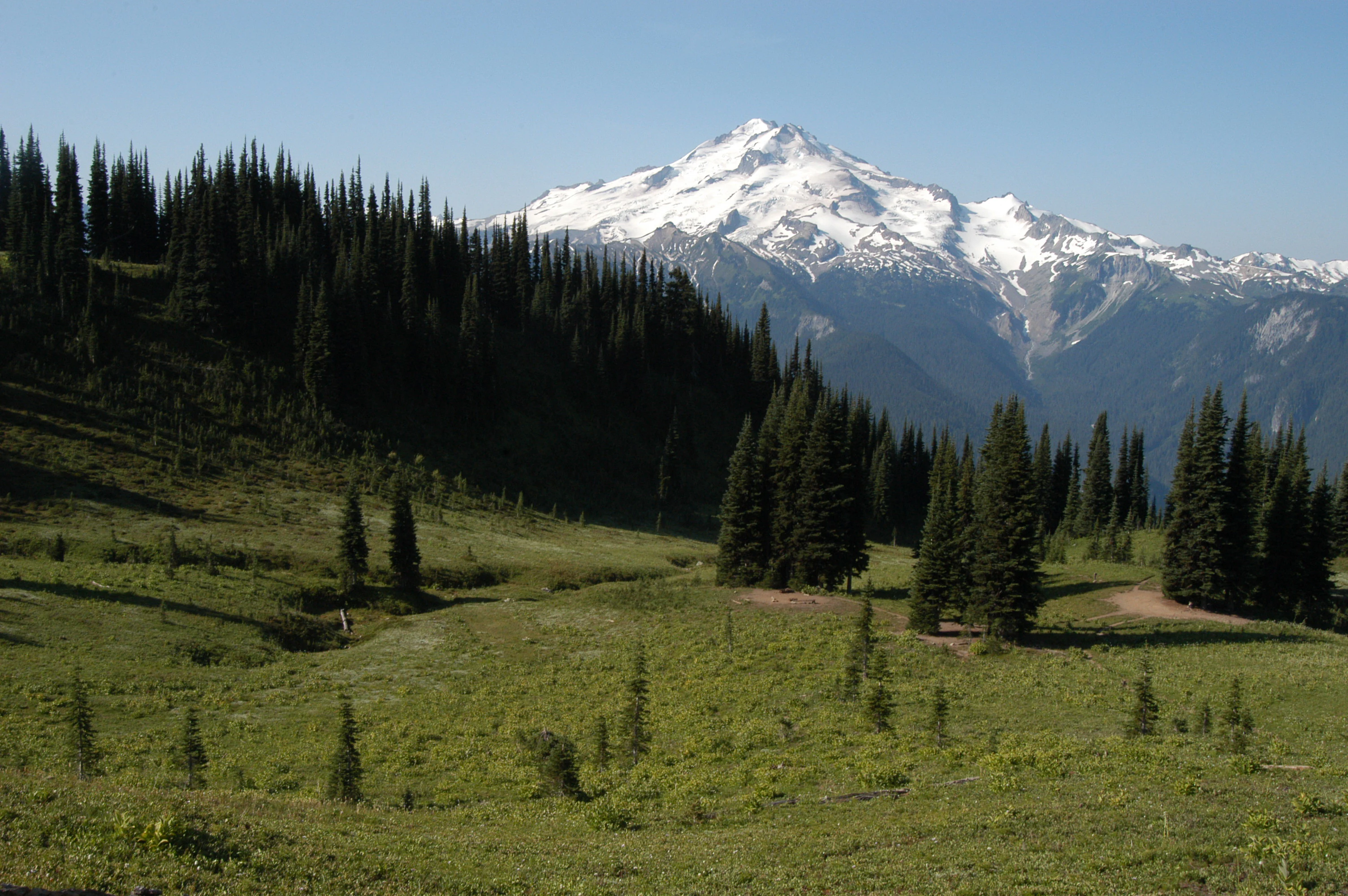
A wide mountain landscape featuring a large snow-capped peak in the distance, viewed from a rolling green alpine meadow with scattered evergreen trees in the foreground.
The snow-capped summit of Glacier Peak rises above the alpine meadows and coniferous forests of the Mount Baker,Snoqualmie National Forest.

Mount Baker, Snoqualmie National Forest history and protected-area timeline

The history of Mount Baker–Snoqualmie National Forest stretches back to the late nineteenth century, when the federal government began setting aside forested land in the Pacific Northwest. Mount Baker National Forest was originally established as the Washington Forest Reserve on February 22, 1897, encompassing more than 3.5 million acres. It was redesignated as a national forest on March 4, 1907, and later renamed Mount Baker National Forest on January 21, 1924.

Snoqualmie National Forest was carved from land within Washington National Forest and established on July 1, 1908, covering more than 961,000 acres. In 1933, a portion of the former Rainier National Forest was added to the growing system. The two forests were administratively combined in 1974, forming the present-day Mount Baker–Snoqualmie National Forest.

Beyond administrative milestones, the forest has played an unusual role in early American film history. Twentieth Century Pictures chose Mount Baker National Forest as the filming location for the 1935 adaptation of The Call of the Wild, starring Clark Gable, Loretta Young, and Jack Oakie, citing the area's remote character as a practical advantage. Paramount Pictures later filmed The Barrier (1937) at Mount Baker Lodge, further embedding the forest in the popular imagination of the era.

In the modern era, the forest's history has been defined by conservation milestones. In 1968, a portion of the forest was transferred to the National Park Service for inclusion in North Cascades National Park. Beginning in 1964 and continuing over the following decades, Congress established a series of wilderness areas that together now protect nearly half of the forest, cementing its long-term role as both a recreation hub and a refuge for old-growth forests, glaciers, and wild rivers.

Mount Baker, Snoqualmie National Forest landscape and geographic character

Mount Baker–Snoqualmie National Forest is defined by the dramatic western flank of the Cascade Range, where elevation rises steadily from forested lowlands to the high volcanic spine of Washington. Mountain summits in the southern portion of the forest typically range from 5,000 to 6,000 feet, while northern ridges climb higher, often reaching 7,000 to 8,000 feet. Above these ridges rise the forest's two signature landmarks: Mount Baker, one of the most heavily glaciated stratovolcanoes in the lower 48 states, and Glacier Peak, a remote and rugged ice-clad peak that dominates the central Cascades.

The terrain below the high country is a mosaic of glaciated valleys, plunging river canyons, subalpine meadows, and densely forested slopes. Rivers such as the Skagit, Cascade, Sauk, and Suiattle have carved broad valleys that connect the alpine interior to the Puget Sound lowlands, while places like Twin Sisters Mountain in the Mount Baker Wilderness showcase the steep, rocky character of the northern forest.

Glaciers and perennial snowfields are central to the forest's identity. The forest contains more glaciers than any national forest outside Alaska, including major ice masses such as Roosevelt, Mazama, Coleman, and South Cascade glaciers. Although many of these glaciers have retreated significantly since the mid-twentieth century, they continue to shape streamflow, sediment patterns, and downstream ecology throughout the region.

Mount Baker, Snoqualmie National Forest ecosystems, habitats, and plant life

Ecologically, Mount Baker–Snoqualmie National Forest encompasses a large portion of the North Cascades ecoregion, one of the most diverse temperate ecosystems in North America. The forest encompasses a clear vegetation gradient that climbs with elevation, beginning in lush, moisture-laden lowland forests and rising through increasingly cold and exposed subalpine environments before reaching the alpine zone.

At lower elevations, the forest is dominated by the Western Hemlock Ecoregion, where dense conifer stands, mossy undergrowth, and salmon-bearing rivers define the maritime Pacific Northwest character. Moving upward, the Silver Fir Ecoregion takes over, supporting tall, straight-trunked forests adapted to heavy snow and persistent moisture. Higher still, the Subalpine Mountain Hemlock Ecoregion marks the transition toward harsher mountain climates, while the Alpine Ecoregion crowns the highest elevations with bare rock, snowfields, glaciers, and fragile tundra-like communities.

Old-growth forest remains a critical component of the forest's ecological character. A 1993 Forest Service study estimated the extent of old growth at roughly 643,500 acres, much of it protected within designated wilderness areas. The forest's protected rivers and intact watersheds also contribute to broader regional biodiversity, sustaining salmon, supporting wintering raptors, and maintaining water quality for downstream communities.

Mount Baker, Snoqualmie National Forest wildlife and species highlights

Mount Baker–Snoqualmie National Forest's wildlife reflects the diversity of its elevation gradient and the integrity of its connected wilderness and river systems. The forest's rivers, particularly the Skagit, Cascade, Sauk, and Suiattle, provide important habitat for salmon, which depend on cold, clean, sediment-balanced waters fed by glacial and snowmelt runoff. These fish populations, in turn, support a broader food web that stretches from the rivers up into the surrounding forests and mountains.

The Skagit Wild and Scenic River System is notable for supporting one of the largest wintering populations of bald eagles in the United States. Each winter, the river corridors fill with thousands of eagles drawn by salmon runs, creating one of the premier eagle viewing destinations in North America.

Beyond bald eagles and salmon, the forest's wilderness areas, old-growth stands, and alpine zones provide habitat for a wide range of characteristic Pacific Northwest species. Dense forests support deer, black bear, mountain goats, elk, and small mammals, while the higher elevations and rocky ridges offer space for species adapted to harsh alpine conditions. The combination of wilderness protection and relatively intact watersheds makes the forest an important refuge for wildlife across the western Cascades.

Mount Baker, Snoqualmie National Forest conservation status and protection priorities

Conservation sits at the core of Mount Baker–Snoqualmie National Forest's identity, even as it serves as one of the most heavily used recreation landscapes in the country. A substantial share of the forest, roughly 827,101 acres, has been designated as wilderness since 1964, protecting nearly half of its area from development and ensuring long-term preservation of its most ecologically sensitive terrain.

Major protected areas within the forest include Alpine Lakes Wilderness, Boulder River Wilderness, Clearwater Wilderness, Glacier Peak Wilderness, Henry M. Jackson Wilderness, Mount Baker Wilderness, Noisy-Diobsud Wilderness, Norse Peak Wilderness, Pasayten Wilderness, and Wild Sky Wilderness. Together these wilderness areas safeguard old-growth forests, alpine ecosystems, and critical watersheds, while also providing clean water and solitude for future generations.

Beyond wilderness designation, the forest plays a critical role in river conservation. The Skagit Wild and Scenic River System, established by Congress in 1978, protects 125 miles of rivers across the Skagit, Cascade, Sauk, and Suiattle systems. These rivers are not only ecologically important for fish and wildlife, but also support some of the largest winter bald eagle gatherings in the country.

In 1968, a portion of the forest was transferred to the National Park Service and absorbed into North Cascades National Park, strengthening the broader network of protected Cascade landscapes. However, conservation in Mount Baker–Snoqualmie is not only about preservation; it is increasingly about adaptation. Significant glacier retreat, reduced summer runoff, warming streams, and downstream impacts on salmon highlight the growing importance of the forest as a landscape under climate stress.

Mount Baker, Snoqualmie National Forest cultural meaning and human context

Mount Baker–Snoqualmie National Forest holds a distinct cultural footprint shaped by its early conservation history, its role in early American cinema, and its deep connection to outdoor recreation culture in the Pacific Northwest. The forest's dramatic scenery attracted Hollywood productions during the 1930s, most notably when Twentieth Century Pictures selected Mount Baker National Forest as the filming location for The Call of the Wild (1935), starring Clark Gable, Loretta Young, and Jack Oakie. Studios valued the area's remoteness as a practical guarantee against interruption from skiers and other visitors. Paramount later produced The Barrier (1937) at Mount Baker Lodge, reinforcing the forest's appeal as a dramatic wilderness setting.

In the modern era, the forest is deeply woven into regional identity. It serves as a defining outdoor space for communities across the Puget Sound region, supporting traditions of hiking, climbing, skiing, snowboarding, and river recreation that have shaped how residents of Seattle, Everett, Bellingham, and surrounding cities relate to the surrounding mountains.

Top sights and standout views in Mount Baker, Snoqualmie National Forest

Mount Baker–Snoqualmie National Forest stands out for its sheer scale and diversity, offering everything from glaciated volcanic peaks to low-elevation old-growth forests within a single continuous corridor. The forest's two signature volcanoes, Mount Baker and Glacier Peak, anchor a landscape that contains more glaciers than any other national forest outside Alaska.

Nearly half of the forest's area lies within designated wilderness, including Mount Baker Wilderness, Glacier Peak Wilderness, Wild Sky Wilderness, and several others. Together with the Skagit Wild and Scenic River System, these protected lands form one of the most significant networks of conserved Cascade terrain in the United States, while also welcoming more visitors than any other national forest in the country.

Best time to visit Mount Baker, Snoqualmie National Forest

Mount Baker–Snoqualmie National Forest offers a strong year-round experience, with the seasons shaping very different kinds of visits. Summer is the most popular and accessible season, when high-country trails, alpine ridges, and wildflower meadows are typically free of snow, and the forest's rivers and glacial streams run at their fullest. This period offers the widest range of hiking, climbing, camping, and backpacking opportunities, though it is also when the forest's popularity is at its peak.

Winter transforms the forest into a major snow recreation destination, especially in areas near Mount Baker, which is renowned for its exceptionally deep snowfall. Skiing, snowboarding, snowshoeing, and winter camping all draw visitors to the forest during the colder months. Late autumn and early winter also bring one of the region's most remarkable wildlife events, as thousands of bald eagles gather along the Skagit River to feed on spawning salmon.

Monthly climate preview

Long term temperature and precipitation measurements across twelve recorded intervals

Mount Baker Snoqualmie National Forest Climate Normals and Weather by Month

Representative coordinate records show monthly mean temperatures shifting between subfreezing winter lows and warmer summer maximums alongside varying daily precipitation rates. Examining the full twelve month profile reveals detailed temperature ranges and monthly precipitation patterns for this protected location.
Annual mean4 °C
-4 °C14 °C
Jan-3°
Feb-3°
Mar-1°
Apr
May
Jun10°
Jul14°
Aug14°
Sep11°
Oct
Nov
Dec-4°
Warmest month
August

14 °C

Coolest month
December

-3.7 °C

Wettest month
November

9.5 mm/day

Driest month
July

1.3 mm/day

Park location guide

Geography guide, regional context, and park location map for Mount Baker, Snoqualmie National Forest

Mount Baker, Snoqualmie National Forest park geography, regions, and map view in United States of America

Understand where Mount Baker, Snoqualmie National Forest sits in United States of America through a broader geographic reading of the surrounding landscape, nearby location context, and its mapped position within the national park landscape.

How Mount Baker, Snoqualmie National Forest fits into United States of America

The United States of America is a federal presidential republic and one of the world's largest countries by area and population. It consists of 50 states across a vast territory spanning multiple time zones, with its capital in Washington, D.C. and largest city in New York City. The nation has a diverse economy, influential political system, and significant cultural and military presence globally.

Wider geography shaping Mount Baker, Snoqualmie National Forest in United States of America

The United States occupies a vast territory in North America, bordered by Canada to the north and Mexico to the south. The 48 contiguous states stretch from the Atlantic to the Pacific Ocean, while Alaska occupies the northwestern region and Hawaii is an archipelago in the Pacific. The country encompasses diverse terrain including the Rocky Mountains, Appalachian Mountains, Great Plains, and extensive river systems.

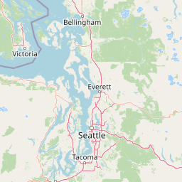
Map view of Mount Baker, Snoqualmie National Forest

Use this park location map to pinpoint Mount Baker, Snoqualmie National Forest in United States of America, understand its exact geographic position, and read its mapped placement within the surrounding landscape more clearly.

Pigeon | © OpenStreetMap contributors

Location context for Mount Baker, Snoqualmie National Forest

Washington
Natural feature types

Explore Geographic Landmarks in Mount Baker–Snoqualmie National Forest

Continue your geographic research by examining the specific natural formations within this protected forest. This collection offers a detailed view of the terrain, water bodies, and alpine features that define the character of Mount Baker–Snoqualmie National Forest.
Recorded earthquake history

Explore Historical Earthquake Records for Mount Baker–Snoqualmie National Forest

Browse the documented catalogue of seismic events associated with the geography of Mount Baker–Snoqualmie National Forest. MoriAtlas provides these historical records to support geographic discovery and understanding of seismic activity patterns across this region of the Cascade Range.

Mount Baker–Snoqualmie National Forest Earthquake Records

Catalogued events

266 events

Strongest magnitude

Magnitude 5.4

Most recent event

Jul 2, 2026

This history includes earthquakes recorded inside the park or within 50 km of its borders

Visual exploration of Cascade Range terrain, glaciers, and forest habitats

Mount Baker–Snoqualmie National Forest Photos, Landscapes, and Scenery

Visual records capture the dramatic terrain and protected landscapes of Mount Baker–Snoqualmie National Forest across its rugged western slopes. High-resolution imagery reveals the distinct character of ancient maritime forests, glaciated volcanic peaks, and deep river valleys.

A wide mountain landscape featuring a large snow-capped peak in the distance, viewed from a rolling green alpine meadow with scattered evergreen trees in the foreground.

A mountainous landscape showing the rugged, snow-dusted Twin Sisters peaks in the distance, set behind a foreground of rolling green alpine meadows filled with small white wildflowers.

Park atlas

Compare regional mountain terrain, glaciated volcanic peaks, and adjacent wilderness areas

Explore Parks Near Mount Baker–Snoqualmie National Forest and Surrounding Protected Lands

Compare Mount Baker–Snoqualmie National Forest against other protected natural areas across the Pacific Northwest. Broaden your geographic perspective by examining adjacent mountain ranges, river valleys, and conserved wildlife habitats.
A soft watercolor illustration depicting a range of layered mountain peaks with green slopes and snow-covered summits against a white background.
Wildlife reserveWashington
Park boundaries overlap#1 closest

Northeast

Glacier Peak Wilderness: Mapping the Volcanic and Glaciated Geography of Washington State

A detailed look at one of the most remote volcanic reserves in the Cascade Range.

Defined by the presence of an isolated stratovolcano and extensive glacial systems, Glacier Peak Wilderness represents a significant protected area within the Washington Cascades. This overview details the rugged landscape, from the deeply incised river valleys of the Chiwawa and Suiattle to the high-alpine rock and ice environment at the peak summit, providing essential geographic context for this roadless wilderness.

Area
2,290.75 km²
Established
1960
IUCN
Ib
Relief
Mountain
A watercolor painting showing a range of mountains in the background with soft pink, green, and yellow hues, with forest vegetation in the midground and foreground on a white background.
Protected landscapeWashington
Park boundaries overlap#2 closest

North

Mount Baker National Recreation Area: An Atlas of Washington's Volcanic Terrain

Exploration of a remote, roadless Cascade protected landscape

The Mount Baker National Recreation Area provides a unique geographic window into the volcanic heart of the Pacific Northwest. Characterized by its glacier-clad massif and network of subalpine trails, the area serves as a vital protected habitat for elk, mountain goats, and diverse conifer forests. This record details the park's topography, ranging from deep glacial valleys to high-elevation ridges that overlook the broader North Cascades region.

Area
34.29 km²
Established
1984
Relief
Mountain
Climate
Alpine
A horizontal watercolor painting showing a range of purple-tinted mountain peaks above a green forest and a light pinkish shoreline.
Wildlife reserveWashington
Park boundaries overlap#3 closest

North

Mount Baker Wilderness: Mapped Volcanic Peaks and Glacial Geography in Washington State

Protected wilderness boundaries in the Northern Cascades

Mount Baker Wilderness encompasses a vast mountain landscape characterized by an active stratovolcano and significant permanent snowfields. The terrain features a vertical gradient from dense west side conifer forests to exposed alpine summits, creating a distinct ecological corridor connected to neighboring protected areas in the Pacific Northwest.

Area
485.58 km²
Established
1984
IUCN
Ib
Relief
Mountain
National parkWashington
Park boundaries overlap#4 closest

South

Mount Rainier National Park: A National Park in Washington with Distinct Mapped Boundaries

Explore its protected landscape and regional geography.

Mount Rainier National Park represents a core protected area within Washington State, offering rich opportunities for geographic discovery through its mapped boundaries and natural terrain. As a designated national park, it contributes significantly to the atlas of United States protected lands. This destination allows for detailed exploration of its landscape context, making it an essential point of reference for understanding regional geography and conservation areas.

Area
956.6 km²
Established
1899
IUCN
II
Visitors
1.6M annual
National parkWashington
Park boundaries overlap#5 closest

North

North Cascades National Park: US National Park Protected Landscape and Geographic Context

Explore mapped boundaries and regional Washington geography.

Gain insight into North Cascades National Park, a vital US National Park located in Washington. This entry focuses on its protected land status, mapped geographic extent, and its role within the regional atlas. Users seeking to understand the park's landscape character, natural terrain, and its specific location in Washington will find this an essential point for detailed park geography exploration and protected area discovery.

Area
2,042.26 km²
Established
1968
IUCN
II
Visitors
16.5K annual
A watercolor painting of a mountain landscape with soft-colored rolling hills, a green forest line, and foreground vegetation on a white background.
Protected landscapeWashington
Park boundaries overlap#6 closest

Northeast

Okanogan, Wenatchee National Forest: A Comprehensive Look at Washington's Protected Mountain Landscapes

Mapping ecological gradients and wilderness boundaries across the eastern Cascade Range

Spanning from the moist coniferous forests of the western Cascades to the arid plateaus of the Okanogan, this massive national forest protects an unmatched diversity of terrain. Explore the intricate geography of river-carved valleys, glacial cirques, and remote wilderness areas that characterize this critical environmental corridor in the Pacific Northwest.

Area
6,066.33 km²
Established
1911
Visitors
397K annual
Relief
Mountain
A soft watercolor painting of a calm river or lake flowing through a green meadow with a forest and mountain range in the background.
Protected landscapeWashington
Park boundaries overlap#7 closest

North

Ross Lake National Recreation Area: A Glacial Reservoir Landscape in Washington

Mapping the Skagit River and North Cascades alpine corridor

Located in the heart of Washington, Ross Lake National Recreation Area preserves a unique landscape of connected reservoirs and deep, glacier-cut valleys. This protected area acts as a vital geographic link within the North Cascades, offering access to high-altitude peaks, riverine forests, and the distinct turquoise waters of Diablo Lake.

Area
475.81 km²
Established
1968
IUCN
V
Visitors
998K annual
A horizontal watercolor illustration featuring a waterfall on the left, a range of rolling mountains in the background, and clusters of trees in the midground, rendered in soft, blended colors.
Protected landscapeWashington
9.7 km away#8 closest

South

Gifford Pinchot National Forest: Geographic Overview of Washington's Volcanic Cascade Protected Lands

Mapping volcanic peaks, deep river canyons, and old-growth wilderness corridors

Gifford Pinchot National Forest represents a major protected expanse in the Washington Cascades, characterized by a complex volcanic topography that includes active craters, cinder cones, and rugged lava fields. This atlas entry details the forest's primary geographic features, from the high-elevation alpine terrain of the Goat Rocks to the river-carved valleys of the Lewis and Cowlitz systems, providing essential context on this integral Pacific Northwest protected landscape.

Area
5,347.95 km²
Established
1908
Visitors
1.8M annual
Relief
Mountain

Common questions about visiting, size, designation, and location context for Mount Baker, Snoqualmie National Forest

Mount Baker, Snoqualmie National Forest FAQs for park facts, access, geography, and protected area context

Find quick answers about Mount Baker, Snoqualmie National Forest, including protected-area facts, park geography, trail and visitor context, and how the park fits into its surrounding country and regional landscape.
MoriAtlas Explorer

Continue Your Protected Areas Search Across the Global Atlas

Deepen your exploration by continuing the structured search for national parks and protected areas worldwide. Utilize the comprehensive filtering capabilities to compare different conservation landscapes and refine your understanding of global park geography. Discover more about the distribution and characteristics of protected natural areas.

Global natural geography