Mori Atlas logo
Nature reserveMount Currie Nature Reserve

Mapping the dramatic dolerite cliffs and high-altitude wetland habitats of the East Griqualand region

Mount Currie Nature Reserve: A Protected Mountain and Wetland Landscape in KwaZulu-Natal

Mount Currie Nature Reserve serves as a vital protected landscape situated in the East Griqualand region of KwaZulu-Natal. The terrain is defined by the prominent Mount Currie peak, rising above 2,200 meters, and a rugged network of sandstone outcrops and dolerite cliffs. Centrally located wetland systems, known as vlei, sustain essential water sources while supporting a rich diversity of bird species, including high-altitude specialists and the endangered Wattled crane.

Drakensberg foothillsmountain reservegrasslandhigh-altitude wetlandvleiindigenous forest patches

Mount Currie Nature Reserve

Nature reserve

Park overview

Structured park overview, official facts, and landscape profile for Mount Currie Nature Reserve

Mount Currie Nature Reserve park facts, protected area profile, and essential visitor context

Review the core facts for Mount Currie Nature Reserve, including designation, size, terrain, visitor scale, habitats, and operating context in one park-focused overview.

About Mount Currie Nature Reserve

Mount Currie Nature Reserve sits at the edge of one of South Africa's most distinctive mountain regions, where the southern Drakensberg begins to rise from the rolling grasslands of East Griqualand. Although modest in size, the reserve captures an unusually full cross-section of the area's natural and cultural character, making it a meaningful destination for visitors interested in scenery, birds, botany, and history alike.

The terrain revolves around Mount Currie peak, which rises above 2,200 meters and anchors a landscape of steep dolerite cliffs, exposed sandstone, and sheltered kloof systems. Between these ridges, a large central vlei acts as the heart of the reserve, gathering water that emerges at the Crystal Spring before continuing toward Kokstad. The wet ground supports a wetland ecology that contrasts with the drier grasslands on the surrounding slopes, creating a mosaic of habitats within a relatively contained footprint.

Ecologically, the reserve sits at an interface between Drakensberg montane flora and East Griqualand grassland. The open slopes are dominated by Drakensberg Foothill Moist Grassland, while the protected kloofs allow small patches of indigenous forest to persist, with species such as Ouhout and Yellowwood. The reserve is also known for the diversity of its ground orchids and proteas, which contribute to its botanical appeal, especially during the warmer and wetter months.

Its wildlife profile is shaped largely by the mix of grassland and wetland. Common large mammals include eland, reedbuck, mountain reedbuck, blesbok and grey rhebok, with springbok present as an introduced antelope. Birdlife is perhaps the standout feature, with more than 240 recorded species and a particular reputation for high-altitude and wetland specialists, including Bearded and Cape vultures, Gurney's sugarbird, and the endangered Wattled crane. Together, these features make the reserve a compact but ecologically rich site within the broader KwaZulu-Natal conservation network managed by Ezemvelo KZN Wildlife.

What truly sets Mount Currie apart, however, is the way this natural setting is layered with cultural memory. The reserve stands on land closely associated with the Griqua community and the migration led by Adam Kok III in the 1860s. Sites such as Adam Kok III's grave, the early Griqua cemetery, and the remains of the original stone laager give the landscape an interpretive depth that complements its scenic and ecological value.

Quick facts and research context for Mount Currie Nature Reserve

Mount Currie Nature Reserve lies just north of Kokstad in the East Griqualand region of KwaZulu-Natal, South Africa, in the foothills that link the town to the southern Drakensberg and the high borderlands of Lesotho. The reserve is categorized as an IUCN Category IV habitat and species management area, a designation that emphasizes active stewardship of particular habitats and species rather than strict wilderness preservation.

The landscape is defined by the Mount Currie peak, steep dolerite cliffs, sandstone outcrops, and a central vlei system that feeds the Crystal Spring. The reserve is managed by Ezemvelo KZN Wildlife, the provincial conservation body for KwaZulu-Natal, and was formally established in 1980. It is also notable for the cultural weight it carries as a former Griqua settlement, particularly in connection with Adam Kok III.

Protection and recognition

Explore terrestrial protection records and official conservation data for Mount Currie Nature Reserve.

Mount Currie Nature Reserve Protection Status and Designated Area Scope

Documented protection metrics for Mount Currie Nature Reserve outline terrestrial conservation scope and administrative frameworks. Verified records establish baseline territorial status and international recognition data for ecological research.

Protection details

Protection scope
Terrestrial
Transboundary protection
No
Park context

Deeper park guide and search-rich context for Mount Currie Nature Reserve

Mount Currie Nature Reserve history, landscape, wildlife, and travel context

Explore Mount Currie Nature Reserve through its history, landscape character, ecosystems, wildlife, conservation priorities, cultural context, and seasonal travel timing in a structured park guide built for atlas discovery and search intent.

Why Mount Currie Nature Reserve stands out

Mount Currie Nature Reserve is best known for combining three strong identities in a relatively small area: a rugged Drakensberg foothill landscape, a rich set of high-altitude and wetland bird habitats, and a cluster of Griqua heritage sites tied to the 1860s settlement under Adam Kok III. The reserve is widely recognized among birders and naturalists as a reliable site for species such as Gurney's sugarbird, Bearded vulture, Cape vulture, and the endangered Wattled crane, which depends on the vlei system. Beyond its wildlife, it is also valued as the resting place of Adam Kok III and as the location of the original Mount Currie Laager, giving the natural setting a deep historical and cultural dimension that distinguishes it from many other small South African nature reserves.

Mount Currie Nature Reserve history and protected-area timeline

The modern Mount Currie Nature Reserve was formally recognized in 1980 and has since been managed by Ezemvelo KZN Wildlife as an IUCN Category IV habitat and species management area. Its protected status reflects the ecological importance of the mountain and its wetland system, particularly as a refuge for high-altitude and grassland species in the East Griqualand region.

Long before the reserve existed, however, Mount Currie was already a place of deep historical meaning. In the 1860s, the Griqua people, a community of mixed-race descent under the leadership of Adam Kok III, migrated into the area and settled at the foot of Mount Currie, at a site known at the time as Mount Currie Laager. This settlement predated the founding of Kokstad on its present site and served as the community's first base in the region.

Several physical traces of that earlier chapter survive within the reserve. Adam Kok III's grave, recognized as a National Heritage Site, lies near the reserve entrance. A small cemetery contains the graves of early Griqua pioneers, while the remains of the original stone laager, the protective fortifications used in the early years of settlement, mark the location of the original community. These sites give the reserve a layered identity, in which the conservation of natural heritage and the preservation of cultural heritage are intertwined.

Mount Currie Nature Reserve landscape and geographic character

The landscape of Mount Currie Nature Reserve is defined by contrast on a relatively small scale. The dominant feature is Mount Currie peak itself, a prominent summit that rises above 2,200 meters and gives the reserve its sense of altitude and scale. From this high point, the terrain falls away into a rugged network of steep dolerite cliffs and exposed sandstone outcrops, creating a rocky backbone that runs through much of the protected area.

Between these rocky ribs, the reserve's central feature is a large vlei, or seasonal wetland, which acts as a gathering point for the catchment's water. The vlei feeds the Crystal Spring, the name given to the headwaters that supply Kokstad. The presence of standing and slow-moving water in an otherwise steeply mountainous terrain introduces a softer, flatter element into the scenery and strongly shapes both the ecological character and the visual identity of the reserve.

Sheltered kloofs, or ravines, cut through the slopes and provide refuge for small pockets of indigenous forest amid the otherwise grassland-dominated terrain. The combination of high rocky ground, wetland flats, and forested gullies creates a varied topography within walking distance of the town of Kokstad, and offers wide views toward Lesotho and the southern Drakensberg from the upper slopes.

Mount Currie Nature Reserve ecosystems, habitats, and plant life

Mount Currie Nature Reserve is small in size but ecologically rich, functioning as a transitional zone where Drakensberg montane flora blends into the grassland systems of East Griqualand. This positioning gives the reserve a botanical mix that is more varied than its modest footprint might suggest, particularly across its different terrain types.

The dominant vegetation type is Drakensberg Foothill Moist Grassland, which covers much of the open slopes and supports a wide variety of grasses and herbaceous plants. In the more sheltered kloofs, where moisture is retained and exposure is reduced, small patches of indigenous forest survive. These patches typically include species such as Ouhout and Yellowwood, which are characteristic of Afromontane forest fragments in this part of South Africa.

The reserve is also recognized for its populations of ground orchids and proteas, which add seasonal interest and contribute to the botanical appeal of the area. The wetland system associated with the central vlei and Crystal Spring adds a further ecological layer, supporting wetland-dependent plants as well as the birdlife drawn to standing water, and reinforcing the reserve's role as an ecological crossroads between mountain, grassland, and wetland environments.

Mount Currie Nature Reserve wildlife and species highlights

The wildlife profile of Mount Currie Nature Reserve is shaped by the interplay between grassland, rocky mountain terrain, and high-altitude wetland. Large mammals are typical of KwaZulu-Natal's Drakensberg fringe reserves and include eland, common reedbuck, mountain reedbuck, blesbok, and grey rhebok. Springbok are also present, though as an introduced rather than naturally occurring species. Together these antelope are well adapted to the mix of open grazing and sheltering rocky habitat that the reserve provides.

Birdlife is the area's standout natural feature. More than 240 species have been recorded, making the reserve a notable birding destination within the southern Drakensberg foothills. Its combination of cliffs, grassland, and wetland habitat supports a wide range of species, including high-altitude specialists such as Gurney's sugarbird, Bearded vulture, and Cape vulture, which use the reserve's cliffs and open airspace.

The reserve's wetland system gives it particular significance for water-associated species. The endangered Wattled crane is among the most important of these, using the vlei habitat as part of its range. The presence of such a sensitive and range-restricted species underscores the conservation value of protecting the reserve's wetland system, and contributes to the reserve's reputation among birdwatchers and conservation biologists.

Mount Currie Nature Reserve conservation status and protection priorities

Mount Currie Nature Reserve is formally protected as an IUCN Category IV habitat and species management area, a designation that reflects the reserve's role in actively safeguarding particular habitats and species rather than maintaining a strictly untouched wilderness. The reserve's conservation significance lies in several converging features.

Its position at the interface between Drakensberg montane flora and East Griqualand grassland gives it value as a botanical transition zone, while the wetland system around the central vlei and Crystal Spring is ecologically important in its own right. This wetland supports vulnerable birdlife such as the Wattled crane, making the reserve directly relevant to broader conservation priorities for threatened grassland and wetland species in KwaZulu-Natal.

Management by Ezemvelo KZN Wildlife places the reserve within the provincial conservation framework responsible for biodiversity stewardship across KwaZulu-Natal. Through this management, the reserve contributes to protecting indigenous forest patches in its kloofs, conserving populations of orchids and proteas, and maintaining habitat for the antelope and bird species that depend on the area's mosaic of rock, grass, and water.

Mount Currie Nature Reserve cultural meaning and human context

Mount Currie's cultural significance centers on the Griqua people and their mid-nineteenth century migration into East Griqualand. Under Adam Kok III in the 1860s, the Griqua settled at the foot of Mount Currie at a place then known as Mount Currie Laager, before the town of Kokstad was established at its present location. This earlier settlement marks an important chapter in the region's social history.

Several physical reminders of that period survive within the protected area. Adam Kok III's grave, a declared National Heritage Site, lies near the reserve's entrance and remains an important memorial. Nearby, a small historical cemetery contains the graves of early Griqua pioneers, and the remains of the stone laager, the original fortified settlement, can still be traced at the site. Together, these features give Mount Currie a strong cultural identity that complements its natural value, and position it as a landscape where South African conservation and South African heritage are preserved side by side.

Top sights and standout views in Mount Currie Nature Reserve

Mount Currie Nature Reserve stands out for the way it packages several distinct experiences into one compact protected area. Its rugged mountain scenery, with steep dolerite cliffs, sandstone outcrops, and a peak rising above 2,200 meters, gives it the visual drama of a much larger mountain park.

Its ecological mix of Drakensberg grassland, Afromontane forest patches in protected kloofs, and a sizeable central vlei supports exceptional birdlife, including more than 240 recorded species and dependable sightings of specialties such as Gurney's sugarbird, Bearded and Cape vultures, and the endangered Wattled crane. Layered onto this natural richness is a strong cultural dimension, with Adam Kok III's grave, the early Griqua cemetery, and the remains of the original laager giving the landscape a heritage value as striking as its scenery.

Best time to visit Mount Currie Nature Reserve

The seasonal character of Mount Currie is shaped by the southern KwaZulu-Natal climate, with warm, wetter summer months and cooler, drier winter months. Summer brings richer grass cover, more active flowering in orchids and proteas, and the most rewarding birdwatching as migratory species are present and wetland habitat is at its fullest. The wetland system around the vlei and Crystal Spring tends to be most expressive during this wetter period, which also enhances views from the slopes.

Winter offers clearer skies and crisper views, particularly from the upper trails looking toward Lesotho and across the southern Drakensberg. Cooler conditions make hiking to the summit more comfortable, and the more open grassland can make mammal viewing easier. Visitors interested primarily in birding, wildflowers, and wetland scenery will generally find the warmer months richer, while those drawn to hiking, panoramas, and heritage sites may favor the cooler, drier season.

Monthly climate preview

Long-term representative monthly temperature and precipitation patterns across the protected terrain

Mount Currie Nature Reserve Climate Normals and Annual Temperature Rhythm

Representative coordinate records show measured variations in average monthly temperature and precipitation throughout the year at Mount Currie Nature Reserve. Detailed month-by-month climate profile statistics provide complete numerical insight into long-term environmental patterns for this protected area.
Annual mean15 °C
9 °C19 °C
Jan19°
Feb19°
Mar17°
Apr14°
May12°
Jun
Jul
Aug11°
Sep14°
Oct16°
Nov17°
Dec19°
Warmest month
January

19.2 °C

Coolest month
July

8.6 °C

Wettest month
January

6.4 mm/day

Driest month
June

0.6 mm/day

Park location guide

Geography guide, regional context, and park location map for Mount Currie Nature Reserve

Mount Currie Nature Reserve park geography, regions, and map view in South Africa

Understand where Mount Currie Nature Reserve sits in South Africa through a broader geographic reading of the surrounding landscape, nearby location context, and its mapped position within the national park landscape.

How Mount Currie Nature Reserve fits into South Africa

South Africa is the southernmost country in Africa, spanning 1.22 million km² with a population of over 63 million. The country operates with three capital cities, Pretoria (executive), Cape Town (legislative), and Bloemfontein (judicial), and is renowned for its biodiversity, national parks, and multicultural society.

Wider geography shaping Mount Currie Nature Reserve in South Africa

South Africa occupies the southernmost region of Africa, with coastline along both the Atlantic Ocean to the west and the Indian Ocean to the east. The interior features elevated plateaus including the Highveld, with the Drakensberg escarpment marking the eastern highlands. The country shares borders with Namibia, Botswana, Zimbabwe, Mozambique, Eswatini, and Lesotho.

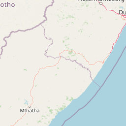
Map view of Mount Currie Nature Reserve

Use this park location map to pinpoint Mount Currie Nature Reserve in South Africa, understand its exact geographic position, and read its mapped placement within the surrounding landscape more clearly.

Pigeon | © OpenStreetMap contributors

Location context for Mount Currie Nature Reserve

KwaZulu-Natal
Park atlas

Compare regional mountain terrain, high-altitude wetlands, and connected conservation landscapes.

Parks Near Mount Currie Nature Reserve and Surrounding Protected Areas

Browse other parks and protected areas sharing the rugged terrain, high-altitude wetlands, and montane geography of Mount Currie Nature Reserve. Expanding your search across surrounding regional landscapes provides a broader view of southern Drakensberg conservation areas.
Nature reserveKwaZulu-Natal
About 31 km away#1 closest

North

Ntsikeni Nature Reserve: High-Elevation Wetland Geography and Protected Landscape Atlas

A remote Drakensberg foothills wetland and montane grassland reserve.

Ntsikeni Nature Reserve is recognized as the largest and one of the highest wetlands in South Africa. Located in the KwaZulu-Natal province, this protected area features a unique, misty plateau landscape that sustains diverse orchid flora and essential headwater ecosystems. Use these geographic maps to examine the terrain, park boundaries, and the ecological transition between rolling foothills and the Drakensberg escarpment.

Area
92.87 km²
Established
1978
Relief
Upland
Climate
Temperate
Nature reserveKwaZulu-Natal
About 61 km away#2 closest

North

Coleford Nature Reserve: Protected Grasslands and Wetlands in KwaZulu-Natal

Tracing the landscape of a key Drakensberg foothill reserve

The Coleford Nature Reserve represents a critical protected area in the Southern Drakensberg, featuring threatened Drakensberg Foothill Moist Grassland. Its landscape is defined by the Ngwagwane River valley and diverse wetland systems, providing essential habitat for endangered bird species. This reserve functions as a gateway to the broader montane geography of the southwestern KwaZulu-Natal region.

Area
12.72 km²
Established
1948
IUCN
IV
Relief
Highland
National parkQacha's Nek District
About 64 km away#3 closest

Northwest

Sehlabathebe National Park: Mapped Protected Landscape in Lesotho's Maloti Mountains

Explore high-altitude terrain, waterfalls, and ancient rock art sites.

Sehlabathebe National Park stands as a protected national park within the rugged Maloti Mountains of Lesotho's Qacha's Nek District. This destination is vital for understanding the geographic context of protected areas, featuring dramatic cliffs, iconic waterfalls like Tsoelikana, and numerous rock art sites that speak to its cultural and historical significance. Its high-altitude Afro-Alpine and sub-alpine ecosystems offer unique landscape characteristics and support notable biodiversity, making it a key point of interest for atlas-driven exploration of natural and protected terrains.

Area
69.5 km²
Established
1969
IUCN
IV
Relief
Mountain
Protected areaKwaZulu-Natal
About 65 km away#4 closest

North

uKhahlamba-Drakensberg Park: Protected Mountain Landscapes and Escarpment Geography in South Africa

Exploring the basalt cliffs and alpine plateau of KwaZulu-Natal.

uKhahlamba-Drakensberg Park encompasses an expansive protected region where the Drakensberg escarpment rises sharply from the foothills of KwaZulu-Natal. This atlas record details the park landscape, including its transition from sandstone terraces to high-altitude basalt, its extensive river gorges, and the concentration of archaeological cave sites. Use this resource to understand the geographic scale of this transboundary conservation area.

Area
2,429.13 km²
Relief
Mountain
Climate
Temperate
Access
Access unknown
A watercolor illustration featuring soft, green rolling hills in the foreground with pale, layered mountain peaks in the background, set against a plain white field.
Protected areaKwaZulu-Natal
About 65 km away#5 closest

North

Maloti-Drakensberg Park Geography: Mountain Escarpments and Alpine Plateau Exploration

A transboundary protected landscape spanning South Africa and Lesotho

Spanning the core of the Drakensberg mountain system, Maloti-Drakensberg Park provides a unique window into high-altitude biodiversity and geological drama. The protected area features basalt cliffs, rolling valleys, and an extensive plateau, forming a critical ecological and cultural corridor. This atlas entry covers the topographic features and spatial distribution of one of southern Africa's most significant protected landscapes.

Area
2,493.13 km²
Established
2001
Relief
Mountain
Climate
Alpine
Nature reserveKwaZulu-Natal
About 92 km away#6 closest

Southeast

Umtamvuna Nature Reserve: Geographic Atlas of the South African Coastal Sandstone Gorges

Protected riverine terrain in the KwaZulu-Natal province

Located along the Mtamvuna River in KwaZulu-Natal, this protected area features steep sandstone cliffs and extensive river frontage. The landscape provides a critical intersection between coastal scarp forest and plateau grasslands, offering a rich study in localized topography and endemic plant environments.

Area
32.57 km²
Established
1971
Relief
Upland
Climate
Subtropical
A soft watercolor painting depicting a coastal landscape with a waterfall cascading toward the ocean, surrounded by rolling hills and greenery.
Nature reserveEastern Cape
About 96 km away#7 closest

Southeast

Mkhambathi Nature Reserve: A Coastal Protected Area in the Eastern Cape, South Africa

Endemic flora, forested river ravines, and Ramsar-listed wetland geography.

Mkhambathi Nature Reserve protects a striking coastal corridor along the Wild Coast. The area is characterized by rolling grasslands, indigenous swamp forests, and dramatic river incisions. This Ramsar wetland site supports rare floral endemism and critical bird habitats, serving as a primary study site for understanding the unique biological connectivity between South African coastal forests and marine environments.

Area
77.2 km²
Established
2009
National parkEastern Cape
About 102 km away#8 closest

West

Grassland National Park National Park: Exploring Protected Landscapes and Regional Geography

Mapped boundaries and natural terrain context for an Eastern Cape protected area.

Grassland National Park represents a crucial protected area within South Africa's Eastern Cape province. As a national park, it offers significant insights into the region's natural landscapes and geographic character. This atlas perspective focuses on understanding the park's mapped scope, its terrain features, and its place within the broader provincial geography. Discover the unique protected landscape identity of Grassland National Park and how it contributes to the mapped natural heritage of the Eastern Cape.

Area
102.25 km²
Established
2025
IUCN
II
Relief
Mountain

Common questions about visiting, size, designation, and location context for Mount Currie Nature Reserve

Mount Currie Nature Reserve FAQs for park facts, access, geography, and protected area context

Find quick answers about Mount Currie Nature Reserve, including protected-area facts, park geography, trail and visitor context, and how the park fits into its surrounding country and regional landscape.
MoriAtlas Explorer

Continue Your Protected Areas Search Across the Global Atlas

Deepen your exploration by continuing the structured search for national parks and protected areas worldwide. Utilize the comprehensive filtering capabilities to compare different conservation landscapes and refine your understanding of global park geography. Discover more about the distribution and characteristics of protected natural areas.

Global natural geography