

Mori Atlas logo
Wildlife reserveMount Grafton Wilderness

Explore the geography and diverse forest ecosystems of this expansive Nevada wilderness area.

Mount Grafton Wilderness: Protected High-Desert Landscapes in the Nevada Schell Creek Range

Mount Grafton Wilderness comprises nearly 80,000 acres of protected high-desert mountain terrain in eastern Nevada. Centered on the 10,990-foot Mount Grafton in the Schell Creek Range, this wilderness area supports a complex mosaic of pinyon, juniper, aspen, and old-growth bristlecone pine forests. The mapped geography reveals steep rocky ridges and deep canyons that serve as essential summer habitat for elk, mule deer, and bighorn sheep within the Great Basin.

wilderness areaBLM wildernessSchell Creek Rangehigh desert mountainconiferous forestpinyon-juniper woodland

Mount Grafton Wilderness

Wildlife reserve

Park overview

Structured park overview, official facts, and landscape profile for Mount Grafton Wilderness

Mount Grafton Wilderness park facts, protected area profile, and essential visitor context

Review the core facts for Mount Grafton Wilderness, including designation, size, terrain, visitor scale, habitats, and operating context in one park-focused overview.

About Mount Grafton Wilderness

Mount Grafton Wilderness occupies a remote section of eastern Nevada within the Schell Creek Range, the long, north-south oriented mountain system that runs through southern White Pine County and into northern Lincoln County. The wilderness is named for Mount Grafton, a 10,990-foot peak that is its highest point and most recognizable geographic feature. Covering roughly 78,754 acres, it represents one of the more substantial BLM-administered wilderness blocks in the region and lies roughly 30 miles south of Ely, with the small community of Lund, Nevada, as the nearest town.

The defining character of the wilderness is its elevation contrast with the surrounding Great Basin. Beneath the summit, the terrain includes steep forested slopes, ridge lines, canyons, and rocky outcrops that together create conditions capable of supporting a broader range of vegetation and wildlife than the lower, drier basins that flank the range. The presence of pinyon pine, juniper, and white fir at middle elevations, combined with aspen, limber pine, and bristlecone pine at higher elevations, gives the area a layered forest character that is unusual in the Nevada context.

Wildlife is a central part of the wilderness's identity. Mount Grafton and its surrounding slopes provide important summer habitat for large mammals such as elk, mule deer, Rocky Mountain bighorn sheep, and mountain lion, making the area ecologically significant at a landscape level. The wilderness also contributes to the continuity of high-elevation wildlife habitat across the Schell Creek Range, linking forested zones that, outside the protected area, are fragmented by older patterns of grazing, logging, and other land uses.

The wilderness was formally designated on December 20, 2006, formally placing these forested ridges and alpine zones under federal wilderness protections administered by the U.S. Bureau of Land Management. Its establishment reflects the increasing recognition of Nevada's mountain ranges as important conservation landscapes in their own right, beyond the more famous desert and playa environments that typically characterize the state. Today, the area is recognized primarily for its ecological value, scenic mountain setting, and role in supporting native wildlife populations within one of Nevada's defining mountain corridors.

Quick facts and research context for Mount Grafton Wilderness

Mount Grafton Wilderness is a federal wilderness area in eastern Nevada, sitting within the Schell Creek Range south of Ely. It was designated on December 20, 2006, and is administered by the U.S. Bureau of Land Management. The protected area spans both White Pine and Lincoln counties and provides habitat for wildlife ranging from elk and mule deer to bighorn sheep and mountain lion.

The wilderness is named for Mount Grafton, a 10,990-foot summit that anchors the area and is a focal point for both wildlife habitat and scenic value. With thousands of acres of largely forested terrain composed of pinyon pine, juniper, aspen, bristlecone pine, limber pine, and white fir, the area represents one of the larger conserved forest blocks in this part of the Great Basin.

Protection and recognition

Examine terrestrial protection scope, designation history, and administrative recognition records.

Mount Grafton Wilderness Protection Status and Geographic Recognition Data

Mount Grafton Wilderness maintains a documented terrestrial protection scope within official conservation frameworks. Regional records compile active management classifications and international recognition data for comprehensive geographic analysis.

Protection details

Protection scope
Terrestrial
Transboundary protection
No
Park context

Deeper park guide and search-rich context for Mount Grafton Wilderness

Mount Grafton Wilderness history, landscape, wildlife, and travel context

Explore Mount Grafton Wilderness through its history, landscape character, ecosystems, wildlife, conservation priorities, cultural context, and seasonal travel timing in a structured park guide built for atlas discovery and search intent.

Why Mount Grafton Wilderness stands out

Mount Grafton Wilderness is best known for its namesake peak, Mount Grafton, which rises to 10,990 feet within the Schell Creek Range and serves as high-elevation summer habitat for large mammals such as elk, mule deer, Rocky Mountain bighorn sheep, and mountain lion. The wilderness is also recognized for the unusually diverse forest communities that blanket its slopes, including old-growth bristlecone pine stands alongside aspen, white fir, pinyon pine, juniper, and limber pine. Beyond its peak and forests, the area is valued as an example of Nevada's high-desert mountain wilderness, where elevation, isolation, and varied plant communities together create habitat conditions not found in the surrounding basin lands. The combination of a defined summit, dense forested zones, and large mammal presence gives the wilderness a strong conservation identity within the broader Great Basin landscape.

Mount Grafton Wilderness history and protected-area timeline

The lands that now form Mount Grafton Wilderness were, prior to federal designation, public lands administered by the U.S. Bureau of Land Management in eastern Nevada. They remained part of the broader landscape of the Schell Creek Range, a mountain system long associated with ranching, limited timber use, and open-range grazing rather than settlement.

Mount Grafton Wilderness was formally designated as part of the United States' federal wilderness system on December 20, 2006. The designation placed roughly 78,754 acres of forested mountain terrain under wilderness protections, restricting new roads, mechanized uses, and most forms of development in order to preserve the area's natural character. Management responsibility has remained with the U.S. Bureau of Land Management.

The 2006 designation was part of a broader wave of wilderness recognition across Nevada during that period, when several of the state's larger mountain ranges were similarly protected. Since designation, the wilderness has functioned primarily as a conservation landscape for high-elevation wildlife habitat and as a benchmark for the protection of coniferous forest communities within the Great Basin.

Mount Grafton Wilderness landscape and geographic character

Mount Grafton Wilderness sits within the Schell Creek Range, a long, generally north-south trending highland in eastern Nevada. The range is characterized by steep, rocky ridges separated by narrow canyons, with the mountain slopes rising sharply from lower basin lands. The wilderness captures a substantial section of this terrain, giving it a varied topography of ridges, draws, and exposed rock.

At the center of the landscape is Mount Grafton itself, a 10,990-foot peak that anchors the wilderness and serves as the area's defining summit. From the peak, terrain descends in a series of forested slopes and benches before dropping more steeply toward the surrounding valleys. Elevations within the wilderness are diverse, and this gradient is part of what allows the area to support such a range of forest communities.

The broader visual character is one of forested high country rising above open desert basins, a typical Great Basin pattern in which green mountain neighborhoods sit within a wider sea of sagebrush and grass. Within the wilderness, this pattern is intensified by extensive stands of pine, juniper, aspen, and fir, giving much of the area a more heavily vegetated appearance than the lower country that surrounds it.

Mount Grafton Wilderness ecosystems, habitats, and plant life

The natural character of Mount Grafton Wilderness is defined by its elevation-driven forest diversity. The wilderness supports extensive stands of pinyon pine and juniper, which dominate the lower and middle slopes and are characteristic of the high desert mountain ranges across Nevada. Higher up, the forest composition shifts to subalpine species, with aspen, white fir, limber pine, and bristlecone pine forming a mosaic across upper elevations.

The presence of bristlecone pine is particularly significant ecologically, as these long-lived trees represent one of the most distinctive high-elevation tree communities in the Great Basin. The combination of conifer stands with relatively rare species like bristlecone pine gives the wilderness a botanical identity that distinguishes it from the more typical pinyon-juniper woodlands that dominate much of the region.

Understory vegetation and ground cover vary with elevation and slope, and the canyons and draws within the wilderness provide additional microhabitats. The result is a relatively diverse ecological mosaic for a single mountain block, with coniferous forest types that reflect both the Great Basin's harsh conditions and the moderating effect of higher elevations.

Mount Grafton Wilderness wildlife and species highlights

Mount Grafton Wilderness is recognized primarily as habitat for large mammals that depend on the forested and rocky terrain of the Schell Creek Range. The slopes of Mount Grafton itself serve as important summer range for elk, mule deer, Rocky Mountain bighorn sheep, and mountain lion. These big-game and predatory species are among the most visible indicators of the wilderness's ecological significance.

The presence of bighorn sheep in particular reflects the value of the area's rocky, high-elevation terrain, which provides the escape cover and rugged habitat that the species depends on. Mountain lions, in turn, benefit from the abundance of deer and the cover provided by forested slopes and rocky draws.

Beyond these large mammals, the wilderness's mix of conifer forest types and elevation ranges supports a wider ecological community of birds, small mammals, and other native Great Basin wildlife. The protected status of the area, combined with its size and habitat continuity, makes it an important refuge within the broader matrix of public lands in eastern Nevada.

Mount Grafton Wilderness conservation status and protection priorities

Mount Grafton Wilderness is significant from a conservation perspective because it protects a substantial, contiguous block of forested mountain habitat within an otherwise arid landscape. Its designation in December 2006 under the U.S. federal wilderness system committed the area to long-term protection against road building, mechanized uses, and most forms of development, preserving its natural character.

The wilderness's conservation value is closely tied to its role as wildlife habitat, particularly for large mammals that depend on summer range in forested and rocky terrain. By protecting the slopes of Mount Grafton and the surrounding Schell Creek Range, the wilderness contributes to maintaining habitat connectivity for species like elk, mule deer, bighorn sheep, and mountain lion across eastern Nevada.

In addition, the area's diversity of coniferous forest communities, including pinyon pine, juniper, aspen, white fir, limber pine, and bristlecone pine, gives the wilderness a botanical conservation role. Bristlecone pine stands in particular are widely valued for their ecological and scientific importance, and their protection within this wilderness adds to the area's broader conservation significance within the Great Basin.

Mount Grafton Wilderness cultural meaning and human context

Mount Grafton Wilderness lies within a region historically defined by ranching, small rural communities, and limited settlement across eastern Nevada. The Schell Creek Range, in which the wilderness is located, has long been associated with open-range grazing and sparse human presence rather than dense settlement, and the surrounding communities of Ely and Lund reflect a regional culture shaped by mining, ranching, and the high-desert environment.

There is no specific cultural tradition uniquely tied to the wilderness itself documented in the available source material, but the broader cultural context of eastern Nevada is one of adaptation to mountain and basin landscapes, with land use traditions that have emphasized livestock grazing and the use of natural resources scattered across public lands.

Top sights and standout views in Mount Grafton Wilderness

Mount Grafton Wilderness stands out for the combination of a 10,990-foot summit, large mammal summer habitat, and unusually diverse high-elevation forests covering nearly 80,000 acres. Its protected status under the U.S. Bureau of Land Management, secured in December 2006, gives the area long-term conservation significance within the Schell Creek Range.

The wilderness is also notable for the presence of bristlecone pine alongside other major conifer types such as pinyon, juniper, aspen, white fir, and limber pine, a rare forest composition that gives the area a distinct ecological identity within the Great Basin.

Best time to visit Mount Grafton Wilderness

Mount Grafton Wilderness, like other high-elevation Nevada wilderness areas, is best experienced when mountain conditions are mild and trails and forest areas are accessible. Late spring through early fall is generally the most favorable window, when snow has melted from lower elevations and the higher slopes become accessible on foot. Summer months, in particular, are when the area's wildlife habitats are most active, including the elk, mule deer, and bighorn sheep that use the slopes of Mount Grafton during the warmer months.

Winter brings heavy snow to the upper elevations, making the area largely inaccessible except to experienced backcountry travelers. Visitors in any season should expect high-elevation conditions, including significant temperature swings between day and night, and should treat the wilderness as a remote environment with limited services and infrastructure.

Monthly climate preview

Long-term representative measurements of monthly temperature and precipitation rhythms

Mount Grafton Wilderness Climate Normals and Annual Weather Patterns

Representative coordinate records show measured variations in monthly mean temperatures and precipitation rates across the landscape. Examining the full twelve-month profile provides complete historical averages for climate comparison and meteorological tracking.
Annual mean10 °C
-1 °C24 °C
Jan-1°
Feb
Mar
Apr
May14°
Jun20°
Jul24°
Aug23°
Sep18°
Oct10°
Nov
Dec-1°
Warmest month
July

24.5 °C

Coolest month
December

-1.4 °C

Wettest month
February

0.9 mm/day

Driest month
June

0.4 mm/day

Park location guide

Geography guide, regional context, and park location map for Mount Grafton Wilderness

Mount Grafton Wilderness park geography, regions, and map view in United States of America

Understand where Mount Grafton Wilderness sits in United States of America through a broader geographic reading of the surrounding landscape, nearby location context, and its mapped position within the national park landscape.

How Mount Grafton Wilderness fits into United States of America

The United States of America is a federal presidential republic and one of the world's largest countries by area and population. It consists of 50 states across a vast territory spanning multiple time zones, with its capital in Washington, D.C. and largest city in New York City. The nation has a diverse economy, influential political system, and significant cultural and military presence globally.

Wider geography shaping Mount Grafton Wilderness in United States of America

The United States occupies a vast territory in North America, bordered by Canada to the north and Mexico to the south. The 48 contiguous states stretch from the Atlantic to the Pacific Ocean, while Alaska occupies the northwestern region and Hawaii is an archipelago in the Pacific. The country encompasses diverse terrain including the Rocky Mountains, Appalachian Mountains, Great Plains, and extensive river systems.

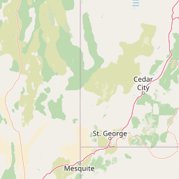
Map view of Mount Grafton Wilderness

Use this park location map to pinpoint Mount Grafton Wilderness in United States of America, understand its exact geographic position, and read its mapped placement within the surrounding landscape more clearly.

Pigeon | © OpenStreetMap contributors

Location context for Mount Grafton Wilderness

Nevada
Park atlas

Compare adjacent mountain ranges and high desert conservation landscapes

Parks Near Mount Grafton Wilderness and Surrounding Protected Natural Areas

Browse protected areas and wilderness zones sharing the rugged topography of eastern Nevada. Regional park comparison reveals connected high elevation ecosystems across the Great Basin.
Wildlife reserveNevada
About 30 km away#1 closest

Southeast

Fortification Range Wilderness: Mapping Volcanic Terrain in the Nevada Great Basin

A protected volcanic mountain chain in Lincoln County.

This wilderness preserves the entirety of the Fortification Range, a significant volcanic block rising above the surrounding desert basins. The protected land is characterized by its dramatic northern cliffs and expansive southern woodlands, offering an exceptional look at the varied natural terrain of the eastern Great Basin. Learn about its geographic boundaries, unique volcanic geology, and the diverse pinyon-juniper forest communities that define this remote high-country landscape.

Area
124.06 km²
Established
2004
IUCN
Ib
Relief
Mountain
A watercolor painting showing soft green hills, distant pink-hued mountains, and a pale blue lake in a serene, stylized landscape.
Protected landscapeNevada
About 37 km away#2 closest

West

Humboldt, Toiyabe National Forest: Protected Landscape and Regional Mountain Geography

A vast network of Nevada mountain ranges and alpine wilderness

Humboldt, Toiyabe National Forest serves as a defining public land entity across Nevada and eastern California. As the largest national forest in the contiguous United States, it preserves a striking collection of isolated mountain ranges, including the Ruby Mountains and the rugged Jarbidge wilderness, within a broader basin-and-range landscape. Examine the boundaries and terrain that characterize this complex, high-desert ecosystem.

Area
25,454 km²
Established
1908
Relief
Mountain
Access
Easy access
National parkNevada
About 42 km away#3 closest

Northeast

Great Basin National Park: Nevada's Protected National Park Geography and Map Details

Understanding its mapped boundaries and regional context.

Delve into the protected landscape of Great Basin National Park, a significant national park located in Nevada. This entry focuses on the park's geographic attributes, providing users with essential map context, details on its protected area boundaries, and an understanding of its place within the broader regional geography. It serves as a focused resource for exploring the park's unique natural terrain and landscape characteristics through an atlas-driven lens.

Area
312.3 km²
Established
1986
IUCN
II
Visitors
144.9K annual
Wildlife reserveNevada
About 56 km away#4 closest

Northwest

Red Mountain Wilderness: Mapping Protected Volcanic Terrain in Eastern Nevada

High-desert wilderness, ancient pines, and volcanic geography.

Red Mountain Wilderness encompasses a rugged block of protected high-country featuring dramatic, iron-rich volcanic slopes. This arid landscape stands out in the White Pine Range for its deep red coloration and the presence of long-lived bristlecone pine. Analyze the boundaries and geographic context of this significant Great Basin wilderness through our structured atlas and map resources.

Area
82.9 km²
Established
2006
IUCN
Ib
Relief
Mountain
Protected areaNevada
About 79 km away#5 closest

Northeast

Mount Moriah Wilderness: A Geographic Profile of the Northern Snake Range Protected Area

High elevation limestone terrain in eastern Nevada

The Mount Moriah Wilderness represents a significant protected area in eastern Nevada, anchored by the iconic 12,050-foot Mount Moriah and the expansive flat-topped Table plateau. This rugged high-country landscape displays deep limestone exposures, shallow caves, and a rich array of riparian habitats. Spanning an entire elevational gradient of the Great Basin, the wilderness preserves ancient bristlecone pine groves alongside critical archaeological sites that document long-term human use of these mountains.

Area
363.4 km²
Established
1989
Relief
Mountain
Water
Minor water
Wildlife reserveNye County
About 90 km away#6 closest

Southwest

Quinn Canyon Wilderness: Exploring Protected Mountain Geography in Central Nevada

High-desert ridges and alpine canyon ecosystems

Quinn Canyon Wilderness serves as a vital protected area for understanding Great Basin geography. Its landscape of deep, V-shaped canyons and high ridgelines supports unique biological gradients from pinyon-juniper forests to rare bristlecone pine, providing a study in extreme solitude and rugged mountain terrain.

Area
106.25 km²
Established
1989
IUCN
Ib
Relief
Mountain
Wildlife reserveUtah
About 180 km away#7 closest

Southeast

Red Mountain Wilderness: Mapped Sandstone Massif and Protected Landscape in Utah

Ecological transitions between the Mojave Desert and Great Basin

Red Mountain Wilderness is a distinct protected landscape in southwestern Utah characterized by its dramatic Navajo sandstone block. Positioned near the Gunlock Fault and Snow Canyon, the area features rugged desert terrain where Mojave and Great Basin ecosystems converge. This wilderness preserves significant archaeological history and diverse plant communities within its sandstone canyons and flats, offering a window into the varied natural environment of the region.

Area
75.8 km²
Established
2009
IUCN
Ib
Relief
Upland
National parkUtah
About 190 km away#8 closest

Southeast

Zion National Park National Park: Detailed Mapped Geography and Protected Landscape Identity

Explore the mapped terrain and regional context of this Utah national park.

Zion National Park represents a key protected area within Utah, ideal for detailed geographic exploration. This canonical page offers insights into the park's specific mapped boundaries, its inherent landscape character, and its regional geographic setting. It is designed for users seeking to understand the atlas-level significance of Zion National Park as a national park entity, focusing on its protected terrain and natural geography.

Area
593.26 km²
Established
1919
IUCN
II
Visitors
4.9M annual

Common questions about visiting, size, designation, and location context for Mount Grafton Wilderness

Mount Grafton Wilderness FAQs for park facts, access, geography, and protected area context

Find quick answers about Mount Grafton Wilderness, including protected-area facts, park geography, trail and visitor context, and how the park fits into its surrounding country and regional landscape.
MoriAtlas Explorer

Continue Your Protected Areas Search Across the Global Atlas

Deepen your exploration by continuing the structured search for national parks and protected areas worldwide. Utilize the comprehensive filtering capabilities to compare different conservation landscapes and refine your understanding of global park geography. Discover more about the distribution and characteristics of protected natural areas.

Global natural geography