
Mori Atlas logo
Nature reserveNa horách

Mapped terrain, protected biodiversity, and historical grazing patterns in the Brdy Highlands

Na horách Nature Reserve: A Detailed Geographic Study of Bohemian Steppe-Like Landscapes

(Přírodní památka Na horách)

Na horách represents an ecologically significant nature reserve situated in the Central Bohemian Region. This protected area preserves a rare mosaic of dry, sun-exposed grasslands and ancient Cambrian sedimentary bedrock that supports specialized thermophilous plant species. The site functions as a vital refuge for meadow pasqueflower and green-winged orchid communities, offering insight into the long-term interaction between human pastoral history and unique Bohemian geological conditions.

dry grasslandthermophilous vegetationsteppe floraorchid habitatpasqueflowerNatura 2000
A flat-style digital illustration showing a tiered waterfall descending into a valley with rolling hills, pine forests, and a meadow full of wildflowers in the foreground.

Na horách

Nature reserve

Park overview

Structured park overview, official facts, and landscape profile for Na horách

Na horách park facts, protected area profile, and essential visitor context

Review the core facts for Na horách, including designation, size, terrain, visitor scale, habitats, and operating context in one park-focused overview.

About Na horách

Na horách is a compact but ecologically valuable nature reserve that protects one of the better-preserved dry-grassland communities in the Brdy Highlands of central Bohemia. The protected area lies on a gently to moderately sloping hillside above the village of Křešín, near Příbram, and represents a surviving fragment of the open, sun-warmed, species-rich landscapes that once covered much larger areas of the Bohemian uplands before agricultural intensification, reforestation, and post-war land-use changes reduced them to small isolated patches.

The site's significance rests on a notable combination of geology, soils, and land-use history. The bedrock consists of Middle Cambrian marine sediments belonging to the Jinec and Ohrazenice formations, comprising shales, greywackes, and conglomerates. Soils derived from this substrate are unusually shallow and stony in the upper and middle parts of the slope, dominated by skeletal rankers, while deeper and somewhat more fertile cambisols appear only in the lower part of the reserve. Combined with the south-facing exposure and relatively low precipitation, these conditions create a dry, warm, nutrient-poor environment that has favored the development of sub-xerothermic grasslands and pioneer vegetation on silicate rock outcrops.

Beyond its botanical importance, Na horách also illustrates an enduring tension between traditional rural land use and modern conservation management. Sheep and goat grazing shaped the site for centuries, kept shrub encroachment at bay, and accidentally produced exactly the kind of disturbance regime that maintains steppe and dry-grassland biodiversity. The interruption of grazing, followed by 20th-century plantings of black locust and Austrian pine, briefly threatened the very features that made the site valuable, and the reserve's story is in large part a story of how conservationists have had to restore the physical and ecological conditions created by centuries of pastoral agriculture.

Quick facts and research context for Na horách

Na horách is a Czech natural monument (přírodní památka) located near Křešín in the Příbram district of the Středočeský region. It was legally designated on 1 January 1997 and covers roughly 4.86 hectares on a south-facing slope between approximately 420 and 455 meters in elevation. The site lies in the Brdská vrchovina (Brdy Highlands) and overlaps with a European Site of Community Importance within the Natura 2000 network. Its protected status is IUCN Management Category IV (habitat/species management area), and the site is administered under Czech nature conservation code 1979.

Protection and recognition

Documented terrestrial protection scope and 1997 designation records

Na Horách Protection Status, Designation History, and Recognition

Terrestrial protection status records for Na Horách outline a designated establishment year of 1997 without transboundary classification. Official conservation data compiles management scope and foundational protected area facts for reference.

Protection details

Protection scope
Terrestrial
Designated year
1997
Transboundary protection
No
Park context

Deeper park guide and search-rich context for Na horách

Na horách history, landscape, wildlife, and travel context

Explore Na horách through its history, landscape character, ecosystems, wildlife, conservation priorities, cultural context, and seasonal travel timing in a structured park guide built for atlas discovery and search intent.

Why Na horách stands out

Na horách is best known for its exceptionally rich dry-grassland flora, particularly the presence of the Bohemian subspecies of meadow pasqueflower (Pulsatilla pratensis subsp. bohemica) together with the green-winged orchid (Orchis morio) and a suite of other thermophilous and steppe-like species. The reserve is a textbook example of how centuries of sheep grazing, thin rocky soils, and a warm microclimate have preserved an open seminatural steppe habitat in the middle of the Czech highlands.
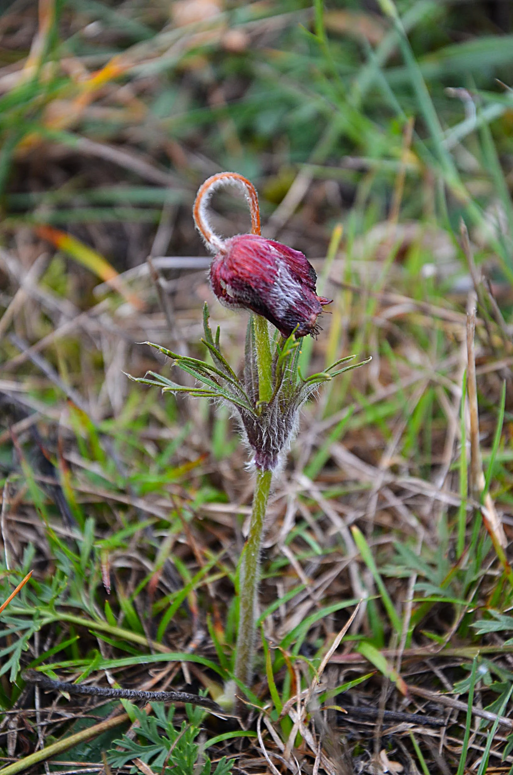
A close up view of a small, purple, nodding meadow pasque flower with fuzzy stems and leaves, growing in dry grass.
The meadow pasque flower (Pulsatilla pratensis) found within the Na horách nature reserve.

Na horách history and protected-area timeline

Human use of the Na horách area stretches back to the medieval period, when local iron ore mining brought wider activity to the surrounding landscape. By the 19th century the locality was under the administration of Count Rudolf von Vrbno, under whose management extensive sheep farming developed on the open slopes. The area functioned as pastureland, a role that was almost certainly also played by the site in earlier, undocumented periods.

At the beginning of the 20th century the site was still held as a communal pasture, but grazing was gradually discontinued across the decades that followed. The cessation of grazing, together with new planting in the 20th century, allowed woody species to expand significantly. Part of the reserve was afforested with black locust (Robinia pseudoacacia), Austrian pine (Pinus nigra), and a smaller share of oaks, reaching their greatest extent of coverage in the 1980s. This period also saw disturbance from military training activity, with armoured vehicles causing substantial physical damage to soils and vegetation.

The trajectory changed in the second half of the 20th century when conservation attention turned to the dry-grassland flora. An initial proposal to designate the site as protected was made in 1976, when the locality's ecological condition was already poor, but it did not succeed at that time. Continued monitoring, combined with removal of illegal waste dumps, eventually led to the formal declaration of Na horách as a přírodní památka (natural monument) in 1996 and effective protection from 1997. From 1997 onward, conservation management focused on cutting back invasive woody regrowth and mowing grassland patches, with the resulting mosaic management repeated over subsequent years to maintain the open character of the site and the rare plant communities it supports.

Na horách landscape and geographic character

The reserve occupies a sloping hillside with a long, gently inclined relief that is nevertheless varied enough at the local scale to produce numerous microhabitats. The terrain is drier and rockier in the upper and middle parts of the slope, becoming somewhat moister and deeper in soils toward the lower edge of the protected area.

Geologically the site sits on ancient seafloor, with the bedrock formed by Middle Cambrian marine sediments of the Jinec and Ohrazenice formations. These include dark shales, fine- to medium-grained greywackes, and locally developed conglomerates, all of which were deposited roughly 500 million years ago. The weathering of these rocks has produced shallow, stony soils dominated by skeletal rankers, which contribute to the dryness and nutrient-poor character of the upper slope. In the lower portion of the reserve, deeper cambisols provide a contrasting, more productive soil environment.

Hydrologically Na horách is a comparatively dry site, with no significant surface water features. Drainage flows generally outward toward the Litavka river valley, and the limited water supply comes overwhelmingly from precipitation. The combination of rocky substrates, shallow soils, slope exposure, and modest rainfall produces the warm and dry conditions that give the site its distinctive open, steppe-like character.
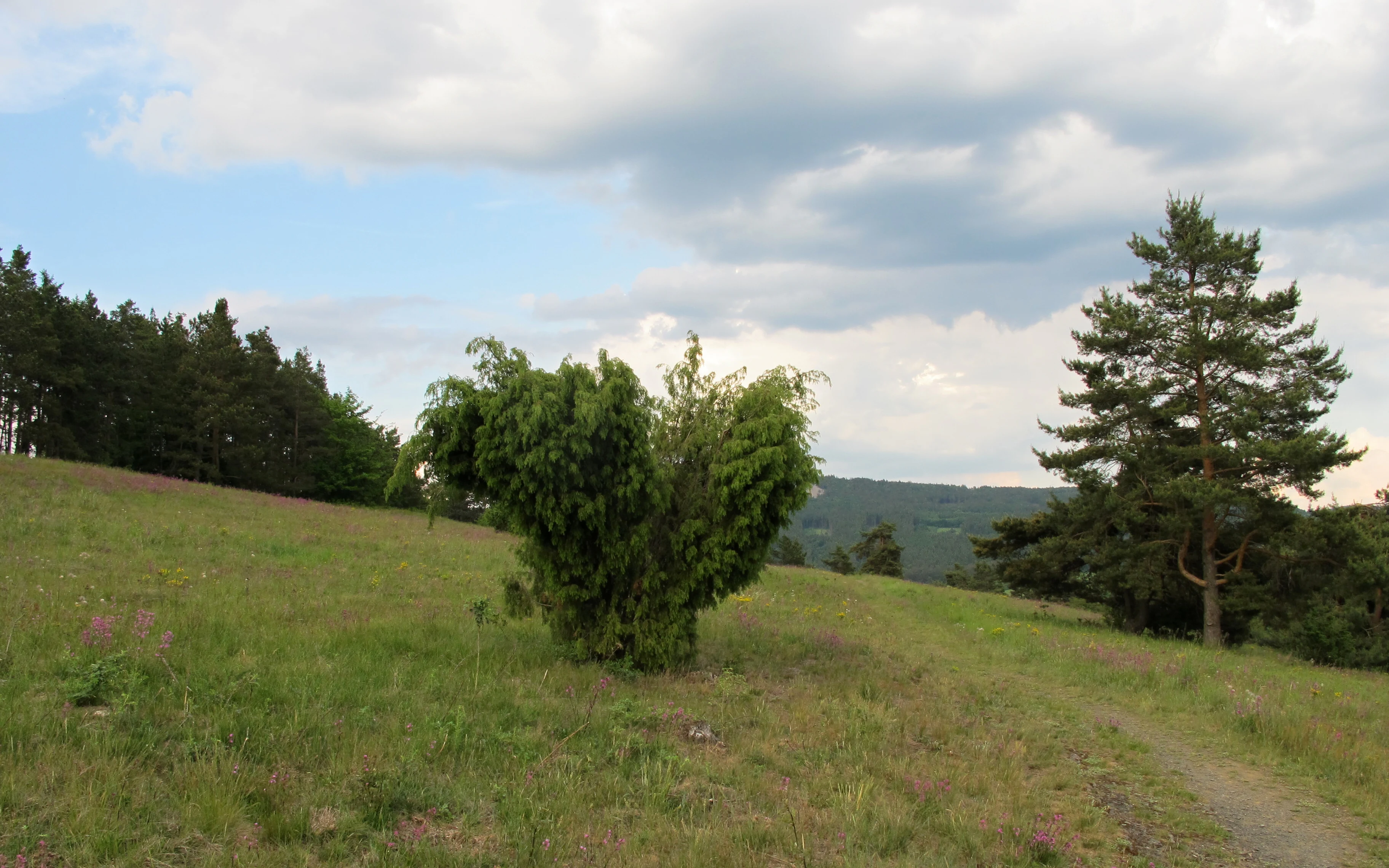
A slightly sloped grassy meadow with a prominent central shrub, a pine tree on the right, and a forest line in the background under a cloudy sky.
A grassy meadow landscape within the Na horách natural monument.

Na horách ecosystems, habitats, and plant life

The ecological identity of Na horách is defined by its thermophilous and pioneer vegetation on silicate rock. Sub-xerothermic grasslands dominate the protected area, interspersed with patches of pioneer herbaceous vegetation that colonises thin soils, rock ledges, and eroding terrace edges. The openness of the habitat, maintained historically by long-term grazing, has allowed a striking number of stress-adapted and drought-adapted species to persist in a small area.

On the shallowest soils, tussocks of sand cinquefoil (Potentilla arenaria) intermix with grey seseli (Seseli osseum), while larger expanses of the slope are dominated by sheep's fescue (Festuca ovina), giving the grasslands a characteristic fine-leaved, low-growing appearance. Lichens play a significant role in the vegetation, particularly reindeer lichens of the genus Cladonia and Iceland lichens of the genus Cetraria, which often colour large stretches of the stoniest ground. Where conditions are slightly more favourable, small patches of dry acidophilic grassland host the green-winged orchid (Orchis morio), one of the key species of conservation interest. Around such open rock terraces, pioneer communities of succulents, stonecrops (Sedum), houseleeks (Sempervivum), speedwells (Veronica), and cerastiums (Cerastium) occupy the thinnest soils and active erosion surfaces.

Scattered across the grassland are solitary trees and shrubs, including Scots pine (Pinus sylvestris), common juniper (Juniperus communis), hornbeam (Carpinus betulus), ash (Fraxinus excelsior), oaks (Quercus sp.), and wild cherry (Prunus avium). These trees typically grow as isolated individuals rather than as closed canopy, allowing the grassland flora to remain dominant underneath. Older plantings of fruit trees are also preserved locally. The invasive black locust (Robinia pseudoacacia) is considered a particularly serious threat and is actively controlled, as are non-native invasive herbaceous species that can otherwise displace the original flora.
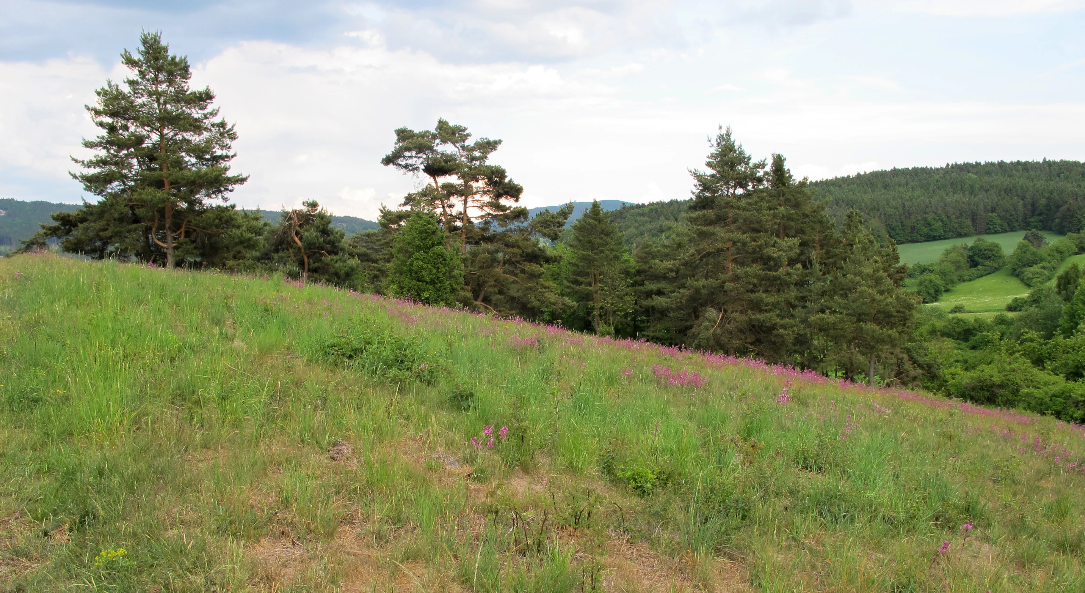
A gently sloping green meadow with patches of purple wildflowers in the foreground and a line of evergreen trees against a cloudy sky in the background.
A grassy hillside meadow at the Na horách nature reserve in the Central Bohemian Region.

Na horách wildlife and species highlights

Although the reserve is designated primarily for its flora, its open dry-grassland character also makes it an important habitat for steppe and rock-dwelling invertebrates. The site supports rich populations of ants, several butterfly species, and orthopterans (grasshoppers and crickets), including the rare small heath grasshopper (Stenobothrus stigmaticus). Among arachnids, the striking banded garden spider (Argiope bruennichi) is one of the most characteristic species. The combination of warm microclimate, rocky outcrops, and undisturbed open ground sustains these invertebrate communities in numbers that would be unusual in more intensively managed surrounding landscapes.

Vertebrate wildlife is less prominent but includes regular breeding of the woodlark (Lullula arborea), a species strongly associated with open, semi-natural habitats with scattered trees and shrubs. Among small mammals, the harvest mouse (Micromys minutus) has been documented at the site. Even though animals are not the formal subject of protection, management practices explicitly leave unmown patches in the grasslands to maintain habitat mosaics that support these invertebrate and small-vertebrate populations.
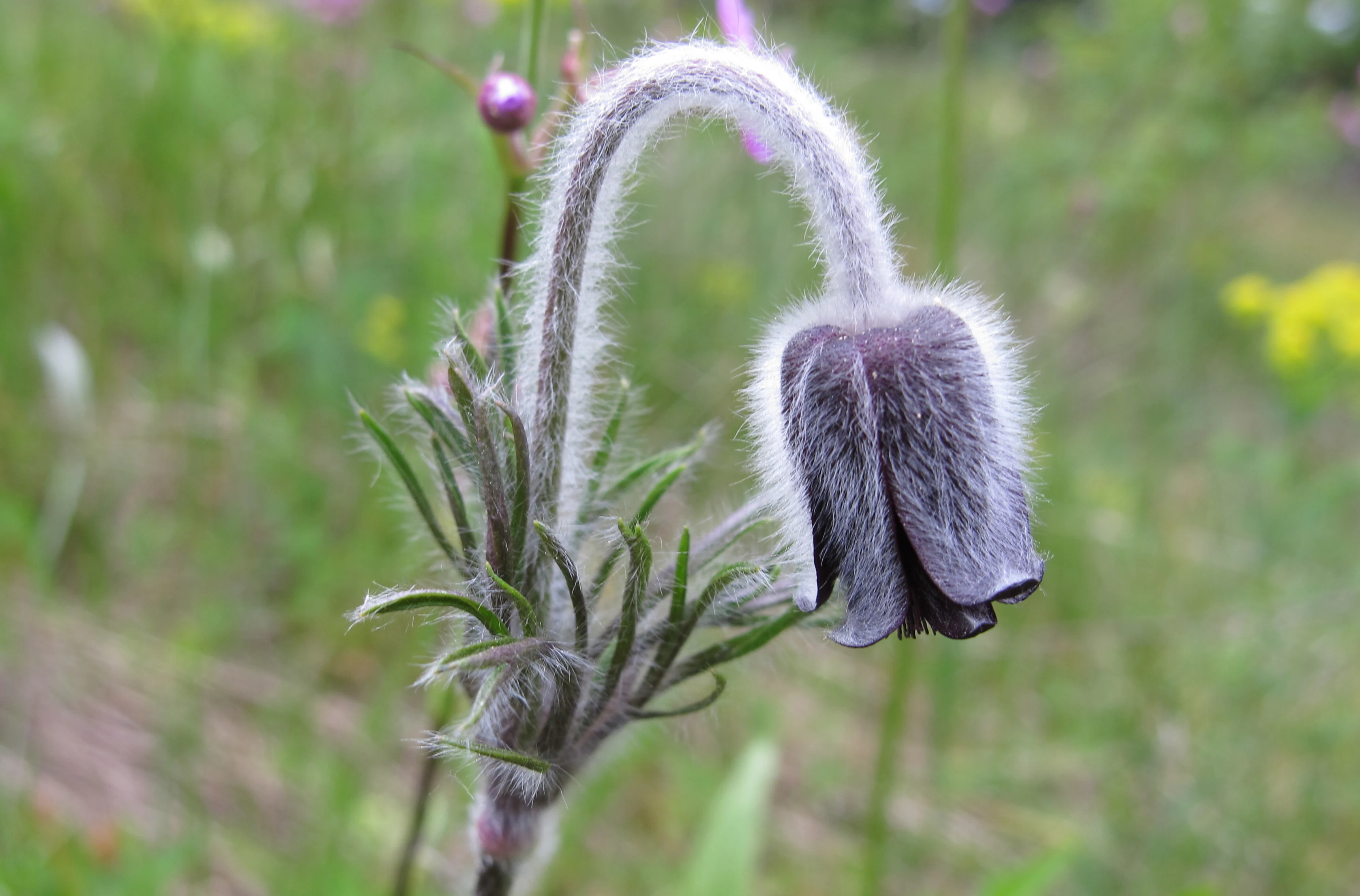
A close-up view of a purple, nodding meadow pasque flower, Pulsatilla pratensis, featuring hairy stems and leaves in a natural meadow setting.
A meadow pasque flower, Pulsatilla pratensis, in the Na horách nature reserve.

Na horách conservation status and protection priorities

Na horách is classified as a přírodní památka (natural monument), corresponding to IUCN Management Category IV, which is intended for the protection of particular species or habitats through active management rather than complete non-intervention. The reserve also overlaps with a European Site of Community Importance, placing it within the Natura 2000 network and emphasising its cross-border conservation significance.

The principal conservation target is the preservation of thermophilous calcareous and silicate grasslands and the rare plant communities they support, especially populations of green-winged orchid (Orchis morio) and Bohemian meadow pasqueflower (Pulsatilla pratensis subsp. bohemica). A secondary target is the conservation of pioneer vegetation on silicate rock, including ephemeral species and succulents that occupy shallow soils and eroding rock surfaces. Conservation management aims both to maintain the existing extent and quality of these habitats and, where possible, to improve habitat condition.

The principal environmental pressures on the site include encroachment by invasive and native woody species, particularly black locust (Robinia pseudoacacia), and the spread of non-native invasive herbaceous plants. Former 20th-century afforestation left a legacy of established trees that continue to encroach, despite efforts to remove them. Management practices combine regular mowing with targeted grazing by sheep and goats, with a long-term goal of increasing the share of grazing. Grazing is preferred because it produces a more natural pattern of small-scale disturbance that benefits seed germination and prevents dominant species from monopolising the sward. Additional measures include manual cutting of woody regrowth and, where absolutely necessary, herbicide treatment of the most problematic invasives.

Top sights and standout views in Na horách

Na horách stands out as a compact but extraordinarily species-rich fragment of Bohemian dry grassland, where the Bohemian subspecies of meadow pasqueflower and the green-winged orchid share an open hillside with junipers, solitary pines, and ancient Cambrian bedrock. The site is a striking demonstration of how centuries of sheep grazing, combined with unusual geological conditions, can sustain plant communities reminiscent of more continental steppe landscapes well within the Central European mixed-forest zone. Its inclusion in the Natura 2000 network adds a wider European dimension to a very local but ecologically distinctive protected area.
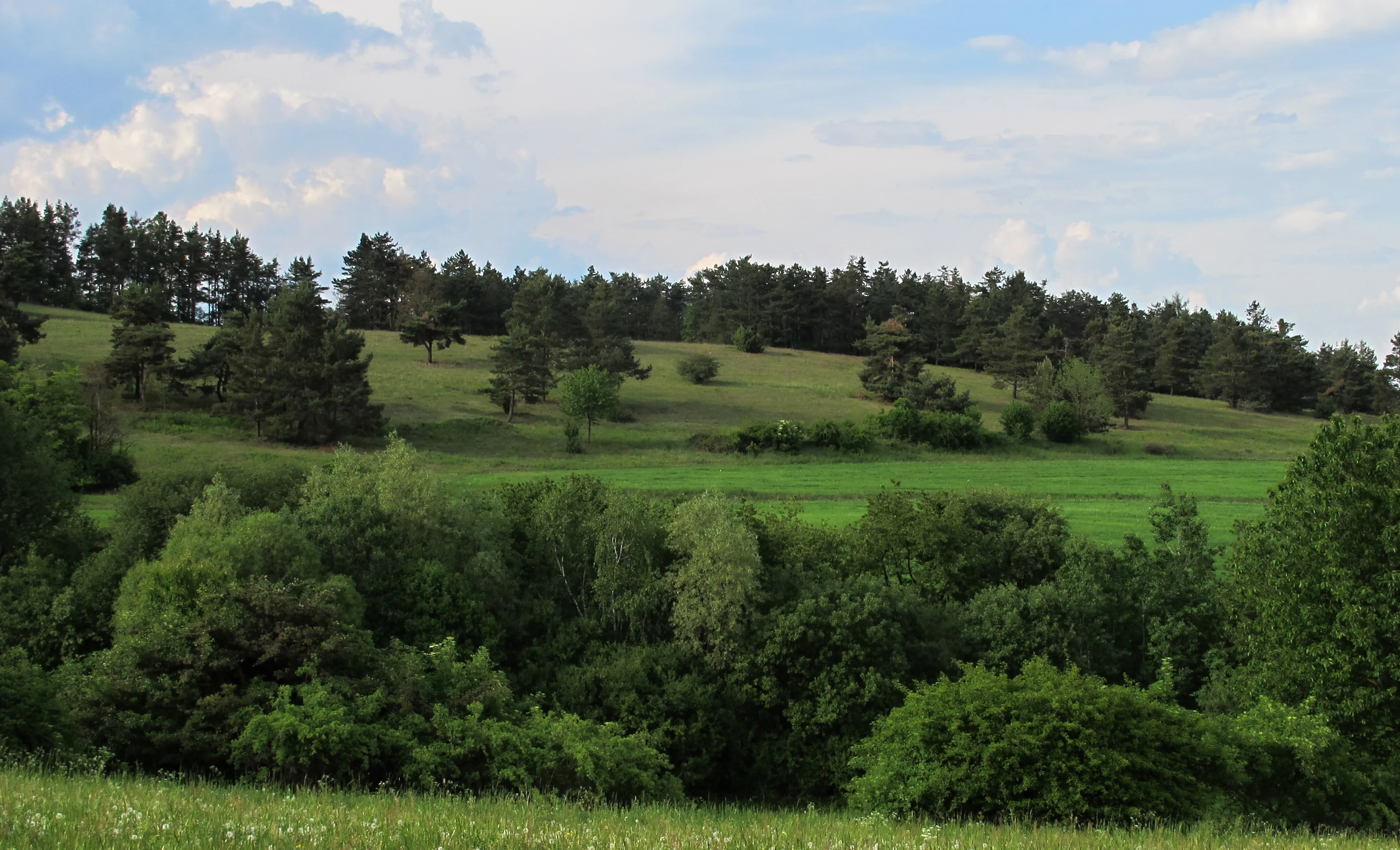

A wide view of a rolling green hillside with scattered trees and a dense line of forest in the background under a blue sky with light clouds.
The rolling meadows and woodland edge at the Na horách natural monument.
Monthly climate preview

Long-term representative monthly temperature and precipitation data for Na horách

Na Horách Climate Normals and Measured Annual Weather Patterns

Representative coordinate records show measured monthly temperature and precipitation distributions across the protected landscape throughout the year. Detailed monthly climate profiles provide complete twelve-month statistical comparisons for ongoing environmental research.
Annual mean8 °C
-2 °C19 °C
Jan-2°
Feb-1°
Mar
Apr
May13°
Jun17°
Jul19°
Aug19°
Sep14°
Oct
Nov
Dec-1°
Warmest month
July

19.2 °C

Coolest month
January

-2.4 °C

Wettest month
June

2.6 mm/day

Driest month
February

1.1 mm/day

Park location guide

Geography guide, regional context, and park location map for Na horách

Na horách park geography, regions, and map view in Czechia

Understand where Na horách sits in Czechia through a broader geographic reading of the surrounding landscape, nearby location context, and its mapped position within the national park landscape.

How Na horách fits into Czechia

Czech Republic is a landlocked Central European country with a population of approximately 10.9 million people. The nation was established as an independent state on January 1, 1993, following the dissolution of Czechoslovakia. Its capital and largest city is Prague, with other major urban centers including Brno, Ostrava, Plzeň, and Liberec.

Wider geography shaping Na horách in Czechia

The Czech Republic is a landlocked country in Central Europe. It is bordered by Germany to the west, Austria to the south, Poland to the northeast, and Slovakia to the southeast. The landscape is predominantly hilly, with the territory covering 78,871 square kilometers.

Map view of Na horách

Use this park location map to pinpoint Na horách in Czechia, understand its exact geographic position, and read its mapped placement within the surrounding landscape more clearly.

Pigeon | © OpenStreetMap contributors

Location context for Na horách

Středočeský kraj

Explore detailed imagery of dry grassland terrain and rare flora across the Bohemian uplands.

Na horách Photos and Landscape Scenery: Visualizing Protected Area Habitats

Visual records capture the open steppe character, rocky slopes, and rare grassland flora defining the reserve. Examining field photographs helps visitors understand local topography, microhabitats, and conservation landscapes more clearly.

A close up view of a small, purple, nodding meadow pasque flower with fuzzy stems and leaves, growing in dry grass.

A close-up view of bright blue bugle flower spikes rising above green leaves and dry grass in a field.

A slightly sloped grassy meadow with a prominent central shrub, a pine tree on the right, and a forest line in the background under a cloudy sky.

A gently sloping green meadow with patches of purple wildflowers in the foreground and a line of evergreen trees against a cloudy sky in the background.

A close-up view of a purple, nodding meadow pasque flower, Pulsatilla pratensis, featuring hairy stems and leaves in a natural meadow setting.

A close up view of the fuzzy, wispy seed head of a Pulsatilla flower growing in a field of green grass.

A wide view of a rolling green hillside with scattered trees and a dense line of forest in the background under a blue sky with light clouds.

A close-up view of a cluster of small, pale pink and white flowers of Antennaria dioica, surrounded by green grass and sparse vegetation.

A sloped, grassy meadow in the foreground leading toward a distant rural village and a tree-lined horizon under a cloudy sky.

A close up view of low lying mossy ground cover and sparse dry grass on a sloping hillside, with a small pink flower visible in the foreground and a tree line in the background.

A wide landscape view of an open grassy hillside in the foreground, with scattered pine trees and a small village nestled in the background under a cloudy sky.

Park atlas

Compare regional conservation landscapes and nearby Bohemian reserves

Explore Protected Areas and Other Notable Parks Near Na Horách

Visitors exploring Na Horách can browse adjacent protected areas across the surrounding Brdy Highlands region. Examining nearby natural monuments provides broader ecological context for dry grassland habitats and regional park geography.
Natural monumentCzechia
About 3.1 km away#1 closest

Southeast

Vinice Natural Monument: Geological Heritage and Cambrian Stratigraphy in Central Czechia

Protected xeric woodlands and ancient marine sedimentary records

Vinice serves as a vital protected area in the Příbram district, safeguarding one of the world's most important Cambrian fossil sites. Its steep, south-facing slope above the Litavka River offers a visual map of geological history, where exposed rock sequences meet diverse forest and grassland habitats. This site remains a key reference for understanding Bohemian natural heritage and the long-term evolution of local terrain.

Area
0.423 km²
Established
1999
Relief
Upland
Climate
Temperate
A watercolor illustration of a rolling forest landscape with soft green ridgelines and hazy, pale hills in the background.
Protected landscapeCentral Bohemian Region
About 15 km away#2 closest

East

Přírodní park Hřebeny: Geographic Overview of the Central Bohemian Forested Ridge

Mapped protected landscape and regional upland terrain

Analyze the territorial structure of Přírodní park Hřebeny, a vast protected area in the Czech Republic covering 184 square kilometers. This detailed overview covers the park's ridgeline geography, forested composition including beech and mixed stands, and its strategic placement within the broader landscape of the Central Bohemian Region.

Area
184 km²
Established
2009
Relief
Mountain
Climate
Temperate
A wide watercolor illustration showing a winding river, a line of green trees, and soft rolling hills in pastel green, pink, and purple tones against a white background.
Natural monumentStředočeský kraj
About 23 km away#3 closest

Northwest

Skryjsko-týřovické kambrium: A Scientific Natural Monument and Geological Landmark

Paleontological heritage in the central Bohemian hills.

Skryjsko-týřovické kambrium provides essential protection for fossil-bearing Cambrian strata in the Czech Republic. This landmark, managed as a natural monument within the Středočeský kraj, remains a foundational reference site for international researchers exploring early Paleozoic marine life, characterized by its unique rock outcrops along the Berounka river valley.

Area
0.3 km²
Established
2011
IUCN
IV
Relief
Upland
A watercolor illustration of a rolling, green landscape with distant, faint hills and small ponds or water bodies in the foreground.
Natural monumentPlzeňský kraj
About 27 km away#4 closest

West

Rokycanská stráň Natural Monument: Geological Exposures and Regional Protected Landscapes

Stratigraphic reference site in the Plzeňský kraj, Czech Republic

Rokycanská stráň represents a key geological protected area situated on the outskirts of Rokycany. The site protects the Klabava Formation stratotype and fossil-rich shales, functioning as a benchmark for Ordovician geology in the Barrandian area. Its four distinct parcels illustrate the interface between urban development and important paleontological research sites in the Plzeň region.

Area
0.208 km²
Established
1981
IUCN
IV
Relief
Upland
Natural monumentCentral Bohemian Region
About 27 km away#5 closest

Northwest

Valachov Natural Monument: Geological and Historical Landscape Analysis in Central Bohemia

Mineralogical type locality and industrial-archaeological protected area.

Valachov is a small yet significant natural monument located in the Central Bohemian Region, serving as the primary type locality for the mineral slavíkit. Beyond its mineralogical importance, the hill preserves physical evidence of medieval lead and nineteenth-century pyrite mining, including shafts and adits embedded within a diverse forested ecosystem of the Křivoklátsko protected landscape area.

Area
0.03 km²
Established
1977
IUCN
III
Relief
Upland
Watercolor painting of a rolling Czech landscape featuring meadow flowers in the foreground, forest in the midground, and distant hazy hills.
Natural monumentStředočeský kraj
About 30 km away#6 closest

North

Markův mlýn Natural Monument: Exploring the Geography and Protected Flora of Central Bohemia

A rare botanical reserve featuring unique rock-steppe plant communities

Markův mlýn is a protected natural monument situated in the Středočeský kraj region, characterized by its rare combination of dry, thin-soil hillside meadows and stream-influenced valley terrain. The area serves as a critical habitat for specialized steppe flora, including the protected Bohemian pasqueflower. This record offers a detailed look at the site's compact geography and the specific environmental conditions that sustain its unusual plant communities.

Area
0.001 km²
Established
1987
IUCN
III
Relief
Lowland
A minimalist watercolor painting depicting a winding river through green rolling hills and meadows on a white background.
Protected landscapePlzeňský kraj
About 32 km away#7 closest

West

Přírodní park Berounka: Protected Landscape Mapping and Geography in Plzeňský kraj

Western Bohemia river canyon and protected corridor

Přírodní park Berounka defines a large, unified protected landscape following the upper course of the Berounka River. The area encompasses dramatic valley scenery, including steep cliff sections, wooded slopes, and a mosaic of fields and historic villages throughout the Plzeňský kraj. Gain insight into the regional geography and the network of connected nature reserves that define this distinctive Bohemian river corridor.

Area
131 km²
Established
2021
Relief
Upland
Water
Major water bodies
Natural monumentPrague
About 35 km away#8 closest

Northeast

Zmrzlík Natural Monument: Geological Profile and Protected Landscape Map of Prague

Silurian stratotype sites and calcareous grassland ecosystems

Zmrzlík is a protected natural monument in Prague, defined by its rich Silurian geological sequences and fossil-bearing limestone deposits. The site offers a clear view into the Kopanina Formation, featuring distinct basaltic volcanic remains and rare xerothermic vegetation. This map-based resource details the terrain and ecological mosaic of the area, ranging from rocky ridges to the valleys of the Mlýnský potok.

Area
0.164 km²
Established
1988
IUCN
IV
Relief
Upland

Common questions about visiting, size, designation, and location context for Na horách

Na horách FAQs for park facts, access, geography, and protected area context

Find quick answers about Na horách, including protected-area facts, park geography, trail and visitor context, and how the park fits into its surrounding country and regional landscape.
MoriAtlas Explorer

Continue Your Protected Areas Search Across the Global Atlas

Deepen your exploration by continuing the structured search for national parks and protected areas worldwide. Utilize the comprehensive filtering capabilities to compare different conservation landscapes and refine your understanding of global park geography. Discover more about the distribution and characteristics of protected natural areas.

Global natural geography