
Mori Atlas logo
Natural monumentNa Novém rybníce

A compact mosaic of fen meadows, wetland basins, and alder woodlands in the Klíčava valley

Na Novém rybníce Natural Monument: Mapped Protected Landscapes of Středočeský kraj

(Přírodní památka Na Novém rybníce)

Na Novém rybníce stands as a significant natural monument within the Central Bohemian Region of the Czech Republic. This protected area preserves a complex mosaic of open water, reed marshes, and species-rich fen meadows. The site serves as a vital ecological record of the lowland wetland systems that define the geography of the Klíčava valley and its broader surrounding terrain.

wetlandfen meadowpondmirewet meadowalder woodland
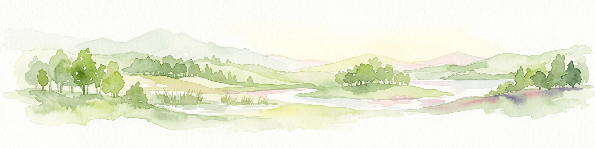
Digital vector illustration of a valley landscape with a winding river, grassy banks featuring cattails, and forested hills under a soft pastel sky.

Na Novém rybníce

Natural monument

Park overview

Structured park overview, official facts, and landscape profile for Na Novém rybníce

Na Novém rybníce park facts, protected area profile, and essential visitor context

Review the core facts for Na Novém rybníce, including designation, size, terrain, visitor scale, habitats, and operating context in one park-focused overview.

About Na Novém rybníce

Na Novém rybníce is a protected natural monument situated in the Central Bohemian Region of the Czech Republic, just outside the town of Nové Strašecí in the Rakovník district. Although it is small in geographic terms, the site plays an important role in the regional conservation of wetland and fen meadow habitats, both of which have become increasingly fragmented across the Bohemian landscape.

The protected area centres on Novostrašecký rybník, a small pond whose margins are lined by typical wetland vegetation, with extensive reed beds and broader-leaved cattail stands creating a transitional zone between open water and the surrounding meadows. Beyond the immediate shoreline, the site extends into permanently waterlogged meadows and alder-dominated wetland woodland along the floodplain of the Klíčava, producing a mosaic of aquatic, marsh and wet meadow habitats within a very compact area.

Ecologically, the site is most important for its fen flora. The wet meadows harbour populations of Davall's sedge, a key indicator species of calcareous fens, together with broad-leaved bog cotton and marsh trefoil. These species collectively define the botanical character of the reserve and underline the conservation value of the area. During the growing season, the meadows also host flowering displays of the May orchid and, in autumn, the autumn crocus, while the presence of the tall globeflower is regarded as the area's most valuable botanical feature.

Visitors who know the area tend to encounter it as a quiet local landscape feature rather than as a major tourist destination. Its accessibility and modest scale make it a useful example of how small ponds and their immediate surroundings can support a remarkable density of specialist plant species, and how such sites remain an essential component of Central Bohemian ecological heritage.

Quick facts and research context for Na Novém rybníce

Na Novém rybníce was designated as a Czech natural monument (přírodní památka) on 30 November 1990, placing it under IUCN Category III protection. The site lies in the Středočeský kraj, within the Rakovník okres, immediately adjacent to the town of Nové Strašecí.

The protected area covers 5.37 hectares and sits at an elevation of roughly 416 to 420 metres above sea level. The site combines a small artificial pond with mire-like wet meadows and alder wetlands in the Klíčava river floodplain, and is chiefly valued for its rare fen flora.

Protection and recognition

Examine the terrestrial protection records and formal conservation status for Na Novém rybníce.

Na Novém rybníce Protection Status and Designated Conservation Scope

Terrestrial protection records for Na Novém rybníce outline the documented management scope and conservation parameters associated with the protected area. Structured atlas data compiles official designation frameworks to support detailed environmental research and regional park analysis.

Protection details

Protection scope
Terrestrial
Transboundary protection
No
Park context

Deeper park guide and search-rich context for Na Novém rybníce

Na Novém rybníce history, landscape, wildlife, and travel context

Explore Na Novém rybníce through its history, landscape character, ecosystems, wildlife, conservation priorities, cultural context, and seasonal travel timing in a structured park guide built for atlas discovery and search intent.

Why Na Novém rybníce stands out

Na Novém rybníce is best known for its fen meadow flora, which is unusually rich for such a small protected area. The combination of a traditional pond, surrounding waterlogged meadows and fen-like vegetation creates conditions that support several rare plant species of conservation importance. Among its most notable floral features are stands of Davall's sedge and bog cotton, the presence of marsh trefoil and the locally significant occurrence of the tall globeflower, one of the most prized species in the site's botanical inventory. The protected area is therefore regarded as an important reference site for Bohemian fen meadow conservation.
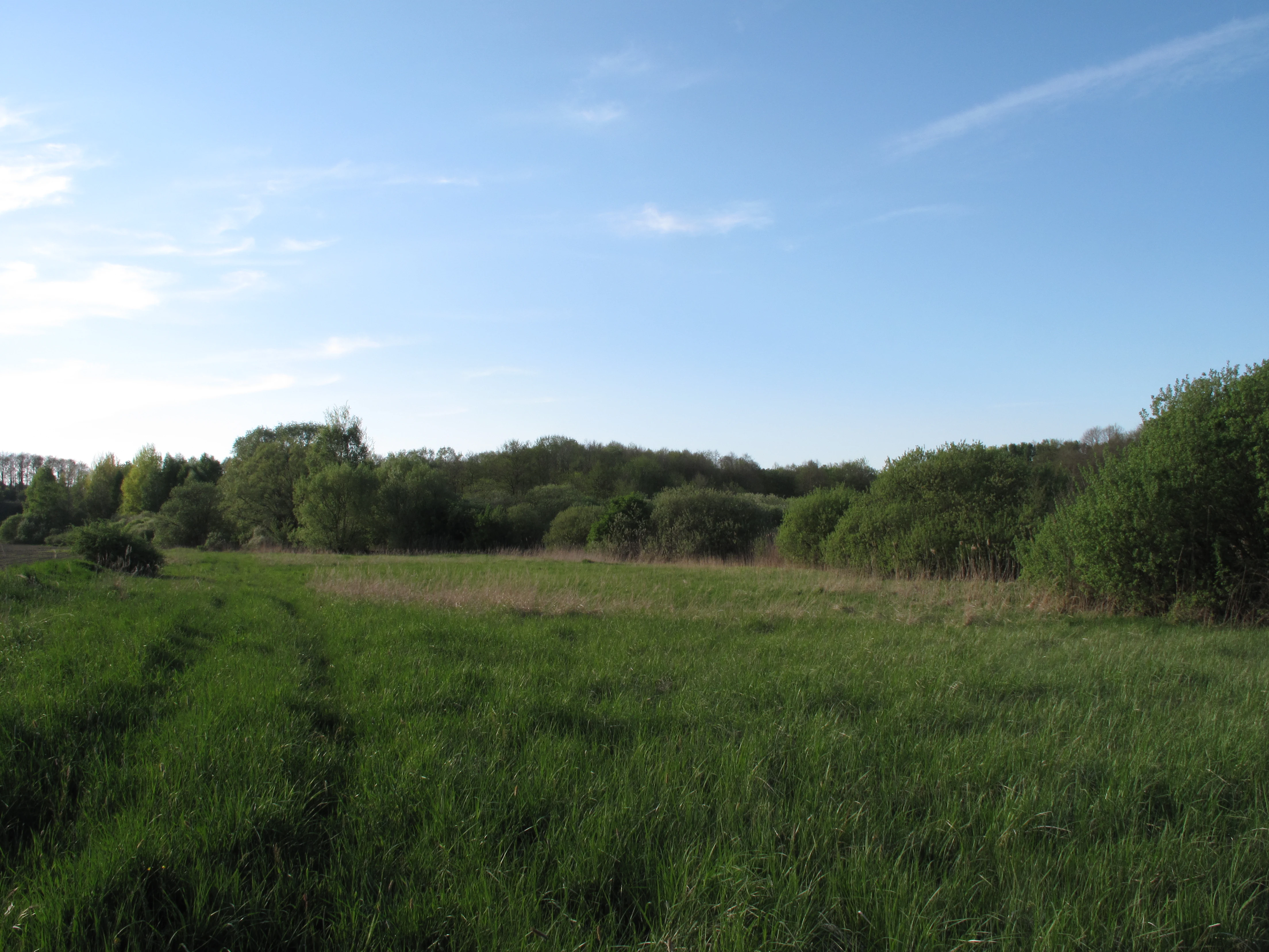
A wide shot of a green, grassy meadow bordered by a dense forest under a clear blue sky.
A view of the open meadow and surrounding woodland at the Na Novém rybníce natural monument.

Na Novém rybníce history and protected-area timeline

Na Novém rybníce was formally designated as a přírodní památka, a Czech natural monument, on 30 November 1990. The designation followed increasing recognition of the site's botanical significance, particularly the rare fen meadow species present in the meadows bordering Novostrašecký rybník.

The pond and its surrounding wet meadows already existed as a traditional agricultural and landscape feature of the Nové Strašecí area, with the dam and basin long visible in the local landscape. Their formal protection established a framework for managing the area to maintain its hydrology and associated fen vegetation, ensuring that the site's botanical value would be preserved against broader pressures on Bohemian wetlands.

Na Novém rybníce landscape and geographic character

The landscape of Na Novém rybníce is defined by a small pond basin set within a broader wetland floodplain in the Klíčava river valley. The dam of Novostrašecký rybník is a visible local landmark, while the surrounding terrain consists of gently sloping meadows that grade into permanently saturated ground and alder stands.

The overall character of the area is quiet and low-lying, with elevations only modestly above 400 metres. The combination of open water, reed marsh, wet grassland and shrubby wetland woodland creates a layered landscape that is visually modest but ecologically rich, offering a textbook example of a Bohemian lowland wetland mosaic in miniature.

Na Novém rybníce ecosystems, habitats, and plant life

Ecologically, Na Novém rybníce represents a compact but well-developed wetland complex, comprising aquatic, marsh, wet meadow and alder woodland communities within a single small site. The pond supports floating and emergent vegetation, while the wet meadows and surrounding alder stands host the most important habitats from a conservation perspective.

The defining ecological feature is the presence of calcareous fen vegetation, a habitat type that has become rare and fragmented across much of Central Europe. The meadows sustain specialist plant communities adapted to permanently waterlogged, nutrient-poor conditions, making the site an important local refuge for fen meadow biodiversity in the wider Křivoklátsko region.

Na Novém rybníce wildlife and species highlights

Focusing strictly on fauna documented or strongly indicated in the source material is difficult, since the available description centres on botanical features. Accordingly, this field is limited: reliable wildlife content cannot be reconstructed independently, and speculation is avoided.

The wetland mosaic of pond, reed bed, wet meadow and alder woodland does, however, make the area a plausible habitat for amphibians, dragonflies, reed-associated songbirds and other wetland fauna typical of Bohemian fen landscapes. Detailed animal records are not present in the supplied source.

Na Novém rybníce conservation status and protection priorities

The principal conservation value of Na Novém rybníce lies in its fen meadows, which support several plant species of regional conservation interest. The site's designation in 1990 reflected the recognition that such small, specialised wetland pockets are important reservoirs of botanical diversity in an otherwise heavily modified agricultural landscape.

By protecting not only the pond itself but also the surrounding waterlogged meadows and alder stands, the reserve safeguards the hydrological conditions and habitat continuity essential to fen meadow survival. In this way, the small area plays a disproportionate role in preserving the character of Bohemian lowland fen systems at the local and regional scale.

Na Novém rybníce cultural meaning and human context

Na Novém rybníce is closely tied to the rural and small-town landscape around Nové Strašecí, where small ponds and river floodplains have long shaped local land use. The pond is a traditional feature of the surrounding countryside, and the meadow habitats reflect centuries of careful wetland management that balanced hay production with the maintenance of biodiversity.

The site therefore carries a modest but real cultural significance as part of the everyday landscape heritage of the Nové Strašecí area, illustrating how traditional rural land use can coexist with ecologically valuable habitats.

Top sights and standout views in Na Novém rybníce

The most distinctive feature of Na Novém rybníce is the unusual botanical richness of its wet meadows, including populations of Davall's sedge, broad-leaved bog cotton and the locally valued tall globeflower.

Also notable is the compact mosaic of habitats on offer: a small pond, reed marsh, wet meadow and alder woodland all sit within a single protected site, illustrating how multiple communities can be conserved together in a very limited area.

Best time to visit Na Novém rybníce

Late spring and early summer are generally the most rewarding time to appreciate the meadows of Na Novém rybníce, when fen flora such as the May orchid and marsh trefoil are in flower and the surrounding vegetation is at its most varied. Autumn brings additional interest through the appearance of autumn crocus, while the pond and alder stands provide a quieter year-round backdrop.

Visitors should be aware that this is primarily a conservation site rather than a developed visitor attraction, and the experience typically centres on quiet observation of meadow and wetland plant life rather than scenic viewpoints.

Monthly climate preview

Long-term representative averages tracking monthly temperature ranges and precipitation rhythms

Na Novém rybníce Climate Normals, Annual Temperature and Precipitation Patterns

Historical data records multi-year temperature variations and daily precipitation averages measured across representative park coordinates. Detailed monthly profiles provide complete baseline normals for comparative environmental analysis.
Annual mean8 °C
-2 °C19 °C
Jan-2°
Feb-1°
Mar
Apr
May13°
Jun17°
Jul19°
Aug19°
Sep14°
Oct
Nov
Dec-1°
Warmest month
July

19.2 °C

Coolest month
January

-2.4 °C

Wettest month
June

2.6 mm/day

Driest month
February

1.1 mm/day

Park location guide

Geography guide, regional context, and park location map for Na Novém rybníce

Na Novém rybníce park geography, regions, and map view in Czechia

Understand where Na Novém rybníce sits in Czechia through a broader geographic reading of the surrounding landscape, nearby location context, and its mapped position within the national park landscape.

How Na Novém rybníce fits into Czechia

Czech Republic is a landlocked Central European country with a population of approximately 10.9 million people. The nation was established as an independent state on January 1, 1993, following the dissolution of Czechoslovakia. Its capital and largest city is Prague, with other major urban centers including Brno, Ostrava, Plzeň, and Liberec.

Wider geography shaping Na Novém rybníce in Czechia

The Czech Republic is a landlocked country in Central Europe. It is bordered by Germany to the west, Austria to the south, Poland to the northeast, and Slovakia to the southeast. The landscape is predominantly hilly, with the territory covering 78,871 square kilometers.

Map view of Na Novém rybníce

Use this park location map to pinpoint Na Novém rybníce in Czechia, understand its exact geographic position, and read its mapped placement within the surrounding landscape more clearly.

Pigeon | © OpenStreetMap contributors

Location context for Na Novém rybníce

Středočeský kraj

Explore protected wetland habitats, pond basins, and fen meadow vegetation.

Visualizing Na Novém rybníce Photos and Landscape Scenery

Visual records reveal the diverse wetland mosaic, shallow pond basins, and waterlogged alder stands defining the protected landscape. Examining detailed field photography helps researchers interpret local vegetation zones, fen meadow flora, and regional terrain characteristics.

A wide shot of a green, grassy meadow bordered by a dense forest under a clear blue sky.

A calm pond with grassy banks and reeds, surrounded by a lush green forest under a clear blue sky.

Park atlas

Compare surrounding wetland reserves and regional protected landscapes

Explore Other Protected Areas and Parks Near Na Novém rybníce in Central Bohemia

Browse other parks near Na Novém rybníce to evaluate connected wetland habitats and regional protected landscapes across Central Bohemia. Extending the geographical comparison reveals broader ecological patterns among local valley reserves and shallow pond basins.
A horizontal watercolor painting showing a winding stream flowing through a lush, green valley with rolling hills and distant mountains under a soft light.
Natural monumentCentral Bohemian Region
About 10 km away#1 closest

East

Smečenská rokle Natural Monument: Geological Gorge and Protected Landscape

Geological cross section in the Central Bohemian Region

Smečenská rokle is a compact natural monument featuring a deep erosional canyon cut into the marlstone plateau. The site offers a detailed stratigraphic view of Bohemian Cretaceous Basin sediments while preserving rare patches of scree and ravine forest within the broader agricultural environment of Central Bohemia.

Area
0.062 km²
Established
1987
IUCN
III
Relief
Upland
A wide watercolor painting showing a landscape of green hills, scattered trees, and distant pink and purple mountains under a pale sky.
Natural monumentStředočeský kraj
About 11 km away#2 closest

East

Smečno Natural Monument: A Protected Woodland Ecosystem in Středočeský Kraj

Geography and conservation mapping in the Czech Republic

Located in the Kladno District, Smečno Natural Monument preserves mature deciduous trees essential for the survival of the hermit beetle. The site acts as a geographical link between distinct landform units, offering a clear look at how small, cavity-rich forest patches maintain ecological connectivity within the broader Central Bohemian landscape.

Area
0.772 km²
Established
2012
IUCN
IV
Relief
Upland
Watercolor illustration of a peaceful, open landscape with gentle hills in the background and clusters of trees in the foreground.
Nature reserveStředočeský kraj
About 11 km away#3 closest

North

Na Pilavě Nature Reserve: A Detailed Botanical Atlas of the Středočeský kraj Landscape

Mapping protected orchid habitats and forest flora in the Džbán highland.

Na Pilavě is a specialized nature reserve in the Kladno District, valued for its dense concentration of rare woodland orchids and the critically endangered black false hellebore. Set within the forested slopes of the Pilavské údolí, this protected area serves as a vital refuge for thermophilic plant communities and ancient deciduous forest flora.

Area
0.031 km²
Established
1969
IUCN
IV
Relief
Upland
A horizontal watercolor illustration showing a soft-toned landscape with green trees in the foreground, rolling yellow-green fields in the midground, and faint mountains in the background.
Natural monumentStředočeský kraj
About 12 km away#4 closest

North

Smradovna Natural Monument: Geography and Protected Habitats in Central Bohemia

A protected stream valley system within the Stredocesky kraj region.

Smradovna preserves a unique concentration of lowland habitats, including calcareous beech forests and rare alkaline fens. This protected natural monument, located near Bilichov, is defined by its characteristic travertine springs and continuous stream-corridor ecosystem. Gain insight into the regional geography and botanical significance of this tightly knit protected landscape through our structured mapping and data.

Area
1.556 km²
Established
2014
IUCN
IV
Relief
Upland
A soft, light-toned watercolor painting depicting a green, hilly landscape with a winding path in the foreground.
Protected landscapeStředočeský kraj
About 14 km away#5 closest

Northwest

Přírodní park Džbán: Geography and Protected Landscape Analysis of the Džbán Ridge

Forested highland and hydrological center of Středočeský kraj

Přírodní park Džbán encompasses a significant Cretaceous plateau and mixed-woodland system that functions as a triple watershed for three major river basins. The park preserves a rich mosaic of thermophilic plants and woodland fauna while maintaining the characteristic opuka geological features that define the vernacular architecture of this central Bohemian region.

Area
416 km²
Established
1994
Relief
Upland
Climate
Temperate
Natural monumentStředočeský kraj
About 16 km away#6 closest

East

Vinařická hora Natural Monument: A Volcanic Geography and Protected Terrain Study

Key protected area and geological landmark in the Středočeský kraj region.

Vinařická hora is a compact, asymmetric hill serving as a vital natural monument for the study of Tertiary volcanic processes and dry-slope plant communities. Its abandoned quarries provide a clear stratigraphic record of ash and lava, while its summit offers panoramic views across the central Bohemian plateau. This site represents a convergence of deep geological history and specialized modern habitat preservation.

Area
0.684 km²
Established
1985
IUCN
III
Relief
Upland
Natural monumentCentral Bohemian Region
About 17 km away#7 closest

Southwest

Valachov Natural Monument: Geological and Historical Landscape Analysis in Central Bohemia

Mineralogical type locality and industrial-archaeological protected area.

Valachov is a small yet significant natural monument located in the Central Bohemian Region, serving as the primary type locality for the mineral slavíkit. Beyond its mineralogical importance, the hill preserves physical evidence of medieval lead and nineteenth-century pyrite mining, including shafts and adits embedded within a diverse forested ecosystem of the Křivoklátsko protected landscape area.

Area
0.03 km²
Established
1977
IUCN
III
Relief
Upland
Watercolor painting of a pastoral landscape featuring rolling green hills, patches of trees, and a river flowing through the center.
Natural monumentStředočeský kraj
About 18 km away#8 closest

Northeast

Slánská hora Natural Monument: Volcanic Geography and Protected Hilltop Terrain in Central Bohemia

Detailed geological mapping of a Tertiary volcanic outlier and historic monument

Slánská hora functions as a significant geological landmark where basaltic vent remnants meet centuries of human history. This natural monument offers a window into the volcanic processes of the region through exposed columnar basalt and rock fissures. The site serves as a vital protected area, balancing remnants of warm-loving steppe vegetation and deciduous forest with the legacy of former quarries and ancient archaeological strata atop the Slaný ridge.

Area
0.022 km²
Established
1998
IUCN
III
Relief
Mountain

Common questions about visiting, size, designation, and location context for Na Novém rybníce

Na Novém rybníce FAQs for park facts, access, geography, and protected area context

Find quick answers about Na Novém rybníce, including protected-area facts, park geography, trail and visitor context, and how the park fits into its surrounding country and regional landscape.
MoriAtlas Explorer

Continue Your Protected Areas Search Across the Global Atlas

Deepen your exploration by continuing the structured search for national parks and protected areas worldwide. Utilize the comprehensive filtering capabilities to compare different conservation landscapes and refine your understanding of global park geography. Discover more about the distribution and characteristics of protected natural areas.

Global natural geography