
Rivers
Park geography
Analyzing the terrain, regional context, and physical landscape of Canada's protected area.
Detailed Geographic Profile and Boundary Mappings of Nahanni National Park Reserve
Examine the structured geographic data for Nahanni National Park Reserve, located within the Northwest Territories. This profile details the recorded boundary dimensions, elevation range, and the expansive array of mountains, karst systems, and riverine landscapes across this boreal protected region.
Related tags
UNESCO World Heritage SiteCanadian Heritage RiverRiver CanyonsNorthern CanadaWilderness Protected Area
A remote wilderness sanctuary of deep canyons, thundering waterfalls, and ancient geological wonders in Canada's far north
Nahanni National Park Reserve
Nahanni National Park Reserve is a vast wilderness protected area in the Dehcho Region of the Northwest Territories, Canada, situated approximately 500 kilometres west of Yellowknife. The park safeguards a spectacular portion of the Mackenzie Mountains Natural Region, centred on the South Nahanni River, known in the local Dene language as Naha Dehé. This remote landscape features four dramatic canyons with walls reaching up to 1,000 metres in height, Virginia Falls plunging 90 metres in a thunderous plume, and the Rabbitkettle hotsprings with Canada's largest tufa mound formations. Inscribed as a UNESCO World Heritage Site in 1978, Nahanni was the first natural site in the world to receive this recognition, honoured for its outstanding universal value including wilderness character, extensive river systems, and geological significance. The park spans over 30,000 square kilometres and remains in reserve status pending resolution of outstanding Aboriginal land claims in the region.
- Location
- Canada
- Park type
- National park
- Established
- 1972
- Area
- 30,050 km²
- Highest point
- 2,773 m
Location overview
Regional placement inside Northwest Territories and Dehcho Region
Geographic Location of Nahanni National Park Reserve in Canada
Nahanni National Park Reserve is situated within Canada, specifically in the Northwest Territories Dehcho Region. Landlocked boundaries remain non-transboundary, lying entirely within national borders.
- Countries
- Canada
- Regions
- Dehcho Region, Northwest Territories
- Primary location
- Northwest Territories
Boundary and coordinates
Interactive boundary geometry, coordinate limits, and area metrics
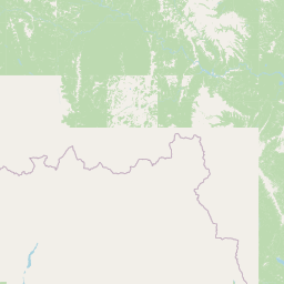
Nahanni National Park Reserve Boundary Map and Geographic Extent
Mapped park geometry provides essential spatial context for examining protected boundaries across the terrain. Derived area metrics, coordinate limits, and geographic spans accompany the interactive outline for complete spatial reference.
- Boundary area
- 30,057.2 km²
- Boundary perimeter
- 1,168.9 km
- Northernmost point
- 62.6167° N
- Southernmost point
- 60.7605° N
- Easternmost point
- 123.5385° W
- Westernmost point
- 129.1685° W
- Geographic centre
- 61.61° N, 125.9032° W
- North–south span
- 206.9 km
- East–west span
- 297.9 km
Elevation and terrain
Mountain ranges, peaks, and recorded hydrological features
Nahanni National Park Reserve Terrain and Elevation Profile
Recorded elevation data shows a maximum height of 2773 meters across the mountain terrain. Linked feature cards supply names, types, measurements, and spatial relationships for recorded natural features within the park.
- Maximum elevation
- 2,773 m
- Highest point
- 2,773 m
Selected named natural features
Rivers
Caribou River
Lakes
McMillan Lake
Peaks
Mount Ida
2,538 m
Peaks
Dome Peak
2,350 m
Rivers
Tetcela River
Environmental setting
Analysis of recorded boreal climate, mountain relief, and major water features
Nahanni National Park Reserve Environmental Classification and Terrain Settings
Recorded landscape features, habitat types, and relief classifications provide complementary methods for reading the physical setting of Nahanni National Park Reserve. Stored environmental categories connect directly to relevant atlas destinations across the protected area.
- Relief
- Mountain
- Climate
- Boreal
- Water
- Major water bodies
- Forest cover
- Mostly forested
- Seasonality
- Seasonal
Landscape features
Mountains · Valleys · Cliffs · Canyon · Forest · Wetland · Lakes · Rivers · Waterfalls · Glacier · Cave · Karst · Tundra
Habitat types
Boreal forest · Alpine meadow · Wetland · Riverine habitat · Lacustrine habitat · Tundra habitat · Karst habitat
Park atlas
Trace the regional spread of protected landscapes and mapped geography across Canada's North.
Explore Related National Parks and Protected Areas Near Nahanni National Park Reserve
After exploring Nahanni National Park Reserve, browse an expanded list of national parks and protected areas in the surrounding wilderness regions of Canada. Compare these distinct conservation landscapes to understand the broader geographic patterns and protected-area context of Northern Canada's vast territories.
National parkNorthwest Territories
Park boundaries overlap#1 closest
Northwest

Nááts'ihch'oh National Park Reserve: Mapped Protected Landscape in Northwest Territories
Explore its geographic boundaries and regional context.
Gain a structured understanding of Nááts'ihch'oh National Park Reserve, a significant protected national park within the Northwest Territories. This detail provides context for its geographical placement and the extent of its protected landscape, vital for anyone exploring the region's natural areas through maps and atlas data.
- Area
- 4,850 km²
- Established
- 2014
- IUCN
- II
- Visitors
- 109 annual
State or regional parkBritish Columbia
About 125 km away#2 closest
Southeast
Maxhamish Lake Provincial Park and Protected Area: Mapping Northern British Columbia Wilderness
Boreal lake ecosystems and protected indigenous heritage lands
Spanning over 27,500 hectares, Maxhamish Lake Provincial Park and Protected Area is a remote boreal refuge characterized by its central lake and extensive coniferous forests. This park provides a critical habitat for moose, deer, and cold-water fish species while maintaining deep ties to the Fort Nelson First Nation and Acho Dene Koe. Its geography reveals a distinct northern basin, offering insight into the ecological character and protected landscape features of northeastern British Columbia.
- Area
- 275.16 km²
- IUCN
- II
- Water
- Major water bodies
- Season
- Seasonal
State or regional parkBritish Columbia
About 151 km away#3 closest
South
Liard River Hot Springs Provincial Park: Boreal Geothermal Mapping and Regional Geography
Protected northern wilderness, thermal water systems, and muskeg wetland terrain
Liard River Hot Springs Provincial Park serves as a protected geographic nexus where thermal water discharge creates a unique biological oasis. The park landscape combines expansive boreal forest with sensitive muskeg wetlands, centered around a natural hot spring system that supports orchid populations and regular wildlife sightings. This atlas entry provides essential context on the physical boundaries and ecological features that define this significant regional park in northern British Columbia.
- Area
- 10.82 km²
- Established
- 1957
- IUCN
- III
- Relief
- Lowland
State or regional parkBritish Columbia
About 189 km away#4 closest
Southeast
Jackpine Remnant Provincial Park: Protected Boreal Landscape and Regional Map Context
Conservation and terrain data for the Fort Nelson region
Jackpine Remnant Provincial Park provides a critical study in northern conservation geography. Located in the Fort Nelson area of British Columbia, this 148-hectare site protects a rare stand of jack pine trees. Its mapped boundaries and boreal forest terrain offer a focused look at small-scale protected landscapes and their significance within the broader regional ecosystem of the Canadian north.
- Area
- 1.48 km²
- Established
- 2001
- IUCN
- II
- Relief
- Lowland
State or regional parkBritish Columbia
About 198 km away#5 closest
South
Horneline Creek Provincial Park: Protected Canyon Landscapes and Rocky Mountain Trench Geography
Remote glacial-terrace wilderness in northern British Columbia
Located deep in the Rocky Mountain Trench, Horneline Creek Provincial Park is defined by its deep-cut canyon and ancient glacial terraces. This protected area offers an intimate view of sub-boreal terrain where mineral-stained walls and aspen-dotted grasslands create a concentrated, ecologically significant landscape within a remote corner of northern British Columbia.
- Area
- 2.98 km²
- Established
- 1999
- IUCN
- II
- Relief
- Upland
State or regional parkBritish Columbia
224 km away#6 closest
South
Denetiah Provincial Park and Protected Area: Regional Geography and Wilderness Mapping
An undisturbed boreal reserve in the Stikine Region
Discover the geographic structure of Denetiah Provincial Park and Protected Area, a vast roadless landscape in northern British Columbia. This park protects pristine boreal forests, elongated glacial lake basins, and critical river headwaters that serve as a benchmark for northern conservation within the Muskwa-Kechika Management Area.
- Area
- 1,053.49 km²
- Established
- 1999
- IUCN
- II
- Relief
- Upland
State or regional parkBritish Columbia
About 264 km away#7 closest
South
Dune Za Keyih Provincial Park and Protected Area: Watershed and Terrain Geography
Remote wilderness landscape in northern British Columbia
Dune Za Keyih Provincial Park and Protected Area protects the largest unlogged watershed in British Columbia. Situated within the Muskwa-Kechika Management Area, this remote wilderness is defined by the geological structures of the Rocky Mountain Trench, providing a continuous corridor of undisturbed mountain forest, riparian zones, and highland terrain.
- Area
- 3,468.33 km²
- Established
- 2001
- IUCN
- Ib
- Relief
- Mountain
Wildlife reserveYukon
272 km away#8 closest
West
Nisutlin River Delta National Wildlife Area: Yukon Delta and Wetland Geography
Protected boreal river delta and lake ecosystem.
The Nisutlin River Delta National Wildlife Area occupies a strategic position where riverine flow meets the expansive basin of Teslin Lake. The reserve is characterized by its dramatic seasonal transitions, transforming from high-water spring channels to expansive autumn mudflats. This dynamic geography supports essential migratory corridors through the boreal forest terrain of the southern Yukon.
- Area
- 54.83 km²
- Established
- 1995
- IUCN
- III
MoriAtlas Explorer
Continue Exploring Nahanni National Park Reserve's Mapped Geography and Protected Landscape
Delve deeper into the geographic specifics of Nahanni National Park Reserve, examining its mapped boundaries and unique landscape context within Northwest Territories. This platform facilitates a structured understanding of protected areas, allowing you to trace the park's contours and appreciate its regional setting for comprehensive atlas discovery.
Browse next
Global natural geography
Explore related park routes
Explore MoriAtlas Global ParksBrowse All MoriAtlas ParksGlobal Park Map DiscoveryMoriAtlas: Browse All CountriesBrowse All MoriAtlas ContinentsNational Park Environment AtlasGrand Canyon National Park AtlasYellowstone National Park AtlasYosemite National Park Atlas and GeographySerengeti National Park AtlasGalápagos National Park Protected LandscapeBanff National Park Geography and AtlasKruger National Park Atlas EntryUluṟu-Kata Tjuṯa National Park AtlasExplore Uluru-Kata Tjuta National Park GeographyPlitvice Lakes National Park AtlasFiordland National Park Protected LandscapeGreat Smoky Mountains National Park AtlasAfghanistan National Parks and Protected AreasAlbania National Parks and Protected AreasAlgeria National Parks and Protected AreasAmerican Samoa National Parks and Protected AreasAndorra National Parks and Protected AreasAngola National Parks and Protected AreasAntarctica National Parks and Protected AreasAntigua and Barbuda Park List