

Mori Atlas logo
National parkNangar National Park

Discover the mapped boundaries and regional landscape of this Australian national park.

Nangar National Park: Protected Landscape and Geographic Context in New South Wales

Nangar National Park stands as a protected natural landscape within New South Wales, Australia. This dedicated national park offers a specific focus for atlas exploration, allowing users to understand its mapped boundaries and geographic setting. Investigate its place within the regional context of New South Wales, providing essential data for understanding Australia's protected area network and its natural terrain.

National ParkNew South WalesEucalypt WoodlandSandstone CliffsBirdwatchingKangaroo Habitat

Nangar National Park

National park

Park overview

Structured park overview, official facts, and landscape profile for Nangar National Park

Nangar National Park park facts, protected area profile, and essential visitor context
Review the core facts for Nangar National Park, including designation, size, terrain, visitor scale, habitats, and operating context in one park-focused overview.

About Nangar National Park

Nangar National Park occupies a distinctive position in central New South Wales, protecting a landscape of considerable scenic and ecological value within the Nangar-Murga Range. The park lies roughly midway between the small towns of Eugowra and Canowindra, an area that transitions from the more heavily cleared agricultural lands of the central west into elevated terrain with exposed sandstone formations and denser woodland cover. The reserve was formally established in 1983 when an initial area of approximately 1,550 hectares of bushland received national park status, and it was significantly expanded in 1994 through the addition of the former Nangar State Forest, bringing the total area to approximately 9,196 hectares. Nangar Mountain, the park's highest point at 778 metres above sea level, provides panoramic views across the surrounding countryside and is a focal feature of the reserve's identity. The park's management falls under the NSW National Parks and Wildlife Service, which maintains the area as a protected landscape for conservation and sustainable public recreation.

Quick facts and research context for Nangar National Park

Nangar National Park is located in the Central Tablelands region of New South Wales, between the towns of Eugowra and Canowindra. The park encompasses the Nangar-Murga Range with Nangar Mountain reaching 778 metres elevation. The area was first protected in 1983 and expanded in 1994 when Nangar State Forest was incorporated into the reserve. The landscape features steep sandstone cliffs, rocky ridgelines, and forested slopes dominated by ironbark, scribbly gum, and black pine. Native wildlife includes eastern grey kangaroos, various wallaby species, and a notable bird community featuring glossy black cockatoos and birds of prey such as falcons and hawks.

Park context

Deeper park guide and search-rich context for Nangar National Park

Nangar National Park history, landscape, wildlife, and travel context
Explore Nangar National Park through its history, landscape character, ecosystems, wildlife, conservation priorities, cultural context, and seasonal travel timing in a structured park guide built for atlas discovery and search intent.

Why Nangar National Park stands out

Nangar National Park is best known for its rugged sandstone cliffs and the prominent Nangar Mountain, which forms a striking backdrop to the surrounding agricultural plains. The park protects one of the few remaining substantial tracts of semi-wilderness in the central west of New South Wales, with the ironbark and scribbly gum woodlands providing critical habitat for the glossy black cockatoo, a species of conservation significance in the region. The historical Dripping Rock area, added to the park in 1988, represents both the park's expansion and its layered landscape history, once serving as a grazing property before becoming part of the protected estate.

Nangar National Park history and protected-area timeline

The establishment of Nangar National Park unfolded over more than a decade, beginning with the initial protection declaration in 1983 when roughly 1,550 hectares of bushland were set aside as a national park. The first significant expansion occurred in 1988 with the addition of the Dripping Rock area, a property with a distinct history stretching back to 1928 when it was established as a grazing run. Dripping Rock took its name from a seasonal waterfall in the area, and the original homestead was subsequently converted for use as a shearing shed while a new residence was constructed in 1935. In 1994, the Nangar State Forest was incorporated into the park, expanding its boundaries substantially to approximately 9,196 hectares and creating the modern extent of the reserve. The park's more recent history includes a significant loss when the Dripping Rock homestead constructed in 1935 was destroyed by bushfire in September 2009, an event that marked the vulnerability of the park's cultural infrastructure to fire events that remain a feature of the Australian landscape.

Nangar National Park landscape and geographic character

The landscape of Nangar National Park is defined by the rocky, elevated terrain of the Nangar-Murga Range, characterised by steep sandstone cliffs, ridgelines, and undulating forested slopes. The park rises from lower rolling country at its margins to the prominent peak of Nangar Mountain at 778 metres AHD, with the exposed rock formations along cliff faces providing the most visually striking terrain within the reserve. The underlying geology consists largely of sandstone and associated sedimentary formations that give rise to the characteristic rugged topography. The forest cover is dominated by various eucalypt species including ironbark and scribbly gum, interspersed with black pine on more elevated and rocky sites. The landscape supports numerous small valleys and drainage lines that carry water seasonally, feeding the vegetation communities that blanket the hillslopes between the rocky outcrops and cliff lines.

Nangar National Park ecosystems, habitats, and plant life

The vegetation of Nangar National Park reflects the semi-arid to subhumid transition zone of central New South Wales, with the park supporting several distinct plant communities across its elevational range. The dominant tree cover consists of various eucalypt species including ironbark, scribbly gum, and black pine, forming open woodland and forest that characterises much of the park's extent. Beneath the tree canopy, the understorey includes a diverse array of shrubs such as spider flowers and thyme spurge, with the ground layer featuring the nodding blue lily and waxlip orchid among other herbaceous species. The rocky cliff faces and exposed ridgelines support specialised plant communities adapted to the harsher conditions of these exposed sites. The park lies within a transition zone between different rainfall patterns, which influences the mix of species present and contributes to the biodiversity significance of the area.

Nangar National Park wildlife and species highlights

Nangar National Park supports a diverse vertebrate fauna community, with mammals being particularly well represented. Eastern grey kangaroos are common throughout the park, moving through the woodland and feeding in more open areas, while three wallaby species occur within the boundaries: grey kangaroos, red-necked wallabies, and swamp wallabies. The bird community is notably diverse, with wrens and thornbills among the smaller bird groups recorded, while birds of prey including falcons, hawks, and peregrine falcons hunt across the open areas and cliffs. The glossy black cockatoo, a species of conservation concern in much of eastern Australia, has been recorded within the park and depends on the ironbark and stringybark woodlands for feeding and nesting. The rocky cliff faces provide nesting habitat for the peregrine falcon and other raptors, while the diverse shrub and tree layers support numerous passerine species throughout the year.

Nangar National Park conservation status and protection priorities

Nangar National Park plays an important role in protecting remnant bushland in a region that has experienced extensive land clearing for agriculture. The park conserves one of the more substantial areas of semi-wilderness in the central west of New South Wales, preserving both the scenic values of the Nangar-Murga Range and the ecological communities that depend on the intact woodland and cliff habitats. The glossy black cockatoo population within the park is of particular conservation significance, as this species has declined significantly across much of its range due to habitat loss and fragmentation. The protection of the ironbark and scribbly gum woodlands ensures that foraging and nesting resources remain available for this and other forest-dwelling species. The park also conserves the rocky cliff communities that provide habitat for peregrine falcons and other raptors, contributing to the broader conservation network in the central tablelands region.

Nangar National Park cultural meaning and human context

The cultural context of Nangar National Park relates primarily to the European pastoral history of the central New South Wales region, with the Dripping Rock area representing the most tangible link to this past within the park boundaries. The property was established as a grazing run in 1928 and named for a seasonal waterfall that remains a local feature. The subsequent conversion of the original homestead to a shearing shed and the construction of a replacement residence in 1935 reflects the practical evolution of pastoral infrastructure in the region. The loss of the 1935 homestead to bushfire in 2009 represents the ongoing interaction between fire, landscape, and human settlement in the Australian environment. While the park does not appear to have detailed documented association with Aboriginal cultural heritage in the available sources, the broader Nangar-Murga Range would have supported Indigenous communities prior to European settlement.

Top sights and standout views in Nangar National Park

Nangar National Park's principal highlights include the dramatic sandstone cliffs and the panoramic views from Nangar Mountain, which at 778 metres provides the park's most elevated vantage point across the surrounding agricultural landscape. The ironbark and scribbly gum woodlands support populations of glossy black cockatoos, making the park a destination of interest for birdwatchers seeking this distinctive species. The historical Dripping Rock area adds another dimension to the park, offering visitors a tangible connection to the pastoral history of the region. The network of walking tracks allows exploration of the different landscape zones, from the forested slopes to the rocky outcrops and cliff faces that define the park's character.

Best time to visit Nangar National Park

The park can be visited throughout the year, though the cooler months from late autumn through winter into early spring typically offer the most comfortable conditions for walking and outdoor exploration. Summer months can bring hot conditions, particularly in January and February when temperatures regularly exceed 30 degrees Celsius in the central west region. Winter brings cooler daytime temperatures but offers clear skies and the opportunity to observe wildlife moving through the woodland as vegetation density decreases. Spring provides the advantage of wildflower displays throughout the understorey, with species such as the waxlip orchid flowering during this season. Visitors should be aware that bushfire risk increases during the warmer months, and park access may be affected during fire danger periods or after significant fire events.
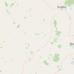

Park location guide

Geography guide, regional context, and park location map for Nangar National Park

Nangar National Park park geography, regions, and map view in Australia
Understand where Nangar National Park sits in Australia through a broader geographic reading of the surrounding landscape, nearby location context, and its mapped position within the national park landscape.

How Nangar National Park fits into Australia

Australia is a constitutional monarchy and federal parliamentary democracy comprising six states and ten territories. With a population of nearly 28 million, it is one of the world's most urbanised countries, with most people concentrated on the eastern seaboard. The country has a high Human Development Index and is known for its cultural diversity, ancient Aboriginal heritage, and unique wildlife.

Wider geography shaping Nangar National Park in Australia

Australia occupies the entire Australian continent, the island of Tasmania, and numerous smaller islands. It is the world's flattest and driest inhabited continent, featuring vast deserts in the interior (the Outback), tropical rainforests along the eastern coast, and a coastline bordering the Indian and Pacific Oceans.

Map view of Nangar National Park

Use this park location map to pinpoint Nangar National Park in Australia, understand its exact geographic position, and read its mapped placement within the surrounding landscape more clearly.

Pigeon | © OpenStreetMap contributors

Location context for Nangar National Park

New South Wales
Park atlas

Map protected areas near Nangar National Park and compare diverse landscapes across central New South Wales.

Discover More National Parks Near Nangar National Park and Explore Regional Protected Areas
Continue your exploration beyond Nangar National Park to browse a curated list of nearby protected areas and compare their distinct geographic features across central New South Wales. This atlas-style view helps users understand regional park distribution, identify connected conservation landscapes, and plan further discovery within similar ecosystems.
National parkNew South Wales

Conimbla National Park: Protected Landscape Atlas and Regional Geography

Mapped boundaries and terrain within New South Wales.

Examine the protected landscape of Conimbla National Park, a designated national park situated in New South Wales, Australia. This entry provides focused geographic context, detailing its mapped boundaries and the regional terrain. It serves as a valuable resource for understanding the park's identity within the national atlas and its specific place in the Australian landscape.

Area
84.71 km²
Established
1980
IUCN
II
Relief
Upland
National parkNew South Wales

Weddin Mountains National Park: National Park Mapping and Geographic Context

Discover mapped protected landscape boundaries in New South Wales.

Weddin Mountains National Park represents a key protected area within New South Wales, Australia, offering a focused lens for geographic exploration. This detail page provides access to the park's specific mapped boundaries and its role as a national park. Understand the surrounding regional geography and the protected landscape's identity through a detailed atlas perspective, ideal for mapping conservation areas.

Area
83.61 km²
Established
1971
IUCN
II
Relief
Mountain
Watercolor depiction of a river, trees, and rolling hills in a landscape
National parkNew South Wales

Jindalee National Park: New South Wales National Park Protecting Cypress Pine Woodlands

Explore unique mapped terrain and regional conservation landscape.

Jindalee National Park represents a vital conservation effort in New South Wales, safeguarding remaining cypress pine woodlands and Critically Endangered grassy woodland ecosystems. Situated in the South West Slopes region, its undulating terrain and drainage lines form a distinctive natural landscape. The park's designation as a national park underscores its importance for preserving threatened species habitats and offers a focused point for atlas-driven discovery of its unique protected-area character and geographic context.

Area
10.76 km²
Established
2011
IUCN
II
Relief
Lowland
National parkNew South Wales

Abercrombie River National Park: A Protected Landscape in New South Wales

Explore its national park designation and mapped geography.

Delve into the details of Abercrombie River National Park, a designated national park situated in New South Wales. This entry focuses on its identity as a protected landscape, providing a geographically specific atlas perspective. Understand the extent of its mapped boundaries and its contribution to the regional geography, offering a clear view of its protected area status for discovery and reference.

Area
190 km²
Established
1995
IUCN
II
Relief
Mountain
National parkNew South Wales

Turon National Park National Park: Protected Landscape and Geographic Atlas Details

Mapped boundaries and regional context within New South Wales.

Turon National Park is a protected national park in New South Wales, Australia, offering a distinct geographic identity for atlas exploration. This entry focuses on its mapped boundaries, natural terrain, and its role as a conservation landscape. Users can discover its specific features and regional context, enhancing their understanding of Australia's protected areas.

Established
2002
IUCN
II
Relief
Mixed relief
Climate
Temperate
National parkNew South Wales

Gardens of Stone National Park: National Park Protected Landscape and Geographic Atlas

New South Wales protected area and mapped terrain exploration.

Delve into the protected landscape of Gardens of Stone National Park, an important national park situated in New South Wales, Australia. This page offers an atlas-centric view, focusing on the park's distinct geographic identity, its mapped protected boundaries, and its contribution to the regional context of protected lands. Understand the fundamental landscape character and terrain that define this significant natural area for structured geographic discovery.

Area
150.8 km²
Established
1994
IUCN
II
Relief
Highland
National parkAustralia

Yarrobil National Park: Australia's Protected Landscape for Geographic Discovery

Explore its national park designation and mapped regional context.

Yarrobil National Park stands as a distinct protected landscape within Australia, identified as a national park. Its geographic significance lies in its contribution to the nation's atlas of conservation areas. This page focuses on providing a clear understanding of the park's identity, its environmental setting, and how its mapped boundaries fit into the broader regional geography of Australia, enabling structured exploration for enthusiasts of protected areas and natural landscapes.

Area
13.22 km²
Established
2005
IUCN
II
Relief
Upland
National parkNew South Wales

Kanangra-Boyd National Park: A Protected Landscape within New South Wales' Geography

Mapped boundaries and regional park context.

Kanangra-Boyd National Park represents a significant protected area, offering valuable insights into the natural landscapes and geographic context of New South Wales. As a national park, it provides a clear example of mapped terrain and protected land distribution, crucial for anyone exploring the atlas of Australian conservation areas. Understanding this park contributes to a broader appreciation of its regional geography and specific landscape identity.

Area
686.6 km²
Established
1969
IUCN
Ib
Relief
Mountain

Common questions about visiting, size, designation, and location context for Nangar National Park

Nangar National Park FAQs for park facts, access, geography, and protected area context
Find quick answers about Nangar National Park, including protected-area facts, park geography, trail and visitor context, and how the park fits into its surrounding country and regional landscape.
MoriAtlas Explorer

Continue Your Protected Areas Search Across the Global Atlas

Deepen your exploration by continuing the structured search for national parks and protected areas worldwide. Utilize the comprehensive filtering capabilities to compare different conservation landscapes and refine your understanding of global park geography. Discover more about the distribution and characteristics of protected natural areas.

Global natural geography