
Why Nastberg stands out
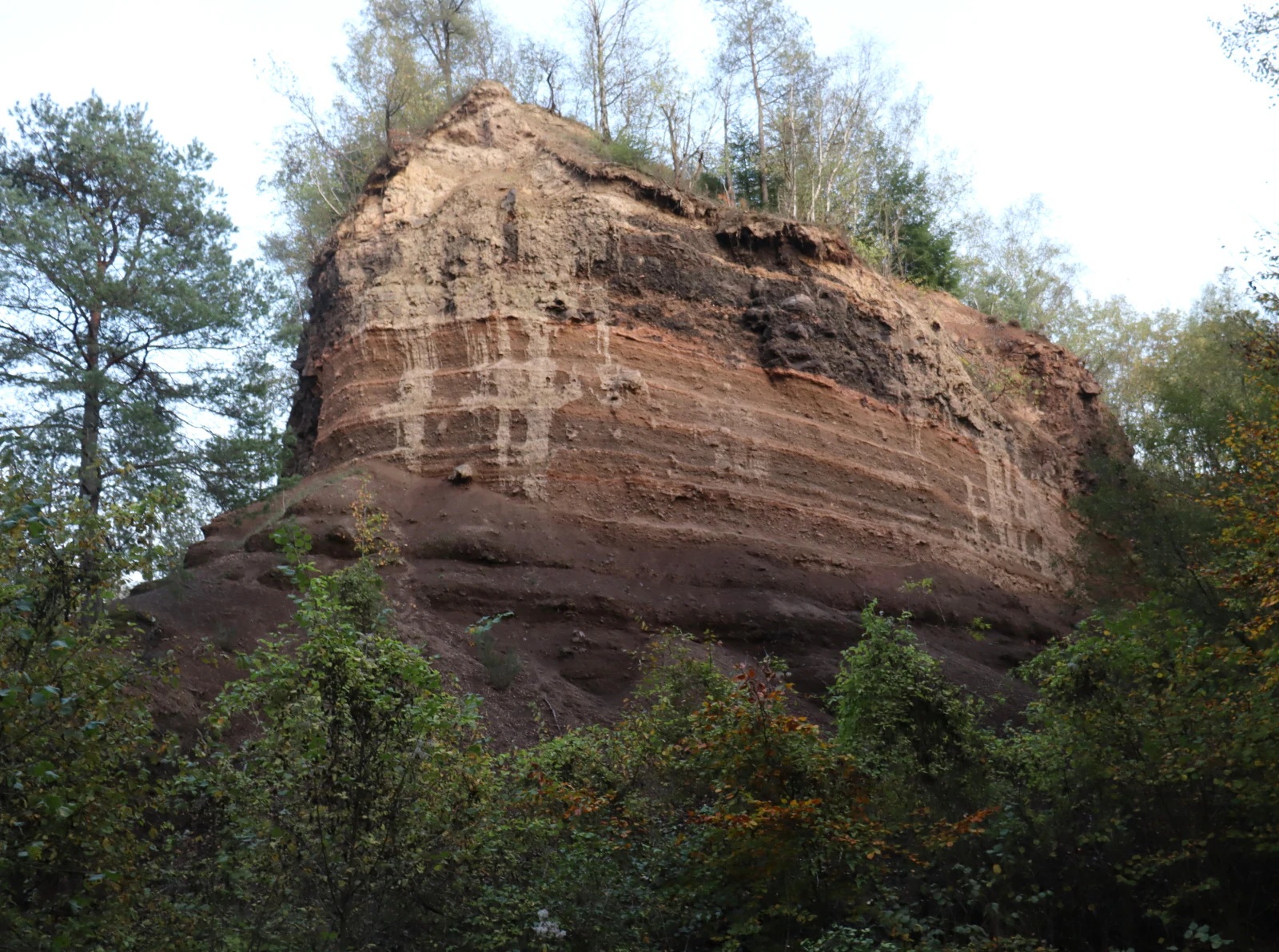
Nastberg is best known as a textbook example of the eruptive sequence that characterizes the East Eifel volcanic field, beginning with a phreatomagmatic maar phase and continuing into subsequent magmatic scoria cone eruptions. The two access quarries, Grube Nord and Grube Süd, expose tilted tuff rings, pumice layers, and overthrown scoria walls that vividly document these stages. As part of the Vulkanpark, it also serves as a publicly accessible geological teaching site illustrating the explosive volcanic past of the Middle Rhine landscape.
Nastberg history and protected-area timeline
The volcanic edifice of Nastberg formed around 225,000 years ago in the Middle Pleistocene, during a period of intense volcanic activity across the East Eifel. The initial eruption was phreatomagmatic, producing a maar surrounded by a tuff ring; later purely magmatic eruptions built the main scoria cone and a thick scoria wall. A subsequent eruption along a new fracture partially collapsed the older walls, and a later flank failure carried part of the northeastern slope into the crater.
In the twentieth century the cone was quarried in several places to extract volcanic material for construction, and the locally used building stone called Krotzen, derived from the scoria, can be seen in many older houses in Andernach-Eich. The two resulting pits, now known as Grube Nord and Grube Süd, are what remain as the most visible traces of these later quarrying activities. In more recent decades the site has been formally protected as a nature reserve and landscape monument, and it has been incorporated into the Vulkanpark educational route operated by the VULKANPARK GmbH in Landkreis Mayen-Koblenz.
Nastberg landscape and geographic character
Nastberg belongs to the eastern part of the Laacher Kuppenland, a natural subregion known for its rolling volcanic knolls and cones rising above otherwise flat lowland. The hill itself sits on what is essentially the southwestern margin of the much broader Neuwied Basin, an alluvial depression shaped by the Rhine and its tributaries. Although the summit of Nastberg reaches only about 317 meters above sea level, it stands out clearly against the surrounding basin thanks to its relatively steep flanks.
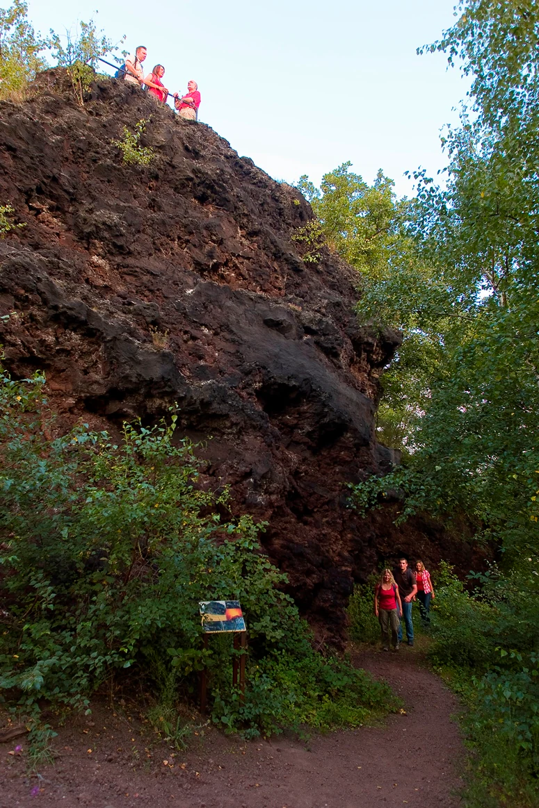
Geomorphologically, the present-day shape of the hill is a partially preserved scoria cone: the western and southwestern scoria wall still exists as a recognizable morphology, but the eruption centers and the eastern wall have been removed by quarrying or eroded away. The two old quarries, Grube Nord and Grube Süd, interrupt the cone and now act as geological windows into the layered interior. From the small summit plateau, the surrounding landscape opens northward into the Neuwied Basin, eastward toward the slopes of the Westerwald, and southward toward the wooded ridges of the Hunsrück.
Nastberg ecosystems, habitats, and plant life
The protected area around Nastberg is small in extent and is valued primarily for its geological features rather than its biological communities. The exposed rock faces of the two quarries, the scoria walls, and the loose tuff material create specialized dry and warm microhabitats compared with the surrounding lowland. Sparse pioneer vegetation has established in pockets of weathered volcanic material, and the surrounding slopes are bordered by agricultural land and by small woodland patches typical of the eastern edge of the Laacher Kuppenland.
Because the protection status is concentrated on the volcanic landforms themselves, the ecological story of Nastberg is tightly tied to its geology. The combination of the dry, mineral-rich volcanic substrate and the regional climate of the Middle Rhine gives the site a distinctive character that contrasts with the broader landscape of the Neuwied Basin around it, and this contrast is part of why the area has been formally recognized both as a nature reserve and a landscape monument.
Nastberg conservation status and protection priorities
Nastberg is protected on two complementary levels. It is designated as a Naturschutzgebiet, or nature reserve, under German conservation law, and it is additionally recognized as a Landschaftsdenkmal, a landscape monument, because of the geological sections exposed in the old quarries. Together these designations are intended to preserve both the remaining volcanic morphology and the layered internal architecture that documents the eruptive history of the volcano.
In a broader sense, the conservation value of Nastberg also lies in its role as a publicly accessible teaching site within the Vulkanpark in Landkreis Mayen-Koblenz. Interpretive panels along the footpath summarize the eruptive phases, and the quarries themselves serve as outdoor classrooms where visitors can directly observe tuff rings, pumice layers, and scoria walls. By combining legal protection with educational infrastructure, the site preserves its scientific value while still allowing low-impact public access.
Nastberg cultural meaning and human context
The volcanic rocks of Nastberg have been part of local building traditions for at least a century. The dark, slag-like scoria material, traditionally known in the region as Krotzen, was extracted from the cone in the twentieth century and used as a common building stone; many houses in the Eich district of Andernach display this distinctive dark volcanic material in their walls.
The site also forms part of the modern regional cultural landscape of the Vulkanpark in Landkreis Mayen-Koblenz, a structured network of volcanic, Roman, and industrial heritage stations along four color-coded routes. Nestled between the Geysir Andernach and the Hohe Buche volcano along the yellow Kruft-Andernach route, Nastberg is tied into a wider narrative of how volcanic geology has shaped settlement, building materials, and identity in this stretch of the Middle Rhine.
Top sights and standout views in Nastberg
The Nastberg's standout features are its clearly readable volcanic history and the two exposures that reveal it. Grube Nord preserves rotated blocks of an older tuff wall that collapsed during a later fissure eruption, while Grube Süd shows the thick scoria wall of the final major eruption, capped by a fine pumice layer. A short footpath with information panels climbs to a summit cross, where the view spans the Neuwied Basin and reaches toward the Westerwald and Hunsrück.
Best time to visit Nastberg
Nastberg is a small outdoor geological site that can be visited year-round, and because its main attractions are rock exposures and panoramic views, clear weather significantly enhances the experience. Spring and early summer tend to be comfortable for the short uphill walk, the quarry walls are most visible when vegetation has not yet covered them, and autumn also offers good visibility into the Neuwied Basin and beyond. Winter visits are possible, but slippery paths on volcanic material and reduced daylight for the viewpoint should be considered.