Mori Atlas logo
Protected areaNatura 2000-område nr. 43 Klitheder mellem Stenbjerg og Lodbjerg

Mapped coastal dune heath systems and stabilized terrain in Northern Jutland, Denmark

Natura 2000-område nr. 43 Klitheder mellem Stenbjerg og Lodbjerg Protected Landscape Atlas

Natura 2000-område nr. 43 Klitheder mellem Stenbjerg og Lodbjerg forms a significant protected coastal landscape along the Thy peninsula of Northern Jutland, Denmark. The terrain encompasses a comprehensive gradient from active maritime foredunes to stable grey-green dune heaths and wet inland dune slacks. This geography supports a rich array of Annex IV species and specialized flora, serving as a critical conservation site within the broader Nordic coastal ecosystem.

dune heathdune habitatscoastal heathlandNatura 2000EU Habitat AreaThy peninsula

Natura 2000-område nr. 43 Klitheder mellem Stenbjerg og Lodbjerg

Protected area

Park overview

Structured park overview, official facts, and landscape profile for Natura 2000 Area No. 43, Klitheder mellem Stenbjerg og Lodbjerg

Natura 2000 Area No. 43, Klitheder mellem Stenbjerg og Lodbjerg park facts, protected area profile, and essential visitor context

Review the core facts for Natura 2000 Area No. 43, Klitheder mellem Stenbjerg og Lodbjerg, including designation, size, terrain, visitor scale, habitats, and operating context in one park-focused overview.

About Natura 2000 Area No. 43, Klitheder mellem Stenbjerg og Lodbjerg

Natura 2000 Area No. 43, Klitheder mellem Stenbjerg og Lodbjerg, is one of the larger protected coastal dune and heath complexes on Denmark's western seaboard. Located on the Thy peninsula in northwestern Jutland, it covers two large spatial units that together form a near-continuous belt of dune and heath running inland from the North Sea coast, tying together the maritime dune strip with the inland heath and plantation mosaic.

The area's western side is shaped by active dune processes and shows a full sequence of dry dune types, from embryonic dunes near the beach through mobile white dunes and into more stabilized grey-green dune heaths. Toward the east the terrain flattens, with dune slacks, small bog pools, and isolated lakes breaking up an otherwise open heath and dune landscape. This combination of dry and wet dune features within a single protected site is one of the defining ecological characteristics of the area.

The site was identified as a Natura 2000 area because of the size and natural quality of its dune habitats, which together form one of the largest coherent dune systems in close-to-natural condition in Denmark. The inclusion of these habitats in the EU Habitats Directive list reflects their international conservation importance, particularly the prioritized dune habitat types that occur here.

The habitat diversity is matched by a notable species richness, including several red-listed plant species adapted to nutrient-poor, acidic sand and the specialised wet dune slack flora. Among the flora, narrow-leaved bur-reed and red-listed Scottish lovage, sea bindweed, and fine hair-grass are documented. The bird community is also significant, with breeding populations of tinksmed and common crane highlighted as particularly valuable, alongside a wider assemblage that benefits from the combination of open heath, dune slacks, and inland water features.

A large proportion of the site is further protected under Section 3 of the Danish Nature Protection Act, with heathland strongly dominant. The Natura 2000 plan was adopted in 2011 and is implemented through binding action plans drawn up by the municipalities and the Danish Nature Agency, in coordination with the Limfjorden water plan.

Quick facts and research context for Natura 2000 Area No. 43, Klitheder mellem Stenbjerg og Lodbjerg

Natura 2000 Area No. 43 sits in northern Jutland within Region Nordjylland and Thisted Municipality, covering approximately 2,918 hectares. The site is composed of two principal sub-areas of dune habitat that together form a large, continuous coastal heath and dune landscape.

The site is designated as an EU Habitat Area under the Natura 2000 network and is primarily protected for its dune habitats and associated wetland features. Most of its land is also covered under Section 3 of the Danish Nature Protection Act, with heathland forming the dominant habitat type and smaller amounts of bog, lake, natural meadow, and stream habitats making up the rest. The Natura 2000 plan for the site was adopted in 2011 and is coordinated with the Limfjorden water plan.

Protection and recognition

Review documented protection frameworks, designation year details, and official recognition metrics.

Protection Status and Designation History for Natura 2000-område nr. 43 Klitheder mellem Stenbjerg og Lodbjerg

Examine the verified 2011 designation history and institutional protection parameters established for Natura 2000-område nr. 43 Klitheder mellem Stenbjerg og Lodbjerg. This structured data overview details official conservation classifications and recorded administrative frameworks.

Protection details

Designated year
2011
Park context

Deeper park guide and search-rich context for Natura 2000 Area No. 43, Klitheder mellem Stenbjerg og Lodbjerg

Natura 2000 Area No. 43, Klitheder mellem Stenbjerg og Lodbjerg history, landscape, wildlife, and travel context

Explore Natura 2000 Area No. 43, Klitheder mellem Stenbjerg og Lodbjerg through its history, landscape character, ecosystems, wildlife, conservation priorities, cultural context, and seasonal travel timing in a structured park guide built for atlas discovery and search intent.

Why Natura 2000 Area No. 43, Klitheder mellem Stenbjerg og Lodbjerg stands out

The area is best known for its extensive, near-natural dune heaths; the unusually large, coherent dune system along the Thy coastline; and its rich coastal heath and dune slack habitats. It is also notable for its birdlife, particularly the presence of breeding tinksmed (spotted redshank) and cranes, and for rare, red-listed plants adapted to acidic, nutrient-poor dune environments. The site represents one of the more complete examples of the gradient from active foredunes through white dunes and grey-green dune heaths into stabilized inland heaths and wet dune slacks in Denmark.

Natura 2000 Area No. 43, Klitheder mellem Stenbjerg og Lodbjerg history and protected-area timeline

The landscape has long been shaped by natural dune processes and by human efforts to stabilize the moving sand. The earliest formal protection on this stretch dates back to 1955, when a declaration by the Fredningsnævnet for Thisted Amtsrådskreds established protections for areas in Stenbjerg and Vorupør. This was extended in 1964 by a decision of the Overfredningsnævnet covering additional dune and heath areas around Stenbjerg and Vorupør, and again in 1976 with the Overfredningsnævnet order of 26 April that protected the heath and dune areas between Lyngby and Flade Sø.

These overlapping conservation orders were issued to preserve the natural state of the heath and dune land, to maintain those areas unchanged in their natural condition, and to prevent subdivision of the area for summerhouse development. Together they form the core of the long-standing national protection that still covers most of the site today.

The site was formally incorporated into the European Natura 2000 network as Area No. 43, with the Natura 2000 plan adopted in 2011. Following adoption, the municipal councils and the Danish Nature Agency prepared binding action plans to implement the plan on the ground, and the framework is periodically reviewed and extended through subsequent planning periods, coordinated with the Limfjorden water plan.

Natura 2000 Area No. 43, Klitheder mellem Stenbjerg og Lodbjerg landscape and geographic character

The landscape of Natura 2000 Area No. 43 is a classic west Jutland coastal dune and heath system. On its western edge the terrain is shaped by the sea, with an active dune belt that includes embryonic foredunes, mobile white dunes, and more stabilized grey-green dune heaths climbing inland. This dry, exposed character defines the western part of the site.

To the east the topography eases out. Large flat expanses of heath and dune dominate, interspersed with dune slacks (klitlavninger), small lakes, and boggy hollows. The dune slacks in particular create the wet, low-lying pockets that contrast with the dry, windblown dunes along the coast and add significant habitat diversity to the site.

The site borders the Stenbjerg, Hvidbjerg, and Lodbjerg Klitplantager plantations, and the transition between open dune heath and forested plantation creates a distinct landscape mosaic. The overall impression is of a broad, open coastal heathland where the sea and wind continuously reshape the western fringe while the inland areas gradually stabilize into heath and slack.

Natura 2000 Area No. 43, Klitheder mellem Stenbjerg og Lodbjerg ecosystems, habitats, and plant life

Ecologically, the site is built around the dune habitat sequence that gives it its name. Multiple dry dune types are present, including foredune, white dune, grey-green dune, dune heath, sea-buckthorn dune, and grey-willow dune habitats, complemented by wet dune slacks and associated lake and stream features. The dune heaths are the dominant habitat type overall, with bogs, small lakes, and short stream reaches adding important wet elements.

These habitats together represent one of the larger coherent dune systems in near-natural condition in Denmark, with internlobliable areas preserving close-to-natural dune dynamics along the western edge. The dry, nutrient-poor character of the sands together with the wet dune slacks produces a steep ecological gradient over short distances, which supports the specialized plant assemblages for which the site is known.

In addition to the dune habitats, the site includes small Lobelia lakes and soft-water lakes with sparse shore vegetation, as well as brunvandet sø (brown-water lakes) and stream sections characteristic of the Limfjorden catchment. Stands of stilkege scrub (Quercus robur scrub) appear locally, adding a woodland element to an otherwise open heath and dune landscape.

Natura 2000 Area No. 43, Klitheder mellem Stenbjerg og Lodbjerg wildlife and species highlights

The site is valued first and foremost as an important bird area. It supports a particularly notable breeding population of tinksmed (Tringa glareola) and common cranes, with the dune slacks and inland heath providing suitable open, wet conditions for these species. The mix of dry heath, wet slacks, pools, and adjacent plantation edge creates varied conditions for a broader bird community seasonally.

The herptile fauna is also significant in conservation terms. Of the Annex IV species under the EU Habitats Directive, the site hosts the large great crested newt, the agile frog, the natterjack toad, and the common sand lizard. The presence of these species underlines the importance of the site's small lakes, dune slacks, and open sandy areas for amphibians and reptiles that depend on a mosaic of breeding ponds and dry habitat.

The flora includes a number of rare and red-listed plant species, including Scottish lovage, sea bindweed, and fine hair-grass, alongside narrow-leaved bur-reed in the wetter slacks and lake margins.

Natura 2000 Area No. 43, Klitheder mellem Stenbjerg og Lodbjerg conservation status and protection priorities

The site's principal conservation importance lies in the scale and natural quality of its dune habitats, which form one of the largest coherent near-natural dune systems that Denmark contributes to the EU Natura 2000 network. Several of the dune habitat types listed for the site are classified as prioritized habitats under the Habitats Directive, reflecting their particularly high conservation status.

Most of the area's land surface is also protected under Section 3 of the Danish Nature Protection Act, with heathland being the most extensive protected type. A substantial portion of the remainder is bog and freshwater habitats, both of which also receive protection through the Nature Protection Act and the coordinated Limfjorden water plan. The dune heath and slack mosaic is therefore protected through a layered system of national and European designations.

The Natura 2000 plan adopted in 2011 sets the framework for active management, including binding action plans prepared by Thisted Municipality and the Danish Nature Agency. These plans aim to maintain open dune and heath habitats, safeguard water levels in slacks and lakes, and protect the breeding conditions of the site's key bird and herptile species. Coordination with the Limfjorden water plan ensures that water quality and hydrology in the site's streams and lakes are managed consistently with broader catchment goals.

Natura 2000 Area No. 43, Klitheder mellem Stenbjerg og Lodbjerg cultural meaning and human context

The dunes and heaths along this stretch of Thy have shaped local life for generations, with the coastal fisheries villages of Stenbjerg and Vorupør forming closely linked human communities on the edge of the protected landscape. The dune plantations of Stenbjerg, Hvidbjerg, and Lodbjerg were established largely to stabilize the migrating sands that historically threatened farmland and settlements inland, and they remain part of the working coastal landscape today.

The early conservation orders on this site, beginning with a 1955 declaration and followed by decisions in 1964 and 1976, reflect a long tradition of Danish nature protection aimed at keeping these coastal heaths and dunes open and intact and preventing their conversion to summerhouse development. This layered protection history is itself part of the cultural context of the area.

Top sights and standout views in Natura 2000 Area No. 43, Klitheder mellem Stenbjerg og Lodbjerg

The site stands out for the exceptional scale of its dune habitats, occupying close to the full ecological gradient from active coastal dunes to inland stabilized heaths within a single protected area. It carries weight as a Special Area of Conservation under the EU Habitats Directive, and several of its dune habitat types are prioritized at the European level.

Its species profile is strongly linked to the dune environment: breeding tinksmed and cranes, Annex IV amphibians and reptiles such as the great crested newt and natterjack toad, and red-listed dune plants including Scottish lovage, sea bindweed, and fine hair-grass. The overlap between European designations, long-running national Section 3 protection, and coordination with the Limfjorden water plan gives the site a particularly robust conservation framework.

Best time to visit Natura 2000 Area No. 43, Klitheder mellem Stenbjerg og Lodbjerg

The dune and heath landscapes of Thy are most expressive in the warmer months, when the flowering of dune plants and the breeding activity of birds, including tinksmed and cranes, make inland slacks and adjacent heaths especially worthwhile for nature observation. Late spring and summer generally offer the richest mix of active birdlife and visible plant communities.

In winter and early spring the exposed western dunes can be harsh, with strong winds off the North Sea, but the open heath and the firmer tracks inland remain accessible. For a focus on the site's ecological character, including dune slacks, lakes, and specialized flora, the warmer half of the year tends to provide the most rewarding conditions.
Monthly climate preview

Long term temperature averages and monthly precipitation records for Natura 2000-område nr. 43 Klitheder mellem Stenbjerg og Lodbjerg

Annual Climate Normals and Weather Patterns for Natura 2000-område nr. 43 Klitheder mellem Stenbjerg og Lodbjerg

Measured representative coordinate records outline the annual temperature progression and monthly precipitation rhythm across Natura 2000-område nr. 43 Klitheder mellem Stenbjerg og Lodbjerg. Detailed twelve month climatology data provides deeper insight into multi year meteorological baselines and seasonal normals.
Annual mean9 °C
3 °C17 °C
Jan
Feb
Mar
Apr
May10°
Jun13°
Jul16°
Aug17°
Sep15°
Oct11°
Nov
Dec
Warmest month
August

16.7 °C

Coolest month
February

3.2 °C

Wettest month
October

3.6 mm/day

Driest month
April

1.7 mm/day

Park location guide

Geography guide, regional context, and park location map for Natura 2000 Area No. 43, Klitheder mellem Stenbjerg og Lodbjerg

Natura 2000 Area No. 43, Klitheder mellem Stenbjerg og Lodbjerg park geography, regions, and map view in Denmark

Understand where Natura 2000 Area No. 43, Klitheder mellem Stenbjerg og Lodbjerg sits in Denmark through a broader geographic reading of the surrounding landscape, nearby location context, and its mapped position within the national park landscape.

How Natura 2000 Area No. 43, Klitheder mellem Stenbjerg og Lodbjerg fits into Denmark

Denmark is a constitutional monarchy and Nordic country in Northern Europe. It is the southernmost of the Scandinavian countries, bordering Germany to the south, Norway to the north, and Sweden to the southwest. The country consists of the Jutland peninsula and an archipelago of islands, with Copenhagen as its capital and largest city. Denmark has a population of over 6 million and is characterized by flat, arable land, sandy coasts, and a temperate climate.

Wider geography shaping Natura 2000 Area No. 43, Klitheder mellem Stenbjerg og Lodbjerg in Denmark

Denmark occupies the Jutland peninsula and roughly 406 islands in Northern Europe. It is situated between the North Sea to the west and the Baltic Sea to the east. The country borders Germany to the south and is connected to Sweden via the Øresund Bridge. Denmark is predominantly flat terrain with low elevation, the highest point being Møllehøj at 170.86 meters.

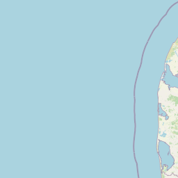
Map view of Natura 2000 Area No. 43, Klitheder mellem Stenbjerg og Lodbjerg

Use this park location map to pinpoint Natura 2000 Area No. 43, Klitheder mellem Stenbjerg og Lodbjerg in Denmark, understand its exact geographic position, and read its mapped placement within the surrounding landscape more clearly.

Pigeon | © OpenStreetMap contributors
Park atlas

Compare regional coastal heaths and protected natural landscapes across northern Jutland

Other Parks Near Natura 2000-område nr. 43 Klitheder mellem Stenbjerg og Lodbjerg

Visitors exploring Natura 2000-område nr. 43 Klitheder mellem Stenbjerg og Lodbjerg can discover adjacent protected areas and coastal dune reserves. Broader geographic comparison reveals connected regional habitats and shared ecological gradients across the Thy peninsula.
Watercolor illustration of a landscape with trees, water, and distant hills
National parkDenmark
Mapped location lies within the park boundary#1 closest

Northeast

Thy National Park: Explore Denmark's First Protected Coastal Landscape and Heathlands

Mapped dune systems, rare heath habitats, and coastal geography.

Thy National Park, Denmark's inaugural national park, protects a significant expanse of windswept coastal terrain. This area is renowned for its rare dune heaths, a habitat of particular European ecological importance, and a landscape shaped by a century of sand drift stabilization efforts. The park's diverse geography includes extensive sandy heaths, conifer plantations, and a striking coastline along the North Sea, offering rich opportunities for atlas exploration of protected natural areas and their surrounding regional context. Discover the mapped extent of this vital conservation landscape.

Area
244 km²
Established
2007
IUCN
II
Relief
Lowland
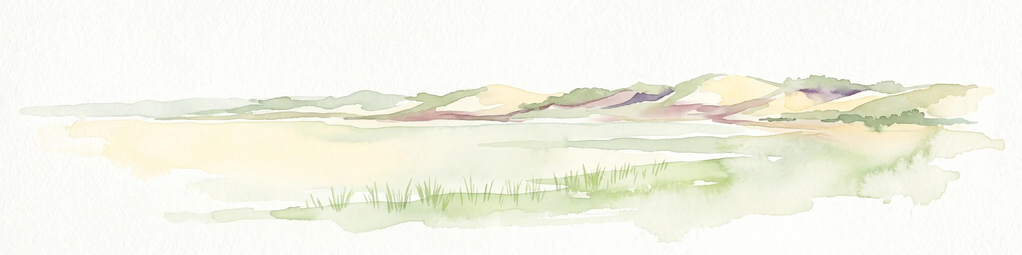
A soft watercolor painting depicting a flat, open coastal landscape with rolling, pale-colored dunes in the distance and muted green grasses in the foreground against a white background.
Protected areaDenmark
About 6.2 km away#2 closest

South

Agger Tange Protected Area: Coastal Peninsula and Wetland Geography in Northwestern Denmark

Mapping the North Sea and Limfjorden interface

Agger Tange is a significant coastal landform in northwestern Denmark, characterized by its exposed western dunes and sheltered eastern salt marshes. This protected landscape documents the dramatic influence of storm surges on the Jutland coast, resulting in a complex network of lagoons and tidal flats that support critical bird habitats.

Area
24 km²
Established
1984
Relief
Lowland
Scope
Mixed
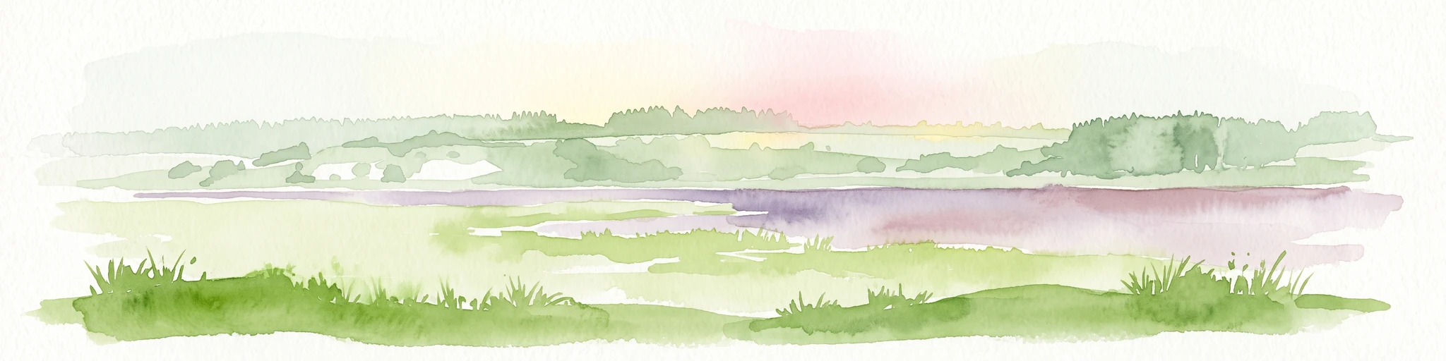
A soft, painterly watercolor illustration of a shallow lake landscape featuring gentle green grassy foreground, a calm body of water, and distant treelined hills under a pale, warm sky.
Protected areaRegion Nordjylland
About 9.7 km away#3 closest

East

Ove Sø Protected Area: Geographic Overview of the Thy Wetland Landscape in Denmark

Mapped freshwater terrain in Region Nordjylland

Ove Sø features a long, shallow basin and complex wetland margins within the Thy landscape of Denmark. This entry provides a detailed look at the lake's hydrographic position, its connection to the Limfjorden system, and the protected status of its surrounding reed beds and meadow habitats.

Area
3.5 km²
Relief
Lowland
Scope
Terrestrial
Water
Water-dominated
Protected areaDenmark
About 16 km away#4 closest

South

Nissum Bredning Protected Area: Geography and Coastal Mapping in Denmark

Shallow bay ecosystems, glacial cliffs, and Limfjorden sand flats.

Nissum Bredning is a broad, low-lying basin in western Denmark known for its extensive shallow sand flats, including Fjordgrund and Gåseholm. The protected area encompasses a diverse coastal mosaic of brackish lagoons, salt meadows, and the distinctive Toftum Bjerge glacial cliff. This geography offers a clear view into the intersection of active North Sea currents and sheltered inland fjord environments.

Area
200 km²
Relief
Lowland
Climate
Temperate
Access
Easy access
Nature reserveRegion Nordjylland
About 18 km away#5 closest

East

Mågerodde og Karby Odde Nature Reserve: Coastal Protected Landscapes in Region Nordjylland

Limfjorden shoreline, shallow bays, and saline meadows.

Mågerodde og Karby Odde serves as a key coastal reserve in Denmark, defined by its extensive Limfjorden shoreline and complex mix of aquatic and terrestrial habitats. From saline meadows and coastal lagoons to acidic grasslands and spring-fed mires, this protected area offers a look at a diverse maritime ecosystem. The site is recognized for its importance to migratory waterfowl and breeding coastal birds, providing a essential link in the regional geography of the Limfjorden.

Area
4.97 km²
Established
2011
Relief
Lowland
Climate
Temperate
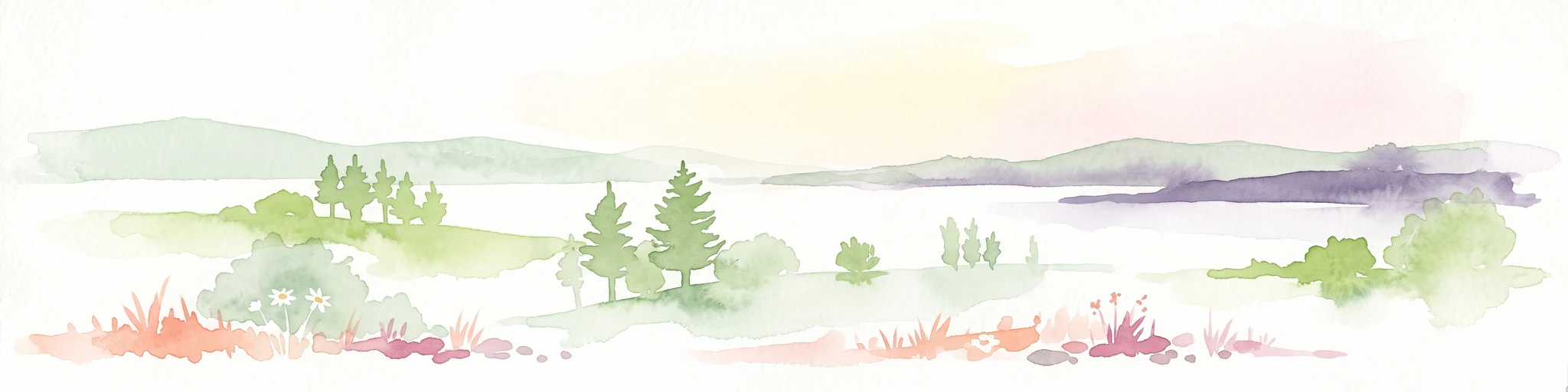
A wide panoramic watercolor illustration showing a landscape with green hills, pine trees, a body of water, and colorful foreground vegetation in pastel tones.
Natural monumentRudmose Aggerø
About 23 km away#6 closest

Southeast

Rudmose Aggerø Natural Monument: Mapped Coastal and Fjord Landscapes in Denmark

Protected shallow-water habitats and rural island geography

Rudmose Aggerø presents a unique study in protected coastal geography. Situated in the western Limfjorden, this low-lying island features managed nature reserves and essential intertidal ecosystems. Its geography is shaped by the interplay of sandbanks and shallow marine environments, offering a serene perspective on Denmark's protected fjord landscapes.

Area
0.275 km²
Relief
Lowland
Climate
Temperate
Scope
Mixed
Nature reserveRegion Nordjylland
About 40 km away#7 closest

Northeast

Korsø Knude Nature Reserve: Protected Chalk Headland and Coastal Terrain in Northern Jutland

Geographic analysis of lime-rich grassland and coastal dune systems

Korsø Knude protects a rare habitat mosaic where chalk geology meets shifting dune sand. This small but significant area in Region Nordjylland serves as a key site for specialized calcareous flora and coastal biodiversity, offering a distinct example of the Skagerrak coastline's natural terrain.

Area
0.2 km²
Established
1955
Relief
Upland
Climate
Temperate
Protected areaRegion Midtjylland
About 41 km away#8 closest

Southeast

Natura 2000-område nr. 62 Veno, Veno Sund: Protected Coastal and Marine Landscape Map

Regional geography and protected coastal habitat overview

Analyze the protected area characteristics of Natura 2000-område nr. 62 Veno, Veno Sund, where shallow brackish sound meets dune heaths and calcareous grasslands. This site provides essential habitat for waders and marine mammals within the broader Limfjorden ecosystem in Region Midtjylland.

Area
29.26 km²
Established
2011
Relief
Lowland
Climate
Temperate

Common questions about visiting, size, designation, and location context for Natura 2000 Area No. 43, Klitheder mellem Stenbjerg og Lodbjerg

Natura 2000 Area No. 43, Klitheder mellem Stenbjerg og Lodbjerg FAQs for park facts, access, geography, and protected area context

Find quick answers about Natura 2000 Area No. 43, Klitheder mellem Stenbjerg og Lodbjerg, including protected-area facts, park geography, trail and visitor context, and how the park fits into its surrounding country and regional landscape.
MoriAtlas Explorer

Continue Your Protected Areas Search Across the Global Atlas

Deepen your exploration by continuing the structured search for national parks and protected areas worldwide. Utilize the comprehensive filtering capabilities to compare different conservation landscapes and refine your understanding of global park geography. Discover more about the distribution and characteristics of protected natural areas.

Global natural geography