
Why Naturpark Rhein-Westerwald stands out
The park is best known for the transition between the Middle Rhine valley and the Westerwald: a landscape composed of right-bank Rhine terraces, forested ridges, and broad inland plateaus that frame the river in a distinctive, gentler manner than the more dramatic left-bank sections downstream. It is also recognized for the deeply wooded and quiet valleys of the Wied and its tributaries, for the volcanic geological heritage of the Rheinwesterwälder Vulkanrücken, and for the historic traces of the Roman Limes that still run through its forests. Walkers and cyclists encounter dense beech and mixed forest stands, open agricultural plateaus, and wide viewpoints looking west toward the Rhine and the Eifel.
Naturpark Rhein-Westerwald history and protected-area timeline
Naturpark Rhein-Westerwald was founded in 1962, making it one of the earliest nature parks established in Germany and giving it more than five decades of continuous development as a protected landscape. The year 2012 marked its fiftieth anniversary, a milestone that underscored its role as a pioneer among Germany's regional nature parks.
The legal foundation for the park as it now operates was laid by a state ordinance issued in 1978 by the Rhineland-Palatinate ministry then responsible for agriculture, viticulture, and environmental protection. Paragraph 4 of that ordinance defines the protective purpose of the park in explicit terms: preserving the scenic character, beauty, and special recreational value for short and longer visits of the largely undeveloped Vorderer Westerwald and the right-bank Rhine slopes between Neuwied and the state's northern border.
The park is administered by an incorporated association, Naturpark Rhein-Westerwald e. V., which acts as the legal and organizational body for coordination among the municipalities involved. Over time, this formal structure has supported a stable regional partnership across parts of the districts of Neuwied and Altenkirchen, where many of the constituent Verbandsgemeinden overlap directly with the park area.
Naturpark Rhein-Westerwald landscape and geographic character
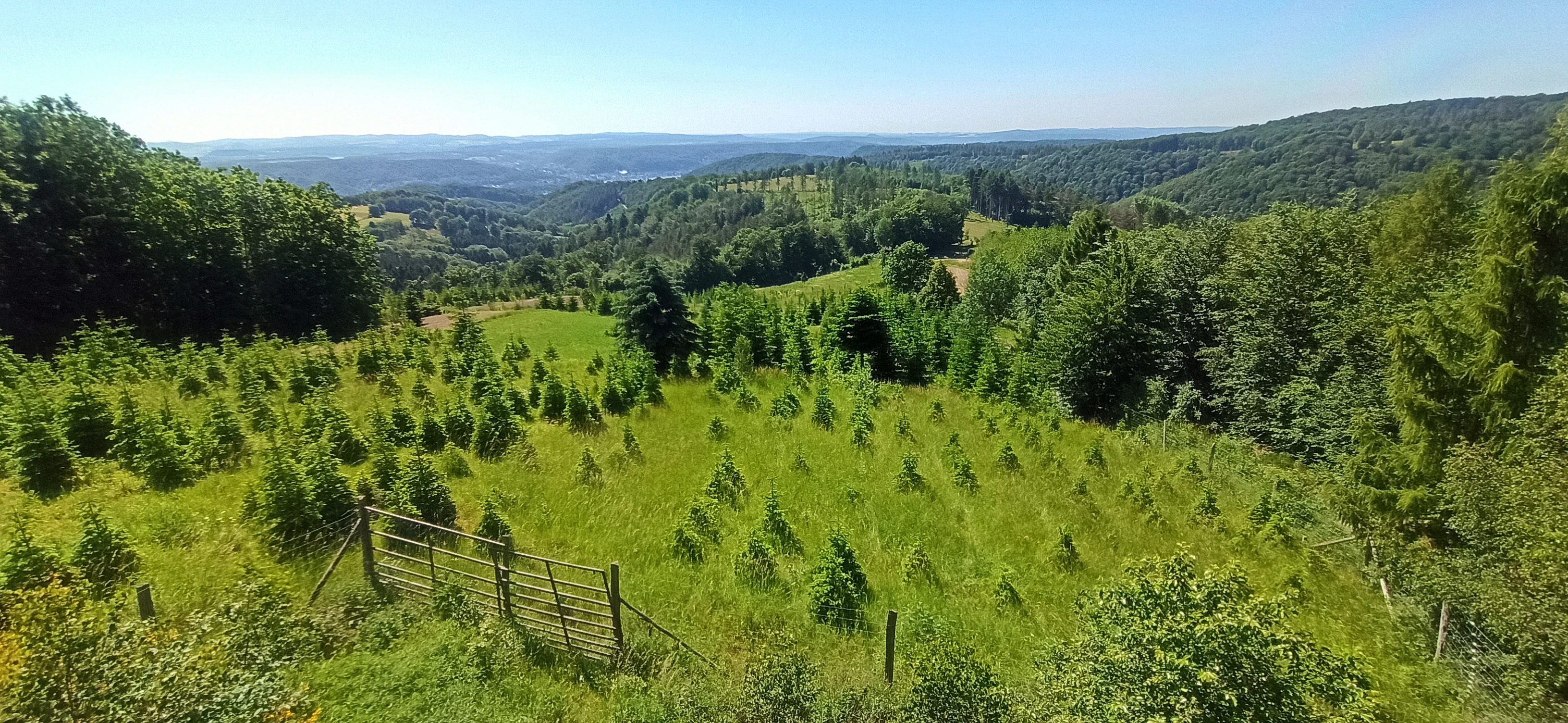
The defining physical feature of Naturpark Rhein-Westerwald is the staircase of landscapes rising eastward from the Rhine. At the lowest level sits the Linzer Terrasse, a right-bank terrace that marks the transition from the river itself to the higher land behind it. From there the surface climbs through the ridges and highlands of the Westerwald, reaching up to the broader plateaus that form the spine of the region's interior.
Geologically, much of the park sits on the Rheinwesterwälder Vulkanrücken, a ridge system shaped by ancient volcanic activity. This substrate has produced a varied terrain of gentle summits, slope forests, and small valleys that contrast with the very different geological makeup of the true Middle Rhine gorge further south. Inland, the Asbacher Hochfläche and the Sayn-Wied-Hochfläche form expansive, gently undulating plateaus used largely for agriculture and forestry.
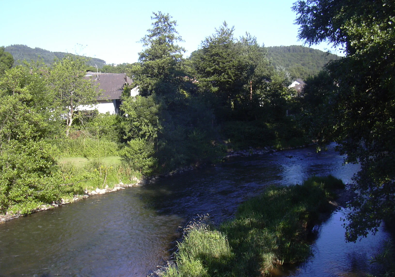
Water shapes the park's interior as well. The Wied and its tributary valleys, including the Waldbreitbacher Wiedtal and the Fockenbachtal, cut into the highlands, creating densely wooded, often steep-sided small valleys famous for their quiet character. These valleys alternate with viewpoints and high forests, and they provide some of the more sheltered and atmospheric walking environments within the park. From the higher ridges and from sites such as the Roman watchtower location in the Rheinbrohler Wald, continuous vistas open westward over the Rhine and across to the Eifel.
Naturpark Rhein-Westerwald ecosystems, habitats, and plant life
Naturpark Rhein-Westerwald preserves a transition zone between riverine lowland, forested valley, and upland plateau habitats. Its forest cover is dominated by mixed deciduous and coniferous stands typical of the lower Westerwald: beech and oak on better soils, with spruce and pine in patches where silviculture has shaped the landscape over centuries. The extensive forest tracts like Rheinbrohler Wald, Heimbacher Wald, and Märker Wald form the ecological backbone of the park and provide the broad, quiet canopy that defines much of the visitor experience.
In the river-adjacent areas near Neuwied and Unkel, ecological conditions shift toward warmer south-facing slopes, dry grasslands, vineyard-adjacent habitats, and communities shaped by the moderating influence of the Rhine valley. Inland, the high plateaus carry more open agricultural land interspersed with field margins, hedgerows, small brook valleys, and forest fragments. This mosaic supports a wide range of species typical of central German low-mountain landscapes.
The five designated core zones of the park: Rheinbrohler Wald, Heimbacher Wald, Märker Wald, Fockenbachtal, and Lahrer Herrlichkeit play a particular role in maintaining natural quiet and ecological integrity. These zones are intended to retain processes of undisturbed forest development and to offer landscapes with minimal noise and visual disturbance, distinguishing the park's deeper interior from its more settled edges.
Naturpark Rhein-Westerwald wildlife and species highlights
The park's animal life reflects the character of central German low-mountain and river-slope habitats. In the wooded valleys of the Wied system and in the larger core forest zones, typical forest species thrive, including red deer, roe deer, and wild boar, alongside smaller mammals such as foxes, martens, and squirrels. The continuity of forest cover through the Rheinbrohler Wald and the adjacent wooded ridges supports stable populations that depend on large, connected woodland.
Bird life is shaped by the same structural diversity. Forest interiors host woodland species including various tits, woodpeckers, and common forest songbirds, while the open plateaus and field margins attract farmland and meadow bird communities. Along the Rhine edge and the warmer south-facing slopes, species with affinities to Mediterranean-influenced river valleys add a different component to the local fauna, including raptors that use the slope forests and the open airspace above the Rhine.
The Wied river system and its tributary brooks, especially within the Fockenbachtal core zone, contribute freshwater habitats that support fish, amphibians, and invertebrate communities adapted to smaller, partly shaded forest streams. Together these patterns give the park a representative cross-section of western German forest, field, and riverine wildlife rather than a single specialized fauna.
Naturpark Rhein-Westerwald conservation status and protection priorities
As one of Germany's oldest nature parks, the area has long been shaped by the goal of conserving a relatively undeveloped rural and forested landscape in the immediate neighborhood of a major industrial and transportation corridor along the Rhine. The 1978 state ordinance explicitly anchors conservation to the preservation of scenic character, beauty, and recreational value of an area that has remained largely free from built development and intrusive land use.
Core zones give the conservation framework an additional structural tier. The Rheinbrohler Wald, Heimbacher Wald, Märker Wald, Fockenbachtal, and Lahrer Herrlichkeit are designated to maintain quieter conditions and to allow natural forest processes greater weight than in the broader park area. Recreation in stillness is recognized as a legitimate conservation purpose in its own right, alongside the more typical goals of habitat and landscape preservation.
The park also plays a connecting role in the wider regional network. Its location between the Middle Rhine valley, the Westerwald, and adjacent protected areas in Rhineland-Palatinate makes it a transitional landscape, both ecologically and in terms of visitor flows. By preserving working forest, agricultural plateaus, river-slope habitats, and quiet valleys under a unified framework, the park helps maintain ecological continuity between the river and the inland highlands.
Naturpark Rhein-Westerwald cultural meaning and human context
The cultural context of the park is layered and largely tied to its position on the eastern side of the Middle Rhine, opposite the more celebrated left-bank sections. The communities within the park area, including Asbach, Bad Hönningen, Dierdorf, Flammersfeld, Linz am Rhein, Puderbach, Rengsdorf-Waldbreitbach, Unkel, and the city of Neuwied, reflect a mix of small agricultural villages, market towns, and historically river-oriented settlements.
A prominent historical feature is the Roman Limes, the former frontier of the Roman Empire, whose preserved right-bank segments run through the forests of the park. Sites associated with this frontier, including watchtower remains, link the landscape to a much older phase of European boundary-making and offer visitors a tangible cultural route through otherwise quiet woodland.
Regional identity is also expressed in the long-standing land-use patterns of the Westerwald: small-scale forestry, mixed agriculture, and a network of villages connected historically through the valleys of the Wied and its tributaries. These traditions continue to shape the visual and social character of the park, distinguishing it from more strictly protected wilderness areas in Germany.
Top sights and standout views in Naturpark Rhein-Westerwald
The combination of right-bank Rhine slopes, the volcanic ridges of the Rheinwesterwälder Vulkanrücken, and the broad inland plateaus gives the park a notably varied topography within a compact footprint. Its five core forest zones, especially the Rheinbrohler Wald and the Wied valley forests, anchor a quiet, deeply wooded interior that contrasts with the open Rhine edge.
Visitors particularly value the long-distance views westward from the higher ridges and from historic sites such as the Roman watchtower location in the Rheinbrohler Wald, as well as the routes through the Wiedtal and the Fockenbachtal. The presence of the Roman Limes adds an unusual cultural dimension for a nature park, allowing walks through forest landscapes that also tell a story of Europe's ancient frontier.
Best time to visit Naturpark Rhein-Westerwald
Spring and early summer are especially rewarding for the park, when the deciduous forests of the Wiedvalley and the core forest zones come into fresh leaf and the bird communities are at their most active. Late spring also tends to offer good visibility from the higher ridges before the higher humidity of mid-summer settles over the plateaus.
Autumn brings strong color to the mixed beech and oak forests of the Westerwald highlands, and clear days at that season open wide views from the Rheinwesterwälder Vulkanrücken westward over the Rhine. Winter visits can be quieter and emphasize the structural character of forests, valleys, and the Rhine terraces, although conditions on exposed ridge sections can be harsher than in the sheltered valleys below. The right-bank Rhine edge generally has milder conditions than the uplands, which can be useful to keep in mind when planning walks that cross both zones.