
Mori Atlas logo
Protected landscapeNaturpark Vesterhavet

Mapping the dramatic transition from North Sea dunes to inland heath and restored wetland systems

Naturpark Vesterhavet: A Layered Coastal Protected Landscape in Western Denmark

Naturpark Vesterhavet encompasses a unique 35 kilometer long coastal corridor on the West Jutland shoreline of Denmark. This protected landscape is defined by its layered mosaic of mobile white dunes, historical dune plantations, open heathlands, and shallow freshwater lakes like the restored Filsø. The park functions as a vital conservation belt, hosting international bird habitats and diverse terrain that shifts from the sandy North Sea edge to the interior plains of the Danish landscape.

coastal nature parkdune landscapeheathlanddune plantationswetlandsrestored lake
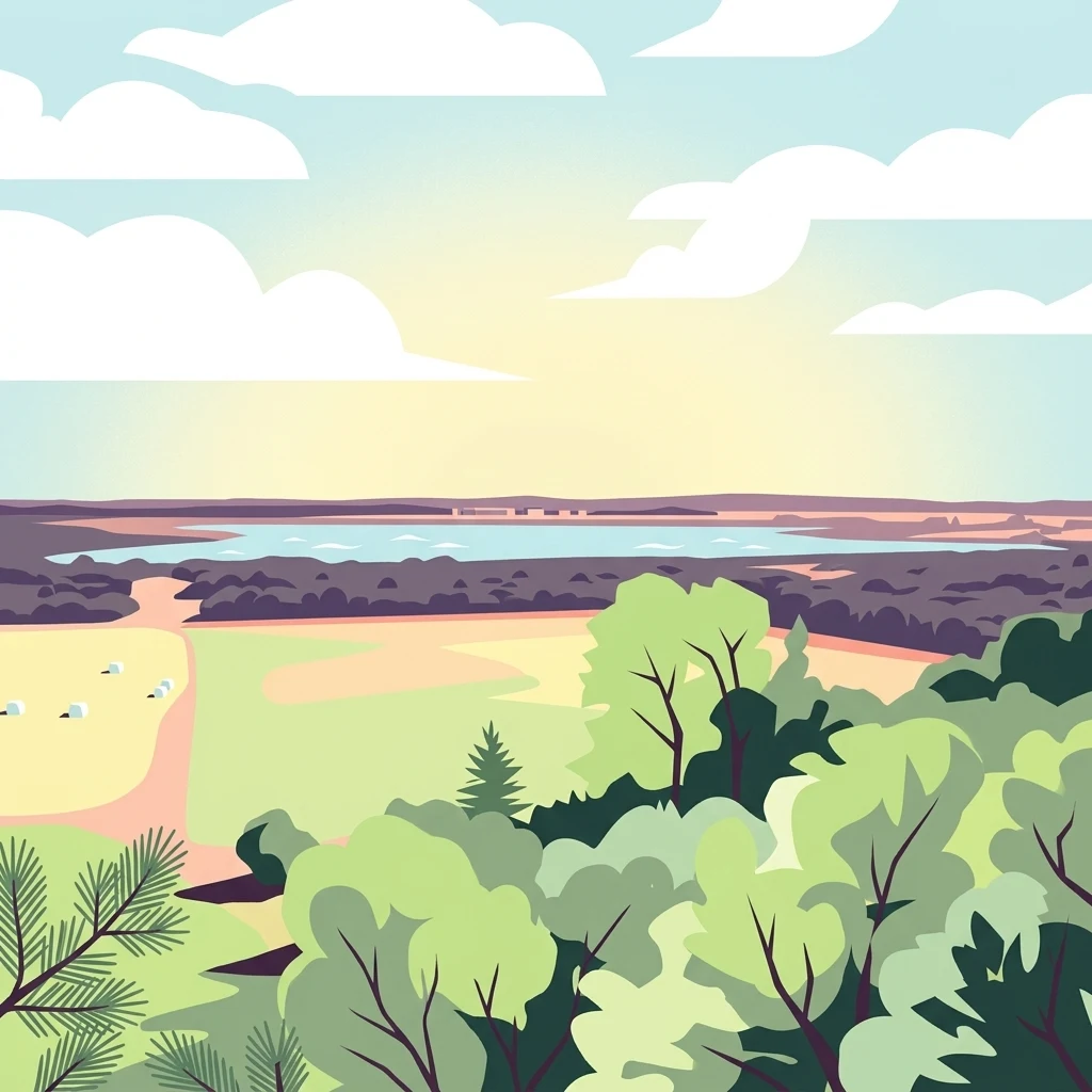
A flat-style digital illustration showing a panoramic coastal landscape with a foreground of green trees, a sandy field, a dark forest strip, and a body of water in the distance under a bright sky with white clouds.

Naturpark Vesterhavet

Protected landscape

Park overview

Structured park overview, official facts, and landscape profile for Naturpark Vesterhavet

Naturpark Vesterhavet park facts, protected area profile, and essential visitor context

Review the core facts for Naturpark Vesterhavet, including designation, size, terrain, visitor scale, habitats, and operating context in one park-focused overview.

About Naturpark Vesterhavet

Naturpark Vesterhavet is a large coastal nature park on the western edge of Jutland, Denmark, designed to protect and showcase the characteristic West Jutland landscape of sea, dunes, heath, plantations, and lakes. The park extends about 35 kilometers along the North Sea coast and reaches roughly nine kilometers inland, forming a continuous belt of protected and managed nature between Blåvandshuk at the northern end and Nymindegab at the southern end.

The park's identity is built around the transition zones where the marine environment of the Wadden Sea and North Sea meets Denmark's inland heath and dune systems. Wide sandy beaches give way to mobile and stabilized dunes, which in many places have been planted with coniferous forests to anchor the sand. Behind these belts lie open heaths, including large protected expanses such as Kallesmærsk Hede and Lyngbos Hede, as well as rare oak scrub at Blåbjerg Egekrat. Scattered through the landscape are coastal lakes like Grærup Langsø and the much larger, restored Filsø, which convert the inland side of the park into a mosaic of shallow wetlands, reedbeds, and meadows.

Ecologically, the park is one of Denmark's most significant coastal conservation areas. Large portions are part of the European Natura 2000 network, and the area contains substantial bird protection zones of European importance. The park also hosts two Ramsar wetlands: the Filsø area in the south and Ringkøbing Fjord with Tipperne in the north. The combination of dunes, heath, freshwater lakes, and marine influence creates a rare diversity of habitats within a single coherent park boundary.

Since its inauguration on 26 April 2015, Naturpark Vesterhavet has been managed as a partnership between local organizations and development councils, reflecting its dual role as a conservation area and a regional destination for outdoor recreation. The park includes an eight kilometer certified Premium hiking route and serves as a hub for nature tourism, birdwatching, and landscape interpretation on the Danish west coast.

Quick facts and research context for Naturpark Vesterhavet

Naturpark Vesterhavet is a roughly 22,500 hectare coastal nature park on Denmark's west coast, forming a nine kilometer wide belt that runs about 35 kilometers along the North Sea between Blåvandshuk and Nymindegab. It is officially recognized as a Danish nature park (naturpark), combining protected habitats with landscape restoration and public use.

Much of the park's territory is internationally protected, including Natura 2000 areas covering Blåbjerg Egekrat, Lyngbos Hede, Hennegårds Klitter, Kallesmærsk Hede, Grærup Langsø, Filsø, and Kærgård Klitplantage, along with two Ramsar wetland sites. The park also contains a Premium hiking route certified by the German Wanderinstitute, and is administered through a local nature park council linking it into regional development and conservation planning.

Protection and recognition

Documented terrestrial protection scope and official designation records

Naturpark Vesterhavet Protection Status and Conservation Recognition Data

Naturpark Vesterhavet features structured documentation detailing terrestrial protection scope and management parameters. Verified conservation records assemble official designation history and international recognition sources into a unified park profile.

Protection details

Protection scope
Terrestrial
Transboundary protection
No
Park context

Deeper park guide and search-rich context for Naturpark Vesterhavet

Naturpark Vesterhavet history, landscape, wildlife, and travel context

Explore Naturpark Vesterhavet through its history, landscape character, ecosystems, wildlife, conservation priorities, cultural context, and seasonal travel timing in a structured park guide built for atlas discovery and search intent.

Why Naturpark Vesterhavet stands out

Naturpark Vesterhavet is especially known for the meeting of the North Sea with classic Danish dune, heath, and planted dune forest landscapes, and for the dramatic wetland restoration at Filsø. The park contains some of Denmark's most important coastal bird habitats, with internationally designated areas supporting migratory and breeding waterbirds. A defining trait is the layered mosaic of landforms that unfold from the beach inland: white coastal dunes, dark coniferous dune plantations, open inland heath, oak scrub, and large shallow lakes. This compressed sequence of protected habitats, combined with Ramsar and Natura 2000 status, makes the park a flagship example of integrated coastal nature conservation in western Denmark.
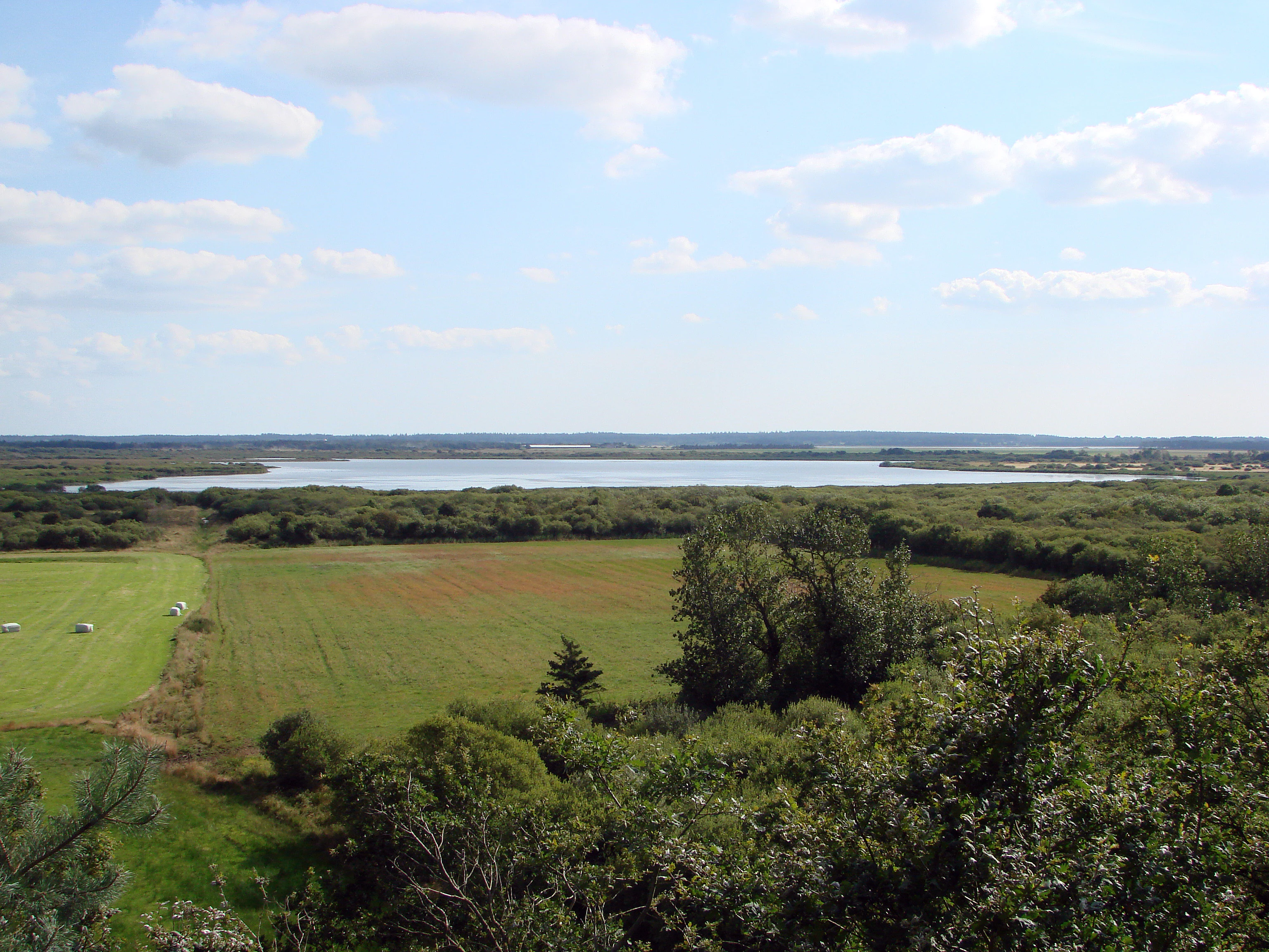
A wide, elevated landscape view featuring a large, calm lake in the distance, surrounded by fields and patches of green forest under a partly cloudy sky.
A view of the Filso lake landscape within Naturpark Vesterhavet, Denmark.

Naturpark Vesterhavet history and protected-area timeline

Naturpark Vesterhavet was officially inaugurated on 26 April 2015, marking the formal establishment of one of Denmark's larger coastal nature parks along the North Sea. Its creation tied together an already heavily protected landscape, consolidating overlapping national, European, and international designations into a single park identity.

Long before the park existed, key areas within it had already received international protection. The Filsø lake and surroundings were designated as Ramsar Area No. 1 in 1977, protecting about 4,248 hectares of wetland. The broader Ringkøbing Fjord system, including Tipperne, Værnengene, and Nymindestrømmen, was also designated in 1977 as Ramsar Area No. 2, overlapping the northern portion of today's park. With the Wadden Sea gaining Ramsar status in 1987 as Ramsar Area No. 27, the southern boundary of the park became bordered by Denmark's most recently listed Ramsar wetland.

Within Denmark, the park's constituent habitats were progressively brought under European protection as part of the Natura 2000 network. These designations, covering dune forests, heathlands, oak scrubs, lakes, and bird areas, gave the area an internationally recognized conservation framework that preceded and shaped the later nature park designation. The decision to formalize Naturpark Vesterhavet reflected both this accumulated protection history and a desire to integrate local development, recreation, and landscape management under one regional structure, supported by a nature park council made up of local organizations and development groups.

A notable cultural milestone within the park is the Blochsgaard hiking route, an approximately eight kilometer long trail that became only the sixth route in Denmark to earn certification as a Premium Hiking Route by the German Wanderinstitute.

Naturpark Vesterhavet landscape and geographic character

Naturpark Vesterhavet is defined by a classic Danish west coast dune and heath landscape, organized as a series of strips running parallel to the North Sea. The northern end is anchored at Blåvandshuk, Denmark's westernmost point, while the southern end reaches Nymindegab where the coast curves inward toward the Ringkøbing Fjord outlet. Between these two points stretches a roughly nine kilometer wide coastal belt about 35 kilometers long.

Along the seaward edge, the park contains wide sandy beaches backed by an active dune belt of pale, mobile sand dunes. Landward of the mobile dunes lie extensive dune plantations, notably Kærgård Klitplantage, where coniferous forests were established historically to stabilize the sands. Behind the plantations, the terrain opens into broad inland heaths such as Kallesmærsk Hede and Lyngbos Hede, characterized by low vegetation, sandy soils, and exposed wind-shaped surfaces.

Set within this dune and heath matrix is a sequence of lakes and wetlands that anchor the park's inland side. Grærup Langsø is a long, narrow dune lake, while the much larger Filsø dominates the southern interior. Filsø, once drained for agriculture and now restored as a shallow freshwater lake with surrounding reedbeds and meadows, dramatically shapes the park's contemporary landscape. Together, the alternating bands of beach, dune, plantation, heath, scrub, and wetland give the park a strongly layered and visually distinct character.

Naturpark Vesterhavet ecosystems, habitats, and plant life

The habitats of Naturpark Vesterhavet form a compressed sequence of coastal and inland ecosystems within a relatively narrow belt. Closest to the North Sea are open sandy beaches and active white dunes, supporting salt-tolerant pioneer vegetation and specialized invertebrates adapted to shifting sand.

Behind the active dunes, planted dune forests create shady, acidic landscapes dominated by conifers, with their own characteristic ground flora. Further inland, the landscape transitions into extensive inland heaths characterized by heather, grasses, and exposed sandy soils. These heath areas include rare oak scrub formations, most notably Blåbjerg Egekrat, where isolated oak growth on former dunes creates a habitat type found in only a few places in Denmark.

The park's most ecologically distinctive habitats are its wetlands. The restored Filsø lake and its surrounding reedbeds, meadows, and shallow water zones represent one of the largest wetland restoration projects in Denmark, providing habitat for waterbirds, waders, and wetland vegetation communities. Other inland lakes, including Grærup Langsø, add to the freshwater habitat diversity. The influence of the nearby Wadden Sea and Ringkøbing Fjord further strengthens the park's ecological character, linking freshwater, brackish, and marine systems along a short geographic gradient.

Naturpark Vesterhavet wildlife and species highlights

Naturpark Vesterhavet is of significant international importance for birds, and its wildlife profile is dominated by waterbirds, waders, and seabirds that rely on the combination of coastal lakes, heath edges, dunes, and adjacent marine habitat. The park includes several European bird protection zones, particularly around the Filsø area, where wetland restoration has created high-value feeding and breeding habitat.

Around Blåvandshuk in the north, the meeting of North Sea currents, beaches, and dune lakes attracts rare bird species, and the area is recognized as a notable birdwatching destination in Denmark. Near Nymindegab, the overlap with Ringkøbing Fjord and Tipperne adds another major waterbird area, with mudflats, meadows, and shallow water that traditionally support large flocks of geese, ducks, and waders.

The heathlands and dune plantations host characteristic inland fauna, including deer and smaller mammals typical of West Jutland's open sandy landscapes. Insects and reptiles associated with dry, warm heath and dune habitats also find refuge in the park's less disturbed areas. Although the park is not primarily known as a large mammal reserve, its combination of freshwater wetlands, heath, and dune habitats gives it a rich and varied birdlife that draws much of its conservation significance.

Naturpark Vesterhavet conservation status and protection priorities

Naturpark Vesterhavet sits at the center of a layered conservation framework spanning national, European, and international designations. Much of the park's territory falls within the Natura 2000 network, including sites that protect heathlands, oak scrubs, dune plantations, lakes, and important bird habitats. These designations reflect the park's role in maintaining rare and threatened Danish habitat types, particularly inland heath and oak-on-dune vegetation.

The park contains two Ramsar wetlands of international importance. The Filsø area, designated in 1977 and covering 4,248 hectares of protected land, was dramatically transformed through restoration from drained farmland back into a large shallow lake and wetland complex. Ringkøbing Fjord, Tipperne, Værnengene, and Nymindestrømmen form a second Ramsar area overlapping the park in the north, while the Wadden Sea Ramsar site borders the park to the south.

A local nature park council, anchored in regional organizations and development councils, coordinates the ongoing management of the park. Conservation priorities include maintaining open heath landscapes, protecting dune and oak habitats, securing breeding and resting areas for waterbirds, and ensuring the long-term ecological value of the restored Filsø wetland. The park thus functions both as a working example of integrated coastal nature conservation and as a demonstration of how Danish nature parks combine habitat protection with regional sustainability goals.

Naturpark Vesterhavet cultural meaning and human context

Naturpark Vesterhavet's cultural context is closely tied to the rural and coastal identity of West Jutland. The landscape has historically been shaped by human attempts to manage shifting sands, stabilize dunes through plantations, and use inland heaths and coastal meadows for grazing and small-scale agriculture. Many of the dune plantations and inland heaths in the park today are the result of generations of human land management.

The restoration of Filsø stands as a particularly important cultural and environmental moment, reflecting a shift from 19th and 20th century drainage and cultivation toward modern wetland restoration. Local organizations and development councils play a central role in the park's governance, reinforcing a tradition of community-based stewardship of West Jutland's natural landscapes.

The park also serves as a setting for outdoor recreation traditions such as hiking, with the certified Blochsgaard Premium route marking a formal acknowledgment of the area's role as a place of nature-based cultural experience on Denmark's west coast.

Top sights and standout views in Naturpark Vesterhavet

Naturpark Vesterhavet's standout qualities include the dramatic gradient from the North Sea across dunes, plantations, heath, and inland lakes within a few kilometers, and the presence of two Ramsar wetlands plus multiple Natura 2000 sites within a single park boundary. The restored Filsø lake, the protected heathlands of Kallesmærsk Hede and Lyngbos Hede, the rare Blåbjerg oak scrub, and the bird-rich northern coast near Blåvandshuk together define the park's ecological identity.

Best time to visit Naturpark Vesterhavet

The park's coastal and heath landscapes can be experienced meaningfully across much of the year, but the character of a visit shifts notably with the seasons. Late spring and summer typically bring the most active birdlife around Filsø and the coastal lakes, with calmer weather suited to longer hiking routes such as the Blochsgaard Premium trail.

Autumn and winter tend to emphasize the open, atmospheric quality of the heath and dune landscapes, when migratory waterbirds concentrate at Filsø, Tipperne, and the Ringkøbing Fjord edges. Migration periods in spring and autumn are particularly rewarding for birdwatchers, while summer offers the broadest opportunities for combining walking, beach time, and wetland exploration.

Monthly climate preview

Long term representative point measurements tracking monthly averages across the protected area

Naturpark Vesterhavet Climate Normals, Annual Temperature and Precipitation Rhythm

Representative coordinates record sustained temperature variations and monthly precipitation rates spanning twelve distinct periods across Naturpark Vesterhavet. Examining the complete twelve month climatology profile reveals broader environmental patterns observed at a standardized five meter elevation.
Annual mean9 °C
3 °C17 °C
Jan
Feb
Mar
Apr
May11°
Jun14°
Jul17°
Aug17°
Sep15°
Oct11°
Nov
Dec
Warmest month
August

17.2 °C

Coolest month
February

2.6 °C

Wettest month
October

3.1 mm/day

Driest month
April

1.4 mm/day

Park location guide

Geography guide, regional context, and park location map for Naturpark Vesterhavet

Naturpark Vesterhavet park geography, regions, and map view in Denmark

Understand where Naturpark Vesterhavet sits in Denmark through a broader geographic reading of the surrounding landscape, nearby location context, and its mapped position within the national park landscape.

How Naturpark Vesterhavet fits into Denmark

Denmark is a constitutional monarchy and Nordic country in Northern Europe. It is the southernmost of the Scandinavian countries, bordering Germany to the south, Norway to the north, and Sweden to the southwest. The country consists of the Jutland peninsula and an archipelago of islands, with Copenhagen as its capital and largest city. Denmark has a population of over 6 million and is characterized by flat, arable land, sandy coasts, and a temperate climate.

Wider geography shaping Naturpark Vesterhavet in Denmark

Denmark occupies the Jutland peninsula and roughly 406 islands in Northern Europe. It is situated between the North Sea to the west and the Baltic Sea to the east. The country borders Germany to the south and is connected to Sweden via the Øresund Bridge. Denmark is predominantly flat terrain with low elevation, the highest point being Møllehøj at 170.86 meters.

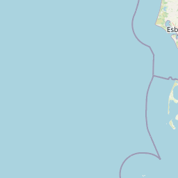
Map view of Naturpark Vesterhavet

Use this park location map to pinpoint Naturpark Vesterhavet in Denmark, understand its exact geographic position, and read its mapped placement within the surrounding landscape more clearly.

Pigeon | © OpenStreetMap contributors

Visualizing coastal dunes, heathlands, and wetland habitats

Naturpark Vesterhavet Photos and Landscape Scenery

Explore curated photography of Naturpark Vesterhavet to examine its layered coastal terrain, expansive dune plantations, and restored lake environments. Visual documentation reveals the distinct topography and habitat diversity shaping the protected West Jutland shoreline.

A wide, elevated landscape view featuring a large, calm lake in the distance, surrounded by fields and patches of green forest under a partly cloudy sky.

Park atlas

Compare surrounding coastal landscapes and regional conservation areas

Explore Protected Areas and Parks Near Naturpark Vesterhavet

Browse other protected areas near Naturpark Vesterhavet to evaluate similar coastal dune formations, heathlands, and wetland ecosystems across the region. Extending the geographic review helps place local West Jutland terrain into a broader framework of regional conservation landscapes.
National parkDenmark
About 6.7 km away#1 closest

Southeast

Wadden Sea National Park: Denmark's Premier Tidal Wetland and Migratory Bird Sanctuary

Mapped boundaries and unique protected landscape exploration.

Wadden Sea National Park is a vast national park encompassing the Danish portion of the Wadden Sea, a globally significant tidal wetland. Recognized for its critical role in bird migration, hosting millions of birds annually, it features a distinctive landscape of tidal flats, salt marshes, coastal dunes, and barrier islands. This protected area offers a unique lens through which to explore dynamic coastal geography, intertidal ecosystems, and the conservation of a World Heritage Site.

Area
1,466 km²
Established
2010
IUCN
II
Relief
Lowland
A pale watercolor landscape painting of a quiet fjord with soft green and pink marshy vegetation in the foreground and rolling hills in the background.
Protected areaRegion Midtjylland
About 13 km away#2 closest

North

Ringkøbing Fjord og Nymindestrømmen: Coastal Lagoon and Protected Wetland Geography

A vast Danish wetland complex in Region Midtjylland.

Ringkøbing Fjord og Nymindestrømmen defines the Danish west coast through its unique combination of brackish lagoons, salt meadows, and dune belts. This protected area integrates the Skjern Å river delta and the freshwater-lagoon chain of Nymindestrømmen, creating an internationally significant habitat for diverse waterbirds and migratory species across its multi-layered terrain.

Area
276.84 km²
Relief
Lowland
Climate
Temperate
Scope
Mixed
Watercolor painting of a green salt marsh landscape with a winding river and wildflowers.
Protected areaDenmark
About 17 km away#3 closest

Southeast

Skallingen Protected Area: Geography and Coastal Dynamics in the Danish Wadden Sea

Coastal peninsula landscape and tidal wetland geography

Skallingen is an active, naturally formed peninsula in Denmark, characterized by its horizontal gradients of beach, dune, and marsh. As a protected area within the wider Wadden Sea ecosystem, the land showcases the raw interplay of sediment and sea, offering a distinct look at one of Europe's most significant intertidal landscapes and its layered historical legacy.

Area
20 km²
Established
1634
Relief
Lowland
Climate
Temperate
Protected areaRegion Midtjylland
About 28 km away#4 closest

Northeast

Lønborg Hede Protected Area: Heathland Geography and Mire Ecosystems in Denmark

Detailed landscape analysis of a unique Central Jutland nature reserve

Lønborg Hede is a distinctive protected area featuring a rare micro-topographic gradient where inland dune heath rises 15 meters above wet bog and mire environments. This site provides a concentrated look at western Jutland's historical heathland character, featuring a mosaic of nutrient-poor aquatic habitats and diverse ground-nesting bird environments across 350 hectares.

Area
3.53 km²
Established
1970
Relief
Lowland
Scope
Terrestrial
Nature reserveCentral Denmark Region
About 41 km away#5 closest

Northeast

Borris Hede Nature Reserve: Mapping the Protected Heathland of the Central Denmark Region

Glacial plains, wetland mosaics, and habitat conservation zones

Borris Hede encompasses a massive stretch of sandy outwash plain in central-western Denmark. This nature reserve serves as a vital habitat mosaic, ranging from dry and wet heath to bogs and riparian stream corridors. By preserving these open terrain characteristics, the site supports specialized birdlife and maintains one of the most distinctive geological and biological landscapes within the Danish geography.

Area
47.78 km²
Established
1903
Relief
Lowland
Climate
Temperate
Nature reserveRegion Midtjylland
About 41 km away#6 closest

Northeast

Natura 2000-område nr. 68 Skjern Å: Protected Riverine Geography and Valley Landscapes

A central Jutland nature reserve featuring glacial valley systems

Explore the geographic boundary and habitat diversity of Natura 2000-område nr. 68 Skjern Å. This protected landscape preserves the vital connection between freshwater river channels, raised bogs, and open heathland, serving as a landmark for regional river management and biodiversity conservation in western Denmark.

Area
25.8 km²
Established
2011
Protected areaDenmark
About 58 km away#7 closest

North

Natura 2000 area no. 66 Stadil Fjord og Vest Stadil Fjord Coastal Wetland Complex

Protected lagoon and dune landscape in western Jutland, Denmark.

Natura 2000 area no. 66 Stadil Fjord og Vest Stadil Fjord comprises a significant coastal lagoon system, encompassing shallow brackish waters, reed beds, and surrounding dune heaths. This protected area supports a high degree of botanical diversity and provides essential habitat for various bird species, serving as a primary example of Denmark's complex hydrological and coastal geography.

Area
69.03 km²
Relief
Lowland
Climate
Temperate
Access
Easy access
Protected areaRegion Midtjylland
About 59 km away#8 closest

North

Kimmelkær Landkanal: Mapped Protected Area and Regional Geography in Midtjylland

A rare aquatic habitat within the Ringkøbing Fjord water system.

Focusing on a narrow canal corridor, Kimmelkær Landkanal serves as a vital protected area for threatened aquatic species. Its geography is characterized by soft sandy sediments and a distinct parallel channel structure, connecting small watercourses to the larger wetland ecosystems of the Stadil Fjord catchment area.

Area
0.03 km²
Established
2011
Relief
Lowland
Scope
Terrestrial

Common questions about visiting, size, designation, and location context for Naturpark Vesterhavet

Naturpark Vesterhavet FAQs for park facts, access, geography, and protected area context

Find quick answers about Naturpark Vesterhavet, including protected-area facts, park geography, trail and visitor context, and how the park fits into its surrounding country and regional landscape.
MoriAtlas Explorer

Continue Your Protected Areas Search Across the Global Atlas

Deepen your exploration by continuing the structured search for national parks and protected areas worldwide. Utilize the comprehensive filtering capabilities to compare different conservation landscapes and refine your understanding of global park geography. Discover more about the distribution and characteristics of protected natural areas.

Global natural geography