
Mori Atlas logo
Nature reserveNaturschutzgebiet Abgrabung Stemmen

Exploring the post-industrial landscape and heterogeneous habitat mosaic in Kreis Lippe

Naturschutzgebiet Abgrabung Stemmen: Mapping the Ecological Value of a Protected Nature Reserve

Naturschutzgebiet Abgrabung Stemmen represents a significant example of secondary habitat succession within a former sand and gravel quarry. Located in the municipality of Kalletal within the Kreis Lippe district, this protected area spans approximately 20 hectares. The site features a complex topography of settling basins, embankments, and reed-fringed ponds that provide refuge for specialized flora and fauna, showcasing how managed intervention creates enduring ecological value.

post-mining landscapeformer quarrynature reserveNorth Rhine-WestphaliaKalletalKreis Lippe
A flat vector illustration of a scenic landscape featuring a winding river in the foreground, rolling green hills, a diverse forest with various tree types, and soft clouds under a pastel sky.

Naturschutzgebiet Abgrabung Stemmen

Nature reserve

Park overview

Structured park overview, official facts, and landscape profile for Naturschutzgebiet Abgrabung Stemmen

Naturschutzgebiet Abgrabung Stemmen park facts, protected area profile, and essential visitor context

Review the core facts for Naturschutzgebiet Abgrabung Stemmen, including designation, size, terrain, visitor scale, habitats, and operating context in one park-focused overview.

About Naturschutzgebiet Abgrabung Stemmen

Naturschutzgebiet Abgrabung Stemmen is a small protected nature reserve in the Lippe district of eastern North Rhine-Westphalia. Covering approximately 20 hectares just east of the village of Stemmen, it represents a deliberate effort to preserve the ecological legacy of a former industrial site. The quarry, originally operated for the extraction of sand and gravel, has been allowed to evolve into a patchwork of plant communities that would be unlikely to occur in the surrounding intensively used agricultural landscape.

Structurally, the reserve is shaped by its industrial past. Former settling basins, access tracks, and spoil mounds give the terrain a varied relief, while deeper areas hold a silted-up pond bordered by reed bed. Recultivated grassland occupies parts of the western section, and older oak stands persist in the southwestern corner, lending the site a layered vegetation history that complements the younger pioneer communities.

The Biologische Station Lippe prepared a care and development plan in 1996 and 1997 that catalogued the site's biodiversity. Notable plant records included Barestem Hedgemustard, Mountain Sandbell, Dyer's Greenweed, Small Bird's-foot, and Spotted Orchid, alongside a faunal inventory that captured Marsh Warbler, Hen Harrier, Wall Brown butterfly, Speckled Wood, Kidney-spot Blue, Tree Frog, and Sand Lizard. Sand-poor grassland and dry heath communities that were once present have since been lost to natural succession, giving the reserve a dynamic character that reflects ongoing ecological change.

Quick facts and research context for Naturschutzgebiet Abgrabung Stemmen

The reserve covers about 20 hectares east of Stemmen within the municipality of Kalletal in Kreis Lippe, North Rhine-Westphalia, and reaches east to the state border with Lower Saxony. It safeguards a former sand and gravel extraction site that has developed into a mosaic of secondary habitats including reed beds, willow pioneer woodland, ruderal grasslands, and old oak stands.

First protected in 1995 under Landscape Plan No. 4 Kalletal and re-designated in 2004, the site is officially catalogued as LIP-032 in the North Rhine-Westphalian nature conservation information system. Its declared purposes include preserving habitats for wild plant and animal species, maintaining and developing these anthropogenic secondary biotopes as refuges for threatened species, and supporting scientific and Earth-historical study of the area.

Protection and recognition

Official protected area designation data and international recognition metrics

Naturschutzgebiet Abgrabung Stemmen Protection Status and WDPA Records

Naturschutzgebiet Abgrabung Stemmen preserves documented conservation metrics and administrative boundaries within official protected area databases. Structured records assemble verified designation parameters and management scope for geographic reference.

Protection details

WDPA ID
318079
Park context

Deeper park guide and search-rich context for Naturschutzgebiet Abgrabung Stemmen

Naturschutzgebiet Abgrabung Stemmen history, landscape, wildlife, and travel context

Explore Naturschutzgebiet Abgrabung Stemmen through its history, landscape character, ecosystems, wildlife, conservation priorities, cultural context, and seasonal travel timing in a structured park guide built for atlas discovery and search intent.

Why Naturschutzgebiet Abgrabung Stemmen stands out

The reserve is best known for the way a former sand and gravel quarry has been transformed into a refuge for threatened species. Its mix of settling basins, embankments, willow pioneer woodland, reed-fringed ponds, ruderal vegetation, and surviving oak stands creates a remarkably heterogeneous habitat mosaic within a very small footprint. It is also notable for the presence of rare plants and animals in an apparently ordinary post-mining setting, including documented populations of Dyer's Greenweed, Spotted Orchid, Tree Frog, Hen Harrier, and Wall Lizard. The site stands as an example of how abandoned extraction sites can become ecologically valuable secondary landscapes when actively managed.
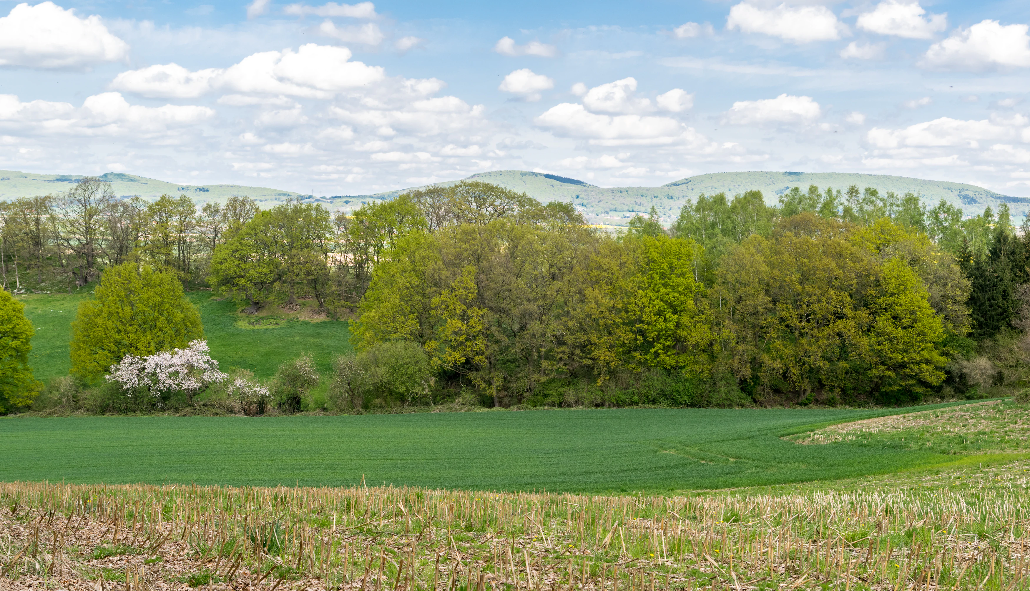
A green field leads toward a line of deciduous trees and rolling hills under a cloudy blue sky.
The green landscape of the Naturschutzgebiet Abgrabung Stemmen nature reserve in Kalletal.

Naturschutzgebiet Abgrabung Stemmen history and protected-area timeline

The reserve emerged from a working sand and gravel quarry whose extraction activities shaped the topography and substrate still visible today. Once mining operations ceased, the site entered a transitional phase in which former settling basins, haul roads, and embankments began to be colonised by pioneer vegetation and gradually more established plant communities.

Formal protection began in 1995, when the district council of Kreis Lippe designated the area as a Naturschutzgebiet under Landscape Plan No. 4 Kalletal. A decade later, in 2004, the council readopted the protection status through a revised landscape plan, recognising the site's continued ecological significance. Between these two designations, the Biologische Station Lippe completed a care and development plan in 1996 and 1997 that documented both the habitats and the threatened species present, providing a baseline for ongoing habitat management.

To the east of the protected boundary, extraction of sand and gravel has continued into Lower Saxony, leaving a sharp juxtaposition between active industrial land use and the conservation-focused landscape within the reserve.

Naturschutzgebiet Abgrabung Stemmen landscape and geographic character

The physical landscape of the reserve is unusually varied for such a small area because it reflects the geometry of former quarry operations. Former settling basins, embankments, and access roads create a relief that alternates between shallow basins, raised spoil mounds, and sloping banks, offering multiple microhabitats within a limited footprint.

A silted-up pond occupies the lowest part of the site and is fringed by a stand of reed, while the higher ground to the west preserves larger open areas dominated by ruderal vegetation. Recultivated grassland is found in parts of the western zone, and willow-birch pioneer woodland with shrub communities has established on the eastern settling basins. Older oak stands survive in the southwestern corner, providing a contrast to the younger, more dynamic vegetation elsewhere.
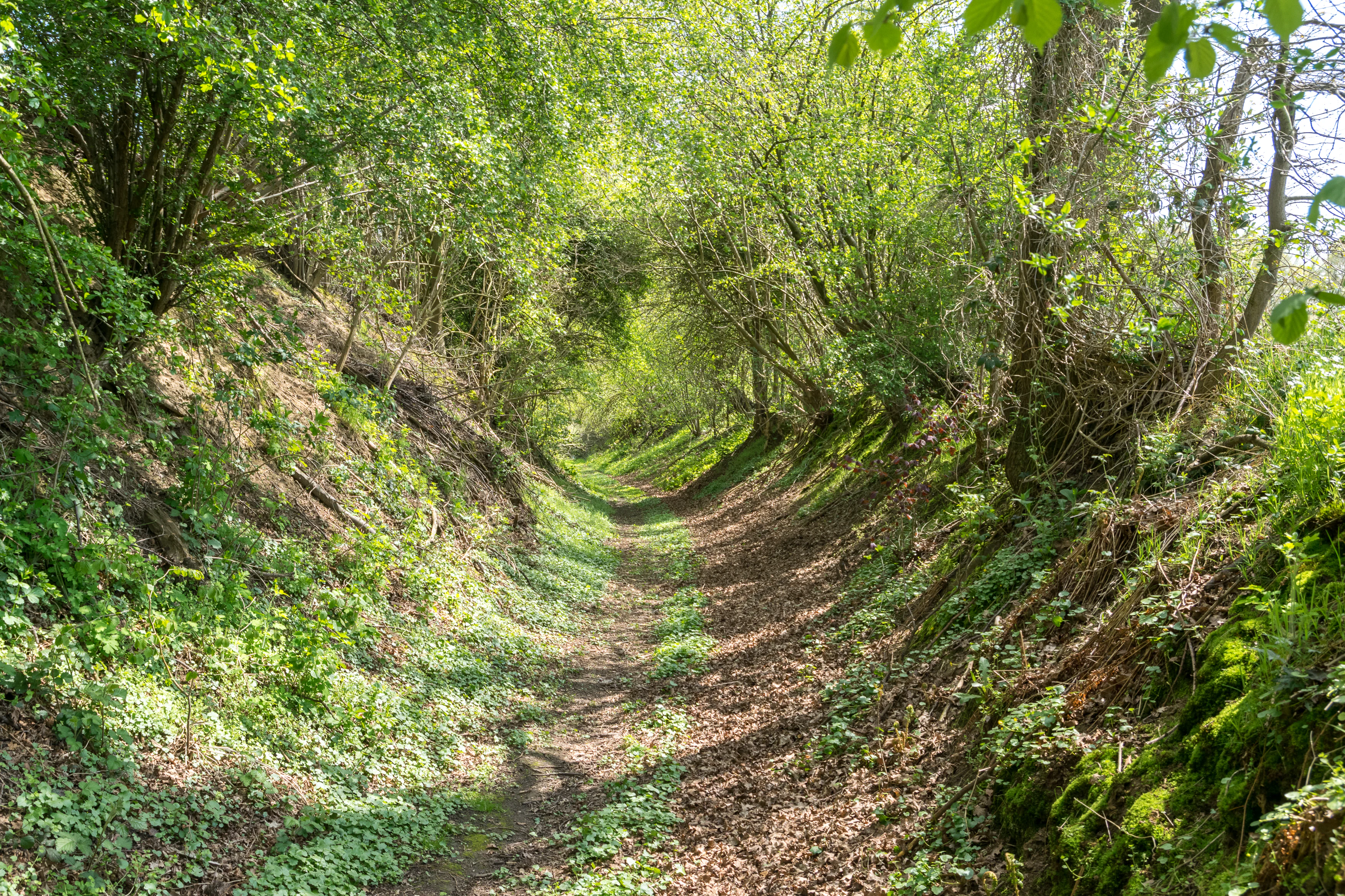
A narrow, dirt hiking trail carved between sloped, tree-lined embankments, with dense foliage creating a tunnel-like canopy overhead.
A shaded earthen path winding through the lush greenery of the Naturschutzgebiet Abgrabung Stemmen.

Naturschutzgebiet Abgrabung Stemmen ecosystems, habitats, and plant life

Ecologically, the reserve is defined by the interaction between post-industrial substrates and encroaching vegetation. Sandy and gravelly soils left by the former quarry operations have supported open ruderal communities and pioneer woodland rather than closed forest, while the wetter settling basins have given rise to reed-dominated wetland vegetation.

The combination of dry, sandy terrain, damp basins, scrub, and veteran oaks creates conditions for a wide range of plant communities within close proximity. Ruderal flora, including goldenrod and land reedgrass, dominates former access tracks, while pioneer scrub of goat willow and bramble encroaches at the margins. The 1996 and 1997 survey recorded several regionally uncommon plant species, underlining the importance of this small habitat mosaic for botanical diversity.

Naturschutzgebiet Abgrabung Stemmen wildlife and species highlights

Wildlife interest at the reserve is high relative to its size, reflecting the diversity of habitats and the careful management by the Biologische Station Lippe. Bird records include Marsh Warbler, a species associated with reed and tall herb vegetation, and Hen Harrier, a raptor of open landscapes that passes through or hunts over such sites.

Reptiles and amphibians are a particular feature, with confirmed populations of Tree Frog in wetter habitats and Sand Lizard in the dry, sandy sections. Butterflies add a further dimension to the fauna, with Wall Brown, Speckled Wood, and Kidney-spot Blue all documented in the management plan. The mix of dry sandy substrate, scrub, reed, and old trees collectively supports an unusually rich assemblage of invertebrates and vertebrates for a former industrial site.

Naturschutzgebiet Abgrabung Stemmen conservation status and protection priorities

The reserve's conservation significance rests on its role as a refuge for threatened species within an otherwise intensively used agricultural and rural landscape. By preserving a mosaic of dry sandy ruderal habitats, reed beds, scrub, and older oak woodland in close proximity, it safeguards ecological conditions that have largely disappeared from the surrounding countryside.

Protection was first granted in 1995 and reaffirmed in 2004, with formal objectives that emphasise preserving habitats of wild plant and animal species, maintaining and developing the site's secondary biotopes as substitute habitats for threatened organisms, and supporting scientific, natural-historical, and Earth-historical study. The Biologische Station Lippe's care and development plan provides an ongoing framework for monitoring and management, even though natural succession has already led to the loss of former sand-poor grassland and dry heath communities.

Top sights and standout views in Naturschutzgebiet Abgrabung Stemmen

Abgrabung Stemmen is distinguished by the ecological richness that has developed on a former quarry site, with rare plants such as Dyer's Greenweed and Spotted Orchid recorded alongside Marsh Warbler, Hen Harrier, Tree Frog, and Wall Lizard.

The reserve's layered history of extraction, abandonment, succession, and conservation planning makes it a particularly clear example of how secondary habitats can take on real conservation value when actively managed.


Monthly climate preview

Long-term representative point measurements tracking monthly temperature and precipitation patterns

Naturschutzgebiet Abgrabung Stemmen Climate Normals and Annual Temperature Rhythm

Historical data records mean monthly temperatures spanning from near freezing up to warm summer maximums alongside steady daily precipitation rates across the year. Reviewing this detailed twelve-month climate profile helps clarify the long-term environmental patterns recorded at representative park coordinates.
Annual mean9 °C
1 °C18 °C
Jan
Feb
Mar
Apr
May13°
Jun16°
Jul18°
Aug18°
Sep14°
Oct
Nov
Dec
Warmest month
July

18.1 °C

Coolest month
January

0.5 °C

Wettest month
December

2.6 mm/day

Driest month
April

1.6 mm/day

Park location guide

Geography guide, regional context, and park location map for Naturschutzgebiet Abgrabung Stemmen

Naturschutzgebiet Abgrabung Stemmen park geography, regions, and map view in Germany

Understand where Naturschutzgebiet Abgrabung Stemmen sits in Germany through a broader geographic reading of the surrounding landscape, nearby location context, and its mapped position within the national park landscape.

How Naturschutzgebiet Abgrabung Stemmen fits into Germany

Germany is a federal republic in Western and Central Europe with a population of over 83 million across sixteen constituent states. It is Europe's largest economy by nominal GDP and a major global exporter and importer. The capital is Berlin, and the country borders Denmark, Poland, Czech Republic, Austria, Switzerland, France, Luxembourg, Belgium, and the Netherlands.

Wider geography shaping Naturschutzgebiet Abgrabung Stemmen in Germany

Germany is located in Western and Central Europe, spanning 357,022 km². It borders Denmark to the north, Poland and the Czech Republic to the east, Austria and Switzerland to the south, and France, Luxembourg, Belgium, and the Netherlands to the west. The country has coastlines on the Baltic Sea and North Sea to the north, with the Alps located in the southern region.

Map view of Naturschutzgebiet Abgrabung Stemmen

Use this park location map to pinpoint Naturschutzgebiet Abgrabung Stemmen in Germany, understand its exact geographic position, and read its mapped placement within the surrounding landscape more clearly.

Pigeon | © OpenStreetMap contributors

Location context for Naturschutzgebiet Abgrabung Stemmen

Kreis Lippe

Visualizing the post-mining terrain, pioneer woodland, and secondary habitats of the reserve

Naturschutzgebiet Abgrabung Stemmen Photos and Landscape Scenery

Visual records capture the distinctive post-industrial terrain, settling basins, and regenerating pioneer woodland across Naturschutzgebiet Abgrabung Stemmen. Studying these photographs helps researchers evaluate secondary habitat succession, rare plant distribution, and protected-landscape character within the reserve.

A green field leads toward a line of deciduous trees and rolling hills under a cloudy blue sky.

A narrow dirt hiking path leads into a deciduous forest, surrounded by a carpet of small white wildflowers covering the grassy woodland floor.

A narrow, dirt hiking trail carved between sloped, tree-lined embankments, with dense foliage creating a tunnel-like canopy overhead.

Park atlas

Explore nearby nature reserves and regional conservation landscapes

Parks Near Naturschutzgebiet Abgrabung Stemmen And Surrounding Protected Areas

Compare Naturschutzgebiet Abgrabung Stemmen with other protected natural areas and secondary habitats across the surrounding North Rhine Westphalia region. Evaluating adjacent park geography reveals broader ecological patterns and unique post industrial conservation networks.
A watercolor painting showing a soft, green landscape with gentle rolling hills and a stream flowing through a grassy area.
Nature reserveKreis Lippe
About 11 km away#1 closest

South

Quellbereich der Osterkalle: Protected Nature Reserve and Kastental Valley Atlas

A preserved stream valley landscape in Kreis Lippe

Quellbereich der Osterkalle is a protected nature reserve encompassing roughly 23 hectares of stream valley and hillside habitat. Defined by its characteristic box-shaped Kastental profile, the reserve maintains a near-natural brook system surrounded by riparian trees, wet meadows, and traditional sheep-grazed slopes within the Kreis Lippe district.

Area
0.23 km²
Established
1995
Relief
Upland
Scope
Terrestrial
A watercolor illustration of a rural landscape with a single prominent tree in the foreground, green hills in the distance, and soft fields in between.
Nature reserveNordrhein-Westfalen
About 11 km away#2 closest

Southwest

Kleiner Selberg Nature Reserve: Protected Landscape and Geographic Mapping

Essential geographic context for the Lipper Bergland protected areas

Kleiner Selberg stands as a prominent hill and nature reserve within the Kreis Herford region. Its landscape is defined by a dense population of juniper shrubs and restored heathland, offering a vital ecological corridor in the Weserbergland. Explore the spatial arrangement of its woodland patches and pasture slopes that characterize this protected hill environment.

Area
0.136 km²
Established
1971
Relief
Mountain
Climate
Temperate
Nature reserveNorth Rhine-Westphalia
About 12 km away#3 closest

Northwest

Wittekindsberg Nature Reserve: Mapping Protected Forests and Jurassic Cliffs in Germany

A conservation-focused geographic analysis of the Wiehengebirge ridge

Wittekindsberg Nature Reserve represents a key protected landscape in northeastern North Rhine-Westphalia. Spanning the crest of the Wiehengebirge, the area is characterized by a mosaic of beech-dominated forests and Jurassic-age geological features. This atlas entry provides essential context on the reserve's topography, cliff-face habitats, and its role as a representative ecological site within the larger Natura 2000 network of the region.

Area
1.143 km²
Established
1990
IUCN
IV
Relief
Mountain
A watercolor illustration of a calm stream flowing through a green valley with trees and gentle hills in the background.
Nature reserveNorth Rhine-Westphalia
About 15 km away#4 closest

West

Naturschutzgebiet Mittelbach Nature Reserve: Mapped Protected Landscapes in Vlotho

Classic Siek stream valley geography and riparian woodland habitats

The Naturschutzgebiet Mittelbach is a protected area in eastern Westphalia that defines the local landscape with its deeply cut moisture-rich valley. This site serves as a vital reference for the traditional Ravensberger Siek morphology, preserving a compact ecological network of sedge communities, beech forest patches, and riparian alder stands along a two-kilometer stream stretch.

Area
0.341 km²
Established
1998
Relief
Upland
Climate
Temperate
A watercolor painting showing a stylized landscape with rolling green hills, a winding path or stream, and distant purple mountains against a white background.
Nature reserveNorth Rhine-Westphalia
About 16 km away#5 closest

Southwest

Ilse Nature Reserve: Protected Stream Corridor and Floodplain Geography in North Rhine-Westphalia

Mapped riparian habitats and regional conservation landscape context.

Ilse Nature Reserve serves as a critical protected corridor within the Lippe district, spanning five distinct sections along the Ilse stream. The reserve is defined by its near-natural watercourse, wet meadows, and traditional orchard remnants that safeguard species-rich habitats. This geographic focus provides essential insights into the conservation of lowland stream ecosystems and their role in maintaining the ecological connectivity of the broader Bega river valley.

Area
0.142 km²
Established
2009
IUCN
IV
Relief
Upland
Watercolor painting of a soft landscape with green hills, patches of trees, and muted earth tones, suggesting a rural or park setting.
Nature reserveNordrhein-Westfalen
About 20 km away#6 closest

Southeast

Hecken- und Grünlandkomplex auf der Sonnenborner Hochfläche und dem Knappberg Nature Reserve Atlas

Protected calcareous grasslands and hedgerow mosaics in Nordrhein-Westfalen.

Discover the geographic configuration of this 51.4-hectare nature reserve. Featuring the prominent Knappberg hill, the area showcases a complex interplay of semi-dry limestone grasslands and scrub mosaics that form a cornerstone of the regional Lippe hill country landscape.

Area
0.514 km²
Established
1962
IUCN
IV
A horizontal watercolor painting depicting a soft, impressionistic forest landscape with green trees, subtle hints of pink and purple, and a light background.
Nature reserveNorth Rhine-Westphalia
About 20 km away#7 closest

North

Heisterholz: Protected Oak Forests and Wetland Mosaics in North Rhine-Westphalia

Geographic overview of a key nature reserve and forest belt

Explore the structured geography of Heisterholz, a state-protected lowland forest in the Rahden-Diepenauer Geest. This site details the composition of its oak-dominated woodlands, spring zones, and stream valleys, illustrating its critical function within the interconnected forest chain of northern Germany.

Area
8.8 km²
Relief
Lowland
Climate
Temperate
Scope
Terrestrial
Watercolor illustration of a peaceful lakeside scene at Lahder Marsch, featuring birch trees, marshy vegetation, and a calm water surface.
Nature reserveKreis Minden-Lübbecke
About 21 km away#8 closest

North

Lahder Marsch Nature Reserve: Protected Wetland Mosaic in Kreis Minden-Lübbecke

A mapped sanctuary for migratory birds within the Weser floodplain.

Lahder Marsch is a designated nature reserve located in the Weser river valley, forming a chain of flooded gravel pits that sustain diverse avian populations. This protected landscape, characterized by open water, islands, and dense reed fringes, serves as a crucial habitat within the larger Weseraue Natura 2000 network, illustrating the geographic importance of restored extraction sites in lowland Germany.

Area
0.19 km²
Water
Major water bodies

Common questions about visiting, size, designation, and location context for Naturschutzgebiet Abgrabung Stemmen

Naturschutzgebiet Abgrabung Stemmen FAQs for park facts, access, geography, and protected area context

Find quick answers about Naturschutzgebiet Abgrabung Stemmen, including protected-area facts, park geography, trail and visitor context, and how the park fits into its surrounding country and regional landscape.
MoriAtlas Explorer

Continue Your Protected Areas Search Across the Global Atlas

Deepen your exploration by continuing the structured search for national parks and protected areas worldwide. Utilize the comprehensive filtering capabilities to compare different conservation landscapes and refine your understanding of global park geography. Discover more about the distribution and characteristics of protected natural areas.

Global natural geography