
Why Naturschutzgebiet Pragpaul stands out
Pragpaul is best known for its species-rich slope mixed forests clinging to the rocky, Lenne-facing hillsides above the river. The reserve combines beech woodlands, gorge woodland, and coppice (Niederwald) into a mosaic that is unusually tightly interlocked for such a small area. Exposed rock outcrops, cliffs, a near-natural stretch of the Lenne with submerged aquatic vegetation, and the floodplain island Werth with mature softwood floodplain forest give the reserve a layered character rarely compressed into 70 hectares.
Naturschutzgebiet Pragpaul history and protected-area timeline
The area around Pragpaul has long been shaped by the topography of the Lenne valley and by traditional forest uses such as coppicing. Formal protection began when the Bezirksregierung Arnsberg designated the area as a nature reserve (Naturschutzgebiet) through ordinances issued in 1999 and 2004, with the Untere Landschaftsbehörde of the Märkischer Kreis responsible for ongoing administration.
A significant step came in 2004, when the reserve was integrated into the larger European Natura 2000 network as part of the Fauna-Flora-Habitat site 'Schluchtwälder im Lennetal' (site code DE-4712-301). This linkage tied the local NSG designation into a broader conservation framework aimed at preserving the gorge forests of the Lenne valley and gave Pragpaul supraregional ecological recognition through the Fachinformationssystem of the North Rhine-Westphalian state office for nature, environment, and consumer protection.
Naturschutzgebiet Pragpaul landscape and geographic character
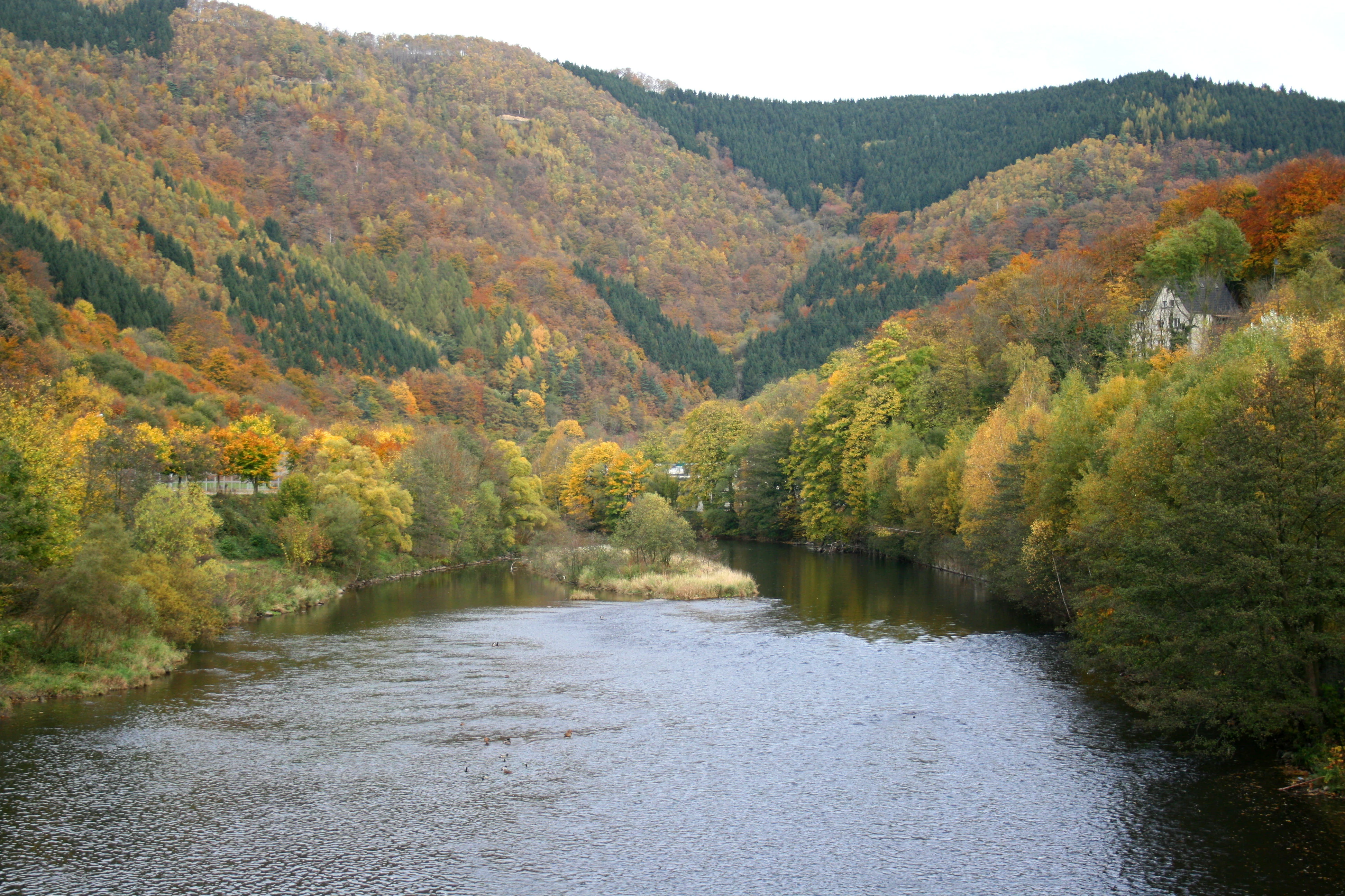
The reserve occupies a tight strip of steeply sloping terrain that drops from the hills above Altena down to the River Lenne. The forest here is shaped by the closely compressed topography: rocky ridges, narrow gullies, and abrupt transitions between sunny upper slopes and shaded cliff bases create a strongly varied relief within a very small footprint.
Rock outcrops and small cliff faces appear in multiple places, breaking through the otherwise continuous forest canopy and giving the slopes a noticeably rugged appearance. Below the slopes, the Lenne runs through a near-natural channel flanked by riparian woodland, and the small river island Werth carries a softwood floodplain forest that contrasts with the largely broadleaf slope communities above. The overall vertical span of the reserve is significant, with elevations running from roughly 143 m to 385 m above sea level within the protected boundary.
Naturschutzgebiet Pragpaul ecosystems, habitats, and plant life
Ecologically, Pragpaul is defined by the unusually close interweaving of several woodland habitat types typically found separately in larger landscapes. Slope mixed forests of beech dominate the hillside matrix, while more sheltered, rocky, and humid microhabitats have allowed genuine Schluchtwald (gorge woodland) communities to develop on the steepest, most shaded faces. Lower on the slopes, older Niederwald (coppice) stands preserve a historical forest-use legacy that still contributes to structural diversity today.
The riverine habitats add a second ecological layer. A near-natural stretch of the Lenne carries submerged aquatic vegetation, and the banks are lined by riparian woodland that transitions into the softwood floodplain forest on the Werth island. The Fachinformationssystem of the North Rhine-Westphalian state environment agency specifically highlights the tight mosaic and good conservation condition of these habitats as being of supraregional importance. The site is also formally classed as an IUCN Category IV Habitat/Species Management Area, underlining its focus on targeted habitat conservation.
Naturschutzgebiet Pragpaul conservation status and protection priorities
Pragpaul's conservation value lies in the combination of habitat diversity, habitat quality, and landscape connectivity. Within just 70 hectares it preserves slope mixed forests, gorge woodland, coppice woodland, exposed rock habitats, a near-natural stretch of the Lenne with aquatic vegetation, riparian woodland, and a floodplain island with softwood forest, all closely interlocked rather than scattered.
The site's good conservation condition, recognized as being of supraregional importance by North Rhine-Westphalia's Fachinformationssystem, is the core of its protection rationale. Since 2004, Pragpaul has contributed to the FFH site 'Schluchtwälder im Lennetal' (DE-4712-301), embedding the local slope forests within a broader Natura 2000 framework for the gorge forests of the Lenne valley. The reserve is managed by the Untere Landschaftsbehörde of the Märkischer Kreis, with the national identifier MK-099 and a corresponding entry in the World Database on Protected Areas (WDPA ID 329574).
Top sights and standout views in Naturschutzgebiet Pragpaul
Pragpaul's strongest highlights are its steep, rocky Lenne-facing slopes, the presence of genuine gorge woodland alongside beech slope mixed forest and older coppice stands, the near-natural stretch of the Lenne with submerged aquatic vegetation, and the small floodplain island Werth. Equally important is the site's formal status since 2004 as part of the larger FFH site 'Schluchtwälder im Lennetal', which gives the small reserve supraregional ecological significance despite its modest 70-hectare footprint.