
Mori Atlas logo
Nature reserveNaturwald Schwarzacher Tännig

Examining natural forest dynamics and protected woodland boundaries within the Steigerwald foothills

Naturwald Schwarzacher Tännig: Mapping the Protected Oak Forest Landscapes of Bavaria

Naturwald Schwarzacher Tännig represents a significant conservation effort in northern Bavaria, preserving a mature oak woodland stand within the Steigerwaldvorland region. This protected forest reserve allows natural ecological processes, including deadwood accumulation and forest regeneration, to unfold without human intervention. Situated amidst a broader mosaic of agricultural fields and regional habitat networks, the area provides critical insight into the conservation of lowland oak ecosystems and local biodiversity patterns.

oak forestnatural forest reserveSteigerwaldvorlandLower FranconiaBavariaNatura 2000 site
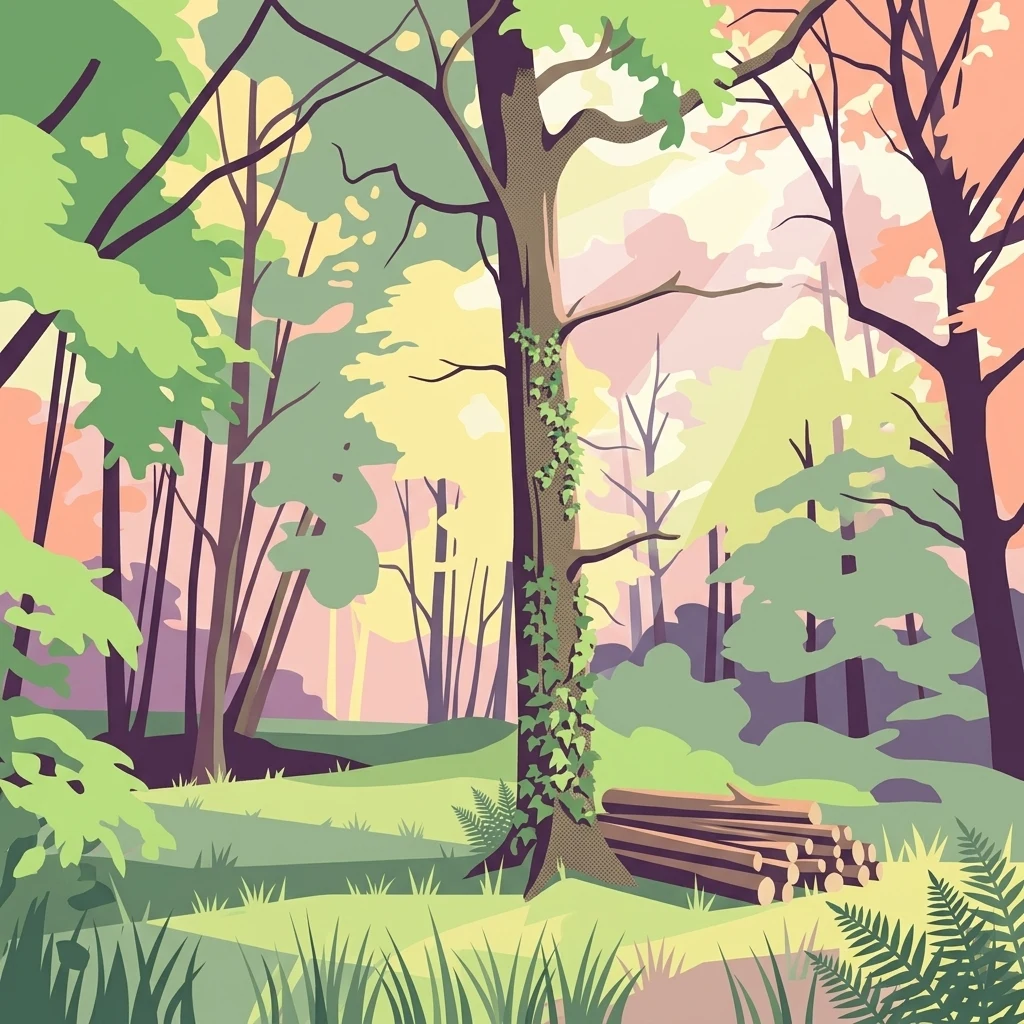
A digital illustration of a forest scene with a large, ivy-covered tree in the center and a stack of logs on the right, rendered in a palette of green, soft pink, and yellow.

Naturwald Schwarzacher Tännig

Nature reserve

Park overview

Structured park overview, official facts, and landscape profile for Naturwald Schwarzacher Tännig

Naturwald Schwarzacher Tännig park facts, protected area profile, and essential visitor context

Review the core facts for Naturwald Schwarzacher Tännig, including designation, size, terrain, visitor scale, habitats, and operating context in one park-focused overview.

About Naturwald Schwarzacher Tännig

Naturwald Schwarzacher Tännig is a small but ecologically focused forest reserve in the Steigerwaldvorland, the gently rolling foreland northwest of the Steigerwald uplands in Lower Franconia, northern Bavaria. The area lies within the broader forest complex of Klosterforst, which surrounds parts of the town of Kitzingen, and is bordered by villages including Albertshofen to the east and Kleinlangheim to the west.

The reserve is notable for being one of the areas set aside under a decisive shift in Bavarian forest policy. Following the Volksbegehren Artenvielfalt und Naturschönheit in Bayern in 2019, the Bavarian state government committed to taking ten percent of the state forest out of active timber management. The Schwarzacher Tännig, with its mature oak stand, was among the areas identified for that purpose and was formally established as a Naturwald in 2021, under Article 12a of the Bavarian Forest Law and managed by the Bayerische Staatsforsten.

Although the reserve covers only about nine hectares and is not formally reported to the IUCN, it sits inside an important network of overlapping European protections. It lies within the FFH area Sandgebiete bei Schwarzach, Klein- und Großlangheim and the Bird Directive area Südliches Steigerwaldvorland, areas that protect sandy substrates and associated open and semi-open habitats. Nearby protected features include the Sphagnum-Schilfmoor and Ungeheurer See natural monuments to the northeast and the Naturschutzgebiet Kranzer to the southeast, with additional nature reserves such as Belkers bei Großlangheim and Sande am Tannenbusch bei Kleinlangheim situated in the wider vicinity.

The defining ecological character of the reserve is its oak-dominated woodland. In the Steigerwaldvorland, where sandy soils, dry grassland, and mixed agricultural land create a mosaic of habitats, oak forests are a characteristic and ecologically valuable element. By removing the Tännig from forestry use, the site becomes a place where natural processes, including regeneration, deadwood development, and gradual species turnover, can proceed without human intervention, apart from measures needed for safety or forest health. This makes the reserve a small but meaningful element of Bavaria's expanding network of natural forest areas.

Quick facts and research context for Naturwald Schwarzacher Tännig

Naturwald Schwarzacher Tännig is a nine-hectare forest reserve in the Steigerwaldvorland of Lower Franconia, Bavaria, administered by the Bayerische Staatsforsten. It was established in 2021 as one of the state forest areas withdrawn from timber production under Article 12a of the Bavarian Forest Law.

The site is identified as NW-4472 and overlaps with the Natura 2000 site DE6227371, the FFH area Sandgebiete bei Schwarzach, Klein- und Großlangheim, and the Bird Directive area Südliches Steigerwaldvorland. Its protected status is rooted in the presence of a mature oak stand, which is left unmanaged so that natural forest processes can develop freely.

Protection and recognition

Terrestrial conservation metrics and documented designation records

Naturwald Schwarzacher Tännig Protection Status and Recognition Data

Naturwald Schwarzacher Tännig brings together documented terrestrial protection status and management scope details within the conservation database. Structured facts outline the recorded designation history and available international recognition sources for the protected area.

Protection details

Protection scope
Terrestrial
Park context

Deeper park guide and search-rich context for Naturwald Schwarzacher Tännig

Naturwald Schwarzacher Tännig history, landscape, wildlife, and travel context

Explore Naturwald Schwarzacher Tännig through its history, landscape character, ecosystems, wildlife, conservation priorities, cultural context, and seasonal travel timing in a structured park guide built for atlas discovery and search intent.

Why Naturwald Schwarzacher Tännig stands out

The reserve is best known for its older oak woodland, which gave it priority for protection when Bavarian forest policy shifted toward setting aside portions of state forest from timber use. The Tännig offers an example of how a relatively small area can contribute to the conservation of lowland oak habitats in the Steigerwald foothills. By keeping the stand untouched except where safety or forest health demands intervention, the reserve allows natural regeneration, deadwood accumulation, and structural diversification typical of an old-growth oak forest to develop over time. Its placement within a larger Natura 2000 framework also links it to regional efforts to safeguard sandy soils, dry habitats, and open agricultural landscapes.
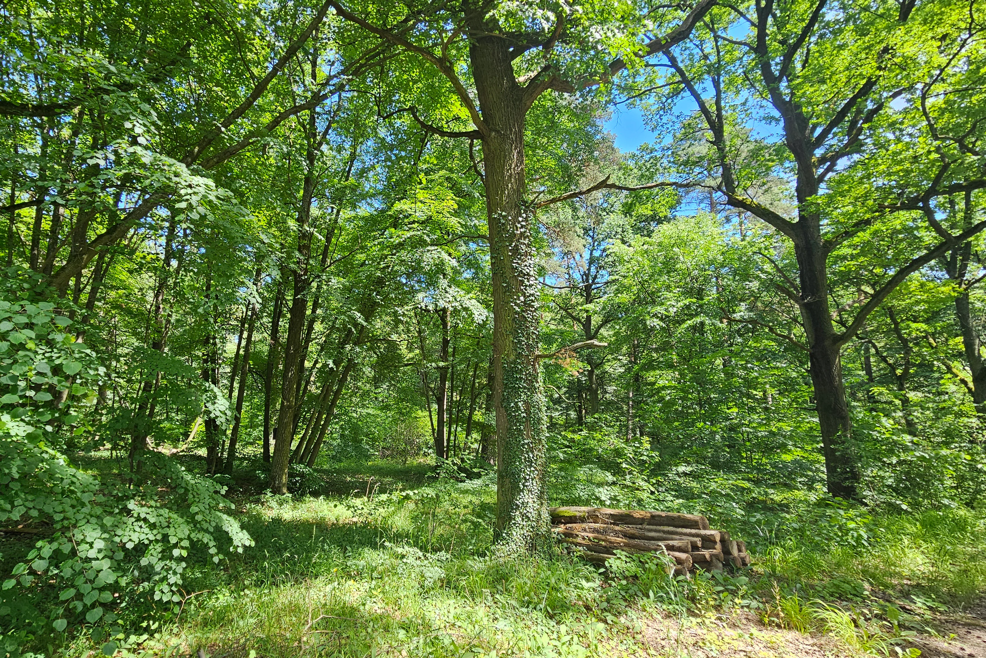
A sunny, dense forest scene featuring mature deciduous trees with green leaves and a stack of logs on the forest floor.
A view into the lush canopy of the Naturwald Schwarzacher Tännig nature forest reserve.

Naturwald Schwarzacher Tännig history and protected-area timeline

The Schwarzacher Tännig has a relatively short formal history as a protected area, but its establishment was the direct outcome of a broader political movement in Bavaria. In 2019, the Volksbegehren Artenvielfalt und Naturschönheit in Bayern gathered public support for stronger nature protection, prompting the Bavarian state government to commit to taking ten percent of state forest land out of active timber use.

Under this commitment, the Bayerische Staatsforsten identified areas with high ecological value that could be transitioned to passive management. The Schwarzacher Tännig, recognized for its older oak stand, was selected and formally designated as a Naturwald in 2021 under Article 12a of the Bavarian Forest Law. Since then, the site has been managed without forestry, aside from any necessary interventions for forest protection or public safety.

Although not officially registered with the IUCN, partly because its area falls short of typical international size thresholds, the reserve nonetheless represents a tangible outcome of a significant change in Bavarian conservation and forestry policy.

Naturwald Schwarzacher Tännig landscape and geographic character

The landscape of the Schwarzacher Tännig is shaped by the Steigerwaldvorland, a transition zone between the Main valley and the higher Steigerwald hills. This area is characterized by gently undulating terrain, sandy substrates, and a patchwork of woodland, dry grassland, and agricultural fields, all of which influence the local ecology.

Within this setting, the Naturwald itself is a compact patch of oak-dominated forest, embedded in the larger Klosterforst, a traditional woodland complex linked historically to the town of Kitzingen. To the northeast lie the Sphagnum-Schilfmoor and the Ungeheurer See, a raised bog and a small lake that indicate the presence of wet, peat-forming habitats in the broader landscape, while drier sandy habitats extend through surrounding FFH areas.

The visual character of the reserve is that of a quiet, mature lowland oak wood, with the open and varied surroundings of the Steigerwald foothills providing a wider landscape context of cultural and ecological value.

Naturwald Schwarzacher Tännig ecosystems, habitats, and plant life

Ecologically, the Naturwald Schwarzacher Tännig centers on its oak woodland. Oak forests on sandy soils, like those of the Steigerwaldvorland, support distinctive communities of plants, fungi, insects, and birds that depend on old trees, deadwood, and the open, light-filled structure typical of such stands.

By ceasing timber harvesting, the reserve allows natural regeneration, an accumulation of deadwood, and gradual changes in species composition, processes that diversify habitat structure over time and benefit species tied to undisturbed forest conditions. The Steigerwaldvorland context adds further ecological richness: the surrounding sandy open habitats, agricultural mosaics, bog remnants, and small waters each contribute different ecological conditions, and the Naturwald functions as a wooded core within this varied landscape.

Within the Natura 2000 framework, the oak reserve links to broader efforts to protect sandy habitats, which in the region also host specialized flora and fauna adapted to dry, nutrient-poor conditions.

Naturwald Schwarzacher Tännig wildlife and species highlights

As an unmanaged oak forest, the Schwarzacher Tännig supports wildlife communities associated with mature broadleaf woodland. Oak trees are known for their rich insect faunas, which in turn provide food for a wide range of bird species, including cavity-nesting and bark-foraging birds that depend on old trees and the structural complexity of natural forests.

Deadwood, both standing and fallen, is a key feature of such reserves and provides habitat for saproxylic insects, fungi, and small woodland fauna. Over time, undisturbed conditions allow the development of microhabitats such as rot holes, bark crevices, and decaying wood, which are increasingly rare in intensively managed forests.

Because the reserve is situated within the Bird Directive area Südliches Steigerwaldvorland, its woodland also contributes to the broader bird conservation goals of the region, complementing the open and sandy habitats that surround it.

Naturwald Schwarzacher Tännig conservation status and protection priorities

The conservation significance of the Schwarzacher Tännig lies in its role as an unmanaged refuge for an older oak stand in a landscape where such features are increasingly rare. By being taken out of forestry use, the reserve safeguards natural processes that are otherwise suppressed in production forests, including regeneration, deadwood formation, and the gradual development of old-growth characteristics.

The reserve's establishment reflects a policy shift initiated by the Volksbegehren Artenvielfalt und Naturschönheit in Bayern, an important moment in which Bavarian conservation ambitions were translated into concrete changes in state forest management. Although small, the Tännig is part of a broader strategy that treats scattered natural forest areas as essential components of regional biodiversity conservation.

Its integration into the Natura 2000 network, through both the FFH site Sandgebiete bei Schwarzach, Klein- und Großlangheim and the Bird Directive area Südliches Steigerwaldvorland, connects it to continent-level conservation goals and ensures that its oak habitat contributes to the coherence of the protected areas mosaic in the Steigerwald foothills. The reserve is not formally listed with the IUCN, likely because its area falls below international size thresholds, but its national and European designations are nonetheless substantial.

Naturwald Schwarzacher Tännig cultural meaning and human context

The Schwarzacher Tännig lies within the Klosterforst, a traditional forest associated historically with the town of Kitzingen and shaped by centuries of human land use and stewardship in the Steigerwaldvorland. Forests like this were long managed for timber and game, and their transition into protected natural forest areas reflects evolving ideas about the relationship between forest ecosystems and cultural landscapes in Bavaria.

The surrounding region is also marked by a long tradition of small-scale agriculture, viticulture, and settlement, reflected in the nearby villages of Großlangheim, Kleinlangheim, Albertshofen, and Schwarzach am Main. The reserve thus sits at the intersection of cultural landscape and ecological protection, illustrating how conservation in Bavaria often works within, rather than apart from, long-settled rural environments.

Top sights and standout views in Naturwald Schwarzacher Tännig

The Schwarzacher Tännig's principal highlight is its mature oak stand, preserved without forestry intervention to allow natural forest dynamics. Its establishment under Bavarian forest law in 2021 makes it a tangible result of the state's commitment to expand natural forest areas in response to public pressure for biodiversity protection.

Another highlight is the reserve's location within a tightly knit network of European protected areas, including an FFH habitat site and a Bird Directive area, allowing a small forest patch to contribute meaningfully to landscape-scale conservation in the Steigerwald foothills. The proximity of natural monuments such as the Sphagnum-Schilfmoor and the Ungeheurer See further enriches the ecological mosaic around the Tännig.

Best time to visit Naturwald Schwarzacher Tännig

The Naturwald Schwarzacher Tännig is a small, year-round feature of the landscape, and its appeal changes with the seasons in the way typical of central European oak forests. Spring brings fresh leaf-out and active birdlife, while summer offers dense foliage and shaded woodland conditions. Autumn is especially rewarding in oak forests, with structured acorn production and the changing colors of broadleaf trees, and winter reveals the architectural structure of the mature oaks once the leaves have fallen.

Because the reserve is not reported as a major visitor destination and access details are limited, visitors interested in experiencing the area are generally best served by approaching it as part of a broader exploration of the Steigerwaldvorland during the milder months, when walking through the rural landscape and connecting protected sites is most pleasant.

Monthly climate preview

Long-term representative measurements of monthly temperature and precipitation patterns

Naturwald Schwarzacher Tännig Climate Normals and Annual Weather Rhythm

Representative coordinate records show measured variations in monthly average temperature and precipitation across the protected area. Evaluating this multi-year climate profile provides deeper insight into long-term environmental patterns.
Annual mean9 °C
-1 °C20 °C
Jan-1°
Feb
Mar
Apr
May13°
Jun17°
Jul20°
Aug19°
Sep15°
Oct
Nov
Dec
Warmest month
July

19.7 °C

Coolest month
January

-0.7 °C

Wettest month
July

2.4 mm/day

Driest month
April

1.3 mm/day

Park location guide

Geography guide, regional context, and park location map for Naturwald Schwarzacher Tännig

Naturwald Schwarzacher Tännig park geography, regions, and map view in Germany

Understand where Naturwald Schwarzacher Tännig sits in Germany through a broader geographic reading of the surrounding landscape, nearby location context, and its mapped position within the national park landscape.

How Naturwald Schwarzacher Tännig fits into Germany

Germany is a federal republic in Western and Central Europe with a population of over 83 million across sixteen constituent states. It is Europe's largest economy by nominal GDP and a major global exporter and importer. The capital is Berlin, and the country borders Denmark, Poland, Czech Republic, Austria, Switzerland, France, Luxembourg, Belgium, and the Netherlands.

Wider geography shaping Naturwald Schwarzacher Tännig in Germany

Germany is located in Western and Central Europe, spanning 357,022 km². It borders Denmark to the north, Poland and the Czech Republic to the east, Austria and Switzerland to the south, and France, Luxembourg, Belgium, and the Netherlands to the west. The country has coastlines on the Baltic Sea and North Sea to the north, with the Alps located in the southern region.

Map view of Naturwald Schwarzacher Tännig

Use this park location map to pinpoint Naturwald Schwarzacher Tännig in Germany, understand its exact geographic position, and read its mapped placement within the surrounding landscape more clearly.

Pigeon | © OpenStreetMap contributors

Location context for Naturwald Schwarzacher Tännig

Bavaria

Visual reference for oak woodland habitats and terrain in the Steigerwald foothills

Naturwald Schwarzacher Tännig Photos and Landscape Scenery

Visual documentation of Naturwald Schwarzacher Tännig reveals the mature oak canopy and natural forest dynamics shaping the protected reserve. Examining these landscape views and habitat conditions provides deeper insight into the ecological character of the Bavarian forest.

A sunny, dense forest scene featuring mature deciduous trees with green leaves and a stack of logs on the forest floor.

Park atlas

Compare surrounding regional habitats and connected lowland woodland reserves.

Other Protected Areas and Parks Near Naturwald Schwarzacher Tännig

Browsing other protected areas near Naturwald Schwarzacher Tännig reveals connected lowland woodland reserves and regional habitat networks. Expanding the geographic comparison provides deeper insight into the ecological mosaic of the Steigerwald foothills.
A watercolor painting of a rolling landscape with scattered trees, grasslands, and soft rolling hills in the background, rendered in pale pastel tones.
Nature reserveUnterfranken
About 2.9 km away#1 closest

East

Sande am Tannenbusch bei Kleinlangheim Nature Reserve: Protected Area and Atlas Overview

Geography of the Steigerwaldvorland sand landscape

Discover the ecological composition of Sande am Tannenbusch bei Kleinlangheim, a nature reserve in Unterfranken defined by its inland sand deposits and fragmented woodland footprint. This site is significant for its sand grassland mosaic, serving as a primary habitat for farmland birds and representing a specialized enclave within the broader Klosterforst region.

Area
0.382 km²
Established
1995
IUCN
IV
Relief
Lowland
A watercolor painting of a gentle landscape showing grassy plains, distant rolling hills, and patches of trees.
Nature reserveBayern
About 5.4 km away#2 closest

North

Sandfluren bei Volkach, Schwarzach am Main und Sommerach: Protected Sand Habitats

Inland dune formations and xerothermic grasslands in Bayern

Located in the Main valley, this nature reserve is defined by its inland sand dunes and drift sand flats that provide a refuge for specialized flora and fauna. As a designated Geotop and Natura 2000 site, it offers a distinct study of arid habitats surviving within an agricultural landscape. Explore the geographic boundaries and terrain mosaic that make this protected area a noteworthy feature of the Lower Franconian environment.

Area
1.048 km²
Established
1989
IUCN
IV
A watercolor illustration depicting a soft, rolling landscape of green hills, distant mountain silhouettes, and a winding stream.
Protected areaBavaria
About 11 km away#3 closest

Southeast

Naturwald Speckfeld: Protected Forest Reserve and Steigerwald Geographic Detail

Broadleaf woodland and gypsum ridge landscapes in Bavaria

Naturwald Speckfeld offers a look into unharvested forest dynamics within the Steigerwald mountains. This protected area stands out for its steep topography, historical castle ruins, and rare broadleaf woodland transitions, providing a critical reference point for natural forest conservation in the Lower Franconia region of Bavaria.

Area
0.195 km²
Established
1978
Relief
Upland
Climate
Temperate
A soft, light watercolor painting of a pastoral landscape with rolling green fields, scattered trees, and distant hills under a pale yellow sky.
Nature reserveBavaria
About 12 km away#4 closest

North

Sandgrasheiden am Elgersheimer Hof Nature Reserve and Main Valley Protected Landscapes

Rare sand grassland geography and conservation status in Lower Franconia, Bavaria

Sandgrasheiden am Elgersheimer Hof protects two distinct parcels of sand grassland, a rare habitat type that provides a refuge for specialized plant communities like Jurinea cyanoides. Situated within the Maintal between Schweinfurt and Dettelbach, the reserve creates a critical ecological link between agricultural plains and riverine meadow landscapes. This atlas entry details the geographic context and habitat mosaic of this significant Bavarian nature reserve.

Area
0.035 km²
Established
1999
IUCN
IV
Watercolor painting showing rolling green hills, trees in the midground, and purple-tinted mountains in the background against a white backdrop.
Nature reservePrichsenstadt
About 15 km away#5 closest

Northeast

Naturwald Krackentännig Nature Reserve: A Protected Forest Landscape in Northern Bavaria

Geography of the Steigerwaldvorland and Gänsseegraben valley floor

Situated near Prichsenstadt, Naturwald Krackentännig acts as a refuge for ash and alder trees that thrive in the moist soils of the Lower Franconian countryside. This nature reserve provides a critical example of undisturbed forest development, showcasing a specialized ecosystem within the rolling hills of the Steigerwaldvorland and a commitment to preserving small-scale woodland habitats.

Area
0.026 km²
Established
2021
Relief
Lowland
Scope
Terrestrial
Watercolor painting of a forest landscape with a grassy clearing and distant hills, rendered in soft green and pink tones.
Nature reserveGermany
About 21 km away#6 closest

Northeast

Naturwald Waldhaus: Geographic Mapping of an Ancient Beech Reserve in Steigerwald, Bavaria

Protected natural woodland and forest biodiversity in northern Germany.

Naturwald Waldhaus stands as a prime example of a protected forest in the Steigerwald, recognized for its exceptionally old beech stands and documented saproxylic beetle populations. This nature reserve provides essential ecological continuity within the Bamberg district, representing a rare, undisturbed woodland landscape that serves as a cornerstone for forest research in southern Germany.

Area
1.062 km²
Established
1978
Relief
Upland
Climate
Temperate
A horizontal watercolor painting showing a soft, layered forest landscape with coniferous trees in the foreground and rolling mountains in the distance.
Nature reserveGermany
About 24 km away#7 closest

North

Naturwaldreservat Riedholz: Protected Woodland and Floodplain Forest in Lower Franconia

Mapped natural forest reserves in the Steigerwaldvorland region

Naturwaldreservat Riedholz represents a pioneering municipal initiative in Bavaria to preserve lowland forest processes permanently. Located near Grettstadt and Schwebheim, this protected woodland preserves moisture-loving vegetation and relict oaks, acting as a vital ecological anchor within the agricultural landscape of the Schweinfurt Basin.

Area
0.11 km²
Established
1999
Relief
Lowland
Scope
Terrestrial
A watercolor painting showing a panoramic landscape with light green hills, tall slender trees in the foreground, and soft washes of color depicting a natural forest scene.
Nature reserveBavaria
About 26 km away#8 closest

East

Naturwald Schlag Nature Reserve: Geographic Atlas and Protected Forest Context in Bavaria

A dedicated site for natural forest development and regional conservation mapping

Naturwald Schlag serves as a vital case study for non-intervention forestry in the Steigerwald region of Upper Franconia. Located near the locality of Heuchelheim, this reserve protects a mature stand of pine, beech, and oak. MoriAtlas provides a clear view of its formal designation and geographic position within the broader Bavarian natural forest network.

Area
0.008 km²
Established
2021
Relief
Upland
Climate
Temperate

Common questions about visiting, size, designation, and location context for Naturwald Schwarzacher Tännig

Naturwald Schwarzacher Tännig FAQs for park facts, access, geography, and protected area context

Find quick answers about Naturwald Schwarzacher Tännig, including protected-area facts, park geography, trail and visitor context, and how the park fits into its surrounding country and regional landscape.
MoriAtlas Explorer

Continue Your Protected Areas Search Across the Global Atlas

Deepen your exploration by continuing the structured search for national parks and protected areas worldwide. Utilize the comprehensive filtering capabilities to compare different conservation landscapes and refine your understanding of global park geography. Discover more about the distribution and characteristics of protected natural areas.

Global natural geography