
Mori Atlas logo
Nature reserveNekselø

A study in microclimate, community-led conservation, and wetland biodiversity in Sejerø Bay

Nekselø Nature Reserve: Mapping the Protected Landscape and Geography of this Danish Island

Nekselø stands as a significant protected landscape within Denmark, defined by its rare Great Belt microclimate that fosters warm and dry conditions unlike much of the surrounding region. This nature reserve, situated off the coast of Kalundborg Kommune, serves as a crucial habitat within the broader Natura 2000 and Ramsar wetland network. Its terrain balances traditional island topography with specialized steppe-like ecological zones, supporting warmth-loving species such as the natterjack toad across its protected boundaries.

Danish islandisland naturemicroclimatesteppe climatewetlandRamsar site
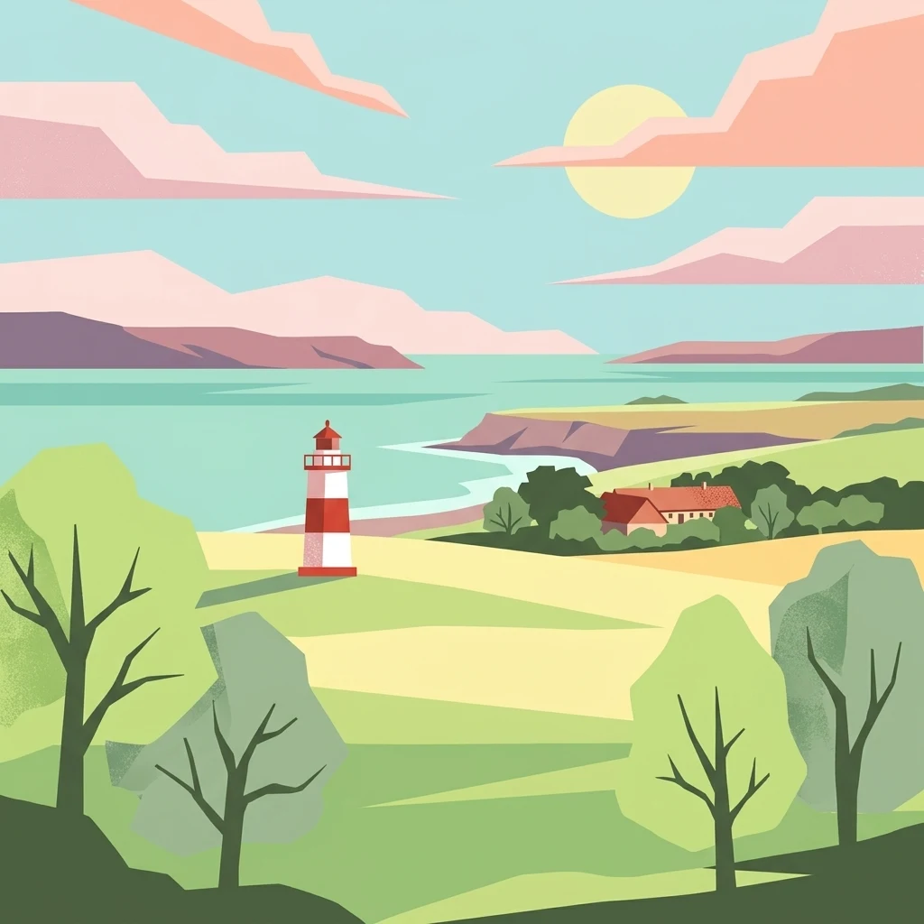
An illustration in a flat, modern graphic style showing a red and white lighthouse on a grassy coastal bluff, with a sunlit sea and hills in the background.

Nekselø

Nature reserve

Park overview

Structured park overview, official facts, and landscape profile for Nekselø

Nekselø park facts, protected area profile, and essential visitor context

Review the core facts for Nekselø, including designation, size, terrain, visitor scale, habitats, and operating context in one park-focused overview.

About Nekselø

Nekselø is a small inhabited island in the Sejerø Bugt, the broad bay that opens between northern Zealand and the Kattegat. It lies a short ferry ride from Havnsø on Zealand and belongs administratively to Kalundborg Kommune. Although modest in scale, with an area of about 2.2 square kilometers, the island has long been regarded as one of the more ecologically distinctive places along the Danish coast.

What sets Nekselø apart is its local climate. The island sits within a region where the influence of the Great Belt produces a noticeably drier, sunnier, and milder climate than much of Denmark. This microclimate, sometimes described locally as a 'storebæltklima', softens the winters and reduces rainfall, producing conditions that resemble a steppe environment more than the typical Danish maritime weather. As a result, the island supports plants and animals that are otherwise rare or absent elsewhere in the country, including warmth-loving reptiles and amphibians such as the natterjack toad.

The ecological importance of Nekselø has been formally recognized at multiple levels. In 1951 the island's residents chose to place the entire island under conservation protection, an early community-led act of stewardship. Today Nekselø forms part of a Ramsar-area designation focusing on wetlands and migratory waterbirds, and is integrated into the broader European Natura 2000 network through the Sejerø Bugt, Saltbæk Vig, Bjergene, Diesebjerg, and Bollinge Bakke site. Together these designations place a small Danish island into the same pan-European conservation framework as much larger protected areas.

Despite this protected status, Nekselø is not uninhabited. A small year-round community continues to live on the island, with roughly a dozen permanent residents and around six children. The island's church, Nekselø Kirke, has stood since 1931 and is an annex to nearby mainland parishes. A former island school operated between 1850 and 1973, when declining enrollment forced its closure. The Nekselø ferry remains the lifeline of the community and also provides visitors access to the island's natural landscapes, including the Sømose wetland, coastal views across the Sejerø Bugt, and an interior mosaic of fields and small farms such as Nordgård.

Quick facts and research context for Nekselø

Nekselø is an island of about 2.2 square kilometers in the Sejerø Bugt, part of Kalundborg Kommune on the northwestern coast of Zealand, Denmark. It has a permanent population in the low double digits and is connected to the mainland by a ferry service from the town of Havnsø. The island is administratively and historically tied to Føllenslev Sogn on Zealand and has maintained its own church since 1931. Ecologically, it is one of Denmark's most distinctive small islands: the entire area has been under nature protection since 1951 and it sits within both a Ramsar wetland designation and the Natura 2000 network.

Protection and recognition

Examine the official protection framework and management scope for Nekselø.

Nekselø Protection Status and Documented Conservation Scope

Nekselø maintains a mixed protection scope governed by documented conservation standards and official management frameworks. Structured protection data outlines the legal status and recognized administrative boundaries associated with the reserve.

Protection details

Protection scope
Mixed
Transboundary protection
No
Park context

Deeper park guide and search-rich context for Nekselø

Nekselø history, landscape, wildlife, and travel context

Explore Nekselø through its history, landscape character, ecosystems, wildlife, conservation priorities, cultural context, and seasonal travel timing in a structured park guide built for atlas discovery and search intent.

Why Nekselø stands out

Nekselø is best known for its microclimate. Positioned in the lee of Zealand, it falls within a 'storebæltklima' zone that is appreciably drier, sunnier, and milder in winter than the rest of Denmark. This patchwork of steppe-like conditions allows a remarkable range of warmth-loving species to thrive, including the natterjack toad, which gives the island strong ecological and conservation significance. The island is also notable as a quiet example of community-led conservation. Its inhabitants voluntarily placed the entire island under nature protection in 1951, an early and unusual act of stewardship that gave Nekselø a protected status long before many comparable Danish natural sites. Today this protection is reinforced by its inclusion in a Ramsar wetland site and the Natura 2000 network, making the island a small but recognized reference point for Danish natural heritage.
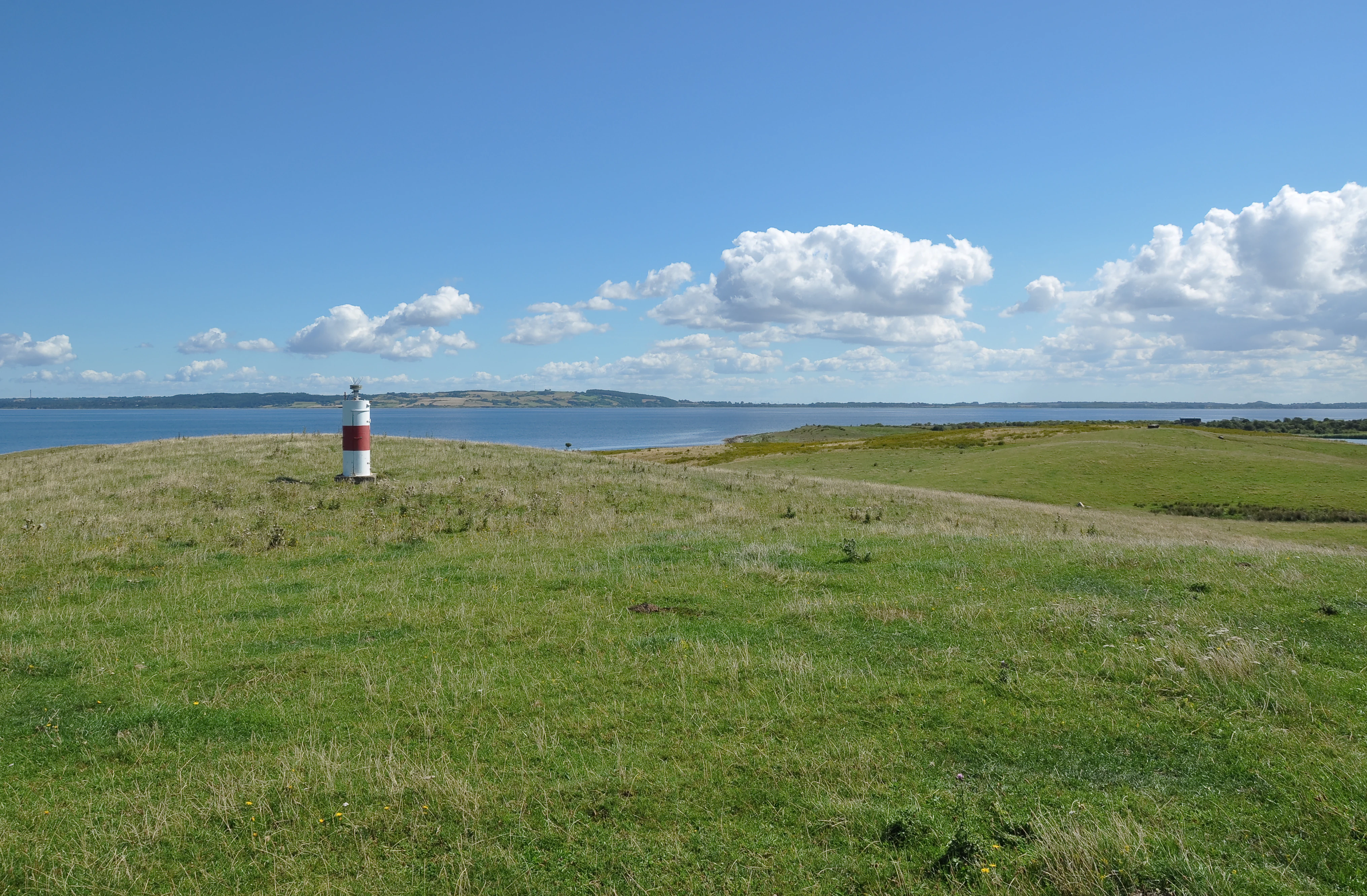
A red and white navigational beacon stands on a grassy, open hillside overlooking the sea under a clear blue sky with white clouds.
A navigational beacon standing on the grassy hills of Nekselø island, Denmark.

Nekselø history and protected-area timeline

Nekselø's documented history is largely the history of a small Danish island community shaped by geography, climate, and a long tradition of local self-sufficiency. The island has historically been linked to the Føllenslev parish on Zealand, and its residents maintained their own civic institutions even as the population remained very small.

In 1931 the island received its own church, Nekselø Kirke, which functions as an annex to the mainland churches at Føllenslev and Særslev. Earlier, in the mid-nineteenth century, a local school was established on the island; records indicate it operated from 1850 until 1973, when it closed after enrollment dropped to just one pupil. Today roughly six children live on the island, reflecting both the demographic fragility of small Danish island communities and the continued presence of family life on Nekselø.

The most significant date in the island's modern history is 1951, when the residents themselves voted to place the entire island under nature conservation. This community-initiated protection was an early and unusually broad act of stewardship in Denmark, and it laid the foundation for Nekselø's later inclusion in international and European conservation frameworks, including a Ramsar-area designation and the Natura 2000 network.

Nekselø landscape and geographic character

Nekselø's landscape combines a gentle, low-lying Danish island topography with views that open across the wide Sejerø Bugt. The coastline frames the island with views toward the bay and, on clear days, toward neighboring landmarks such as Vejrhøj on the Zealand horizon. A small harbor, Nekselø Havn, anchors the island to maritime traffic and serves as the point of arrival for the ferry to Havnsø.

Inland, the terrain unfolds as a mosaic of agricultural fields, scattered farms such as Nordgård, and patches of natural habitat. Wetland areas like Sømose punctuate the interior and contribute to the island's ecological value. A northern lighthouse, or fyr, marks one end of the island and serves as a recognizable landmark within the broader Sejerø Bugt seascape.

Despite the island's small size, the climatic setting lends its landscape an unusually Mediterranean or steppe-like quality. Reduced rainfall and more sunshine compared with most of Denmark allow plants and animals associated with drier, warmer conditions to flourish here, giving the scenery an ecological character distinct from typical Danish coastal landscapes.
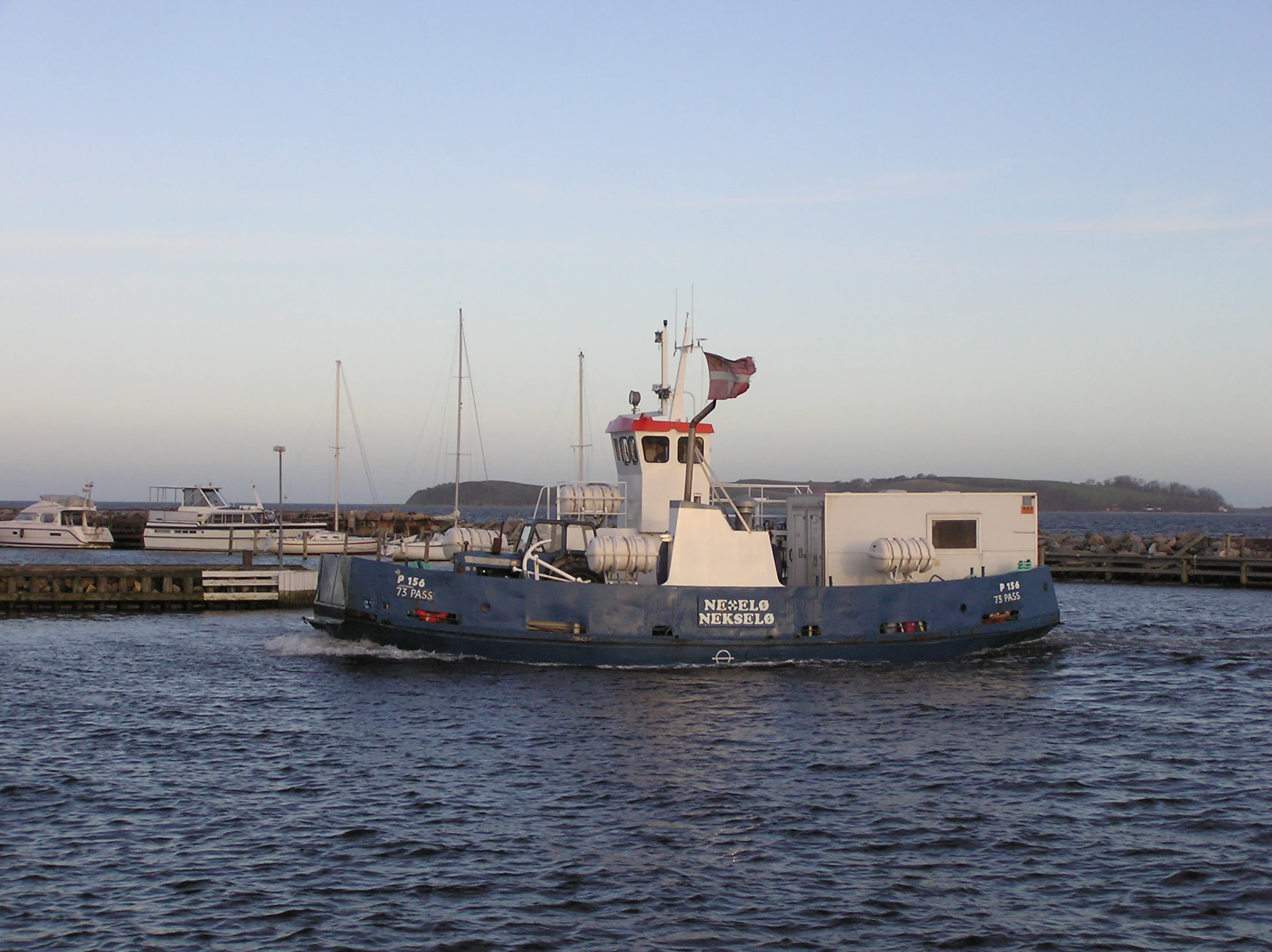
A blue ferry boat named Nekselø crossing calm water with a marina in the background.
The Nekselø ferry, the primary vessel for accessing the island of Nekselø in Denmark.

Nekselø ecosystems, habitats, and plant life

Nekselø is ecologically one of the most distinctive small islands in Denmark, principally because of the influence of its local climate. Located in the lee of Zealand, the island experiences substantially less rainfall, more sunshine hours, and milder winters than most of the country. This 'storebæltklima' has produced a steppe-influenced environment that supports a wide range of species not normally found further north or in cooler, wetter parts of Denmark.

Habitats on the island include coastal margins around the Sejerø Bugt, inland agricultural areas, and wetland patches such as Sømose. These varied environments collectively support a notably broader range of warmth-loving flora and fauna than would be expected for a small Danish island at this latitude.

The combination of these habitats and the unusual microclimate gives Nekselø particular conservation value. It is formally integrated into the Natura 2000 area covering Sejerø Bugt, Saltbæk Vig, Bjergene, Diesebjerg, and Bollinge Bakke, and it forms part of a Ramsar wetland designation. Together these recognitions place Nekselø within the broader European framework for protecting biodiversity and wetland habitats.
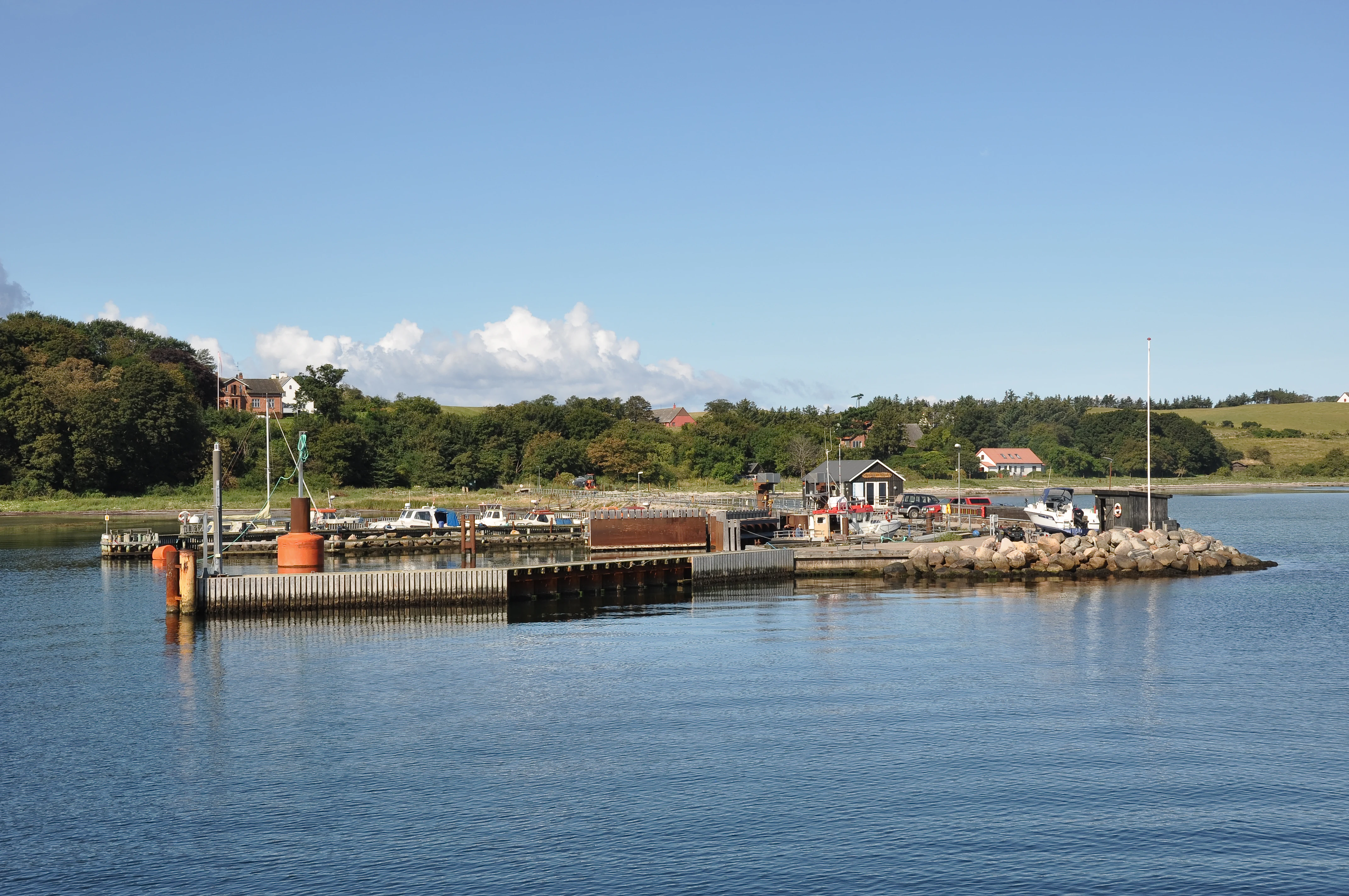
A small ferry landing with concrete piers and small buildings on the shoreline of Nekselø island, Denmark, viewed from the water.
The ferry landing and small harbor on the coast of Nekselø island.

Nekselø wildlife and species highlights

The mild, dry microclimate of Nekselø is the principal driver of its distinctive wildlife. Because winters are softer and rainfall is reduced compared with most of Denmark, the island supports a range of plant and animal species that are otherwise uncommon in the country. The presence of warmth-adapted species, including the natterjack toad, has been specifically highlighted as a feature of the island's natural character.

The combination of coastal habitat around the Sejerø Bugt, inland wetland areas like Sømose, and a mosaic of fields and pastures also supports a broader suite of breeding birds, insects, and small fauna typical of Danish coastal and wetland environments. The overall effect is a small island that punches well above its weight in terms of species diversity relative to its size.

Protection of these wildlife communities has been layered over time. The residents' 1951 conservation decision provided a local foundation, while later inclusion in the Ramsar convention and the Natura 2000 network connected Nekselø's wildlife to international frameworks for waterbirds and habitat protection.
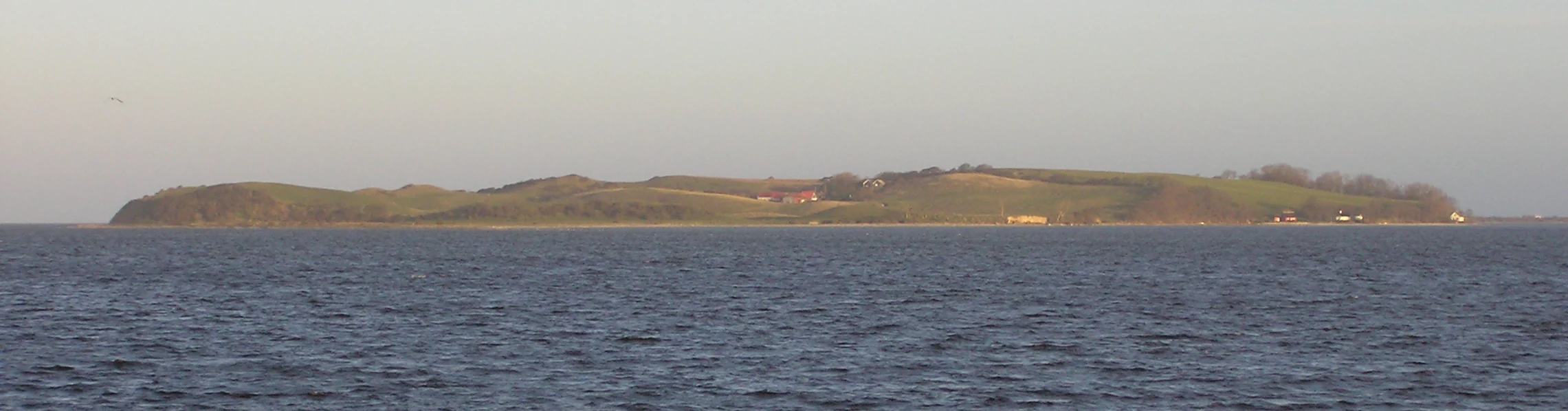
A distant view of the island of Nekselø across open sea water under a pale, overcast sky.
A view of Nekselø island from the south.

Nekselø conservation status and protection priorities

Conservation is central to Nekselø's modern identity. The most striking episode is the 1951 decision by the island's own residents to place the entire island under nature protection. That community-led act is unusually comprehensive by Danish standards and means that, in practice, the island has functioned as a de facto reserve for more than seven decades.

This local protection has been reinforced at both international and European levels. Nekselø lies within the Natura 2000 site covering Sejerø Bugt, Saltbæk Vig, Bjergene, Diesebjerg, and Bollinge Bakke, placing the island within the European Union's coordinated network of protected habitats. It is also included in a Ramsar-area designation tied to wetlands and migratory waterbirds.

Together these layers of recognition underscore why conservation authorities treat Nekselø as a significant site despite its small size: the combination of microclimate, steppe-like habitat, and wetland elements makes it a genuinely distinctive ecological reference point within Denmark.

Nekselø cultural meaning and human context

Nekselø's cultural character is that of a small, tightly held Danish island community sustained across generations. Like many Danish islands, it has its own church, here the Nekselø Kirke consecrated in 1931, which continues to serve the island as an annex to mainland parishes at Føllenslev and Særslev. The community's historical self-sufficiency is reflected in the long-lived island school, which operated from 1850 until 1973, when it closed because only a single pupil remained.

The 1951 community decision to protect the entire island is itself a notable cultural act, marking Nekselø as an early example of local stewardship in Denmark. Today the island sustains a small year-round population, including about six children, and continues to be reached by the Nekselø ferry from Havnsø on Zealand, which serves both residents and visitors.

Top sights and standout views in Nekselø

Nekselø's standout qualities include its unusually mild and dry Great Belt microclimate, the presence of warmth-loving species such as the natterjack toad, and the breadth of its formal protection, ranging from a resident-led 1951 conservation effort to inclusion in the Ramsar convention and the Natura 2000 network. The compact island also retains a living community, a 1931 church, and accessible ferry connections from Havnsø, making it a rare case where nature protection and inhabited island life coexist on a small Danish scale.

Best time to visit Nekselø

Because Nekselø's character is strongly shaped by its dry, sunny, mild climate relative to the rest of Denmark, late spring through early autumn is generally the most rewarding time to experience both its steppe-like vegetation and the wider Sejerø Bugt views. Warmer months highlight the climatic contrast with the rest of the country and improve conditions for observing the island's distinctive flora and fauna, while milder winters give the island a softer character than most of Denmark. Visitors should be aware that access is by ferry from Havnsø, so conditions on the bay will always play a role in any trip.
Monthly climate preview

Track measured monthly averages across the representative coordinate dataset.

Nekselø Climate Normals, Long-Term Temperature and Precipitation Rhythms

Representative coordinate records show average monthly temperatures ranging from 1.41 °C to 17.68 °C alongside recorded precipitation levels between 1.34 mm and 2.57 mm per day. Reviewing the complete twelve-month sequence provides precise historical context for long-term thermal and moisture patterns across the protected landscape.
Annual mean9 °C
1 °C18 °C
Jan
Feb
Mar
Apr
May11°
Jun15°
Jul17°
Aug18°
Sep15°
Oct10°
Nov
Dec
Warmest month
August

17.7 °C

Coolest month
February

1.4 °C

Wettest month
August

2.6 mm/day

Driest month
April

1.3 mm/day

Park location guide

Geography guide, regional context, and park location map for Nekselø

Nekselø park geography, regions, and map view in Denmark

Understand where Nekselø sits in Denmark through a broader geographic reading of the surrounding landscape, nearby location context, and its mapped position within the national park landscape.

How Nekselø fits into Denmark

Denmark is a constitutional monarchy and Nordic country in Northern Europe. It is the southernmost of the Scandinavian countries, bordering Germany to the south, Norway to the north, and Sweden to the southwest. The country consists of the Jutland peninsula and an archipelago of islands, with Copenhagen as its capital and largest city. Denmark has a population of over 6 million and is characterized by flat, arable land, sandy coasts, and a temperate climate.

Wider geography shaping Nekselø in Denmark

Denmark occupies the Jutland peninsula and roughly 406 islands in Northern Europe. It is situated between the North Sea to the west and the Baltic Sea to the east. The country borders Germany to the south and is connected to Sweden via the Øresund Bridge. Denmark is predominantly flat terrain with low elevation, the highest point being Møllehøj at 170.86 meters.

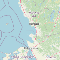
Map view of Nekselø

Use this park location map to pinpoint Nekselø in Denmark, understand its exact geographic position, and read its mapped placement within the surrounding landscape more clearly.

Pigeon | © OpenStreetMap contributors

Location context for Nekselø

Kalundborg Kommune

Explore photographic records of coastal terrain, microclimate habitats, and protected Danish island scenery.

Nekselø Photos and Landscape Scenery: Visualizing Protected Island Habitats

Visual documentation captures the distinctive coastal terrain, wetland patches, and microclimate habitats defining the protected landscape of Nekselø. Studying these photographic views reveals the unique environmental character and conservation profile of the island across the Sejerø Bugt.

A red and white navigational beacon stands on a grassy, open hillside overlooking the sea under a clear blue sky with white clouds.

A wide view of a rural landscape on Nekselø, Denmark, featuring a traditional farmhouse with a red roof, surrounded by green fields and trees, with the sea visible in the background under a clear blue sky.

A blue ferry boat named Nekselø crossing calm water with a marina in the background.

A small ferry landing with concrete piers and small buildings on the shoreline of Nekselø island, Denmark, viewed from the water.

A distant view of the island of Nekselø across open sea water under a pale, overcast sky.

A wide shot of a small harbor and concrete pier extending into calm water, with green rolling hills, a few small houses, and a red building visible on the coastal hillside in the background.

Park atlas

Compare regional coastal terrain and neighboring protected landscapes

Exploring Parks Near Nekselø and Other Protected Areas in the Surrounding Region

Browsing other parks near Nekselø reveals broader ecological patterns across the surrounding coastal region and marine wetlands. Expanding the geographic comparison helps trace similar protected habitats and regional nature reserves throughout the Danish archipelago.
Nature reserveKalundborg Municipality
About 7.1 km away#1 closest

Southwest

Saltbæk Vig Nature Reserve: Geography and Protected Wetland Landscapes in Kalundborg Municipality

A brackish lagoon basin shaped by historic land reclamation efforts.

Saltbæk Vig is a major coastal water body on the northwestern edge of Zealand, Denmark, defined by shallow waters and low-lying wetland terrain. This nature reserve serves as an important regional landmark, where historic drainage embankments now form unique boundaries that define the lagoon's ecological character and protected status.

Area
26 km²
Established
1992
Relief
Lowland
Climate
Temperate
A soft watercolor illustration showing a hazy green landscape with rolling hills, a line of trees, and a calm body of water in the foreground.
Nature reserveKalundborg Municipality
About 29 km away#2 closest

South

Flasken Nature Reserve: Mapped Protected Landscapes in Kalundborg Municipality

Coastal river mouths and brackish lagoon ecology

Flasken stands as a significant protected nature reserve in western Denmark, defined by the confluence of the Halleby Å river and the Storebælt. This mapped landscape provides essential context for understanding the long-term coastal geomorphology of the Reersø tombolo and the wider wetland ecosystems of the Åmosen basin.

Established
1979
Relief
Lowland
Climate
Temperate
Access
Access unknown
A minimalist watercolor painting showing a horizontal landscape of green islands and shoreline against a white background.
Protected areaDenmark
About 30 km away#3 closest

West

Stavns Fjord Protected Area: An Atlas of Danish Coastal Landscapes

Mapping the islands and tidal flats of Samsø

Stavns Fjord offers a rare glimpse into a sheltered coastal landscape set entirely within the island of Samsø. Characterized by its calm waters, shallow tidal flats, and the curving spit of Besser Rev, this protected site is a critical Ramsar wetland habitat for coastal bird populations. Explore the unique geography and layered history, from Viking canals to medieval fortifications, that define this essential Danish protected area.

Area
20 km²
Established
1926
Relief
Lowland
Access
Moderate access
Nature reserveRegion Midtjylland
About 41 km away#4 closest

West

Natura 2000-område nr. 55 Stavns Fjord, Samsø Østerflak og Nordby Hede Protected Landscapes

Coastal lagoons and glacial islands in Region Midtjylland

Gain insight into the expansive marine and terrestrial geography of this protected site. The area spans a diverse mosaic of salt meadows, dunes, and shallow reefs while supporting critical habitats for waterbirds and seals within the Kattegat sea.

Area
156.63 km²
Established
1981
Relief
Lowland
Climate
Temperate
Watercolor illustration showing rolling hills, a lake, pink flowering trees, and distant mountains
National parkDenmark
About 49 km away#5 closest

Northwest

Mols Bjerge National Park: Glacial Geography and Protected Terrain in Central Jutland

Mapping the coastal cliffs and rolling heathland of Denmark

Mols Bjerge National Park protects a sweeping mosaic of glacial hills, woodlands, and coastal zones on the Djursland peninsula. With a landscape shaped by ancient ice sheets, the park offers a detailed view into Denmark's geological history, preserved ancient barrows, and rich botanical diversity along the Kattegat sea.

Area
180 km²
Established
2009
IUCN
II
Relief
Upland
Watercolor painting depicting a gentle, rolling green landscape leading to a distant blue sea under a pale sky.
Protected areaRegion Midtjylland
About 49 km away#6 closest

Northwest

Nordby Bakker Protected Area: Glacial Moraine and Grasslands in Region Midtjylland

Coastal cliffs, dunes, and rare calcareous ecosystems

Nordby Bakker preserves one of the largest continuous dry grassland complexes in Denmark, set upon a prominent glacial terminal moraine. Located at the northern tip of Samsø, this protected area features a unique synthesis of coastal dunes, beach ridges, and inland lakes that support a distinct array of rare plant and insect species within the central Kattegat region.

Area
6.28 km²
Relief
Upland
Climate
Temperate
Scope
Mixed
A horizontal watercolor painting depicting a soft, rolling landscape with green grassy fields, small clusters of trees, and tall grasses in the foreground.
Protected areaCentral Denmark Region
About 50 km away#7 closest

West

Horsens Fjord, havet øst for og Endelave: Protected Coastal Landscape and Map Context

Mapping island habitats, reefs, and fjord geography in Denmark

Examine the geographic composition of Horsens Fjord, havet øst for og Endelave, a significant Natura 2000 site. This protected area connects inland fjord waters to open Kattegat coastlines, featuring a chain of islands, tidal sand flats, and submerged stone reefs that define this distinct ecological region.

Area
458.23 km²
Established
2011
Relief
Lowland
Climate
Temperate
A watercolor illustration of a soft rolling landscape with green forests, gentle hills in shades of yellow and pink, and a winding waterway.
Protected landscapeDenmark
About 59 km away#8 closest

East

Naturpark Mølleåen: A Protected Glacial Landscape and Tunnel Valley Map in Denmark

Glacial landforms and conserved nature corridors near Copenhagen

Naturpark Mølleåen spans fifty square kilometers of protected forests, lake districts, and ice-margin ridges in northern Zealand. This glacial terrain represents a nationally recognized geological area, offering a rare density of tunnel valleys and meltwater channels that serve as an essential ecological refuge within the broader Danish landscape.

Area
50 km²
Established
1942
Relief
Upland
Climate
Temperate

Common questions about visiting, size, designation, and location context for Nekselø

Nekselø FAQs for park facts, access, geography, and protected area context

Find quick answers about Nekselø, including protected-area facts, park geography, trail and visitor context, and how the park fits into its surrounding country and regional landscape.
MoriAtlas Explorer

Continue Your Protected Areas Search Across the Global Atlas

Deepen your exploration by continuing the structured search for national parks and protected areas worldwide. Utilize the comprehensive filtering capabilities to compare different conservation landscapes and refine your understanding of global park geography. Discover more about the distribution and characteristics of protected natural areas.

Global natural geography