Mori Atlas logo
National parkNelson Lakes National Park

Discover the mapped geography and protected wilderness of this Southern Alps national park.

Nelson Lakes National Park: Alpine Landscapes and Glacial Terrain in New Zealand

Nelson Lakes National Park represents a significant protected landscape at the northern end of New Zealand's Southern Alps. This national park offers a unique atlas-driven exploration of dramatic alpine scenery, encompassing two major glacial lakes, Rotoiti and Rotoroa, set amidst rugged mountain ranges like the Saint Arnaud and Travers. Users can investigate the park's precise geographic boundaries, its pristine beech forest ecosystems, and the diverse natural terrain that defines this vital conservation corridor in the South Island.

Alpine EnvironmentBeech ForestsGlacial LakesMountain RangesNational ParkNew Zealand

Nelson Lakes National Park

National park

Park overview

Structured park overview, official facts, and landscape profile for Nelson Lakes National Park

Nelson Lakes National Park park facts, protected area profile, and essential visitor context

Review the core facts for Nelson Lakes National Park, including designation, size, terrain, visitor scale, habitats, and operating context in one park-focused overview.

About Nelson Lakes National Park

Nelson Lakes National Park represents one of New Zealand's original national parks, created in 1956 as part of a wave of protected area establishment in the decades following the National Parks Act of 1952. The park occupies a strategically important position at the northern end of the Southern Alps, where the mountainous terrain gives way to the valleys and lakes that characterize this portion of the South Island. The landscape tells a story of glacial evolution, with the lakes Rotoiti and Rotoroa formed by ice Age glaciers that scoured deep valleys through the surrounding mountain ranges. The park's western boundary follows the Alpine Fault, a major tectonic feature that shapes the geology and geography of the entire South Island. Beyond the two main lakes, the park encompasses numerous tributary valleys including the Travers, Sabine, D'Urville, and upper Mātakitaki rivers, creating an extensive network of wilderness that connects to adjacent protected lands including Victoria Forest Park to the west and Mount Richmond Forest Park to the northeast. The visitor centre at Saint Arnaud provides the main gateway for visitors entering the park, offering information and access to the extensive network of tracks and huts that penetrate this rugged landscape.

Quick facts and research context for Nelson Lakes National Park

Nelson Lakes National Park spans 1,018.8 square kilometres in the Tasman District of New Zealand's South Island, at the northern terminus of the Southern Alps. The park was established in 1956 under New Zealand's National Parks Act and is administered by the Department of Conservation. It features two primary lakes, Rotoiti and Rotoroa, surrounded by mountain ranges including the Saint Arnaud Range, Travers Range, and Ella Range. The landscape contains beech forests, glacial valleys, alpine zones, and the northernmost permanent snowfields on the South Island. The park is significant for conservation, hosting the Rotoiti Mainland Island project focused on predator control and native species recovery.

Protection and recognition

Mapping the documented conservation scope and terrestrial protection framework of the park.

Nelson Lakes National Park Protected Area Status and Terrestrial Designations

Nelson Lakes National Park maintains a designated terrestrial protection status to safeguard its natural geographic features and high country lake systems. Visitors and researchers can browse the official management scope, boundary characteristics, and documented conservation frameworks that define the crucial South Island ecological reserve.

Protection details

Protection scope
Terrestrial
Transboundary protection
No
Park context

Deeper park guide and search-rich context for Nelson Lakes National Park

Nelson Lakes National Park history, landscape, wildlife, and travel context

Explore Nelson Lakes National Park through its history, landscape character, ecosystems, wildlife, conservation priorities, cultural context, and seasonal travel timing in a structured park guide built for atlas discovery and search intent.

Why Nelson Lakes National Park stands out

Nelson Lakes National Park is best known for its dramatic alpine landscape centred on the twin lakes of Rotoiti and Rotoroa, surrounded by rugged mountain ranges and pristine beech forests. The park protects significant populations of native birds including kākā, South Island robin, and the endangered blue duck (whio). The Rotoiti Mainland Island conservation project has achieved notable success in reducing predator numbers and restoring native wildlife populations. The Travers-Sabine Circuit and the route to Lake Angelus are among New Zealand's most celebrated backcountry tramping routes, offering access to remote alpine scenery.

Nelson Lakes National Park history and protected-area timeline

The lands of Nelson Lakes National Park hold deep significance for multiple Māori nations, or iwi, including Ngāti Apa ki te Rā Tō, Ngāti Kuia, Rangitāne o Wairau, Ngāti Rārua, Ngāti Tama ki Te Tau Ihu, Ngāti Toa Rangatira, Te Atiawa o Te Waka-a-Māui, and earlier Ngāti Tūmatakōkiri. The waters of the lakes are particularly important as sources for rivers flowing through various regions, establishing long-standing connections between iwi and these landscapes. The colonial New Zealand Company claimed to have purchased large areas including the Nelson Lakes region in 1839, though these claims were disputed and discredited in 1844. While disputed settlements were reached in 1856, the agreements were largely not honoured by the Crown, and not all iwi with interests were included. The national park movement in New Zealand gained momentum through pressure from Māori groups and Pākehā supporters seeking to preserve land. After the passage of the National Parks Act in 1952, Nelson Lakes became one of four national parks created in the 1950s, alongside Fiordland (1952), Mount Cook (1953), and Urewera (1954). The first park ranger, George Lyon, was appointed in 1959 and spent much of the 1960s building huts and improving tracks throughout the park.

Nelson Lakes National Park landscape and geographic character

The landscape of Nelson Lakes National Park is defined by its position at the northern end of the Southern Alps, where mountain ranges rise dramatically above glacier-carved lakes and forested valleys. The park is centred on two large lakes, Rotoiti and Rotoroa, which sit within broad valleys carved by glacial ice during the Pleistocene epoch. Surrounding the lakes are several distinct mountain ranges: the Ella Range features peaks including Mount Magadalene at 2,187 metres and Mount Ella at 2,253 metres; the Travers Range includes Mount Hopeless at 2,278 metres, Angelus Peak at 2,075 metres, and Mount Robert at 1,411 metres; the Saint Arnaud Range contains Mount McKay at 2,300 metres and the Camel at 1,889 metres. Two permanent snowfields on Mt. Ella and Mt. Hopeless represent the northernmost occurrences of this feature on the South Island. The terrain ranges from alpine scree and rock to forested valley floors, with elevation differences of over 1,500 metres between valley bottoms and alpine summits creating diverse microclimates and habitats.

Nelson Lakes National Park ecosystems, habitats, and plant life

The ecological diversity of Nelson Lakes National Park encompasses a remarkable range of habitats from alpine scree and tussocklands through to wetlands and upland mountain beech forests. Three species of beech dominate the forest ecosystems: mountain beech, red beech, and silver beech, each occupying different elevations and moisture regimes within the park. These beech forests produce honeydew, a sugary secretion that supports complex invertebrate communities, though this resource has been severely impacted by invasive wasps. The park supports notable diversity of alpine flora, including several rare species. Four plant taxa are currently listed as either threatened (three species of beech mistletoe) or endangered, including Pittosporum patulum. The variety of ecosystems within the relatively compact area supports numerous bird, amphibian, and insect communities, making the park a significant area for New Zealand biodiversity.

Nelson Lakes National Park wildlife and species highlights

Nelson Lakes National Park supports populations of several notable New Zealand bird species, though many have experienced significant declines over the past century. The kākā, a large parrot species, was historically abundant with hundreds recorded around Lake Rotoroa around 1900, but populations declined throughout the 20th century. The species has benefited from the extensive stoat trapping carried out by the Rotoiti Nature Recovery Project, and concentrated populations persist around Lakes Rotoiti and Rotoroa. The yellow-crowned parakeet, once described as very common with hundreds near Lake Rotoroa around 1900, has declined but remains present throughout the park's valleys. The South Island robin is commonly seen throughout the park, often approaching visitors curiously. The endangered blue duck or whio, once widespread throughout the region's rivers, is now extremely rare within the park with insufficient numbers, especially females, to ensure population survival without human intervention. The extremely rare Cupola gecko was discovered in the Sabine Valley in 2021, confirming its presence in alpine regions. Western weka and long-tailed bats have both declined from common to rare over the past century.

Nelson Lakes National Park conservation status and protection priorities

The Rotoiti Mainland Island project represents the primary conservation initiative within Nelson Lakes National Park, encompassing 5,000 hectares of beech forest around Lake Rotoiti. This project aims to eliminate introduced mammalian predators including stoats, possums, and rodents, as well as invasive wasps, to allow recovery of forest ecosystems and native wildlife populations. The Rotoiti Nature Recovery Project has achieved measurable success in reducing predator numbers on the eastern side of Lake Rotoiti, with visitors now able to observe great spotted kiwi, robins, bellbirds, fantails, rock wrens, kea, and paradise ducks as a result of these efforts. The park's conservation significance is further enhanced by its connectivity to adjacent protected areas including Victoria Forest Park, Mount Richmond Forest Park, Lewis Pass Scenic Reserve, and the St James Conservation Area, creating a larger conservation landscape in the northern South Island.

Nelson Lakes National Park cultural meaning and human context

The lands and waters of Nelson Lakes National Park are of deep cultural significance to multiple Māori iwi, reflecting the long history of human occupation and connection to this landscape. The lakes hold particular importance as sources for rivers that flow through various regions, establishing ecological and cultural connections that extend beyond the park's boundaries. Seven iwi maintain ongoing connections to the area: Ngāti Apa ki te Rā Tō, Ngāti Kuia, Rangitāne o Wairau, Ngāti Rārua, Ngāti Tama ki Te Tau Ihu, Ngāti Toa Rangatira, and Te Atiawa o Te Waka-a-Māui, along with the earlier Ngāti Tūmatakōkiri. Historical accounts from European explorers and settlers document the rich birdlife of the region in the mid-1800s, providing baseline data against which contemporary declines can be measured. The establishment of the national park in 1956 followed decades of advocacy for land preservation from both Māori groups and the broader conservation movement.

Top sights and standout views in Nelson Lakes National Park

The Travers-Sabine Circuit stands as one of New Zealand's premier multi-day tramping routes, winding through glacial valleys past Lake Angelus and connecting multiple backcountry huts. The route to Angelus Hut via Robert Ridge offers access to one of the most popular alpine huts in the national park, though the route is considered dangerous in bad weather and has been the site of multiple search and rescue operations. Lake Rotoiti and Lake Rotoroa provide the main access points for visitors, with campgrounds on their shores offering direct contact with the park's lakes and forests. The diversity of landscape within the park, ranging from beech-forested valleys to alpine peaks with permanent snowfields, creates opportunities for varied experiences from easy nature walks to challenging backcountry expeditions. The success of predator control in the Rotoiti Mainland Island area has made wildlife viewing increasingly rewarding, with visitors now able to encounter species that have become rare in other parts of New Zealand.

Best time to visit Nelson Lakes National Park

The best time to visit Nelson Lakes National Park depends on the activities pursued and tolerance for varying conditions. Summer months from December to February offer the most stable weather and longest daylight hours, making them ideal for tramping and camping, though this is also the busiest period. Autumn often brings clear skies and colourful foliage in the beech forests. Winter access to alpine areas becomes dangerous due to snow, ice, and rapidly changing weather conditions, though the park remains accessible at lower elevations. The mountain environment can experience severe weather at any time of year, and visitors to alpine areas should be prepared for conditions that can change quickly. Regardless of season, visitors planning to use the more remote tracks or access high-altitude huts should check weather forecasts and carry appropriate safety equipment, as hypothermia risk exists even in summer.
Monthly climate preview

Long-term temperature and precipitation averages recorded at over one thousand meters elevation.

Nelson Lakes National Park Climate Normals and Monthly Weather Patterns

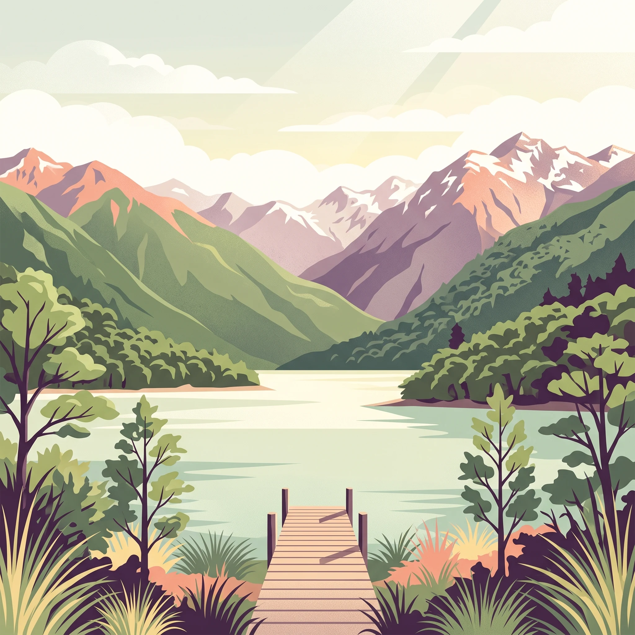
Long-term measurements from the 1991 to 2020 baseline show monthly mean temperatures peaking near thirteen degrees Celsius alongside steady daily precipitation across the high-elevation terrain. Reviewing the complete twelve-month climatology profile reveals monthly minimums, maximums, and rainfall trends to clarify the environmental cycle of Nelson Lakes National Park.
Annual mean7 °C
1 °C13 °C
Jan12°
Feb13°
Mar10°
Apr
May
Jun
Jul
Aug
Sep
Oct
Nov
Dec10°
Warmest month
February

12.7 °C

Coolest month
July

0.9 °C

Wettest month
June

3.3 mm/day

Driest month
February

2.2 mm/day

Park location guide

Geography guide, regional context, and park location map for Nelson Lakes National Park

Nelson Lakes National Park park geography, regions, and map view in New Zealand

Understand where Nelson Lakes National Park sits in New Zealand through a broader geographic reading of the surrounding landscape, nearby location context, and its mapped position within the national park landscape.

How Nelson Lakes National Park fits into New Zealand

New Zealand is an island nation in the southwestern Pacific Ocean comprising two main islands and numerous smaller islands. Located east of Australia across the Tasman Sea, it features varied topography with the Southern Alps running along the South Island and volcanic terrain on the North Island. The country was settled by Maori people between 1280 and 1350, followed by European exploration beginning in 1642, and became a Dominion in 1907 before gaining full independence in 1947.

Wider geography shaping Nelson Lakes National Park in New Zealand

New Zealand lies in the southwestern Pacific Ocean, east of Australia across the Tasman Sea. The country consists of two main islands, the North Island and South Island, plus over 600 smaller islands. The North Island features volcanic plateaus and hills while the South Island is dominated by the Southern Alps mountain range. The country has a long coastline and is surrounded by the Pacific Ocean.

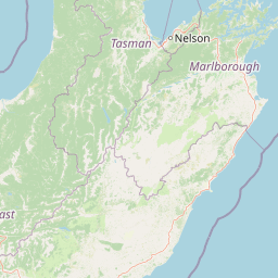
Map view of Nelson Lakes National Park

Use this park location map to pinpoint Nelson Lakes National Park in New Zealand, understand its exact geographic position, and read its mapped placement within the surrounding landscape more clearly.

Pigeon | © OpenStreetMap contributors

Location context for Nelson Lakes National Park

Tasman District
Natural feature types

Explore the Natural Landscapes and Geographic Features of Nelson Lakes National Park

Continue your geographic exploration by examining the individual landforms and water bodies that shape the environment of Nelson Lakes National Park. MoriAtlas provides a structured view of the alpine and valley features located throughout this significant protected area in the Southern Alps.
Recorded earthquake history

Review the Historical Earthquake Catalogue for Nelson Lakes National Park

Browse recorded seismic events associated with the mountainous terrain and glacial valleys of this New Zealand destination. MoriAtlas provides this factual database to support geographic discovery of past regional activity, independent of hazard or risk assessment.

Nelson Lakes National Park Earthquake History

Catalogued events

175 events

Strongest magnitude

Magnitude 6.1

Most recent event

Apr 6, 2025

This history includes earthquakes recorded inside the park or within 50 km of its borders

Park atlas

Browse connected landscapes and compare protected area geography across New Zealand's northern South Island.

Explore Other National Parks and Protected Areas Near Nelson Lakes National Park

After exploring Nelson Lakes National Park, continue your discovery by browsing nearby national parks and other protected areas across New Zealand's Tasman District and the broader Southern Alps region. Compare varied landscapes, from alpine environments and glacial lakes to extensive beech forests, gaining deeper geographic context and understanding regional conservation efforts.
Protected landscapeMarlborough Region
2.3 km away#1 closest

Northeast

Mount Richmond Forest Park: Geography and Protected Landscapes in the Marlborough Region

Expansive native bush and mountain peak terrain

Mount Richmond Forest Park stands as one of the largest protected forest areas on the South Island of New Zealand. Dominated by dense native bush and rugged subalpine ridges, the park offers a complex topography of river valleys and high-altitude peaks, including its namesake Mount Richmond. It serves as a vital conservation landscape and a core segment of the regional geography between Nelson and the Marlborough district.

Area
1,659 km²
Established
1977
Relief
Mountain
Scope
Terrestrial
Watercolor painting of mountains, green valleys, and a winding river under a soft sky
National parkWest Coast Region
8.3 km away#2 closest

North

Kahurangi National Park: A National Park of Ancient Geology and Diverse Protected Landscapes in New Zealand

Explore the mapped natural terrain and regional geographic context.

Kahurangi National Park is distinguished by its extraordinary geological diversity, representing New Zealand's finest Paleozoic rock sequence and expansive karst features. Covering a vast area in the West Coast Region, it protects a remarkable array of natural landscapes, from coastal cliffs and nikau palm forests to alpine tussock basins and deep gorges. This national park is crucial for understanding New Zealand's natural heritage, offering a rich tapestry of mapped terrain and protected biodiversity for dedicated geographic exploration.

Area
5,193 km²
Established
1996
IUCN
II
Relief
Mixed relief
Protected landscapeCanterbury
About 38 km away#3 closest

Southwest

Lake Sumner Forest Park: Geography and Protected Landscape Atlas for Canterbury

Mountainous river valleys and remote beech forests

Spanning over 100,000 hectares of the Canterbury high country, Lake Sumner Forest Park stands as a prime example of New Zealand's protected backcountry. This mapping resource details the park's river-carved terrain, subalpine fringes, and its role as a connective wilderness area between major South Island mountain ranges.

Area
1,051 km²
Relief
Mountain
Climate
Temperate
Access
Moderate access
Protected landscapeSouth Island
About 39 km away#4 closest

Southwest

Victoria Forest Park: A Deep Dive Into New Zealand's Largest Protected Forest Landscape

Inland West Coast mountain ranges and beech forest ecosystems

Spanning over 200,000 hectares, Victoria Forest Park stands as a defining geographic feature of the South Island. It acts as a critical refuge for endemic species and preserves all five native beech tree types within a massive, continuous protected area. The landscape integrates rugged mountain ranges with deep river valleys and historical industrial artifacts, providing a comprehensive look at the intersection of conservation and regional history.

Area
2,069 km²
Established
1981
Relief
Mountain
Climate
Temperate
National parkWest Coast Region
42 km away#5 closest

West

Paparoa National Park: Detailed Geographic Atlas of Karst Formations and Coastal Terrain

Discover protected landscape boundaries and unique New Zealand geology.

Paparoa National Park, located in the West Coast Region of New Zealand, offers a unique window into complex karst geology and dynamic coastal landscapes. This national park is characterized by extensive limestone cave systems, underground rivers, and the famous Pancake Rocks and Blowholes. The park's geography includes dramatic mountain terrain within the Paparoa Range and a striking coastline, providing a rich dataset for mapping protected area context and understanding regional natural features. It stands apart for its subterranean wonders and eroded limestone formations.

Area
429.7 km²
Established
1987
IUCN
II
Relief
Mountain
National parkNew Zealand
62 km away#6 closest

Southwest

Arthur's Pass National Park: Dramatic Alpine Protected Landscape in the Southern Alps

Explore the unique geography and mapped boundaries of this South Island national park.

Arthur's Pass National Park, a substantial protected area within New Zealand's Southern Alps, presents a compelling focus for geographic and atlas exploration. Characterized by dramatic alpine terrain shaped by ancient glacial forces, the park exhibits a striking ecological contrast between its drier eastern beech forests and wetter western rainforests. Users can delve into the mapped park boundaries and understand the regional landscape context of this unique protected area, making it a key destination for understanding New Zealand's natural geography.

Area
1,184.7 km²
Established
1929
IUCN
II
Relief
Mountain
Marine protected areaCanterbury
79 km away#7 closest

Southeast

Hikurangi Marine Reserve: Protected Marine Geography and Submarine Canyon Systems

Exploring the coastal reefs and deep trench environments of Canterbury

Hikurangi Marine Reserve represents a core protected landscape within the New Zealand marine atlas. Centered on the Kaikoura Canyon, the reserve features a sharp transition from rocky shoreline reefs to deep-sea environments that support a high density of cetaceans and seabirds. This map-focused profile examines the physical boundaries and unique oceanographic conditions that define this essential no-take marine zone.

Area
104.16 km²
Established
2014
IUCN
Ia
Relief
Lowland
Marine protected areaWest Coast
About 86 km away#8 closest

West

Punakaiki Marine Reserve: Mapped Protected Waters and West Coast Geographic Context

Exploring marine habitats and coastal land-sea corridors

Punakaiki Marine Reserve provides a critical look at marine conservation geography in New Zealand. Located along the West Coast, the reserve encompasses a variety of seafloor substrates and coastal formations that define the boundary between the Tasman Sea and the rugged limestone landscapes of the region. This atlas entry provides essential context for understanding the reserve's role in linking terrestrial and marine ecosystems.

Area
35.2 km²
Established
2014
Relief
Lowland
Climate
Temperate

Common questions about visiting, size, designation, and location context for Nelson Lakes National Park

Nelson Lakes National Park FAQs for park facts, access, geography, and protected area context

Find quick answers about Nelson Lakes National Park, including protected-area facts, park geography, trail and visitor context, and how the park fits into its surrounding country and regional landscape.
MoriAtlas Explorer

Continue Your Protected Areas Search Across the Global Atlas

Deepen your exploration by continuing the structured search for national parks and protected areas worldwide. Utilize the comprehensive filtering capabilities to compare different conservation landscapes and refine your understanding of global park geography. Discover more about the distribution and characteristics of protected natural areas.

Global natural geography