
Mori Atlas logo
Regional parkNgula Bulgarabang Regional Park

Tracing the geographic boundaries and forest character of this New South Wales escarpment

Ngula Bulgarabang Regional Park: A Protected Plateau Landscape in the Upper Blue Mountains

Ngula Bulgarabang Regional Park forms a well-defined plateau located on the upper Blue Mountains western escarpment, positioned west of Katoomba. Adjoining the Greater Blue Mountains World Heritage Area, this protected region spans 756 acres of eucalypt bushland and historic pine plantations. The area provides critical habitat for native species and preserves significant cultural pathways that traverse the dramatic sandstone cliffs overlooking the Megalong Valley.

upper blue mountainsblue mountains escarpmentplateau landscapeMegalong ValleyGreater Blue Mountains World Heritage Areaeucalypt bushland
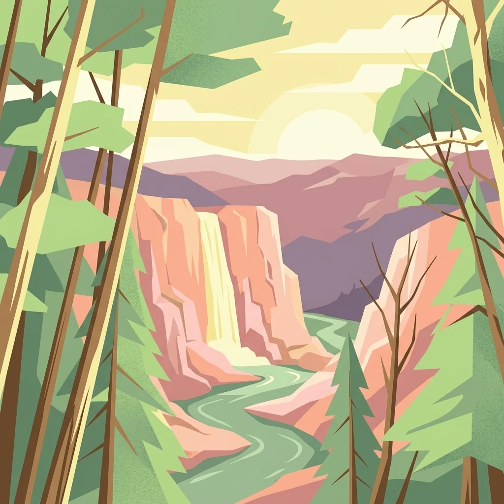
A graphic illustration showing a river winding through a canyon toward a waterfall at sunset, framed by stylized evergreen trees.

Ngula Bulgarabang Regional Park

Regional park

Park overview

Structured park overview, official facts, and landscape profile for Ngula Bulgarabang Regional Park

Ngula Bulgarabang Regional Park park facts, protected area profile, and essential visitor context

Review the core facts for Ngula Bulgarabang Regional Park, including designation, size, terrain, visitor scale, habitats, and operating context in one park-focused overview.

About Ngula Bulgarabang Regional Park

Ngula Bulgarabang Regional Park is a moderately sized protected area on the upper Blue Mountains western escarpment, west of Katoomba in New South Wales, Australia. The park occupies a clearly defined plateau to the west of Pulpit Hill Road, perched above the Megalong Valley and placed along the boundary of the Greater Blue Mountains World Heritage Area. Its roughly 756 acres consist of natural escarpment bushland combined with a historic plantation of radiata pine, giving the landscape a character that sets it apart from the surrounding eucalypt-dominated escarpment terrain.

The park provides a continuous bushland connection between residential edge areas of Katoomba and the broader wilderness and forested landscapes of the Blue Mountains. Its plateau position offers broad views across the Megalong Valley and a calmer, more open walking environment compared to the steep cliff-and-gully terrain that dominates much of the upper Blue Mountains. Vegetation on the plateau ranges from remnant dry sclerophyll forest elements through to the dense stands of radiata pine that have shaped its modern character and its older colloquial name.

Ecologically, Ngula Bulgarabang contributes to habitat connectivity across the escarpment, supporting mammals such as the spotted-tail quoll and greater glider, along with bird species such as the flame robin. The presence of the traditional Aboriginal pathway Blacks Ladder adds further cultural depth, linking the plateau to long-standing Gundungurra movement corridors across the upper mountains.

As a relatively new addition to the NSW national parks estate, the park has expanded the protected footprint of the upper Blue Mountains and strengthened the buffer of natural bushland that surrounds nearby townships. It now forms part of a network of regional and national park reserves that protect the escarpment forests, sandstone cliffs, and valley systems of this part of New South Wales.

Quick facts and research context for Ngula Bulgarabang Regional Park

Ngula Bulgarabang Regional Park lies on the upper Blue Mountains western escarpment near Katoomba in New South Wales, Australia. It covers roughly 756 acres of plateau bushland and borders both the Megalong Valley and the Greater Blue Mountains World Heritage Area.

The park is managed by the NSW National Parks and Wildlife Service and was gazetted in June 2020 after the NSW State Government purchased the property in 2019. Its official name, Ngula Bulgarabang, means 'very large forest' in the Gundungurra language, while the older colloquial name 'Radiata Plateau' reflects a mid twentieth century radiata pine plantation that still stands on parts of the plateau.

Protection and recognition

Terrestrial protected area classification and established conservation scope for 2020

Ngula Bulgarabang Regional Park Protection Status and Designation History

Ngula Bulgarabang Regional Park maintains a documented terrestrial protection status established in the year 2020. Official records compile the historical designation framework and international recognition data for this protected landscape.

Protection details

Protection scope
Terrestrial
Designated year
2020
Transboundary protection
No
Park context

Deeper park guide and search-rich context for Ngula Bulgarabang Regional Park

Ngula Bulgarabang Regional Park history, landscape, wildlife, and travel context

Explore Ngula Bulgarabang Regional Park through its history, landscape character, ecosystems, wildlife, conservation priorities, cultural context, and seasonal travel timing in a structured park guide built for atlas discovery and search intent.

Why Ngula Bulgarabang Regional Park stands out

Ngula Bulgarabang Regional Park is best known as a forested plateau sitting on the upper Blue Mountains western escarpment, directly overlooking the Megalong Valley and adjoining the Greater Blue Mountains World Heritage Area. The plateau carries a distinctive mix of natural escarpment bushland and an older radiata pine plantation, which has given the park its alternative identity as Radiata Plateau. It is also notable for its ecological role within the broader Blue Mountains landscape, supporting species such as the spotted-tail quoll, greater glider, and flame robin, and for preserving the traditional Gundungurra Aboriginal pathway known as Blacks Ladder that runs through the area.
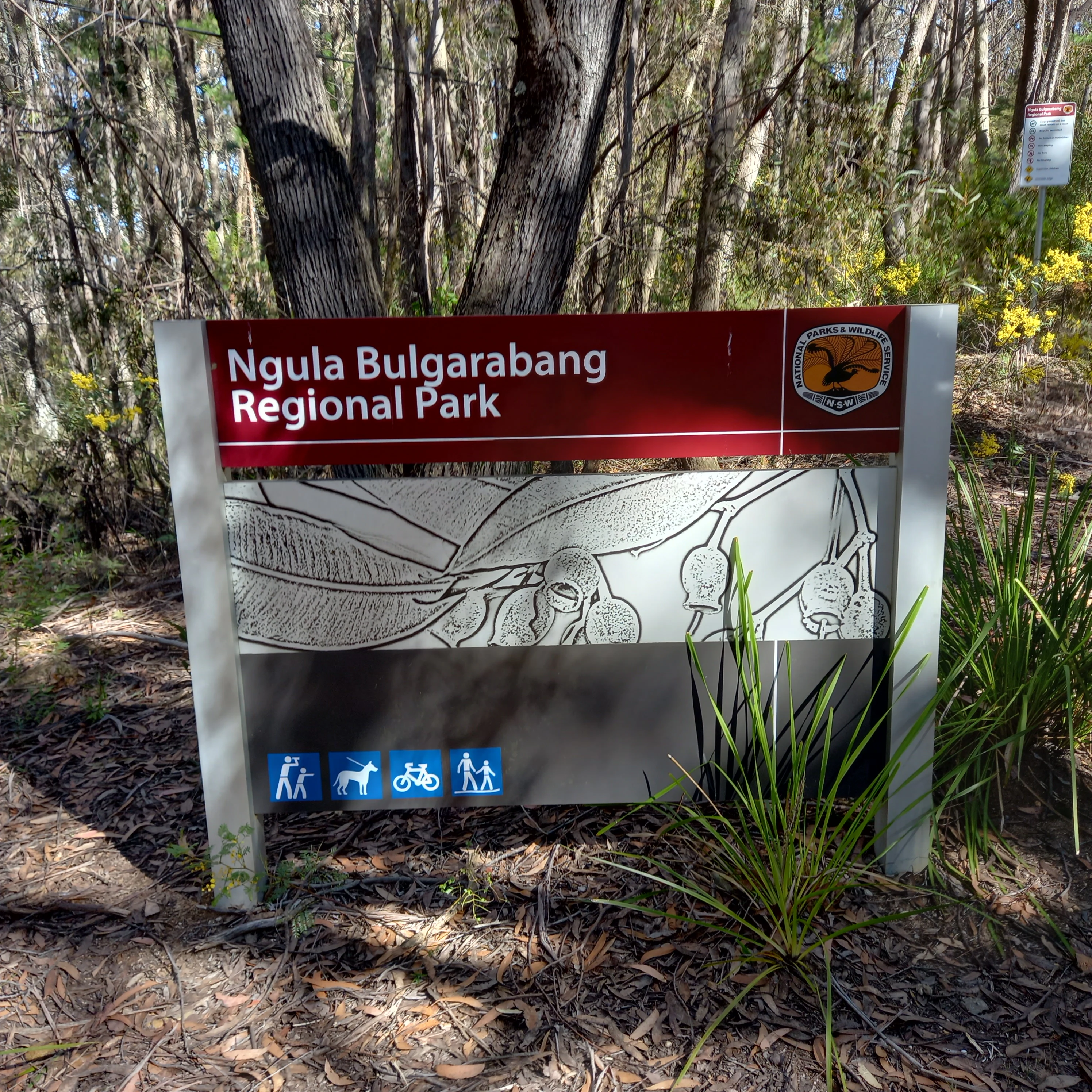
An eye level shot of a rectangular park sign for Ngula Bulgarabang Regional Park with a dark red top bar, a line drawing of eucalyptus leaves and gumnuts in the center, and blue activity icons at the bottom.
Official entrance sign for Ngula Bulgarabang Regional Park.

Ngula Bulgarabang Regional Park history and protected-area timeline

The plateau that now forms Ngula Bulgarabang Regional Park was held by a single family for 45 years, from 1974 to 2019, and was known to them as Invincibility Point. During this long period of private ownership, the property was identified by its Pulpit Hill Road address in Katoomba and was widely regarded as one of the largest undeveloped escarpment holdings in the upper Blue Mountains.

Before its modern history, the plateau was known as Pulpit Plateau. In the 1960s, parts of the plateau were cleared to establish a plantation of radiata pine, which has remained a defining feature of the landscape and gave rise to the colloquial name Radiata Plateau. The plantation sits within a broader matrix of natural escarpment bushland that has persisted around the planted pines.

Recognition of the property's conservation significance grew through the late 2010s. In 2019, it was offered for sale as a substantial multi-lot escarpment holding. Later that year, the NSW State Government purchased the property for $2.8 million, and on 8 October 2019, NSW Environment Minister Matt Kean announced that the area would be incorporated into the State's national park reserve system.

The park was officially gazetted in June 2020 under the name Ngula Bulgarabang, meaning 'very large forest' in the Gundungurra language, formalizing the transition from a privately held escarpment property to a regionally significant protected area within the Blue Mountains landscape.

Ngula Bulgarabang Regional Park landscape and geographic character

Ngula Bulgarabang Regional Park sits on a well-defined plateau along the upper Blue Mountains western escarpment, west of Katoomba. The plateau forms a relatively level upper surface that contrasts sharply with the steep sandstone cliffs and deeply incised valleys typical of the surrounding Blue Mountains terrain. From the plateau edge, the land drops away toward the Megalong Valley, producing long, open views across one of the upper mountains' most prominent valleys.

Within the park, the physical landscape is shaped by two overlapping elements: the natural escarpment bushland that covers much of the plateau, and the broad stands of radiata pine planted in the 1960s. The pine plantation gives parts of the park an open, parkland-like character, while surrounding native vegetation creates denser bushland corridors around the plateau margins and along the escarpment edge.

The location immediately adjoining the Greater Blue Mountains World Heritage Area places the park within a continuous sandstone landscape of cliffs, ledges, and forested valley systems. Pulpit Hill Road defines much of the eastern approach to the plateau, and the property's layout across several lots supports a mix of plateau interior and escarpment-edge terrain.

Ngula Bulgarabang Regional Park ecosystems, habitats, and plant life

The vegetation of Ngula Bulgarabang Regional Park reflects its position on the upper Blue Mountains western escarpment, where dry sclerophyll eucalypt forest types typically dominate surrounding landscapes. On the plateau itself, the natural bushland has been supplemented by a substantial mid twentieth century radiata pine plantation, producing a distinctive mixture of native canopy elements and a non-native conifer understory in parts of the park.

Around the plantations and across the rest of the plateau, regenerating native vegetation continues to occupy gullies, rock outcrops, and escarpment edges. The plateau's location adjoining the Greater Blue Mountains World Heritage Area places it within one of the most significant temperate eucalypt forest systems in Australia, with habitat continuity between the park and the broader wilderness of the upper mountains.

The combination of plateau forest, plantation, and escarpment-edge habitat creates a mosaic of environments that supports a variety of animal species and contributes to broader ecological functioning across the upper Blue Mountains escarpment corridor.

Ngula Bulgarabang Regional Park wildlife and species highlights

Ngula Bulgarabang Regional Park is known to support several notable native species that are characteristic of the upper Blue Mountains escarpment forests. Among the mammals recorded in the area is the spotted-tail quoll, a medium-sized marsupial carnivore that depends on large, connected tracts of forested landscape. The plateau's forest and escarpment-edge habitats also provide habitat for the greater glider, a gliding marsupial associated with mature eucalypt forest and hollow-bearing trees.

Birdlife in the park includes species such as the flame robin, a small insectivorous bird typically associated with open eucalypt woodlands and forest edges. The mix of native bushland and plantation, along with the adjoining Megalong Valley and the Greater Blue Mountains World Heritage Area, broadens the range of habitats available to both resident and seasonally mobile bird species.

Because the park sits within a wider landscape of protected escarpment forests, its wildlife communities are closely tied to broader patterns of species movement and habitat use across the upper Blue Mountains, making the plateau an important local refuge and connectivity area.

Ngula Bulgarabang Regional Park conservation status and protection priorities

Ngula Bulgarabang Regional Park is significant from a conservation perspective because it protects a substantial block of upper Blue Mountains escarpment bushland at the edge of the Greater Blue Mountains World Heritage Area. The park safeguards a mix of natural forest cover and an older radiata pine plantation within a landscape that has historically experienced considerable clearing and fragmentation.

Its position immediately adjoining the World Heritage Area strengthens habitat connectivity across the upper mountains, supporting species such as the spotted-tail quoll and greater glider that depend on extensive, connected forest environments. By adding another plateau and escarpment parcel to the State's reserve network, the park extends the buffer of protected bushland between the townships of the upper Blue Mountains and the surrounding wilderness.

The park's acquisition by the NSW State Government in 2019 and its gazetting in 2020 reflect recognition of the plateau's contribution to long-term ecological resilience, biodiversity protection, and the preservation of escarpment forest systems in this part of New South Wales.

Ngula Bulgarabang Regional Park cultural meaning and human context

The name Ngula Bulgarabang, given to the park at its gazetting in 2020, comes from the Gundungurra language and translates to 'very large forest'. The Gundungurra people are the traditional custodians of the Blue Mountains landscape, including the upper western escarpment country around Katoomba and the Megalong Valley. Naming the park in Gundungurra language reflects recognition of the continuing cultural significance of the area to Aboriginal communities.

A traditional Aboriginal pathway known as Blacks Ladder runs through the plateau, indicating long-standing Aboriginal travel routes through the upper escarpment. The presence of this pathway highlights the importance of the plateau not only as a natural landscape but as part of broader traditional movement corridors and cultural geographies of the Gundungurra people.

The lower profile colloquial names 'Pulpit Plateau' and 'Radiata Plateau', together with the private-era name Invincibility Point, also illustrate the layered human history of the area, ranging from European-era pastoral and land use patterns through to the modern recognition of Aboriginal place naming within the formal protected-area system.

Top sights and standout views in Ngula Bulgarabang Regional Park

Ngula Bulgarabang Regional Park protects a well-defined upper Blue Mountains plateau near Katoomba, sitting directly above the Megalong Valley and adjoining the Greater Blue Mountains World Heritage Area. Its roughly 756 acres of escarpment bushland include one of the more notable radiata pine plantations on the upper mountains, a legacy of 1960s clearing that gives the site its alternative identity as Radiata Plateau.

The park supports signature species of the Blue Mountains such as the spotted-tail quoll, greater glider, and flame robin, and incorporates the traditional Aboriginal pathway Blacks Ladder, which traverses the plateau as part of longer historic Gundungurra travel corridors. Its 2020 gazetting as Ngula Bulgarabang marked a significant expansion of protected escarpment bushland in the upper Blue Mountains.

Best time to visit Ngula Bulgarabang Regional Park

Visitation character at Ngula Bulgarabang Regional Park is shaped by the cool, elevated climate of the upper Blue Mountains, where conditions can shift between misty, wetter periods and clearer, drier windows. Cooler months generally produce crisper views across the Megalong Valley and more comfortable walking conditions across the plateau, while warmer months can bring higher temperatures and occasional summer storms, sometimes reducing visibility from the escarpment edge.

The plateau's mix of radiata pine plantation and surrounding native bushland gives it distinct seasonal character, with cooler periods often highlighting the structural contrast between the open pine stands and the denser eucalypt canopy. Wildlife activity across the area tends to follow broader upper Blue Mountains patterns, with cooler seasons frequently associated with more visible animal movement and clearer conditions for viewing across the valley.

Monthly climate preview

Long-term representative temperature and precipitation patterns across twelve recorded months

Ngula Bulgarabang Regional Park Climate Normals and Annual Weather Rhythm

Ngula Bulgarabang Regional Park displays a measured annual sequence of monthly average temperatures and precipitation rates based on historical coordinate data. Examining the complete monthly climate normals reveals full seasonal shifts in temperature extremes and precipitation distribution.
Annual mean13 °C
6 °C20 °C
Jan20°
Feb19°
Mar17°
Apr13°
May
Jun
Jul
Aug
Sep10°
Oct13°
Nov16°
Dec18°
Warmest month
January

20.4 °C

Coolest month
July

5.7 °C

Wettest month
February

3.6 mm/day

Driest month
May

1.3 mm/day

Park location guide

Geography guide, regional context, and park location map for Ngula Bulgarabang Regional Park

Ngula Bulgarabang Regional Park park geography, regions, and map view in Australia

Understand where Ngula Bulgarabang Regional Park sits in Australia through a broader geographic reading of the surrounding landscape, nearby location context, and its mapped position within the national park landscape.

How Ngula Bulgarabang Regional Park fits into Australia

Australia is a constitutional monarchy and federal parliamentary democracy comprising six states and ten territories. With a population of nearly 28 million, it is one of the world's most urbanised countries, with most people concentrated on the eastern seaboard. The country has a high Human Development Index and is known for its cultural diversity, ancient Aboriginal heritage, and unique wildlife.

Wider geography shaping Ngula Bulgarabang Regional Park in Australia

Australia occupies the entire Australian continent, the island of Tasmania, and numerous smaller islands. It is the world's flattest and driest inhabited continent, featuring vast deserts in the interior (the Outback), tropical rainforests along the eastern coast, and a coastline bordering the Indian and Pacific Oceans.

Map view of Ngula Bulgarabang Regional Park

Use this park location map to pinpoint Ngula Bulgarabang Regional Park in Australia, understand its exact geographic position, and read its mapped placement within the surrounding landscape more clearly.

Pigeon | © OpenStreetMap contributors

Location context for Ngula Bulgarabang Regional Park

New South Wales

Visual reference of plateau terrain, eucalypt forests, and pine plantations

Ngula Bulgarabang Regional Park Photos and Escarpment Landscape Scenery

Visual records capture the distinctive protected landscape and native habitats across the upper Blue Mountains plateau. Detailed photography illustrates the escarpment terrain, pine plantations, and expansive valley drop-offs that define the region.

An eye level shot of a rectangular park sign for Ngula Bulgarabang Regional Park with a dark red top bar, a line drawing of eucalyptus leaves and gumnuts in the center, and blue activity icons at the bottom.

A low angle view looking up into a dense canopy of tall, mature Radiata pine trees against a bright blue sky in Ngula Bulgarabang Regional Park.

Park atlas

Discover related protected areas, regional plateau reserves, and connected mountain landscapes.

Explore Other Parks Near Ngula Bulgarabang Regional Park and Surrounding Escarpment Terrain

Compare Ngula Bulgarabang Regional Park with other protected landscapes across the surrounding escarpment terrain. This regional park view expands your geographic exploration into adjacent bushland corridors and nearby mountain reserves.
National parkNew South Wales
About 9.6 km away#1 closest

Southwest

Kanangra-Boyd National Park: A Protected Landscape within New South Wales' Geography

Mapped boundaries and regional park context.

Kanangra-Boyd National Park represents a significant protected area, offering valuable insights into the natural landscapes and geographic context of New South Wales. As a national park, it provides a clear example of mapped terrain and protected land distribution, crucial for anyone exploring the atlas of Australian conservation areas. Understanding this park contributes to a broader appreciation of its regional geography and specific landscape identity.

Area
686.6 km²
Established
1969
IUCN
Ib
Relief
Mountain
National parkNew South Wales
About 20 km away#2 closest

Northeast

Blue Mountains National Park National Park: Mapped Protected Landscape Atlas

Explore New South Wales park geography and natural terrain.

Blue Mountains National Park, designated as a national park in New South Wales, offers a rich subject for geographic discovery and atlas exploration. This entry details its specific mapped boundaries and natural landscape features, providing essential context for understanding its place within Australia's protected areas. Engage with the park's core geographic identity and explore its protected terrain within a structured, map-focused dataset.

Area
2,679.54 km²
Established
1959
IUCN
II
Visitors
8.4M annual
A horizontal watercolor painting showing layers of rolling hills in shades of green, yellow, and soft pink against a white background.
Nature reserveNew South Wales
About 26 km away#3 closest

Southwest

Jenolan Karst Conservation Reserve: Atlas and Geographic Landscape Profile

Protected nature reserve in the New South Wales Central Tablelands

The Jenolan Karst Conservation Reserve protects one of the most significant fluviokarst landscapes on the planet. This profile details the reserve's complex surface and subterranean drainage systems, including the famous Grand Arch and the multi-level cave network that defines the valley's distinct geological character within the Great Dividing Range.

Area
30.83 km²
Established
1997
IUCN
III
Visitors
250K annual
National parkNew South Wales
About 28 km away#4 closest

North

Wollemi National Park: Mapping Australia's Protected Natural Landscape in New South Wales

Detailed geographic context and protected area exploration.

Wollemi National Park is a critical component of New South Wales' protected natural areas, offering rich opportunities for geographic discovery. This national park provides a distinct focus for understanding the mapped terrain and regional landscape context of Australia. Explore its position within New South Wales, uncovering the details that define its unique protected status and natural geography for dedicated atlas exploration.

Area
5,017.03 km²
Established
1979
IUCN
Ib
Relief
Mountain
State or regional parkNew South Wales
About 35 km away#5 closest

East

Yellomundee Regional Park: Mapped Escarpment Boundaries and Nepean River Geography

A significant bushland reserve in New South Wales, Australia

Yellomundee Regional Park serves as a protected bushland buffer on the Blue Mountains escarpment, where ridge topography meets the Nepean River. With a landscape largely untouched by human development, this reserve offers a window into the natural bushland ecosystems and riverine corridors of the Great Dividing Range in New South Wales. Use this atlas to visualize the park's ridgelines, gullies, and vertical transition from mountain slopes to river valley flats.

Area
4.85 km²
Established
2000
IUCN
V
Relief
Mountain
Nature reserveNew South Wales
About 40 km away#6 closest

East

Agnes Banks Natural Area Nature Reserve and Geological Landscape in New South Wales

Rare inland sand dunes and native flora habitats

The Agnes Banks Natural Area preserves an ancient, wind-reworked sand deposit that supports coastal-style woodland communities far from the ocean. This site serves as a crucial ecological link within the Cumberland Plain, offering significant value for studying sand-dune evolution, geological history, and rare flora species unique to this protected landscape in New South Wales.

Established
1999
Relief
Lowland
Scope
Terrestrial
Water
Minor water
A soft watercolor illustration of a river flowing through a grassy valley with scattered trees and distant rolling hills on a white background.
State or regional parkNew South Wales
About 42 km away#7 closest

Southeast

Bents Basin State Conservation Area: A Geographic Atlas of the Nepean River Gorge

Protected river basin and sandstone terrain in New South Wales

Centered on a lagoon-like swimming hole formed by the Nepean River, Bents Basin State Conservation Area represents a critical protected landscape within New South Wales. The reserve showcases a transition between rugged sandstone gorge topography and the undulating shale-based soils of the Cumberland Plain. Examine the mapped boundaries and natural features of this ecologically rich riparian corridor located in the Sydney metropolitan area.

Area
0.62 km²
Established
1980
IUCN
II
Relief
Upland
National parkNew South Wales
About 44 km away#8 closest

North

Gardens of Stone National Park: National Park Protected Landscape and Geographic Atlas

New South Wales protected area and mapped terrain exploration.

Delve into the protected landscape of Gardens of Stone National Park, an important national park situated in New South Wales, Australia. This page offers an atlas-centric view, focusing on the park's distinct geographic identity, its mapped protected boundaries, and its contribution to the regional context of protected lands. Understand the fundamental landscape character and terrain that define this significant natural area for structured geographic discovery.

Area
150.8 km²
Established
1994
IUCN
II
Relief
Highland

Common questions about visiting, size, designation, and location context for Ngula Bulgarabang Regional Park

Ngula Bulgarabang Regional Park FAQs for park facts, access, geography, and protected area context

Find quick answers about Ngula Bulgarabang Regional Park, including protected-area facts, park geography, trail and visitor context, and how the park fits into its surrounding country and regional landscape.
MoriAtlas Explorer

Continue Your Protected Areas Search Across the Global Atlas

Deepen your exploration by continuing the structured search for national parks and protected areas worldwide. Utilize the comprehensive filtering capabilities to compare different conservation landscapes and refine your understanding of global park geography. Discover more about the distribution and characteristics of protected natural areas.

Global natural geography