
Mori Atlas logo
Nature reserveNidderauen von Stockheim

Tracing the mapped boundaries and wetland terrain of this vital river valley conservation landscape.

Nidderauen von Stockheim Nature Reserve: A Detailed Geographic Atlas of Protected Floodplains

(Naturschutzgebiet Nidderauen von Stockheim)

Nidderauen von Stockheim stands as a core protected area within the floodplain networks of the Wetteraukreis region. This reserve features an intricate mosaic of wet meadows, reedbeds, and re-naturalized river corridors along the Nidder, providing critical habitat within a managed lowland landscape. The site serves as a vital case study for floodplain conservation, where large-herbivore grazing and river restoration maintain open wetland terrain for migratory birds and protected amphibian species.

floodplainwet meadowsreedbedsriver restorationlarge herbivore grazingFFH site
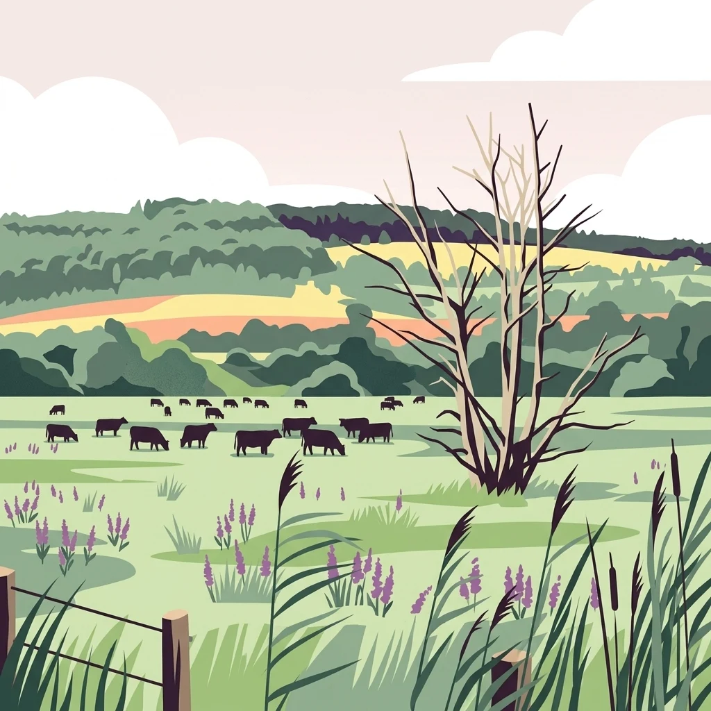
A stylized flat-design illustration of a rural landscape with grazing cattle in a green meadow, a large leafless tree in the foreground, and rolling hills in the background.

Nidderauen von Stockheim

Nature reserve

Park overview

Structured park overview, official facts, and landscape profile for Nidderauen von Stockheim

Nidderauen von Stockheim park facts, protected area profile, and essential visitor context

Review the core facts for Nidderauen von Stockheim, including designation, size, terrain, visitor scale, habitats, and operating context in one park-focused overview.

About Nidderauen von Stockheim

Nidderauen von Stockheim is a small but ecologically significant nature reserve located in the Nidder river valley in the Wetterau region of Hesse, Germany. Designated as a Naturschutzgebiet in 1981, the reserve protects roughly 51 hectares of floodplain habitat spread across both banks of the Nidder between the communities of Stockheim (part of Glauburg) and Effolderbach (part of Ortenberg). Its position within the larger Auenverbund Wetterau floodplain network gives it both regional and European-scale conservation significance.

The defining character of the reserve lies in its mosaic of wet meadows, reedbeds (Röhricht), tall herb communities (Hochstaudenfluren), pond systems, and traditionally managed grassland, all set within a slowly flowing lowland river landscape. Together these habitats form a continuous floodplain corridor that supports breeding, resting, and wintering populations of wetland-dependent fauna. The reserve's open water surfaces and well-maintained trail system also make it accessible to visitors interested in nature observation.

Beyond its national-level protection as a nature reserve, Nidderauen von Stockheim is also designated as a European Fauna-Flora-Habitat (FFH) site under the EU Habitats Directive, reinforcing its importance for maintaining threatened habitat types and species at the broader continental level. Habitat management has been a defining aspect of the reserve's development: from 2005 a major restoration project re-naturalized a 1,400-meter stretch of the Nidder between Ortenberg-Effolderbach and Glauburg-Stockheim, and since 2011 the area has been grazed by Heck cattle (a back-breeding of the extinct aurochs) and Konik horses to maintain open habitats and prevent ponds from being overgrown.

Because the reserve connects directly upstream with the Auwiesen von Effolderbach and the Salzwiesen von Selters, the broader landscape around Stockheim functions as a unified floodplain complex of more than 250 hectares. This makes the area not only an isolated protected site but also a functional segment of a much larger regional floodplain ecosystem running through the Wetterau.

Quick facts and research context for Nidderauen von Stockheim

Nidderauen von Stockheim is a nature reserve (Naturschutzgebiet) established in 1981 in the Wetteraukreis district of Hesse, Germany. The reserve lies on both sides of the Nidder river between the villages of Stockheim in Glauburg and Effolderbach in Ortenberg. It covers roughly 51 hectares and is integrated into the Auenverbund Wetterau floodplain network, which together with adjacent reserves covers more than 250 hectares.

The area is protected both as a German nature reserve and as a European Fauna-Flora-Habitat (FFH) site under the EU Habitats Directive. Its habitats include wet meadows, reedbeds, tall herb communities, and traditionally used farmland along a floodplain river system. Since 2011, Heck cattle and Konik horses have been used for year-round grazing to keep ponds and meadows from being overgrown.

Protection and recognition

Explore the documented terrestrial conservation scope and recognition history.

Nidderauen von Stockheim Protection Status and Official Designation Data

Nidderauen von Stockheim maintains a documented terrestrial protection status with structured management parameters recorded for conservation analysis. Designated administrative scopes and international recognition records provide factual context for this protected natural landscape.

Protection details

Protection scope
Terrestrial
Transboundary protection
No
Park context

Deeper park guide and search-rich context for Nidderauen von Stockheim

Nidderauen von Stockheim history, landscape, wildlife, and travel context

Explore Nidderauen von Stockheim through its history, landscape character, ecosystems, wildlife, conservation priorities, cultural context, and seasonal travel timing in a structured park guide built for atlas discovery and search intent.

Why Nidderauen von Stockheim stands out

Nidderauen von Stockheim is best known as a compact but ecologically rich floodplain reserve that supports an unusually high diversity of wetland bird species. It is a recognized breeding site for rare birds such as bluethroat, sedge warbler, spotted crake, water rail, kingfisher, marsh harrier, and little grebe, and also serves as an important staging area for migrating waterbirds. The reserve is also notable for its blend of habitat types along a small river system: wet meadows, reedbeds, ponds, and actively managed floodplain farmland. Its combination of conservation-focused river restoration, traditional grazing with Heck cattle and Konik horses, and overlap with EU-level habitat protection makes it a characteristic example of Wetterau floodplain conservation.
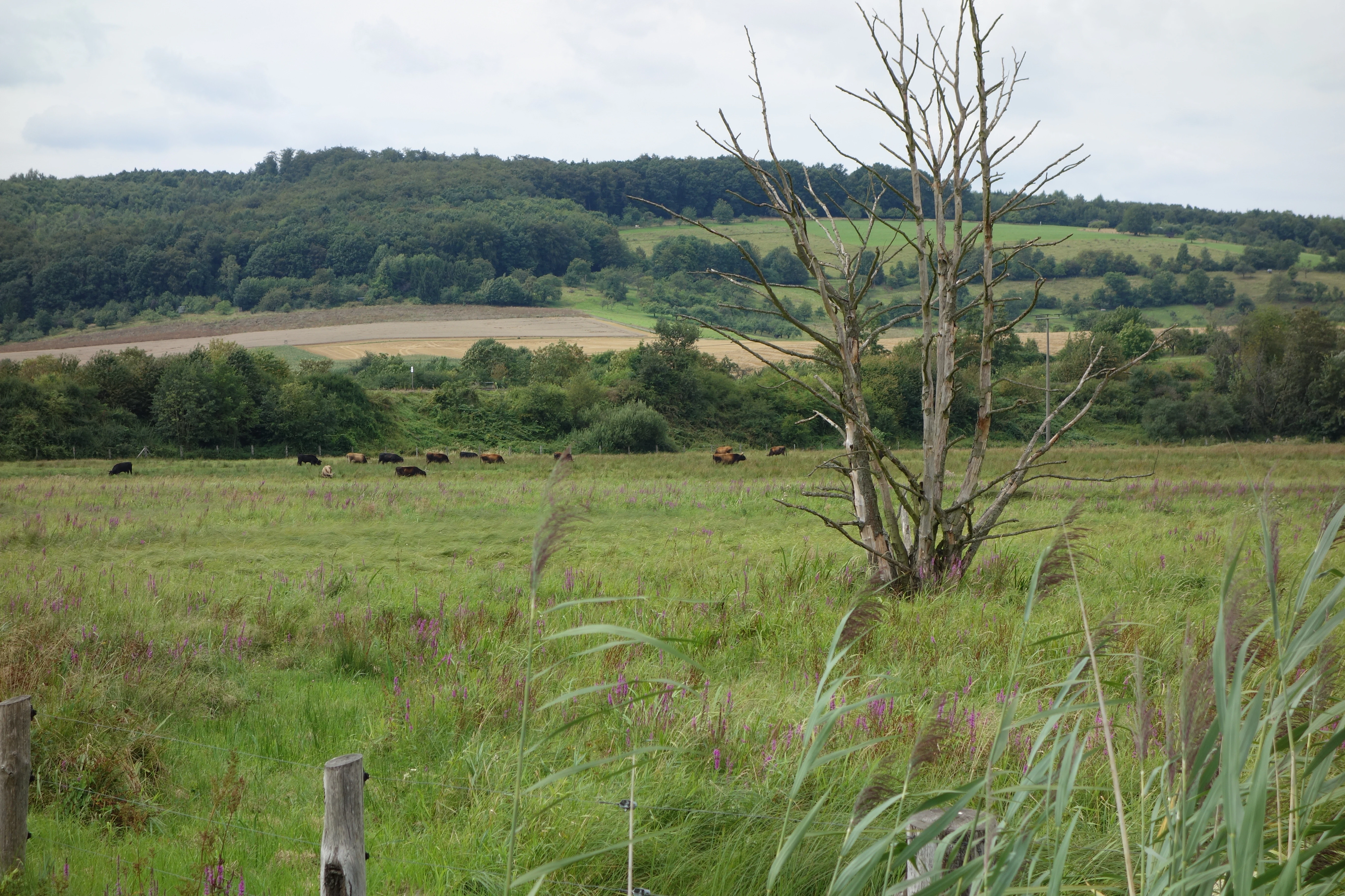
A wide view of a green wetland meadow in Nidderauen von Stockheim with a bare, dead tree in the foreground and dark cattle grazing in the distance, backed by forested rolling hills.
A view of the wetland meadows at Nidderauen von Stockheim nature reserve, characterized by open fields and grazing livestock.

Nidderauen von Stockheim history and protected-area timeline

Nidderauen von Stockheim was formally designated as a nature reserve in 1981, placing roughly 51 hectares of floodplain habitat along the Nidder river under protection. The protection order aimed to secure wet meadows, reedbeds, tall herb communities, and traditionally used farmland in the Nidder valley as habitats for breeding, staging, feeding, and wintering populations of threatened animal species, while also preserving endangered plant communities.

From 2005 onward, a substantial restoration project focused on a 1,400-meter stretch of the Nidder between Ortenberg-Effolderbach and Glauburg-Stockheim aimed to return the river to a more natural floodplain character. The project complemented the reserve's broader role within the Auenverbund Wetterau and laid groundwork for reintroducing landscape-scale grazing as a management tool.

Since 2011, the area has been managed through grazing with Heck cattle and Konik horses. Heck cattle are a re-breeding of the extinct aurochs and are used here to mimic large-herbivore influence on the floodplain. The grazing animals also use the shorelines of the shallow ponds, preventing them from being overgrown by tall herb vegetation and woody plants. As part of the Hessian species protection program for the European pond terrapin, habitat optimization measures were also carried out to support a settlement population in the southern part of the reserve.

Nidderauen von Stockheim landscape and geographic character

The landscape of Nidderauen von Stockheim is shaped by the lowland floodplain of the Nidder river in the Wetterau region of Hesse. The reserve extends along both sides of the river, creating a typical shallow-valley floodplain setting with gently graded banks, flat alluvial meadows, and slow-moving water.

Within this broader river valley, the terrain breaks into a mosaic of landforms: seasonally flooded wet meadows, permanently moist reed-fringed ponds, patches of tall herb vegetation, and traditionally mown or grazed grassland. The visible water surfaces are spread across the floodplain rather than concentrated in a single channel, and this openness is one of the reserve's defining visual characteristics. The well-developed path network allows clear views across the meadows and ponds.

Towards the edges of the reserve the floodplain transitions gradually into the surrounding agricultural land of the Wetterau. The wider landscape context of the Auenverbund Wetterau connects the reserve to adjacent wet meadow and floodplain habitats, producing an extended lowland river-valley character rather than any prominent mountain or coastal scenery.

Nidderauen von Stockheim ecosystems, habitats, and plant life

Ecologically, Nidderauen von Stockheim is defined by its floodplain habitat mosaic. The core habitats are species-rich wet meadows, reedbeds dominated by tall graminoids and reeds, and patches of tall herb vegetation (Hochstaudenfluren) that develop along ditch edges and moist margins. These habitats are interspersed with shallow open ponds and lesser water bodies, which create the standing water conditions that many wetland species require.

The reserve forms part of the larger Auenverbund Wetterau floodplain network, and as such it plays a key role in maintaining the continuity of wet meadow and reedbed habitat along the Nidder. The area also carries overlapping European protection as an FFH site, underscoring the significance of its habitat types at the continental scale. Botanical interest includes species such as the broad-leaved marsh orchid (Breitblättriges Knabenkraut), which is one of the more recognizable indicator species of the reserve's meadows.

This habitat mosaic is not static; it is actively shaped by conservation management. The restoration of the river itself, combined with year-round grazing by Heck cattle and Konik horses, maintains open shorelines and prevents the wet meadows and ponds from succeeding toward shrub or woodland. The result is a dynamic, semi-open floodplain landscape that retains the hydrological and habitat conditions characteristic of a lowland river valley.

Nidderauen von Stockheim wildlife and species highlights

Nidderauen von Stockheim is most strongly associated with its birdlife, and the reserve functions as a key site for several rare and threatened breeding species. Documented breeding species of conservation concern include bluethroat, sedge warbler, spotted crake, water rail, kingfisher, marsh harrier, and little grebe. The river warbler (Rohrschwirl) has also established itself as a breeding species in the area, reflecting the ongoing value of the reserve's reedbeds. Beyond its breeding importance, the area also serves as a significant staging and resting site for many other wetland-dependent bird species during migration.

Amphibians form a second major faunal focus. The European tree frog is highlighted as an important resident of the reserve, supported by the combination of shallow ponds, wet meadows, and seasonally flooded areas that provide both breeding habitat and terrestrial shelter.

Reptile conservation is represented by a settlement population of the European pond terrapin in the southern part of the reserve, established through the Hessian species protection program. In preparation, extensive habitat optimization measures were carried out to make the area suitable for the species. The continuous grazing pressure from Heck cattle and Konik horses also benefits reptile and amphibian species by maintaining open basking sites along pond margins.

Nidderauen von Stockheim conservation status and protection priorities

Nidderauen von Stockheim carries overlapping layers of conservation status that together reflect its significance beyond a typical local nature reserve. It was designated as a German Naturschutzgebiet in 1981, and its wet meadow areas also hold protection under the European Union's Habitats Directive as a Fauna-Flora-Habitat (FFH) site, embedding it within the continent-wide Natura 2000 network of protected areas.

The reserve's conservation rationale centers on preserving the natural floodplain character of the Nidder valley: securing wet meadows, reedbeds, tall herb communities, and traditionally managed agricultural land as habitats for endangered species and as reservoirs for threatened plant communities. Hydrological restoration along a 1,400-meter stretch of the Nidder since 2005 has been central to this effort, aiming to restore natural flooding patterns, sediment dynamics, and habitat structure in the river corridor.

A particularly distinctive conservation strategy is the use of large herbivores (Heck cattle and Konik horses) to maintain open floodplain conditions. By grazing shorelines and meadows, these animals prevent the encroachment of tall herbs and woody plants that would otherwise simplify the habitat mosaic. The reserve is also functionally connected to the Auwiesen von Effolderbach and the Salzwiesen von Selters, forming part of a coherent floodplain complex of over 250 hectares, which greatly enhances its conservation value at the landscape scale.

Top sights and standout views in Nidderauen von Stockheim

The reserve is small in area but disproportionately rich in habitat value, combining wet meadows, reedbeds, ponds, and tall herb communities in a compact stretch of the Nidder valley. Its designation as both a German nature reserve and a European FFH site is a clear indicator of its conservation weight.

Equally distinctive is the management approach: re-naturalized river sections, large-herbivore grazing, and targeted species programs that have supported pond terrapin settlement and continue to maintain habitat conditions for rare breeding birds and amphibians. Together these features make Nidderauen von Stockheim a representative example of how small floodplain reserves can play an outsized role within a broader regional network.

Best time to visit Nidderauen von Stockheim

Spring and early summer are generally the most rewarding seasons for visiting Nidderauen von Stockheim, when wet meadows and reedbeds support active breeding bird communities and are most acoustically and visually alive. Migrating and staging waterbirds also tend to be present in high numbers during spring passage and again in autumn.

Late spring into early summer is a good period for observing amphibians and wetland flora such as marsh orchids. Visits in winter can still be worthwhile for observing waterbirds in open water and for experiencing the open, exposed character of the managed floodplain landscape, when large herbivores are often visible against the low vegetation. The well-developed path network makes most seasons accessible on foot.

Monthly climate preview

Examining recorded monthly temperature ranges and precipitation averages across representative park terrain

Nidderauen von Stockheim Climate Normals and Long-Term Weather Patterns

Nidderauen von Stockheim maintains measured long-term climate normals spanning sub-zero winter lows to warm summer maximums alongside steady daily precipitation rates. Reviewing the complete twelve-month temperature and precipitation sequence provides comprehensive context for the regional ecosystem.
Annual mean9 °C
-1 °C19 °C
Jan-1°
Feb
Mar
Apr
May13°
Jun16°
Jul19°
Aug19°
Sep14°
Oct
Nov
Dec
Warmest month
July

18.8 °C

Coolest month
January

-0.6 °C

Wettest month
July

2.5 mm/day

Driest month
April

1.6 mm/day

Park location guide

Geography guide, regional context, and park location map for Nidderauen von Stockheim

Nidderauen von Stockheim park geography, regions, and map view in Germany

Understand where Nidderauen von Stockheim sits in Germany through a broader geographic reading of the surrounding landscape, nearby location context, and its mapped position within the national park landscape.

How Nidderauen von Stockheim fits into Germany

Germany is a federal republic in Western and Central Europe with a population of over 83 million across sixteen constituent states. It is Europe's largest economy by nominal GDP and a major global exporter and importer. The capital is Berlin, and the country borders Denmark, Poland, Czech Republic, Austria, Switzerland, France, Luxembourg, Belgium, and the Netherlands.

Wider geography shaping Nidderauen von Stockheim in Germany

Germany is located in Western and Central Europe, spanning 357,022 km². It borders Denmark to the north, Poland and the Czech Republic to the east, Austria and Switzerland to the south, and France, Luxembourg, Belgium, and the Netherlands to the west. The country has coastlines on the Baltic Sea and North Sea to the north, with the Alps located in the southern region.

Map view of Nidderauen von Stockheim

Use this park location map to pinpoint Nidderauen von Stockheim in Germany, understand its exact geographic position, and read its mapped placement within the surrounding landscape more clearly.

Pigeon | © OpenStreetMap contributors

Location context for Nidderauen von Stockheim

Wetteraukreis

Visual reference of lowland floodplain habitats, wet meadows, and river terrain

Nidderauen von Stockheim Landscape and Scenery Photography

Visual records capture the distinctive lowland river valley character, flat alluvial meadows, and open water channels of Nidderauen von Stockheim. Examining these protected area photos reveals the complex mosaic of reedbeds and wetland habitats that define the regional ecosystem.

A wide view of a green wetland meadow in Nidderauen von Stockheim with a bare, dead tree in the foreground and dark cattle grazing in the distance, backed by forested rolling hills.

Park atlas

Compare adjacent floodplain reserves and regional river valley habitats in Hesse

Explore Parks Near Nidderauen von Stockheim and Surrounding Protected Landscapes

Browse other protected areas and wetland habitats situated across the surrounding Wetterau region. Connecting individual floodplain reserves provides deeper geographic context for lowland river valley conservation.
Protected areaGermany
About 3.9 km away#1 closest

Southwest

Bruch von Heegheim Protected Area: A Wetland Landscape in the Nidder River Valley

Mapped wetland habitats and ecological site geography

Bruch von Heegheim is a specialized nature reserve that protects a delicate mosaic of shallow water bodies and reed-dominated marshes in the German district of Wetteraukreis. The site serves as a vital refuge for European tree frogs and breeding marshland birds, demonstrating how compact protected lands contribute to broader biodiversity conservation within agricultural floodplains.

Area
0.108 km²
Established
1976
Relief
Lowland
Climate
Temperate
A horizontal watercolor illustration showing a meandering stream flowing through open green grasslands with scattered trees and low hills in the background.
Nature reserveHessen
About 5.4 km away#2 closest

West

Nachtweid von Dauernheim Nature Reserve: Geographic Overview and Wetland Conservation

Saline meadows and floodplain habitats in Hessen

Nachtweid von Dauernheim is a specialized nature reserve in the Wetterau district, defined by its rare saline-influenced grassland flora and extensive sedge marshes. As a core rail bird biotope, the site anchors a wider wetland network alongside the Nidda river floodplain. This protected area offers a deep look into central Germany's unique hydrologic conditions and sensitive open-terrain conservation.

Area
0.789 km²
Established
1978
Nature reserveHesse
About 6.4 km away#3 closest

South

Im Rußland und in der Kuhweide bei Lindheim: Nature Reserve and Floodplain Geography

Protected grassland landscapes in the Wetterau, Hesse.

Located in the Wetteraukreis district of Hesse, this nature reserve protects extensive floodplain meadows along the Nidder river. The area is defined by its open grassland mosaic, providing critical refuge for meadowbirds and diverse amphibian populations. Access detailed map data and landscape context for this significant German conservation site.

Area
2.495 km²
Established
1984
Relief
Lowland
Climate
Temperate
A horizontal watercolor painting showing a wetland landscape with gentle rolling hills, marshy vegetation, and scattered trees under a light sky.
Nature reserveHesse
About 10 km away#4 closest

Northwest

Bingenheimer Ried Nature Reserve: Mapped Floodplain Geography in Hesse

A critical lowland mire and wetland conservation network

Located in the Horloff valley, Bingenheimer Ried represents an essential protected landscape characterized by seasonal flooding and shallow mire habitats. This nature reserve supports significant bird populations and diverse aquatic life, functioning as a primary reference point for floodplain management and conservation geography within the state of Hesse.

Area
0.85 km²
Established
1985
Watercolor painting of a green landscape with rolling hills, small clusters of trees, and soft pinkish tones in the background.
Nature reserveHesse
About 14 km away#5 closest

Southwest

Krebsbachtal bei Kaichen: Protected Stream Valley Geography and Landscape Map in Hesse

Nature reserve featuring diverse meadow and forest habitat mosaics

Spanning 34 hectares in the Main-Kinzig-Kreis, the Krebsbachtal bei Kaichen reserve protects a unique concentration of riparian stream life, dry grasslands, and traditional orchard meadows. This valley landscape, framed by the Hainwald forest, provides a protected corridor that remains a significant representative of the historic natural terrain found in central Hesse.

Area
0.34 km²
Established
1988
Relief
Lowland
Climate
Temperate
Nature reserveHessen
About 18 km away#6 closest

South

Kinzigaue von Langenselbold: Nature Reserve and Protected Floodplain in Hessen

Riparian ecosystems, alluvial forests, and wetland geography

Spanning 129 hectares, Kinzigaue von Langenselbold represents a well-preserved riverine corridor in central Germany. The reserve integrates the meandering Kinzig river, mature gallery forests, and the Ruhlsee into a compact, protected landscape that serves as an essential habitat for diverse bird species and rare floodplain vegetation.

Area
1.287 km²
Established
1980
IUCN
IV
A wide watercolor painting showing a green river valley with marshy foreground, a line of trees, and rolling hills in purple and green in the background.
Nature reserveWetteraukreis
About 19 km away#7 closest

West

Salzwiesen von Wisselsheim Nature Reserve: Atlas and Regional Geography of Wetteraukreis

Protected inland salt meadows and floodplain geography in Hesse, Germany.

Salzwiesen von Wisselsheim stands as a significant protected area in the Wetteraukreis region, distinguished by rare inland salt meadows fed by natural saline springs. This reserve presents a compelling landscape defined by the River Wetter, offering deep insights into how unique hydrogeology and historical salt production have formed a specialized lowland habitat that is largely absent from other inland regions.

Area
0.23 km²
Established
1982
Relief
Lowland
Climate
Temperate
A watercolor painting showing a soft, peaceful landscape with green rolling hills, a small body of water in the foreground, and faint, distant mountains under a pale sky.
Nature reserveHesse
About 20 km away#8 closest

West

Kiesgrube Laukertsberg bei Nieder-Mörlen Protected Area in Hesse, Germany

A reclaimed post-industrial nature reserve and habitat

Located in the Wetterau district of Hesse, Kiesgrube Laukertsberg bei Nieder-Mörlen represents a significant shift from industrial gravel extraction to protected ecological sanctuary. The terrain features open-ground habitats and seasonal wetlands that support sensitive species, illustrating how landscape management can prioritize biodiversity. Analyze the site boundaries and its role within the broader regional geography of central Germany.

Area
0.157 km²
Established
2019
IUCN
IV
Relief
Lowland

Common questions about visiting, size, designation, and location context for Nidderauen von Stockheim

Nidderauen von Stockheim FAQs for park facts, access, geography, and protected area context

Find quick answers about Nidderauen von Stockheim, including protected-area facts, park geography, trail and visitor context, and how the park fits into its surrounding country and regional landscape.
MoriAtlas Explorer

Continue Your Protected Areas Search Across the Global Atlas

Deepen your exploration by continuing the structured search for national parks and protected areas worldwide. Utilize the comprehensive filtering capabilities to compare different conservation landscapes and refine your understanding of global park geography. Discover more about the distribution and characteristics of protected natural areas.

Global natural geography