

Mori Atlas logo
National parkNino Konis Santana National Park

Discover the geographic extent and rich biodiversity of this vital protected area in Lautém District.

Nino Konis Santana National Park: Timor-Leste's Premier National Park and Protected Landscape

Nino Konis Santana National Park represents Timor-Leste's foundational national park, established to protect a significant portion of the nation's natural and cultural heritage at the eastern tip of the island. Spanning both land and crucial marine environments within the Coral Triangle, this park offers unparalleled opportunities for geographic discovery and landscape context. Users can explore its mapped boundaries, understand the distribution of its diverse habitats from coastal areas to inland forests and wetlands, and appreciate its significance as a continuous protected corridor rich in biodiversity and ancient cultural sites.

National ParkCoral TriangleBird ConservationEndemic SpeciesRock ArtMarine Biodiversity

Nino Konis Santana National Park

National park

Park overview

Structured park overview, official facts, and landscape profile for Nino Konis Santana National Park

Nino Konis Santana National Park park facts, protected area profile, and essential visitor context

Review the core facts for Nino Konis Santana National Park, including designation, size, terrain, visitor scale, habitats, and operating context in one park-focused overview.

About Nino Konis Santana National Park

Nino Konis Santana National Park represents Timor-Leste's flagship protected area and the nation's first national park. Located at the eastern tip of the island, the park spans a remarkable range of ecosystems from mountain forests to coastal marine environments. The terrestrial portion encompasses lowland tropical and monsoon forest, moist deciduous lowland forest, evergreen hill forest, dry deciduous woodland, swamp forest, and coastal strand vegetation. Primary forests remain a notable feature throughout the park. The marine component falls within the Coral Triangle, the global centre of marine biodiversity for both coral species and reef fish. The park connects several identified Important Bird Areas, creating a continuous protected landscape that supports critical habitats for threatened and endemic species. Six villages lie within the park boundaries, home to communities with deep ancestral connections to the land. The park's designation under IUCN Category V reflects its integrated approach to conserving both natural and cultural heritage as inseparable elements of the landscape.

Quick facts and research context for Nino Konis Santana National Park

Nino Konis Santana National Park covers 1,236 square kilometres at the eastern tip of Timor-Leste in the Lautem District. It comprises 68,000 hectares of terrestrial land with lowland tropical and monsoon forest, and 55,600 hectares of marine area within the Coral Triangle. The park contains six villages with approximately 15,000 residents, including Bauro, Com, Tutuala, Méahara, Maupitine, and the hamlet Malahara. Lake Ira Lalaro serves as a central wetland feature, while Jaco Island stands as a prominent coastal landmark. The park was the country's first national park and is governed by the Department of Protected Areas and National Parks of Timor-Leste.

Protection and recognition

Documented biosphere reserve status and regional conservation frameworks for mixed terrains.

Nino Konis Santana National Park Protection Status and Official Designations

National park database records outline the mixed protection scope and registered boundaries of Nino Konis Santana National Park. Comprehensive atlas data clarifies the official global status of the reserve by verifying documented UNESCO Biosphere Reserve credentials alongside regional management parameters.

International recognition

Protection details

Protection scope
Mixed
Designated year
2026
Transboundary protection
No
Core area
1,312.96 km²
Buffer area
585.35 km²
Park context

Deeper park guide and search-rich context for Nino Konis Santana National Park

Nino Konis Santana National Park history, landscape, wildlife, and travel context

Explore Nino Konis Santana National Park through its history, landscape character, ecosystems, wildlife, conservation priorities, cultural context, and seasonal travel timing in a structured park guide built for atlas discovery and search intent.

Why Nino Konis Santana National Park stands out

Nino Konis Santana National Park is best known for its exceptional biodiversity across both terrestrial and marine environments. The terrestrial area supports approximately 200 bird species, including the critically endangered yellow-crested cockatoo and the endangered Timor green-pigeon, both endemic to Timor. The marine section within the Coral Triangle contains extraordinary coral and reef fish diversity. The park also preserves over 200 cultural sites, including ancient rock art in caves such as Lene Hara and Jerimalai, with occupation dating back over 40,000 years, making it one of the oldest continuously inhabited regions in the world.

Nino Konis Santana National Park history and protected-area timeline

The protection history of this area traces to the Indonesian occupation of Timor-Leste from 1975 to 1999, when part of the region first became a natural conservation reserve. Following the country's transition to United Nations administration as UNTEAT, the same area was declared a protected wild area in 2000 under Regulation Number 2000/19, combining Tutuala beach with its adjoining forest. This designation recognized the cultural heritage of the five villages and approximately 15,000 people whose ancient ancestral heritage was integral to the protected area. Following Timor-Leste's independence in 2002, action to establish the first national park was undertaken by BirdLife International in association with the Department of Environment and Climate Change, supported by funding from the Australian Government's Regional Natural Heritage Programme, Japan's Keidanren Nature Conservation Fund, and the Darwin Initiative of the United Kingdom. The park was officially established on 15 August 2007 and named after Nino Konis Santana, a Falintil commander born in Tutuala.

Nino Konis Santana National Park landscape and geographic character

The park's landscape encompasses diverse terrain at the eastern tip of Timor-Leste. The terrestrial area includes mountainous regions near Tutuala, the marshy floodplains of Lake Ira Lalaro, and rolling hills with evergreen forest. The Paichao Range runs along the south coast, while Cape Hero, also known as Tanjung Tei, marks a prominent coastal point. Jaco Island, or Totina, rises as an offshore island visible from Ili Kérékéré cliff. The Fuiloro Plateau lies within the park boundaries. Coastal features include Com Beach and Valu Beach. The landscape supports moist deciduous lowland forest on the lower slopes and evergreen forest on higher ground, with the floodplains of Lake Ira Lalaro providing extensive marshy wetland habitat. Walled settlements at Tutuala, Lori Lata, Lopomalai, Ili Mimiraka, Mua Mimiraka, and Tutun reflect traditional settlement patterns.

Nino Konis Santana National Park ecosystems, habitats, and plant life

The park supports multiple vegetation types reflecting its range of elevations and moisture regimes. Moist deciduous lowland forest dominates the lower elevations, while evergreen forest covers the hillslopes. Dry deciduous forest, swamp forest, and coastal strand vegetation also occur within the park boundaries. The marshy floodplains surrounding Lake Ira Lalaro represent a distinct wetland habitat. Primary forests remain a significant feature, with old-growth stands сохраняя significant ecological value. The marine environment within the Coral Triangle represents one of the world's most biodiverse underwater regions, with exceptional coral cover and reef fish communities. The combination of terrestrial forest types, wetland systems, and marine ecosystems creates a mosaic of habitats supporting high species turnover and endemism.

Nino Konis Santana National Park wildlife and species highlights

The park supports remarkable wildlife diversity across both terrestrial and marine environments. The terrestrial area contains approximately 200 bird species, of which about ten are endemic to Timor. The critically endangered yellow-crested cockatoo and the endangered Timor green-pigeon represent the most threatened avian species, with the latter threatened by loss of monsoon forest habitat and the former by capture for regional and global trade. More than twenty native bat species have been recorded, along with Timor endemic and undescribed shrew species. Sub-fossil deposits contain evidence of giant rat species that may now be extinct. The northern common cuscus, introduced from Papua New Guinea approximately 9,000 years ago, remains common. The marine portion within the Coral Triangle supports exceptional diversity of coral and coral reef fish, forming the livelihoods of coastal communities at Com and Tutuala. Fish harvested include pelagic species, shellfish, turtles, and seasonal sea worms, while Lake Ira Lalaro provides catfish and bream.

Nino Konis Santana National Park conservation status and protection priorities

Nino Konis Santana National Park holds significant conservation value across multiple dimensions. The park protects critical habitat for globally threatened bird species including the critically endangered yellow-crested cockatoo and endangered Timor green-pigeon, both dependent on the monsoon forest ecosystems preserved within the protected area. The park's designation as an Important Bird Area by BirdLife International recognizes its role in conserving restricted-range and threatened species. The marine component within the Coral Triangle contributes to global marine conservation efforts in the world's most biodiverse marine region. The IUCN Category V Landscape/Seascape designation reflects an integrated approach that recognizes the interdependence of natural and cultural heritage, treating the human communities and their ancestral lands as inseparable from the ecological systems. Conservation International conducted a rapid marine biodiversity assessment in 2012, documenting the reef systems' significance.

Nino Konis Santana National Park cultural meaning and human context

The park holds profound cultural significance for the Fataluku people, who inhabit the six villages within its boundaries and speak a linguistically distinct language, considering themselves ethnically distinct. Over 200 cultural sites have been documented within the park, including numerous rock art sites with paintings on limestone terraces and cave walls, as well as rock engraving locations. The rock shelter Lene Hara contains internationally significant heritage value, with Jerimalai showing evidence of human occupation dating to more than 40,000 years before present, making this one of the oldest documented sites of continuous human habitation. The park contains ancient walled settlements, shell middens at Kusu and Valu Beach, pottery artifacts, burial sites, and sacred water sources. Many ritualistic sites known as lupurasa are maintained by the Fataluku, and sacred printed cloth depicting rock art forms is exchanged during marriage ceremonies.

Top sights and standout views in Nino Konis Santana National Park

The park's standout features include the extraordinary marine biodiversity of the Coral Triangle, the wetland floodplains of Lake Ira Lalaro, and the scenic coastal presence of Jaco Island. The ancient rock art found in caves such as Lene Hara and Jerimalai represents human occupation spanning over 40,000 years. The Fuiloro Plateau provides elevated terrain with distinct ecological character. The six traditional Fataluku villages preserve cultural practices and ancestral connections dating to antiquity. The park protects significant populations of the critically endangered yellow-crested cockatoo and endangered Timor green-pigeon. The combination of terrestrial forest habitats with marine reef systems creates exceptional ecological diversity within a single protected area.

Best time to visit Nino Konis Santana National Park

The optimal time to visit Nino Konis Santana National Park corresponds with the dry season from May through October, when weather conditions are most stable and landscape visibility is clearest. This period offers favourable conditions for wildlife observation and exploring the park's diverse habitats. The wet season from November to April brings higher rainfall, which can affect access to some areas and reduce visibility for landscape appreciation. Visitor activities should be planned with awareness of seasonal weather patterns appropriate for the tropical climate of eastern Timor-Leste.

Monthly climate preview

Long-term temperature trends and monthly precipitation averages for Lautém District

Climate Normals and Weather by Month in Nino Konis Santana National Park

Representative climate measurements from nineteen meters elevation reveal a warm tropical profile with a distinct dry period during August and September. Accessing the complete monthly data provides deeper insight into historical temperature variations and shifting precipitation rhythms across the protected landscapes of Lautém District.
Annual mean28 °C
26 °C29 °C
Jan29°
Feb28°
Mar28°
Apr28°
May28°
Jun27°
Jul26°
Aug26°
Sep26°
Oct27°
Nov29°
Dec29°
Warmest month
December

29 °C

Coolest month
August

25.7 °C

Wettest month
January

6 mm/day

Driest month
September

0.2 mm/day

Park location guide

Geography guide, regional context, and park location map for Nino Konis Santana National Park

Nino Konis Santana National Park park geography, regions, and map view in Timor-Leste

Understand where Nino Konis Santana National Park sits in Timor-Leste through a broader geographic reading of the surrounding landscape, nearby location context, and its mapped position within the national park landscape.

How Nino Konis Santana National Park fits into Timor-Leste

Timor-Leste is a sovereign nation in Southeast Asia located on the eastern portion of Timor island, with a small coastal exclave (Oecusse) and several smaller islands. After centuries of Portuguese colonial rule and decades of Indonesian control, it achieved full independence in May 2002 as the first new sovereign state of the 21st century. The country uses the US dollar as its currency and maintains Portuguese and Tetum as official languages.

Wider geography shaping Nino Konis Santana National Park in Timor-Leste

Timor-Leste occupies the eastern half of Timor island in the Malay Archipelago, positioned at the southeastern edge of Southeast Asia. The country also includes the coastal exclave of Oecusse in western Timor, plus the islands of Atauro and Jaco. It borders Indonesia to the west and is separated from Australia to the south by the Timor Sea. The terrain is predominantly mountainous, with the highest point being Mount Tatamailau.

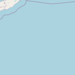
Map view of Nino Konis Santana National Park

Use this park location map to pinpoint Nino Konis Santana National Park in Timor-Leste, understand its exact geographic position, and read its mapped placement within the surrounding landscape more clearly.

Pigeon | © OpenStreetMap contributors

Location context for Nino Konis Santana National Park

Lautém District
Recorded earthquake history

View Historical Seismic Records near Nino Konis Santana National Park

Access a structured historical dataset of recorded earthquakes associated with the geography of Nino Konis Santana National Park. MoriAtlas provides these documented records to support transparent geographic study, offering event details such as magnitudes and proximity measurements for each seismic occurrence near this protected region.

Nino Konis Santana National Park Earthquake History

Catalogued events

158 events

Strongest magnitude

Magnitude 6.2

Most recent event

Jun 18, 2026

This history includes earthquakes recorded inside the park or within 50 km of its borders

Park atlas

Compare diverse conservation landscapes and regional park geographies, tracing protected areas across Timor-Leste.

Discover Related National Parks and Protected Areas Near Nino Konis Santana National Park

After viewing Nino Konis Santana National Park, browse other national parks and protected areas, tracing their geographic distribution and unique conservation profiles. This allows for comparative atlas discovery, revealing adjacent park landscapes and broader regional protected areas across similar environmental contexts.
Marine protected areaNorthern Territory
233 km away#1 closest

Southeast

Oceanic Shoals Marine Park: A Regional Overview of Protected Marine Geography

Explore the seafloor features and protected shelf waters of Northern Australia.

Oceanic Shoals Marine Park is a sprawling marine protected area located off the coast of the Northern Territory. It serves as a cornerstone of the North Marine Parks Network, featuring distinctive geological formations such as the Van Diemen Rise and the pinnacles of the Bonaparte Basin. This atlas entry details the park's bathymetric diversity, ranging from shallow carbonate banks to the deep shelf break of the Arafura Sea, highlighting its role as a productive corridor for migratory marine megafauna and reef ecosystems.

Area
71,743 km²
Established
2018
IUCN
VI
Relief
Lowland
National parkWakatobi Regency
About 444 km away#2 closest

Northwest

Wakatobi National Park: Indonesian National Park Protected Landscape Explorer

Mapped boundaries and regional park geography.

Wakatobi National Park provides a detailed look into a specific protected area within Indonesia. This entry focuses on the park's designated national park status, its geographic distribution, and its role within the larger Wakatobi Regency. Users can explore the park's mapped natural landscape and understand its context as a key protected territory.

Area
13,900 km²
Established
2002
IUCN
II
Relief
Upland
Marine protected areaWestern Australia
497 km away#3 closest

Southwest

Kimberley Marine Park: Atlas of Protected Marine Habitats and Submerged Coastal Geography

Western Australia Marine Protected Area and seafloor terrain

Spanning over 74,000 square kilometres of the Indian Ocean, Kimberley Marine Park encompasses an intricate underwater landscape. From shallow banks and pinnacles to deep oceanic trenches, the park serves as a vital refuge for migratory humpback whales, sea turtles, and dugongs within a complex Commonwealth marine reserve network.

Area
74,469 km²
Established
2018
IUCN
VI
Relief
Lowland
Marine protected areaAustralia
551 km away#4 closest

Southwest

Cartier Island Marine Park: Geographic Boundaries and Marine Sanctuary Overview

Remote Timor Sea reef systems and protected pelagic landscapes in Australian waters.

Cartier Island Marine Park functions as a strictly managed sanctuary zone, preserving the delicate balance of emergent reefs and open-ocean ecosystems within the North West Shelf. The area is characterized by its isolation, featuring complex reef flats and critical habitats that support significant sea snake populations, foraging marine turtles, and diverse seabird breeding colonies. This atlas entry examines the physical terrain and protected marine boundaries of the site.

Area
172 km²
Established
2000
IUCN
Ia
Relief
Lowland
National parkEast Nusa Tenggara
About 553 km away#5 closest

West

Kelimutu National Park: Volcanic Terrain and Colored Crater Lakes in East Nusa Tenggara

Explore the mapped geography of this unique Indonesian national park.

Kelimutu National Park represents a remarkable protected landscape in East Nusa Tenggara, Indonesia, distinguished by its volcanic origins and the famed three colored lakes of Mount Kelimutu. This national park protects diverse montane forests and offers a unique insight into the region's geological wonders. Its geography features volcanic slopes and the iconic caldera, making it a significant point of interest for atlas-driven exploration of protected natural areas.

Area
50 km²
Established
1992
IUCN
II
Visitors
12.5K annual
Marine protected areaAustralia
554 km away#6 closest

Southwest

Ashmore Reef Marine Park: Mapping Australia's Remote Timor Sea Protected Marine Landscape

Deep-water coral reef flats, seagrass meadows, and migratory seabird rookeries.

Located in the remote outer Timor Sea, Ashmore Reef Marine Park acts as a major hub for marine biodiversity and bird conservation. The protected area features emergent islands, sheltered lagoons, and expansive intertidal flats that demonstrate complex oceanic influence from the Indonesian Throughflow. Examine the regional geography and protected boundaries of this vital offshore sanctuary within the Australian marine jurisdiction.

Area
583 km²
Established
1983
IUCN
Ia
Relief
Lowland
Protected landscapeNorthern Territory
About 563 km away#7 closest

Southeast

Vernon Islands Conservation Reserve: Northern Territory Coastal Protected Landscape and Island Geography

Tropical reef and island system in the Northern Territory

Vernon Islands Conservation Reserve stands as a protected landscape encompassing three distinct islands and the exposed Knight Reef. Located in the tropical waters near Darwin, this area defines a crucial marine and intertidal seascape within the Northern Territory, shaped by complex tidal dynamics and significant Aboriginal land tenure history.

Area
81.58 km²
Established
1974
IUCN
V
Relief
Lowland
National parkKimberley
565 km away#8 closest

South

Niiwalarra Islands National Park: Protected Area and Kimberley Geography Explorer

Mapped landscape context for this Australian national park.

Gain a comprehensive atlas-style understanding of Niiwalarra Islands National Park, a designated national park situated in Australia's Kimberley region. This dedicated page provides insight into its protected landscape, its precise geographic boundaries as mapped within the region, and its overall significance as a natural area. Explore the structured geographic data that defines this park's identity and its unique place in the Australian atlas.

Area
33.52 km²
Established
2019
IUCN
Ia
Scope
Mixed

Common questions about visiting, size, designation, and location context for Nino Konis Santana National Park

Nino Konis Santana National Park FAQs for park facts, access, geography, and protected area context

Find quick answers about Nino Konis Santana National Park, including protected-area facts, park geography, trail and visitor context, and how the park fits into its surrounding country and regional landscape.
MoriAtlas Explorer

Continue Your Protected Areas Search Across the Global Atlas

Deepen your exploration by continuing the structured search for national parks and protected areas worldwide. Utilize the comprehensive filtering capabilities to compare different conservation landscapes and refine your understanding of global park geography. Discover more about the distribution and characteristics of protected natural areas.

Global natural geography
