
Mori Atlas logo
Marine protected areaNoss Head

Tracing the rugged Caithness cliff coastline and the submerged horse mussel ecosystems of the North Atlantic.

Noss Head Marine Protected Area: An Atlas of Scotland's Coastal and Benthic Landscapes

(Noss Head Marine Protected Area)

Noss Head serves as a prominent rocky headland on the far north coast of Scotland, anchoring a significant marine protected area within the Highland region. The site features a dramatic transition from vertical coastal cliffs and weathered headlands to deep-water sediment zones that support the largest known horse mussel bed in Scottish waters. This mapped protected area provides a focal point for understanding the interplay between northern maritime geography and the cold-water benthic communities thriving beneath the surface.

coastal headlandcliffsmarine protected areahorse musselsbenthic habitatcold-water marine life
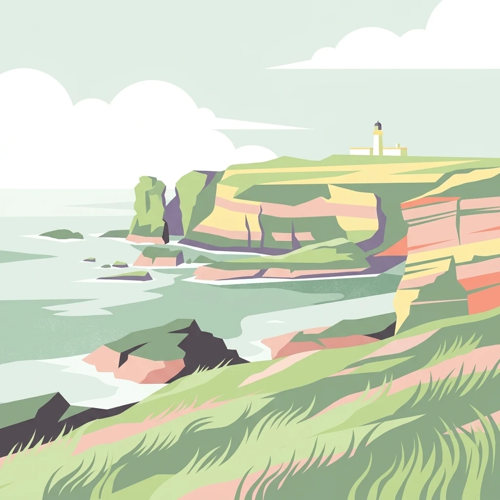
A minimalist, stylized vector illustration of coastal cliffs meeting the sea, with a lighthouse visible in the distance on top of the headland.

Noss Head

Marine protected area

Park overview

Structured park overview, official facts, and landscape profile for Noss Head

Noss Head park facts, protected area profile, and essential visitor context

Review the core facts for Noss Head, including designation, size, terrain, visitor scale, habitats, and operating context in one park-focused overview.

About Noss Head

Noss Head frames a remote and exposed stretch of the Caithness coastline, where steep cliffs drop towards the waters of Sinclairs Bay and the open sea. Its position on the far north shoulder of mainland Scotland gives it a sense of isolation and a strongly maritime atmosphere, shaped by long winters, frequent sea fog, and persistent Atlantic swell.

Although the headland itself is sparsely inhabited, its surrounding waters hold significant ecological value. In 2014 the Scottish Government designated an area of about 800 hectares offshore as a Marine Protected Area, cementing Noss Head's role in Scotland's national network of marine conservation sites. The MPA is classified as an IUCN Category IV protected area, recognising its importance for managing sensitive habitats and species rather than as a strict wilderness reserve.

The MPA is managed by Marine Scotland, while navigation and safety in the area remain the responsibility of the Northern Lighthouse Board, which still maintains the historic lighthouse on the headland. Together, these overlapping roles reflect the dual character of Noss Head as both a working maritime landscape and a place of recognised natural value.

Quick facts and research context for Noss Head

Noss Head lies in Caithness on the north-east coast of Scotland, near the town of Wick. It is administered as a Marine Protected Area by Marine Scotland and holds IUCN Category IV status as a habitat and species management area.

The protected sea zone covers roughly 800 hectares and centres on a horse mussel bed between 35 and 45 metres below the surface, one of the largest known in Scottish waters. The headland itself is also home to Noss Head Lighthouse, an 18-metre tower dating from 1849 and still operated by the Northern Lighthouse Board.

Protection and recognition

Documented conservation history and designation scope for Noss Head

Noss Head Protection Status and Marine Designated Area Records

Noss Head maintains a documented marine protection status established in the year 2014. Official records outline the designation timeline and management scope associated with this protected coastal territory.

Protection details

Protection scope
Marine
Designated year
2014
Transboundary protection
No
Park context

Deeper park guide and search-rich context for Noss Head

Noss Head history, landscape, wildlife, and travel context

Explore Noss Head through its history, landscape character, ecosystems, wildlife, conservation priorities, cultural context, and seasonal travel timing in a structured park guide built for atlas discovery and search intent.

Why Noss Head stands out

Noss Head is best known for the extensive horse mussel bed that lies in the waters off the headland, widely regarded as the largest of its kind recorded in Scottish waters. This dense aggregation of Modiolus modiolus, found at depths of 35 to 45 metres, defines the ecological character of the reserve. The site is equally notable for the richness of the marine community associated with the mussel bed, from soft corals and brittlestars to tubeworms, sea mats, barnacles, and a wide range of molluscs. Together, these features give Noss Head a distinctive cold-water marine identity that sets it apart from many other coastal protected areas in Scotland.
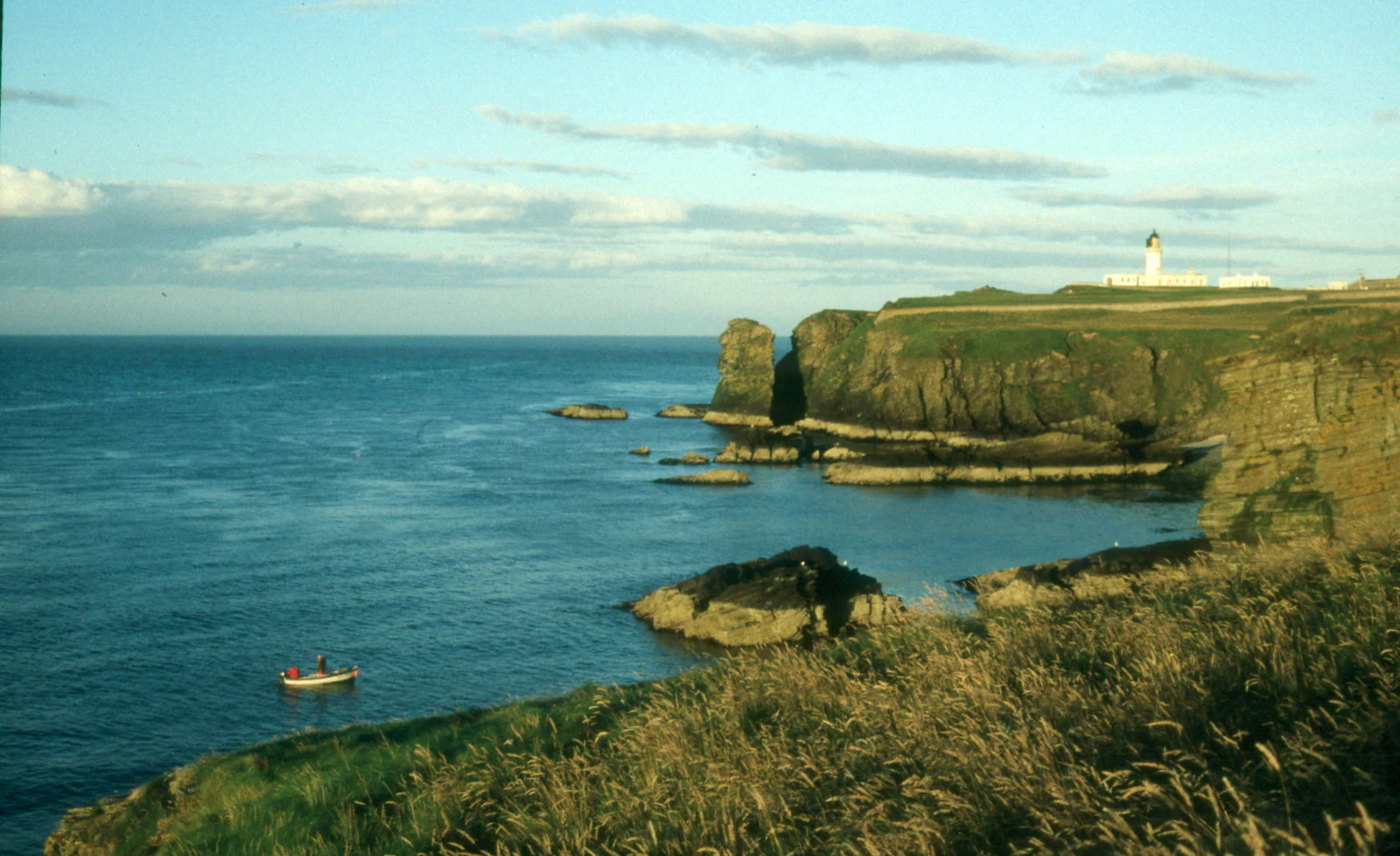
Coastal view at Noss Head showing sea cliffs, a lighthouse in the distance, and a small boat on the water.
A view across Sand Geo towards the coastal cliffs and lighthouse at Noss Head.

Noss Head history and protected-area timeline

The headland has a remarkably long recorded history. As early as the second century AD, the Greek geographer Ptolemy referred to the promontory as Verubium Promontorium, anchoring Noss Head in the ancient geographical imagination of the Mediterranean world.

The modern identity of the site is closely linked to its lighthouse, which entered service in 1849. The Noss Head Lighthouse was an 18-metre white cylindrical tower, notable for being the first lighthouse built with a diagonally paned lantern room, an engineering curiosity that has lingered in the history of Scottish coastal navigation. The light was automated in 1987, although the Northern Lighthouse Board retains ownership and operational responsibility.

In 2014, Noss Head took on a new conservation role when the surrounding waters were designated as a Marine Protected Area by the Scottish Government. This formal recognition elevated the headland from a primarily navigational and maritime landmark to a nationally protected marine habitat, anchoring the site's significance in the twenty-first century as well as in antiquity.

Noss Head landscape and geographic character

Noss Head is a classic example of a Caithness cliff coastline, where the land falls abruptly towards the sea along the northern edge of Sinclairs Bay. The cliff line is broken by geos, stacks, and weathered headland features that create a rugged and exposed scenic profile, especially visible from the south and west where the headland projects into the bay.

Beneath the cliffs, the seabed drops into deeper water, reaching the depth range of 35 to 45 metres where the protected mussel bed is found. The transition from hard rocky shore to deeper offshore sediment is central to the landscape character of the site, supporting very different ecological communities at different depths.

The wider setting is typical of Caithness, with broad expanses of open coastal terrain and a generally low, sculpted landform stretching inland from the cliffs. The dramatic meeting of sea, cliff, and northern light is the defining visual experience of the headland.

Noss Head ecosystems, habitats, and plant life

The ecological identity of Noss Head centres on the marine habitats around the headland rather than the terrestrial vegetation of the cliff tops. The protected waters hold one of the most significant aggregations of horse mussels in Scotland, forming a dense and structurally complex habitat on the seabed.

Horse mussel beds are considered biodiversity hotspots in the North Atlantic because the shells accumulate sediment and create shelter for many other species. At Noss Head, this biological enrichment is reflected in a rich community of soft corals, tubeworms, barnacles, sea firs, sea mats, brittlestars, crabs, worms, and molluscs, all living in close association with the mussels.

The combination of cold North Atlantic water, stable substrate at moderate depth, and the presence of the mussel framework gives the site a particular ecological character that distinguishes it from more typical nearshore Scottish habitats.

Noss Head wildlife and species highlights

The wildlife profile of Noss Head is overwhelmingly marine rather than terrestrial. The signature species is the horse mussel, Modiolus modiolus, whose dense bed supports most of the visible animal life in the protected waters.

Among the species living in and around the mussel bed, soft corals stand out as some of the most visually distinctive, while brittlestars, crabs, and tubeworms represent the typical invertebrate richness of North Atlantic bivalve communities. Smaller organisms such as sea mats, sea firs, barnacles, and various molluscs and worms complete this dense benthic community.

Above the waterline, the cliff and coastal edge provide habitat for seabirds typical of the northern Scottish coastline, though the headland's internationally recognised ecological significance lies much more clearly in the protected sea zone than on land.

Noss Head conservation status and protection priorities

Noss Head stands out in the Scottish MPA network because of the exceptional scale and condition of its horse mussel bed, which is the largest recorded in Scottish waters. Protecting such a habitat is significant because horse mussel communities are slow-growing, structurally complex, and vulnerable to physical disturbance from activities such as bottom trawling.

The site is formally classified as an IUCN Category IV protected area, indicating that its primary purpose is to manage particular habitats and species rather than to provide full ecosystem protection. Management responsibility lies with Marine Scotland, while the surrounding sea remains in active use for navigation, fishing, and other coastal activities under regulatory control.

By safeguarding a nationally important example of a cold-water bivalve habitat and its associated community, the Noss Head MPA contributes to broader efforts to maintain representative examples of Scotland's marine biodiversity within the country's MPA network.

Noss Head cultural meaning and human context

Noss Head carries a striking depth of cultural and historical association for a relatively remote piece of coastline. Its appearance in Ptolemy's second-century writings as Verubium Promontorium places the headland among the named landmarks of the ancient world, referenced from across Europe even before the modern era.

In the Victorian period, the headland took on a new cultural role through the construction of the Noss Head Lighthouse in 1849. As a working navigation aid and an example of innovative lighthouse engineering, it became part of the long maritime story of Wick and the northern Caithness coast, a region historically tied to herring fisheries and coastal trade.

Today, the headland occupies a quiet place in the local identity of Caithness, valued by residents and visitors as a defining natural landmark along a sparsely populated stretch of coast.

Top sights and standout views in Noss Head

The Noss Head MPA is anchored by the largest known horse mussel bed in Scottish waters, a nationally important marine habitat lying 35 to 45 metres below the surface. This single feature gives the site its principal conservation identity and sets it apart from many other Scottish coastal protected areas.

The diversity of the associated community is another key highlight. Soft corals, brittlestars, tubeworms, sea firs, sea mats, barnacles, crabs, and numerous molluscs all coexist within and around the mussel bed, illustrating the role of bivalve aggregations as biodiversity hotspots in the North Atlantic.

Alongside these marine features, the lighthouse on the headland offers a vivid cultural and historical dimension, while the cliffs themselves provide a classic Caithness coastal landscape that ties together the natural, maritime, and historical layers of the site.

Best time to visit Noss Head

Because Noss Head is valued primarily for its marine protection rather than as a developed visitor destination, timing of any visit tends to be shaped by landscape and weather rather than by specific seasonal openings. Late spring and summer generally offer the longest daylight hours, calmer conditions for coastal walking, and the best chance of clear views along the cliff line and across Sinclairs Bay.

Autumn and winter bring a more austere atmosphere, with stronger winds, heavier seas, and shorter days, but they also reveal the raw character of the headland and its exposure to the North Atlantic. Birdwatchers often find these colder months rewarding along the cliff tops, while divers and boat operators with an interest in the marine environment may benefit from calmer sea states in the warmer half of the year, depending on conditions.
Monthly climate preview

Long-term monthly temperature ranges and precipitation rhythm for Noss Head in Highland

Noss Head Climate Normals, Annual Temperature and Precipitation Patterns

Representative coordinates record measured monthly temperature variations alongside shifting precipitation averages across the year at Noss Head. Comprehensive monthly climate normals provide deeper insight into long-term environmental patterns for this location.
Annual mean9 °C
5 °C14 °C
Jan
Feb
Mar
Apr
May
Jun11°
Jul13°
Aug14°
Sep12°
Oct10°
Nov
Dec
Warmest month
August

13.6 °C

Coolest month
February

4.8 °C

Wettest month
October

3.7 mm/day

Driest month
May

2.1 mm/day

Park location guide

Geography guide, regional context, and park location map for Noss Head

Noss Head park geography, regions, and map view in United Kingdom

Understand where Noss Head sits in United Kingdom through a broader geographic reading of the surrounding landscape, nearby location context, and its mapped position within the national park landscape.

How Noss Head fits into United Kingdom

The United Kingdom is a parliamentary constitutional monarchy located in northwestern Europe, consisting of four constituent countries: England, Scotland, Wales, and Northern Ireland. As a major global power with over 69 million residents, it maintains significant international influence in politics, economics, and culture.

Wider geography shaping Noss Head in United Kingdom

The United Kingdom is an island nation located in northwestern Europe, surrounded by the Atlantic Ocean, North Sea, English Channel, Celtic Sea, and Irish Sea. It shares a land border with the Republic of Ireland to the west. The territory includes the island of Great Britain, the northeastern portion of Ireland, and most of the smaller British Isles islands.

Map view of Noss Head

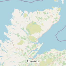
Use this park location map to pinpoint Noss Head in United Kingdom, understand its exact geographic position, and read its mapped placement within the surrounding landscape more clearly.

Pigeon | © OpenStreetMap contributors

Location context for Noss Head

HighlandScotland

Explore photographic records of rocky headlands, benthic ecosystems, and coastal terrain.

Noss Head Photos and Landscape Scenery: Visualizing Cliff Coastlines and Marine Habitats

Visual documentation reveals the rugged topography and marine environments that define the protected headland. Photographic records capture the dramatic cliff formations and offshore habitats shaping the regional landscape.

Coastal view at Noss Head showing sea cliffs, a lighthouse in the distance, and a small boat on the water.

Park atlas

Compare adjacent marine reserves and rugged cliff coastlines across the regional landscape.

Explore Other Parks Near Noss Head and Surrounding Coastal Protected Areas

Visitors exploring Noss Head can browse nearby national parks and protected coastal landscapes to examine regional environmental patterns. Expanding the search helps connect individual marine reserves with wider geographic terrain and comparable habitats.
Nature reserveScotland
About 5.3 km away#1 closest

Southwest

East Caithness Cliffs Nature Reserve: Regional Geography and Coastal Protected Area Atlas

Coastal sandstone cliffs and maritime heath habitats in northern Scotland.

Examine the layered conservation architecture and physical geography of East Caithness Cliffs. This site serves as a prime example of protected northern coastal terrain, where sandstone formations and maritime heath support vast seabird populations across a mosaic of land and sea boundaries.

Area
116.96 km²
Established
1996
Relief
Upland
Climate
Temperate
A watercolor painting showing a wide, sweeping landscape of green hills, a winding stream, and flat boggy terrain under a soft, light-colored sky.
Nature reserveScotland
About 39 km away#2 closest

West

Flow Country: Geography and Protected Landscape Analysis of Scotland's Blanket Bog

Northern Scotland's vast, waterlogged peatland ecosystem.

The Flow Country is defined by its extensive, open peatland terrain stretching across Caithness and Sutherland. This nature reserve serves as a critical geographic study area for understanding blanket bog formation, carbon storage, and the restoration of fragile wetland habitats in northern Europe.

Area
4,000 km²
Relief
Lowland
Scope
Terrestrial
Water
Water-dominated
Wildlife reserveOrkney
About 73 km away#3 closest

North

Rousay Wildlife Reserve: Mapped Geography and Protected Landscapes in the Orkney Archipelago

Island moorlands, coastal cliffs, and freshwater loch ecosystems.

Rousay represents a critical protected area within the Orkney islands, characterized by its elevated moorland summits and dramatic shorelines. The mapped terrain reveals complex interactions between marine sounds and terrestrial habitats, offering a deep look into the regional geography and conservation status of this northern sanctuary.

Area
48.6 km²
Relief
Upland
Climate
Temperate
Access
Moderate access
Watercolor painting of soft rolling dunes, green hills, and light clouds.
Protected areaSutherland
About 84 km away#4 closest

Southwest

Coul Links Protected Area: Coastal Dune and Heathland Geography in Sutherland, Scotland

A study of coastal dune succession and wetland terrain

Coul Links serves as a quintessential example of a Scottish coastal links landscape, tracing a continuous path from active beach fronts through to stable, juniper-rich heathland. Situated in Sutherland, the site offers a window into the formation of dune slacks, seasonal freshwater lochans, and the ecological dynamics of a complex, interwoven coastal system.

Relief
Lowland
Climate
Temperate
Access
Easy access
Scope
Terrestrial
A wide watercolor illustration showing a mountain range in the distance, a valley, and green forests on either side, with soft pastel colors.
Protected landscapeHighland
About 109 km away#5 closest

West

North West Sutherland National Scenic Area: Mapping the Peaks and Coasts of Highland Scotland

Protected quartzite mountain landscapes and Atlantic coastal geography

This detailed overview of the North West Sutherland National Scenic Area maps the dramatic interplay between the white quartzite mountains of Foinaven and Arkle and the darker Lewisian gneiss that forms the underlying Highland landscape. The analysis provides deep insights into the region's knock and lochan topography, sea lochs, and the protected coastal habitats of Handa Island, anchoring the area within its broader Scottish geological context.

Area
266 km²
Established
1981
Relief
Mountain
Climate
Temperate
Watercolor painting depicting mountains, forested hills, and a river in a scenic landscape
National parkScotland
About 123 km away#6 closest

South

Cairngorms National Park: Explore Scotland's Largest Protected Mountain Landscape

Mapped boundaries and arctic-alpine geography.

As the United Kingdom's largest national park, Cairngorms National Park in Scotland presents a vast expanse of distinctive arctic-alpine terrain and ancient Caledonian forests. This protected landscape offers a unique opportunity to explore mapped geographic features, from its extensive mountain plateaus to its vital river systems. Discover the contours and context of this significant natural area within the broader atlas of Scotland's protected lands.

Area
4,528 km²
Established
2003
IUCN
V
Visitors
1.9M annual
Protected landscapeHighland
About 157 km away#7 closest

Southwest

Wester Ross National Scenic Area: Protected Highland Mountain and Coastal Landscape Atlas

Geographic mapping of the Northwest Highlands terrain

Wester Ross National Scenic Area spans vast stretches of the Northwest Highlands, characterized by towering Torridonian sandstone peaks and deeply carved sea lochs. This protected region integrates ancient Scots pine forests, glacial-carved glens, and complex coastal environments into one of the most recognizable geographic features of Scotland. The landscape serves as a vital record of geological heritage and high-latitude biodiversity within the Highland administrative region.

Area
1,634.58 km²
Established
1981
Visitors
70K annual
Relief
Mountain
Marine protected areaShetland
About 190 km away#8 closest

Northeast

Boddam Marine Protected Area: A Geographic Profile of Southern Shetland Coastal Waters

Coastal conservation landscapes and North Atlantic marine ecology

Located on the southern Mainland of Shetland, the Boddam Marine Protected Area stands as a vital site for marine conservation. The region is widely recognized for its consistent sandeel populations, which provide essential nourishment for seabirds and predatory marine mammals. This site combines a rich Norse crofting history with a sheltered maritime geography, offering a window into the interconnectedness of land and sea in the northern reaches of Scotland.

Relief
Lowland
Water
Major water bodies

Common questions about visiting, size, designation, and location context for Noss Head

Noss Head FAQs for park facts, access, geography, and protected area context

Find quick answers about Noss Head, including protected-area facts, park geography, trail and visitor context, and how the park fits into its surrounding country and regional landscape.
MoriAtlas Explorer

Continue Your Protected Areas Search Across the Global Atlas

Deepen your exploration by continuing the structured search for national parks and protected areas worldwide. Utilize the comprehensive filtering capabilities to compare different conservation landscapes and refine your understanding of global park geography. Discover more about the distribution and characteristics of protected natural areas.

Global natural geography