
Mori Atlas logo
Protected landscapeOberes Starzeltal und Zollerberg

Examining the karstic limestone plateau, Starzel river valley, and Swabian Alb summits.

Oberes Starzeltal und Zollerberg Protected Landscape and Regional Geography Mapping

(Landschaftsschutzgebiet „Oberes Starzeltal und Zollerberg")

The protected landscape of Oberes Starzeltal und Zollerberg spans the southwestern Alb region of Baden-Württemberg, encompassing a diverse limestone terrain characterized by the incised Starzel river valley and prominent summits like Kornbühl and Zollerberg. This area preserves a unique gradient from dense valley forests through traditional juniper heath and dry grassland slopes to an open agricultural plateau. As a vital connective conservation network, the landscape integrates multiple nature reserves and bird protection zones, illustrating the historical intersection of ecological heritage and land use.

Landscape Protection AreaSwabian AlbSwabian JuraMittlerer Juralimestone plateauriver valley
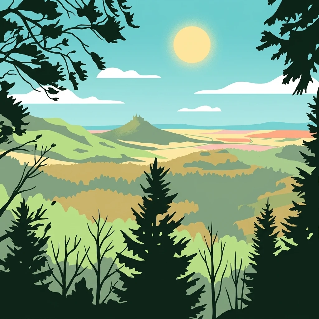
A flat-style digital illustration of a valley landscape framed by dark silhouette pine trees in the foreground, with a sunlit sky and a prominent, castle-topped mountain peak, the Zollerberg, in the distance.

Oberes Starzeltal und Zollerberg

Protected landscape

Park overview

Structured park overview, official facts, and landscape profile for Oberes Starzeltal und Zollerberg

Oberes Starzeltal und Zollerberg park facts, protected area profile, and essential visitor context

Review the core facts for Oberes Starzeltal und Zollerberg, including designation, size, terrain, visitor scale, habitats, and operating context in one park-focused overview.

About Oberes Starzeltal und Zollerberg

Oberes Starzeltal und Zollerberg is a large landscape protection area in the Zollernalbkreis district of Baden-Württemberg, in southwestern Germany. It occupies much of the upper Starzel river valley and the Zollerberg hill on the western edge of the Swabian Alb (Schwäbische Alb). The area covers about 79 square kilometres and stretches across parts of four municipalities: the city of Hechingen and its eastern districts, the city of Burladingen and its western districts, the municipality of Jungingen (nearly its entire area), and the municipality of Bisingen around the Zollerberg.

The landscape reflects the geological character of the Mittlerer Jura, a limestone-dominated upland dissected by river valleys. Large parts of the area are forested, while the high plateau near Salmendingen is shaped by arable farming and grassland, and the valley bottoms around Hechingen and Burladingen carry a mix of meadows and settlement land. The slopes carry the visible imprint of centuries of sheep grazing, expressed today in juniper heath (Wacholderheiden) and dry, species-rich grassland (Magerrasen) that thrive on the shallow, calcareous soils over Jurassic bedrock.

The area is anchored by two prominent summits, the Kornbühl near Salmendingen and the Zollerberg near Zimmern, and is drained by the Starzel, a Neckar tributary that rises south of Hausen im Killertal and runs through the valley that gives the protected area its name. Beyond its scenic and cultural value, the protection area functions as an ecological connector: it embeds several nature reserves, overlaps with several FFH sites including Reichenbach und Killertal zwischen Hechingen und Burladingen, and includes parts of the Südwestalb und Oberes Donautal bird protection area.

Quick facts and research context for Oberes Starzeltal und Zollerberg

Oberes Starzeltal und Zollerberg is a landscape protection area in the Zollernalbkreis district of Baden-Württemberg, Germany, established on 19 December 1972 by order of the former Landratsamt Hechingen and now administered by the Landratsamt Zollernalbkreis.

It spans approximately 79 square kilometres across Hechingen, Bisingen, Jungingen, and western Burladingen, protecting an upper Starzel river valley landscape dominated by forest, juniper heath, dry grassland, and farmland on the Swabian Alb plateau.

The area is classified under IUCN Category V (Protected Landscape/Seascape) and is interlaced with several nature reserves, FFH sites, and the Südwestalb und Oberes Donautal bird protection area.

Protection and recognition

Terrestrial protected area geography and formal conservation tracking data

Oberes Starzeltal und Zollerberg Protection Status and Designation Records

Oberes Starzeltal und Zollerberg holds documented terrestrial protection status within global conservation databases, tracking official management scope and designation records. Systematic registry data details the administrative framework governing this protected landscape without relying on unverified assumptions.

Protection details

Protection scope
Terrestrial
Transboundary protection
No
WDPA ID
323392
Park context

Deeper park guide and search-rich context for Oberes Starzeltal und Zollerberg

Oberes Starzeltal und Zollerberg history, landscape, wildlife, and travel context

Explore Oberes Starzeltal und Zollerberg through its history, landscape character, ecosystems, wildlife, conservation priorities, cultural context, and seasonal travel timing in a structured park guide built for atlas discovery and search intent.

Why Oberes Starzeltal und Zollerberg stands out

The protected area is best known for combining a deeply incised Swabian Alb river valley with the iconic Zollerberg hill and traditional juniper heath slopes. It preserves the transition from forested valley floor to open agricultural plateau and sheep-grazed dry grassland typical of the Mittlerer Jura. It is also notable as a connective protected landscape, embedding smaller nature reserves and overlapping with multiple FFH and bird directive sites, which gives it regional importance for habitat networks on the southwestern Alb.
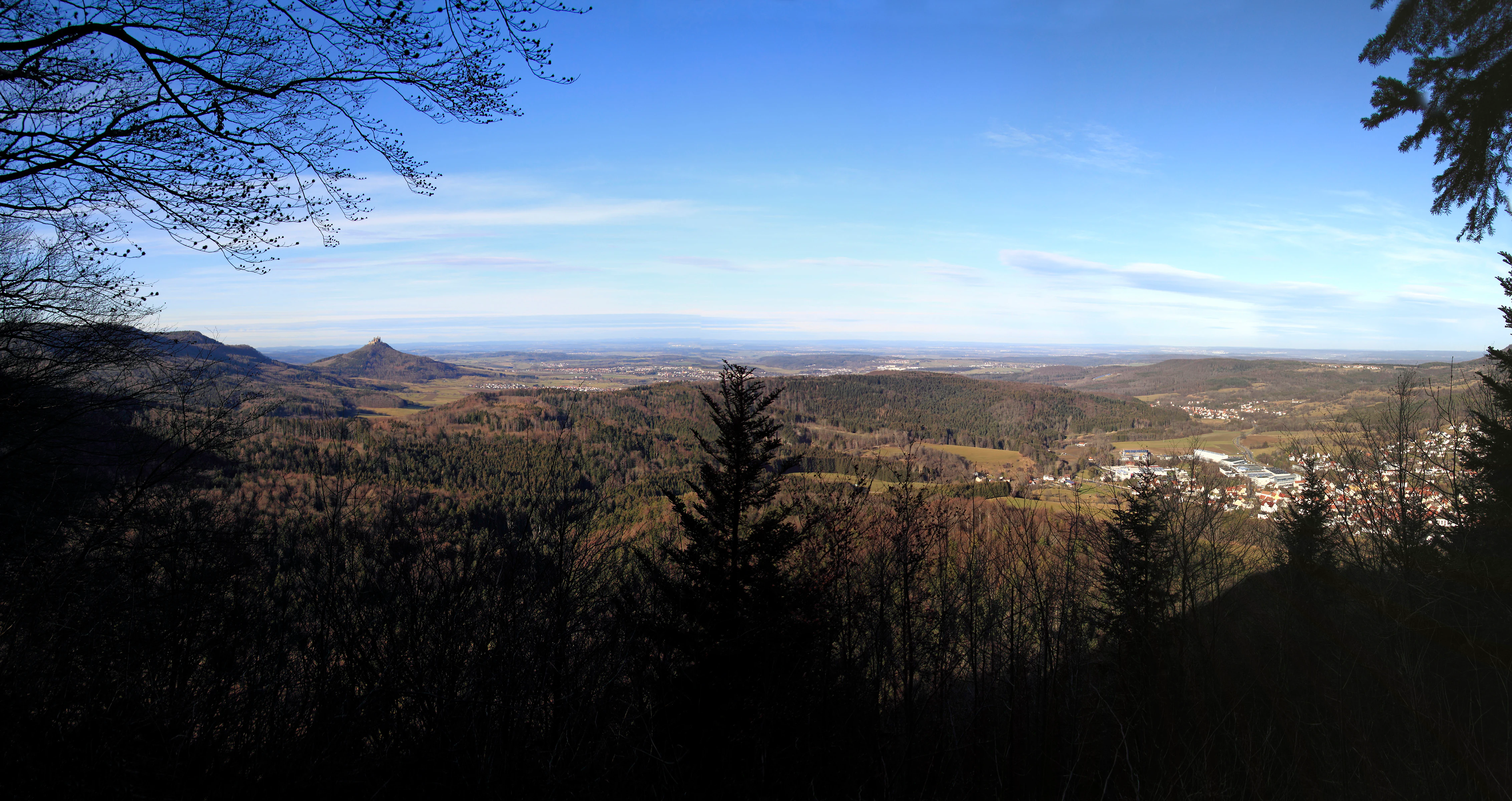
Panoramic landscape view from a high vantage point, looking out over a valley with rolling hills, dense forests, and a distant town, under a clear blue sky.
Panoramic view from Himberg, overlooking the forested hills and surrounding landscape of the Oberes Starzeltal und Zollerberg region.

Oberes Starzeltal und Zollerberg history and protected-area timeline

Parts of today's protected area, including the Zollerberg and its surroundings, were placed under landscape protection as early as 1957 by formal ordinance, predating the larger 1972 designation by fifteen years.

The current Oberes Starzeltal und Zollerberg landscape protection area was designated on 19 December 1972 by the Landratsamt Hechingen. Since that designation it has been reduced in size several times. The first reductions came as multiple smaller nature reserves were carved out within its boundaries, removing a total of around 313 hectares from the protected area. In 1999, additional planned building zones were excluded from the protection, further adjusting its extent. Today the area is administered by the Landratsamt Zollernalbkreis.

Oberes Starzeltal und Zollerberg landscape and geographic character

The protected area lies on the Swabian Alb, a karstic limestone plateau of the Middle Jurassic. The Starzel river has cut a characteristic valley into this plateau, producing the steep wooded slopes and narrow valley bottom that define the core of the protection area. The Starzel rises south of Hausen im Killertal and flows along the valley's length, shaping both the natural drainage and the settlement pattern of the region.

Above the valley, the Albhochfläche near Salmendingen opens into flatter, agriculturally used highland. Two named summits give the landscape vertical relief: the Kornbühl near Salmendingen and the Zollerberg near Zimmern, both visible landmarks from the surrounding area. The slopes between the valley and the plateau carry dry, semi-open vegetation shaped by long historical grazing pressure, where juniper heath and nutrient-poor dry grassland alternate with patches of woodland.

Oberes Starzeltal und Zollerberg ecosystems, habitats, and plant life

The interplay between forested valley slopes, open agricultural plateau, and extensively grazed hillside grassland produces a rich mosaic of habitats on a relatively small scale. Forest dominates much of the area, covering the steeper valley sides and parts of the higher ground, while the flatter Salmendingen plateau is shaped by arable fields and meadows.

The Middle Jurassic limestone geology supports a distinctive flora on the slopes, where thin, calcareous soils encourage juniper heath and species-rich dry grassland (Magerrasen). These slopes are also notable for their many springs, a consequence of the Middle Jurassic's characteristic water-bearing layers, which sustain wet features interwoven into an otherwise dry landscape mosaic.

Oberes Starzeltal und Zollerberg conservation status and protection priorities

Oberes Starzeltal und Zollerberg carries IUCN Category V status as a Protected Landscape, recognising both its natural and cultural value. It is a connective element within a wider conservation network on the southwestern Swabian Alb: several nature reserves lie entirely within its boundaries, and the protection area overlaps with FFH sites including Reichenbach und Killertal zwischen Hechingen und Burladingen, Gebiete um Albstadt, Gebiete zwischen Bisingen, Haigerloch und Rosenfeld, Salmendingen/Sonnenbühl, and Albvorland bei Mössingen und Reutlingen, as well as parts of the Südwestalb und Oberes Donautal bird protection area.

Its main conservation role is to maintain the traditional Swabian Alb cultural landscape: juniper heath, dry grassland, spring-fed slopes, and large connected forest tracts that support habitat continuity between more strictly protected reserves. Over time, carve-outs for nature reserves (totalling roughly 313 hectares) and the 1999 exclusion of planned building zones have reshaped, rather than weakened, its conservation role, concentrating protection on habitats where the landscape character remains intact.

Oberes Starzeltal und Zollerberg cultural meaning and human context

The name "Zollerberg" reflects the area's deep ties to the Hohenzollern dynasty and the historic Zollern region, of which the iconic Hohenzollern castle hill lies nearby. The landscape itself carries strong human imprint: the steep Alb slopes were traditionally used as communal sheep pastures, and that long grazing history is directly responsible for the survival today of juniper heath and dry, species-rich grassland that would otherwise revert to forest.

Villages such as Killer, Starzeln, Hausen im Killertal, Salmendingen, Schlatt, Boll, Stetten, Wessingen, and Zimmern are woven into the protected area, framing how agricultural plateau land, valley settlements, and historic grazing commons together produce the distinctive Zollernalb cultural landscape.

Top sights and standout views in Oberes Starzeltal und Zollerberg

Large protected landscape straddling the upper Starzel valley and the Zollerberg on the western Swabian Alb, with several named Alb summits rising out of forested slopes. The landscape preserves the classic Swabian Alb cultural-landscape gradient from forested valley, through juniper heath and dry grassland slopes, to an open agricultural plateau used for crops and hay meadows. Acting as a connective reserve, it embeds multiple nature reserves, FFH sites, and parts of the Südwestalb und Oberes Donautal bird protection area, making it more than the sum of its neighbours.

Best time to visit Oberes Starzeltal und Zollerberg

As a low-intensity cultural and natural landscape without a single highly seasonal attraction, the area is broadly accessible throughout the year. Spring and early summer bring fresh green growth on the valley slopes and active birdlife along the Starzel and on the adjacent plateau, while late spring and early summer are the most rewarding window for the dry grassland and juniper heath flowering. Autumn is well suited to experiencing the beech and mixed forest that dominates much of the area in full colour, whereas winter can highlight the open plateau near Salmendingen and the silhouettes of the Kornbühl and Zollerberg.

Monthly climate preview

Long-term temperature ranges and monthly precipitation patterns for Baden-Württemberg

Oberes Starzeltal und Zollerberg Climate Normals and Annual Weather by Month

Representative coordinate measurements track recorded monthly temperature variations and precipitation averages across the protected terrain. Full monthly climate profiles provide complete statistical context for long-term meteorological normals.
Annual mean8 °C
-1 °C18 °C
Jan-1°
Feb
Mar
Apr
May12°
Jun16°
Jul18°
Aug18°
Sep14°
Oct
Nov
Dec
Warmest month
July

18.1 °C

Coolest month
January

-0.9 °C

Wettest month
July

3.1 mm/day

Driest month
April

1.9 mm/day

Park location guide

Geography guide, regional context, and park location map for Oberes Starzeltal und Zollerberg

Oberes Starzeltal und Zollerberg park geography, regions, and map view in Germany

Understand where Oberes Starzeltal und Zollerberg sits in Germany through a broader geographic reading of the surrounding landscape, nearby location context, and its mapped position within the national park landscape.

How Oberes Starzeltal und Zollerberg fits into Germany

Germany is a federal republic in Western and Central Europe with a population of over 83 million across sixteen constituent states. It is Europe's largest economy by nominal GDP and a major global exporter and importer. The capital is Berlin, and the country borders Denmark, Poland, Czech Republic, Austria, Switzerland, France, Luxembourg, Belgium, and the Netherlands.

Wider geography shaping Oberes Starzeltal und Zollerberg in Germany

Germany is located in Western and Central Europe, spanning 357,022 km². It borders Denmark to the north, Poland and the Czech Republic to the east, Austria and Switzerland to the south, and France, Luxembourg, Belgium, and the Netherlands to the west. The country has coastlines on the Baltic Sea and North Sea to the north, with the Alps located in the southern region.

Map view of Oberes Starzeltal und Zollerberg

Use this park location map to pinpoint Oberes Starzeltal und Zollerberg in Germany, understand its exact geographic position, and read its mapped placement within the surrounding landscape more clearly.

Pigeon | © OpenStreetMap contributors

Location context for Oberes Starzeltal und Zollerberg

Baden-Württemberg

Visualizing the limestone uplands, river valleys, and juniper heath slopes

Oberes Starzeltal und Zollerberg Landscape and Scenery Photography

Visual documentation of Oberes Starzeltal und Zollerberg reveals the dramatic topography of the Swabian Alb through detailed terrain imagery and protected area views. Examining these landscape photographs provides clear insight into the forested valley floors, prominent summits, and traditional grazing habitats defining the region.

Panoramic landscape view from a high vantage point, looking out over a valley with rolling hills, dense forests, and a distant town, under a clear blue sky.

Park atlas

Compare surrounding Swabian Alb protected areas and regional park geography

Parks Near Oberes Starzeltal und Zollerberg and Related Protected Landscapes

Browse other parks and protected areas near Oberes Starzeltal und Zollerberg to compare similar limestone plateau terrain and river valley ecosystems. Extending your geographic search across the surrounding region reveals connected conservation networks and adjacent regional landscapes.
Watercolor painting of a green valley with a winding river and a small group of trees under a light sky.
Protected landscapeZollernalbkreis
About 9.1 km away#1 closest

Northwest

Mittleres Starzeltal Protected Landscape: Mapping the Geography of the Zollernalbkreis District

A detailed look at the Starzel river valley and forest mosaic.

The Mittleres Starzeltal protected landscape represents a significant river corridor in the Zollernalbkreis district. This area spans through Hechingen and Bisingen, characterized by its traditional orchard meadows and dense forest slopes that frame the middle Starzel valley. Explore the boundaries and topographic features that define this protected territory within the Swabian Alb conservation network.

Area
12.454 km²
Established
1963
IUCN
V
Relief
Upland
A minimalist watercolor illustration showing a winding river flowing through a soft green landscape with rolling hills in the background and clusters of trees.
Nature reserveBaden-Württemberg
About 14 km away#2 closest

West

Gebiete zwischen Bisingen, Haigerloch und Rosenfeld Nature Reserve and Geographic Context

Fragmented protected terrain in the Swabian Alb foothills

Gain insight into the fifteen separate fragments that constitute this protected nature reserve in Baden-Württemberg. From open limestone meadows to narrow floodplain strips, the area represents a critical mosaic of EU-protected habitat types that demand careful geographic consideration and mapping.

Area
7.53 km²
Established
2019
A watercolor painting showing a wide view of a winding river flowing through a lush green valley with distant purple hills and forested ridges.
Protected landscapeLandkreis Tübingen
About 19 km away#3 closest

Northwest

Oberes Neckartal mit den Seitentälern Rommelstal, Starzeltal und Eyachtal Protected Landscape

Geographic landscape analysis of the upper Neckar river valley and its forested tributaries.

Situated within Landkreis Tübingen, this protected landscape is defined by its distinct Muschelkalk geology and the interplay between deep valley slopes and open orchard meadows. The area encompasses the upper Neckar river valley along with the side valleys of Rommelstal, Starzeltal, and Eyachtal. This detailed landscape profile provides insight into the structured natural environment, forest coverage, and fluvial terrain that characterize this region of southwestern Germany.

Area
23.364 km²
Established
1981
IUCN
V
Relief
Upland
A watercolor painting showing a soft, panoramic view of green rolling hills and a winding river against a pale background of distant mountains.
Protected landscapeBaden-Württemberg
About 21 km away#4 closest

Southwest

Oberhohenberg Protected Landscape: A Geographical Atlas of the Swabian Alb Zeugenberg

Mapping limestone summits, block forests, and relict meadow habitats.

Oberhohenberg is a designated protected landscape situated on the Swabian Alb. As a striking zeugenberg, the hill supports a complex environment consisting of limestone rock faces, remnant grasslands, and rare blockschuttwald forest types. This compact area offers a precise view into the geological and structural diversity defining the regional landscape of Baden-Württemberg.

Area
0.286 km²
Established
1953
IUCN
V
Relief
Mountain
Protected landscapeBaden-Württemberg
About 21 km away#5 closest

North

Unteres Ammertal Protected Landscape: Regional Geography and Valley Maps

A structured cultural valley in Baden-Württemberg

Unteres Ammertal serves as a critical example of a managed agricultural landscape near Tübingen. This protected area preserves a rich variety of wet meadows, hedgerows, and river channels, offering insights into the complex land-use patterns of the Swabian foothills and the broader ecology of the Neckar basin.

Area
3.479 km²
Established
1999
IUCN
V
Relief
Lowland
Watercolor painting of a green, rolling landscape with forested hills and a soft, hazy background.
Protected landscapeBaden-Württemberg
About 22 km away#6 closest

North

Pfaffenberg Landscape Protection Area: Geography and Mapped Natural Features

Examining geological formations and cultural land use in Baden-Württemberg

Pfaffenberg is a significant protected landscape in Germany, recognized for its identity as an isolated Keuper-stage Zeugenberg. The area preserves a unique mosaic of mixed forest and historic orchard meadows, revealing the complex geological and agricultural heritage of the upper Neckar region within the Baden-Württemberg state boundaries.

Area
3.168 km²
Established
1967
IUCN
V
Nature reserveGermany
About 23 km away#7 closest

Southwest

Hintere Harrasbachtalwiesen Nature Reserve: Swabian Alb Valley and Meadow Geography

A mapped protected landscape in Baden-Wurttemberg, Germany

Hintere Harrasbachtalwiesen is a protected valley landscape in the Tuttlingen district, characterized by its stream network and distinctive forest-encircled wet meadows. This compact reserve provides a clear example of local Swabian Alb topography, linking small-scale riparian corridors to the extensive regional Natura 2000 protected land network.

Area
0.08 km²
Established
1944
Relief
Upland
Climate
Temperate
A soft, impressionistic watercolor painting depicting a meandering river flowing through a green landscape with rolling hills and scattered trees, rendered in light pastels.
Protected landscapeBaden-Württemberg
About 24 km away#8 closest

North

Mittleres Neckartal Protected Landscape and Neckar Valley Geographic Atlas

Regional protected area analysis in Baden-Württemberg

Analyze the Mittleres Neckartal, a significant landscape protection area defined by its open floodplain, intensive agriculture, and river corridor features. This record provides a clear look at the valley's spatial extent, from its gravel-pit lakes to the regional transport links shaping this working landscape within southern Germany.

Area
5.318 km²
IUCN
V
Relief
Lowland
Water
Major water bodies

Common questions about visiting, size, designation, and location context for Oberes Starzeltal und Zollerberg

Oberes Starzeltal und Zollerberg FAQs for park facts, access, geography, and protected area context

Find quick answers about Oberes Starzeltal und Zollerberg, including protected-area facts, park geography, trail and visitor context, and how the park fits into its surrounding country and regional landscape.
MoriAtlas Explorer

Continue Your Protected Areas Search Across the Global Atlas

Deepen your exploration by continuing the structured search for national parks and protected areas worldwide. Utilize the comprehensive filtering capabilities to compare different conservation landscapes and refine your understanding of global park geography. Discover more about the distribution and characteristics of protected natural areas.

Global natural geography